Showing 6802 items matching "river"
-
 Orbost & District Historical Society
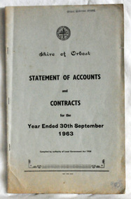
statement of accounts, Shire of Orbost Statement of Accounts, 1963
This document was made by the Shire of Orbost, local government. The Shire of Orbost was a local government area about 380 kilometres (236 mi) east of Melbourne, the state capital of Victoria, Australia. The shire covered an area of 9,347 square kilometres (3,608.9 sq mi), and existed from 1892 until 1994. Originally, Orbost was part of the Bairnsdale Road District which was created on 30 April 1867. Splitting away as part of the Shire of Tambo in 1882, Orbost was first incorporated as a shire in its own right as the Shire of Croajingolong on 30 May 1892. It received its present name on 17 February 1893. On 3 January 1913 part of its western riding was annexed to Tambo as its Cunninghame Riding. On 2 December 1994, the Shire was abolished, and merged with City and Shire of Bairnsdale, Shire of Tambo, most of Shire of Omeo and the Boole Boole Peninsula from Shire of Rosedale into the Shire of East Gippsland. Local governments play an important role in the lives of citizens in Australia. Local government authorities exist to provide services and amenities to local communities, and are also responsible for regulating and providing services for land and property in their district. This item is representative of a time when Orbost had its own Shire Council. A document with a light blue cover, black print. It is a "statement of accounts for the Shire of Orbost for the year ended 30th September, 1963".document-statement-of-accounts orbost-shire -
 Orbost & District Historical Society
catalogue, Snowy River Mail, 1931
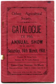
This catalogue is for the 39th Annual Orbost Show held in 1931. Admission was 2/- for adults and 6d for children under 14. The first meeting to form an Agricultural society in Orbost was convened by the then Orbost Progress Association and held in the Mechanics Hall on Saturday, 10th October 1891. Its first show was held on 3rd March 1904...on a site alongside the Bonang Road where the present Golf Club stands. It is currently held at the Recreation Reserve at Newmerella.(Ref: In Times Gone By-Deborah Hall)This item is associated with the Orbost Agricultural Society 's Annual Show which has been a major event in Orbost for over a century. Agricultural shows are an important part of cultural life in small country towns and the Orbost Show is an integral part of Orbost 's agricultural history. A thin side stapled paper catalogue for the 39th Orbost Annual Show. It has a red cover and black print"Catalogue of 39th Annual Show Saturday 14th March 1931". It contains details of entry requirements. There are also advertisements for local businesses. 755.1 is a complete stapled photcopy.orbost-agricultural-society orbost-events -
 Orbost & District Historical Society
program, Snowy River Mail, 1939
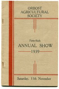
The first meeting to form an Agricultural society in Orbost was convened by the then Orbost Progress Association and held in the Mechanics Hall on Saturday, 10th October 1891. Its first show was held on 3rd March 1904...on a site alongside the Bonang Road where the present Golf Club stands. It is currently held at the Recreation Reserve at Newmerella. Ref: In Times Gone By-Deborah Hall This program is for the 46th annual show in 1939.This item is associated with the Orbost Agricultural Society 's Annual Show which has been a major event in Orbost for over a century. Agricultural shows are an important part of cultural life in small country towns and the Orbost Show is an integral part of Orbost 's agricultural history. A thin grey book with red stripes on the cover. In black print is " 46th Annual Show 1939 Saturday 11th March".orbost-agricultural-show events -
 Orbost & District Historical Society
envelope and receipt, Snowy River Mail as "Mail" Print, May 17 1956
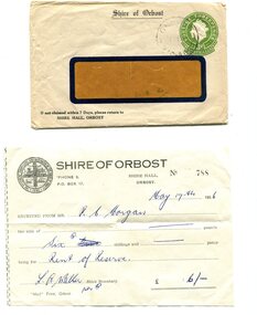
This receipt was issued to R. C. Morgan of Orbost. on May 17, 1956. It was for rent of reserve for six shillings. It was issued by the Orbost Shire Council. The Shire of Orbost was a local government area about 380 kilometres east of Melbourne, the state capital of Victoria, Australia. The shire covered an area of 9,347 square kilometres and existed from 1892 until 1994. Originally, Orbost was part of the Bairnsdale Road District which was created on 30 April 1867. Splitting away as part of the Shire of Tambo in 1882, Orbost was first incorporated as a shire in its own right as the Shire of Croajingolong on 30 May 1892. It received its present name on 17 February 1893. On 3 January 1913 part of its western riding was annexed to Tambo as its Cunninghame Riding. Local governments play an important role in the lives of citizens in Australia. Local government authorities exist to provide services and amenities to local communities, and are also responsible for regulating and providing services for land and property in their district. This item is representative of a time when Orbost had its own Shire Council. A widow - faced envelope with a green threepence stamp top right corner. At the top is "Shire of Orbost". Bottom right is "If not claimed within 7 Days please return to SHIRE HALL, ORBOST".There is a receipt to R.C. Morgan for 6/- being for the "rent of reserve" and signed by L.A. Walker. It has the Orbost Shire logo in the top left corner.orbost-shire-council morgan-r.c. -
 Orbost & District Historical Society
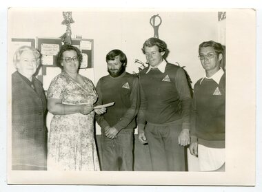
black and white photograph, April 1979
In this photograph are : L -R Margory Smith, Margaret Vincent, Michael Pardew, Rob Young and George Thomas. Orbost Apex Club donated $1,800 to the Orbost Continuing Care Appeal (now Lochiel House). The money had been raised at a successful New Year's Eve Ball. Margory Smith and Margaret Vincent, Acting President, were the O.C.C.A representatives. Michael Pardew was the co-ordinator of the New Year's Eve Ball, Rob Young was the Apex President and George Thomas was the Apex Social Director. Apex clubs were made up of volunteers who "raise awareness about social justice issues, assist the needy in a practical way and contribute resources to causes" (ref Apex website) The Apex Club of Orbost was a volunteer service club which contributed to the Orbost community. A declining population has led to the demise of many social groups in the area.A black / white photograph of two women and three men standing in front of a wall. The men are wearing wearing long - sleeved tops with a triangular shaped logo at the top left shoulder,on back -a list of namesorbost-clubs apex-club-orbost service-club -
 Orbost & District Historical Society
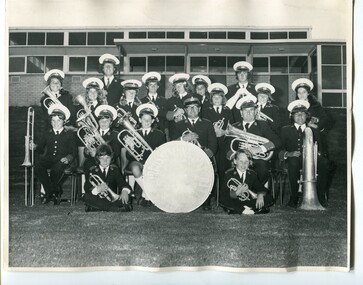
black and white photograph, December 1973
This photograph of the Orbost Municipal Band was taken outside the Orbost Youth Centre in Nicholson Street, Orbost. Those in the photograph are: At Rear- Peter Fagg and Alan Miles; Back Row - Jacqueline Solomon' Cryatal Barling, Julie West, Raymond Barling, Maddy Barr' Peter Rowley, Luigi Battel, Michelle Zuccolo, Helen Light; Seated - Phillip Barling, Russell Jensen, Susan Wood, Alf Barling (Band Master), Edward Knight, Charles Soloman; In Front - Mark Barling and Peter Knight The first Orbost Brass Band was formed in 1889. Around 1908 the town band split and the Orbost Workers' Band was formed. Eventually the two bands merged in 1913 to reform as the Orbost Municipal Band under conductorship of Charles Spink. The band continued for many years but was later disbanded and again reformed. This was to happen a number of times, the last time being in 1961 and continuing through to the late 1970's. Further info and Ref: In Times Gone By - Deborah Hall This is a pictorial record of the Orbost Municipal Band. The various Orbost bands over the years played a major role in community activities providing entertainment and musical experiences for the many members.A large black / photograph of a group of uniformed band members standing and seated in rows outside a building. All are holding musical instruments. There is a drum in the centre front row.on back - label with list of namesmusic-orbost orbost-municipal-band entertainment recreation -
 Orbost & District Historical Society
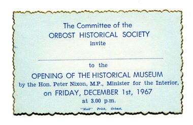
Invitations, 1967
Made for the Orbost Historical Society. The first Orbost Museum was opened in 1967. It was situated in Nicholson Street, Orbost.This item is an historic record of the opening of the Orbost Museum.Six blue rectangular cards with darker blue print and a gold scalloped edge. They are unused invitations to the opening of the Orbost Museum in December, 1967.The Committee of the Orbost Historical Society invite _________ to the OPENING OF THE HISTORICAL MUSEUM by the Hon. Peter Nixon MP, Minister for the Interior on FRIDAY DECEMBER 1st 1967 at 3.00pmorbost-museum document-invitation -
 Orbost & District Historical Society
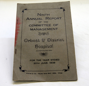
book, 1939
The Committee of Management held monthly meetings and "the members were conscientious in their attendance". 1938/1939 were busy years for the Orbost Hospital as there was a serious outbreak of poliomyelitis and some cases had to be sent on to Sale. There was also pressure from Dr Nettleton to begin a garbage collection in the town to clean up the town As the polio epidemic abated, diptheria took over and Dr Nettleton urged the shire to fund a further free immunisation campaign. In February, 1939t here were major bush fires in the district and the fire came within 300 yards of the Orbost Hospital. (info. from Orbost Hospital History, Personalities and Stories by Margaret Hollands)The Orbost Hospital was completed by the end of October 1929 after more than twenty years of agitation and preparation. Orbost is an isolated town and the importance of the medical service in the community is immense. This report is a reminder of its early history.A small book - 9th annual report of the Management Committee of Orbost & District Hospital, incorporated 1930. In black print inside rectangular border is title plus "For the Year Ended 30th June, 1939."orbost-hospital report-orbost-hospital-committee-of-management -
 Orbost & District Historical Society
newspaper article, January 31 1991
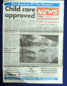
On 24 January 1991 a severe hailstorm occurred in Orbost. The Insurance Council of Australia estimated the 1991 damage at $12 million.This is a contemporary record of a significant event in Orbost.The front and back page of The East Gippsland News dated Thursday January 1991. The main article is a photograph of the hailstorm damage to Nicholson Street in Orbost.hailstorm-orbost east-gippsland-news newspaper-article -
 Orbost & District Historical Society
ticket, 1950's -1960's
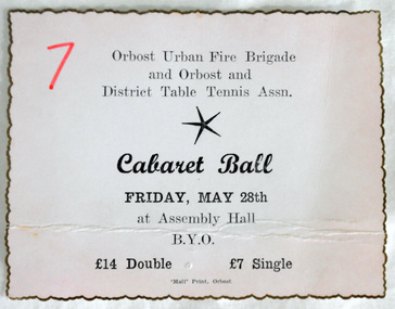
This is a ball ticket purchased by Marilyn Morgan C1950's.Community events such as balls were an important feature of the mid 20th century. This was pre-television and night social events were well attended. This item is reminiscent of that era.A pale pink coloured rectangular shaped ticket made of cardboard. It has fluted gold edging. The wording is in black " Orbost Urban Fire Brigade and Orbost & District Table Tennis association CABARET BALL Friday May 28th at Assembly Hall. B.Y.O. £14 double £7 single"7 written in red ink on left hand top.recreation dancing ticket cabaret -
 Orbost & District Historical Society
ticket, 1987
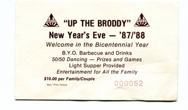
This ticket was for an entertainment at Brodribb for the celebration of the incoming bi-centennial year, 1988. The bicentenary of Australia was celebrated in 1988. It marked 200 years since the arrival of the First Fleet of British convict ships at Sydney in 1788. Many events were organised to celebrate the occasion.The Apex Club of Orbost was a volunteer service club which contributed to the Orbost community. A declining population has led to the demise of many social groups in the area. The Apex Club, like other groups in Orbost have organised social events for the local community for many years.A rectangular shaped cardboard ticket coloured white/cream. On the front in brown print is " APEX 'Up the Broddy' new Year's Eve - '87/88 WElcome in the Bi-Centennial Year BYO barbecue and drinks. 50/50 dancing - prizes and games. Light supper provided. Entertainment for all the family. $10 per family/couple". In red is 000052.celebration bicentennial-celebration-orbost -
 Orbost & District Historical Society
ticket, Snowy River Mail as "Mail" Print, 1986
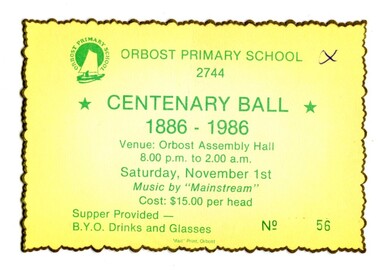
Colours of ticket reflect school, colours of green and yellow. The ticket was issued for a ball/celebration for the centenary of Orbost Primary School. This school was the earliest primary school in Orbost established in 1886.Orbost Primary School was the earliest primary school in Orbost. A centenary celebration ball would have been a popular local event.A rectangular shaped yellow card with a fluted gold edge. Printed in green is "ORBOST PRIMARY SCHOOL 2744 CENTENARY BALL 1886 - 1986 Venue - Orbost Assembly Hall 8.00pm -2.00am Saturday Nov. 1st Music by "MAINSTREAM" Cost $15 per head. Supper provided -BYO drinks & glasses." In bottom right corner is No.56orbost-primary-school-centenary celebration -
 Orbost & District Historical Society
exhibitors' information, Snowy River Mail as "Mail" Print, 1975
This was created for the annual Orbost Show 1975. It provides information to potential exhibitors. The first meeting to form an Agricultural society in Orbost was convened by the then Orbost Progress Association and held in the Mechanics Hall on Saturday, 10th October 1891. Its first show was held on 3rd March 1904...on a site alongside the Bonang Road where the present Golf Club stands. It is currently held at the Recreation Reserve at Newmerella. Ref: In Times Gone By-Deborah HallThis item is associated with the Orbost Agricultural Society 's Annual Show which has been a major event in Orbost for over a century. Agricultural shows are an important part of cultural life in small country towns and the Orbost Show is an integral part of Orbost 's agricultural history.A six fold sheet of white paper with information on categories for the Orbost Annual Show, March 10th 1975. Tet is black print.orbost-show -
 Orbost & District Historical Society
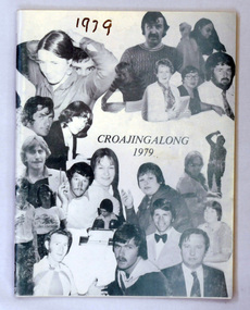
magazine, Snowy River Mail, Croajingalong 1979, 1979
The name Croajingolong derives from the Australian Aboriginal Krauatungalung words galung, meaning "belonging to" and kraua, meaning "east". This is the thirty-second edition of the annual magazine of Orbost High School. The magazine belonged to Mary Gilbert, a former teacher at the school. This 32nd issue of the annual Orbost High School magazine is a useful reference tool.A white 62 pp light card covered magazine. On the front cover in the middle is the title in green print. Around it are photographs of men and women - staff of Orbost High School.orbost-high-school magazine croajingalong -
 Orbost & District Historical Society
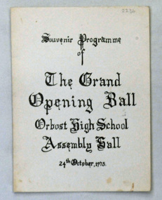
program, Snowy River Mail as "Mail" Print, 1975
This item was produced as a souvenir for the opening of the Orbost High School Assembly hall. The ball was held on October 24, 1975. The school was established in 1912.Orbost High School / Orbost Secondary College has played a significant part in the education of senior students in the Orbost district . It is the sole senior educational institution. This item is representative of its history. Balls werefor many years a common community event in the Orbost district.A rectangular cardboard program for the "Grand Opening Ball Orbost High School Assembly Hall". It is a single card folded in half with black print on a white background.orbost-high-school dance-ball entertainment recreation -
 Orbost & District Historical Society
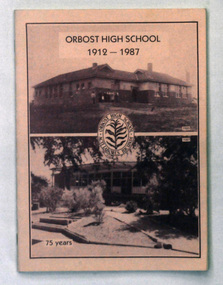
book, Snowy River Mail as "Mail" Print, ORBOST HIGH SCHOOL 1912 -1987, 1987
This magazine was produced for the 75th anniversary of Orbost High School. 2238.1 belonged to Mary Gilbert. 2238.2 belonged to Ruth Legge.Orbost High School / Orbost Secondary College has played a significant part in the education of senior students in the Orbost district . It is the sole senior educational institution. This item is representative of its history. It is a useful reference tool.Two copies of a 48 pp magazine titled, "Orbost High School 1912-1987". It has a pink cover with two photos of Orbost High School - 1925 and 1987. In the centre is the school badge.magazine-orbost-high-school -
 Linton Mechanics Institute and Free Library Collection
Book - Novel, Page, Gertrude (afterwards Gertrude Dobbin), Follow after!, [1915]
284 p.fictionfiction -
 Linton Mechanics Institute and Free Library Collection
Book - Novel, Curwood, James Oliver, The Golden Snare by James Oliver Curwood, 1918
Hardcover book, 302 pages. Book has a dark red cover with a gold embossed image of a building.fictionjames oliver curwood, fiction -
Linton Mechanics Institute and Free Library Collection
Book - Novel, Gerhardi, William, Jazz and Jasper : the story of Adams and Eva, 1928
312 p. : plain red cover, title and author's name embossed in gold on spine.fictionfiction, william gerhardi -
Linton Mechanics Institute and Free Library Collection
Book - Novel, Braddon, M. E. (Mary Elizabeth), Dead love has chains, [n.d.] [1907?]
270 p.fictionfiction -
Linton Mechanics Institute and Free Library Collection
Book - Novel, Peterson, Margaret, Fate and the watcher, [n.d.] [First published 1917? Date of this Hurst & Blackett reprint not known.]
253 p. : embossed red cover. fictionfiction, margaret peterson -
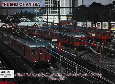 Victorian Railway History Library
Book, Bow River Publishing, The end of an era : the final years of Sydney's single-deck electric trains, 2007
A photographic tribute to the final years of Sydney's single-deck electric trainsIll, p.80.non-fictionA photographic tribute to the final years of Sydney's single-deck electric trainssuburban railways - sydney, passenger carriages - sydney -
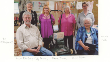 Lakes Entrance Historical Society
Photograph, Snowy River Mail, East Gippsland Heritage Network 2013, 1/04/2013 12:00:00 AM
Colour photograph of East Gippsland Heritage Network members Ian Hollingsworth, Marie Fish, Judy Gray, Judy Davies, Marie Tanner, Janet Palmer at Orbost Historical Society exhibition Orbost Victoriahistory group members, groups, historical society -
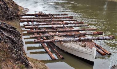 Port of Echuca
Functional object - Outrigger Barge, Murray River Sawmills, D26, 1926
The D26 is an authentic outrigger logging barge - one of four that were towed by P.S. Adelaide for 80 years of its working life. In March 1987 Council purchased the barge from Deakin Shire in South Australia for $15,000. However, its restoration was put on hold until the crew had completed work on the P.S. Enterprise, eventually beginning in 1988 using local red gum. The barge was relaunched at Echuca East on Australia Day, 1990. The D26 remains at the Port of Echuca and on special occasions can be seen being towed by the P.S. Adelaide for demonstrations. The restored D26 outrigger barge is an example of early 20th century boat building technology developed for transporting reg gum logs downstream along the Murray River, often from the Barmah Forest to the Murray River Sawmills at Echuca. It shows the resourcefulness and manual transport techniques for a timber that does not float and had to be chained to the outrigging logs laying perpendicular to the hull. These outrigger barges could be let go to float with the current downstream with a bargeman onboard. Often there was no tiller or helm, but a chain was tied to the ballast at the back to keep the barge in the centre of the river channel. This allowed the Murray River Sawmills built 4 barges to go behind the PS Adelaide, the A11, the B22, the C24 and the D26. Timber outrigger logging bargeD26d26, p.s. adelaide, logging industry, murray river sawmill -
 Orbost & District Historical Society
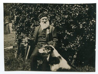
black and white photograph, early 20th century
This is a photograph of Samuel Smith, aged 92, with his dog outside his home, Gloucester House, near Cann River. He was the keeper at CapeEverard (Point Hicks) for five years.He retired from the lighthouse position in 1904. His life story was written in The Snowy River Mail, Orbost, Wednesday Evening – 27 January 1937 as "LIFE STORY OF SAMUEL SMITH". He was born in Gloucestershire in 1844 and died in 1937 at the the Orbost Hospital. There was an obituary in The Argus (Melbourne) on Saturday 18 February, 1939. Samuel Smith, of Noorinbee, East Gippsland, was the last survivor of the original crew of the frigate Victoria, the first vessel of the old Victorian Navy. When the Victoria arrived in Melbourne in 1861 after having landed soldiers in New Zealand for the Maori War, the crew was given a civil reception, and each member was presented with a sovereign in honor of the birth of the Victorian Navy. A black / white photograph of a bearded elderly man sitting and holding a cane. A dog is sitting at his knee. The photograph has ben taken outside in a garden.on back - "Samuel Smith, Head Lighthouse Keeper at C. Everard, retired 1904"cape-everard point-hicks smith-samuel -
 Eltham District Historical Society Inc
Photograph - Digital Photograph, Alan King, Maroondah Aqueduct Siphon Bridge over the Plenty River, 26 January 2008
Opened in 1891, the bridge formed part of the Maroondah Aqueduct carrying water from Watts River near Healesville to the reservoir at Preston where it joined Melbourne's metropolitan water system. Covered under Heritage Overlay, Nillumbik Planning Scheme. Published: Nillumbik Now and Then / Marguerite Marshall 2008; photographs Alan King with Marguerite Marshall.; p99 Built to supply thirsty Melbourne in the late 19th century, the siphon bridge spanning the Plenty River off Leischa Court, Greensborough, was part of an engineering masterpiece. Opened in 1891, the bridge formed part of the Maroondah Aqueduct carrying water from the Watts River near Healesville to the reservoir at Preston where it joined the metropolitan distribution system. A major link in Melbourne’s water supply, it also had a huge impact on communities, which mushroomed along its route. Named after the Aboriginal word for the area around the Maroondah Reservoir, the Maroondah Aqueduct was fully operational until the 1970s. Since the 1980s the land along parts of the aqueduct have been used for walking and bicycle riding, shaded in places by Monterey Pine trees planted to stabilise the surrounding ground. From 1857 the Yan Yean Reservoir supplied Melbourne’s water but the growing city needed additional catchments.1 In 1886 work began on a weir on the Watts River to enable the aqueduct to carry most of the river water 41 miles (66km) to Melbourne. The aqueduct, built by the Board of Works, is the oldest remaining aqueduct near Melbourne and was probably the first built with concrete.2 Although the aqueduct is now only used between the Maroondah and Sugarloaf Reservoirs, it can still be traced across the Shire. It extends from the Maroondah Reservoir through Christmas Hills, Kangaroo Ground, Research, Eltham, St Helena and then previously wound west through Greensborough to Reservoir.3 Built by horse and manpower the aqueduct gravity fed 25 million gallons (113.6ML) of water a day to Melbourne along a gradient of one foot to the mile. It included 25 miles (41km) of open concrete and brick channel, six miles (10km) of tunnels, and nine miles (15km) of 14 inverted siphons of riveted wrought-iron across creeks. Bricks for the aqueduct were made from clay found near the sites and remains of several kilns can still be found between Kangaroo Ground and Christmas Hills. Building the aqueduct transformed local communities. An abattoir was established at Christmas Hills. Grog shanties and labourers’ camps sprang up and local courts dealt with cases of ‘petty pilfering and boisterous behaviour’.4 The Kangaroo Ground school population jumped to 91, crammed into a room with one teacher. Miners who built the tunnels camped just north of Churinga in Greensborough – then called Tunnel Hill Camp – and adjacent to the Evelyn Arms Hotel. The miners’ high spirits were sometimes quenched in horse troughs or by a ‘welt under the ear and kick on the behind’ as the local constable calmed them down rather than lock them up.5 But the growing city of Melbourne needed more water, so the O’Shannassy catchment, east of Warburton, was added to the system in 1914. In 1920 work began on the present concrete Maroondah Dam one mile (1.6km) from the weir on the Watts River. The aqueduct capacity was thus doubled to 50 million gallons (227ML) a day.6 Intense land development threatened to pollute the open water supply, so channel sections were replaced with large pipes. In the late 1960s a large water main was built from the tunnel outlet at Research and extended through St Helena and Greensborough, so this section of the aqueduct was taken out of use. Long sections of the unused open channels in Greensborough and Bundoora were destroyed, but the old channel in Research and Eltham North remained largely intact. In the 1970s, the Sugarloaf Reservoir was constructed, inundating 445 hectares of land in Christmas Hills. Sugarloaf was officially opened in 1980 and serves as a water storage and treatment plant supplying Melbourne. In the early 1980s pipes replaced the section from Sugarloaf Reservoir to the tunnel entrance at Kangaroo Ground. The Research-Kangaroo Ground tunnel operates as part of the pipeline system.This collection of almost 130 photos about places and people within the Shire of Nillumbik, an urban and rural municipality in Melbourne's north, contributes to an understanding of the history of the Shire. Published in 2008 immediately prior to the Black Saturday bushfires of February 7, 2009, it documents sites that were impacted, and in some cases destroyed by the fires. It includes photographs taken especially for the publication, creating a unique time capsule representing the Shire in the early 21st century. It remains the most recent comprehenesive publication devoted to the Shire's history connecting local residents to the past. nillumbik now and then (marshall-king) collection, maroondah aqueduct, pipe bridge, siphon bridge -
 Eltham District Historical Society Inc
Negative - Photograph, Warrandyte Bridge over River Yarra, c.1910
View of the 1875 timber trestle bridge over the Yarra River reproduced from a newsprint image. Also known as Anderson's Creek (Road) Bridge A contract was accepted for William Elliot to erect a bridge over the Yarra River at Warrandyte on Anderson's Creek Road and other improvements for £1,331.6.2 - Gazette No. 143. Tuesday, November 13th 1860 - http://gazette.slv.vic.gov.au/view.cgi?year=1860&class=general&page_num=2161&state=V&classNum=G143&id=). The bridge was washed away by floods in 1863. It was replaced with a taller timber trestle structure in October 1875, designed and built by C.S. Wingrove, Shire Clerk, Engineer and Surveyor for Eltham Shire Council. A replacement for this bridge was commenced in 1955 to cope with increasing traffic and this structure was widened in 2018 to meet further traffic demands. Argus (Melbourne, Vic. : 1848 - 1957), Thursday 23 September 1875, page 7 ________________________________________ THE WARRANDYTE BRIDGE. The ceremony of formally opening the newly erected bridge over the Yarra at Ander-son's Creek was performed on Monday last, in the presence of the members of the Eltham and Bulleen shire councils whose territories it joins, and a goodly number of the residents of the district. The task was delegated to Mr. Cameron, M.L.A., who, after a few introductory remarks declared the bridge to be opened, and christened it the " Warrandyte Bridge." The party then adjourned to Grant's Hotel, where a cold collation had been prepared. The chair was taken by the president of the Eltham shire (Mr. John Bell) and the vice chair by Mr. Kent, a member of the Bulleen council. Mr Robert Williamson proposed "Success to the bridge," coupling with it the name of Mr. Cameron, to whose exertions was in the main to be attributed the erection of that structure which was an ornament to the district and would prove of great service to both sides of the river. Mr. Cameron, in responding, alluded to the great difficulties, mainly of a pecuniary nature, that had been encountered in carrying out the project, and which had only been got over by their united efforts and by the liberal spirit in which the late Commissioner of Roads had dealt with the case. The healths of the contractor and the engineer were also drunk. The bridge is a trussed timber one, resting on yellow box piles sunk into the solid rock, each pier being weighted with 50 tons of stone. The abutments consist of dry stone walls, 6ft. thick at the base, and tapering to 3ft. on the top, the face of the work having a batter of 1 to 1. The length of the bridge is 308ft., there being four openings in the centre of 66ft. each, and two at the ends of 20ft. each. The width in the clear is 9½ft., and the height from the bed of the river about 33ft. The approaches comprise 1,100 cubic yards of earthwork, and the formation of 48 chains of sideling, the whole cost of the work, which was carried out under the direction of the engineer to the Eltham Shire Council, being £1,413.This photo forms part of a collection of photographs gathered by the Shire of Eltham for their centenary project book,"Pioneers and Painters: 100 years of the Shire of Eltham" by Alan Marshall (1971). The collection of over 500 images is held in partnership between Eltham District Historical Society and Yarra Plenty Regional Library (Eltham Library) and is now formally known as the 'The Shire of Eltham Pioneers Photograph Collection.' It is significant in being the first community sourced collection representing the places and people of the Shire's first one hundred years.Digital image 4 x 5 inch B&W Neg B&W Print 12.5 x 9 cmsepp, shire of eltham pioneers photograph collection, warrandyte, bridge -
 Vision Australia
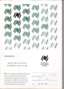
Certificate - Text, Association for the Blind: Bicentennial River Run 1988, 1987
Certificate reads "Awarded to Association for the Blind Bicentennial River Run 1988. By the Australian Bicentennial Authority which was established to plan and coordinate a nationwide program of celebrations in 1988 to commemorate the 200th anniversary of permanent European settlement in Australia" Signed by the Chairman: Victoria Council (illegible) and Executive Director (illegible), dated 30th July 1987. All text on this certificate is located on the bottom half of the document. The top half is populated by a repeated stylised graphic of a map of Australia, in various shades of green and gold. There is also a gold version of the same logo, labelled with "Endorsed Bicentennial Activity" , situated above the official signatures. 1 certificate with Australia imageryassociation for the blind, awards -
 Mordialloc College Alumni Association Inc (MCAA)
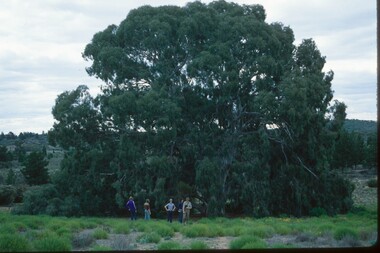
Photograph, 1979 Wyperfeld Old Be-al River Red Gum Tree, 1979
1979 - Mordialloc-Chelsea High School students standing in front of “Old Be-al” in Victoria’s Wyperfeld National Park, near Outlet Creek. It has been described as one of the most magnificent River Red Gums in the land. This glorious tree with foliage hanging to the ground escaped the fire of 1959 but not the fire of 1982 that damaged it badly. It lives on but has also suffered from lack of water and is now inaccessible to the public in a reference area. The MCAA has provided this image to the Friends of Wyperfeld National Park. Mordialloc-Chelsea High School students visited the Wyperfeld National park annually for the biology and geography Year 11 school camp.Example of a River Red Gum at Wyperfeld National Park.Digital image reproduced from colour slide.big desert fire 1959, mordialloc-chelsea high school camp, wyperfeld national park, fire 1982, old be-al river red gum -
 Flagstaff Hill Maritime Museum and Village
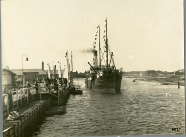
Photograph - S. S. Casino, Early 19th century
This photograph was one of ten photographs donated to Flagstaff Hill Maritime Museum and Village by Fred Trewartha. Frederick John Fox Trewartha (Fred) was a well-known Warrnambool businessman. He was born in Beeac near Geelong in 1920 and came to Warrnambool with his family as a very young child. He was apprenticed to his father John, as a saddler and later opened his own shop on Raglan Parade. He then moved into working with tarpaulins and canvases for the trucking industry. Fred was keenly interested in photography (and was a member of the Warrnambool Cine Club), yachting and boat building. He kept his yacht moored at Port Fairy for many years and participated in sailing events locally and interstate. He also built boats with his sons. He had the opportunity to meet many older sailors and it's thought this photo (and others in the set) may have been given to him by one of these men. Fred Trewartha died in 2016 in Warrnambool. The S.S. Casino was a passenger and freight steamer built in Dundee, Scotland, in 1882 for the Newcastle and Hunter River Steam Navigation Company of N.S.W. She weighed 425 tons gross with a length of 160.4 feet, beam of 24.1 feet and a depth of 10.2 feet. She had saloon accommodation for 35 people, a fore cabin for 25 more people, and she carried 300 tons of cargo. While on her delivery journey on May 30th 1882, the S.S. Casino called in at the Port of Warrnambool for coal, narrowly escaping going ashore in gale force winds due to the quick action of the pilot. At that time, still at anchor, she impressed the directors of the Belfast and Koroit Steam Navigation Company so much that they bought her immediately; she was ideal for trade along the West Coast of Victoria. (The Belfast and Koroit Steam Navigation Company was first managed by Messers. Saltau and Osburne and after the passing of Mr. Osburne, by produce merchants Messers H. Sautau and Sons, who had a hay and corn store and shipping agency on the corner of Liebig and Koroit Streets in Warrnambool. ) The S.S. Casino became “the most famous steamer to operate in Victorian waters along the West Coast” by author Jack Loney. Captain Boyd was her first Master, followed by Captain Chapman, who stayed with her from 1890 until 1924. Captain W. Robertson followed for a short term, and then Captain Middleton then took command from 1925 - 1932. An article published on Monday 11th June 1932 in The Sun News Pictorial (Melbourne) giving a detailed history of S. S. Casino said "owned by Port Fairy interests, she was an integral part of the town's development ... for a long time, her arrival in Port Fairy was an event, the townspeople going down to the wharf to see her come in". It also said "Except when the weather was bad, the Casino hugged the coast on her trips and passengers obtained wonderful views of the sandstone terraces and caves. A little time ago every member of her regular crew except one, was a Scotsman." This particular photograph of the S.S. Casino shows it decorated with numerous flags in "holiday rigging". During the years between 1884 and 1915, the Casino would take locals and holiday makers on excursions around the Port Fairy Bay. Local towns such as Terang, Penshurst and Mortlake held their Picnic Days in Port Fairy and excursions on the Casino would be available for them and in 1906 Terang and District Schools held an excursion to Port Fairy (where the Casino was organised to provide a series of trips around the Bay.) In 1916 new regulations introduced by the Marine Board requiring the Casino to carry enough lifebelts for every passenger on board, prevented the steamer from making trips around the Bay on excursion days. The S.S. Casino had several mishaps during her life. One was on 3rd January 1898 when she collided with the S.S. Flinders in Apollo Bay with minor damage. Another was on 24th October 1924 when she grounded on a reef at Point Hawdon near Grey River and most of her cargo (of Christmas goods) had to be dumped into the sea. Then in February 1929 she was ‘holed’ when she struck a submerged object as she entered Lady Bay, Warrnambool. In the years following the turn of the century, the S.S. Casino remained the only regular trader with normal passenger accommodation along the West Coast. From 1882 she had made at least 2,500 voyages on the one run. On the morning of 10th July 1932, after attempting to berth at Apollo Bay jetty in heavy seas, Captain Middleton decided to take her out into the bay and wait until the seas abated. It was not realised that the anchor used to steady her as she manoeuvred to her berth had pierced her hull. She put about and headed for the beach but sank. Captain Middleton and nine others lost their lives; nine people were rescued including the two female passengers. Captain Middleton had been in charge of the S.S. Casino for seven years. He was the first ship’s Master to lose his life in a shipwreck in the West Coast trade. In June 1932, the directors of the Belfast and Koroit Steam Navigation Company had proposed to celebrate the completion of fifty years of trading by the steamer Casino in August, but tragically the Casino was wrecked only one month later (and "was only one month off completing its fifty years of valuable service between Melbourne and Portland.") Flagstaff Hill’s collection has a photograph of a portrait of Captain Chapman, a ship model of the S.S. Casino that shows both forms of power under which she sailed, steam and sail. The ship is painted green and flies three flags. The inscription across the case of the ship model, incorrectly dated, tells the sad story of the wreck of the ship and the loss of lives on July 10th 1932 at Apollo Bay. A print in the Collection shows S.S. Casino underway in the heavy sea off Point Lonsdale, another two photographs show her at the Port of Warrnambool, leaving from the Breakwater in Lady Bay and another identifies the S.S. Casino as a ship from the Belfast and Koroit Steam Navigation Company. (Belfast is the original name for the township of Port Fairy).This photograph is significant because of its association with the coastal trader S.S. Casino and its significance to trade along Victoria's West Coast in the late 19th and early 20th centuries. The wreck of the S.S. Casino is considered an important part of Victorian and Australian cultural heritage and as such has been declared and protected as an Historic Shipwreck under State and Commonwealth Law in the Commonwealth Historic Shipwrecks Act (1976).A black and white photograph showing a small steamer with decorative flags on both masts, coming into up a river towards a pier where a small crowd is waiting. The pier on the left of the photograph has several buildings and a bell on it. Three small boats are tied up to the dock. Low lying land with several buildings scattered on it can be seen on the right hand side. On the back of the photograph are handwritten labels. One is printed in dark blue ink and one is written in cursive writing in biro. There is also the number 6944 stamped in the centre of the photograph.Back - Donors name, address and telephone number 6944 "CASINO IN HOLIDAY RIG" "at Port Fairy"flagstaff hill maritime museum and village, warrnambool, great ocean road, shipwreck coast, s. s. casino, steamer casino, casino, port fairy, captain chapman, belfast and koroit steam navigation company, saltau and osburne, captain middleton, apollo bay, apollo bay shipwreck, lady bay