Showing 1260 items
matching wattle
-
 Melbourne Tram Museum
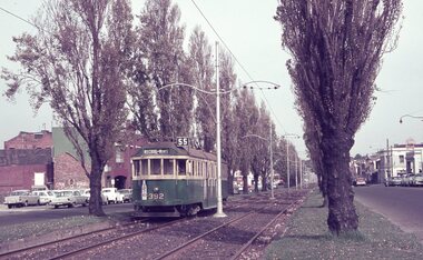
Album - Robert Thomson Slide Collection, "Melbourne 1965 April Box 2", 1965
Photo - see pdf file for further information. Number Brief Description RT137 Peel St - tram 392 - "West Coburg via William St" - route 55 RT138 Batman Avenue - tram 954 - "Prahran" - route 77 RT139 Batman Avenue - tram 388 - "Wattle Park Elgar Rd" - route 70 RT140 Elizabeth Street - tram 949 - "North Coburg" - route 19 RT141 East Coburg Ter - tram 668 - "South Melb Beach" - route 1 RT142 Royal Pde Jct - tram 764 - "North Coburg" - route 19, Haymarket, Hotel Gresham RT143 High st - tram 979 - "City Spencer St" - route 90, Clifton Hill RT144 High St - tram 1036 - "East Preston" - route 88, Clifton Hill RT145 tram 52 - "Footscray" - route 82, Maribyrnong River bridge reconstruction RT146 tram 802 - "City via North Melb" - route 57, tram 599, West Maribyrnong - Maribyrnong River bridge reconstruction RT147 tram 52 - "Footscray" - route 82 Raleigh Road, near Rosamond Road RT148 tram 52 - "Footscray" - route 82 at Moonee Ponds, Ascot Vale Road Demonstrates the work of Robert Thomson in photography, collection and/or production of slidesAssembled album in a black presentation folder of 12 colour slides, collected or produced by Robert Thomson. All photographs have been scanned and placed on the Museum's G drive. A list of all photographs with details has been compiled. melbourne, tramways, trams -
 Melbourne Tram Museum
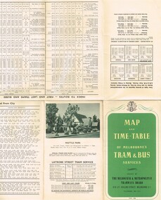
Map, Melbourne & Metropolitan Tramways Board (MMTB), "Map and timetable of Melbourne Tram and Bus Services" - May 1956", May. 1956
Fold out map (10 sections), coloured of Melbourne's Tram and Bus routes, route numbers, rail lines, municipalities boundaries and location of major places of interest. Titled - "Map and timetable of Melbourne Tram and Bus Services" - May 1956". At base of map - timetable of all night trams and bus services. On rear index to routes, 1st and last services, time of Sunday am services, LaTrobe St. services and photo of Wattle Park. Dated May 1956. Note the inset map shows Bourke St as a bus. Three copies held. 413.1 - as for above but with a pasted over section titled "Time table of all - night bus services" on the base of the map replacing the all night tram and bus services. Dated 3/7/1957. Copy from donation of Gary Butler added 3/12/15. See Reg Item 2300 for the March 1952 version.trams, tramways, melbourne, map, tram & bus services, all night services, mmtb -
 Melbourne Tram Museum
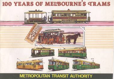
Book, G. McEldowney, "100 years of Melbourne's Trams", Nov. 1985
Thirty Two page book, A4 landscape format, saddle stapled, titled "100 years of Melbourne's Trams", published by the Metropolitan Transit Authority and the Australian Tramway and Motor Omnibus Employees Association in 1985. Colour cover featuring drawings of Melbourne trams from cable trams to articulated electric trams. Has foreword by Tom Roper, Minister for Transport. Book published to celebrate the centenary of the opening of the first cable tram in Melbourne, 11/11/1885. Reviews the history of trams in Melbourne, cable trams, horse trams, Clapp, municipal tramways, electric trams, MMTB, buses, Preston Workshops, Wattle Park and the Metropolitan Transit Authority. Notes the MTA winning the tender to building the Kowloon - Canton Light Rail system and Melbourne's Automatic Vehicle Monitoring System. Has colour photos and sepia toned (black and white) photos throughout. Second copy added 26-6-17 from donation of Neil Elfick.trams, tramways, melbourne, mmtb, cable trams, mta, horse trams -
 Melbourne Tram Museum
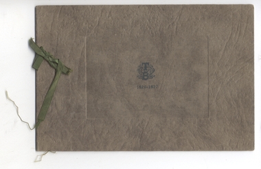
Ephemera - Christmas Card, Melbourne & Metropolitan Tramways Board (MMTB), 1926
M&MTB Season Greetings Card 1926 – 1927. The card consists of a heavily embossed brown cover with the MMTB logo on the front cover, with a printed sheet internally and tied together with a green ribbon. The photographs have been overlaid with a gold borders and the message has been printed in gold ink. An experienced printer estimated it would have taken some two hours to hand set the message, the press operator another two hours to get the registration correct before printing it and after printing allowed up to four days for the gold ink to dry before handling the paper again. This is certainly a work of art in terms of printing. Whether it was done by the M&MTB’s internal printing office is unknown. Of the view it would have only been sent to “select” people. On the front of the insert sheet is a photo of Dandenong Road, page 2 a message from The Board, page 3 a photo of Wattle Park, page 4 blank.trams, tramways, christmas cards, mmtb, dandenong rd, wattle park -
 Melbourne Tram Museum
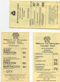
Document - Timetable/s, Melbourne & Metropolitan Tramways Board (MMTB), "MMTB Tram Timetables", 1980 - 1984
Set of 13 MMTB Tram timetables, folded sheets, 10 sections, providing timetables for specific routes, day of week giving information on tram times at specific time points, route map, sections and fares and organisation address - 616 Little Collins St. Melbourne. .1 - Route 72, 32 and 73 - Camberwell City via Swanston St (72), via William St (32) and Camberwell Junction (73) printed on yellow paper, dated April 1981 .2 - Route 88, 14, 89 and 90 - East Preston via Bourke St (88), via Latrobe St (14), East Preston Bell St (89) and Northcote Dundas St (90) to the city, printed on yellow paper, dated September 1980. .3 - Route 67, 37 and 66 - Carnegie - City via Swanston St (67), via William St (37) and Glenhuntly Depot (66) - printed on yellow paper, dated Jan. 1984 -has the Metropolitan Transit Logo. .4 - Route 70, 71 and 76 - Wattle Park - Nov 1979 .5 - Route 77, 78 and 79 - Prahran - City, Prahran - North Richmond - Nov 1979 .6 - Route 82 and 223 - Footscray - Moonee Ponds - tram and bus - Jan 1981 .7 - Route 1, 2, 4 - South Melbourne Beach - Feb 1981 .8 - Route 5 and 35 - Malvern - April 1981 .9 - route 70, 71, 76 - Wattle Park - April 1981 .10 - Route 15, 16, 53 and 55 - St Kilda Beach - Feb 1981 .11 - Route 6, 36. 7 - Glen Iris - July 1981 .12 - Route 59, 49, 51, 52, 82 - Essendon Airport March 1982 .13 - Route 48, 24, 40, 41, 29 North Balwyn - March 1982trams, tramways, mmtb, timetables, melbourne, fares, route 1, route 2, route 4, route 5, route 6, route 7, route 14, route 15, route 16, route 24, route 29, route 32, route 35, route 36, route 37, route 40, route 41, route 48, route 49, route 51, route 52, route 53, route 55, route 59, route 66, route 67, route 70, route 71, route 72, route 73, route 76, route 77, route 78, route 79, route 81, route 82, route 88, route 89, route 90, route 223 -
 Mission to Seafarers Victoria
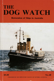
Journal (item) - Periodicals-Annual, Shiplovers' Society of Victoria, The Annual Dog Watch, 1991
This journal provides the reader with glimpses of the adventures and hardships of a seaman's life. Many of the stories are of sailing ships.Contributes to our knowledge of the importance of shipping and places on record those stories of the sea which would otherwise be lost.Contents Foreword - - 5 Editorial - - 9 Steam Tug Wattle - G.C. Hogben - 11 The Legend of the Marco Polo Pride of all New Brunswick - Sponsors of the Marco Polo Restoration Project - 17 Yarra Mud Re-visited - Harrow Morgan - 21 Abandon Ship (in Dry Dock) - T. E. Goldfinch - 33 The Golden Plover Lives Again - Alison Forte - 37 San Pedro Offshore - P.H. Lewis - 41 White Sails in Australian Waters - Late D. McLennan - 45 Barque Polly Woodside - - 52 The Edwin Fox Restoration Picton, New Zealand - - 55 A Gulf Trader - R.N. Thiele - 57 The Great Britain (Poem) - C.E. Bonwick - 65 Singapore for Orders - - 67 Memories of a Master Under Sail The China Coast - Late Captain William Phillip - 71 Junior Marine Radio Officer on the S.S. Iron Flinders - Ellery Teare - 75 Australia’s Oldest Vessel — The Portland Lifeboat - Reprinted from the Journal of Portland Smelter Services Pty. Ltd. - 79 Any port in a Storm - W.P. Shemmeld - 81 A Happy Introduction to Sail - Captain George Molyneux - 87 Restored Ships in Sydney Harbour - Jean Barrie - 89 The Voyage of the Jane Richardson — 1889 Part II - Late E. Binham - 99 Preservation of HMAS Castlemaine. - Peter J. Williams - 103 When Blood Stained the Wattle - Late D. McLennan - 107 Book Reviews - - 112sailing ships, steamships, shipping, seafaring life, shiplovers' society of victoria, dog watch, wattle tug, tug boat -
 Ringwood and District Historical Society
Document, Packet: Flora of Ringwood - reports lists and notes 1930s onwards, plus clipping 1853
Packet containing miscellaneous articles and correspodence.Packet includes: . Letter from Maroondah Group for the Society for Growing AustraliannPlants to Ringwood Council outlining objections to development of Glenvale Road area from flora and fauna aspects. Dated 17/7/94. Report by Eva Buchanan on proposed subdivision 94/112- Glenvale Road area dated August 1994. . Correspondence between Jack Lundy, Mrs Pullin and Bryan Tonkin re bulbs. . Miscellaneous documents on the Flora of Ringwood. . Typed notes- Eucalypts of Ringwood, Plants and Fungi of Ringwood, Birds of Ringwood area, Plants of Mitcham area, Wattles of Ringwood. (Refer also to "Ringwood- Place of Many Eagles" book, Appendix IV: Ringwood Natural History by F.J.C. Rogers, pages 241 to 268). -
 The Beechworth Burke Museum
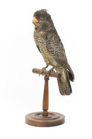
Animal specimen - Gang Gang Cockatoo (male), Trustees of the Australian Museum, 1860-1880
The Gang-gang Cockatoo can be found throughout much of south-eastern Australia. They reside in mountainous forests and open woodlands, often in small groups or larger flocks at sources of food and water. They eat mainly seeds from native trees and shrubs along with wattles, eucalypts and hawthorns. The Gang-gang Cockatoo is also known to incorporate berries, nuts, fruits and insects to their diet. The sound made by this type of Cockatoo is often described as a rasping screech which resembles the sound of a rusty hinge being moved.This type of call is made when the bird is in flight. These birds also fond of attention and can pick their own feathers if they are bored. The name "gang gang" derives from a New South Wales Aboriginal language, either the Ngunnawal or Wiradjuri. This specimen is part of a collection of almost 200 animal specimens that were originally acquired as skins from various institutions across Australia, including the Australian Museum in Sydney and the National Museum of Victoria (known as Museums Victoria since 1983), as well as individuals such as amateur anthropologist Reynell Eveleigh Johns between 1860-1880. These skins were then mounted by members of the Burke Museum Committee and put-on display in the formal space of the Museum’s original exhibition hall where they continue to be on display. This display of taxidermy mounts initially served to instruct visitors to the Burke Museum of the natural world around them, today it serves as an insight into the collecting habits of the 19th century.This specimen is part of a significant and rare taxidermy mount collection in the Burke Museum. This collection is scientifically and culturally important for reminding us of how science continues to shape our understanding of the modern world. They demonstrate a capacity to hold evidence of how Australia’s fauna history existed in the past and are potentially important for future environmental research. This collection continues to be on display in the Museum and has become a key part to interpreting the collecting habits of the 19th century.The male Gang Gang Cockatoo is standing stylised on a wooden perch. The Cockatoo has a dark slate-grey coloured body with a scarlet red/orange coloured head with a wispy crest. This specimen stands with its wings positioned to its sides and has round glass bead eyes. The bill has a hooked shape and is horn-coloured. The legs and feet of this specimen are dark grey.taxidermy mount, taxidermy, animalia, burke museum, beechworth, australian museum, skin, reynell eveleigh johns, bird, australian birds, cockatoo, gang-gang cockatoo, cockie -
 The Beechworth Burke Museum
Animal specimen - Gang Gang Cockatoo (female), Trustees of the Australian Museum, 1860-1880
The Gang-gang Cockatoo can be found throughout much of south-eastern Australia. They reside in mountainous forests and open woodlands, often in small groups or larger flocks at sources of food and water. They eat mainly seeds from native trees and shrubs along with wattles, eucalypts and hawthorns. The Gang-gang Cockatoo is also known to incorporate berries, nuts, fruits and insects to their diet. The sound made by this type of Cockatoo is often described as a rasping screech which resembles the sound of a rusty hinge being moved.This type of call is made when the bird is in flight. These birds also fond of attention and can pick their own feathers if they are bored. The name "gang gang" derives from a New South Wales Aboriginal language, either the Ngunnawal or Wiradjuri. This specimen is part of a collection of almost 200 animal specimens that were originally acquired as skins from various institutions across Australia, including the Australian Museum in Sydney and the National Museum of Victoria (known as Museums Victoria since 1983), as well as individuals such as amateur anthropologist Reynell Eveleigh Johns between 1860-1880. These skins were then mounted by members of the Burke Museum Committee and put-on display in the formal space of the Museum’s original exhibition hall where they continue to be on display. This display of taxidermy mounts initially served to instruct visitors to the Burke Museum of the natural world around them, today it serves as an insight into the collecting habits of the 19th century.This specimen is part of a significant and rare taxidermy mount collection in the Burke Museum. This collection is scientifically and culturally important for reminding us of how science continues to shape our understanding of the modern world. They demonstrate a capacity to hold evidence of how Australia’s fauna history existed in the past and are potentially important for future environmental research. This collection continues to be on display in the Museum and has become a key part to interpreting the collecting habits of the 19th century.This female Gang-gang Cockatoo has a grey head and crest with brown glass eyes. The beak is hooked and a pale bone colour. The neck and torso of the cockatoo is patterned with orange and black stripes. The feathers of the underparts and back are slate-grey with an edging of pink and yellow. The female cockatoo has more yellow in their feathers than the males which gives them a further barred appearance. taxidermy mount, taxidermy, animalia, burke museum, beechworth, australian museum, skin, reynell eveleigh johns, bird, australian birds, australaisian shovelor, shovelor, cockatoo, gang-gang cockatoo, cockie -
 Eltham District Historical Society Inc
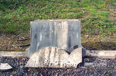
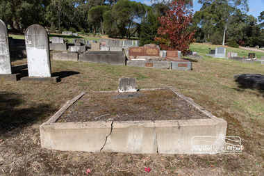
Negative - Photograph, Harry Gilham, Grave of Sarah and Phillip Shillinglaw, Eltham Cemetery, Victoria, Sep 2009
Philip Shillinglaw and his wife Sarah came to Eltham in 1882. Their property "Wattle Brae" originally encompassed present-day Eltham Central Park and part of Eltham Library, extending north to include Andrew Park and the site of the railway station. An early photo shows that much of it was planted for crops. They also had cows; in 1913 Philip wrote to the local paper complaining about an earlier report that one of them had been killed on the railway line. "I give an emphatic denial to the report. It is not true." Their house Shillinglaw Cottage (built by George Stebbings) still exists, though it was moved with funding from local residents in 1963-64 when faced with demolition to make room for new Council Offices. Philip was actively involved with the Methodist Church as preacher, Church Steward and Sunday School teacher. A Sunday School picnic and a sports carnival were held on his paddock. Eight of his children attended Eltham Primary School. In 1908 he ploughed part of the schoolyard (possibly for use as a garden) free of charge. When Philip died in 1914, his funeral was described as one of the largest ever seen in Eltham. He and Sarah are buried in Eltham Cemetery. In Loving Memory of Sarah Ann Shillinglaw Died 10th Dec. 1891 Also Phillip Loved husband of above Died 18th Aug. 1914 Sweet BestRoll of 35mm colour negative film, 6 stripsKodak GC 400-9eltham cemetery, gravestones, phillip shillinglaw, sarah ann shillinglaw -
 Eltham District Historical Society Inc
Photograph, Peter Pidgeon, Grave of Sarah and Phillip Shillinglaw, Eltham Cemetery, Victoria, 5 April 2021
Philip Shillinglaw and his wife Sarah came to Eltham in 1882. Their property "Wattle Brae" originally encompassed present-day Eltham Central Park and part of Eltham Library, extending north to include Andrew Park and the site of the railway station. An early photo shows that much of it was planted for crops. They also had cows; in 1913 Philip wrote to the local paper complaining about an earlier report that one of them had been killed on the railway line. "I give an emphatic denial to the report. It is not true." Their house Shillinglaw Cottage (built by George Stebbings) still exists, though it was moved with funding from local residents in 1963-64 when faced with demolition to make room for new Council Offices. Philip was actively involved with the Methodist Church as preacher, Church Steward and Sunday School teacher. A Sunday School picnic and a sports carnival were held on his paddock. Eight of his children attended Eltham Primary School. In 1908 he ploughed part of the schoolyard (possibly for use as a garden) free of charge. When Philip died in 1914, his funeral was described as one of the largest ever seen in Eltham. He and Sarah are buried in Eltham Cemetery. In Loving Memory of Sarah Ann Shillinglaw Died 10th Dec. 1891 Also Phillip Loved husband of above Died 18th Aug. 1914 Sweet BestBorn Digitaleltham cemetery, gravestones, phillip shillinglaw, sara ann shillinglaw -
 Eltham District Historical Society Inc
Photograph, Frank Stokes with daughters Dorothy (left) and Beryl (right) at Stokes Orchard, Nyora Road, Eltham, 1944, 1944
Frank Stokes first traveled to the district by train in 1944 to find land with the intention to establish an orchard. By chance he met Arthur Bird of Bird Orchard (bounded by Pitt Street, Eucalyptus Road and Wattle Grove) and they got talking over their common interest. Arthur put Frank up for the night and pointed out the land, part of Crown Allotment 15, Section 5, Parish of Nillumbik (CA15) somewhat diagonally opposite Bird Orchard. Frank bought the land and for the next two years would travel by train from Melbourne to Eltham every weekend establishing Stokes Orchard and building a home for his family, which they eventually moved into in 1946. In the mid 1970s the Shire of Eltham divided the orchard up into numerous rate-able parcel lots, which became affordable for Frank. As a consequence Stokes Orchard was turned into a housing development by Macquarie Builders and marketed as the Stokes Orchard Estate in two stages; Stage 1 encompassing Scarlet Ash Court, Ironbark Close and Peppermint Grove bounded by Nyora and Eucalyptus roads c.1976 and Stage 2 encompassing Stokes Place, Orchard Way, The Crest and The Lookout bound by Nyora and Diosma roads c.1979. The development of Orchard Way, The Crest and The Lookout did not proceed as planned due to the lack of the sewer along Diosma Road and so many of the proposed lots were incorporated into five-acre parcels instead.Representative of the orchard growing areas of ElthamDigital file only - Digitised by EDHS from a scrapbook (containing commercially printed photos of digital scans) on loan from Beryl Bradbury (nee Stokes), daughter of Frank Stokes.1944, beryl bradbury (nee stokes), beryl bradbury (nee stokes) collection, dorothy stokes, eltham, frank stokes, nyora road, stokes orchard -
 City of Moorabbin Historical Society (Operating the Box Cottage Museum)
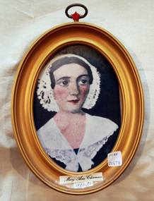
Painting, Mary Ann Charman 1820 - 1870, c1860
Mary Ann Charman was a pioneer settler in the Cheltenham area of the Parish of Moorabbin c1850 Stephen Charman , who emigrated in 1942 as a Henry Dendy employee aged 21 years, sadly lost his wife and child shortly after arriving in Brighton. When Dendy could not employ him he found other work. In 1850 he met Mary Gettens a widow with 5 children who supported her family by managing her late husband’s Inn in Collins St. Melbourne. Stephen purchased land in Spring Grove, now Cheltenham, in 1852 and the family moved to the wattle and daub hut after their marriage. Mary and Stephen worked very hard to establish a market garden, poultry and pork farm . They specialised in Marigolds which they sold to Martin & Pleasance Pharmacy , Melbourne for medicinal purposes. Mary and Stephen had 7 more children and Mary still managed to find time to sell the pork, poultry and vegetables from a horse drawn cart she drove around St Kilda. 1857 Stephen donated land to the Methodist Church for a School, burial ground and Chapel in Balcombe Road. Mary died 1870. Stephen remarried in 1878 and died aged 85 years 1906. Charman Road runs from Nepean Highway , Cheltenham through Beaumaris to the Beach Road at Mentone. Mr Les Jones was the Great Grandson of Mary Ann CharmanAn oval framed colour painting of the likeness of Mary Ann Charman, 1820 - 1870 pioneer settler in the Cheltenham area of the Parish of Moorabbinpioneers, early settlers, dendy henry, charman mary ann, jones les, cheltenham, moorabbin, brighton, market gardeners, dairy farmers, charman stephen, poultry farms, pork farms, charman road, balcombe road, mentone, beaumaris, st kilda, methodist church, -
 City of Moorabbin Historical Society (Operating the Box Cottage Museum)
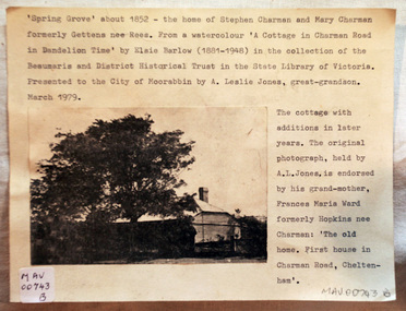
Document - Photograph, photocopy, of ‘Spring Grove’ 19th C house, Charman Road, Cheltenham, c1979
In 1852 Stephen Charman purchased 160 acres bounded by Charman Rd and Balcombe Road in an area called Spring Grove , later Cheltenham. A spring ran through the land providing a good source of water. Stephen aged 21 years had arrived in Melbourne 1842 as one of Henry Dendy’s emigrants . His Ship passage was paid by the Colonial Land and Emigration Commission and in return he was required to work on the land of the Henry Dendy Special Survey Brighton 1841. However Henry Dendy could not provide enough work for all the emigrants that arrived and Stephen had to obtain other work. Then sadly his young wife Harriett and their infant died. 1850 Stephen married widow Mary Gettens, a Publican in Little Collins Street, with 5 children. Stephen & Mary built a wattle and daub hut and established a market garden producing marigolds for Martin & Pleasance Pharmacists, Melbourne. They had 7 more children and built a weatherboard cottage that was used for early Methodist Church services. Stephen donated 1 acre to the Methodist Church in 1855 for Chapel , School and Cemetery. This is the weatherboard cottage in the photocopy showing the building extension, The road between Cheltenham and Mentone bears their name. Mary died in 1870 and Stephen remarried 1878 and died in Gippsland 1906. The original Photograph is endorsed by Francis Marie Ward , formerly Hopkins nee Charman who was the grandmother of Mr A.L Jones A photocopy of a black and white photograph of ‘Spring Grove’ , that was the first house in Charman Road , Cheltenham c1852 , showing later extensions. spring grove cottage 1852, schumer l, cheltenham, charman stephen, early settlers, jones a l, gettens mary, rees mary, charman mary, moorabbin, brighton, henry dendy special survey 1841, ward frances marie, charman frances marie -
 Eltham District Historical Society Inc
Photograph, View at Eltham, Vic, c.1924
Copy of possible Rose Stereograph Co. postcard “View at Eltham, Vic.”, c.1924 looking southwest from Main Road near York Street to Bridge Street and the original 1875 bridge across what is now the Alistair Knox Park The land in the foreground was first bought from the Crown by J.M. Holloway in 1851. The land was sub-divided and called "Little Eltham". Bridge Street was created as part of the sub-division. Most of the sub-division was residential lots but the creek valley was divided into lots for small farms. Council started to buy the land for the Eltham Town park in the early 1960s. The area was used as a garbage tip and filled above the flood plain of the creek. Development of the land for a park began in the early 1970s. The house on the right was owned for many years by the Hill family until Council bought it in the early 1960s. The house was built in the 1850s or 60s. The house on the left stood on what is now the southwest corner of Susan and Bridge Streets. The Braithwaite family was associated with this house. The double line of fencing in the foreground was a continuation of York Street to the creek. The Bridge Street bridge was built in 1875 and replaced in 1958. (Ref: Early view of Little Eltham; Byways of History by Colleen Ison, Publication unk, 24 August 1982) Reproduced on p61 of 'Pioneers & Painters' Date estimated on same as View at Hurstbridge featuring Wattle Valley EstateThis photo forms part of a collection of photographs gathered by the Shire of Eltham for their centenary project book,"Pioneers and Painters: 100 years of the Shire of Eltham" by Alan Marshall (1971). The collection of over 500 images is held in partnership between Eltham District Historical Society and Yarra Plenty Regional Library (Eltham Library) and is now formally known as the 'The Shire of Eltham Pioneers Photograph Collection.' It is significant in being the first community sourced collection representing the places and people of the Shire's first one hundred years.Digital image 120 format B&W negative Prints 17 x 25 cm and 10 x 15 cmsepp, shire of eltham pioneers photograph collection, eltham, bridge street, bridge, alistair knox park, braithwaite, bridge street bridge, eltham town park, hill family home, main road, pioneers and painters, york street -
 Wangaratta RSL Sub Branch
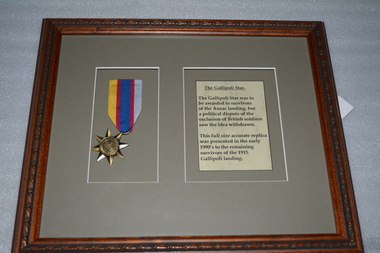
Framed Medal, Gallipoli Star
The Gallipoli Star and its ribbon were designed in 1917 by R K Peacock, but official approval from King George V for the proposed campaign medal was withdrawn after the ribbon, but not the medal, had been manufactured, because it was to have been presented only to Australians and New Zealanders, but not British or other Empire soldiers involved in the campaign. Some Anzac veterans are known to have been issued with lengths of ribbon during the war in anticipation of the medal's production. In 1990, Mr Ross Smith, a former Australian Army Warrant Officer and Vietnam veteran, arranged, at his own expense, for dies from the original design to be manufactured, and for A J Parkes & Co Pty Ltd, of Brisbane, to strike 1000 examples of the medal. 200 of these stars were presented to surviving Australian and New Zealand Gallipoli veterans to mark the 75th anniversary of the campaign. The remainder were sold to the public. A further 1000 were later struck for sale to collectors. The design features an eight pointed star, representing the states and territories of Australia (seven points) and New Zealand. The colours of the ribbon are blue, representing the ocean, gold, representing Australian Wattle, silver grey, representing New Zealand fern, and red for the colour of Australian gum blossom and the New Zealand Rata flower. This full size accurate replica was presented in the early 1990's to the remaining survivors of the 1915 Gallipoli landing. The Gallipoli Star Medal 1914-1915 was to be awarded to survivors of the Anzac landing but a political dispute of the exclusion of British Soldiers saw the idea withdrawn. Timber look frame containing medal on yellow/blue/red ribbon and paper with black writing on grey cardboard surround.gallipoli star, medal, 1914-1915 -
 Surrey Hills Historical Society Collection
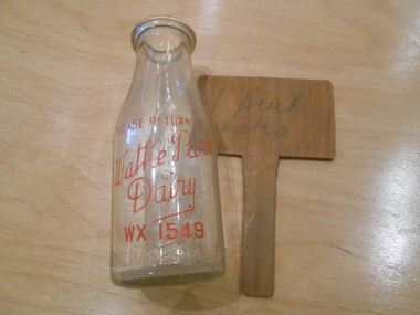
Domestic object - Wooden note, Note for the milk man
This note to the local milkman was associated with the milk bottle from the Wattle Park Dairy, which was purchased by Robin Kelly from a home in Surrey Hills in the 1970's or 1980's. This dairy was established by Horrie Breeden. The Breeden family came to Surrey Hills in 1905, first to Guildford Road, then Middlesex Road where Horrie Breeden lived as a boy. He sometimes used to help with milking at the adjoining Kenneally's dairy in Highfield Road. Sometimes he and his brother drove the cows from there to Schneider's property near Florence Road on the way to Surrey Hills Primary School. The cows would graze here until the boys took them back after school. At other times he would deliver milk from the Croydon Road dairy (Isherwood's or Bovill's) to St Joseph's Boys Home before school. Horrie became an apprentice in woodwork / carpentry at Vine's timber yard before serving in World War 1. Horrie's father died in 1919 and in the same year he bought 3 cows and established his own dairy on his mother's property on the corner of Goodwood Street and Boisdale Road. In the 1920s Horrie built the first house in Goodwood Street. He went on to build others in the street including his own at No 7 Goodwood Street. He did all the joinery and internal fittings for this. [Oral testimony: Horrie Breeden to Jocelyn Hall in 1979.] In the first half of the 20th century there were many local dairies in Surrey Hills and Mont Albert. In those days home deliveries were comparatively informal. This note to the milkman is material evidence of this. A rectangular wooden T-shaped note; the vertical part extending from middle of the lower edge and the upper part wide enough to balance on the top of a milk bottle.In grey lead pencil: " 1 pint / extra"dairies, milk delivery -
 Parks Victoria - Mount Buffalo Chalet
Bookends
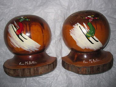
Sold as a souvenir of Mt Buffalo. 'Souvenirs in relation to the Chalet and Mount Buffalo were first mention in December 1912... A large range of souvenirs has since been associated with the Chalet and Mount Buffalo from crafted wooden items, silver spoons, cups etc... The collection includes a broad selection of products that have been sold throughout much of the Chalet's history, each representative of the transient fashions of their period.' (Pg. 114. Historica) "Souvenirs in relation to the chalet were perhaps first mentioned in December 1912, when enterprising locals, Mr J Pass of Porepunkah and Mr C Walker asked for permission to use timber on the mountain for making ornamental souvenirs . The government was agreeable to the ide and soon afterwards PWD chief architect George Austin went to Mount buffalo to make arrangements for supply of the timber, They proposed to make wooden egg cups, small boxes and photograph frames to sell to tourists, small items that' will serve as an advertising medium of the famous mount'" (Pg. 113.Historica) ' Fig 123. Bookends MBC0319,serviette rings MBC0217.2,eggcup MBC0218 and ashtray MBC0205 made of mulga, a wood from particular types of wattle tree that grow in arid climates. Souvenirs crafted from mulga became popular in the post WW2 years' (Pg 117. Historica) Purchased in a second hand shop and donated to MBC. Listed in Draft Inventory of Significant Collection Items . Appendix A.3. Souvenirs. (Pg 168. Historica).Two matching mulga wood book ends. They form a sphere when placed together. Hand painted motif and inscription on each. Painting of a skier dressed in colourful clothing on each and "From Mt Buffalo" painted at the base. "From Mt Buffalo" -
 Melbourne Tram Museum
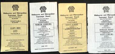
Ephemera - Timetable, Melbourne & Metropolitan Tramways Board (MMTB), MMTB Tram timetables, set of 12, 1971
Timetables for specific routes, day of week giving information on tram times at specific time points, route map, sections and fares and organisation address - 616 Little Collins St. Melbourne. 1 - Glen Iris - City route 6 - Oct. 1971 2 - North Coburg with connecting bus to Fawkner and Gowrie - Upfield on Sundays - June 1971 3 - Mont Albert - City - routes 42, 44, 45, 37 - Oct. 1971 4 - West Coburg - Domain Road and West Coburg City on Sundays - routes 55, 56 and 68 - May 1971 5 - Essendon Aerodrome - City route 59 - June 1971 6 - East Brighton - City - routes 64, 65, 62, 61 - Oct. 1971 7 - Carnegie - City - routes 67, route 66 - Oct. 1971 8 - Wattle Park - City route 70, route 71 and route 76 - Oct. 1971 9 - Camberwell - City - route 72, route 73 - Oct. 1971 10 - Prahran - City, North Richmond -Prahran - St Kilda Beach, routes 77, 78 and 79 - Oct. 1971 11 - East Preston - City and East Brunswick - City - routes 88, 89, 90. 96 and 97 - Oct. 1971 12 - ditto for Sundays printed on green paper. 13 - Route 8, Toorak, Oct. 1971-*Yields information about 1971 MMTB timetables.Set of 12 1971 MMTB Tram timetables, folded sheets.trams, tramways, timetables, mont albert, route 42, route 6, route 19, upfield, route 44, route 45, route 37, route 55, route 56, route 68, route 59, route 64, route 65, route 62, route 61, route 67, route 66, route 70, route 71, route 76, route 72, route 73, route 77, route 78, route 79, route 88, route 90, route 96, route 97, route 8 -
 Eltham District Historical Society Inc
Photograph, 218 Pitt Street, Eltham, c.1985, 1985c
House was rented by Kim Tarpey between October 1983 and June 1985. It was one of the buildings originally part of Birds Orchard. Harold Bird was her landlord, a retired primary school teacher who, when she knew him was driving the mobile library bus. Her partner had him as a teacher at Montmorency Primary in grade 4. The house was next door to what is now a bushland reserve near the Pauline Toner Reserve. It was on the corner of Pitt and Arthur St - the driveway was near the roundabout and went off to the right of the driveway that now belongings to 220 Pitt street and which was bushland at the time. It was sold in 1985 and consequently demolished, a large house has replaced it. It was situated approximately where the front door of No. 218 is nowadays with the facade roughly in line with the now garage wall to the left of this front door.Digital file only - scanned from personal photo album on loan (27 images) List of images EDHS_04644-1.tif Kitchen window looking towards Eucalyptus Road, 218 Pitt Street, Eltham, c.1985 EDHS_04644-2.tif 218 Pitt Street, Eltham, c.1985 EDHS_04644-3.tif 218 Pitt Street, Eltham, c.1985 EDHS_04644-4.tif Kitchen looking towards Pitt Street Reserve, 218 Pitt Street, Eltham, c.1985 EDHS_04644-5.tif 218 Pitt Street, Eltham, c.1985 EDHS_04644-6.tif Bathroom walkway/laundry, 218 Pitt Street, Eltham, c.1985 EDHS_04644-7.tif 218 Pitt Street, Eltham, c.1985 EDHS_04644-8.tif 218 Pitt Street, Eltham, c.1985 EDHS_04644-9.tif 218 Pitt Street, Eltham, c.1985 EDHS_04644-10.tif 218 Pitt Street, Eltham, c.1985 EDHS_04644-11.tif 218 Pitt Street, Eltham, c.1985 EDHS_04644-12.tif 218 Pitt Street, Eltham, c.1985 EDHS_04644-13.tif 218 Pitt Street, Eltham, c.1985 EDHS_04644-14.tif 218 Pitt Street, Eltham, c.1985 EDHS_04644-15.tif 218 Pitt Street, Eltham, c.1985 EDHS_04644-16.tif 218 Pitt Street, Eltham, c.1985 EDHS_04644-17.tif Lounge window looking towards Mount Pleasant Road, 218 Pitt Street, Eltham, c.1985 EDHS_04644-18.tif Fire place in lounge, 218 Pitt Street, Eltham, c.1985 EDHS_04644-19.tif Fire place in lounge, 218 Pitt Street, Eltham, c.1985 EDHS_04644-20.tif View from lounge room window looking towards corner of Eucalyptus and Mount Pleasant roads, 218 Pitt Street, Eltham, c.1985 EDHS_04644-21.tif View from lounge room window looking towards corner of Eucalyptus and Mount Pleasant roads, 218 Pitt Street, Eltham, c.1985 EDHS_04644-22.tif View from lounge room looking towards Pitt Street and Wattle Grove, 218 Pitt Street, Eltham, c.1985 EDHS_04644-23.tif View from lounge room looking towards Pitt Street and Wattle Grove, 218 Pitt Street, Eltham, c.1985 EDHS_04644-24.tif 218 Pitt Street, Eltham, c.1985 EDHS_04644-25.tif Back garden showing previous tank stumps. There was a hole in the wall where a possum got through, 218 Pitt Street, Eltham, c.1985 EDHS_04644-26.tif View from back fence looking towards Pitt Street and Wattle Grove, 218 Pitt Street, Eltham, c.1985 EDHS_04644-27.tif View from back fence on to Eucalyptus Road. Pitt Street Reserve to the right, 18 Pitt Street, Eltham, c.1985218 pitt street, eltham, houses, birds orchard, harold bird, kim tarpey, eucalyptus road -
 Bendigo Historical Society Inc.
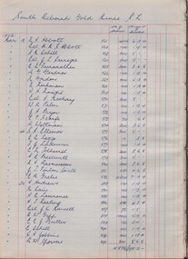
Book - MCCOLL, RANKIN AND STANISTREET COLLECTION: SHARE REGISTER - VARIOUS MINES LISTED BELOW, 1952
Book; Hard cover with paper pages listing shares held by shareholders and funds distributed. 1. South Deborah G.M. N.L. - 1st & final distribution. 2. Monument Hill Cons. N.L. 1st & final distribution. 3. Napoleon Reef G.M. N.L. 1st & final distribution. 4. South Wattle Gully Co. N.L. 1st 7 final distribution. 5. East Clarence G.M. Co. N.L. 1st 7 final distribution. 6. Golden Carshalton G.M. N.L. 1st 7 final distribution. 7. South Nell Gwynne G. M. N.L. 1st 7 final distribution. 8. North Virginia G.M. N.L. 1st 7 final distribution. 9. Central Napoleon G.M. N.L. 1st & final distribution. 10. Red White & Blue Extended G.M. N.L. 1st & final distribution. 11. South Costerfield Antimony G.M. Co. N.L. 1st & final distribution. Graphic Analysis Book 13 Sets on front cover.MCCOLL RANKIN & STANISTREETorganisation, industry, shares, mccoll rankin & stanistreet -
 Melbourne Tram Museum
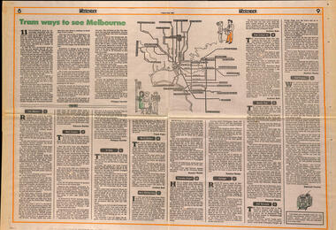
Newspaper, The Age, "Tram ways to see Melbourne", 8/5/1981
Newspaper clipping, from The Age, Weekender, Friday 8/5/1981 titled "Tram ways to see Melbourne", with a number of writers giving a short piece on a particular line. Has a Map of the Melbourne system with destination and route numbers. Has an introduction written by Phillipa Hawker which looks at the history, its place in Melbourne, and possibilities for the future. Written just before the MTA came into existence. Items: East Malvern, Route 3, Rebecca Batties West Preston Route 10, Phillipa Hawker St Kilda, Route 12, Frank Prain North Balwyn, route 48, Andrew Bolt West Maribyrnong route 57, Rosslyn Beeby Essendon Airport, Route 59, Rosslyn Beeby Carnegie, Route 67, Andrew Bolt Kew Cotham Rd, route 69, Andrew Bolt Wattle Park, route 70, Rosslyn Beeby East Burwood, route 75, Rosslyn Beeby East Preston, route 88, Deborah Forster Has some sketches of trams and people.trams, tramways, melbourne, people and places, tourism, east malvern, west preston, st kilda, north balwyn, west maribyrnong, essendon airport, carnegie, kew- cotham rd, wattle park, east burwood, east preston, route 3, route 10, route 12, route 48, route 57, route 59, route 67, route 69, route 70, route 75, route 88, maps -
 Glenelg Shire Council Cultural Collection
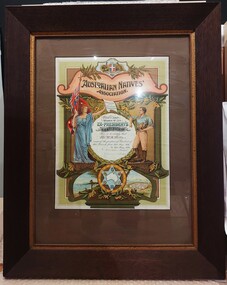
Certificate - Australian Natives Association Certificate, c. 1939
The Australian Natives Association (ANA) was founded in Melbourne in 1871. Its membership was restricted to white men born in Australia and its aim was to benefit them.Certificate issued by the Australian Natives Association. Portland Branch's ex President's certificate. Issue to Mr W.A. Mills. Occupied the position from 16 May 1938 to 15 May 1939. Signed by the President and the Secretary (illegible, faded). The certificate has the Australian emblem at the top under which is an orange banner with the words ' Australian Natives Association' across. Under this is a woman in classical style dress holding an Australian flag in her right hand and a document in her left which reads, 'Constitution of the Australian Commonwealth'. A circular frame states the owner of the certificate and why it was issued. On the other side of the circle is a man. He wears leather riding boots, cream trousers and a blue shirt. He is holding something in his left hand. Under is a central star in which is an image of Australia. Either side is a picture of the sea with an Aboriginal man standing at the shore by some boats. The other side has an image of white buildings. Wattle is depicted around the entire certificate.certificate, ana, australian natives association -
 Eltham District Historical Society Inc
Photograph, Slab hut, Warrandyte, Warrandyte Mystery Tour, 29 May 1994, 29/05/1994
[article by Bettina Woodburn in EDHS Newsletter No. 97, July 1994:] THE WARRANDYTE MYSTERY TOUR MAY 29TH 1994 - Members of the Eltham Historical Society met at the Old Post Office, now converted into the Warrandyte Historical Museum, for a picnic lunch on the sunny back verandah overlooking the shimmering Yarra River. Interesting photographs and artefacts filled various rooms outlining the history of this area, and told tales of Aboriginal and more recent neighbours of the Eltham Shire. The weather was calm, cloudy mostly with only occasional sunny patches, but it wasn't cold, although the autumnal leaf colours had changed to wintry brown. "All Aboard" and we set off in the Warrandyte Community Bus (with the School Bus sign displayed at the rear) to learn about local places of "Pride and Joy” from Bruce our guide and Tom the driver. Almost directly opposite we entered Whipstick Gully to explore the first of the district's hidden treasures - the Victory, one of the largest of the six or so major mines, past the old quarry now used for abseiling practice. By torchlight we entered the rocky hillside and saw the seams of quartz the miners had followed in their search for gold. Stamping batteries, and there was one in this gully, converted discarded rock into 'road metal'. Warrandyte is proud to be the first declared Goldfield in 1851, and one of the longest surviving, into the 1920s. A pleasant drive across the Bridge and along Bradley's Lane to Norman's Reserve brought us to see another Tunnel at Pound Bend through which the Yarra was diverted to allow about three miles of river-bed to be used for prospecting for alluvial gold. Still on this side of the river we visited the Old Slab Hut in Castles Road. This remnant of miners' housing is preserved because it had been incorporated into a weatherboard house, and saved from the bulldozers - a last minute reprieve, for preservation, by the National Trust. Devastating bush fires have destroyed other old cottages built of wattle and daub, with bark roofs and stone fire-places. The Cairn commemorating the disclosure of Gold Discovery at Warrandyte on June 30th 1851 beside Anderson's Creek Road was our next point of historical interest. We drove on to South Warrandyte and circled back to above the ford on Anderson's Creek to the entrance of the 4th Hill Mine. Again we crept along with our torches, careful of the low roof-rock, and side shafts. At a junction in a large cavity we were able to stand, look up a long air-vent which some 'cavers' climb down, and marvel at, and experience an aspect of a miner's life. Outside we heard the same bird songs, the trills and bell-pealing, saw the same straggly eucalypts, and a silver leafed wattle in flower, native grasses and ferns, and the neat present day houses, often of Warrandyte stone, perhaps veneered only. The day ended pleasantly, seeing more of the Yarra from Everard Drive, and the water rushing out of the Tunnel at Pound Bend, before returning to afternoon tea or coffee at the Museum. A great day for all concerned - many thanks to the Organisers.Colour photographslab hut, warrandyte, "warrandyte miner's cottage" -
 Eltham District Historical Society Inc
Photograph, Pound Bend tunnel, Warrandyte, Warrandyte Mystery Tour, 29 May 1994, 29/05/1994
[article by Bettina Woodburn in EDHS Newsletter No. 97, July 1994:] THE WARRANDYTE MYSTERY TOUR MAY 29TH 1994 - Members of the Eltham Historical Society met at the Old Post Office, now converted into the Warrandyte Historical Museum, for a picnic lunch on the sunny back verandah overlooking the shimmering Yarra River. Interesting photographs and artefacts filled various rooms outlining the history of this area, and told tales of Aboriginal and more recent neighbours of the Eltham Shire. The weather was calm, cloudy mostly with only occasional sunny patches, but it wasn't cold, although the autumnal leaf colours had changed to wintry brown. "All Aboard" and we set off in the Warrandyte Community Bus (with the School Bus sign displayed at the rear) to learn about local places of "Pride and Joy” from Bruce our guide and Tom the driver. Almost directly opposite we entered Whipstick Gully to explore the first of the district's hidden treasures - the Victory, one of the largest of the six or so major mines, past the old quarry now used for abseiling practice. By torchlight we entered the rocky hillside and saw the seams of quartz the miners had followed in their search for gold. Stamping batteries, and there was one in this gully, converted discarded rock into 'road metal'. Warrandyte is proud to be the first declared Goldfield in 1851, and one of the longest surviving, into the 1920s. A pleasant drive across the Bridge and along Bradley's Lane to Norman's Reserve brought us to see another Tunnel at Pound Bend through which the Yarra was diverted to allow about three miles of river-bed to be used for prospecting for alluvial gold. Still on this side of the river we visited the Old Slab Hut in Castles Road. This remnant of miners' housing is preserved because it had been incorporated into a weatherboard house, and saved from the bulldozers - a last minute reprieve, for preservation, by the National Trust. Devastating bush fires have destroyed other old cottages built of wattle and daub, with bark roofs and stone fire-places. The Cairn commemorating the disclosure of Gold Discovery at Warrandyte on June 30th 1851 beside Anderson's Creek Road was our next point of historical interest. We drove on to South Warrandyte and circled back to above the ford on Anderson's Creek to the entrance of the 4th Hill Mine. Again we crept along with our torches, careful of the low roof-rock, and side shafts. At a junction in a large cavity we were able to stand, look up a long air-vent which some 'cavers' climb down, and marvel at, and experience an aspect of a miner's life. Outside we heard the same bird songs, the trills and bell-pealing, saw the same straggly eucalypts, and a silver leafed wattle in flower, native grasses and ferns, and the neat present day houses, often of Warrandyte stone, perhaps veneered only. The day ended pleasantly, seeing more of the Yarra from Everard Drive, and the water rushing out of the Tunnel at Pound Bend, before returning to afternoon tea or coffee at the Museum. A great day for all concerned - many thanks to the Organisers.Two colour photographswarrandyte, activities, pound bend -
 Surrey Hills Historical Society Collection
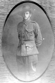
Photograph, George Leslie Rayment of Surrey Hills, AIF serviceman in WW1
George's grandfather was James Rayment Snr (1817-1890). He was born in Essex, England. He arrived in Melbourne aboard the “Bengal” in 1840. He married Jane McKnight on 12 March 1861. She died in 1871. James lived in South Melbourne until he married Elizabeth Brown in 1873. He moved to “Spenceycroft” at 654 Canterbury Road in 1880 - the property had a dairy. He moved to 85 Croydon Road, Surrey Hills (the house still stands) in 1886 but still ran the dairy. He moved back to South Melbourne and died there in 1890. His son James Rayment Jnr (1862-1916) was born in Emerald Hill. He married Harriet Ratten in 1882 and lived at 85-87 Croydon Rd Surrey Hills until 1914. He also owned properties at 70,72,81 and 83 Croydon Road. Harriet died in 1897. He married Victoria Benbow in 1898. In 1912 his occupation was fishmonger. In 1914 he moved to “The Wattles” at 95 Middlesex Road, Surrey Hills. In 1919 his wife Victoria owned lots 45,47,49,51,53,55 Durham Road. Surrey Hills. He died 1916 and Victoria died in 1939. James, the third, lived in Middlesex Road, Surrey Hills where he and his wife had a flower and vegetable farm. His brother was George Leslie Rayment (1894-1976), known as Les, the subject of this photo. He was born in Boroondarra. He lived at 85 Croydon Road, Surrey Hills. In 1914 he enlisted and served in the HQ staff 3rd Light Horse Brigade and was promoted to Staff Sergeant. In 1916 he was discharged for family reasons, those being that his father had died and there was no-one at home to support the family in Middlesex Road. In 1918 he married Grace Lewis at the Highfield Methodist Church. In 1919 they moved into “Clovelly”, 94 Durham Road, Surrey Hills. In 1927 his wife Grace died and in 1933 he married Celia Lewis. In 1936, with the help of his brother James, they built their new house at 14 Benwerrin Road, Surrey Hills. Celia died in 1967 and Les in 1976. Les had 2 children Dr Dulcie Grace Rayment and Norma Lesley Rayment. (Information courtesy of Mel Constable; Mel's wife is a Rayment descendant). Les' brother, James Arthur Rayment, was born in Balwyn in 1889. His A.I.F. record states - he joined on the 14 July 1915 to the 5th Field Company Engineers. His father was living in Middlesex Road, Surrey Hills at the time of his enlistment. He returned to Australia and was discharged on 22/7/1919. His occupation was carpenter; his religion, Methodist. He was 26 years and 2 months at enlistment and left Australia on 23/11/1915. James Arthur Rayment married Lilian Sarah Smith in 1920 (Ref: Victoria 1920/6780). REF: Mrs Dorothy Legg - James Rayment and his wife Elizabeth lived and farmed in Russell Street in the 1860s. The land was a dairy property and may have included some of the land later owned by the Presbyterian Church. Their sons James and Alex walked to the Balwyn State School. James married and lived at 'The Wattles' in Middlesex Road.Black and white photo of George Leslie Rayment in AIF uniform, standing with his hands behind his back. armed forces, world war, 1914 - 1918, clothing and dress, (mr) george leslie rayment, les rayment -
 Eltham District Historical Society Inc
Photograph, Frank Stokes with his mother Florence (nee West) and children, Dorothy (left), David (centre) and Beryl (right), Stokes Orchard, Nyora Road, Eltham, c.1950, 1950c
Frank's mother Florence was visiting from England at the time. Frank Stokes first traveled to the district by train in 1944 to find land with the intention to establish an orchard. By chance he met Arthur Bird of Bird Orchard (bounded by Pitt Street, Eucalyptus Road and Wattle Grove) and they got talking over their common interest. Arthur put Frank up for the night and pointed out the land, part of Crown Allotment 15, Section 5, Parish of Nillumbik (CA15) somewhat diagonally opposite Bird Orchard. Frank bought the land and for the next two years would travel by train from Melbourne to Eltham every weekend establishing Stokes Orchard and building a home for his family, which they eventually moved into in 1946. In the mid 1970s the Shire of Eltham divided the orchard up into numerous rate-able parcel lots, which became affordable for Frank. As a consequence Stokes Orchard was turned into a housing development by Macquarie Builders and marketed as the Stokes Orchard Estate in two stages; Stage 1 encompassing Scarlet Ash Court, Ironbark Close and Peppermint Grove bounded by Nyora and Eucalyptus roads c.1976 and Stage 2 encompassing Stokes Place, Orchard Way, The Crest and The Lookout bound by Nyora and Diosma roads c.1979. The development of Orchard Way, The Crest and The Lookout did not proceed as planned due to the lack of the sewer along Diosma Road and so many of the proposed lots were incorporated into five-acre parcels instead.Representative of the orchard growing areas of ElthamDigital file only - Digitised by EDHS from a scrapbook (containing commercially printed photos of digital scans) on loan from Beryl Bradbury (nee Stokes), daughter of Frank Stokes.1950, beryl bradbury (nee stokes), beryl bradbury (nee stokes) collection, david stokes, dorothy stokes, eltham, flatbed truck, florence stokes (nee west), frank stokes, nyora road, stokes orchard -
 Eltham District Historical Society Inc
Photograph, The Stokes family home blanketed with snow, corner Nyora and Eucalyptus roads, Eltham, winter 1951, 1951
Taken from outside the family home on the southest corner of the intersection of Nyora Road and Pitt Street with Eucalyptus Road. Frank Stokes first traveled to the district by train in 1944 to find land with the intention to establish an orchard. By chance he met Arthur Bird of Bird Orchard (bounded by Pitt Street, Eucalyptus Road and Wattle Grove) and they got talking over their common interest. Arthur put Frank up for the night and pointed out the land, part of Crown Allotment 15, Section 5, Parish of Nillumbik (CA15) somewhat diagonally opposite Bird Orchard. Frank bought the land and for the next two years would travel by train from Melbourne to Eltham every weekend establishing Stokes Orchard and building a home for his family, which they eventually moved into in 1946. In the mid 1970s the Shire of Eltham divided the orchard up into numerous rate-able parcel lots, which became affordable for Frank. As a consequence Stokes Orchard was turned into a housing development by Macquarie Builders and marketed as the Stokes Orchard Estate in two stages; Stage 1 encompassing Scarlet Ash Court, Ironbark Close and Peppermint Grove bounded by Nyora and Eucalyptus roads c.1976 and Stage 2 encompassing Stokes Place, Orchard Way, The Crest and The Lookout bound by Nyora and Diosma roads c.1979. The development of Orchard Way, The Crest and The Lookout did not proceed as planned due to the lack of the sewer along Diosma Road and so many of the proposed lots were incorporated into five-acre parcels instead.Representative of the orchard growing areas of Eltham. One of the rare times it has snowed in ElthamDigital file only - Digitised by EDHS from a scrapbook (containing commercially printed photos of digital scans) on loan from Beryl Bradbury (nee Stokes), daughter of Frank Stokes.1951, beryl bradbury (nee stokes) collection, eltham, eucalyptus road, nyora road, snow, stokes family home -
 Eltham District Historical Society Inc
Photograph, The first houses in construction on the new Stokes Orchard Estate, July 1976, July 1976
Viewed from near the Stokes family home at 1 Nyora Road looking northeast across Ironbark Close to Scarlet Ash Court with Peppermint Grove in the distance. Frank Stokes first traveled to the district by train in 1944 to find land with the intention to establish an orchard. By chance he met Arthur Bird of Bird Orchard (bounded by Pitt Street, Eucalyptus Road and Wattle Grove) and they got talking over their common interest. Arthur put Frank up for the night and pointed out the land, part of Crown Allotment 15, Section 5, Parish of Nillumbik (CA15) somewhat diagonally opposite Bird Orchard. Frank bought the land and for the next two years would travel by train from Melbourne to Eltham every weekend establishing Stokes Orchard and building a home for his family, which they eventually moved into in 1946. In the mid 1970s the Shire of Eltham divided the orchard up into numerous rate-able parcel lots, which became affordable for Frank. As a consequence Stokes Orchard was turned into a housing development by Macquarie Builders and marketed as the Stokes Orchard Estate in two stages; Stage 1 encompassing Scarlet Ash Court, Ironbark Close and Peppermint Grove bounded by Nyora and Eucalyptus roads c.1976 and Stage 2 encompassing Stokes Place, Orchard Way, The Crest and The Lookout bound by Nyora and Diosma roads c.1979. The development of Orchard Way, The Crest and The Lookout did not proceed as planned due to the lack of the sewer along Diosma Road and so many of the proposed lots were incorporated into five-acre parcels instead.Housing development in Eltham as an extension to the Woodridge EstateDigital file only - Digitised by EDHS from a scrapbook (containing commercially printed photos of digital scans) on loan from Beryl Bradbury (nee Stokes), daughter of Frank Stokes.1976-07, beryl bradbury (nee stokes) collection, building construction, ironbark close, nyora road, peppermint grove, scarlet ash court, stokes orchard estate, houses -
 Surrey Hills Historical Society Collection
Photograph, Beatrice Mary Stalker, later Mrs Howard Breedon Everard, at the beach, 1930s
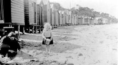
Mary Stalker’s engagement notice in The Argus in July 1947 indicates that she was the youngest daughter of Mr & Mrs A M Stalker of Montlare [Monclair] Avenue, North Brighton. It announces her engagement to ”Cr Howard Breedon Everard JP Ev-Ron, Woori Yallock, Youngest son of Hon WH Everard Wellington St Kew and the late Mrs Everard.” Beatrice Mary Stalker was born in 1919. Her parents were Alexander MacLaren Stalker (1885-1970/1973) and Charlotte Eleanor Hayward (1884-1953) who were married in 1911. Her sisters were Joan Winnock Stalker, Betty Neil Stalker and Ruth McLaren Stalker. Charlotte was a teacher prior to her marriage. Alexander, an accountant, lived in Wattle Valley Road, Canterbury in 1910. From 1912-1931 they are listed at ‘Benwerrin’, Wandsworth Road, Surrey Hills. Mary Stalker married in 1949 and by 1954 she and Howard were living at 44 Wandsworth Road, Surrey Hills, which was their home for decades. Howard was born in 1914 and died in October 2010: "EVERARD. - Howard Breedon. In loving memory of Howard, who lived life to the full to the very end of his 96 years. Greatly loved and honoured by Mary, Rosemary, David, Elizabeth, John and extended families." Beatrice Mary Everard died on 25 September 2019, aged 93. it is assumed that the woman in the photo is Mary's mother, Charlotte Eleanor Stalker (nee Hayward). The photo taken at the beach in 1930's may have been at Brighton, given the family’s later association with the suburb. This photo documents part of the social history of a family with a long and strong association with Surrey Hills. The backdrop of the typical bathing boxes used for changing into swimsuits, for lunch and for storing sports and beach gear, documents beach recreation and culture of the 1930s. Given the family's later residence in Brighton, this may well have been taken at Brighton Beach. For many years in the late nineteenth century, Brighton was Melbourne's favourite seaside destination. The now iconic bathing boxes were a response to Victorian ideas of morality and sea bathing. There are 82 Brighton bathing boxes, which protected by a heritage overlay because of their uniform scale and proportion, building materials, sentry order alignment. All retain their classic Victorian architectural features with timber framing, weatherboards and corrugated iron roofs. They remain as they did over one hundred years ago, as licensed bathing boxes. Service amenities such as electricity or water were never connected.A black and white photograph of a lady and little girl on the beach. There is a row of bathing boxes behind them.(miss) mary stalker, bathing boxes, (mrs) mary everard, (miss beatrice mary stalker, (mrs) beatrice mary everard, (mrs) charlotte eleanor stalker, (miss) charlotte eleanor hayward