Showing 1119 items matching "land development"
-
 Kew Historical Society Inc
Plan - Subdivision Plan, J R Mathers & McMillan, Glenarbor Estate, 1934
... the periods of urban development and subdivisions of land in Kew... the periods of urban development and subdivisions of land in Kew ...Pru Sanderson, in her groundbreaking ‘City of Kew Urban Conservation Study : Volume 2 - Development History’ (1988), summarised the periods of urban development and subdivisions of land in Kew. The periods that she identified included 1845-1880, 1880-1893, 1893-1921, 1921-1933, 1933-1943, and Post-War Development. These periods were selected as they represented periods of rapid growth or decline in urban development. An obvious starting point for Sanderson’s groupings involved population growth and the associated economic cycles. These cycles also highlighted urban expansion onto land that was predominantly rural, although in other cases it represented the decline and breakup of large estates. A number of the plans in the Kew Historical Society’s collection can also be found in other collections, such as those of the State Library of Victoria and the Boroondara Library Service. A number are however unique to the collection.The Kew Historical Society collection includes almost 100 subdivision plans pertaining to suburbs of the City of Melbourne. Most of these are of Kew, Kew East or Studley Park, although a smaller number are plans of Camberwell, Deepdene, Balwyn and Hawthorn. It is believed that the majority of the plans were gifted to the Society by persons connected with the real estate firm - J. R. Mathers and McMillan, 136 Cotham Road, Kew. The Plans in the collection are rarely in pristine form, being working plans on which the agent would write notes and record lots sold and the prices of these. The subdivision plans are historically significant examples of the growth of urban Melbourne from the beginning of the 20th Century up until the 1980s. A number of the plans are double-sided and often include a photograph on the reverse. A number of the latter are by noted photographers such as J.E. Barnes.The little-known Glenarbor Estate comprised 23 allotments bordering Wellington and Denmark Streets and Fenton Avenue. The auction of the allotments in the Estate was held in the Kew Recreation Hall. The purported advantages to Kew are identified on the plan, such as the close proximity of the entrance to the Kew Railway Station and access to shops in Denmark Street. Due to its location, the subdivision was pitched at commercial as well as residential purchasers. The Estate was to cause a crisis in the Kew Council as a majority of councillors voted on 29 May to acquire the entire Estate as the location of a new Town Hall. The Estate was said to be valued at £50,000. A later meeting was to rescind the vote, instead opting for the compulsory acquisition of South Esk on the corner of Charles Street and Cotham Road. That acquisition was to be overturned by the State Government. The debate about the purchase of the Glenarbor Estate by Council coincided with the decision to widen High Street on the South side between Cotham Road and the Junction."D"subdivision plans - kew, glenarbor estate, wellington street, denmark street -
 Kew Historical Society Inc
Plan - Subdivision Plan, Jas R Mathers Son & McMillan, The Dale Estate, Deepdene, 1918
... the periods of urban development and subdivisions of land in Kew... the periods of urban development and subdivisions of land in Kew ...Pru Sanderson, in her groundbreaking ‘City of Kew Urban Conservation Study : Volume 2 - Development History’ (1988), summarised the periods of urban development and subdivisions of land in Kew. The periods that she identified included 1845-1880, 1880-1893, 1893-1921, 1921-1933, 1933-1943, and Post-War Development. These periods were selected as they represented periods of rapid growth or decline in urban development. An obvious starting point for Sanderson’s groupings involved population growth and the associated economic cycles. These cycles also highlighted urban expansion onto land that was predominantly rural, although in other cases it represented the decline and breakup of large estates. A number of the plans in the Kew Historical Society’s collection can also be found in other collections, such as those of the State Library of Victoria and the Boroondara Library Service. A number are however unique to the collection.The Kew Historical Society collection includes almost 100 subdivision plans pertaining to suburbs of the City of Melbourne. Most of these are of Kew, Kew East or Studley Park, although a smaller number are plans of Camberwell, Deepdene, Balwyn and Hawthorn. It is believed that the majority of the plans were gifted to the Society by persons connected with the real estate firm - J. R. Mathers and McMillan, 136 Cotham Road, Kew. The Plans in the collection are rarely in pristine form, being working plans on which the agent would write notes and record lots sold and the prices of these. The subdivision plans are historically significant examples of the growth of urban Melbourne from the beginning of the 20th Century up until the 1980s. A number of the plans are double-sided and often include a photograph on the reverse. A number of the latter are by noted photographers such as J.E. Barnes.The Dale Estate in Deepdene was made possible by the death of Robert Sparrow Smythe, Australian journalist, newspaper editor/owner and theatrical manager. Smythe lived in his residence ‘Highate’, Deepdene until his death in 1917. In the subdivision proposed one year later, before the end of the First World War, 18 allotments were to be created. The very fragmentary plan in the Society’s collection notes that a large weatherboard [house] will need to be removed. This may be Smythe’s own home. The proposed subdivision included allotments facing Burke and Whitehorse Roads and Dale Street. Bordering the subdivision is the Deepdene Station and the Outer Circle Railway Line. The clear directions on the plan indicate that in 1918 it was possible to travel by train from Deepdene to East Camberwell and Ashburtonsubdivision plans - deepdene, the dale estate -
 Kew Historical Society Inc
Plan - Subdivision Plan, Jas R Mathers Son & McMillan, Clifton Estate, Kew, c. 1916
... the periods of urban development and subdivisions of land in Kew... the periods of urban development and subdivisions of land in Kew ...Pru Sanderson, in her groundbreaking ‘City of Kew Urban Conservation Study : Volume 2 - Development History’ (1988), summarised the periods of urban development and subdivisions of land in Kew. The periods that she identified included 1845-1880, 1880-1893, 1893-1921, 1921-1933, 1933-1943, and Post-War Development. These periods were selected as they represented periods of rapid growth or decline in urban development. An obvious starting point for Sanderson’s groupings involved population growth and the associated economic cycles. These cycles also highlighted urban expansion onto land that was predominantly rural, although in other cases it represented the decline and breakup of large estates. A number of the plans in the Kew Historical Society’s collection can also be found in other collections, such as those of the State Library of Victoria and the Boroondara Library Service. A number are however unique to the collection.The Kew Historical Society collection includes almost 100 subdivision plans pertaining to suburbs of the City of Melbourne. Most of these are of Kew, Kew East or Studley Park, although a smaller number are plans of Camberwell, Deepdene, Balwyn and Hawthorn. It is believed that the majority of the plans were gifted to the Society by persons connected with the real estate firm - J. R. Mathers and McMillan, 136 Cotham Road, Kew. The Plans in the collection are rarely in pristine form, being working plans on which the agent would write notes and record lots sold and the prices of these. The subdivision plans are historically significant examples of the growth of urban Melbourne from the beginning of the 20th Century up until the 1980s. A number of the plans are double-sided and often include a photograph on the reverse. A number of the latter are by noted photographers such as J.E. Barnes.The Clifton Estate was an ambitious subdivision. It included 61 allotments bordering Cotham and Park Hill Roads, and Florence and Adeney Avenues. It is difficult to ascertain the exact year when the ‘Clifton Estate’ was surveyed, subdivided and first auctioned. The uncertainty may be due to allotments being released during the First World War. The subdivision took its name from the house ‘Clifton’ (lot 5) on the corner of Adeney Avenue and Cotham Road. The outline of Clifton (since demolished) and the extent of its land following the subdivision are represented on the plan. The auctioneers have also shown ‘Maryfield’ and ‘Wimba’, the neighbouring properties in Cotham Road, on the plan."B"subdivision plans - kew, clifton estate, cotham road, adeney avenue, florence avenue, park hill road -
 Kew Historical Society Inc
Plan - Subdivision Plan, Plan of Subdivision of Part of Crown Portion 84 / Parish of Boroondara / County of Bourke / Lodged Plan No. 2217, Twentieth Century
... the periods of urban development and subdivisions of land in Kew... the periods of urban development and subdivisions of land in Kew ...Pru Sanderson, in her groundbreaking ‘City of Kew Urban Conservation Study : Volume 2 - Development History’ (1988), summarised the periods of urban development and subdivisions of land in Kew. The periods that she identified included 1845-1880, 1880-1893, 1893-1921, 1921-1933, 1933-1943, and Post-War Development. These periods were selected as they represented periods of rapid growth or decline in urban development. An obvious starting point for Sanderson’s groupings involved population growth and the associated economic cycles. These cycles also highlighted urban expansion onto land that was predominantly rural, although in other cases it represented the decline and breakup of large estates. A number of the plans in the Kew Historical Society’s collection can also be found in other collections, such as those of the State Library of Victoria and the Boroondara Library Service. A number are however unique to the collection.The Kew Historical Society collection includes almost 100 subdivision plans pertaining to suburbs of the City of Melbourne. Most of these are of Kew, Kew East or Studley Park, although a smaller number are plans of Camberwell, Deepdene, Balwyn and Hawthorn. It is believed that the majority of the plans were gifted to the Society by persons connected with the real estate firm - J. R. Mathers and McMillan, 136 Cotham Road, Kew. The Plans in the collection are rarely in pristine form, being working plans on which the agent would write notes and record lots sold and the prices of these. The subdivision plans are historically significant examples of the growth of urban Melbourne from the beginning of the 20th Century up until the 1980s. A number of the plans are double-sided and often include a photograph on the reverse. A number of the latter are by noted photographers such as J.E. Barnes.Undated Plan of Subdivision of Crown Portion 84 in what is now Kew. The area shown is bordered by Burke Road, Harp Road, Arglye Road and Normanby Road.subdivision plans -- kew (vic), harp road, burke road, normanby road, lady loch's drive, gladstone street, second avenue, first avenue -
 Kew Historical Society Inc
Map, MMBW, MMBW Plan No.117 Heidelberg & Kew, 1900-1910
The Melbourne and Metropolitan Board of Works (MMBW) was established by an act of the Victorian Parliament in 1890 to prepare for and to implement a sewerage and water reticulation system across what was then inner Melbourne, its surrounding and middle distance suburbs, including Kew. The MMBW was disbanded in 1991.The map collection of the Kew Historical Society has at its core the historic maps assembled and originally stored in the City Engineer's Department of the City of Kew. These include maps in a number of scales. The vast majority of maps were produced by the MMBW in the first two decades of the twentieth century, and are solid working maps, backed by linen for durability. These maps are historically significant to Kew, the City of Boroondara and to the history of the development of state utilities in Victoria. A number of the Kew maps have additional details added by former municipal officers, including the levels reached by various floods. As these were working documents, information was added to them long after the period of their initial production and distribution.Early map of part of the Borough of Kew, created in the early twentieth century, at a scale 160 ft to 1 inch. The map covers what was then the north eastern part of Kew showing the natural landscape and limited development on the south side of the Yarra River. In the Kew section, south of the river, the land is occupied currently by the Greenacres and Kew Golf Clubs. The map shows the extent of urban development by that time and the outlines of the few built structures in the municipality. The height above sea level of all parts of the landscape are indicated numerically in feet. Contour lines and the levels of historic floods were added in ink to the map at a later stage. MELBOURNE AND METROPOLITAN BOARD OF WORKS / PLAN NO. 117 / HEIDELBERG & KEW melbourne & metropolitan board of works, mmbw maps, borough of kew, cartography, mmbw plan no. 117, kew (vic.) -- maps, heidelberg (vic.) -- maps -
 Kew Historical Society Inc
Photograph - Yarra Valley Floods: Kew East, 1916
Flooding of the Yarra Valley, including that section of the Yarra bordering Kew and Kew East in the north and west of the municipality, was a regular occurrence. Extreme flood events of the Yarra River are recorded to have occurred in 1891, 1901, 1916, 1923 and 1934. The Municipality of Kew's response to these floods was to enact planning decisions restricting residential development in flood prone areas following the floods of 1916, 1921 and 1934. While floods continued after the development of the Upper Yarra Reservoir (construction 1948-57), the regularity and extent of these inundations diminished. During the nineteenth century, the land abutting the south side of the Yarra in Kew was devoted to dairy farming. In the twentieth century, before and after the construction of the Eastern Freeway, much of this low-lying area was used as golf courses and public parks.One of a collection of photographs of flooding in the Kew section of the Yarra Valley which are in important research resource for the location and extent of flooding in the first half of the twentieth century. Flooding of the Yarra Valley at East Kew in 1916. The view is taken from the intersection of Kilby Road with what is believed to be Birdwood Street, looking across the flood waters to Ivanhoe. The extensive flooded area shown in the photograph would have included the Kew Golf Club. Verso: "Floods along Kilby Road / near Birdwood St? & Kilby Road / 1917? / 87yarra river, yarra valley, floods -- kew, kilby road -- kew (vic.), kew golf club -
 Kew Historical Society Inc
Photograph - Yarra Valley Floods: Kew East, 1916
Flooding of the Yarra Valley, including that section of the Yarra bordering Kew and Kew East in the north and west of the municipality, was a regular occurrence. Extreme flood events of the Yarra River are recorded to have occurred in 1891, 1901, 1916, 1923 and 1934. The Municipality of Kew's response to these floods was to enact planning decisions restricting residential development in flood prone areas following the floods of 1916, 1921 and 1934. While floods continued after the development of the Upper Yarra Reservoir (construction 1948-57), the regularity and extent of these inundations diminished. During the nineteenth century, the land abutting the south side of the Yarra in Kew was devoted to dairy farming. In the twentieth century, before and after the construction of the Eastern Freeway, much of this low-lying area was used as golf courses and public parks.One of a collection of photographs of flooding in the Kew section of the Yarra Valley which are in important research resource for the location and extent of flooding in the first half of the twentieth century. Flooding of the Yarra Valley at East Kew in 1916. The view is taken from a street (maybe Birdwood Avenue) intersecting with Kilby Road looking northeast across the flood waters to Ivanhoe and Heidelberg. The extensive flooded area shown in the photograph would have included remnant dairy farms and the Kew Golf Club. Verso: "Floods / Yarra River / East Kew / Kilby Road / 1917? / 87"yarra river, yarra valley, floods -- kew, kilby road -- kew (vic.), kew golf club -
 Kew Historical Society Inc
Photograph - Flooding of the Yarra Valley at Kew East, 1974
Flooding of the Yarra Valley, including that section of the Yarra bordering Kew and Kew East in the north and west of the municipality, was a regular occurrence. Extreme flood events of the Yarra River are recorded to have occurred in 1891, 1901, 1916, 1923 and 1934. The Municipality of Kew's response to these floods was to enact planning decisions restricting residential development in flood prone areas following the floods of 1916, 1921 and 1934. While floods continued after the development of the Upper Yarra Reservoir (construction 1948-57), the regularity and extent of these inundations diminished. During the nineteenth century, the land abutting the south side of the Yarra in Kew was devoted to dairy farming. In the twentieth century, before and after the construction of the Eastern Freeway, much of this low-lying area was used as golf courses and public parks.Late example of the capacity of the Yarra Valley at Kew to flood, even though drainage works and the Upper Yarra Reservoir had reduced their regularity.Original black and white print photograph of the low-lying land at East Kew under floodwater on 16 May 1974. The vantage point of the photographer is Lister Street. In the photo, the fences of the Kilby Farm can be seen. Flooding was caused by overflowing water in Glass' Creek and the River Yarra. Annotation verso: "Hay's Paddock op No.30 Lister Street / 16 May 1974 11.50am / R.L. 46.04"hays paddock, floods, yarra river, glass' creek, lister street -
 Kew Historical Society Inc
Photograph - Flooding of the Yarra Valley at Kew East, 1974
Flooding of the Yarra Valley, including that section of the Yarra bordering Kew and Kew East in the north and west of the municipality, was a regular occurrence. Extreme flood events of the Yarra River are recorded to have occurred in 1891, 1901, 1916, 1923 and 1934. The Municipality of Kew's response to these floods was to enact planning decisions restricting residential development in flood prone areas following the floods of 1916, 1921 and 1934. While floods continued after the development of the Upper Yarra Reservoir (construction 1948-57), the regularity and extent of these inundations diminished. During the nineteenth century, the land abutting the south side of the Yarra in Kew was devoted to dairy farming. In the twentieth century, before and after the construction of the Eastern Freeway, much of this low-lying area was used as golf courses and public parks.Late example of the capacity of the Yarra Valley at Kew to flood, even though drainage works and the Upper Yarra Reservoir had reduced their regularity.Original black and white print photograph of the low-lying land at East Kew under floodwater on 16 May 1974. The vantage point of the photographer is Lister Street. Flooding was caused by overflowing water in Glass' Creek and the River Yarra. Annotation verso: "Lister Street looking north / Flood level / 16 May 1974 11.30am / R.L. 46.04"hays paddock, floods, yarra river, glass' creek, lister street -
 Kew Historical Society Inc
Photograph - Flooding of the Yarra Valley at Kew East, 1974
Flooding of the Yarra Valley, including that section of the Yarra bordering Kew and Kew East in the north and west of the municipality, was a regular occurrence. Extreme flood events of the Yarra River are recorded to have occurred in 1891, 1901, 1916, 1923 and 1934. The Municipality of Kew's response to these floods was to enact planning decisions restricting residential development in flood prone areas following the floods of 1916, 1921 and 1934. While floods continued after the development of the Upper Yarra Reservoir (construction 1948-57), the regularity and extent of these inundations diminished. During the nineteenth century, the land abutting the south side of the Yarra in Kew was devoted to dairy farming. In the twentieth century, before and after the construction of the Eastern Freeway, much of this low-lying area was used as golf courses and public parks.Late example of the capacity of the Yarra Valley at Kew to flood, even though drainage works and the Upper Yarra Reservoir had reduced their regularity.Original black and white print photograph of Hay's Paddock under floodwater on 16 May 1974. The vantage point of the photographer is Keystone Crescent looking east. Flooding was caused by overflowing water in Glass' Creek and the River Yarra. Annotation verso: "Keystone Cr looking east / 16 May 1974 11.50am"hays paddock, floods, yarra river, glass' creek -
 Kew Historical Society Inc
Photograph - Flooding of the Yarra Valley at Kew East, 1974
Flooding of the Yarra Valley, including that section of the Yarra bordering Kew and Kew East in the north and west of the municipality, was a regular occurrence. Extreme flood events of the Yarra River are recorded to have occurred in 1891, 1901, 1916, 1923 and 1934. The Municipality of Kew's response to these floods was to enact planning decisions restricting residential development in flood prone areas following the floods of 1916, 1921 and 1934. While floods continued after the development of the Upper Yarra Reservoir (construction 1948-57), the regularity and extent of these inundations diminished. During the nineteenth century, the land abutting the south side of the Yarra in Kew was devoted to dairy farming. In the twentieth century, before and after the construction of the Eastern Freeway, much of this low-lying area was used as golf courses and public parks.Late example of the capacity of the Yarra Valley at Kew to flood, even though drainage works and the Upper Yarra Reservoir had reduced their regularity.Original black and white print photograph of the low-lying land at East Kew under floodwater on 16 May 1974. The vantage point of the photographer is Lister Street. Flooding was caused by overflowing water in Glass' Creek and the River Yarra. Annotation verso: "Lister St looking same as No.3 / 16 May 1974 11.30"floods, yarra river, glass' creek, lister street -
 Kew Historical Society Inc
Photograph - Flooding of the Yarra Valley at Kew East, 1974
Flooding of the Yarra Valley, including that section of the Yarra bordering Kew and Kew East in the north and west of the municipality, was a regular occurrence. Extreme flood events of the Yarra River are recorded to have occurred in 1891, 1901, 1916, 1923 and 1934. The Municipality of Kew's response to these floods was to enact planning decisions restricting residential development in flood prone areas following the floods of 1916, 1921 and 1934. While floods continued after the development of the Upper Yarra Reservoir (construction 1948-57), the regularity and extent of these inundations diminished. During the nineteenth century, the land abutting the south side of the Yarra in Kew was devoted to dairy farming. In the twentieth century, before and after the construction of the Eastern Freeway, much of this low-lying area was used as golf courses and public parks.Late example of the capacity of the Yarra Valley at Kew to flood, even though drainage works and the Upper Yarra Reservoir had reduced their regularity.Original black and white print photograph of the low-lying land at East Kew under floodwater on 16 May 1974. The vantage point of the photographer is at Willsmere Road. The road itself is underwater.Annotation verso: "Willsmere Rd / Same as No.7 / 16 May 1974 11.15am"floods, yarra river, willsmere road -
 Kew Historical Society Inc
Photograph - Flooding of the Yarra Valley at Kew East, 1974
Flooding of the Yarra Valley, including that section of the Yarra bordering Kew and Kew East in the north and west of the municipality, was a regular occurrence. Extreme flood events of the Yarra River are recorded to have occurred in 1891, 1901, 1916, 1923 and 1934. The Municipality of Kew's response to these floods was to enact planning decisions restricting residential development in flood prone areas following the floods of 1916, 1921 and 1934. While floods continued after the development of the Upper Yarra Reservoir (construction 1948-57), the regularity and extent of these inundations diminished. During the nineteenth century, the land abutting the south side of the Yarra in Kew was devoted to dairy farming. In the twentieth century, before and after the construction of the Eastern Freeway, much of this low-lying area was used as golf courses and public parks.Late example of the capacity of the Yarra Valley at Kew to flood, even though drainage works and the Upper Yarra Reservoir had reduced their regularity.Original black and white print photograph of the low-lying land at East Kew under floodwater on 16 May 1974. The photograph is of Hyde Park looking north-east.Annotation verso: "Hyde Park looking nth-east / Flood Level / 16 May 1974 11.15am / R.L. 46.61"floods, yarra river, hyde park -
 Kew Historical Society Inc
Photograph - Flooding of the Yarra Valley at Kew, 1974
Flooding of the Yarra Valley, including that section of the Yarra bordering Kew and Kew East in the north and west of the municipality, was a regular occurrence. Extreme flood events of the Yarra River are recorded to have occurred in 1891, 1901, 1916, 1923 and 1934. The Municipality of Kew's response to these floods was to enact planning decisions restricting residential development in flood prone areas following the floods of 1916, 1921 and 1934. While floods continued after the development of the Upper Yarra Reservoir (construction 1948-57), the regularity and extent of these inundations diminished. During the nineteenth century, the land abutting the south side of the Yarra in Kew was devoted to dairy farming. In the twentieth century, before and after the construction of the Eastern Freeway, much of this low-lying area was used as golf courses and public parks.Late example of the capacity of the Yarra Valley at Kew to flood, even though drainage works and the Upper Yarra Reservoir had reduced their regularity.Original black and white print photograph of the low-lying land at East Kew under floodwater on 16 May 1974. The photograph is taken from 43 Kellett Grove.Annotation verso: "Kellett Gve No.43 / Flood Level / 16 May 1974 11.40am"floods, yarra river, kellett grove -
 Sunbury Family History and Heritage Society Inc.
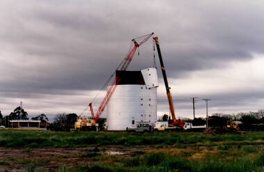
Photograph, Wheat silo
The wheat silo was erected on railway land on the west side of the railway line at Sunbury from approx 1970s - 1980s. It served as a grain storage provision for the local cereal farmers.The former CFA depot which was in Evans Street. With the expansion of the shopping centre the silo was dismantled to provide commercial development on the west side of the railway line.The wheat silo is a reminder of past agricultural industries that were carried out in Sunbury.A non-digital photograph of two trucks and a crane dismantling a metal wheat silo, which has been standing in an open area. A CFA pavilion is visible in the distance.wheat storage, silos, sunbury railway station, evans street -
 Sunbury Family History and Heritage Society Inc.
Photograph
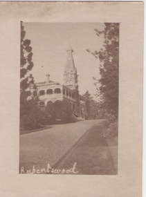
Rupertswood Mansion was the Sunbury residence of the Clarke family from 1874 until 1922 when H.V.McKay of Sunshine Harvester fame bought it from Hon. W.L. Russell Clarke in 1922. After the death of H.V.McKay in 1926, it was purchased by W. Naughton who then sold the mansion and 700 acres of land to the Salesian Fathers, who are the present owners. It is now the site of Salesian College, a Catholic co-educational college fore secondary students.Rupertswood Mansion has had close social, spiritual and educational links with Sunbury's development since 1874.A small sepia photograph with a cream frame of a driveway leading to a large mansion. 'RUPERTSWOOD' written in the LH corner of the photograph.rupertswood mansion, clarke, w.j.t., mckay, h.v., salesian college -
 Sunbury Family History and Heritage Society Inc.
Photograph, c1999
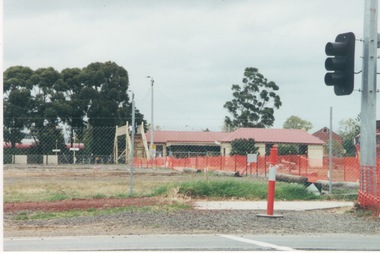
The open are in the foreground was part of railway land on the west side of Sunbury Station along Horne Street. The initial preparations to develop the area into a commercial and entertainment precinct were just commencing. The development that took place on this site was indicative of the growth that was taking place in Sunbury in the early 2000sA coloured photograph of an open area feed off with temporary netting in preparation for construction work. A set of traffic lights are on the RHS of the photograph and a station is in the middle distance.sunbury railway station -
 Sunbury Family History and Heritage Society Inc.
Photograph, 2000
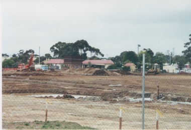
Excavation work to remove the grasslands and trees on the railway land on the west side of the Sunbury Station to make way for commercial development on that side of the line.A coloured photograph of excavation work in operation on land which has cyclone fencing around its perimeter. There are buildings in the middle distance beyond the work site.sunbury railway station -
 Sunbury Family History and Heritage Society Inc.
Photograph, 13 April 2000
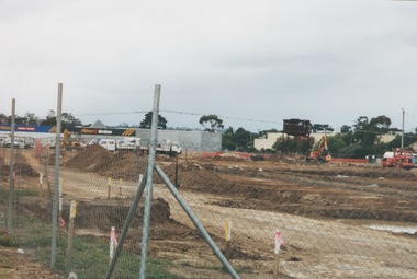
... In 2000 work commenced on the further development... work commenced on the further development of railway land ...In 2000 work commenced on the further development of railway land on the west side of Sunbury station for the construction of commercial and entertainment facilities. Prior to this time the land had been undeveloped and was often used to accommodate visiting circus troupes. Cereal storage silos also occupied this area for some time. The development of this area has been a reflection of the rapid expansion of settlement within Sunbury and surrounding areas that occurred during the early years of the twentieth century.A coloured photograph of a fenced off area undergoing development with earthmoving equipment and trucks in operation and some commercial buildings visible in the middle distance.sunbury railway station -
 Sunbury Family History and Heritage Society Inc.
Photograph, c1900s
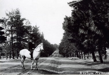
... Sunbury Asylum land. The housing development on the former Sunbury ...The man on the horse was photographed close to the main entrance of The Avenue which was the main approach to the former Sunbury Asylum. In later years the conifer trees were replaced with oak trees and today The Avenue is still the main road leading into Jacksons Hill, the housing estate that has been built on the former Sunbury Asylum land.The housing development on the former Sunbury Asylum site began in the 1980s. A black and white photograph of a man astride a white horse standing on an unmade road with an avenue of tall trees growing on either side of the formed road. A building is just visible in the distance.the avenue, sunbury as, jacksons hill -
 Surrey Hills Historical Society Collection
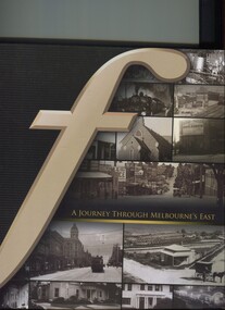
Book, A journey through Melbourne's east, 2008
Pictorial representation of the development of Melbourne's eastern suburbs. A collection of photographs of the local eastern area of Melbourne showing a lot of 'then' and 'now' photographs.A collection of photographs of the local eastern area of Melbourne showing a lot of 'then' and 'now' photographs.fletcher and parker, fletchers, real estate agents, melbourne, hawthorn, balwyn, camberwell, kew, land use, ashburton, montagnana-wallace, (mr) neil wallace, (mr) neil montagnana -
 Surrey Hills Historical Society Collection
Book, Mitchell House, Penguin Land, 2015
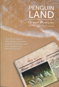
Includes: viewing penguins in the 1920's; Summerland - AKT Sambell, 1944 Town Planning Act, the Summerland Comunity, and Summerland today. The author is a local resident and foundation member of the Surrey Hills Progress Association. Content is centred on the Phillip Island penguin parade and charts a conservation and development struggle that endured for almost 80 yearsContent is centered on the Phillip Island penguin parade and charts a conservation and development struggle that endured for almost 80 yearsSigned on inside cover page by author: Gregor Buchanan / 18/8/15penguins - phillip island, birds - victoria, wildlife conservation - victoria, phillip island penguin reserve - victoria, summerland estate -
 Surrey Hills Historical Society Collection
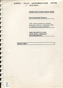
Report, Camberwell conservation study: environmental history 1989 : Draft only, 10/12/1989
Full title on cover: Camberwell Conservation Study: environmental history. Draft report submitted to Advisory Committee, 12 December 1989 at Camberwell Council Chambers An environmental history draft report prepared for City of Camberwell as part of the City of Camberwell Conservation Study. Presented in 2 volumes. Charts the development of the suburb of Camberwell. Beginning late 1880s.An environmental history draft report prepared for City of Camberwell as part of the City of Camberwell Conservation Study. Presented in 2 volumes. Charts the development of the suburb of Camberwell. Beginning late 1880s.camberwell, land places and structures, buildings - conservation and restoration, buildings, structures and establishments, social history, public housing, camberwell estate, st john's wood (wanganella) -
 Surrey Hills Historical Society Collection
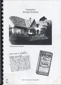
Book, Robin Da Costa-Adams, Enniskillen McAlpin Residence, Feb-09
This report was prepared by historian Robin da Costa-Adams to assess the cultural heritage significance of "Enniskillen" at 14 Balwyn Road, Canterbury. It includes some family history on a number of prominent families - the McAlpin family, the Hindson family and the architect, Arthur William Plaisted who designed 'Enniskillen' for the McAlpin family. McAlpin's was a major Victorian flour company in the nineteenth and early twentieth centuries. Owned and operated by J. McAlpin and Sons, the company sold its flour products across Australia and overseas. McAlpin's developed a successful marketing campaign which was pitched directly at housewives. One innovation was the publishing of a free cookbook which had recipes in it that used McAlpin's products. These free cookbooks were published successively from the 1930s through to the 1960s in Australia. Arthur Plaisted also designed the Surrey Hills Medical Centre in Union Road c1911. Some of his work is featured on the State Library of Victoria Collection. Robin da Costa-Adams has researched and written many publications including 'Blackburn a picturesque history, 1978'; 'Land of Gold: Gwlad yr Aur: James Tipping and a Mining Heritage'; 'Address (with signatories) from the women of Ballarat & Ballarat East to the women of England 1864 : against transportation of convicts', compiled and indexed by Robin; and 'Connie's Story : commemorating the Life of Mrs Edward (Plorn) Dickens'. Robin has been a tireless campaigner for heritage protection in Canterbury. This document on 'Enniskillen' was included with Robin's submission for 2 VCAT hearings regarding possible development of the property. Both resulted in a judgement against the proposed developments. In the recent (2021) hearing the document was specifically mentioned in the judgement.A report prepared by Robin da Costa-Adams in 2009 to assess the cultural heritage significance of "Enniskillen" at 14 Balwyn Road, Canterbury. It includes some family history on the McAlpin family, the Hindson family and the architect Arthur WIlliam Plaisted family.(mr) arthur plaisted, (mr) walter plaisted, enniskillen, shrublands, house names, (mr) francis henty, (mrs) mary henty, (mr) ernest carter, heathfield, (mr) john hindson, (mrs) alice hindson, (mr) william hindson, (mrs) annie west mcalpin, (mr) john mcalpin, mcalpin bakery, (mr) keith matthies, dental surgeon, (mr) william wolf, architects, (miss) mary beacon, robin ca costa-adams -
 Surrey Hills Historical Society Collection
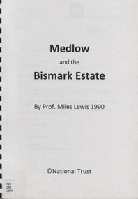
Book, Medlow and the Bismark Estate by Prof. Miles Lewis, 1990
The Medlow Estate is a remarkable testimony to the unfulfilled expectations of the land boom of the 1880s to early 1890s. The areas of the former lot 14 or the lines of Varzin Avenue and Friedrichsruh Street where they pass through the present grounds will be conserved as may seem appropriate to exhibit the development of the garden in the Cairncross and Bull periods.The Medlow Estate is a remarkable testimony to the unfulfilled expectations of the land boom of the 1880s to early 1890s. The areas of the former lot 14 or the lines of Varzin Avenue and Friedrichsruh Street where they pass through the present grounds will be conserved as may seem appropriate to exhibit the development of the garden in the Cairncross and Bull periods.bismark estate, rosalie estate, conservation of natural resources, (mr) rex swanson, landform australia, cairncross family, medlow, varzin avenue, warrigal road, surrey hills, friedrichsruh street, (mr) (dr) r j bull, (miss) mary jane cairncross, g n taylor -
 Surrey Hills Historical Society Collection
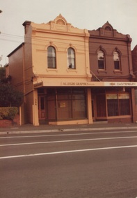
Photograph, 386-384 Canterbury Road Surrey Hills
The donor, Bob Lennox believed that these were the work of his great-grandfather William Lennox and his builders. William and his son were plasterers and often used the shell motif which is seen on the pediment of the buildings. These two terraces were part of the retail development of five terraces along Canterbury Road which were constructed on land subdivided from the parcel of land originally owned by John Woodhead. The Alan Holt register of properties in 3127 gives a list of proprietors / residents at the beginning of each decade from 1890-1980. There are also earlier photos depicting these buildings in the collection. These buildings have been included in the City of Boroondara Heritage Overlay Union Road Commercial Precinct 2011, Surrey Hills.These buildings were amongst the first commercial buildings serving the area of Surrey Hills and followed the extension of the railway from Camberwell in 1883.A colour photo with rounded corners taken from slightly diagonally across Canterbury Road from 2 double-storey Victorian style buildings. Both have the decorative shell motif in the pediment.Back of photo in green pencil "CANTERBURY RD SURREY HILLS / EAST OF UNION RD"victorian style, allegro graphics, william lennox, 386-384 canterbury road, shops, victorian terraces, canterbury road, surrey hills, john woodhead, heritage overlay union road commercial precinct 2011, heritage overlays -
 Surrey Hills Historical Society Collection
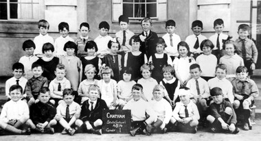
Photograph, Chatham State School Grade 1 1927, 1927
... -crowded. This followed a surge in development following WW1. Land... a surge in development following WW1. Land in surrounding streets ...Chatham School, located in Weybridge Street Surrey Hills, was opened on 1 August 1927 following pressure from local residents as nearby schools (Balwyn, Mont Albert & Surrey Hills) were all over-crowded. This followed a surge in development following WW1. Land in surrounding streets was sub-divided. This included part of John Butler Maling (Jnr)'s small farm bounded by Banool Road, Wharton Road, Weybridge Street and Whitehorse Road. An area surrounding his home, 'The Willows' was retained and not sold until after he died in 1931. leased by Mr John Butler Maling in 1861. Three acres of his land were purchased by the Education Department. Some of the early students have referred to Chatham’s land as Mr Maling’s bull paddock. Some of the original yellow box trees remain on the property. The most significant of these is now called the Friendship Tree. On 1 August 1927 212 students were enrolled; Ralph Rae was one of these. The school was official opened on 15th February 1928. The school number is 4314. A black and white photograph of a group of 39 Grade 1 students from Chatham State School.1927, schools, chatham state school, clothing and dress, primary schools, john butler maling (jnr), ralph rae (mr) -
 Surrey Hills Historical Society Collection
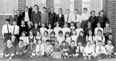
Photograph, Chatham State School Grade 5 1931, 1931
... -crowded. This followed a surge in development following WW1. Land... a surge in development following WW1. Land in surrounding streets ...Chatham School, located in Weybridge Street Surrey Hills, was opened on 1 August 1927 following pressure from local residents as nearby schools (Balwyn, Mont Albert & Surrey Hills) were all over-crowded. This followed a surge in development following WW1. Land in surrounding streets was sub-divided. This included part of John Butler Maling (Jnr)'s small farm bounded by Banool Road, Wharton Road, Weybridge Street and Whitehorse Road. An area surrounding his home, 'The Willows' was retained and not sold until after he died in 1931. leased by Mr John Butler Maling in 1861. Three acres of his land were purchased by the Education Department. Some of the early students have referred to Chatham’s land as Mr Maling’s bull paddock. Some of the original yellow box trees remain on the property. The most significant of these is now called the Friendship Tree. On 1 August 1927 212 students were enrolled; Ralph Rae was one of these. The school was official opened on 15th February 1928. The school number is 4314. A black and white photograph of a group of 51 Grade 5 students from Chatham State School.schools, chatham state school, clothing and dress, primary schools, john butler maling (jnr), ralph rae (mr) -
 Surrey Hills Historical Society Collection
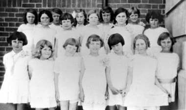
Photograph, Chatham State School Grade 2 1928, 1931
... -crowded. This followed a surge in development following WW1. Land... a surge in development following WW1. Land in surrounding streets ...Chatham School, located in Weybridge Street Surrey Hills, was opened on 1 August 1927 following pressure from local residents as nearby schools (Balwyn, Mont Albert & Surrey Hills) were all over-crowded. This followed a surge in development following WW1. Land in surrounding streets was sub-divided. This included part of John Butler Maling (Jnr)'s small farm bounded by Banool Road, Wharton Road, Weybridge Street and Whitehorse Road. An area surrounding his home, 'The Willows' was retained and not sold until after he died in 1931. leased by Mr John Butler Maling in 1861. Three acres of his land were purchased by the Education Department. Some of the early students have referred to Chatham’s land as Mr Maling’s bull paddock. Some of the original yellow box trees remain on the property. The most significant of these is now called the Friendship Tree. On 1 August 1927 212 students were enrolled; Ralph Rae was one of these. The school was official opened on 15th February 1928. The school number is 4314. Front row centre is Jocelyn Cerini who married Ken Hall, another Chatham student. A black and white photograph of a group of Grade 2 female students from Chatham State School. They are dressed in white.schools, chatham state school, clothing and dress, primary schools, john butler maling (jnr), ralph rae (mr), jocelyn cerini (miss), jocelyn hall (mrs) -
 Surrey Hills Historical Society Collection
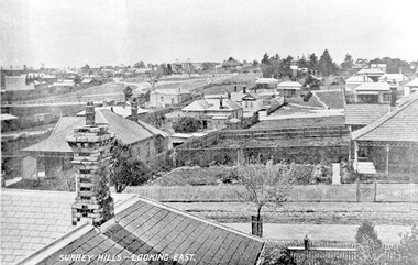
Photograph, Surrey Hills - Looking East from Essex Road, circa 1900, c1900
Date is approximate. Two original post cards of this image - "Surrey Hills - looking East" - were donated by Stephen Wyatt on 10 March 2012. One is blank; the other has been sent to Mrs A Wyatt, C/O Mrs E Young, 'Grand View', Warburton from daughter Nellie from 'The Quantocks', Surrey Hills - postmarked 10 Dec 1906. There is also a reproduction of this image in a framed collage of Surrey Hills photos.This is the earliest known image of the Surrey Gardens. The layout was originally designed by William Guilfoyle, who also designed Melbourne’s Royal Botanic Gardens.Black and white photo taken from an early postcard. Taken from the roof of a house in Essex Road, it shows the development of housing between Essex and Union Roads and includes the section of land fenced off for the Surrey Gardens with paths roughly laid out, one existing tree but no tree planting. The houses depicted are largely Edwardian timber buildings with corrugated rooves. There are still some vacant blocks. Kirkland on Union Road can be seen in the distance, as can some of the shops along Canterbury Road.Lower LHS within original image: " Surrey Hills - Looking East"; on the rear "No 17" in black pen in top LH corner.edwardian style, residential development, kirkland, essex road, suffolk road, norfolk road, surrey gardens, post card