Ringwood and District Historical Society
Archive - Biographical material, Maggs Family of Ringwood and District (Parent Record)
Transcript of the Maggs Family History, given by Joan Walker, former member of RDHS:-
Pioneer Family - Maggs
• James Maggs and wife Harriet Banfield migrated to Melbourne on the “Ticondergoa” which sailed from Birkenhead on 4th August 1852 with 812 assisted immigrants.
• In 1856 James purchased 7 acres of land, part of section 75, in the parish of Nunawading where he developed an orchard.
• Three children died young – Emma (before 1862), Jemima at Ticonderoga Bay and Mary Jane aged 3 weeks at Koonung Creek. Three sons and a daughter survived them. Harriet died in 1875, James in 1888 both buried in Box Hill cemetery.
• Their sons Joseph, Samuel and James all established orchards in the Ringwood/Croydon district.
Samuel Maggs
• Born 11 May 1851, Somerset, England and grew up on his fathers property in Springfield Road, Blackburn, one block east of Surrey Road.
• On 4 October 1876 Sam married Eliza Ann Barnes.
• 1881 purchased a block, Allot. 39 Parish of Warrandyte and developed an apple and cherry orchard. The orchard occupied the area between White Horse Road and Mullum Mullum Creek from Oban Rd east to where White Horse Road takes a slight turn to the right, near Burnt Bridge.
• Son George b.28 December 1876 Warrandyte married Annie Smith d.9 May 1947.
• Daughter Eliza Jane b.27 July 1878 Ringwood married William Dobbin, d.31 May 1946 Camberwell.
• Son James b.15 May 1880, Lilydale married Catherine Atkins d.28 July 1940 Ringwood buried Box Hill.
• Daughter Jemima b.16 December 1881 Warrandyte married Edward Lindsay in 1905, d.2 November 1955 and buried in Box Hill.
• Daughter Jane b.22 May 1884 Warrandyte married Thomas S Knee in 1912 d.31 January 1971, buried at Box Hill.
• Son Samuel William b.1 Jan 1889 Ringwood married Mina Lillian Schuhkraft in 1911 d.15 Jan 1955 Ringwood.
Joseph Maggs
• Born 5 June 1845, Somerset England.
• Married Mary Ann Reid in April 1867 at Templestowe.
• Bought Sec. 26a, in Ringwood on the corner of Eastfield Road an Mt Dandenong Road in February 1870. Planted 4 acres with fruit trees. Was also a wood carter. During the 1880s white clay was mined here, which he carted for the Victorian Porcelain Clay Coy.
• Daughter Emma b.8 Jan 1868 Templestowe d. 3 August 1939, Richmond married May 1890 Fredrick W. McGinnis.
• Daughter Agnes b.16 June 1869 Templestowe married John D Miller c.1894. d.3 February 1912 Heathmont, buried Box Hill.
• Son Albert b.1 May 1871 Nunawading d.15 Nov 1893.
• Son Hubert b.10 May 1873 Nunawading married Isabella Atkins in 1898 Ringwood d.11 August Wagga Wagga and buried there.
• Daughter Harriet Annis b.13 August 1875 Box Hill d.21 Sept 1875.
• Son Joseph b.25 September 1876 Box Hill d.3 Oct 1900 Mitcham.
• Daughter Harriet Annis b.18 Aug 1879, Ringwood married James R Miller d.8 May 1945.
• Son William b.3 Sep 1881 married Mary E Hardidge. D.6 April 1950 South Melbourne.
• Daughter Dora Jane Dulcie b.13 December 1883 Ringwood d.1973.
• Daughter Delia Rose b.20 February 1886, Ringwood married William J Sharkie d.30 October 1914
James Maggs
• Youngest (born 28 April 1862, Blackburn) and only Australian born son was also an orchardist.
• Married Marianne Hardidge in 1880 (divorced in 1906) purchased land in what is now Kalinda Road, adjoining Sam’s land.
• James lived with Teresa Shanks in the Hawthorn and Prahran districts and became a taxi driver. Died in 1925, buried at Box Hill. Marianne became a midwife who delivered over 500 babies in the area – was known as Nurse Polly Maggs, died in 1941 aged 81.
• Daughter Mary Ann Hase Polly b.5 July 1881 Ringwood married Thomas Lawford d.9 November 1961 buried at Box Hill.
• Daughter Jane Emma b.9 May 1883 Ringwood married Frederick Bloom 1910 d.28 July 1954.
• Daughter James John b.17 Jan 1885 Ringwood married Johanna Ida Edith Bloom in 1912 d.24 August 1962 buried at Box Hill.
• Daughter David Joseph b.31 Jan 1887 Ringwood married Violet Lepp married 1916, d.11 July 1966.
• Son Samuel Arthur b.11 March 1888 Ringwood married Bertha Anna Pump in 1913 d.7 August 1957.
• Son John William b.16 April 1890 Ringwood married Lillian Mabel May Smith in 1909 d.18 February 1959 Cobram.
• Daughter Eliza Anne b.6 March 1892 Ringwood d.April 18 1892.
• Son Robert Thomas b.7 March 1893 Ringwood married Edith E Britnell in 1919 d.12 March 1981 buried Box Hill.
• Son Albert Edward b.12 April 1895 Ringwood married Florence Sarah Pearce in 1918 d.30 January 1976 buried at Springvale.
• Daughter Evaleen Victoria b.28 Aug 1897, Ringwood married Sydney Till married 1920 d.5 September 1989 buried at Box Hill.
• Daughter Harriet Banfield Chrissy b.14 December 1899 Ringwood d.28 Dec 1979 buried Box Hill.
Jane Maggs
• Born 19 December 1858 in Blackburn. Died 5 July 1926 buried at Box Hill. Married William Cook and had one child, Harriet Amy Cook who never married and lived in Whitehorse Road, Mitcham until her death in 1962.
Details, extract from Family Tree Maker family tree:-
Descendants of James Maggs
Generation No. 1
1. JAMES5 MAGGS (JOSEPH4, WILLIAM3, WILLIAM2, SAMUEL1)1 died 24 Sep 18881. He married (1) HARRIET MARTHA BANFIELD1 23 Dec 1841 in Bristol, Somerset, England1. She was born 19 Jun 1817 in Clutton, Somerset, England1, and died 12 May 1875 in Nunawading, Victoria, Australia1. He married (2) ROSENA MAHON1 09 Dec 1875 in Fitzroy, Victoria, Australia1. She was born in Deptford, London, England1.
Notes for JAMES MAGGS:
JAMES MAGGS, and his wife HARRIET BANFIELD, migrated to Melbourne on the "Ticonderoga", which sailed from Birkenhead 4th Aug 1852 with 812 assisted immigrants aboard. In the close confines of the ship fever broke out and by the time she arrived off Port Phillip Heads on or about 2nd Nov, 100 deaths had been recorded in the log and hundreds were too weak to help themselves. Captain Wylie of the coastal trader "Champion", informed Captain Ferguson, the harbourmaster at Williamstown, of the tragic plight of the passengers and crew, and he came with two doctors, in the "Empire", to their aid. They anchored just inside Port Phillip Heads on 5 Nov. at the "Sanatory Station", declared but not yet established by the local authorities. Those who were well enough were put ashore in tents made of spars and sails. The "Lysander" was despatched from Melbourne to act as a hospital ship, and 2 houses, built of the local limestone, were commandeered as a quarantine station. For six weeks the survivors were held near Point Nepean at a place still known as Ticonderoga Bay while the fever, propably typhus, a louse borne epidemic disease, ran its course and a further 68 passengers, 2 crew members and 4 newborn babes succumbed to the scourge. Among them was Jemima Maggs, 3 year old daughter of James and Harriet. The dead were buried at the waters edge, in a grove of titree, a site now marked by Heaton's monument. The remainder of the family, including Samuel, just one year old, lived through the ordeal to make a new life in Australia.
James obtained work with Robert Wilson of Bulleen for a period of 3 months at a wage of 52 pounds per annum with rations. By 1856 he was able to purchase 7 acres of land, part of section 75, in the parish of Nunawading at 5 pounds per acre. Here he developed an orchard by means of various mortgages including one taken out 17 July 1872 for 50 pounds from the Victorian Permanent Property Investment & Building Society. Three of their seven children died young, Emma before 1862, Jemima at Ticonderoga Bay, and Mary Jane, the first of their three Australian born children, aged 3 weeks at Konung Creek.Three sons and a daughter survived them. Harriet died in 1875, James lived until 1888 and both are buried at the Box Hill Cemetery. Their sons, Joseph, Samuel, and James all established orchards in the Ringwood/Croydon district.
Bur Reg 308 Box Hill Grave #64 Presbyterian
More About JAMES MAGGS:
Ancestral File Number: LN0V-G01
Burial: 26 Sep 1888, Box Hill, Victoria, Australia1
Christening: 20 Oct 1816, Clutton, Somerset, England1
Record Change: 03 Oct 20041
More About HARRIET MARTHA BANFIELD:
Ancestral File Number: LN0V-N11
Burial: 14 May 1875, Box Hill, Victoria, Australia1
Christening: 31 Aug 18171
Record Change: 29 Nov 20041
More About ROSENA MAHON:
Record Change: 01 Dec 20011
Children of JAMES MAGGS and HARRIET BANFIELD are:
i. EMMA6 MAGGS1, b. 13 Nov 1843, Clutton, Somerset, England1.
More About EMMA MAGGS:
Record Change: 08 Jul 20031
2. ii. JOSEPH MAGGS, b. 05 Jun 1845, Clutton, Somerset, England; d. 24 Jun 1886, Ringwood, Victoria, Australia.
iii. JEMIMA MAGGS1, b. 25 Oct 1848, Clutton, Somerset, England1; d. 1852, Ticonderoga Bay, Victoria, Australia1.
More About JEMIMA MAGGS:
Record Change: 24 Jan 20031
3. iv. SAMUEL MAGGS, b. 11 May 1851, Clutton, Somerset, England; d. 30 Aug 1942, Croydon, Victoria, Australia.
v. MARY JANY MAGGS1, b. 03 Dec 1855, Konung Creek, Victoria, Australia1; d. 27 Dec 18551.
More About MARY JANY MAGGS:
Record Change: 23 Jan 20051
4. vi. JANE MAGGS, b. 19 Dec 1858, Blackburn, Victoria, Australia; d. 05 Jul 1926, , Victoria, Australia.
5. vii. JAMES MAGGS, b. 1862, Nunawading; d. 1925, Fitzroy.
Generation No. 2
2. JOSEPH6 MAGGS (JAMES5, JOSEPH4, WILLIAM3, WILLIAM2, SAMUEL1)1 was born 05 Jun 1845 in Clutton, Somerset, England1, and died 24 Jun 1886 in Ringwood, Victoria, Australia1. He married MARY ANN READ1 01 Apr 1867 in Templestowe, Victoria, Australia1. She was born Abt. 1847 in of Templestowe, Victoria, Australia1, and died 1925 in Ringwood, Victoria, Australia1.
Notes for JOSEPH MAGGS:
Joseph Maggs born 5 Jun 1845 at Clutton, Somerset, England, arrived in Australia age 7 years. He married Mary Ann Read, in Apr 1867 at Templestowe, selected land, Lot 26a,in Ringwood on the corner of Eastfield Road and Mt.Dandenong Road, approx 114 acres, at 11 o'clock 2 Feb 1870. He planted 4 acres with fruit trees valued at 80 pounds and by Sep 1874 his occupation was farmer and wood carter. A 4 room house of lathe and plaster with a paling roof, a kitchen, a slab and bark stable and a pigsty had been errected to a value of 71 pounds. A well, 3 dams, clearing and fencing valued at 96 pounds are also listed. He notes "from the nature of the land, being very poor and heavily timbered, I have not been quite able to clear the complement required, not having means sufficient to do so, neither will the land pay when cultivated." Traces of antimony were found on the land but not in commercial quantities, however during the 1880s white clay was mined here, which he carted for the Victoria Porcelain Clay Coy. In Mar 1880 he was granted freehold title at a price of one pound per acre.
More About JOSEPH MAGGS:
Burial: Box Hill, Victoria, Australia1
Record Change: 18 Feb 20011
More About MARY ANN READ:
Burial: Box Hill, Victoria, Australia1
Record Change: 21 Jul 20021
Children of JOSEPH MAGGS and MARY READ are:
6. i. EMMA7 MAGGS, b. 08 Jan 1868, Templestowe, Victoria, Australia; d. 03 Aug 1939, Richmond, Victoria, Australia.
ii. ALBERT MAGGS1, b. 01 May 1871, Nunawading, Victoria, Australia1; d. 15 Nov 1893, Ringwood, Victoria, Australia1.
More About ALBERT MAGGS:
Record Change: 12 Oct 19971
7. iii. HUBERT MAGGS, b. 10 May 1873, Ringwood, Victoria, Australia; d. 11 Aug 1956, Wagga Wagga, N.S.W., Australia.
iv. HARRIET ANNIS MAGGS1, b. 13 Aug 1875, Box Hill, Victoria, Australia1; d. Ringwood, Victoria, Australia1.
More About HARRIET ANNIS MAGGS:
Burial: 21 Sep 1875, Box Hill, Victoria, Australia1
Record Change: 18 Feb 20011
v. JOSEPH MAGGS1, b. 25 Sep 1876, Box Hill, Victoria, Australia1; d. 03 Oct 1900, Mitcham, Victoria, Australia1.
More About JOSEPH MAGGS:
Record Change: 18 Feb 20011
8. vi. HARRIET ANNIS MAGGS, b. 18 Aug 1879, Ringwood, Victoria, Australia; d. 08 May 1945.
vii. WILLIAM MAGGS1, b. 03 Sep 18811; d. 06 Apr 1950, South Melbourne, Victoria, Australia1; m. MARY ELIZA HARDIDGE1, 24 Dec 1912, Goulburn, N.S.W., Australia1; b. Abt. 1884, , of Victoria, Australia1; d. 1956, Lilydale, Victoria, Australia1.
More About WILLIAM MAGGS:
Record Change: 18 Feb 20011
More About MARY ELIZA HARDIDGE:
Record Change: 18 Feb 20011
viii. DORA JANE DULCIE MAGGS1, b. 13 Dec 1883, Ringwood, Victoria, Australia1; d. 1973, Mitcham, Victoria, Australia1.
More About DORA JANE DULCIE MAGGS:
Record Change: 21 Jan 20021
9. ix. DELIA ROSE MAGGS, b. 20 Feb 1886, Ringwood, Victoria, Australia; d. 30 Oct 1914.
10. x. AGNES MAGGS, b. 16 Jun 1869, Templestowe, Victoria, Australia; d. 03 Feb 1912, Heathmont, Victoria, Australia.
3. SAMUEL6 MAGGS (JAMES5, JOSEPH4, WILLIAM3, WILLIAM2, SAMUEL1)1 was born 11 May 1851 in Clutton, Somerset, England1, and died 30 Aug 1942 in Croydon, Victoria, Australia1. He married ELIZA ANN BARNES1 04 Oct 1876 in Nunawading, Victoria, Australia1. She was born 19 Sep 1848 in St Lukes, London, England1, and died 17 Feb 1923 in Croydon, Victoria, Australia1.
Notes for SAMUEL MAGGS:
SAMUEL MAGGS grew up on his father's property in Springfield Road, Blackburn, one block east of Surrey Road. West of Surrey Road and fronting to White Horse Road was James Barnes' property, so by walking through the Maggs land and crossing Surrey Road, one might enter the back of the Barnes land, an easy way to visit ELIZA ANN BARNES. On the 4 Oct 1876 Sam and Eliza were married at her father's house. Sam wrote to the Secretary for Lands on the 29 Sep 1880, requesting that Allot. 39 Parish of Warrandyte be made available for selection. This block had been refused for selection earlier on the objection of the Mines Department as it was believed that the area was auriferous. When told that the block was available, Sam marked it at 5 o'clock December 3rd and applied for a lease of 12 acres 3 rods and 34 perches on the 6th December. On the application it is noted that he already had leasehold of 104 acres. His license was approved 7 Mar 1881 at a rate of 6 shillings and 6 pence per halfyear. Previously paid fees and rental came to 3 pounds 18 shillings, and he paid another pound for a certificate fee, a pound lease fee, plus the first half years rental, then proceeded to develop the land into an apple and cherry orchard.In 7 Mar 1898 he had succeeded in securing the freehold grant of the area by paying 2 pounds 18 shillings 6 pence fees due,plus a 1 guinea grant fee and assurance fund contribution of 7 pence, a total of 4 pounds and 1 penny. The orchard occupied the area between White Horse Rd and Mullum Mullum Creek,from Oban Rd east to where White Horse Road, now the Maroondah Highway, takes a slight turn to the right, near the Burnt Bridge.
Sam and Eliza built a house on Sec38 and planted Fivecrown apples grafted on a Maggs Seedling stock at 24 ft spacing. Trees put in about 1875 were yielding up to twenty bushells 30 years later. He didn't approve of regulations which required spraying for codlin moth and was reputed to have said when denied coolstorage space until he sprayed his trees, "No one is going to tell me how to grow apples and anyway a bit of codlin is good for you".
More About SAMUEL MAGGS:
Ancestral File Number: LN0V-8X1
Record Change: 20 Aug 19971
Notes for ELIZA ANN BARNES:
ELIZA ANN BARNES married SAMUEL MAGGS, son of neighbouring land owner, James Maggs, 4 Oct 1876 and had 6 children. She had a stroke about 1921 but was able to attend her seventyfourth birthday party held at her daughter Jane Knee's home in Sep 1922 when over forty family members gathered for the celebration(see photo). She died 17 Feb 1923 at Croydon.
More About ELIZA ANN BARNES:
Ancestral File Number: LN0V-2W1
Record Change: 20 Aug 19971
Children of SAMUEL MAGGS and ELIZA BARNES are:
11. i. GEORGE7 MAGGS, b. 28 Dec 1876, Warrandyte, Victoria, Australia; d. 09 May 1947, Ringwood, Victoria, Australia.
12. ii. ELIZA JANE MAGGS, b. 27 Jul 1878, Ringwood, Victoria, Australia; d. 31 May 1946, Camberwell, Victoria, Australia.
13. iii. JAMES MAGGS, b. 15 May 1880, Lilydale, Victoria, Australia; d. 28 Jul 1940, Ringwood, Victoria, Australia.
iv. JANE MAGGS1, b. 22 May 1884, Warrandyte, Victoria, Australia1; d. 31 Jan 19711; m. THOMAS SAMUEL KNEE1, 1907, , Victoria, Australia1; b. 07 Aug 1881, Lilydale, Victoria, Australia1; d. 19 Apr 19601.
More About JANE MAGGS:
Burial: Box Hill, Victoria, Australia1
Record Change: 18 Feb 20011
More About THOMAS SAMUEL KNEE:
Burial: 21 Apr 1960, Box Hill, Victoria, Australia1
Record Change: 22 Aug 20031
14. v. SAMUEL WILLIAM MAGGS, b. 01 Jan 1889, Ringwood, Victoria, Australia; d. 15 Jan 1955, Ringwood, Victoria, Australia.
15. vi. JEMIMA MAGGS, b. 16 Dec 1881, Warrandyte, Victoria, Australia; d. 02 Nov 1955.
4. JANE6 MAGGS (JAMES5, JOSEPH4, WILLIAM3, WILLIAM2, SAMUEL1)1 was born 19 Dec 1858 in Blackburn, Victoria, Australia1, and died 05 Jul 1926 in , Victoria, Australia1. She married WILLIAM COOK1 1880 in , Victoria, Australia1. He was born Abt. 1859 in Wickliffe, Victoria, Australia1, and died 09 Aug 19391.
Notes for JANE MAGGS:
Jane Maggs, the only surviving daughter of James and Harriet, married William Cook and had one child, Harriet Amy Cook, known to her relatives as Cousin Amy. She never married and lived in the house inWhitehorse Road, Mitcham built by her parents, for many years until her death in 1962. She took a keen interest in family history and was a great source of information and memorabilia about the early days of the Ringwood area.
More About JANE MAGGS:
Burial: Box Hill1
Record Change: 18 Feb 20011
More About WILLIAM COOK:
Burial: 10 Aug 1939, Box Hill, Victoria, Australia1
Record Change: 05 Nov 20011
Child of JANE MAGGS and WILLIAM COOK is:
i. HARRIET AMEY7 COOK1, b. 1881, Box Hill, Victoria, Australia1; d. 13 Sep 1962, Surrey Hills, Victoria, Australia1.
More About HARRIET AMEY COOK:
Burial: 17 Sep 1962, Box Hill, Victoria, Australia1
Record Change: 18 Feb 20011
5. JAMES6 MAGGS (JAMES5, JOSEPH4, WILLIAM3, WILLIAM2, SAMUEL1)2,3 was born 1862 in Nunawading4, and died 1925 in Fitzroy4. He married (1) THERESA BROWN4 in Christchurch, New Zealand5. She was born 1869 in Clunes, Victoria, Australia5, and died 1930 in Prahran, Victoria, Australia5. He married (2) MARIANNE HARDIDGE6 1880 in Kew6. She was born 1860 in Doncaster6, and died 1941 in Mitcham6. He married (3) ADA JANE CROY7 19127. She was born 1883 in ,Victoria, Australia7.
Notes for JAMES MAGGS:
James Maggs, the youngest child and only Australian born son of James and Harriet, was an orchardist like his older brothers. He married Marianne Hardidge in 1880 and selected an area in what is now Kalinda Road, adjoining Sam's land. They constructed a four roomed house measuring 26 feet square valued at fifty pounds and stables valued at forty pounds. The buildings were made of palings with an iron roof. Here they raised ten children and lost a little girl, Eliza, aged three weeks. In 1900 James became seriously ill with a kidney disease and was visited during his illness by a wide section of his neighbours, including Mrs Theresa Shanks. He and Theresa became attracted to each other and broke up their marriages, with James and Marianne being divorced in 1906. James and Theresa lived in the Hawthorn and Prahran districts and he became a taxi driver. He contributed to the upkeep of his children although the divorce was a bitter affair. He died in 1925 in Fitzroy and Theresa only survived him by five years. They are buried in the same grave at Box Hill. Marianne became a midwife who delivered over 500 babies in the neighborhood. She was known as Nurse Polly Maggs and the people of Ringwood presented her with a wireless set in appreciation of her service to the community. She died at the age of 81 years in 1941.
More About JAMES MAGGS:
Burial: Box Hill Cemetery8
Record Change: 01 Sep 20018
Notes for THERESA BROWN:
[Ringwood.ged]
Theresa had a son Jim Shanks born1902 (father was James Maggs) Reg No 12243R
More About THERESA BROWN:
Burial: 05 Feb 1930, Box Hill, Victoria, Australia9
Record Change: 01 Sep 200110
More About MARIANNE HARDIDGE:
Burial: Box Hill Cemetery10
Record Change: 01 Sep 200110
Marriage Notes for JAMES MAGGS and MARIANNE HARDIDGE:
[Ringwood.ged]
divorced in 1906
More About ADA JANE CROY:
Burial: 15 Apr 1932, Geelong, Victoria, Australia11
Record Change: 10 Aug 200211
Child of JAMES MAGGS and THERESA BROWN is:
i. JIM7 MAGGS12, b. 190212.
More About JIM MAGGS:
Record Change: 01 Sep 200112
Children of JAMES MAGGS and MARIANNE HARDIDGE are:
ii. MARY ANN HASE7 MAGGS12, b. 188112.
More About MARY ANN HASE MAGGS:
Record Change: 01 Sep 200112
16. iii. JANE EMMA MAGGS, b. 1883; d. 28 Jul 1954.
17. iv. JAMES JOHN MAGGS, b. 1885; d. 24 Aug 1962, Parkville, Victoria, Australia.
v. DAVID JOSEPH MAGGS12,13, b. 188714; d. 11 Jul 1966, Mt. Waverley, Victoria, Australia15; m. VIOLET ADELINE LEPP15, 1916, , Victoria, Australia15; b. 1888, Ballarat, Victoria, Australia15; d. 26 Mar 1966, ,Victoria, Australia15.
More About DAVID JOSEPH MAGGS:
Record Change: 01 Sep 200116
More About VIOLET ADELINE LEPP:
Record Change: 21 Jan 200217
18. vi. SAMUEL ARTHUR MAGGS, b. 1888; d. 07 Aug 1957, Doncaster, Victoria, Australia.
19. vii. JOHN WILLIAM MAGGS, b. 1890; d. 18 Feb 1959, Cobram, Victoria, Australia.
viii. ELIZA ANN MAGGS18, b. 189218; d. 189218.
More About ELIZA ANN MAGGS:
Burial: Box Hill Cemetery18
Record Change: 01 Sep 200118
20. ix. ROBERT THOMAS MAGGS, b. 1893; d. 12 Mar 1981.
21. x. ALBERT EDWARD MAGGS, b. 1895; d. 1976.
22. xi. EVALEEN VICTORIA MAGGS, b. 1897; d. 05 Sep 1989.
xii. HARRIET BANFIELD MAGGS18, b. 189918.
More About HARRIET BANFIELD MAGGS:
Record Change: 01 Sep 200118
23. xiii. MARY ANN HASE POLLY MAGGS, b. 05 Jul 1881, Ringwood, Victoria, Australia; d. 09 Nov 1961.
xiv. HARRIET BANFIELD CHRISSY MAGGS19, b. 14 Dec 1899, Ringwood, Victoria, Australia19; d. 28 Dec 1979, Blackburn, Victoria, Australia19.
More About HARRIET BANFIELD CHRISSY MAGGS:
Burial: Box Hill19
Record Change: 18 Feb 200119
Children of JAMES MAGGS and ADA CROY are:
xv. CLENCIE JOAN7 MAGGS19, m. ARTHUR RODERICK PITTER19.
xvi. CLYDE MAGGS19, b. 1917, Collingwood, Victoria, Australia19; d. 1917, Collingwood, Victoria, Australia19.
More About CLYDE MAGGS:
Record Change: 10 Aug 200219
Generation No. 3
6. EMMA7 MAGGS (JOSEPH6, JAMES5, JOSEPH4, WILLIAM3, WILLIAM2, SAMUEL1)19 was born 08 Jan 1868 in Templestowe, Victoria, Australia19, and died 03 Aug 1939 in Richmond, Victoria, Australia19. She married FREDRICK WILLIAM MCGINNIS19 May 1890 in , Victoria, Australia19. He was born in , of Victoria, Australia19.
More About EMMA MAGGS:
Record Change: 18 Feb 200119
More About FREDRICK WILLIAM MCGINNIS:
Record Change: 18 Feb 200119
Children of EMMA MAGGS and FREDRICK MCGINNIS are:
i. RENIRA EDDA8 MCGINNIS19.
ii. FREDRICK HENRY MCGINNIS19, b. 1894, , of Victoria, Australia19; d. 195819.
More About FREDRICK HENRY MCGINNIS:
Record Change: 18 Feb 200119
7. HUBERT7 MAGGS (JOSEPH6, JAMES5, JOSEPH4, WILLIAM3, WILLIAM2, SAMUEL1)19 was born 10 May 1873 in Ringwood, Victoria, Australia19, and died 11 Aug 1956 in Wagga Wagga, N.S.W., Australia19. He married ISABELLA ATKINS19 09 Mar 1898 in Ringwood, Victoria, Australia19. She was born Abt. 1875 in St Arnaud, Victoria, Australia19.
More About HUBERT MAGGS:
Burial: Wagga Wagga, N.S.W., Australia19
Record Change: 23 Jan 200519
More About ISABELLA ATKINS:
Record Change: 23 Jan 200519
Children of HUBERT MAGGS and ISABELLA ATKINS are:
i. HUBERT CARLYLE8 MAGGS19.
ii. ANNE THORA MAGGS19.
iii. RAYMOND MAGGS19, b. 09 Jun 1905, Ringwood, Victoria, Australia19; d. 20 Jul 190519.
More About RAYMOND MAGGS:
Record Change: 18 Feb 200119
8. HARRIET ANNIS7 MAGGS (JOSEPH6, JAMES5, JOSEPH4, WILLIAM3, WILLIAM2, SAMUEL1)19 was born 18 Aug 1879 in Ringwood, Victoria, Australia19, and died 08 May 194519. She married JAMES RICHARD MILLER19 26 Sep 1910 in Ringwood East, Victoria, Australia19. He was born 1878 in Collingwood, Victoria, Australia19.
More About HARRIET ANNIS MAGGS:
Record Change: 18 Feb 200119
More About JAMES RICHARD MILLER:
Record Change: 18 Feb 200119
Children of HARRIET MAGGS and JAMES MILLER are:
i. DUDLEY8 MILLER19.
ii. IRENE DOROTHY MILLER19, b. 10 Nov 1913, , of Victoria, Australia19; d. 29 Sep 199019.
More About IRENE DOROTHY MILLER:
Burial: Lilydale, Victoria, Australia19
Record Change: 18 Feb 200119
iii. CYRIL MILLER19, b. 26 Sep 1915, , of Victoria, Australia19; d. 05 Apr 197319.
More About CYRIL MILLER:
Burial: Springvale, Victoria, Australia19
Record Change: 18 Feb 200119
9. DELIA ROSE7 MAGGS (JOSEPH6, JAMES5, JOSEPH4, WILLIAM3, WILLIAM2, SAMUEL1)19 was born 20 Feb 1886 in Ringwood, Victoria, Australia19, and died 30 Oct 191419. She married WILLIAM JAMES SHARKIE19.
More About DELIA ROSE MAGGS:
Burial: Box Hill, Victoria, Australia19
Record Change: 18 Feb 200119
Child of DELIA MAGGS and WILLIAM SHARKIE is:
i. RONALD8 SHARKIE19, b. Abt. 1914, , of Victoria, Australia19; d. Abt. 1964, , N.S.W., Australia19.
More About RONALD SHARKIE:
Record Change: 15 Oct 200119
10. AGNES7 MAGGS (JOSEPH6, JAMES5, JOSEPH4, WILLIAM3, WILLIAM2, SAMUEL1)20,21 was born 16 Jun 1869 in Templestowe, Victoria, Australia21, and died 03 Feb 1912 in Heathmont, Victoria, Australia21. She married (1) JOHN DOMONIC MILLER22 189423,24, son of FRANK MILLER and KATE MADDEN. He was born 187025,26, and died 194227,28. She married (2) JOHN DOMINIC MILLER29 1894 in , Victoria, Australia30,31. He was born 1870 in Box Hill, Victoria, Australia31.
More About AGNES MAGGS:
Burial: Box Hill, Victoria, Australia31
Record Change: 11 Sep 200132
More About JOHN DOMONIC MILLER:
Record Change: 11 Sep 200132
More About JOHN DOMINIC MILLER:
Record Change: 18 Feb 200133
Children of AGNES MAGGS and JOHN MILLER are:
i. ALBERT JOHN8 MILLER33, b. 1894, , of Victoria, Australia33.
More About ALBERT JOHN MILLER:
Record Change: 18 Feb 200133
ii. LOUIS NICHOLAS MILLER33, b. 1901, , of Victoria, Australia33; d. 197433; m. LILA MERTON33.
More About LOUIS NICHOLAS MILLER:
Record Change: 18 Feb 200133
iii. LESLIE DOMINIC MILLER33, b. 1904, , of Victoria, Australia33; d. 198933.
More About LESLIE DOMINIC MILLER:
Record Change: 18 Feb 200133
11. GEORGE7 MAGGS (SAMUEL6, JAMES5, JOSEPH4, WILLIAM3, WILLIAM2, SAMUEL1)33 was born 28 Dec 1876 in Warrandyte, Victoria, Australia33, and died 09 May 1947 in Ringwood, Victoria, Australia33. He married ANNIE GRACE SMITH33 26 Mar 1902 in , Victoria, Australia33. She was born Abt. 1878 in of Ringwood, Victoria, Australia33, and died 1967 in Box Hill, Victoria, Australia33.
More About GEORGE MAGGS:
Record Change: 18 Feb 200133
More About ANNIE GRACE SMITH:
Record Change: 21 Jan 200233
Children of GEORGE MAGGS and ANNIE SMITH are:
i. CLYDE8 MAGGS33, m. VIOLET OXENBURY33.
24. ii. GEORGE ALBERT MAGGS, b. 17 Jul 1902, Ringwood, Victoria, Australia; d. 1974, Heidelberg, Victoria, Australia.
iii. HILDA GLADYS BILLIE MAGGS33, b. 05 Sep 1903, Ringwood, Victoria, Australia33; d. 15 Oct 198733; m. LENARD DRYSDALE REID33.
More About HILDA GLADYS BILLIE MAGGS:
Burial: Springvale, Victoria, Australia33
Record Change: 18 Feb 200133
iv. MYRTLE OLIVE MAGGS33, b. 24 Dec 1905, Kew, Victoria, Australia33; d. 02 Jan 198333; m. ROBERT SAMUEL BOB HEAD33, 1924, , Victoria, Australia33; b. 1898, , of Victoria, Australia33; d. 15 Oct 1980, Mermaid Beach, Queensland, Australia33.
More About MYRTLE OLIVE MAGGS:
Record Change: 18 Feb 200133
More About ROBERT SAMUEL BOB HEAD:
Burial: 17 Oct 1980, Nerang, Queensland, Australia33
Record Change: 18 Feb 200133
v. FREDERICK STANLEY MAGGS33, b. 10 Jul 1907, of, Victoria, Australia33; d. 26 Jan 1975, Box Hill, Victoria, Australia33; m. (1) RUBY EMILY BRIERLEY33; m. (2) SARAH MRS FREDERICK MAGGS33; m. (3) ISABEL WOOD33.
More About FREDERICK STANLEY MAGGS:
Record Change: 21 Jul 200233
vi. ALFRED FRANCIS MAGGS33, b. 19 Jun 1909, Ringwood, Victoria, Australia33; d. 06 Feb 198733; m. FRANCES ESTELLE WILLOUGHBY33.
More About ALFRED FRANCIS MAGGS:
Record Change: 18 Feb 200133
vii. ERIC RAYMOND MAGGS33, b. 29 Nov 1910, Ringwood, Victoria, Australia33; d. 29 Jan 198633; m. THELMA THOMPSON33.
More About ERIC RAYMOND MAGGS:
Record Change: 18 Feb 200133
viii. MARJORIE FLORENCE MAGGS33, b. 21 Jun 1912, Ringwood, Victoria, Australia33; d. 20 Aug 197433; m. COLIN ADDISON33.
More About MARJORIE FLORENCE MAGGS:
Record Change: 18 Feb 200133
ix. CLARICE MAGGS33, b. 20 Dec 1913, , Victoria, Australia33; m. RONALD STONE33.
More About CLARICE MAGGS:
Burial: , Queensland, Australia33
Record Change: 18 Feb 200133
12. ELIZA JANE7 MAGGS (SAMUEL6, JAMES5, JOSEPH4, WILLIAM3, WILLIAM2, SAMUEL1)33 was born 27 Jul 1878 in Ringwood, Victoria, Australia33, and died 31 May 1946 in Camberwell, Victoria, Australia33. She married WILLIAM NEWCOMB DOBBIN33 14 Mar 1900 in Ringwood, Victoria, Australia34,35. He was born 02 Aug 1878 in Bendigo, Victoria, Australia35, and died 12 May 1960 in Brighton, Victoria, Australia35.
More About ELIZA JANE MAGGS:
Ancestral File Number: LN0T-NV35
Record Change: 20 Aug 199735
Notes for WILLIAM NEWCOMB DOBBIN:
WILLIAM NEWCOMB DOBBIN, the second child of William Edward Jones Dobbin and Amelia Matilda Shoman, was born at Bendigo in the state of Victoria, on the 2 August 1878. He spent his early childhood years in the goldfields towns of Bendigo and Ballarat but by the time he was of age to start school his family had moved to Melbourne and he commenced his education at the Richmond State school.
His first job as a baker's boy in Ringwood included delivering bread by bicycle to homes in that area, and that was how he met ELIZA JANE MAGGS. By the time he turned 17 he had decided to go to Western Australia so in 1895 he embarked on a ship named the "Inaminka" which carried a deck cargo of draught horses. While crossing the Great Australian Bight a severe storm was encountered and three of the fifteen horses on deck were killed. He found work in a timber camp in the south west,near Albany, and lived in a hut made of palings for a time with five other men. While he was there an itinerant Indian photographer named S.Bhan took a picture of the hut with its inhabitants standing outside.
Approaching the turn of the century his mind turned to thoughts of marriage. He returned to Victoria and proposed to Eliza Jane. They were married on the 14 March 1900 at Lilydale Road Ringwood according to the rites of the Church of Christ by Thomas Hagger in the presence of George Maggs,the brother of the bride and Elizabeth Frances Bell. He and his bride returned to Western Australia on a ship called the "Oruba" and when their first child was born at Denmark, on the 18 January 1901 he named her VERA ORUBA DOBBIN. Eliza Jane found the living conditions very rough and because of poor health she returned to Victoria when Vera was three months old. William followed on a ship called the "Suvic".
Their second child, Cyril William Dobbin was born at Ringwood in October 1902 where William worked an orchard owned by his father-in-law, Sam Maggs. He purchased from Sam an area in Wonga Park Rd, (now Kalinda Rd) north of the creek which had been planted as a cherry orchard and part of the area on the corner of Oban Road
He also worked in a pottery and in the 1905 Sands and McDougall directory he is listed as a brick and tile maker. In 1917 he rented premises in Main Street (Whitehorse Road), Ringwood, then newly built by J.B.McAlpin, the estate agent, on the corner of Melbourne Street. The shop between A.C.Beilby's store and McAlpin's office on the corner was opened as "The Railway Fruit and Confectionary Palace" and a shop in Melbourne Street, which adjoined the Main Street shop at the rear, became "The Fernery Refreshment Rooms". Three more children were born at Ringwood, Leonard Suvic in 1905, Clarence Newcomb in 1907, and the youngest child, a daughter named Elvie Olive in 1909.
A fruit shop in Melrose Street, Sandringham, "The Covent Garden Fruit Palace" was purchased in 1921 and later taken over by his son Cyril. During the early 1930's his marriage failed and he went to Williamstown and opened a florist shop in the name of Walter Dobson which did very well. He married again and settled down to a life of retirement in Prahran, but his second wife, Elsie Fritzlaff (formerly Mrs Wilson) died unexpectedly and he was left alone once more. His eyesight deteriorated badly in his later years and he eventually entered the Mair Street Home for the Blind in Brighton where he died on the 12 May 1960.
More About WILLIAM NEWCOMB DOBBIN:
Ancestral File Number: LN0S-PW35
Record Change: 31 Mar 200135
Children of ELIZA MAGGS and WILLIAM DOBBIN are:
i. ELVIE OLIVE8 DOBBIN35, m. ROY STEWART35; b. 1904, Landsborough, Victoria, Australia35; d. 30 Jun 1992, , Victoria, Australia35.
More About ROY STEWART:
Record Change: 18 Feb 200135
ii. VERA ORUBA DOBBIN35, b. 18 Jan 1901, Denmark, W.A., Australia35; d. 16 May 1995, Warwick, W.A., Australia35; m. ALEXANDER FRANCIS LAIRD35, 16 May 1923, Hampton, Victoria, Australia35; b. 24 Sep 1898, Collingwood, Victoria, Australia35; d. 21 Jul 1981, Kallaroo, W.A., Australia35.
More About VERA ORUBA DOBBIN:
Record Change: 02 Sep 200435
More About ALEXANDER FRANCIS LAIRD:
Ancestral File Number: LN0Q-QS35
Record Change: 02 Sep 200435
iii. CYRIL WILLIAM DOBBIN35, b. 22 Oct 1902, Ringwood, Victoria, Australia35; d. 10 Aug 1989, Frankston, Victoria, Australia35; m. FLORENCE CONSTANCE DAVIDSON35, 22 Mar 1925, Brighton, Victoria, Australia35; b. 08 Mar 1903, South Melbourne, Victoria, Australia35; d. Jun 1987, Australia35.
More About CYRIL WILLIAM DOBBIN:
Record Change: 18 Feb 200135
Notes for FLORENCE CONSTANCE DAVIDSON:
Notes: written by Carol Humphrey (daughter) 2001
Florence Constance Davidson, born in South Melbourne, was the second eldest child in her family. Her father worked for the Victorian railways and while stationed in Hamilton, Victoria, had met and married her mother. The family moved to the city from Hamilton, in 1903. They spent a brief period in South Melbourne before taking up residence in Ringwood.
Throughout her life Florence answered to many different versions of her name. When she was small could never manage to say her full name, the best she could come up with was “Wonnie Connie Davie”. All of her life her immediate family called her “Won” (a shortened version of “Wonnie”). Her husband, Cyril, called her Florrie and her close friends called her Flo.
She attended State School 2997, at the corner of Whitehorse Road and Ringwood Street, Ringwood. In the later stages of her schooling, each Wednesday, she travelled to Glenferrie Technical College (now Swinburne College) in Burwood Road, to attended cooking and laundry classes. She travelled by train to attend these classes and was given 1/- (one shilling) to cover the expenses for the day. A three course meal, which she helped to prepare, cost 3d. (three pence), her train fare cost 8d. (eight pence), leaving her one penny. Depending on the family finances for that week, sometimes she was allowed to spend the change.
After leaving school she signed up as an apprentice tailoress. She began her apprenticeship on 9th May 1919, with Charles Lane & Co., whose workroom was in Flinders Lane Melbourne, between Elizabeth and Market Streets; the shop was on the corner of Flinders Lane and Elizabeth Street. Her wages for the first six months were 7 shillings and 6 pence and they increased gradually over the four year period of the apprenticeship to 35 shillings. After completing her apprenticeship she worked at Jimmy Oliver’s workroom at the back of Melbourne Town Hall, in Little Collins Street. She left this position when she married Cyril Dobbin in 1925.
During her married life Florence worked in the family business in Melrose Street, as well as raising a family of 6 children. She sewed and knitted for her children, was a great cook and she was very meticulous with her laundry, which was probably a reflection of her lessons in cooking and laundry taken years earlier. In later life, when she had more time to herself, she loved to read and was a wizard at crossword puzzles, cryptic crossword puzzles and Scrabble (a word game).
More About FLORENCE CONSTANCE DAVIDSON:
Record Change: 18 Feb 200135
iv. LEONARD SUVIC DOBBIN35, b. 04 Jan 1905, Ringwood, Victoria, Australia35; d. Jan 194435; m. ALMA WEBSTER35.
More About LEONARD SUVIC DOBBIN:
Record Change: 18 Feb 200135
v. CLARENCE NEWCOMB DOBBIN35, b. 17 Mar 1907, Ringwood, Victoria, Australia35; d. 22 Jun 1977, Prahan, Victoria, Australia35; m. ELLEN PEARL ISELIN35, 04 Jul 1936, Camberwell, Victoria, Australia35; b. 17 Nov 1910, Richmond, Victoria, Australia35; d. 24 Aug 1979, Burwood, Victoria, Australia35.
More About CLARENCE NEWCOMB DOBBIN:
Record Change: 18 Feb 200135
More About ELLEN PEARL ISELIN:
Record Change: 18 Feb 200135
13. JAMES7 MAGGS (SAMUEL6, JAMES5, JOSEPH4, WILLIAM3, WILLIAM2, SAMUEL1)35 was born 15 May 1880 in Lilydale, Victoria, Australia35, and died 28 Jul 1940 in Ringwood, Victoria, Australia35. He married CATHERINE ATKINS35 24 Apr 1901 in , Victoria, Australia36,37. She was born 04 Nov 1882 in St Arnaud, Victoria, Australia37, and died 11 Oct 1960 in Ringwood, Victoria, Australia37.
More About JAMES MAGGS:
Burial: 30 Jul 1940, Box Hill, Victoria, Australia37
Record Change: 23 Jan 200537
More About CATHERINE ATKINS:
Burial: 18 Oct 1960, Box Hill, Victoria, Australia37
Record Change: 18 Feb 200137
Children of JAMES MAGGS and CATHERINE ATKINS are:
i. RUBY ISABEL GENIVEVE8 MAGGS37, m. (1) RODERICK CASSIDY37; m. (2) CHARLES BRUCE37.
ii. BEULAH LEAH DRUCILLA DAPHNE MAGGS37, m. HERBERT BOPPEL37.
iii. OLIVER SAMUEL JAMES MAGGS37, b. 10 Jan 1903, Ringwood, Victoria, Australia37; d. 1974, Box Hill, Victoria, Australia37; m. RITA MARGUERITE PICKETT37; b. Abt. 1903, of, Victoria, Australia37; d. 1971, Ringwood, Victoria, Australia37.
More About OLIVER SAMUEL JAMES MAGGS:
Record Change: 22 Jul 200237
More About RITA MARGUERITE PICKETT:
Record Change: 21 Jan 200237
iv. DOUGLAS LINDSAY GORDON MAGGS37, b. 30 Dec 1904, Ringwood, Victoria, Australia37; d. 1977, ,Victoria, Australia37; m. EDITH EMMA ANNE MEYLAND37, Abt. 1930, , Victoria, Australia37; b. 01 Oct 1905, of, Australia37; d. 1980, ,Victoria, Australia37.
More About DOUGLAS LINDSAY GORDON MAGGS:
Record Change: 21 Jul 200237
More About EDITH EMMA ANNE MEYLAND:
Record Change: 21 Jul 200237
v. LAURENCE REGINALD VIVIAN MAGGS37, b. 26 Jun 1906, Ringwood, Victoria, Australia37; d. 04 Jul 1955, Ashburton, Victoria, Australia37; m. DOROTHY CLAIRE SKURRIE37.
More About LAURENCE REGINALD VIVIAN MAGGS:
Record Change: 18 Feb 200137
vi. BASIL RODERICK SYLVESTER MAGGS37, b. 06 Sep 191037; d. 04 Oct 1969, Aspendale, Victoria, Australia37; m. DOROTHY BURLOCK37.
More About BASIL RODERICK SYLVESTER MAGGS:
Record Change: 21 Jan 200237
vii. LEWIS KEVIN MAXWELL MAGGS37, b. 30 May 1912, , of Victoria, Australia37; d. 11 Nov 1948, Ringwood, Victoria, Australia37.
More About LEWIS KEVIN MAXWELL MAGGS:
Record Change: 13 Jul 200037
viii. RONALD ALBURY RUSSEL MAGGS37, b. 25 Sep 1914, , Victoria, Australia37; d. 20 Mar 1960, St Kilda, Victoria, Australia37; m. ELVIE MARY IRENE MAGGS37, Abt. 1946, , Australia37; b. 02 Jun 1920, , of Victoria, Australia37; d. 04 Feb 196837.
More About RONALD ALBURY RUSSEL MAGGS:
Burial: 23 Mar 1960, Springvale, Victoria, Australia37
Record Change: 18 Feb 200137
More About ELVIE MARY IRENE MAGGS:
Record Change: 18 Feb 200137
ix. JAMES RALPH MCKENNA MAGGS37, b. 17 Nov 1921, , Victoria, Australia37; d. 18 Aug 1973, Ashwood, Victoria, Australia37; m. SYLVIA GRACE MAGGS37, Abt. 194237; b. 1925, of, Victoria, Australia37; d. 22 May 200237.
More About JAMES RALPH MCKENNA MAGGS:
Burial: 22 Aug 1973, Templestowe, Victoria, Australia37
Record Change: 18 Feb 200137
More About SYLVIA GRACE MAGGS:
Record Change: 24 Mar 200337
14. SAMUEL WILLIAM7 MAGGS (SAMUEL6, JAMES5, JOSEPH4, WILLIAM3, WILLIAM2, SAMUEL1)37 was born 01 Jan 1889 in Ringwood, Victoria, Australia37, and died 15 Jan 1955 in Ringwood, Victoria, Australia37. He married MINA LILLIAN SCHUHKRAFT37 21 Jun 1911 in , Victoria, Australia37. She was born 21 Jun 189037, and died 1974 in Leongatha, Victoria, Australia37.
More About SAMUEL WILLIAM MAGGS:
Record Change: 18 Feb 200137
More About MINA LILLIAN SCHUHKRAFT:
Record Change: 21 Jan 200237
Children of SAMUEL MAGGS and MINA SCHUHKRAFT are:
i. BRIAN LESLIE8 MAGGS37, m. JEAN AIRD37.
ii. CLIVE LIONEL MAGGS37, m. ALBERTA HARRIS37.
iii. DONALD FREDERICK MAGGS37, m. PAULEEN HIGGS37.
iv. RUSSELL IAN MAGGS37, m. VINA ANDERSON MILLAR37; b. 21 Jan 1928, Kew, Victoria, Australia37; d. 04 Nov 199437.
More About VINA ANDERSON MILLAR:
Record Change: 10 Jul 200237
v. MINA LYLA MAGGS37, m. WILLIAM ERNEST MATTHEWS37.
vi. NANCY ELIN MAGGS37, m. ROBERT JOHN BRUCE37.
vii. KEITH ALAN MAGGS37.
15. JEMIMA7 MAGGS (SAMUEL6, JAMES5, JOSEPH4, WILLIAM3, WILLIAM2, SAMUEL1)38,39 was born 16 Dec 1881 in Warrandyte, Victoria, Australia39, and died 02 Nov 195539. She married EDWARD LINDSAY40,41 190542, son of JAMES LINDSAY and HELEN CORMLEY. He was born 188242, and died 194243,44.
More About JEMIMA MAGGS:
Burial: 04 Nov 1955, Box Hill, Victoria, Australia45
Record Change: 16 Jul 200146
Notes for EDWARD LINDSAY:
[Ringwood.ged]
See
Borough Visitors Book 14
Borough Voters Roll 1924
Borough of Ringwood Voters List 12,13
More About EDWARD LINDSAY:
Burial: Box Hill Cemetery46
Record Change: 15 Aug 200146
Children of JEMIMA MAGGS and EDWARD LINDSAY are:
i. MYRTLE IVY8 LINDSAY46,47, b. 190648; d. 197948; m. BERT QUICK49.
More About MYRTLE IVY LINDSAY:
Record Change: 15 Aug 200150
ii. EUNICE EVELYN LINDSAY50,51, b. 190952; d. 197552; m. ROY LONG53.
More About EUNICE EVELYN LINDSAY:
Record Change: 15 Aug 200154
iii. CLUTHA BRUCE LINDSAY54,55, b. 191156; d. 198156.
More About CLUTHA BRUCE LINDSAY:
Record Change: 15 Aug 200156
16. JANE EMMA7 MAGGS (JAMES6, JAMES5, JOSEPH4, WILLIAM3, WILLIAM2, SAMUEL1)56,57 was born 188358, and died 28 Jul 195459. She married FREDERICK ALFRED BLOOM59 14 Oct 1910 in , Victoria, Australia59. He was born 1882 in Doncaster, Victoria, Australia59.
More About JANE EMMA MAGGS:
Record Change: 01 Sep 200160
More About FREDERICK ALFRED BLOOM:
Record Change: 18 Feb 200161
Child of JANE MAGGS and FREDERICK BLOOM is:
i. HAROLD GRIFFITHS8 BLOOM61, b. 25 Nov 191161; d. 18 Jun 200061; m. MARJORIE HORSBURGH61.
More About HAROLD GRIFFITHS BLOOM:
Burial: 23 Jun 2000, Anderson's Creek, Victoria, Australia61
Record Change: 13 Jul 200061
17. JAMES JOHN7 MAGGS (JAMES6, JAMES5, JOSEPH4, WILLIAM3, WILLIAM2, SAMUEL1)62,63 was born 188564, and died 24 Aug 1962 in Parkville, Victoria, Australia65. He married JOHANNA IDA EDITH BLOOM65 23 Oct 1912 in , Victoria, Australia65. She was born 1880 in Doncaster, Victoria, Australia65, and died 22 Sep 1964 in Box Hill, Victoria, Australia65.
More About JAMES JOHN MAGGS:
Burial: Springvale, Victoria, Australia65
Record Change: 01 Sep 200166
More About JOHANNA IDA EDITH BLOOM:
Record Change: 18 Feb 200167
Children of JAMES MAGGS and JOHANNA BLOOM are:
i. MERLE ADRIENNE8 MAGGS67, m. EDWARD BARNFATHER67.
ii. LINTON DAVID MAGGS67, b. 31 Jan 1915, , Victoria, Australia67; d. 28 Nov 198667; m. DOROTHY JEEVES67.
More About LINTON DAVID MAGGS:
Burial: , Queensland, Australia67
Record Change: 26 Feb 199967
iii. RALPH LINDSAY MAGGS67, b. 05 May 1921, , Victoria, Australia67; d. 1960, , N.S.W., Australia67; m. MAVIS HYLAND67.
More About RALPH LINDSAY MAGGS:
Record Change: 15 Oct 200167
iv. BETTINA MIRIAM MAGGS67, b. 30 Apr 1923, , Victoria, Australia67; d. 12 Feb 194967.
More About BETTINA MIRIAM MAGGS:
Burial: Box Hill, Victoria, Australia67
Record Change: 05 Mar 199967
18. SAMUEL ARTHUR7 MAGGS (JAMES6, JAMES5, JOSEPH4, WILLIAM3, WILLIAM2, SAMUEL1)68,69 was born 188870, and died 07 Aug 1957 in Doncaster, Victoria, Australia71. He married BERTHA ANNA PUMP71 01 Oct 1913 in , Victoria, Australia71. She was born 1887 in Doncaster, Victoria, Australia71, and died 13 Nov 1963 in Box Hill, Victoria, Australia72,73.
More About SAMUEL ARTHUR MAGGS:
Record Change: 01 Sep 200174
More About BERTHA ANNA PUMP:
Record Change: 18 Feb 200175
Children of SAMUEL MAGGS and BERTHA PUMP are:
i. NELLIE8 MAGGS75, m. THOMAS WHITMORE75.
ii. MARY MAGGS75, m. (1) HECTOR WHITMORE75; m. (2) THOMAS BAKER75.
iii. LESLIE JOHN MAGGS75, m. PATRICIA BONNEY75.
19. JOHN WILLIAM7 MAGGS (JAMES6, JAMES5, JOSEPH4, WILLIAM3, WILLIAM2, SAMUEL1)76,77 was born 189078, and died 18 Feb 1959 in Cobram, Victoria, Australia79. He married LILLIAN MABEL MAY SMITH79 20 Nov 1909 in Fitzroy, Victoria, Australia79. She was born 1888 in Walhalla, Victoria, Australia79, and died 18 Jul 1969 in Fitzroy, Victoria, Australia79.
More About JOHN WILLIAM MAGGS:
Record Change: 01 Sep 200180
More About LILLIAN MABEL MAY SMITH:
Record Change: 21 Jan 200281
Children of JOHN MAGGS and LILLIAN SMITH are:
i. BASIL ROBERT BOB8 MAGGS81, m. (1) FRANCES MAY CUNNINGHAM81; b. 05 May 1907, North Melbourne, Victoria, Australia81; d. 21 Jan 1947, Lilydale, Victoria, Australia81; m. (2) MARGARET JESSIE PEG LINCOLN81.
More About FRANCES MAY CUNNINGHAM:
Record Change: 21 Jul 200281
ii. RONALD JNO. MAGGS81.
iii. GLADYS ELLA MAGGS81, m. CHARLES KEATING81.
iv. EDNA LILLIAN MAGGS81, m. ALBERT ROWE81.
v. CLIFFORD HENRY MAGGS81, m. SHIRLEY SMITH81.
vi. EVELYN CHRISTINA MAGGS81, m. (1) FREDERICK HENRY CROSS81; b. 18 Aug 1928, of, Australia81; d. 25 Aug 196881; m. (2) LEONARD LLEWELYN HUGHES81; m. (3) RONALD FRANK BOLLARD81.
More About FREDERICK HENRY CROSS:
Record Change: 18 Feb 200181
vii. IVOR CYRIL EDWARD MAGGS81, b. 03 Mar 1910, Ringwood, Victoria, Australia81; d. 09 Mar 1992, Lilydale, Victoria, Australia81; m. ISABELLA CUNNINGHAM81.
More About IVOR CYRIL EDWARD MAGGS:
Record Change: 18 Feb 200181
viii. LORNA AGNES MAGGS81, b. 31 Jul 1915, , Victoria, Australia81; d. 1981, Ararat, Victoria, Australia81; m. ALBERT HUNTER81.
More About LORNA AGNES MAGGS:
Record Change: 18 Feb 200181
ix. EDWARD WILLIAM TINY MAGGS81, b. 08 Feb 1918, , Victoria, Australia81; d. 24 Aug 198281; m. MURIEL EMILY MORELAND81, 23 Jan 194381; b. 07 Dec 1917, of, Australia81; d. 27 Dec 2001, Bega, N.S.W., Australia81.
More About EDWARD WILLIAM TINY MAGGS:
Record Change: 07 Jan 200281
More About MURIEL EMILY MORELAND:
Record Change: 07 Jan 200281
x. JOHN DAVID JACK MAGGS81, b. 05 Jun 192281; d. 04 Feb 1942, Rabaul, New Guinea, Ww281.
More About JOHN DAVID JACK MAGGS:
Record Change: 18 Feb 200181
xi. MAUREEN LESLEY MAGGS81, b. 12 Jul 1929, , Victoria, Australia81; d. 05 Jul 1989, Melbourne, Victoria, Australia81; m. STEPHEN BELL81.
More About MAUREEN LESLEY MAGGS:
Record Change: 18 Feb 200181
20. ROBERT THOMAS7 MAGGS (JAMES6, JAMES5, JOSEPH4, WILLIAM3, WILLIAM2, SAMUEL1)82,83 was born 189384, and died 12 Mar 198185. He married EDITH ELLEN BRITNELL85 30 Mar 1919 in , Victoria, Australia85. She was born 1893 in , of Victoria, Australia85, and died 07 Sep 1973 in Box Hill, Victoria, Australia85.
More About ROBERT THOMAS MAGGS:
Burial: Box Hill, Victoria, Australia85
Record Change: 01 Sep 200186
More About EDITH ELLEN BRITNELL:
Record Change: 18 Feb 200187
Children of ROBERT MAGGS and EDITH BRITNELL are:
i. GRACE ANNIE8 MAGGS87, m. JACOB BENNETT87.
ii. BERYL ELLEN MAGGS87.
iii. DOROTHY OLIVE PAT MAGGS87, m. ARTHUR BRYAN87; b. 08 May 1928, of, Australia87; d. 06 Jun 2004, ,Victoria, Australia87.
More About ARTHUR BRYAN:
Record Change: 08 Jun 200487
iv. GORDON ROBERT MAGGS87, m. MARY ELIZABETH BETTY GRAHAM87; b. , , of Victoria, Australia87; d. 28 Oct 1995, Swan Hill, Victoria, Australia87.
More About MARY ELIZABETH BETTY GRAHAM:
Record Change: 18 Feb 200187
v. WINIFRED FLORENCE MAGGS87, m. FRANK MCMILLAN87.
vi. ELVIE MARY IRENE MAGGS87, b. 02 Jun 1920, , of Victoria, Australia87; d. 04 Feb 196887; m. (1) JAMES ANDERSON87; m. (2) RONALD ALBURY RUSSEL MAGGS87, Abt. 1946, , Australia87; b. 25 Sep 1914, , Victoria, Australia87; d. 20 Mar 1960, St Kilda, Victoria, Australia87.
More About ELVIE MARY IRENE MAGGS:
Record Change: 18 Feb 200187
More About RONALD ALBURY RUSSEL MAGGS:
Burial: 23 Mar 1960, Springvale, Victoria, Australia87
Record Change: 18 Feb 200187
vii. ALEXANDER NORMAN MAGGS87, b. 19 Jan 192787; d. 199387.
More About ALEXANDER NORMAN MAGGS:
Record Change: 18 Feb 200187
viii. ARTHUR THOMAS MAGGS87, b. 22 Jun 1936, , Victoria, Australia87; d. 15 Apr 1945, Ringwood, Victoria, Australia87.
More About ARTHUR THOMAS MAGGS:
Record Change: 21 Jan 200287
21. ALBERT EDWARD7 MAGGS (JAMES6, JAMES5, JOSEPH4, WILLIAM3, WILLIAM2, SAMUEL1)88,89 was born 189590, and died 197690. He married FLORENCE SARAH PEARCE91 06 Jul 1918 in Box Hill, Victoria, Australia91. She was born Abt. 1898 in , of Victoria, Australia91, and died 1973 in Ringwood, Victoria, Australia91.
More About ALBERT EDWARD MAGGS:
Burial: Springvale, Victoria, Australia91
Record Change: 01 Sep 200192
More About FLORENCE SARAH PEARCE:
Record Change: 21 Jul 200293
Children of ALBERT MAGGS and FLORENCE PEARCE are:
i. JEAN EVELYN8 MAGGS93, b. 31 Oct 1918, Mitcham, Victoria, Australia93; d. 31 Mar 199093; m. ALBERT ERNEST BENNETT93.
More About JEAN EVELYN MAGGS:
Record Change: 18 Feb 200193
ii. STANLEY EDWARD MAGGS93, b. 17 Mar 1920, Ringwood, Victoria, Australia93; d. 26 Mar 1980, Ringwood, Victoria, Australia93.
More About STANLEY EDWARD MAGGS:
Record Change: 22 Jul 200293
iii. RUTH FLORENCE MAGGS93, b. 20 Dec 1923, , Victoria, Australia93; d. 15 Aug 197193; m. THOMAS BOYCE93.
More About RUTH FLORENCE MAGGS:
Record Change: 18 Feb 200193
22. EVALEEN VICTORIA7 MAGGS (JAMES6, JAMES5, JOSEPH4, WILLIAM3, WILLIAM2, SAMUEL1)94,95 was born 189796, and died 05 Sep 198997. She married SYDNEY NORMAN TILL97 12 Jun 1920 in , Australia97. He died 10 Mar 193197.
More About EVALEEN VICTORIA MAGGS:
Burial: Box Hill, Victoria, Australia97
Record Change: 01 Sep 200198
More About SYDNEY NORMAN TILL:
Record Change: 18 Feb 200199
Children of EVALEEN MAGGS and SYDNEY TILL are:
i. ALISON8 TILL99.
ii. ALWYN TILL99, b. 09 May 192199; d. 28 Aug 1944, , Ww299.
More About ALWYN TILL:
Record Change: 18 Feb 200199
23. MARY ANN HASE POLLY7 MAGGS (JAMES6, JAMES5, JOSEPH4, WILLIAM3, WILLIAM2, SAMUEL1)99 was born 05 Jul 1881 in Ringwood, Victoria, Australia99, and died 09 Nov 196199. She married THOMAS CAREY LAWFORD99 1906 in , Victoria, Australia99. He was born 1883 in Box Hill, Victoria, Australia99.
More About MARY ANN HASE POLLY MAGGS:
Burial: Box Hill, Victoria, Australia99
Record Change: 18 Feb 200199
More About THOMAS CAREY LAWFORD:
Record Change: 18 Feb 200199
Children of MARY MAGGS and THOMAS LAWFORD are:
i. LINDA ISOBEL8 LAWFORD99, b. 14 May 190799; d. 08 Mar 199699.
More About LINDA ISOBEL LAWFORD:
Record Change: 26 Feb 199999
ii. MELBA LAWFORD99, b. 08 May 190899; d. 199599.
More About MELBA LAWFORD:
Record Change: 26 Feb 199999
iii. OLIVE LAWFORD99, b. 30 Apr 190999; d. 24 Mar 198799; m. ERIC BLANCHFLOWER99.
More About OLIVE LAWFORD:
Record Change: 26 Feb 199999
Generation No. 4
24. GEORGE ALBERT8 MAGGS (GEORGE7, SAMUEL6, JAMES5, JOSEPH4, WILLIAM3, WILLIAM2, SAMUEL1)99 was born 17 Jul 1902 in Ringwood, Victoria, Australia99, and died 1974 in Heidelberg, Victoria, Australia99. He married THELMA LILIAN SMITH99 17 Oct 1923 in , Australia99. She was born Abt. 1906 in of, Victoria, Australia99, and died 1974 in Melbourne, Victoria, Australia99.
More About GEORGE ALBERT MAGGS:
Record Change: 21 Jan 200299
More About THELMA LILIAN SMITH:
Record Change: 22 Jul 200299
Child of GEORGE MAGGS and THELMA SMITH is:
i. SYLVIA GRACE9 MAGGS99, b. 1925, of, Victoria, Australia99; d. 22 May 200299; m. JAMES RALPH MCKENNA MAGGS99, Abt. 194299; b. 17 Nov 1921, , Victoria, Australia99; d. 18 Aug 1973, Ashwood, Victoria, Australia99.
More About SYLVIA GRACE MAGGS:
Record Change: 24 Mar 200399
More About JAMES RALPH MCKENNA MAGGS:
Burial: 22 Aug 1973, Templestowe, Victoria, Australia99
Record Change: 18 Feb 200199
This is the parent record for the archives collection of the Maggs family in the Ringwood area.
 Lakes Entrance Historical Society
 Lakes Entrance Historical Society
 Lakes Entrance Historical Society
 Lakes Entrance Historical Society
 Lakes Entrance Historical Society
 Lakes Entrance Historical Society
 Lakes Entrance Historical Society
 Warrnambool and District Historical Society Inc.
 Warrnambool and District Historical Society Inc.
 Clunes Museum
 Wodonga & District Historical Society Inc
 Lakes Entrance Historical Society
 Lakes Entrance Historical Society
 Lakes Entrance Historical Society
 Lakes Entrance Historical Society
 Lakes Entrance Historical Society
 Lakes Entrance Historical Society
 Lakes Entrance Historical Society
 Lakes Entrance Historical Society
 Lakes Entrance Historical Society
 Lakes Entrance Historical Society
 Lakes Entrance Historical Society
 Lakes Entrance Historical Society
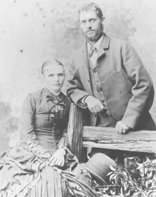 Ringwood and District Historical Society
 Lakes Entrance Historical Society
 Lakes Entrance Historical Society
 Warrnambool and District Historical Society Inc.
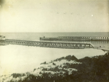 Lakes Entrance Historical Society
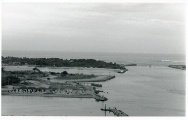 Lakes Entrance Historical Society
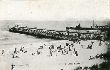 Lakes Entrance Historical Society