Showing 149 items matching "heidelberg-kinglake road"
-
 Eltham District Historical Society Inc
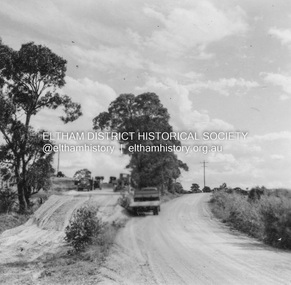
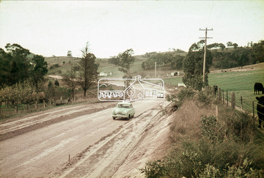
Photograph, Looking south along Kangaroo Ground-Warrandyte Road just east of Heidelberg-Kinglake Road, Kangaroo Ground, c.1989, 1989
... east of Heidelberg-Kinglake Road, Kangaroo Ground, c.1989...-Warrandyte Road just east of Heidelberg-Kinglake Road, Kangaroo ...Roll of 35mm colour negative film, 5 strips Kodak GA100 5095infrastructure, kangaroo ground, kangaroo ground-warrandyte road, streets -
 Eltham District Historical Society Inc
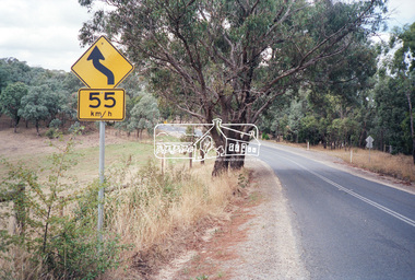
Photograph, Hurstbridge shops, Heidelberg-Kinglake Road, opposite Hurstbridge Railway Station, Eltham Heritage Tour, 24 May 1992, 24/05/1992
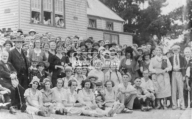
... Hurstbridge shops, Heidelberg-Kinglake Road, opposite... shops, Heidelberg-Kinglake Road, opposite Hurstbridge Railway ...ELTHAM HERITAGE TOUR The Society excursion on 24th May 1992 was arranged by David Bick, leader of the team carrying out the Shire's heritage study. David selected a number of sites or buildings identified in the study, some of them lesser known components of the Shire's heritage. The tour commenced at the Eltham Shire Office at 10.00 am. Travel was by private car and mini-bus with stops at about twelve locations for commentary by David.It included a short walk in Hurstbridge and lunch at Kinglake. Highlights of the tour included: - 10 am Leave from Shire Offices - 3 Important Trees - A Physical Link to Eltham's First Settlers - Toorak Mansion Gates - A Surviving Farm House - An Intact Circa 1900 Main Street - First Settlers - Gold Miners, and Timber-getters - An Early Hotel - A Pioneering Homestead - Changing Eltham Shire - 20th Century - 4 pm Afternoon Tea and Finish Tour Extract from ELTHAM CULTURAL HERITAGE TOUR (Newsletter No. 85, July 1992, by Bettina Woodburn) "Leaving the cars at Hurstbridge we walked the main street of the old village settlement, now a suburb. Near the station was a fine Edwardian house complete with palm and pines. Opposite was the Police Station, 1930-60 with a portable lock-up behind and the residence beside it. No. 794 was the Post Off1ce 3099 the-original shop-front window now has mail-boxes below. Close to the Railway entrance the butcher's shop remains unchanged, but across the road the linear shopping centre tries to keep the character of the olden times. The Fire Bell once hung on a tall gum outside No. 832. Palms in front gardens indicate the age of some of the homes, about 70 years. A corrugated iron shed still stands on the front fence line next to No. 840. Adding to the streetscape is an example of the standard timber early 20th century four veranda post suburban villa."Record of the Society's history and activities and highlighting various aspects of the Heritage Study undertaken by David Bick used to create the future heritage overlay for the Shire of Eltham and later Nillumbik Shire.Roll of 35mm colour negative film, 4 stripsKodak Gold 100 5095shire of eltham historical society, activities, heritage tour, hurstbridge, shops -
 Eltham District Historical Society Inc
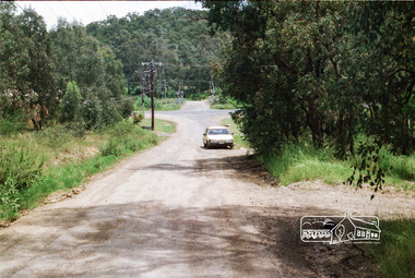
Photograph, Looking west along Mannish Road to the Heidelberg-Kinglake Road and beyond to the railway crossing on Wilson Road, Wattle Glen, c.1989, 1989c
... Looking west along Mannish Road to the Heidelberg-Kinglake... Road to the Heidelberg-Kinglake Road and beyond to the railway ...Streetscape evolutionRoll of 35mm colour negative film, 6 stripsFuji 200Awattle glen, mannish road, houses, streets, wilson road, railway crossing, railway line -
 Eltham District Historical Society Inc
Photograph, Bismark Arms, Caledonia Street, St Andrews, c.1970, 1970c
... , heidelberg-kinglake road, st andrews...The Bismark Arms was situated on the Heidelberg-Kinglake..., caledonia street, heidelberg-kinglake road, st andrews 35mm colour ...The Bismark Arms was situated on the Heidelberg-Kinglake Road opposite the intersection of Buttermans Track. It burnt down in the late 1980s35mm colour positive transparency blue Agfacolour Service plastic mountbismark arms, buttermans track, caledonia street, heidelberg-kinglake road, st andrews -
 Eltham District Historical Society Inc
Album - Photograph Album, J.A. McDonald, Bridge and Road Reconstruction Works, Shire of Eltham, 1952-1962
... Heidelberg-Kinglake Road... Healesville Healesville-Yarra Glen Road Heidelberg-Kinglake Road ...J.A. McDonald produced this record in the course of his responsibilities as Shire Engineer for Eltham Shire Council.Record of various Shire of Eltham infrastructure works undertaken during the period of 1952-1962 involving bridge and road reconstruction projects, sometimes with Eltham Shire Council Project Reference numbers quoted. It was during this period that a number of significant improvements were made to roads and new bridges constructed within the shire that remain in place as of present day (2022). In many situations, the photos provide a tangible visible record of infrastructure that existed throughout the early days of the Shire. The album was put together by or under the direction of the Shire Engineer, J.A. McDonald.a. gillies, alistair knox park, benchmark studies, bend of islands, blease road, box hill state school, box hill teachers college, box hill tip, bridge construction, bridge street bridge, bridge, brisbane street, brougham steet, bulldozer, cecil street, charis pelling, cherry tree road, city of preston, cr. a. brinkkotter, cr. charis pelling, cranes, cromwell street, diamond creek (creek), diamond street, dixons creek bridge, dixon's creek road, drott, eltham leisure centre, eltham north, eltham police station, eltham, eltham-yarra glen road, f. wood, fitzsimons lane bridge, flat rock road, flood damage, floods, floodwater, footpaths and gutters, ford service garage, g. blair, garden hill, glen park bridge, glenauburn road, grand hotel, haldane road, healesville, healesville-yarra glen road, heidelberg-kinglake road, henley road bridge, henley road, hill property, hurstbridge water scheme, hurstbridge, hurstbridge-arthurs creek road, infrastructure, j. jolly, kangaroo ground, kangaroo ground-queenstown road, kangaroo ground-st andrews road, lilydale shire office, long gully bridge, long gully creek, long gully road, long gully, lower plenty bridge, lower plenty footbridge, lower plenty oval, lower plenty road, lower plenty, main road, methodist church, montmorency, mount pleasant road, new holland, old healesville road, opening ceremony, oxley bridge, para road, paul creek bridge, paul creek road, paul krafeznk, pinnacle lane, plaques, plenty river trail, plenty river, presbyterian church, prof donald thomson, pryor street, railway crossing, railway parade, rattray road, reconstruction works, reichelt avenue, research (vic.), research oval, road construction, rymers corner, shire of eltham, shire of whittlesea, silvan road bridge, silver street bridge, silver street, sir dallas brooks, smedley property, st andrews, steels creek, susan street, tarrawarra, tony carberry, uniting church, upper yarra dam, upper yarra reservoir, w.e. wolf, waterfall property, watsons creek, wattletree road bridge, wattletree road, wattletree road bridge, worlingworth, yarra glen, york street, yow yow creek -
 Eltham District Historical Society Inc
Album - Photograph, J.A. McDonald, Kangaroo Ground-Queenstown Road, Mar. 1959
... Heidelberg-Kinglake Road.... Infrastructure shire of eltham bridge construction Heidelberg-Kinglake ...(Kangaroo Ground-St Andrews Road) Realignment South of Alma Road, Panton Hill Opposite CA Sec., Parish of Greensborough March 1959Record of various Shire of Eltham infrastructure works undertaken during the period of 1952-1962 involving bridge and road reconstruction projects, sometimes with Eltham Shire Council Project Reference numbers quoted. It was during this period that a number of significant improvements were made to roads and new bridges constructed within the shire that remain in place as of present day (2022). In many situations, the photos provide a tangible visible record of infrastructure that existed throughout the early days of the Shire. The album was put together by or under the direction of the Shire Engineer, J.A. McDonald.infrastructure, shire of eltham, bridge construction, heidelberg-kinglake road, road construction, 1959-03, alma road, kangaroo ground-queenstown road, kangaroo ground-st andrews road, panton hill -
 Eltham District Historical Society Inc
Negative - Photograph, J.A. McDonald, Bridge decking structure, Mar. 1960
... Heidelberg-Kinglake Road...-03 bridge construction Cherry Tree Road Heidelberg-Kinglake ...Possibly Cherry Tree Road Job 56F443 Contractors Wolf and Wood Old bridge during construction of new bridge March 1960Record of various Shire of Eltham infrastructure works undertaken during the period of 1952-1962 involving bridge and road reconstruction projects, sometimes with Eltham Shire Council Project Reference numbers quoted. It was during this period that a number of significant improvements were made to roads and new bridges constructed within the shire that remain in place as of present day (2022). In many situations, the photos provide a tangible visible record of infrastructure that existed throughout the early days of the Shire. The album was put together by or under the direction of the Shire Engineer, J.A. McDonald.infrastructure, 1960-03, bridge construction, cherry tree road, heidelberg-kinglake road, shire of eltham -
 Eltham District Historical Society Inc
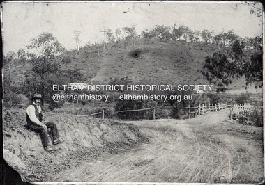
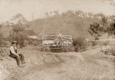
Negative - Photograph, Mr Belot smokes his pipe whilst resting at Cottle's Bridge, c.1990 (c.1890)
... heidelberg-kinglake road... diamond creek (creek) heidelberg-kinglake road Film - Agfa Ortho ...Copy of original photograph. The area, previously known as Back Creek, was named after Thomas Cottle, who settled in the district in the 1870s, and the original bridge over the Diamond Creek on the road to Strathewen. The original bridge (seen in the photo) was replaced with a new timber bridge at a cost of £1,500, the tender being awarded to a contractor named Birch who commenced work in June 1927. The gentleman in the photo who is resting whilst having a smoke of his pipe is a member of the Belot family.Roll of 35mm Black and White negative film, 3 strips, (1 of 14 frames)Film - Agfa Ortho 25belot, bridge, cottles bridge, cottles bridge-strathewan road, diamond creek (creek), heidelberg-kinglake road -
 Eltham District Historical Society Inc
Slide - Photograph, Mittons Bridge, Mittons Bridge Road, St Andrews, c.1993
... Heidelberg-Kinglake Road... melbourne infrastructure roads Heidelberg-Kinglake Road Mittons ...35mm colour positive transparency Mount - Black and Whiteinfrastructure, roads, heidelberg-kinglake road, mittons bridge, mittons bridge road, st andrews -
 Eltham District Historical Society Inc
Slide - Photograph, Whittlesea-Kinglake Road, Kinglake, c.1993
... heidelberg-kinglake road... melbourne infrastructure roads healesville-kinglake road heidelberg ...35mm colour positive transparency Mount - Black and Whiteinfrastructure, roads, healesville-kinglake road, heidelberg-kinglake road, kinglake, kinglake-glenburn road -
 Eltham District Historical Society Inc
Slide - Photograph, Healesville-Kinglake Road, Kinglake, c.1993
... Heidelberg-Kinglake Road... Road Heidelberg-Kinglake Road Kinglake Kinglake Hardware ...35mm colour positive transparency Mount - Black and Whiteinfrastructure, roads, black saturday, healesville-kinglake road, heidelberg-kinglake road, kinglake, kinglake hardware and produce store, victorian bushfires - 2009 -
 Eltham District Historical Society Inc
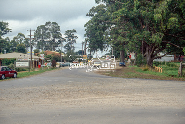
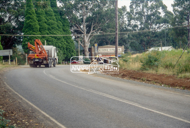
Photograph, Looking west near 942 Main Road, Hurstbridge, c. Oct 1987, 1987
... Display panel, Eltham Festival, Heidelberg-Kinglake Road..., Heidelberg-Kinglake Road, Hurstbridge, Hurstbridge Milk Bar ...Yvonne's Dressmaking and Alteration Service at 942 Main Road. Formerly a bakery, the building was demolished in 1990 and is now the site of Hurstbridge Saddlery. The milkbar is down the road, brick wall with a blue sign on it. There's still an older house next to the milkbar, but that's hidden from view in this shot as it's further back from the road. Date based on other similar display panels visible in images of the Shire of Eltham display at the Eltham Community Festival, 7 November 1987. Shire of Eltham Engineering Department Providing the resources to undertake • Survey, design, consultation • Road construction and maintenance • Bridge construction and maintenance • Street sweeping • Drain and pit cleaning • Traffic engineering installation and maintenance • Garbage collection • Tip management, land reclamation and beautification • Maintenance of community buildings • Provision of community and recreation facilitiesPhoto print mounted on carddisplay panel, eltham festival, heidelberg-kinglake road, hurstbridge, hurstbridge milk bar, infrastructure, main road, mm, shire of eltham, yvonne's dressmaking and alteration service -
 Eltham District Historical Society Inc
Photograph, Kinglake Road, St Andrews, near Mittons Bridge, c.1966-c.1968, 1967c
... Heidelberg-Kinglake Road, Mittons Bridge, St Andrews... melbourne Heidelberg-Kinglake Road, Mittons Bridge, St Andrews ...35mm Colour positive transparency Mount - Agfacolor Service (Blue stepped)inscribed (b) Rolling caster? and 2heidelberg-kinglake road, mittons bridge, st andrews -
 Eltham District Historical Society Inc
Photograph, Kinglake Road, St Andrews, near Mittons Bridge, c.1966-c.1968, 1967c
... heidelberg-kinglake road, mittons bridge, st andrews... melbourne heidelberg-kinglake road, mittons bridge, st andrews 35mm ...35mm Colour positive transparency Mount - Agfacolor Service (Blue stepped)heidelberg-kinglake road, mittons bridge, st andrews -
 Eltham District Historical Society Inc
Photograph, Mr Belot smokes his pipe whilst resting at Cottle's Bridge, c.1890
... heidelberg-kinglake road...) heidelberg-kinglake road Original sepia photograph mounted on card ...The area, previously known as Back Creek, was named after Thomas Cottle, who settled in the district in the 1870s, and the original bridge over the Diamond Creek on the road to Strathewen. The original bridge (seen in the photo) was replaced with a new timber bridge at a cost of £1,500, the tender being awarded to a contractor named Birch who commenced work in June 1927. The gentleman in the photo who is resting whilst having a smoke of his pipe is a member of the Belot family.Original sepia photograph mounted on card broken lower left corner and cracked upper rightbelot, bridge, cottles bridge, cottles bridge-strathewan road, diamond creek (creek), heidelberg-kinglake road -
 Eltham District Historical Society Inc
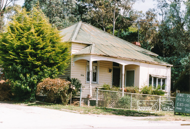
Photograph, 994 Main Road, Hurstbridge
... heidelberg/kinglake road... melbourne houses 994 main road main road heidelberg/kinglake road ...Colour photograph of house at 994 Main Road Hurstbridgehouses, 994 main road, main road, heidelberg/kinglake road, hurstbridge -
 Eltham District Historical Society Inc
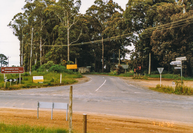
Photograph, Main Road junction, Kinglake, 7 December 1992, 07/12/1992
... heidelberg-kinglake road... healesville-kinglake road heidelberg-kinglake road whittlesea-kinglake ...The Eltham Horse Trail: Research and Warrandyte to Kinglake: Survey of proposed route, December 1992: (3) Kangaroo Ground to KinglakeColour photographeltham horse trail (1992 survey), kinglake, healesville-kinglake road, heidelberg-kinglake road, whittlesea-kinglake road -
 Greensborough Historical Society
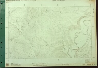
Map, Melbourne and Metropolitan Board of Works. Survey Division, MMBW, Yarra 2500 / 16.25. Wattle Glen, 1978_07
... , Broad Gully Road and Heidelberg-Kinglake Road. Includes Yulong...: Nimmo Road, Broad Gully Road and Heidelberg-Kinglake Road ...Melbourne and Metropolitan Board of Works. Yarra 2500 [base map] 16-25. Wattle Glen. Municipalities of Diamond Valley 257 and Eltham 238. Prominent streets include: Nimmo Road, Broad Gully Road and Heidelberg-Kinglake Road. Includes Yulong Park.MMBW Map in 1:2500 [scale] series. Cream parchment with green tape reinforcing on edges and punched holes on left edge.mmbw, melbourne and metropolitan board of works, shire of diamond valley, wattle glen - maps -
 Eltham District Historical Society Inc
Document - Property Binder, 907 Main Road, Eltham
... to subdivide 1726 Heidelberg-Kinglake Road; Minister's decision awaited... to subdivide 1726 Heidelberg-Kinglake Road; Minister's decision awaited ...Newspaper article: $6000 grant to Our Lady's, The Advertiser, July 2, 1996 - Grant given to Parish of Our LadyHelp of Christians which is taking over the use of the Eltham War Memorial Hall in Main Road and the Nillumbik After School Program. (Other items include: St Andrews Submission Re application to subdivide 1726 Heidelberg-Kinglake Road; Minister's decision awaited - A six-eight lot subdivision at Eagles Nest Road, Strathewen; Mt Pleasant Rd petition - Need for a shared pathway; Policy on ad signs - Amended policy on advertising signs for community events; Main Rd streetscape plan - Plans for streetscape improvement in Main Road to go on display; Special meeting dates set - Special meetings to consider formal submissions and then adopt a final proposal for Shire's electoral structure for Ministerial approval and gazettal. Letter Eltham District Historical Society to Nillumbik Shire Council, 16 September 1996: Proposed roundabouts Main Road Eltham at Dudley Street and Panther Place. Newspaper article: Diamond Valley News 16 October 1996, Pre-school welcomes plan for traffic lights.main road, eltham, property, roundabouts, dudley street, panther place, eltham pre-school, eltham war memorial -
 Eltham District Historical Society Inc
Photograph - Digital Photograph, Alan King, Former St Andrews State School No. 128 building, 23 January 2008
... of School and Heidelberg-Kinglake roads which incorporated... of School and Heidelberg-Kinglake roads which incorporated ...In 1858 the Caledonia Common School No.128 opened at Queenstown, about 1.6km upstream on Diamond Creek from the present site of the old St Andrews school. The school was renamed Queenstown Common School No. 128 in 1867. In 1882, due to declining numbers of pupils at Smiths Gully and increasing numbers in Queenstown the school was moved from a leased building, owned by Head Teacher Robert Harris, into a new larger building on the corner of School and Heidelberg-Kinglake roads which incorporated the original single room school building, which had been moved from Smiths Gully, and included a teacher’s three-roomed residence. In 1887 the school was replaced by the Queenstown State School No. 128. The school and town were renamed St Andrews in 1952. In 1983 a new school was built, 500 metres south of the old school and the old school became the St Andrews Community Centre. Of significance is the c1887 school building (including part of the c1876 Smith's Gully school moved to the site and incorporated into the c1887 school building), the c1911 new room, the c1929 cloakroom, the c1930 renovations, the c1956 new infant room; the c1961 office and storeroom, as well as the c1950 Himalayan Cedar tree and the entire site to the title boundaries. The school building is historically significant for its links with the early settlement of the area and because its use of materials from the former Smith's Gully State school illustrates the common 19th and early 20th century practice of relocating State school buildings based on need. The school building is historically and socially significant because it served the local community, as a school, from 1887 to the late 1970s/early 1980s and because since then it has been used for other community purposes. Covered under Heritage Overlay, Nillumbik Planning Scheme. Published: Nillumbik Now and Then / Marguerite Marshall 2008; photographs Alan King with Marguerite Marshall.; p69This collection of almost 130 photos about places and people within the Shire of Nillumbik, an urban and rural municipality in Melbourne's north, contributes to an understanding of the history of the Shire. Published in 2008 immediately prior to the Black Saturday bushfires of February 7, 2009, it documents sites that were impacted, and in some cases destroyed by the fires. It includes photographs taken especially for the publication, creating a unique time capsule representing the Shire in the early 21st century. It remains the most recent comprehenesive publication devoted to the Shire's history connecting local residents to the past. nillumbik now and then (marshall-king) collection, st andrews, queenstown state school no. 128, smiths gully state school -
 Eltham District Historical Society Inc
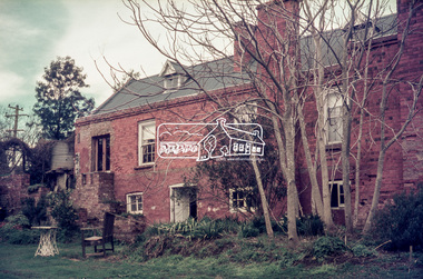
Photograph - Digital Photograph, Marguerite Marshall, Jesse Tree playing the Didgeridoo and Swiss Hang Drum at St Andrews Market, 29 March 2008
... Andrews Market at the corner of Heidelberg-Kinglake Road... Andrews Market at the corner of Heidelberg-Kinglake Road ...Published: Nillumbik Now and Then / Marguerite Marshall 2008; photographs Alan King with Marguerite Marshall.; p175 It’s Saturday morning and thousands of people are visiting St Andrews Market at the corner of Heidelberg-Kinglake Road and Proctor Street. It’s hard to find a park. Cars are banked up along the narrow road and crammed in a nearby parking area. Yet, at the market, people look relaxed and happy amongst the yellow box gums on the site where the Wurundjeri people used to gather. Stone artefacts unearthed there by Koorie researcher, Isabel Ellender, indicate the site was once a Wurundjeri meeting place, according to Aboriginal Affairs Victoria. Acoustic sounds mingle with quiet conversations. A guitarist blows a mouth organ while his bare toes tickle chimes. A tiny busker, perhaps five years old, plays a violin while sounds of a harp emerge from the hall. One stallholder, selling delicious-looking pastries, chats to another in Spanish, then to me in broad Australian. ‘I was born in Fitzroy but my mother came from Mexico and my dad from Serbia,’ she smiles. A New Zealander fell in love with Mongolia and now imports their hand-made embroidered clothes and Yurts (tents) and runs adventure tours. A young woman visited Morocco and when friends admired the shoes she bought, she decided to import them and sell them at the market. Oxfam sells Fair Trade toys and clothes and displays a petition to Make Poverty History. Other stalls sell Himalayan salt, jewellery made from seeds from northern Australia, glass paper-weights from China as well as locally grown vegetables, flowers and organic freshly baked bread. A woman sits in a state of bliss under the hands of a masseur. Another offers Reiki or spiritual healing. A juggler tosses devil sticks – ‘not really about the devil,’ he smiles. This skill was practised thousands of years ago in Egypt and South America he says. At the Chai Tent people lounge on cushions in leisurely conversation. The idea for the market was first mooted among friends over a meal at the home of famous jazz and gospel singer Judy Jacques.2 Jacques remembers a discussion with several local artists including Marlene Pugh, Eric Beach, Les Kossatz, Ray Newell and Peter Wallace. ‘We decided we wanted a meeting place, where all the different factions of locals could meet on common ground, sell their goodies and get to know one another,’ Jacques recalls. They chose the site opposite another meeting place, St Andrews Pub. A week later Jacques rode her horse around the district and encouraged her neighbours to come along to the site to buy or sell. On February 23, 1973, about 20 stallholders arrived with tables. They traded ‘second-hand clothes, vegetables, meat, cheese, eggs, chickens, goats, scones, tea, garden pots and peacock feathers’. Now around 2000 people visit each Saturday. People usually linger until dusk. The market – with around 150 stalls of wares from a wide variety of cultures – stands alongside Montsalvat as the most popular tourist attraction in Nillumbik. By the 1990s St Andrews Market was in danger of being loved to death, as the site was becoming seriously degraded. The market was spreading in all directions and the degradation with it. A local council arborist’s report in 1994 noted exposed tree roots from erosion and compaction. The Department of Sustainability and Environment threatened to close the market if the degradation was not rectified. After many months of research, discussions and lobbying by a few residents, the council formed a Committee of Management, with an Advisory Committee, and introduced an Environment Levy. The State Government, the council and the market, funded terracing of the site to stop erosion, and retain moisture and nutrients. Vehicles were excluded from some sensitive areas and other crucial zones reserved for re-vegetation. Volunteers planted more than 3000 locally grown indigenous species. The old Yellow Box trees fully recovered and are expected to give shade for many years to come.This collection of almost 130 photos about places and people within the Shire of Nillumbik, an urban and rural municipality in Melbourne's north, contributes to an understanding of the history of the Shire. Published in 2008 immediately prior to the Black Saturday bushfires of February 7, 2009, it documents sites that were impacted, and in some cases destroyed by the fires. It includes photographs taken especially for the publication, creating a unique time capsule representing the Shire in the early 21st century. It remains the most recent comprehenesive publication devoted to the Shire's history connecting local residents to the past. nillumbik now and then (marshall-king) collection, didgeridoo, jesse tree, st andrews market, swiss hang drum -
 Eltham District Historical Society Inc
Photograph - Digital Photograph, Alan King, St Andrews Anglican Church, St Andrews, 30 January 2008
... and the Heidelberg-Kinglake Roads. It had been moved from Smiths Gully... and the Heidelberg-Kinglake Roads. It had been moved from Smiths Gully ...Built c.1868, St Andrew’s Anglican Church is Nillumbik Shire’s oldest timber church and is historically, socially, and spiritually significant to the Shire of Nillumbik. The church is historically significant because it may have given its name 'St Andrews' to the town (another suggestion is that the name came from the local hotel), it is also historically significant as one of only four buildings that remain from the Caledonian goldfields era of Queenstown (now St Andrews) and one of only a handful of buildings that survived the 1960s bushfires. The church is historically, socially, and spiritually significant because it has played an important part in community life for more than 150 years; a proposal to move the church in 1984 met with strenuous opposition. Much of the fires on Black Saturday 2009 were the north of the town. The town itself remained intact - as did this heritage building. Covered under Heritage Overlay, Nillumbik Planning Scheme. National Trust of Australia (Victoria) Local significance Published: Nillumbik Now and Then / Marguerite Marshall 2008; photographs Alan King with Marguerite Marshall.; p69 The St Andrews Anglican Church and former St Andrews Primary School, are two reminders of the district’s early days, when it was founded on gold. St Andrews, then called Queenstown, was the earliest goldfield in the Caledonia Diggings.1 It was the Upper Diamond Gold Mining and Administrative Centre, with 3000 miners. Queenstown was also the seat of the Court of Petty Sessions. The church and school then stood close to European and Chinese stores, three hotels, a brewery and a quartz mill.2 In 1861, Queenstown was officially proclaimed a township. From 1865, the name Queenstown was interchangeable with St Andrews, until 1952, when the town was officially named St Andrews. As gold declined from the early 1880s, Queenstown changed dramatically into a settlement of small farms. St Andrew’s Anglican Church, built in 1868, is the Shire’s oldest timber church and possibly gave its name to the township.3 The small timber church was opened on November 1, 1869, by the Dean of Melbourne. Anniversary tea meetings helped raise funds, and in 1889, a three-bedroom parsonage was built alongside. In 1910, the vicar, the Rev Selwyn Chase (and friend of the Scouting Movement’s founder, Baden Powell), established the 1st Queenstown Scout Troop, only two years after Scouting began in Australia. The church was important to the lives of many local residents who were baptised, married and had funeral services there. But by the 1950s the population had decreased and so did the weekly attendances. Around the mid-1960s the church closed, then fell into disrepair. So in the mid 1980s it was sold to the Education Department and was under threat of relocation or demolition. However this caused such opposition from locals,4 that instead, the Anglican church leased it as part of the Panton Hill parish5 and it was reconsecrated in 1987. Queenstown’s first school was held in a tent after transferring from Andersons Creek, Warrandyte.6 From 1858 a church school, Caledonia Diggings, stood west of the main road, a quarter of a mile (0.4km) before Buttermans Track. In 1882 the school was moved from a leased building, owned by headmaster Robert Harris, into a larger building on the corner of the School and the Heidelberg-Kinglake Roads. It had been moved from Smiths Gully and included a teacher’s three-roomed residence.7 In 1887 the school was replaced by the Queenstown State School No 128, although it was also called Caledonia Diggings until 1891. In 1956 it was renamed St Andrews. Still standing, this building is now used as the St Andrews Community Centre and the residence is leased for private use. The original timber-lined room remains alongside the extensions, and is distinctive with its high ceiling and tall small-paned windows. In 1984 a new school was built 500 metres west of the old school. Many residents have contributed much to St Andrews but one family that has done so for several generations is the Harris family. Robert Harris was an active member of the St Andrew’s Anglican Church, and worked hard at improving the town’s amenities until his death in 1887. He was a signatory to the successful 1863 petition to the Chief Commissioner of Police, against the proposed removal of the Court of Petty Sessions and police station at the Caledonia Diggings. The police station stayed in the town until 1917. Harris was Head Teacher of Queenstown State School from 1864 to 1874, then of the Smiths Gully school until it closed in 1882, and he continued teaching at Panton Hill until his death. His son, Robert Charles Harris, was editor and printer of the local newspaper, The Evelyn Observer, from 1873 until 1915. Robert’s son, William Shelley Harris, served in the Boer War and in World War One. In 1928 he became Kinglake National Park’s first park ranger. Robert’s daughter Elizabeth, taught needlework at Queenstown State School, and later ran the post office in Kinglake.This collection of almost 130 photos about places and people within the Shire of Nillumbik, an urban and rural municipality in Melbourne's north, contributes to an understanding of the history of the Shire. Published in 2008 immediately prior to the Black Saturday bushfires of February 7, 2009, it documents sites that were impacted, and in some cases destroyed by the fires. It includes photographs taken especially for the publication, creating a unique time capsule representing the Shire in the early 21st century. It remains the most recent comprehenesive publication devoted to the Shire's history connecting local residents to the past. nillumbik now and then (marshall-king) collection, st andrews, st andrews anglican church -
 Eltham District Historical Society Inc
Slide - Photograph, Aerial Photo (c.1987): Main Road, Lower Plenty from Heidelberg Golf Course to Plenty River, c.Aug. 1990
Part of a presentation, "Roads and Byways of the Shire of Eltham", by Russell Yeoman to the 12 September 1990 Society meeting. Slides shown included copies of old photos and recent images ranging from the suburban streets of Eltham and Montmorency to the mountain roads of Kinglake. In the byways category are views of some iof the Shire's bicycle paths including then recently completed sections of the Main Yarra Trail at Lower Plenty.35mm colour positive transparency (1 of 37) Mount - Agfachrome Agfa CS System black 8 dotsinfrastructure, roads, aerial photographs, heidelberg golf club, lower plenty, lower plenty bridge, main road, plenty river -
 Eltham District Historical Society Inc
Photograph, Gathering at Upper Diamond Creek State School No. 2059, corner of Yates and Heidelberg Kinglake Roads, Upper Diamond Creek
... and Heidelberg Kinglake Roads, Upper Diamond Creek Photograph Albert ...Black and white copy of photo printed on glossy photographic paper 30.5 x 40.5 cm (12 x 16 inch); image size approx. 18.5 x 28 cmgroups, upper diamond creek state school -
 Greensborough Historical Society
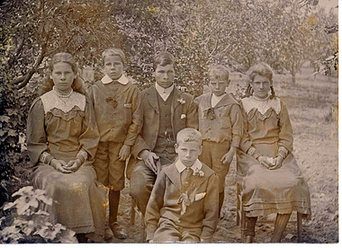
Photograph - Photograph - Digital image, Pill Family, 1910c
Part of a collection of photographs copied from the late Shirley Fraser (nee Black), also descendant of the McLaughlin and Whatmough family. This photograph shows six children of the Pill family (mother Jessie Ann Whatmough, father John Henry Pill), taken at family orchard at 1440 Heidelberg - Kinglake Rd Cottlesbridge. The children are from left to right; Evelyn Alice b 1890, Bertram b 1896, Edwin Henry b 1888, Harry Stanley b 1899, Florence Jessie b 1892 and seated in front William John b 1894. William John Pill was murdered at Cottlesbridge in 1958. local familyDigital copy of black and white photograph.shirley fraser, pill family -
 Eltham District Historical Society Inc
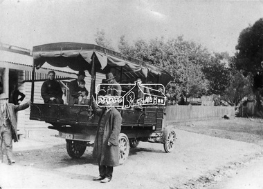
Negative - Photograph, Mail coach en route to Hurstbridge, c.1922
Coach with flaps takes aboard passengers. It travelled between Kinglake and Hurstbridge. The vehicle has advertising on the side indicating: W. BODY. HURSTBRIDGE bread and pastry. The Advertiser on 15 Sep 1922 has a display advertisement on page 2 indicating that Hurstbridge bakery 'W. Body wishes to notify the Public of Hurstbridge and surrounding district that he has purchased Mr Oliver's business'. The Advertiser, Friday 10 November 1922, page 2: Mr J. D. Chalmers, who runs the motor service from Hurstbridge to Kinglake, has just had a large, body built on a two-ton motor, which will be serviceable for either 25 passengers or general goods. The work was entrusted to Mr. D.G. Graham, motor and coach builder, Hurstbridge, who completed it within a month, the finish, painting, etc.. being quite up to the standard of a city shop. The mail coach operated the route between Kinglake and Hurstbridge motor route, on which Mr. Sharpe had pioneered and run a motor mail route with a bus which carried 20 passengers, for many years but Sharpe's license for his motor bus was refused by the Country Roads Board mid 1930 as his bus was considered too large . In February 1935, Mr Sharpe was granted a license to carry passengers between Hurstbridge and Kinglake and Mr Kell between Kinglake and Hurstbridge. In 1936 the mail contract from Heidelberg to Knglake was via car and members of the community were concerned that there was no further any conveyance of passengers from Hurstbridge to Kinglake.This photo forms part of a collection of photographs gathered by the Shire of Eltham for their centenary project book,"Pioneers and Painters: 100 years of the Shire of Eltham" by Alan Marshall (1971). The collection of over 500 images is held in partnership between Eltham District Historical Society and Yarra Plenty Regional Library (Eltham Library) and is now formally known as 'The Shire of Eltham Pioneers Photograph Collection.' It is significant in being the first community sourced collection representing the places and people of the Shire's first one hundred years.Digital image 4 x 5 inch B&W Neg 9 x 12.5 cm B&W printsepp, shire of eltham pioneers photograph collection, kinglake, mail coach, w. body, public transport, bus, bus travel, hurstbridge, pioneers and painters -
 Eltham District Historical Society Inc
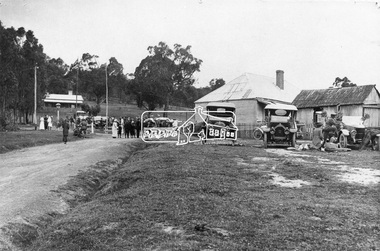
Photograph, Albert Jones, Returned soldiers picnic, Police Paddocks, Queenstown, c.1916
Queenstown (St Andrews) looking towards Panton Hill . A picnic is taking place. Streetscape with dirt road, buildings, Model T Fords and people. Police station far left, the gaol was behind (not visible). On the right is a boarding house according to Mr. Ninks, next to right the Mechanics Institute or library according to Miss Muller. On far right, Coach House (stables not shown) - end of coach run from Heidelberg. This is possibly a picnic for returned servicemen from Gallipoli. The house on the right still existed c.1970 and was alongside Hotel on Kinglake side. Reproduced page 35 Pioneers & Painters also on the back cover and on page 59 of "St Andrews: a village built on gold". Described in chapter headed "The Police Paddocks". This photo forms part of a collection of photographs gathered by the Shire of Eltham for their centenary project book,"Pioneers and Painters: 100 years of the Shire of Eltham" by Alan Marshall (1971). The collection of over 500 images is held in partnership between Eltham District Historical Society and Yarra Plenty Regional Library (Eltham Library) and is now formally known as the 'The Shire of Eltham Pioneers Photograph Collection.' It is significant in being the first community sourced collection representing the places and people of the Shire's first one hundred years.Digital image 4 x 5 inch B&W Neg Prints 20 x 25 and 9 x 12.5 cm sepp, shire of eltham pioneers photograph collection, queenstown, cars, police station, st andrews, model t ford, pioneers and painters, boarding house, gallipoli, picnic, police paddocks, retuned soldiers -
 Greensborough Historical Society
Poster - Planning Document, City of Heidelberg, Subdivision Plan # G 27, Greensborough and Diamond Creek, 1922 and 1963
Plan of Subdivisions in City of Heidelberg: Side 1: 2 plans, Parish of Keelbundoora: plan 1: Henry Street, Vermont Avenue, Lyell Street, Nell Street, McDowell Street, 1922. Plan 2: Henry Street, Nepean Street, Charles Street, 1922. Side 2: 2 plans Parish of Nillumbik, Portion 13: Plan 1: Diamond Creek Road, Delfin Crescent, Ridge Road, 1963. Plan 2: Kinglake Road, Eltham Road, 1963.An example of hard copy subdivision plans from the Greensborough area. Mainly from the Shire of Diamond Valley era (1964-1994).Plan (2 sided) mounted on heavy card. Contains 2 sheets pasted together.Stamped and handwritten Council permissions, dates and other details.subdivision plans, city of heidelberg