Showing 324 items
matching plenty - maps
-
 Greensborough Historical Society
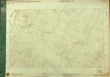
Map, Melbourne and Metropolitan Board of Works. Survey Division, MMBW, Yarra 2500 / 17.25. Hurstbridge, 1978_01
Melbourne and Metropolitan Board of Works. Yarra 2500 [base map] 17-26. Hurstbridge. Municipalities of Diamond Valley 257 and Eltham 238. Prominent streets include: Silvan Road and Hurstbridge Road. MMBW Map in 1:2500 [scale] series. Cream parchment with green tape reinforcing on edges and punched holes on left edge.mmbw, melbourne and metropolitan board of works, shire of diamond valley, hurstbridge - maps -
 Greensborough Historical Society
Map, Melbourne and Metropolitan Board of Works. Survey Division, MMBW, Yarra 2500 / 17.27. Central Hurstbridge, 1978_02
Melbourne and Metropolitan Board of Works. Yarra 2500 [base map] 17-27. Central Hurstbridge. Parish of Greensborough 2724, Municipalities of Diamond Valley 257, Eltham 238 and Whittlesea 239. Prominent streets include: Anzac Avenue and Hurstbridge-Arthurs Creek Road. MMBW Map in 1:2500 [scale] series. Cream parchment with green tape reinforcing on edges and punched holes on left edge.mmbw, melbourne and metropolitan board of works, shire of diamond valley, hurstbridge - maps -
 Greensborough Historical Society
Map, Melbourne and Metropolitan Board of Works. Survey Division, MMBW, Yarra 2500 / 11.22. Bundoora, 1979_01
Melbourne and Metropolitan Board of Works. Yarra 2500 [base map] 11-22. Bundoora. Parish of Keelbundoora 2856, Municipalities of Diamond Valley 257 and Whittlesea 239. Prominent streets include: Greenhills Road, Cabernet Crescent and Plenty Road. Includes Parade College (Christian Brothers) and "proposed future freeway" (now Metropolitan Ring Road)MMBW Map in 1:2500 [scale] series. Cream parchment with green tape reinforcing on edges and punched holes on left edge.mmbw, melbourne and metropolitan board of works, shire of diamond valley, bundoora - maps -
 Greensborough Historical Society
Map, Melbourne and Metropolitan Board of Works. Survey Division, MMBW, Yarra 2500 / 11.21. Bundoora, east of Plenty Road, 1979_01
... of Works. Yarra 2500 [base map] 11-21. Bundoora, east of Plenty ...Melbourne and Metropolitan Board of Works. Yarra 2500 [base map] 11-21. Bundoora, east of Plenty Road. Parish of Keelbundoora 2856, Municipalities of Diamond Valley 257, Preston 225 and Whittlesea 239. Prominent streets include: Grimshaw Street, Settlement Road and Plenty Road. Includes Yulong Park.MMBW Map in 1:2500 [scale] series. Cream parchment with green tape reinforcing on edges and punched holes on left edge.mmbw, melbourne and metropolitan board of works, shire of diamond valley, bundoora - maps -
 Greensborough Historical Society
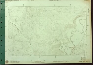
Map, Melbourne and Metropolitan Board of Works. Survey Division, MMBW, Yarra 2500 / 16.25. Wattle Glen, 1978_07
Melbourne and Metropolitan Board of Works. Yarra 2500 [base map] 16-25. Wattle Glen. Municipalities of Diamond Valley 257 and Eltham 238. Prominent streets include: Nimmo Road, Broad Gully Road and Heidelberg-Kinglake Road. Includes Yulong Park.MMBW Map in 1:2500 [scale] series. Cream parchment with green tape reinforcing on edges and punched holes on left edge.mmbw, melbourne and metropolitan board of works, shire of diamond valley, wattle glen - maps -
 Greensborough Historical Society
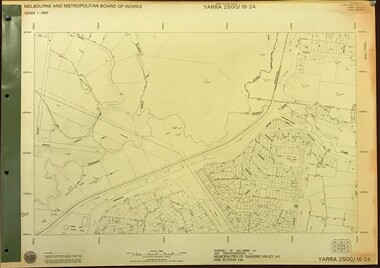
Map, Melbourne and Metropolitan Board of Works. Survey Division, MMBW, Yarra 2500 / 16.24. Northern Diamond Creek and Wattle Glen, 1978_02
Melbourne and Metropolitan Board of Works. Yarra 2500 [base map] 16-24. Northern Diamond Creek and Wattle Glen. Parishes of Nillumbik 3310 and Greensborough 2724. Municipalities of Diamond Valley 257 and Eltham 238. Prominent streets include: Hurstbridge Road, and Reynolds Road. Includes Wattle Glen Station.MMBW Map in 1:2500 [scale] series. Cream parchment with green tape reinforcing on edges and punched holes on left edge.mmbw, melbourne and metropolitan board of works, shire of diamond valley, wattle glen - maps, diamond creek - maps -
 Greensborough Historical Society
Map, Melbourne and Metropolitan Board of Works. Survey Division, MMBW, Yarra 2500 / 16.23. Diamond Creek, 1978_02
Melbourne and Metropolitan Board of Works. Yarra 2500 [base map] 16-23. Diamond Creek. Parish of Nillumbik 3310. Municipalities of Diamond Valley 257 and Eltham 238. Prominent streets include: Phipps Crescent, Bishop Avenue, and Reynolds Road. Includes the former Diamond Creek Technical School.MMBW Map in 1:2500 [scale] series. Cream parchment with green tape reinforcing on edges and punched holes on left edge.mmbw, melbourne and metropolitan board of works, shire of diamond valley, diamond creek - maps -
 Greensborough Historical Society
Map, Melbourne and Metropolitan Board of Works. Survey Division, MMBW, Yarra 2500 / 16.22. Research, 1979_05
Melbourne and Metropolitan Board of Works. Yarra 2500 [base map] 16-22. Research. Parish of Nillumbik 3310. Municipalities of Diamond Valley 257 and Eltham 238. Prominent streets include: Orme Road and Allendale Road. MMBW Map in 1:2500 [scale] series. Cream parchment with green tape reinforcing on edges and punched holes on left edge.mmbw, melbourne and metropolitan board of works, shire of diamond valley, diamond creek - maps -
 Greensborough Historical Society
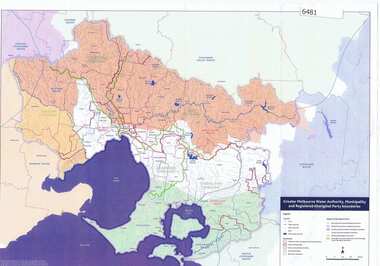
Maps, Greater Melbourne Water Authority, Municipality and Registered Aboriginal party Boundaries, 18/07/2018
Shows Melbourne Water and Municipal area boundaries, with boundaries of registered aboriginal parties, in central Victoria.Printed in colour one sideMap reference 20180746aborigines victoria, water supply, melbourne water -
 Greensborough Historical Society
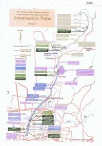
Maps, Yan Yean Water Supply System Conservation Management Plan: Construction dates Map 1, 2007_
Plan of Yan Yean Water Supply System, showing natural and constructed features from 1850s to 1930s from Silver Creek Weirs to Eastern Freeway.Printed in colour one side. 3 copieswater supply, yan yean reservoir, plenty river -
 Greensborough Historical Society
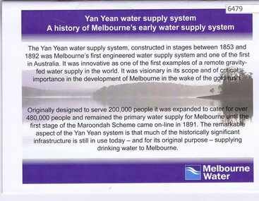
Booklet, Yan Yean water supply system: a history of Melbourne's early water supply system, 2010c
History of the Yan Yean water supply system - Melbourne's earliest. This is an early version of the history.Link: 6479:6482 24 p., colour illus., mapsyan yean reservoir, melbourne water -
 Greensborough Historical Society
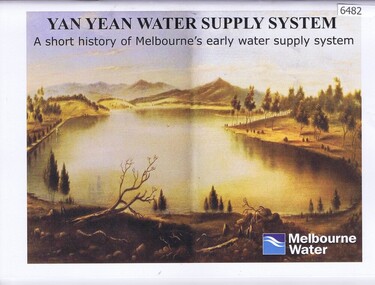
Booklet, Yan Yean water supply system: a short history of Melbourne's early water supply system, 2011c
Early history of the Yan Yean water supply systemLink: 6479:6482 40 p., colour illus. and mapsyan yean reservoir, toorourrong reservoir, melbourne water -
 Greensborough Historical Society
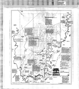
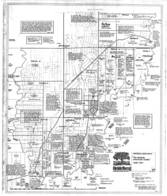
Map, Heidelberg: Historic River Landscape Assessment, Historical Maps. Map A To 1838. Country of the Wawarang, 1985c
Geographical area of around 35 sq. kilometres marked with physical features such as major roads, rivers, vegetation and properties, with contemporary notes on landowners, descriptions and comments on the land and its development. Bounded by Shire of Diamond Valley to the North, Darebin Creek to the West and Plenty River to the East.Black an white sketch map on white paperheidelberg, heidelberg - maps -
 Greensborough Historical Society
Map, Heidelberg: Historic River Landscape Assessment. Historical Maps. Map B 1838-1851, "The Distinctly aristocratic locality", 1985c
Geographical area of around 35 sq. kilometres marked with physical features such as major roads, rivers, vegetation and properties, with contemporary notes on landowners, descriptions and comments on the land and its development. Bounded by Shire of Diamond Valley to the North, Darebin Creek to the West and Plenty River to the EastBlack and white sketch map on white paperheidelberg, heidelberg - maps -
 Greensborough Historical Society
Map, Heidelberg. Historic River Landscape Assessment. Historical maps: Map C 1851-1863. "The Garden of the colony", 1985c
Geographical area of around 35 sq. kilometres marked with physical features such as major roads, vegetation and properties, with locations and notes of the increasing number of farms, gardens orchards and vineyards which had become established in addition to pastoral runs. Bounded by Shire of Diamond Valley to the North, Darebin Creek to the West and Plenty River to the East.Black and white sketch map on white paperheidelberg, heidelberg - maps -
 Greensborough Historical Society
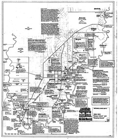
Map, Heidelberg: Historic River Landscape Assessment. Historical maps. Map D 1864 -1901 "Sleepy Hollow" and "Sleeping beauty", 1985c
Geographical area of c. 35 sq. kilometres marked with physical features such as major roads, rivers, vegetation and properties, with locations and notes on the increasing number of farms, orchards and vineyards that had been developed in addition to pastoral runs. Bounded by Shire of Diamond Valley to the North, Darebin Creek to the West, and Plenty River to the East.Black and white sketch on white paper. Second copy 600 x 430 cm printed in black on semi-opaque paperheidelberg, heidelberg - maps -
 Greensborough Historical Society
Map, Heidelberg: Historic River Landscape Assessment. Historical maps. Map E 1901-1934 "A Time of projects and improvements", 1985c
Geographical area of around 35 sq. kilometres marked with physical features such as major roads, railways (new extension to Eltham), rivers and properties, also housing sub-divisions and community facilities such as hospitals, parks and sporting reserves and indications of new small scale industries such as dairying. Bounded by Shire of Diamond Valley to the North, Darebin Creek to the West and Plenty River to the East. Black and white sketch map on white paperheidelberg, heidelberg - maps -
 Greensborough Historical Society
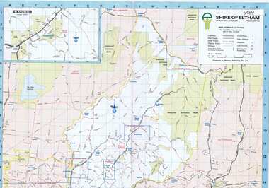
Map, Shire of Eltham, 1990c
... Plenty Lower Plenty melbourne 1:20000 map of Shire of Eltham ...1:20000 map of Shire of Eltham, with enlargements of a number of areas.Colour map, printed both sides.shire of eltham, eltham -
 Greensborough Historical Society
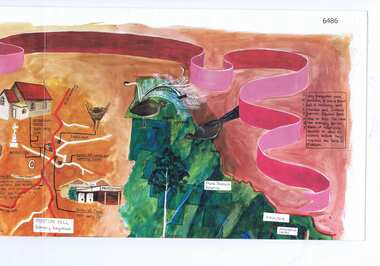
Map, Cultural heritage Map Shire of Eltham, designed and painted by Megan Evans, 1993_
... Plenty Lower Plenty melbourne An annotated map of the Shire ...An annotated map of the Shire of Eltham showing places of interestColoured map, folded four times, annotated with historical notes and descriptions of physical and natural featuresshire of eltham -
 Greensborough Historical Society
Map, Poulter Avenue transverse, 1900 c
This is a survey of land acquired from William Haylock Poulter for the construction of Poulter Avenue. Includes area of River Estate and part of Poulter Reserve, Carter Street, Flintoff Street and Plenty River.1 p. photocopy of traverse survey printed in colourSigned by William Haylock Poulterpoutlter avenue greensborough -
 Greensborough Historical Society
Map, Victoria: Yan Yean, prep. by Australian Section of Imperial General Staff, 1935
Part of 1:63,360 series of survey mapsColour copy from original. Scale: 1: 63,360 (1 inch to 1 mile) 2 copiesRev. 1930 by Australian Survey Corps using RAAF Air Photos. yan yean -
 Greensborough Historical Society
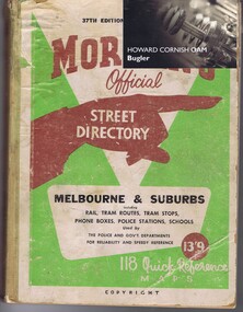
Directory, Morgan's Official Street Directory of Melbourne & Suburbs, 37th edition, 1951, 1951_
One of the standard Melbourne street directories prior to the publication of Melways. Edition 37, 1951. Contains mid-20th century street maps of Melbourne including Greensborough area.Hardback book, printed in black and red, colour coverCard attached: Howard Cornish OAM, Buglerstreet directories, melbourne -
 Greensborough Historical Society
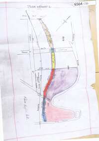
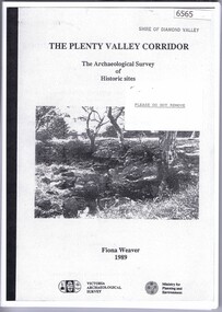
Book, The Plenty Valley Corridor: the archaelogical survey of historic sites, by Fiona Weaver, for the Ministry of Planning & Environment, 1989_
... river 115 p., photocopy, unbound. Illus., maps The Plenty Valley ...The Victorian Archaelogical Survey managed this study onbehalf of the Ministry for Planning & Environment. The study was intended to provide a brief history of Aboriginal and European occupation and use of the area and an outline of the geography of the chief areas of cultural heritage concern, with recommendations for protection of significant cultural sites and recommendations for further research, survey and consultation.115 p., photocopy, unbound. Illus., mapsplenty river -
 Greensborough Historical Society
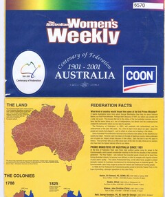
Poster, Centenary of Federation 1901-2001 Australia, 2001_
Celebrating the centenary of Federation, this poster also lists Prime Ministers from 1901 to 2001.Poster with colour map Scale 1: 6,440,000 and list of Australian Prime Ministers, printed one sideaustralia federation, prime ministers - australia -
 Greensborough Historical Society
Document - Document Collection, Local Council Representation Review, 2019_
Contents: 2 x Newspaper Clippings: Banyule City Council Electoral Representative Review, Heidelberg Leader 20/08/2019 and Diamond Valley Leader 21/08/2019. Local Council Representative Review Submission Guide. Victorian Electoral Commission, 2019. 24 p., text. General information for those making a submission to a review. Local Council Representative Review Preliminary Report: Banyule City Council. Victorian Electoral Commission, August 2019. 31 p., text and colour maps. Reports on submissions and gives 3 options for electoral review in Banyule. Local Council Representative Review: Banyule City Council 1. Public hearing agenda and attachments. 25/09/2019. 9 p. 2. Public hearing agenda and attachments. 25/09/2019. 2 p. Agenda and handwritten notes by R. Bray. Local Council Representative Review Final Report: Banyule City Council. Victorian Electoral Commission, October 2019. 46 p., text and colour map. Recommends increasing the number of councillors and wards to 9. 2 newspaper clippings, 3 booklets and agenda with attachments. Filed in black plastic folder.banyule city council, victorian electoral commission, local council representative review 2019 -
 Greensborough Historical Society
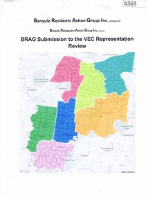
Document, BRAG submission to the VEC Representation Review, by Banyule Residents Action Group Inc, 2019_
This is a submission to the Victorian Electoral Commission, which periodically reviews electoral representation in municipal areas. The last review of Banyule City Council was in 2007.7 p. typescript with colour mapbanyule city council, brag banyule residents action group -
 Greensborough Historical Society
Folder, Victorian democracy and Greensborough, compiled by Anne Paul, 2019_06
Outline of events leading to independent separate representative government for Victoria in 1850, and information on electoral districts and parliamentary members in the Greensborough and surrounding areas to date. Talk presented by Anne Paul to a GHS General meeting on 29 June 2019.90 p. in loose leaf ring binder. Text, maps and colour illustrations. Printed copy of PowerPoint presentationgreensborough, victoria parliament, anne paul -
 Greensborough Historical Society
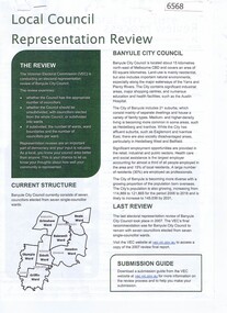
Newsletter, Plenty Gorge Metropolitan Park Newsheet No. 1 August 1989, 1989_08
... , map and col. illus. Plenty Gorge Metropolitan Park Newsheet ...The Shire of Whittlesea obtained a grant from the federal government to investigate the potential development of a park to the west of the Plenty River in 1976. A regional tip site and the Shire of Diamond Valley's Yarrambat Park were handed over to the MMBW to form the existing Metropolitan Park in 1986. A long term project to develop the park further is to commence in 1990.2 p. text, map and col. illus."With compliments of Sherryl Garbutt M.P. Member for Greensborough" (rubber stamp)plenty gorge park -
 Greensborough Historical Society
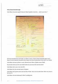
Article and Photograph, Henry Street Greensborough, 2017_
... Plenty Lower Plenty melbourne Map and information about Henry ...Map and information about Henry Street Greensborough, map drawn in 1999 by Valma Simpkins (nee Poulter) of residents and businesses in Henry Street near Grimshaw Street in the 1930s. Further discussion about Poulter and Clayton family connectionsThis photograph and text was copied from a Facebook site. Members are people who lived in the Greensborough area and share their reminiscences of the area with others. The site is administered by a GHS member but is not officially affiliated with the Society. Any information is the opinion of the contributor. Article and photograph sourced from social media.henry street greensborough, valma poulter, valma simpkins, clayton family -
 Greensborough Historical Society
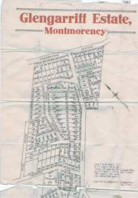
Map, Glengarriff Estate Montmorency, 1938c
Estate Agent's plan of Glengarriff Estate, Montmorency, covering LPs 11334 and 11451. Bordered by Sherbourne Avenue, Calrossie Avenue, Montmorency Station and Price AvenueColour photocopy of subdivision map, on two A3 sheets glengarriff estate montmorency, sherbourne avenue montmorency, calrossie avenue montmorency, price avenue montmorency, montmorency station