Showing 920 items matching "road guide"
-
 Montmorency–Eltham RSL Sub Branch
AMF Rising Sun Hat Badge Collection
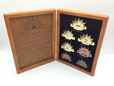
History of the seven versions of the Rising Sun hat badge.Two sided hinged timber look box set containing replicas of the seven versions of the Australian Military Forces (Army) Rising Sun hat badge from 1902 to the current version from 1991. The badges are mounted on a foam and black cloth background. The Rising Sun badges are able to be removed from the cloth background. Printed in black ink on the inside cover of the box is a history guide to the badges from 1902 to the current deisign. An early version of the Rising Sun badge containing bayonet and swords mounted over a crown with a rising sun background is also printed on the inside cover. Mounted on the outside of the front of the box is a gold coloured larger version of the current version of the Rising Sun badge. First Hat Badge - 1902 Second Hat Badge -1902 Third Hat Badge - 1904 Fourth Hat Badge - 1949 Fifth Hat Badge - 1954 Sixth Hat Badge - 1969 Seventh Hat Badge - 1991 Printed on the inside is a history guide to the badges from 1902 to the current design. The Australian Army is printed on the Rising Sun Badge mounted on the front cover. Brandnet Pty Ltd 02 6123 2990 is printed on the back cover. australian military forces, rising sun, hat, badge, collection -
 Lorne Historical Society
Book, The Australian Soldiers’ Pocket Book, April 1943
The information in the book is a guide to what life was like for soldiers during World War 11, covering health, personal cleanliness, conduct. It gives a clear indicaton of what was expected of soldiers and the behavioural expectations.A small red leather bound 127 page book, a gift from the Australian Comforts Fund , to servicemen in 1943world war 11, daisy bell -
 Mission to Seafarers Victoria
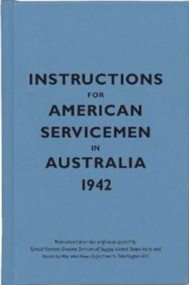
Book - Pocket book, Special Service Devision, Service of Supply, United States Army, Instructions for American Servicemen in Australia 1942, 2007
In 1942, the United States issued Instructions for American Servicemen in Australia as a quick guide to Australia's people, politics, history and culture for Americans stationed there during the Second World War. It was one of several similar sets of instructions put together by the US government to help its soldiers, sailors and airmen adjust to life abroad.Pocket size book of blue colour ix, [54] p. : ill., mapsnon-fictionIn 1942, the United States issued Instructions for American Servicemen in Australia as a quick guide to Australia's people, politics, history and culture for Americans stationed there during the Second World War. It was one of several similar sets of instructions put together by the US government to help its soldiers, sailors and airmen adjust to life abroad. 1942, american soldiers, australia -
 Greensborough Historical Society
Book, Nillumbik Shire Council, 1997 Community Guide Nillumbik, 1997_
Guide to services provided by Nillumbik Shire Council. Nillumbik Shire is located 25 kilometres north-east of Melbourne and the southern boundary is the Yarra River. The south of Nillumbik is predominantly urban, with commercial centres at Eltham and Diamond Creek. The north of the municipality includes significant natural features like Kinglake National Park and Sugarloaf ReservoirAnnual guide to services in Nillumbik. 64 pages. Cover is pale yellow with colour drawings. nillumbik shire council, handbooks -
 Greensborough Historical Society
Book, Nillumbik Shire Council, 1998 Community Guide Nillumbik, 1998_
Guide to services provided by Nillumbik Shire Council. Nillumbik Shire is located 25 kilometres north-east of Melbourne and the southern boundary is the Yarra River. The south of Nillumbik is predominantly urban, with commercial centres at Eltham and Diamond Creek. The north of the municipality includes significant natural features like Kinglake National Park and Sugarloaf ReservoirAnnual guide to services in Nillumbik 72 pages. Cover has white background and some 3-D artwork.nillumbik shire council, handbooks -
 Greensborough Historical Society
Book, Nillumbik Shire Council, 1999 Community Guide Nillumbik, 1999_
Guide to services provided by Nillumbik Shire Council. Nillumbik Shire is located 25 kilometres north-east of Melbourne and the southern boundary is the Yarra River. The south of Nillumbik is predominantly urban, with commercial centres at Eltham and Diamond Creek. The north of the municipality includes significant natural features like Kinglake National Park and Sugarloaf ReservoirAnnual guide to services in Nillumbik76 pages, illus. Cover has photographs of local people and title in white on orange background.nillumbik shire council, handbooks -
 Greensborough Historical Society
Book, Nillumbik Shire Council, Nillumbik Community Guide 2000/2001, 2000-2001
Guide to services provided by Nillumbik Shire Council. Nillumbik Shire is located 25 kilometres north-east of Melbourne and the southern boundary is the Yarra River. The south of Nillumbik is predominantly urban, with commercial centres at Eltham and Diamond Creek. The north of the municipality includes significant natural features like Kinglake National Park and Sugarloaf ReservoirAnnual guide to services in Nillumbik76 pages, black and white illustrations. Cover has a collage of local children with title in white on mid-blue background.nillumbik shire council, handbooks -
 Greensborough Historical Society
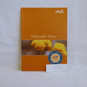
Book, Nillumbik Shire Council, Live local Plant local: Nillumbik Shire, 2001_
Nillumbik Shire is known for its natural vegetation. This text encourages locals to plant indigenous plants in their gardens.A guide to indigenous vegetation in the Nillumbik Shire.56 pages, illus. (some col.). Cover has yelloe flowers in band on orange background with shire logo.nillumbik shire council, environmental and cultural planning section, chris delaney, indigenous plants, native gardens -
 Greensborough Historical Society
Book, Shire of Eltham, Shire of Eltham Handbook 1988, 1988_
The Shire of Eltham was a Local Government Area located about 25 kilometres northeast of Melbourne. The shire covered an area of 277.13 square kilometres and existed from 1856 until 1994.Guide to services provided by Shire of Eltham52 pages, illus. Front cover is a copy of the painting "Panton Hill" by David Armfield.eltham, shire of eltham, handbooks -
 Greensborough Historical Society
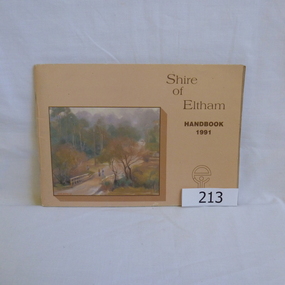
Book, Shire of Eltham, Shire of Eltham Handbook 1991, 1991_
The Shire of Eltham was a Local Government Area located about 25 kilometres northeast of Melbourne. The shire covered an area of 277.13 square kilometres and existed from 1856 until 1994.Annual guide to services in Shire of Eltham60 pages, Illus. Printed on beige paper. Front cover has a copy of the painting "Brougham Street Bridge" by Hilary Jackman.eltham, shire of eltham, handbooks -
 Greensborough Historical Society
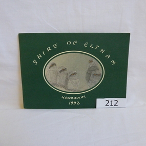
Book, Shire of Eltham, Shire of Eltham Handbook 1992, 1992_
The Shire of Eltham was a Local Government Area located about 25 kilometres northeast of Melbourne. The shire covered an area of 277.13 square kilometres and existed from 1856 until 1994.Annual guide to services in Shire of Eltham72 pages, illus. Front cover has a copy of a sketch "Frogmouths" by Margo Kroyer Pederson on dark green cover. Printed on recycled paper.eltham, shire of eltham, handbooks -
 Greensborough Historical Society
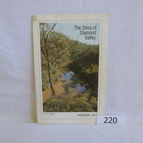
Book, Shire of Diamond Valley, The Shire of Diamond Valley Handbook 1977, 1977_
The Shire of Diamond Valley was a Local Government Area located about 20 kilometres northeast of Melbourne. The shire covered an area of 74.38 square kilometres and existed from 1964 until 1994.Annual guide to services in Shire of Diamond Valley18pages, illus (some colour), maps. Front cover photograph "Plenty Gorge".shire of diamond valley, greensborough, handbooks -
 Greensborough Historical Society
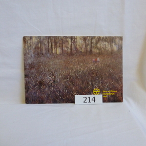
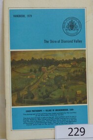
Book, The Shire of Diamond Valley Handbook 1979, 1979_
The Shire of Diamond Valley was a Local Government Area located about 20 kilometres northeast of Melbourne. The shire covered an area of 74.38 square kilometres and existed from 1964 until 1994.Annual guide to services in Shire of Diamond Valley32 pages, illus (some col.), maps. Cover illustration is a copy of the Ellis painting "Village of Greensborough 1889".shire of diamond valley, greensborough, handbooks -
 Greensborough Historical Society
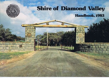
Book, Shire of Diamond Valley Handbook 1983, 1983_
Guide to services provided by Shire of Diamond Valley. The Shire of Diamond Valley was a Local Government Area located about 20 kilometres northeast of Melbourne. The shire covered an area of 74.38 square kilometres and existed from 1964 until 1994.Annual guide to services in Shire of Diamond Valley32 pages, col illus., maps. Cover illustration of the bluestone gateway, main entrance to Yarrambat Park, opened 1982.shire of diamond valley, greensborough, handbooks -
 Greensborough Historical Society
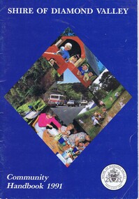
Book, Shire of Diamond Valley Community Handbook 1991, 1991_
Guide to services provided by Shire of Diamond Valley. The Shire of Diamond Valley was a Local Government Area located about 20 kilometres northeast of Melbourne. The shire covered an area of 74.38 square kilometres and existed from 1964 until 1994.Annual guide to services in Shire of Diamond Valley36 pages, col illus., maps. Front cover is a collage of scenes from Diamond Valley, back cover illustration of a copy of "Summer Panorama, Tabletop, NSW" by Max Dimmack, from the Shire of Diamond Valley Art Collection.shire of diamond valley, greensborough, handbooks -
 Greensborough Historical Society
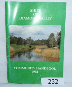
Book, Shire of Diamond Valley Community Handbook 1992, 1992_
Guide to services provided by Shire of Diamond Valley. The Shire of Diamond Valley was a Local Government Area located about 20 kilometres northeast of Melbourne. The shire covered an area of 74.38 square kilometres and existed from 1964 until 1994.Annual guide to services in Shire of Diamond Valley52 pages, col illus., maps. Cover illustration of Kalparrin Gardens Greensboroughshire of diamond valley, greensborough, handbooks -
 Greensborough Historical Society
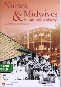
Book, Unlock the Past et al, Nurses & midwives in Australian history: a guide to historical sources, by Noeline Kyle, R. Lynette Russell and Jennifer Blundell, 2015_
Contains a bibliography and list of collecting organisations. A resource book on the subject of Australian nurses and midwives.76 p., stapled, printed in black & white, colour photographsnurses, midwives -
 Greensborough Historical Society
Booklet, Guide to food & nutrition, 1990c
Compilation of information on food and nutrition, produced by the Office of Jenny Macklin MP for Jagajaga16 p., printed in black on white and yellow paper, stapledfood, health, jenny macklin -
 Greensborough Historical Society
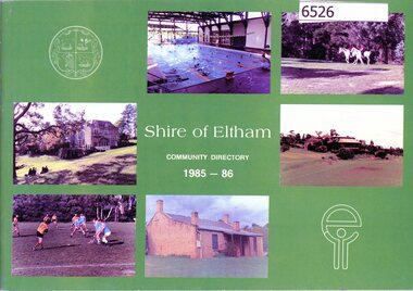
Book, Shire of Eltham Handbook 1985-86, 1985_
The Shire of Eltham was a Local Government Area located about 25 kilometres northeast of Melbourne. The shire covered an area of 277.13 square kilometres and existed from 1856 until 1994.Guide to services provided by Shire of Eltham40 pages, illus. Front cover is a collage of Eltham sceneseltham, shire of eltham, handbooks -
 Greensborough Historical Society
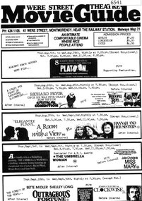
Program, Were Street Theatre Movie Guide 1987, 1987
Program of 9 films, from Thursday 6 August to Wednesday 30 September 1987, to be screened at the Were Street Theatre. "An intimate comfortable cinema where nice people attend"Black print on white paper, one sided.were street theatre, were street theatre movie guide -
 Greensborough Historical Society
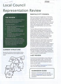
Document - Document Collection, Local Council Representation Review, 2019_
Contents: 2 x Newspaper Clippings: Banyule City Council Electoral Representative Review, Heidelberg Leader 20/08/2019 and Diamond Valley Leader 21/08/2019. Local Council Representative Review Submission Guide. Victorian Electoral Commission, 2019. 24 p., text. General information for those making a submission to a review. Local Council Representative Review Preliminary Report: Banyule City Council. Victorian Electoral Commission, August 2019. 31 p., text and colour maps. Reports on submissions and gives 3 options for electoral review in Banyule. Local Council Representative Review: Banyule City Council 1. Public hearing agenda and attachments. 25/09/2019. 9 p. 2. Public hearing agenda and attachments. 25/09/2019. 2 p. Agenda and handwritten notes by R. Bray. Local Council Representative Review Final Report: Banyule City Council. Victorian Electoral Commission, October 2019. 46 p., text and colour map. Recommends increasing the number of councillors and wards to 9. 2 newspaper clippings, 3 booklets and agenda with attachments. Filed in black plastic folder.banyule city council, victorian electoral commission, local council representative review 2019 -
 Greensborough Historical Society
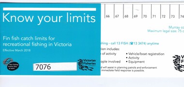
Ruler, Know your limits, 2018_
Guide to fishing in Victoria - includes ruler for measuring fish, and a list of fish, minimum sizes and legal limits.Fish length ruler. Black and aqua text on white card.fishing -
 Greensborough Historical Society
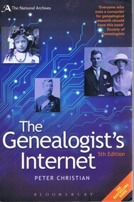
Book, Peter Christian, The genealogist's internet, 5th ed., by Peter Christian, 2012_
"Essential guide to researching your family history online".430 p., paperback book, black & white illustrationsgenealogy, family history -
 Greensborough Historical Society
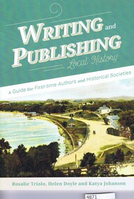
Book, Royal Historical Society of Victoria et al, Writing and publishing local history, by Rosalie Triolo, Helen Doyle and Katya Johanson, 2017_
Writing and publishing local history: a guide for first-time authors and historical societies, by Rosalie Triolo, Helen Doyle and Katya Johanson is a Revised edition of "Publishing History: a guide for Historical Societies". 83 p., paperback, col. illus.authorship, local history -
 Greensborough Historical Society
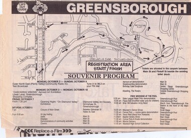
Newspaper, Greensborough Festival '88, 04/10/1988
Program of events for Greensborough Festival 1988, with articles on preparation of banners and the local Boys' BrigadeLinks: 00529:05543 Black and white, lift-out guide, 4 p.Published in Diiamond Valley News 4 October 1988grensborough festival 1988 -
 Greensborough Historical Society
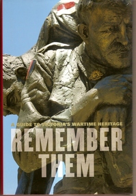
Book, Hardie Grant Books, Remember them: a guide to Victoria's wartime heritage, 2009_
This book contains stories behind some of the names on Victorian War Memorials.Includes stories from colonial times to the present day.The stories within this book bring to life the names contained on war memorials across Victoria.Hard cover book. 308 pages, colour illustrations. Book jacket has photo of "Cobbers", the Australian memorial at Fromelles.war memorials, soldiers, world war 1, victoria -
 Greensborough Historical Society
Book, Banyule City Council, The little Banyule book of things to do: Autumn guide 2014, 2014_04
This small book gives details of activities available in the City of Banyule during Autumn (March to May) 2014.35 pages, illustrations.city of banyule, banyule -
 Greensborough Historical Society
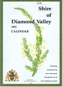
Calendar, Shire of Diamond Valley, Shire of Diamond Valley 1995 Calendar, 1995_
Copies of this calendar were distributed to households in the Shire of Diamond Valley. This 1994 Calendar features images of indigenous plants painted by Jan Lowe. Includes a Guide to services provided by Shire of Diamond Valley. The Shire of Diamond Valley was a Local Government Area located about 20 kilometres northeast of Melbourne. The shire covered an area of 74.38 square kilometres and existed from 1964 until 1994.The annual calendar is a record of the activities and services in the former Shire of Diamond Valley.28 page calendar illustrated with images of local flora, with 16 page liftout "Shire of Diamond Valley Resource Guide"shire of diamond valley, shire of diamond valley calendar, jan lowe -
Glenelg Shire Council Cultural Collection
Book, Mrs Beeton's Englishwoman's Cookery Book and Household Guide, 1890
Brown cloth binding over carboard covers, with title in gold in top left corner. Illustration of a woman in a kitchen on front cover. 191 pp.household management, cookery, mrs beeton, 1800s -
Glenelg Shire Council Cultural Collection
Book - Collection of reference texts on shells, 1964-2004
Collection of reference texts on seashells. Includes: Dance, Peter S., "Seashells", London: Treasure Press, 1971 (4111.1); "Handy Pocket Guide to Tropical Seashelss of Indonesia, 2004 (4111.2); Dance, Peter S., "Shells", Pymble: Harper Collins, 1992 (4111.3); Linder, Gert, "Seahshells of the world", Sydney: Australia & New Zealand Book Company, 1977 (4111.4); Wilson, B. R. & K. Gillett, "Australian Shells", Sydney: Reed, 1971 (4111.5); Harasewych, M.G., "Shells: Jewels from the Sea", New York: Rizzoli, 1989 (4111.6); "The Golden Stamp Book of Seashells", Wisonsin: Golden Books, 1975 (4111.7); Taylor, John & Jerry G. Walls, "Cowries", Neputune City: T.F.H. Pblications, 1975 (4111.8); Child, John & John Currey, "Shells and the Seashore", Melbourne: Landsdowne Press, 1972 (4111.9); "Sea Shells", London: Orbis Books, 1971 (4111.10); Dance, S. Peter, "Shells and shell collecting", London: Hamlyn, 1972 (4111.11); Clayton, JM, "All colour book of Seashells:, London: Octopus Books, 1974 (4111.12); "Exploring the Secrets of Nature", London: Reader's Digest, 1994 (4111.13); Habe, Tadashige, "Shells of the Western Pacific in colour: Vol I", Osaka: Hoikusha, 1964 (4111.14); Habe, Tadashige, "Shells of the Western Pacific in colour: Vol II", Osaka: Hoikusha, 1964 (4111.15); Dance, Peter S. (ed.), "The Encyclopedia of Shells", Sydney: Australia & New Zealand Book Company, 1977 (4111.16); Hinton, Alan, "Guide to Shells of Papua New Guinea", Port Moseby: Robert Brown and Associates, nd (4111.17); Hinton, Alan, "Guide to Australian Shells", Port Moseby: Robert Brown and Associates, nd (4111.18); "The How and Why wonder book of seashells", New York: Grosset & Dunlap, 1972 (4111.19); Child, J., "Australian Golden Stamp Book: Australian Seashells",Sydney: Golden Press, 1971 (4111.20); Hinton, Alan, "Shells of New Guinea and the Central Indo-Pacific", Port Morsby; Milton: Robert Brown and Associates Pty Ltd; The Jacaranda Press, 1975 (4111.21); Coleman, Neville, "Shells in Australia", Sydney: Reed, 1978 (4111.22); Coleman, Neville, "What Shell is That?", Sydney: Ure Smith Press, 1988 (4111.23); Coleman, Neville, "Shells Alive!", Adelaide: Rigby Publishers, 1981 (4111.24); Deas, Walter, "Seashells of Australia", Adelaide: Rigby Ltd, 1974 (4111.25).maritime, marine ecology, sea shells, reference, natural history