Showing 9794 items
matching west
-
 Ballarat Heritage Services
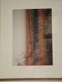
Photograph, Ballarat looking West from the Former Humffray Street Primary School, 12/91/2019
Ballarat looking West from the Former Humffray Street Primary Schoolballarat, humffray street primary school, ballarat town hall, former ballarat state offices, former ballarat post office -
 Kew Historical Society Inc
Photograph, Stewart West, High Street, Kew, 2001, 2001
High Street, Kew. View west towards Kew Junction. One of a pair of photographs prepared by Stuart West comparing the vista in c. 1890 and 2001. This photograph dates from the later date.Nilhigh street (kew) -
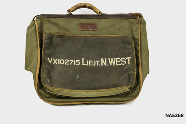 Whitehorse Historical Society Inc.
Functional object - Officers Dress Bag
World War 2 Noel Edmund Charles WestLarge khaki Army Dress bag with handle and many compartments VX102715 Lieut. N. West.VX102715 Lieut. N. Westarmy, bag, w.w.2, noel edmund charles west -
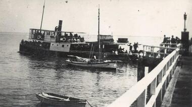 Phillip Island and District Historical Society Inc.
Photograph
One of a collection of over 400 photographs in an album commenced in 1960 and presented to the Historical Society by the Shire of Phillip IslandPhotograph along west side Cowes Jetty showing "Genista" departing.local history, photography, photographs, maritime technology, ferries, ferry "genista" - cowes jetty, black & white photograph, genista, cowes jetty, john jenner, bryant west -
 Phillip Island and District Historical Society Inc.
Photograph, 1900
One of a collection of over 400 photographs in an album commenced in 1960 and presented to the Phillip Island & Westernport Historical Society by the Shire of Phillip IslandPhotograph of The Esplanade Cowes Phillip Island, taken in 1900 - looking westlocal history, photography, photographs, the esplanade cowes, black & white photograph, phillip island, cowes, the esplanade, john jenner, bryant west -
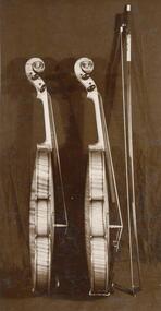 Phillip Island and District Historical Society Inc.
Photograph
One of a collection of over 400 photographs in an album commenced in 1960 and presented to the Phillip Island & Westernport Historical Society by the Shire of Phillip IslandPhotograph of two Violins made on Phillip Island by Mr Bryant Westlocal history, photography, violins, black & white photograph, music, bryant west, john jenner -
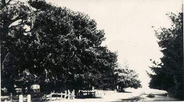
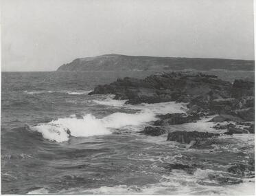 Phillip Island and District Historical Society Inc.
Photograph, Bryant West
One of a collection of over 400 photographs in an album commenced in 1960 and presented to the Phillip Island & Westernport Historical Society by the Shire of Phillip IslandPhotograph of Cape Woolamai looking south west across the Eastern Passage.local history, photography, photographs, coastline, eastern channel, phillip island, cape woolamai, john jenner, bryant west -
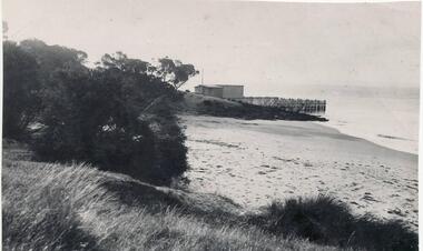 Phillip Island and District Historical Society Inc.
Photograph, Bryan West
One of a collection of over 400 photographs in an album commenced in 1960 and presented to the Phillip Island & Westernport Historical Society by the Shire of Phillip IslandPhotograph of Cowes Sea Baths Beach west of Cowes Jetty - 1900local history, photography, photographs, coastline, cowes, sea baths, phillip island, john jenner, bryant west -
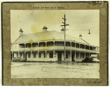 Port Fairy Historical Society Museum and Archives
Photograph
Iconic Hotel in Port Fairy Built as the first of a proposed chain of hotels by John Walwyn Taylor in 1855 on the corner of Bank and Sackville Streets. 2 stories with a balcony wrapping around 2 sides of the building. The site was formerly occupied by the wooden hotel "The Sally Ann". A snapshot of time showing the hotel the power lines, and the style of cars from that era.Black and white photograph of the Star of the West Hotel on a brown bordered mountWritten in Pen at top and underlined - STAR OF THE WEST HOTEL Lower right - ball point pen museum numbers 62.04B.011D On Back- Pencil - 3-17 - S2-7-57 - j o h 2-7-57john walwyn taylor, the sally ann, bank street, sackville street, hotel, star of the west -
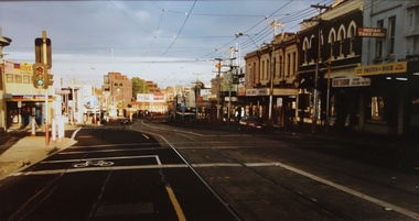
 City of Ballarat Libraries
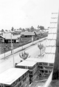
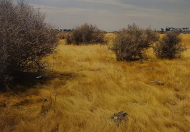
Photograph, View from West Ballarat Fire Station looking north west
View from the West Ballarat Fire Station looking north west looking towards Drummond and Errard Streets. Both the Base and St John of God Hospitals roofs and chimneys are seen.west ballarat fire station, ballarat, drummond street, errard street, base hospial, st john of god hospital -
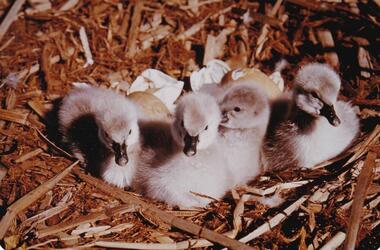 Phillip Island and District Historical Society Inc.
Photograph, Bryant West Bird Album, pre 1970
One of a collection of thirty-six photographs selected for representation in the National Photographic Index of Australian BirdsColour photograph, four black swan cygnets in nest. Bryant West Albumlocal history, photographs, national history, birds, coloured photograph, black swans, cygnets, bryant west -
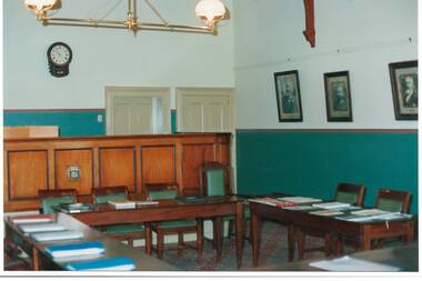 Buninyong & District Historical Society
Photograph - Original Photograph, Mr. C.J. Brooks, Interior, South and West walls and bench of 1886 Buninyong Courthouse, November 1995
gold rush era historic building, social/legal historyColour photo, Interior, South and West walls and bench of 1886 Buninyong Courthouse.buninyong, courthouse, town hall, shire council -
 Tatura Irrigation & Wartime Camps Museum
Photograph, North West Mooroopna Primary School
A4 copy of North West Mooroopna Primary School students (year unknown)northwest mooroopna, school, mulcahy, groves, starritt, mcdowell, stewart -
 Brimbank City Council Art Collection
Photograph, Robert Pointon, West Bank of the Kororoit Creek looking north, 1988
Local SceneHuntsman Chemical works, West Bank of the Kororoit Creek looking north - AR0019 -
 Brimbank City Council Art Collection
Photograph, Robert Pointon, West of Fitzgerald Road, 1990
Local SceneRobert Pointon. West of Fitzgerald Road. Colour photograph, 34 x 49cm -
 Stawell Historical Society Inc
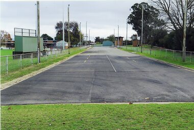
Photograph, Fire Brigade Training Track at North Park 2015 Looking west
Fire Brigade Training Track – North Park - 2015Colour Photograph of bitumen track used for fire fighting training. Looking weststawell -
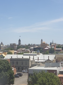
 Ballarat Heritage Services
Photograph, Ballarat looking North West from the Former Humffray Street Primary School, 12/91/2019
Ballarat looking North West from the Former Humffray Street Primary Schoolballarat, humffray street primary school, ballarat railway station, mair street -
 Surrey Hills Historical Society Collection
Photograph, Union Road looking west from the steeple of Holy Trinity Church, 1922, 1922
At the edge of the church roof and on the horizon is 'The Knoll' on the corner of Union Road and Wandsworth Road. To the left of this is 297 Mont Albert Road, home of the Michael Parer family and further left is "Quamby", home of the Sherar family. This is easily recognised by the square viewing tower located on the west wing of the house. The Sherar family owned 'Quamby' from 1900 until 1925, when it became Mosgiel Private Hospital. Norman Carter took many photos of Surrey Hills and Mont Albert in the 1920s; many associated with events and activities of the Church of England. Black and white photo of taken from the steeple of Holy Trinity Church, during its construction, across Union Road to the north-west. In the foreground immature street trees can be seen and an original telephone pole with white insulators. The street has formed paths and bluestone kerb and channelling. holy trinity anglican church, union road, the knoll, quamby, street trees, telegraph and light poles, mosgiel hospital -
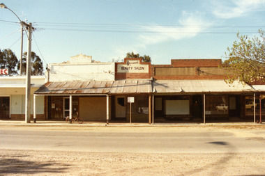 Charlton Golden Grains Museum Inc
Photograph, Charlton High Street, west end, north side 1987, c.1987
West end, north side of High St Charlton. Part of Shire streetscape series 1987. From left, the buildings are; State Electricity Commission, Oakley Thompson Solicitors (formerly Dobson's), Yvonne's Beauty Salon (formerly Linda Hinsen's (?) Frock Shop, former 3CV offices (later J Knights Dentist, Arundell's Shoe Shop.Colour photograph of six shops at the west end, northern side of High St Charlton. Signage above one shop reads Yvonne's BEAUTY SALON. E.C signage for the S.E.C shop visible on LH side of photo. Bicycle leaning against middle verandah post. Large electricity pole on LH side of photo. Signage for Arundell's partially visible on RH side.state electricity commission, oakley thompson, dobsons, yvonnes beauty salon, 3cv, j knights dentist, arundells, business, industry -
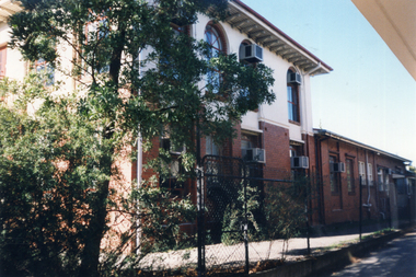 Whitehorse Historical Society Inc.
Photograph, West side of former Municipal Chambers, Nunawading, 1/06/1997 12:00:00 AM
Coloured photo of West side of former Municipal Chambers, 360 Whitehorse Road, Nunawading.municipal chambers, shire of blackburn and mitcham, city of nunawading, whitehorse road, nunawading, no. 360 -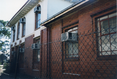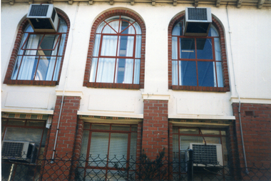
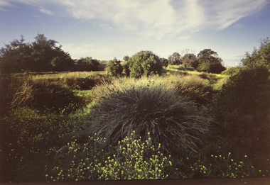
 Brimbank City Council Art Collection
Photograph, Robert Pointon, West of Fairbairn Road, 1989
Local SceneWest of Fairbain Road facing east towards city with grasslands and box thorns. - AR0039 -
 Falls Creek Historical Society
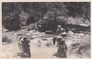
Photograph - George Shirling at the West Kiewa River
George Shirling arrived in Falls Creek in 1962. He engaged Phil Nowell to build the original Koki Alpine Lodge which opened in 1965 with 14 beds. George operated the lodge with Michael “Baldy” Blackwell as manager. He also graduated in sport psychology in 1981 and was invited to become team psychologist for the Australian Winter Olympic team which went to Albertville, France, in 1992. He later owned the Red Onion Chalet. George credited the success of Koki to “Baldy” Blackwell. “Baldy” and Phil Nowell started the Trackers Mountain Lodge in partnership during the 1980s. In 1971 George sold Koki Lodge to Sigi Doerr. In 2024 the renamed Koki Alpine resort remains a highly popular destination in Falls Creek. George Shirling passed away on 27th February 2023. He had remained actively involved in Falls Creek and was generous with his time and knowledge, always an amazing supporter of The Falls Creek Museum and Falls Creek Village.This photo is significant because it captures an image of two pioneers of pioneers and active members of Falls Creek Village.A black and white image of George Shirling with two motorbikes on the bank of the West Kiewa River.george shirling, koki lodge -
 Ringwood and District Historical Society
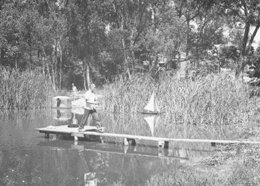
Photograph, Ringwood Lake, West Side 1960
Including boys sailing model boatWritten on back of one copy, "Ringwood Lake, West Side 1960". -
 Ringwood and District Historical Society
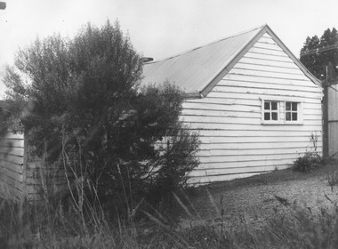
Photograph, 1873 Miners Cottage in 1975. West wall
Written on backing sheet, "1873 Miners Cottage, 1975. West wall." -
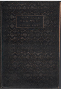 Linton Mechanics Institute and Free Library Collection
Book - Novel, Ertz, Susan, Now East, Now West by Susan Ertz, 1931
Hardcover book, 316 pages. Book has a black cover with gold embossed text and a background of stars.fictionsusan ertz, fiction -
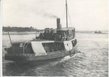 Phillip Island and District Historical Society Inc.
Photograph
One of a collection of over 400 photographs in an album commenced in 1960 and presented to the Phillip Island & Westernport Historical Society by the Shire of Phillip IslandPhotograph of the ferry, "Genista" from a point astern and steaming west towards Cowes Jettylocal history, photography, photographs, maritime technology, ferries, ferry "genista", black & white photograph, shipping, genista, john jenner, bryant west -
National Vietnam Veterans Museum (NVVM)
Audio - Audio, CD, Radio interview with John Methven, 2003
Interview done by Lynn Wells, West Gippsland Community Radio, 7 November 2003national vietnam veterans museum -
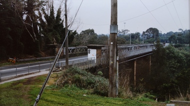 Kew Historical Society Inc
Photograph - Chandler Highway Bridge, Stewart West, 2001
Colour photograph by Stuart West of the Chandler Highway Bridge from the Fairfield side of the River.Nilchandler highway bridge, stewart west