Showing 1293 items matching "victorian maps"
-
 Victorian Railway History Library
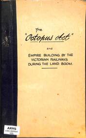
Book, Michael Anthony Venn, The Octopus Act and empire building by the Victorian Railways during the land boom, 1973
A thesis for the Master of Arts Preliminary Course of the History school at Melbourne University, on the empire building by the Victorian Railways with the Railway Construction act of 1884... known as the Octopus Act.bib, maps, p.80.non-fictionA thesis for the Master of Arts Preliminary Course of the History school at Melbourne University, on the empire building by the Victorian Railways with the Railway Construction act of 1884... known as the Octopus Act.victorian railways construction - history, railway expansion - victoria - history -
 Victorian Railway History Library
Book, Michael Anthony Venn, Engineers and Politicians Victorian Railways 1852-1881, 1982
A thesis for the degree of Master of Arts at Melbourne University on the history of railway engineers and their relationship with Victorian politicians in the period 1852 to 1881.bib, ill, maps, p.184.non-fictionA thesis for the degree of Master of Arts at Melbourne University on the history of railway engineers and their relationship with Victorian politicians in the period 1852 to 1881.railway construction - australia, railway construction - victoria - history -
 Stawell Historical Society Inc
Map - Electoral Map, Victorian Government, Map of North - Western ( Country) Electoral Province Legislative Council 1939, 1939
... Electoral Map Government Scale 8 Miles to 1 Inch Map ...Electoral MapMap Overprinted with Provinces In RedScale 8 Miles to 1 Inchgovernment -
 Melbourne Tram Museum
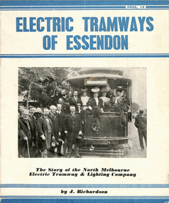
Book, Jack Richardson, "Electric Tramways of Essendon", "The Essendon Tramways", 1963
Book - 16 pages including card covers on semi gloss paper titled "The Essendon Tramways" written by Jack Richardson, published by Traction Publications, Historical Series No. 3 in 1956. The story of the North Melbourne and Electric Tramway and Lighting Company. Foreword on page 2 gives the background to the book and the persons who assisted with it. Details the historical background, a map of the tramway in 1906, relationship with the Victorian Railways, construction, rolling stock, carbarn, (depot) power station, overhead, takeover by the MMTB, connection to the City, 1956 map, expansion under the MMTB, services at the time of publication, Rolling Stock Roster, notes on some of the personnel of the tramway, junction details and dates of the various extensions etc. Includes a number of photographs, a list of railway and tramway books published by Traction Publications on the rear cover a short biography on the author. 2nd copy - from the H. S. McComb collection - stored in the original box - Items 2027 to 2030 and 1309 copy 2 contained within box 72.3 in a brown folder marked "Historical Data regarding Essendon Tramways and their services to the City" PDF copy of 1309.1 - the 1956 version added 25-2-2021 PDF copy of 1309.2 - the 1963 version added 16-3-2017. 1309.2 - 2nd edition, 1963, Historical Series No. 153, with a photo of J. Richardson on rear cover. Has notes on the edition and publisher notes. Revised to pick up errors and other photographs. Added 16-3--2017.1309.2 - has "L. W. Rogers" in ink on the top right hand corner of page 3.trams, tramways, essendon, nmetl, tramcars, depots, moonee ponds, north melbourne -
Clunes Museum
Flyer, Victorian Government, FLOOD RECOVERY COMMUNITIES AND THE ENVIRONMENT, C 2012
FLOOD RECOVERY COMMUNITIES AND ENVIRONMENTA4 DOUBLE SIDED FLYER FROM NORTH CENTRAL CATCHMENT MANAGEMENT AUTHORITY (NCCMA). COLOUR PHOTOS AND TEXT ON FRONT AND MAP OF AFFECTED AREAS ON THE BACK.nccma, flood recovery -
 Bendigo Historical Society Inc.
Document - BENDIGO AND VICTORIA HILL REPORT ON GEOLOGY
Report, 8 pages, on the geology of Bendigo district and Victoria Hill, produced by the Geological Survey Dept., Victorian Government. G.J. Medwell, Geologist. 19.10.1967. On front 'Geological Survey of Victoria. Mines Department Victoria. Report on Geology of Bendigo and of Victoria Hill Area' Letter attached inside front cover to J.C.Balfour, Minister of Mines to G.A. Lambert, Liberal Party, Sunshine, Victoria, sent with book for his information. Report contains: Cobaw batholith and North Harcourt Bendigo goldfield generally Trought, reefs, saddles and spurs Victoria Hill mines; Victoria Consols, Great Central Victoria, Victoria Quartz, Lansells 180, North Old Chum. Maps attached show part of New Chum line of reef and a handdrawn map of Rae's Cutting.bendigo, mining, victoria hill, bendigo goldfield -
Canterbury History Group
Document - A Victorian Gem - Heritage Report "Arklow"
... bound, A4, includes maps Document A Victorian Gem - Heritage ...Heritage Report for "Arklow", 40 Bryson Street, Canterbury - part of Arklow Hill Estate. Report includes information on submission and previous owner Title information11 pages, spinal bound, A4, includes mapsarklow hill estate, heritage studies, bryson street, victorian style -
 Victorian Railway History Library
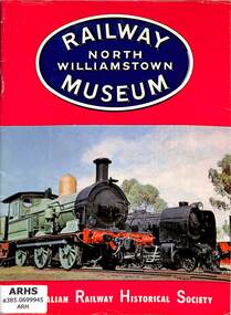
Booklet, Australian Railway Historical Society (Victorian Division), Railway Museum - North Williamstown, 1964
An illustrated guide to the locomotive & rollingstock collection of the Australian Railway Historical Society (Vic Division) Railway Museum in 1968.ill, maps, p.31.non-fictionAn illustrated guide to the locomotive & rollingstock collection of the Australian Railway Historical Society (Vic Division) Railway Museum in 1968.arhs railway museum north williamstown - victoria, tourist railways and museums - australia -
 Victorian Railway History Library
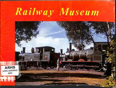
Booklet, Australian Railway Historical Society (Victorian Division), Railway Museum - revised edition, 1964
An illustrated guide to the locomotive & rollingstock collection of the Australian Railway Historical Society (Vic Division) Railway Museum in 1964.ill, maps, p.23.non-fictionAn illustrated guide to the locomotive & rollingstock collection of the Australian Railway Historical Society (Vic Division) Railway Museum in 1964.arhs railway museum north williamstown - victoria, tourist railways and museums - australia -
 Victorian Railway History Library
Booklet, Australian Railway Historical Society (Victorian Division), Railway Museum - Australian Railway Historical Society Victorian Division, 1964
An illustrated guide to the locomotive & rollingstock collection of the Australian Railway Historical Society (Vic Division) Railway Museum in 1962.ill, maps, p.31.non-fictionAn illustrated guide to the locomotive & rollingstock collection of the Australian Railway Historical Society (Vic Division) Railway Museum in 1962.arhs railway museum north williamstown - victoria, tourist railways and museums - australia -
 Narre Warren and District Family History Group
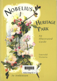
Book, Jo Jenkinson, Nobelius - Heritage Park - An illustrated guide, 2002
Gembrook Nurseries known as Nobelius Nurseries was primarily a wholesale business, founded by Carl Axel Nobelius (1851-1921) and was operated by the Nobelius family for seventy years. It is on the Victorian Heritage Register. Contains various information, drawings, maps and photographs.vi, 57 p.; 21 cmnon-fictionGembrook Nurseries known as Nobelius Nurseries was primarily a wholesale business, founded by Carl Axel Nobelius (1851-1921) and was operated by the Nobelius family for seventy years. It is on the Victorian Heritage Register. Contains various information, drawings, maps and photographs.carl axel nobelius, trees, shrubs, plants, emerald (vic.) -
 Kiewa Valley Historical Society
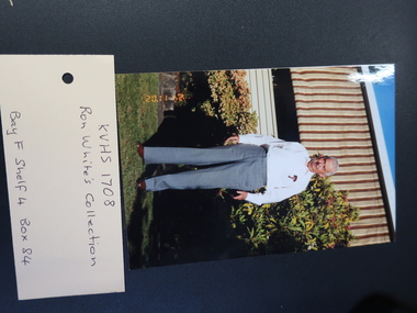
Ron White's Collection - 1920 - 2019
The State Electricity Commission of Victoria constructed the Kiewa Hydro Electric Scheme.See KVHS 1282Ron White was the Principal Hydro Engineer 1966 - 1985 on the Kiewa Hydro Electric Scheme. See KVHS 12821. Booklet "Rules of the Kiewa Hydro Co-operative Distribution Society Limited" and Ron's 'Share Certificate' dated 12th /4/1957 2. Book "Inside Information" explaining the ins and outs of a car for the motorist. 3. Black and White negatives 4. Ron's La Trobe Valley Health Services Membership card x2 5. State Savings Bank of Victoria Kiewa Operations social club 1962 x2 6. The Association of Professional Engineers, Victorian Branch receipts 1956 7. Upper Kiewa Valley Uniting Church list of members 1969-1970 & Financial Statement for 1970 8. 4 Bogong Village coloured postcards 9. Folded Plan of 'Kiewa Area Planimetric Map' 10. Large Photos sent to Ron by "Bill Greenaway / Y.T.S. Lab./ 11-5-66" 1) Football Team x2, 2) Mt Beauty Switchyard, 3) McKay Power Station, 4) Clover Power Stationron white -
 Falls Creek Historical Society
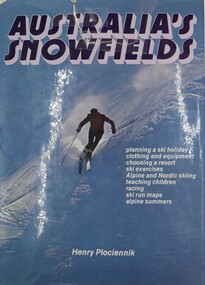
Book - Australia's Snowfields, Henry Plociennok, 1976
Written by the former owner and editor of Skiing News, this is a comprehensive book on the attractions of Australia's snowfields and summer alpine holidays. The first part of the book gives a brief history of skiing in Australia, followed by a detailed guide to planning and organising a ski holiday. It includes advice on which resort to choose and advice on suitable equipment. As well as basic techniques for beginners. The second part of the book examines every major ski resort in Australia. As well as advice on facilities. Six New South Wales, five Victorian and two Tasmanian resorts are covered.This book includes colour photography, black and white illustrations, and detailed maps accompanying advice about the Australian snowfields in the 1970s.Written by the former owner and editor of Skiing News, this is a comprehensive book on the attractions of Australia's snowfields and summer alpine holidays. The first part of the book gives a brief history of skiing in Australia, followed by a detailed guide to planning and organising a ski holiday. It includes advice on which resort to choose and advice on suitable equipment. As well as basic techniques for beginners. The second part of the book examines every major ski resort in Australia. As well as advice on facilities. Six New South Wales, five Victorian and two Tasmanian resorts are covered. skis and skiing australia, australian snowfields -
 Falls Creek Historical Society
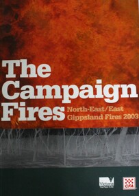
Book - The Campaign Fires - North-East/East Gippsland Fires 2003, Lyndel Hunter
A description of efforts to fight the bushfires in Gippsland in 2003, including maps and illustrations. This volume was published as a tribute to the work of staff and volunteers who put themselves at risk to protect local communities. It shows the impact on those communities in Victoria and the support they gave to those involved in fighting largest bushfires in Victoria for 60 years. The Alpine bushfires started on 8th January 2003, a day of Total Fire Ban. Lightning ignited 87 fires in the North-East and East Gippsland regions. Eight of these fires were unable to be contained; they joined together to form the largest fire in Victoria since the Black Friday fires in 1939. The majority of the area burnt in Victoria was public land, 1.19 million hectares of parks and forests, including 60 per cent of the Alpine National Park and 81 per cent of the Mt Buffalo National Park. Firefighting efforts were made difficult in hard-to-access, remote forest terrain. Approximately 90,000 hectares of private land was burnt.This book is significant because it documents the 2003 Victorian Bushfires and serves as a tribute to the CFA staff and volunteers who fought them.This publication of 119 pages features text, colour images, maps and detailed information related to the 2003 bushfires in Victoria.At bottom of front cover:- CFA Victoria Logo Victorian Government Logovictorian fires 2003, cfa (vic) -
 Victorian Railway History Library
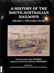
Book, Stewien, Ronald, A History of the South Australian Railways Volume 1 The Early years, 2007
A history of the South Australian Railways early years from 1853.index, ill, map, p.320.non-fictionA history of the South Australian Railways early years from 1853.railroads -- south australia -- history., south australian railways -- history., -
 Victorian Railway History Library
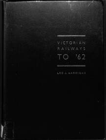
Book, Harrigan, Leo J, Victorian Railways To '62, 1962
... the 1850s to 1962. index, ill, maps, p.299. Victorian Railways ...The history of the Victorian Railways from the 1850s to 1962.index, ill, maps, p.299.non-fictionThe history of the Victorian Railways from the 1850s to 1962.railroads -- australia -- history, railroads -- australia -- victoria -- history. -
 Falls Creek Historical Society
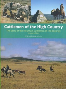
Book - Cattlemen of the High Country, Tor and Jane Holth, 2008
A history of the cattlemen of the Bogongs in the Victorian Alps, including their bushcraft, yarns, hut construction, dog and horse training. It looks at the issue of fire and cattle grazing and the struggle of the mountain cattlemen to retain their leases after the bushfires of 2003. This publication provides an enduring record of a special group of Australian pioneers whose lives and qualities of endurance have become part of Australian folklore.Subtitled "The story of the mountain cattlemen of the Bogongs", this publication of 248 pages includes illustrations, photos, portraits, an index and maps on the end papers. The original edition was published in 1980 A history of the cattlemen of the Bogongs in the Victorian Alps, including their bushcraft, yarns, hut construction, dog and horse training. It looks at the issue of fire and cattle grazing and the struggle of the mountain cattlemen to retain their leases after the bushfires of 2003. This publication provides an enduring record of a special group of Australian pioneers whose lives and qualities of endurance have become part of Australian folklore.bogong high plains, cattlemen of the high plains, bogong high plains history -
 Victorian Railway History Library
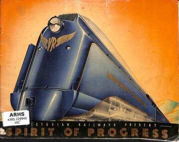
Booklet, The Victorian Railways, The Victorian Railways Presents - Spirit of Progress, 1937
... between Melbourne and Sydney in 1937. ill, maps, p.12 ...A promotional booklet for the launch of the Spirit of Progress passenger train between Melbourne and Sydney in 1937.ill, maps, p.12.non-fictionA promotional booklet for the launch of the Spirit of Progress passenger train between Melbourne and Sydney in 1937.railroad travel -- new south wales -- sydney -- history, railroad travel -- victoria -- melbourne -- history -
 Victorian Railway History Library
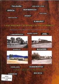
Book, Jeffrey, Max et al, Lost Railway Stations of the Pyrenees, 2019
Illustrated history of the railway stations on the closed railway lines of the Victorian Pyrenees including the line to Navarre & Ararat to Maryborough.ill, maps, p.226.non-fictionIllustrated history of the railway stations on the closed railway lines of the Victorian Pyrenees including the line to Navarre & Ararat to Maryborough.pyrenee range (vic.) -- buildings, structures, etc -- history, railroad stations -- victoria -- pyrenee range -- history -
 Victorian Railway History Library
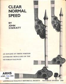
Booklet, Australian Railway Historical Society Victorian Division, Clear Normal Speed: An Outline of Three Position Automatic Signalling on the Victorian Railways, 1966
... signals on the Victorian Railways. ill, maps, p.34. Clear Normal ...Details of the use of 3 position automatic semaphore signals on the Victorian Railways.ill, maps, p.34.non-fictionDetails of the use of 3 position automatic semaphore signals on the Victorian Railways.railroad operations - victoria, railroad signalling - victoria -
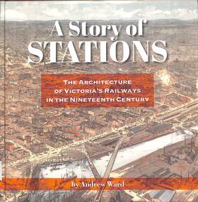 Victorian Railway History Library
Book, Ward, Andrew, A Story of Stations The Architecture of Victoria's Railways in the Nineteenth Century, 2019
Details of the architecture of railway stations building in Victoria Australia in the 19th century.index, ill, maps, p.337.non-fictionDetails of the architecture of railway stations building in Victoria Australia in the 19th century.railroad infrastructure - victoria, railroads - victoria - history -
 Victorian Railway History Library
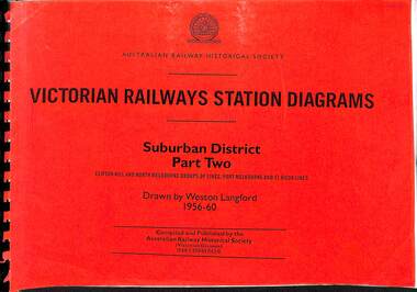
Book, Langford, Weston, Victorian Railway Station Diagrams 1956-1960 - Suburban District Part Two, 1956-1960
... district of Melbourne Victoria in 1956 to 1960. maps, p.52 ...Railway diagrams of the stations on the Clifton Hill, North Melbourne Port Melbourne & St Kilda group of lines in the Suburban district of Melbourne Victoria in 1956 to 1960.maps, p.52.non-fictionRailway diagrams of the stations on the Clifton Hill, North Melbourne Port Melbourne & St Kilda group of lines in the Suburban district of Melbourne Victoria in 1956 to 1960.railroad infrastructure - victoria, railroads - victoria -
 Victorian Railway History Library
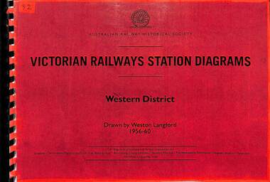
Book, Langford, Weston, Victorian Railway Station Diagrams 1956-1960 - Western District, 1956-1960
... of Victoria in 1956 to 1960. maps, p.56. Victorian Railway Station ...Railway diagrams of all the stations in the Western district of Victoria in 1956 to 1960.maps, p.56.non-fictionRailway diagrams of all the stations in the Western district of Victoria in 1956 to 1960.railroad infrastructure - victoria, railroads - victoria -
 Victorian Railway History Library
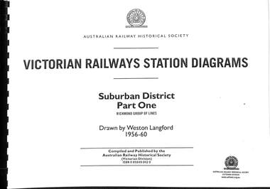
Book, Langford, Weston, Victorian Railway Station Diagrams 1956-1960 - Suburban District Part One, 1956-1960
... to 1960. maps, p.64. Victorian Railway Station Diagrams 1956-1960 ...Railway diagrams of all the stations on the Richmond group of lines in the Suburban district of Melbourne Victoria in 1956 to 1960.maps, p.64.non-fictionRailway diagrams of all the stations on the Richmond group of lines in the Suburban district of Melbourne Victoria in 1956 to 1960.railroad infrastructure - victoria, railroads - victoria -
 Victorian Railway History Library
Book, Langford, Weston, Victorian Railway Station Diagrams 1956-1960 - North Eastern District, 1956-1960
... of Victoria in 1956 to 1960. maps, p.132. Victorian Railway Station ...Railway diagrams of all the stations in the North Eastern district of Victoria in 1956 to 1960.maps, p.132.non-fictionRailway diagrams of all the stations in the North Eastern district of Victoria in 1956 to 1960.railroad infrastructure - victoria, railroads - victoria -
 Victorian Railway History Library
Book, Langford, Weston, Victorian Railway Station Diagrams 1956-1960 - Northern and Midland District, 1956-1960
... district of Victoria in 1956 to 1960. maps, p.43. Victorian Railway ...Railway diagrams of all the stations in the Northern and Midland district of Victoria in 1956 to 1960.maps, p.43.non-fictionRailway diagrams of all the stations in the Northern and Midland district of Victoria in 1956 to 1960.railroad infrastructure - victoria, railroads - victoria -
 Victorian Railway History Library
Book, Langford, Weston, Victorian Railway Station Diagrams 1956-1960 - North Western District, 1956-1960
... of Victoria in 1956 to 1960. maps, p.84. Victorian Railway Station ...Railway diagrams of all the stations in the North Western district of Victoria in 1956 to 1960.maps, p.84.non-fictionRailway diagrams of all the stations in the North Western district of Victoria in 1956 to 1960.railroad infrastructure - victoria, railroads - victoria -
 Victorian Railway History Library
Book, Langford, Weston, Victorian Railway Station Diagrams 1956-1960 - South Western District, 1956-1960
... of Victoria in 1956 to 1960. maps, p.76. Victorian Railway Station ...Railway diagrams of all the stations in the South Western district of Victoria in 1956 to 1960.maps, p.76.non-fictionRailway diagrams of all the stations in the South Western district of Victoria in 1956 to 1960.railroad infrastructure - victoria, railroads - victoria -
 Victorian Railway History Library
Book, Langford, Weston, Victorian Railway Station Diagrams 1956-1960 - Eastern and South Eastern District, 1956-1960
... Eastern district of Victoria in 1956 to 1960. maps, p.67 ...Railway diagrams of all the stations in the Eastern and South Eastern district of Victoria in 1956 to 1960.maps, p.67.non-fictionRailway diagrams of all the stations in the Eastern and South Eastern district of Victoria in 1956 to 1960.railroad infrastructure - victoria, railroads - victoria -
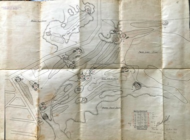 Phillip Island and District Historical Society Inc.
Map, Map of Summerland Golf Course, 15/12/1927
Summerland Estate was created in the 1920s by A.K. T. Sampbell. It consisted of a housing estate, guest house and golf course. This area was acquired and all buildings, roads etc removed by the Victorian Government in the 1980s for a nature reserve for the penguins. This is believed to be the only time in the world when humans have been removed to benefit nature. HistoricalPurple leather covered fold out linen map with hand drawn diagram of the topography, layout of golf holes and club house Broken sand dunes, rough sandy hills, grassy hills and mounds, Swan Lake, Par for nine holes 34, Scratch score for nine holes 36, Drawn by A. Russell 12/12/1927summerland estate, a.k. t. sampbell, map, penguin reserve, summerland golf course