Showing 658 items
matching plan of survey
-
 Bendigo Military Museum
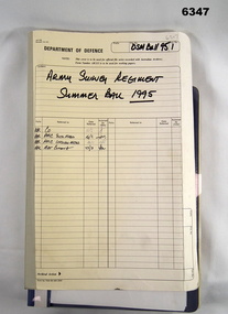
Administrative record - Army Survey Regiment Officers Mess Ball 1995, Army Survey Regiment, Bendigo, 1995
The Army Survey Regiment held Annual Balls at Fortuna Villa. This folder contains the documentation for the Logistics and activities associated with the planning and running of the Officers and Sergeants Mess Ball held in 1995. The folder also contains an after action review of the ball.Cloth bound manila Correspondence Folder containing minutes and correspondence for the Officers and Sergeants Mess Summer Ball of 1995royal australian survey corps, rasvy, fortuna, army survey regiment, army svy regt, asr -
 Bendigo Military Museum
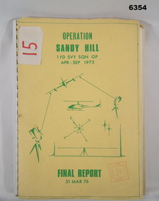
Administrative record - Operation Report - Operation Sandy Hill 1Fd Svy Sqn Apr - Sep 1975, 1 Fd Svy Sqn, 1976
Comprehensive Operation Report on Operation Sandy Hill conducted by 1Fd Svy Sqn Apr-Sep 1975 Part 1 Forward, Part 2 Planning and Mounting, Part 3 Final Report OC 1 Fd Svy Sqn, Part 4 Report Abn/EDM Gp, Part 5 Report Recon, Stn Marking and Traversing Gp, Part 6 Admin Report, Part 7 Report OC 171 Op Spt Sqn, Part 8 Computations and Results, Part 9 Observations and Recommendations.A4 size report held together with a plastic spiral binding, Light Cardboard cover includes many foldout Annexes"15" on front cover. Rubber stamp "Army Survey Regiment Map Library"royal australian survey corps, rasvy, fortuna, army survey regiment, army svy regt, asr -
 Bendigo Military Museum
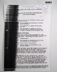
Administrative record - Use of Military maps for water supply planning, 1962
... then be used for water supply planning. Royal Australian Survey Corps ...These are typed notes on the use of Military maps for water supply planning. This demonstrates the value of Military Mapping containing accurate relief information that can then be used for water supply planning.5 x A4 pages of typed notes, poorly photocopiedroyal australian survey corps, rasvy, fortuna, army survey regiment, army svy regt, asr, state rivers and water supply commission -
 Bendigo Military Museum
Photograph - Co-ordinatorgraph Map Grid Production, Army Survey Regiment, Fortuna Bendigo, c1960s to 1970s
This is a set of seven photographs of map grid production using co-ordinatorgraphs at the Army Survey Regiment, Fortuna Bendigo. c1960s to 1970s. The Aristo Co-ordinatorgraph introduced in 1962 was a large heavy steel framed light table with a scribing head that moved in a XY direction using a vernier calibrated measuring scale to 0.001 of an inch. Whilst hand operated it was much quicker and accurate than manual grid and graticule calculation, plotting and scribing. Mapping PNG presented the Regiment with many challenges. WO1 Farrington and CPL John Dean developed computer software for the digitally controlled co-ordinatorgraph, the Calcomp 718 Flatbed Plotter. Much time was saved by automatically plotted cartographic grids and graticules, and automatically draw base compilation sheets complete with aerial triangulated stereo model control. This could be used for a number of maps and was the first step towards map automation. The history of co-ordinatorgraphs is covered in more detail with additional historic photographs, in pages 50 to 51 and page 88 of Valerie Lovejoy’s book 'Mapmakers of Fortuna – A history of the Army Survey Regiment’ ISBN: 0-646-42120-4. SGT Bill Boyd appearing in photo .1P reach the rank of WO1 and for 11 years was the technical warrant officer at the Detachment Army Survey Regiment located at Bonegilla, Victoria. He was awarded the OAM, the Order of Australia Medal for the development of the Flexiflow quality control system. This system comprised a series of job plans and charts linked to a task allocation to resource magnetic planning board. Using critical path analysis and task prioritisation, complex job planning was efficiently scheduled, and re-prioritisations readily made. Reproduction requirements were effectively coordinated by way of weekly courier to the Army Survey Regiment. Supervisors and technicians fully embraced the system as they could understand their role, others around them and the positive production achievements. Bendigo. See page 178 of Valerie Lovejoy’s book for more information on WO1 Boyd’s contribution to RA Svy.This is a set of seven photographs of map grid production using co-ordinatorgraphs at the Army Survey Regiment, Fortuna Bendigo. c1960s to 1970s. The photographs were printed on photographic paper and are part of the Army Survey Regiment’s Collection. The photographs were scanned at 300 dpi. .1) - Photo, black & white, c1960s, L to R: SGT Bill Boyd demonstrating Aristo Co-ordinatorgraph equipment to unidentified technicians (x3) .2) - Photo, black & white, c1960s, Aristo Co-ordinatorgraph equipment. .3) - Photo, black & white, c1960s, unidentified technician operating Aristo Co-ordinatorgraph equipment. .4) - Photo, black & white, c1960s, L to R: PTE Desi Asaris and CPL Kalen Sargent operating Aristo Co-ordinatorgraph equipment. .5) - Photo, black & white, Photo, black & white, c1970s, John Bloor operating Calcomp co-ordinatorgraph equipment. .6) - Photo, black & white, Photo, black & white, c1970s, unidentified technician operating Calcomp co-ordinatorgraph equipment. .7) - Photo, black & white, Photo, black & white, c1970s, L to R: SGT Andy Covington and SGT John Waight operating Calcomp co-ordinatorgraph equipment..7P annotated on back ‘Covington & Waight’.royal australian survey corps, rasvy, army survey regiment, army svy regt, fortuna, asr, carto, air survey -
 Bendigo Military Museum
Photograph - Johnson Ground Elevation Meter (JGEM) Survey Vehicle - Army Survey Regiment, Fortuna, Bendigo, c1960s
This is a set of 16 photograph of the Royal Australian Survey Corps’ Johnson Ground Elevation Meter (JGEM) Survey Vehicle taken at the Army Survey Regiment, Fortuna, Bendigo. The JGEM vehicle was extensively used by RA Svy within Australia from the late 1960s. A limited number of Ground Elevation Meter (GEM) station wagon type vehicles were manufactured by General Motors Corporation (GMC) in the USA for the United States Geological Survey, Canada’s mapping agencies, RA Svy and National Mapping (Natmap). The GEM was a four-wheel drive, four-wheel steer vehicle. Four-wheel steering was necessary to avoid systematic errors caused by non-tracking of front and rear wheels on conventionally steered vehicles. The manufacturer substituted the rear axle with a front axle and connected them to form the four-wheel steering mechanism. The two Australian GEM vehicles, referred to as Johnson GEMs (JGEMs) were converted into right-hand drive. After delivery in 1964, acceptance Natmap and RA Svy testing and operator training was undertaken at the Army's School of Military Survey located at Balcombe, Victoria. A small fifth wheel was mounted on a cantilever arm suspension midway between the front and rear wheels on the right side of the vehicle. It was lowered to and raised from its operating position by use of a constant pressure air cylinder. A telescopic bar, suspended between the front and rear axles, provided the reference datum for the angle measurement. The wheel provided the velocity or distance signal through a pulse generator system. A sensitive pendulum mounted on this bar provided the angle measurement for each minute distance traversed. The JGEM contained electromechanical instruments used to determine relative elevations, by trigonometric principles, along a traversed path. These relative elevations were obtained through apparatus which measures the instantaneous angle of inclination of the road and the instantaneous velocity of the meter along such a path. Road routes over which the JGEM operated were planned so that each started and ended as near as practicable to an existing point of known elevation (formally referred to as a level traverse bench mark). The difference in height from the bench mark and the road surface alongside the JGEM’s fifth wheel was measured with a level and staff. Along each route, mapping control photo reference points where new elevation values were required were identified on aerial photographs. Under favourable conditions it was possible to survey as much as 160km in an ordinary working day. The first of RA Svy’s JGEM operations was undertaken in 1:250,000 scale map areas of Queensland. CPL John Hook was the JGEM’s main operator in the early 1970s undertaking operations covering 1:250,000 scale map blocks over northern Victoria and central NSW, each requiring 36 points (9 runs of photography and 4 points across. SPR Lyn Thompson and SPR Bob McDonagh teamed with CPL Hook on some of these JGEM operations. When RA Svy was integrated into the Royal Australian Engineers in 1996, the JGEM vehicle with the Survey Corps collection was donated to its museum. It is believed to be the last of the original manufactured fleet in existence. The JGEM has undergone extensive refurbishment to achieve roadworthiness and is currently housed at The Australian Army Museum of Military Engineering, Hoslworthy Barracks, NSW. It can be viewed by making an appointment with the museum’s curator.This is a set of 16 photograph of the Royal Australian Survey Corps’ Johnson Ground Elevation Meter (JGEM) Survey Vehicle taken at the Army Survey Regiment, Fortuna, Bendigo. The photographs were on 35mm slide film and were scanned at 96 dpi. They are part of the Army Survey Regiment’s Collection. .1) - Photo, colour, c1960s, Johnson Ground Elevation Meter (JGEM) Survey Vehicle .2) - Photo, colour, c1960s, JGEM instrumentation, on-board computer. .3) - Photo, colour, c1960s, JGEM instrumentation. .4) - Photo, colour, c1960s, JGEM instrumentation, on-board computer. .5) - Photo, colour, c1960s, JGEM tyre pressure controller .6) - Photo, colour, c1960s, JGEM rear doors, SGT Geoff Briggs. .7) - Photo, colour, c1960s, JGEM 5th wheel distance/angle measurement device in lowered position, SGT Geoff Briggs. .8) - Photo, colour, c1960s, JGEM 5th wheel distance/angle measurement device in lowered position. .9) & .10) - Photo, colour, c1960s, JGEM tyre pressure system, SGT Geoff Briggs. .11) - Photo, colour, c1960s, JGEM tyre pressure system. SGT Geoff Briggs. .12) - Photo, colour, c1960s, JGEM levelling scope, levelling staff, unidentified technicians. .13) & .14) - Photo, colour, c1960s, JGEM levelling scope, unidentified technician. .15) & .16) - Photo, colour, c1960s, probably survey operation adjusted height plotted on block base sheet. .1P to .16P - Some of the equipment is annotated on the frame of the 35mm slides.royal australian survey corps, rasvy, army survey regiment, army svy regt, fortuna, asr, surveying -
 Bendigo Military Museum
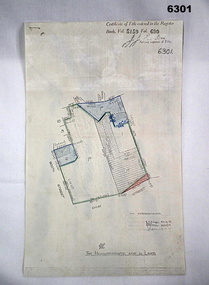
Plan - Victorian Titles Office - Fortuna Lot Plan, Victorian Titles Office, 3 Dec 1975
Title plan of Fortuna property depicting the initial acquisition in 1951 plus additional areas acquired during 1955 and 1957. The accompanying notes show details of the acquisitions, when they occurred and the costs. The plan is foolscap in size whilst the Notes are a single smaller sheet. Includes one foolscap size page, probably part of a larger (more page) document.Title plan of Fortuna property depicting the initial acquisition in 1951 plus additional areas acquired during 1955 and 1957. The accompanying notes show details of the acquisitions, when they occurred and the costs. The plan is foolscap in size whilst the Notes are a single smaller sheet.Top right hand corner - "Certificate of Title entered in the Register Book Vol. 8159 Fol. 690, Signature Illegible, Assistant Registrar of Titles". Towards the bottom right hand corner - "No ENDOURSEMENTS (some unreadable Signatures) H.D. Draper 24.11.75, R.B? 26.11.75, ? 3.12.75. Near bottom of Page - Initials?" "THE MEASUREMENTS ARE IN LINKS"royal australian survey corps, rasvy, fortuna, army survey regiment, army svy regt, asr -
 Kiewa Valley Historical Society
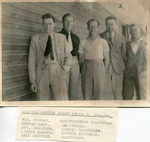
Set of 4 photographs of SECV Clerical staff, 1940 - 1941
The Kiewa Hydroelectric Scheme is the largest hydro-electric scheme in Victoria and the second largest in mainland Australia after the Snowy Mountains Scheme. The scheme is situated in the Australian Alps in north-eastern Victoria about 350 km from Melbourne and is wholly owned by AGL Energy. The scheme was originally constructed between 1938 and 1961 by the State Electricity Commission of Victoria although it was privatised in the 1990s. The scheme was originally developed solely for electricity generation, unlike the Snowy Mountains Scheme, which was also intended to direct water west of the Snowy Mountains for purposes of irrigation. From 1937 to 1944 the construction of dams at Pretty Valley, Rocky Valley and the Junction Dam were undertaken requiring large numbers of planning and support staff to see the projects successfully completed. Planning and support staff were the backbone of the successful completion of the Kiewa Valley Hydro Electric Scheme and contributed significantly to the development of the Kiewa Valley area. Many descendants of the men in the photographs still living and working in the local areaSet of 4 black and white photographs of SECV clerical staff – Circa 1940/1941Typed on note glued to back of each photo, Numbers handwritten in blue ink in top left hand corner 1. DRAWING OFFICE STAFF KIEWA C. 1940-41 Bob Morgan – Construction Draftsman; Duncan Kerr – Draftsman; Rob Hollands – Survey Draftsman; Arthur Keeble – Office Engineer; Bill Godfrey – Draftsman 2. CLERICAL OFFICE STAFF KIEWA Peter Harnetty – Clerical; Bert Connors – Clerical; John Martin – Stores Clerical; Ken Calder – Head Storekeeper; Bill black – Construction Records 3. CLERICAL OFFICE STAFF KIEWA Jack Norman, Herb Kendall, Jack Bray – Stores Clerical; Ken Calder – Head Storekeeper; Jim Swain, George Milner – Stores Clerical; Jim Gleeson – Storekeeper; John Martin – Stores Clerical 4. OFFICE STAFF KIEWA C. 1940 Don Faulkner – Cadet Engineer; Tas Davies – Survey Draftsman; Bob Morgan – Construction Darftsman; R.J. Martin, Arthur Keeble – Office Engineers; Rob Hollands – Survey Draftsman; Jack Wollard – Head Surveyor; Harry Wilson – Plan Officer. Printing Plans Handwritten in red ink on back of photo 4 – Refer Rob Hollands secv clerical staff -
 Kiewa Valley Historical Society
Photographs and copies of photographs of the pack horses and early horsemen who transported supplies to outposts in the Bogong High Plains, via cattle tracks before access roads were made
... and communications for outlying outposts, surveying and early planning ...In the mid to late 1930’s survey outposts were established to plot the early stages of the Kiewa Hydro Electric System for the SECV in the Bogong High Plains. Before any roads were built, the old cattleman’s tracks were used with packhorses to deliver supplies, wages and mail and collect timesheets and correspondence from the workmen and dam builders living in canvas tents and at the outlying survey posts. The trip up the mountain was long and hard and dangerous for both horse and man Most of the men of the survey teams were not bush-men and were often ill equipped for the harsh weather and living conditions of bush camping, often arriving in their city clothes ready for work. The tent city at Bogong was destroyed by bush fires in 1939 after which an access road was built from Mt Beauty to transport building materials for more permanent dwellings for workmen. Pack horses continued to be used for transporting goods etc. to workers further up the mountain.Without the work of horsemen and their pack horses providing supplies and communications for outlying outposts, surveying and early planning for the Kiewa Valley Hydro Electric scheme could not have gone ahead and the dams and power stations which support the system could not have been constructed. The Hydro-electric scheme, and the workers who planned and built it play a major part in the early history of the Kiewa Valley and many original families still remain living, or have ties with the local area.: Set of 21 black and white photographs and copies of photographs depicting the pack horses and the men who handled them, transporting supplies and correspondence to the outlying camps and survey posts in the Bogong High Plains, via the rough cattlemen’s tracks. Photographs also show the early tent camps of the workers. Some photos mounted on A4 white paper. Some photos enlarged to A3 poster size for display1. Handwritten on back – Max Lawrence 2. -8 No inscriptions 9. Handwritten on back- Packing in supplies for early workers of the Kiewa Hydro scheme. There were no roads in the early days of the scheme 10. Printed on bottom of photo- Roper’s cattle on road below Howman’s Gap 11. Handwritten on back – Roper’s et al about to leave for the high plains 12. Printed under photo- Syd Ryder at the Pretty Valley Cut-Out (JBR) 13-16. No markings 17. Printed under photo- Gwen Talbot visits the Camp area. 1937 18. Handwritten on back- 14/1 Barbara Talbot 19. No markings 20-21. No markings 22. Printed under photo- STATE ELECTRICITY COMMISSION OF VICTORIA. Date: 15-3-45 Time: 8.0pm No: K 1838 Kiewa Hydro-Electric Works, Investigations 1944-1945 – Survey Camp at Young’s Hut pack horses; bogong high plains; survey posts; supplies delivery -
 Kiewa Valley Historical Society
Evacuation Plans for children during WWII, 1941
During World War 2 the State Emergency Council for Civil Defence (Victoria) sent out forms to Municipal Councils requesting a survey to be carried out regarding the suitability of householders to accommodate persons, especially children, in the more dangerous parts of Victoria. Also, surveying parents as to their wishes regarding the evacuation of their own children if necessary. The documents list householders living in the Kiewa Valley including Gundowring giving an insight into the families (size, age, religion, sex), the homes (size, number and type of rooms), Water supply, Conveyance (motor or horse drawn), distance from railway station and school. Papers created by the State Emergency Council for Civil Defence, Premier's Department 1941 requesting Municipal Councils to survey people in case of the billeting of persons who may be evacuated from the more dangerous parts of Victoria. The Accommodation Survey lists the householder, details of the house, how many people living there and how many could be accommodated.There are also forms asking householders if they wish their children to be evacuated if necessary.Forms filled out in ink. world war ii; evacuation plans; kiewa valley; gundowring -
 Warrnambool and District Historical Society Inc.
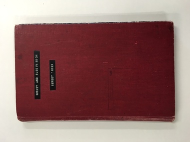
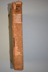
Register, Survey & subdivision street index, 1930s
This is a book with the City of Warrnambool surveys and subdivisions listed under the street names. It covers the period from 1938 to 1975. The information is listed under the headings of plan number, street name, section, allotment, date and remarks. The information contained therein would now be held as electronic data in the Council Records Department. Warrnambool, founded in 1847, became a municipality in 1856, a Borough in 1863, a Town in 1883 and a City in 1918. This book is of considerable interest because it lists Warrnambool streets from 1938 to 1975 and gives details of the subdivisions and surveys during that time. It will be very useful for researchers. This is a foolscap-size hard-cover book with a red cover with a mottled-blue pattern paper inside the covers. It has 95 pages with ruled red and blue lines. It has a handwritten alphabet index throughout the pages. The contents are handwritten in blue, green and black ink. The inside binding has been mended with adhesive tape and one page is loose. The book lists subdivisions in the City of Warrnambool under the heading of the street names and covers 1938 to 1975. The cover is somewhat grubby.Front Cover (in plastic tape): ‘Survey and Subdivision. Street Index’warrnambool city council, warrnambool streets and subdivisions -
 Warrnambool and District Historical Society Inc.
Ledger, Chadwick Copying Book Co, Letter book 1905, 1902
This letter book has maps, letters and plans dating from 1902 to 1905. It came from the office of John William Crawley, Junior, an engineer, architect and surveyor in private practice in Warrnambool and also the engineer for the Shire of Warrnambool from 1895 to 1935. His father, brother and son were all engineers and worked in that capacity or as Shire Secretary for the Shire of Warrnambool, with the Crawley family recording a total of 132 years of service to the Shire of Warrnambool. The Shire of Warrnambool existed from 1863 to 1994. This letter book was passed on to John Crawley’s son, Rolf, engineer for the Shire of Warrnambool from 1935 to 1968. The letter book then came into the possession of Michael Hand who took over the private surveying business of Rolf Crawley in Warrnambool. The Warrnambool and District Historical Society acquired the letter book, along with several other Crawley ledgers, from the Michael Hand estate. This letter book is of considerable importance as it contains the letters, maps and plans produced by John William Crawley Junior, a Shire of Warrnambool engineer for 40 years. It will be useful to researchers. This is a black hard cover letter book of 505 pages, plus an alphabetical index at the back of the book. The letter book contains handwritten letters, sketch maps and plans. There is gold lettering on the spine.‘1’ ‘Invoice’ ‘Chadwick Copying Book Co. Springfield Mass.’ john william crawley, junior, warrnambool, rolf crawley, warrnambool, shire of warrnambool, history of warrnambool -
 Warrnambool and District Historical Society Inc.
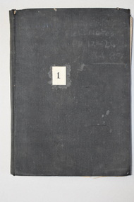
Ledger, Letter book 1892-1904, 1892
This letter book has letters, sketch maps and plans and dates from 1892 to 1904. It came from the office of John William Crawley, Junior, an engineer, architect and surveyor in private practice in Warrnambool and also the engineer of the Shire of Warrnambool from 1895 to 1935. His father, brother and son were also engineers and worked in that capacity or as the Shire Secretary for the Shire of Warrnambool, with the Crawley family recording a total of 132 years of service to the Shire. This letter book was passed on to John Crawley’s son, Rolf Crawley, Engineer for the Shire of Warrnambool from 1935 to 1968. The letter book then came into the possession of Michael Hand who took over the private surveying business of Rolf Crawley in Warrnambool. The Warrnambool and District Historical Society has acquired the letter book, one of several Crawley ledgers, from the Michael Hand estate. This letter book is of considerable significance as it contains maps, plans, sketches and written information which is the work of John William Crawley Junior, the engineer for the Shire of Warrnambool for 40 years. It will be very useful to researchers. This is a hard cover letter book of 500 pages. The cover is black with leather binding on the edges of the cover and on the spine. The pages contain an alphabetical listing of the letters, handwritten letters and many sketch maps and plans. There are several loose pages of plans and diagrams at the back of the book. The inside of the covers has a blue mottled pattern. The edges of the cover are torn. There is a mauve stamp on the first page. ‘Letter Book 1892 to 1901’ ‘Rolf L. Crawley, Civil Engineer, Drainage and Water Supply Engineer, Licensed Surveyor, Registered Architect, Warrnambool’ john william crawley, junior, warrnambool, rolf crawley, warrnambool, shire of warrnambool -
 Warrnambool and District Historical Society Inc.
Letter Book 3, 1901 - 1908, 1900
This letter book has letters, plans and maps and dates from 1901 to 1908. It came from the office of John William Crawley, Junior, an engineer, architect and surveyor in private practice in Warrnambool and also the engineer for the Shire of Warrnambool from 1895 to 1935. His father, brother and son were also engineers and worked in that capacity or as the Shire Secretary for the Shire of Warrnambool, with the Crawley family recording a total of 132 years of service to the Shire. The letter book was passed on to John Crawley’s son, Rolf, engineer for the Shire of Warrnambool from 1935 to 1968. The letter book then came into the possession of Michael Hand who took over the private surveying business of Rolf Crawley in Warrnambool. The Warrnambool and District Historical Society has acquired the letter book, one of several Crawley ledgers, from the Michael Hand estate. The Shire of Warrnambool existed from 1863 to 1994. This letter book is of considerable significance as it contains maps, plans and letters produced by John William Crawley Junior, the engineer for the Shire of Warrnambool for 40 years. It will be very useful for research. This is a hard cover letter book of 717 pages. It has a black cover with brown leather binding on the cover edges and spine. The leather is worn away in places. The letter book contains an alphabetical index, handwritten letters, sketch plans and maps. There is a mauve stamp on the inside front cover. ‘3’ ‘Letter Book 1901 to 1908’ ‘Letter Book J.Wm. Crawley’ ‘Rolf L. Crawley, Civil Engineer, Drainage and Water Supply Engineer, Licensed Surveyor, Registered Architect, Warrnambool’ john william crawley junior, warrnambool, rolf crawley, warrnambool, history of warrnambool -
 Warrnambool and District Historical Society Inc.
Letter Book 4, 1901, 1908
This letter book has letters, invoices, sketch maps and plans and dates from 1908 to 1910. It came from the office of John William Crawley Junior, an engineer, architect and surveyor in private practice in Warrnambool and also the official engineer of the Shire of Warrnambool from 1895 to 1935. His father, brother and son were also engineers and worked in that capacity or as the Shire Secretary for the Shire of Warrnambool, with the Crawley family members recording a total of 132 years of service to the Shire. The letter book was passed on to John Crawley’s son, Rolf, Engineer for the Shire of Warrnambool from 1935 to 1968. The letter book then came into the possession of Michael Hand who took over the private surveying business of Rolf Crawley in Warrnambool and the Warrnambool and District Historical Society has acquired the letter book, one of several Crawley ledgers, from the Michael Hand estate. This letter book is of considerable significance as it contains maps, plans, sketches and written information on the work of John William Crawley, the engineer for the Shire of Warrnambool for 40 years. This is a black-covered letter book with copies of letters and field maps and plans and an alphabetical listing at the front. Some of the letters are invoices for work carried out. The leather section of the front cover has been almost completely torn away and the binding is mended with adhesive tape. There are some torn pages. The front page has a signature and a mauve stamp. ‘Letter Book’ ‘J.Wm. Crawley (Private)’ ‘ Rolf L. Crawley, Civil Engineer, Drainage and Water Supply Engineer, Licensed Surveyor, Registered Architect, Warrnambool’ ‘4’ rolf crawley, warrnambool, john william crawley, junior, warrnambool, history of warrnambool -
 Warrnambool and District Historical Society Inc.
Letter book 5, 1910
This letter book has letters, invoices and sketch maps and dates from 1910 to 1914. It came from the office of John William Crawley, Junior, an engineer, surveyor and architect in private practice in Warrnambool and also the official engineer for the Shire of Warrnambool from 1895 to 1935. His father, brother and son were also engineers and worked in that capacity or as the Shire Secretary for the Shire of Warrnambool, with the Crawley family recording a total of 132 years of service to the Shire. The letter book was passed on to John Crawley’s son, Rolf, engineer for the Shire of Warrnambool from 1935 to 1968. The letter book then came into the possession of Michael Hand who took over the private surveying business of Rolf Crawley in Warrnambool and the Warrnambool and District Historical Society has acquired the letter book, one of several Crawley ledgers, from the estate of Michael Hand.This letter book is of considerable significance as it contains maps, plans, sketches and written information, the work of John William Crawley, Junior, the Shire of Warrnambool engineer for 40 years. It will be very useful for research purposes. This is a brown-covered letter book of 750 pages with a mottled blue inside lining. The pages contain an alphabetical index and copies of handwritten letters and sketch maps and plans. There is one loose letter dated 1937. The pages are somewhat stained and the spine on the cover has been torn away. There is a mauve stamp on the first page. ‘5’ ‘Rolf L. Crawley, Civil Engineer, Drainage and Water Supply Engineer, Licensed Surveyor, Registered Architect, Warrnambool’ rolf crawley, warrnambool, john william crawley, junior, warrnambool -
 Warrnambool and District Historical Society Inc.
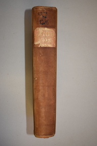
Letter book 6, Jan 1914 - 1917, 1914
This letter book contains letters, plans and sketch maps dating from 1914 to 1917. It came from the office of John William Crawley Junior, an engineer, architect and surveyor in private practice in Warrnambool and also the engineer for the Shire of Warrnambool from 1895 to 1935. His father, brother and son were also engineers and worked in that capacity or as the Shire Secretary for the Shire of Warrnambool, with the Crawley family recording a total of 132 years of service to the Shire of Warrnambool. This Shire existed from 1863 to 1994. The letter book was passed on the John Crawley’s son, Rolf, engineer for the Shire of Warrnambool from 1935 to 1968. It then came into the possession of Michael Hand who took over the private surveying practice of Rolf Crawley in Warrnambool. The Warrnambool and District Historical Society has acquired the letter book, along with several other Crawley ledgers, from the Michael Hand estate. This letter book is of considerable significance as it contains letters, maps and plans drawn up by John William Crawley, Junior, the engineer for the Shire of Warrnambool for 40 years. It will be very useful for researchers. This is a brown hard cover letter book with leather binding on the edges of the cover and on the spine. The leather is worn away in several places. There is gold lettering on the spine. The book has 750 pages of handwritten letters, maps and plans. The inside cover is of a mottled blue colour. There is an alphabetical index at the beginning of the book. ‘6’ ‘Letter Book 1914 to 1917’ john william crawley junior, warrnambool, rolf crawley, warrnambool, shire of warrnambool -
 Warrnambool and District Historical Society Inc.
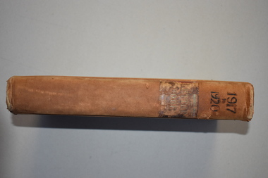
Letter book 7, 1917-1920, 1917
This letter book contains handwritten letters, sketch maps and plans and dates from 1917 to 1920. It comes from the office of John William Crawley Junior, an engineer, architect and surveyor in private practice in Warrnambool and also the engineer for the Shire of Warrnambool from 1895 to 1935. His father, brother and son were also engineers and worked in that capacity or as Shire Secretary for the Shire of Warrnambool, with the Crawley family recording 132 years of service with the Shire of Warrnambool. The Shire existed from 1863 to 1994. The letter book was passed on to John Crawley’s son, Rolf, the engineer for the Shire of Warrnambool from 1935 to 1968. The letter book then came into the possession of Michael Hand who took over the private surveying business of Rolf Crawley in Warrnambool. The Warrnambool and District Historical Society then acquired this letter book, along with other Crawley ledgers, from the Michael Hand estate. This letter book is of considerable significance as it contains letters, plans and maps drawn up John William Crawley Junior, the engineer for the Shire of Warrnambool for 40 years. It will be very useful for research. This is a hard cover book of 745 pages. It has leather trim on the cover edges and the spine with gold lettering on the spine. The leather covering is scuffed and torn. The inside covers have a mottled blue lining. The book contains maps, plans and handwritten letters and has an alphabetical index at the beginning of the book. Most of the pages have been water-stained. ‘7 Private’ ‘Letter Book 1917 to 1920’john william crawley junior, warrnambool, rolf crawley, warrnambool, shire of warrnambool -
 Warrnambool and District Historical Society Inc.
Letter book 14, 1923
This letter book contains letters, sketch maps and plans and dates from 1923 to 1926. It came from the office of John William Crawley, Junior, an engineer, surveyor and architect in private practice in Warrnambool and also the engineer for the Shire of Warrnambool from 1895 to 1935. His father, brother and son were also engineers, working in that capacity or as the Shire Secretary for the Shire of Warrnambool, with the Crawley family recording a total of 132 years of service to the Shire. The Shire of Warrnambool existed from 1863 to 1994. This letter book was passed on to John Crawley’s son, Rolf, the engineer for the Shire of Warrnambool from 1935 to 1968. It then came into the possession of Michael Hand who took over the private surveying business of Rolf Crawley in Warrnambool. The Warrnambool and District Historical Society acquired the letter book, along with several other Crawley ledgers, from the estate of Michael Hand.This letter book is of considerable significance as it contains letters, maps and plans drawn up by John William Crawley, an engineer and surveyor in private practice in Warrnambool and the engineer for the Shire of Warrnambool for 40 years. It will be useful for researchers. This is a brown hard cover letter book of 1010 pages, with brown binding on the corners of the cover and on the spine. The cover is cuffed and torn. There is gold lettering on the spine. The book contains handwritten letters, maps and plans and an alphabetical index at the front, The pages are water-stained. There is a mauve stamp on the first page.‘Letter Book 1923 to 1926’ ‘J. Wm. Crawley Shire Hall Warrnambool (Private)’ ‘Rolf L. Crawley Civil Engineer, Drainage and Water Supply Engineer, Licensed Surveyor, Registered Architect, Warrnambool’ john william crawley junior, warrnambool, rolf crawley, warrnambool, shire of warrnambool -
 Warrnambool and District Historical Society Inc.
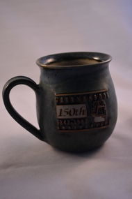
Household, Souvenir Cup (Warrnambool’s 150th ), 1997
This cup was produced by Ken Sadler as a souvenir of the 150th anniversary of the settlement of Warrnambool. Ken Sadler was a potter in Liebig Street, Warrnambool for many years (end of 20th century and beginning of 21st century). Warrnambool was founded as a planned town in 1847 to provide port facilities for the produce of squatters who had settled in the area. The town centre was surveyed by William Pickering at the request of Superintendent La Trobe of Melbourne and the first land sales were held in Melbourne in July 1847. The celebrations to mark the 150th anniversary of Warrnambool included concerts, race meetings, church services and the erection of an anniversary tablet on Cannon Hill. Ken Sadler, a well-known Warrnambool potter, made 500 of these cups which are now collectible souvenirs of the city’s 150th anniversary celebrations. This one retained by the Warrnambool and District Historical Society is numbered 189. The 150th anniversary of the founding of Warrnambool was an important event in the city’s history.This is a ceramic cup with a round base and larger rounded body with a round overhanging rim at the top opening. The cup is mottled green with an impressed image of a ship and lettering in white, gold and brown. There is some lettering on the bottom of the cup.‘Warrnambool 150th Anniversary 1847-1997’ ‘Sadler 97 189/500 Warrnambool’ warrnambool’s 150th anniversary, history of warrnambool, ken sadler, warrnambool potter -
 Warrnambool and District Historical Society Inc.
Original Document, Map: Agricultural area of Ballangeich 1865, 1865
George Eddington arrived in Australia in 1839 and named and established property in 1841 calling the property Ballangeich after a Pass near his home town of Stirling in Scotland. It is situated 151 miles west of Melbourne and to the south of Mortlake and was originally part of the Mortlake shire, which was proclaimed 26th Jan 1864. Nearest streams are the Hopkins Riverand Lyall and Drysdale creek running through good agricultural land. This map relates to the breaking up of large runs which the Victorian government enabled through selection acts of the 1860's. The previously larger runs which were mainly cattle and sheep based were now more open to closer settlement and a greater variety in farming.The lots range in size from approximately 50 acres to around 600 acres.Some areas are set aside for reserves. By 1886 the population of Ballangeich had grown to around 600 with an hotel, three state schools and a church.Tri weekly coaches ran to Colac, Warrnambool and Camperdown providing access to supplies mail and communication. This map is typical of many which were produced in the 1860's in Victoria during a significant period of Victoria's and Warrnambool district history.Rectangular light card paper with black text showing allotments of land The area is coloured in green with scale at bottom right cornerAt the top: Plan of the Agricultural area of Ballangeich 1865 At the bottom left: Prepared by the Board of Lands & Works in accordance with the Amending Land Act 1865 Lands & Survey Office Melbourne 13th April 1865. With signaturehistory of warrnambool, ballangeich, land surveys victoria 1865, lands act 1865 victoria, ballangeich map 1865 -
 Warrnambool and District Historical Society Inc.
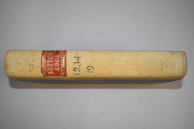
Letter book, J & R Crawley, 1934
This letter book contains letters, sketch maps and plans and dates from1934 to 1936. It originally came from the office of John William Crawley Junior, an engineer, surveyor and architect in private practice in Warrnambool and also the Shire Engineer for the Shire of Warrnambool from 1895 to 1935. His father, brother and son were also engineers and worked in that capacity or as the Shire Secretary for the Shire of Warrnambool, with the Crawley family recording a total of 132 years of service to the Shire. The Shire of Warrnambool existed from 1863 to 1994. The letter book was also used in the private practice of John Crawley’s son, Rolf who was the engineer for the Shire of Warrnambool from 1935 to 1968. The letter book then came into the possession of Michael Hand who took over the private surveying business of Rolf Crawley in Warrnambool. The Warrnambool and District Historical Society acquired the letter book, along with several other Crawley ledgers, from the estate of Michael Hand.This letter book is of considerable significance as it contains letters written by John Crawley and Rolf Crawley who were in an engineering, surveying and architects private practice in Warrnambool over the time covered in the book. It will be very useful to researchers. This is a hard cover book of 1000 pages but only 354 pages have been used. The cover is bound at the corners and on the spine with buff-coloured leather. The book contains an alphabetical index, handwritten letters, sketch maps and plans. ‘Private Letter Book 1934- 19.’ ‘R.L./J. W. Crawley Private’ john william crawley junior, warrnambool, rolf crawley, warrnambool, shire of warrnambool -
 Warrnambool and District Historical Society Inc.
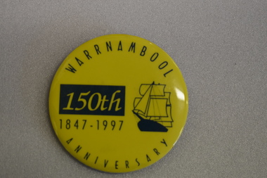
Badge, Warrnambool 150th 1847-1997
This badge was produced in 1997 as a souvenir of the 150th anniversary of the founding of Warrnambool. Warrnambool was a planned town, established in 1847 as a port to service the squatters who had taken up large tracts of land in the Warrnambool area in the 1840s.The town was surveyed by the Government surveyor William Pickering at the request of Superintendent La Trobe and the first town lots of the new town were sold in Melbourne in 1847, with some settlers arriving at the new settlement soon after.This badge is one of the many souvenirs of the 1997 celebrations in Warrnambool Circular concave metal badge with blue drawing of a sailing ship and text. There is a clip pin on the reverse.WARRNAMBOOL ANNIVERSARY 150th 1847 -1997 -
 Eltham District Historical Society Inc
Document - Folder, Victoria Archaeological Survey, 1982-1990
sites, structures, archaeological significance, victoria archaeological survey -
 Eltham District Historical Society Inc
Document - Folder, Wellers of Kangaroo Ground, 1984-2017
Wellers of Kangaroo Ground Vertical File Contents: 1. Article: History of Wellers Restaurant by Sandra Cahir, revised 2017. 7 pages 2. Article: Weller’s Hotel of Kangaroo Ground (final draft) by Jim Allan, 1 June 2017, including feedback email from Sandra Cahir (7 May 2017). 3. Printout of online image - Kangaroo Ground landholders from 1841, Kangaroo Ground Presbyterian Church. (2022, June 29). Retrieved from https://kgpc.pcvic.org.au/images/history_images/Kangaroo-Ground-landholders.jpg 4. Folder of printouts of historical newspaper articles referencing the hotel 1866-1911 https://trove.nla.gov.au/list/163201 5. Printouts (various versions) from Victorian Heritage Database (National Trust and Nillumbik Shire) https://vhd.heritagecouncil.vic.gov.au/ 6. Collection of research notes, copies of records from various publications including EDHS Chronology of Events and Kangaroo Ground: The Highland Taken by Mick Woiwod, pp90, 180-181 (EDHS_01618). 7. Report: Request for ministerial amendment to use the property as a restaurant, includes existing conditions and plan for development, 1 November 1984 8. Papers donated by Diana and Peter Bassett-Smith including: a. Photocopy of Weller’s Hotel, Licensee M. Weller b. Letter: Shire of Eltham to Office of the Secretary for Planning and Environment, 23 Feb 1984 - Information regarding inclusion of Wellers Hotel into the Historic Buildings Register c. Letter: Historic Buildings Council letter to Peter Bassett-Smith seeking historical information on Wellers Hotel, 10 Jan 1985 d. Memo: Peter Bassett-Smith to Robert N. Hendrey on history of Wellers Hotel, 28 Jan 1985 - Includes extract of information about Mary Weller, Dept. of Crown Lands and Survey Map NILLUMBIK showing properties of John Weller and E. Weller and a Diamond Valley News article from 10 April 1973, p11, "Eltham on old coach route" 9. Information about the Weller family including family trees from various sources a. Edward Weller, Pioneer Families in Victoria, http://mepnab.netau.net/w/w09.html, 1 Jan 2017 (link broken) b. The WELLER family tree. (2017, January 1), 2 pages. Retrieved from https://www.weller.org.uk/cgi-bin/FamilyTree/ShowFamily.pl? and 27 pages Retrieved from https://www.weller.org.uk/cgi-bin/FamilyTree/ShowFamily.pl?ListAllPeople=A c. Edward WELLER on the WELLER family tree. (2017, January 1), 1 page. Retrieved from https://www.weller.org.uk/cgi-bin/FamilyTree/ShowFamily.pl?PersonID=516 d. Photograph (print copy), believed to be Edward Weller, 1836-1883 e. Photograph (print copy), Gravestone of Weller family at Kangaroo Cemetery f. Wellers of Kangaroo Ground, 1 page, possibly from History, http://www.wellers.com.au (broken) c.2016 g. Edward and Mary Weller miscellaneous biographical research notes (by Jim Allen?) including from Ancestry.com, and extracts from Chappel file (EDHS_04448) with relevant names highlighted h. Information about the Vernon Pitman family from Ancestry.com 10. Newspaper articles: a. Cobb & Co called here by Marguerite Marshall; Diamond Valley News, May 4, 1982, p2 b. Rich is history, 30 August 1983 (very similar to previous article) c. Weller’s Pub - restaurant, craft store or art gallery? Diamond Valley News, October 22, 1985, p3 d. Despite years of neglect a magical charm lies waiting, Diamond Valley News, October 29, 1985 e. Old pub fate still in doubt, Diamond Valley News, (?) 29 October 1985 f. Renovated Weller’s Pub to begin its new stage of life, DVN 26 January 1988 g. Wellers Restaurant, Lynne Hillier, Network, October 1988, p14 h. Revolution at Wellers, Nillumbik Mail, December 20, 2000 i. Wellers brings on good times, Valley Weekly, June 22, 2005 j. Dine in with ideal outlook, Valley News, 10 August 2005 k. Advertisement: Wellers of Kangaroo Ground, Enjoy lunch, afternoon tea and dinner at Wellers from Tuesday to Sunday, Valley Weekly, Wednesday, August 31, 2005 l. Advertisement: Wellers of Kangaroo Ground, Appearing live; Normie Rowe Fri 24 Feb, Diamond Valley Leader February 22, 2006, p11 m. Advertisement: Wellers of Kangaroo Ground, Lunch Special, Diamond Valley Leader March 27, 2010 n. Braithwaite abounds to Kangaroo Ground, Gig Guide, The Age, Friday, October 8, 2010, p14 o. History up for grabs, Diamond Valley Leader, March 28, 2012 p. Advertisement: Wellers Restaurant, Freehold only for sale, Morrison Kleeman, Diamond Valley Leader, March 28, 2012 q. Restaurant’s crash course, Megan Bailey, Diamond Valley Leader, January 1, 2014, p3. Also accessible online - Staff praised after car crashes through Kangaroo Ground eatery. (2022, June 29). Retrieved from https://www.heraldsun.com.au/leader/north/staff-praised-after-car-crashes-through-kangaroo-ground-eatery/news-story/021c896a1ab6d76bd6b73f2e57dc1854 r. Eatery set for revival, Brittany Shanahan, Diamond Valley Leader 15 February 2017; Also, online as Much-loved Wellers of Kangaroo Ground to be relaunched as Italian restaurant Fondata 1872. (2022, June 29). Retrieved from https://www.heraldsun.com.au/leader/north/muchloved-wellers-in-kangaroo-ground-to-be-relaunched-as-italian-restaurant-fondata-1872/news-story/665777fb347584ef483867ae2b536a8f s. Fondata 1872 proves a big hit with food, Diamond Valley Leader 3 May 2017, p3 11. Wellers of Kangaroo Restaurant Bar Entertainment Functions, tri-fold brochure promotional brochure 12. Website Printout: Wellers Restaurant, Live Guide, (2017, January 5). Retrieved from http://www.liveguide.com.au/Restaurants_Bars/VIC/Kangaroo_Ground/Food_Styles/3... 13. Website Printout: Wellers of Kangaroo Ground, Only Melbourne (2017, January 30). Retrieved from http://www.onlymelbourne.com.au/wellers-of-kangaroo-ground 14. Printouts from Fondata 1872 website and Facebook page including colour photograph of sign in front and business card (2017). Related EDHS Collection items • Wellers Hotel of Kangaroo Ground by Jim Allen, Part 1, Newsletter No. 235, Eltham District Historical Society, August 2017. Retrieved from https://elthamhistory.files.wordpress.com/2017/08/edhs-nl-235-aug-2017.pdf • Wellers Hotel of Kangaroo Ground by Jim Allen, Part 2, Newsletter No. 236, Eltham District Historical Society, October 2017. Retrieved from https://elthamhistory.files.wordpress.com/2017/10/edhs-nl-236-oct-2017.pdf • EDHS_03997 - Slide, Wellers Hotel, Pitmans Corner, Eltham-Yarra Glen Road, Kangaroo Ground, c.1975 https://victoriancollections.net.au/items/5e59e36221ea671798ac40eb • EDHS_03998 - Slide, Wellers Hotel, Pitmans Corner, Eltham-Yarra Glen Road, Kangaroo Ground, c.1975 https://victoriancollections.net.au/items/5e59e39e21ea671798ac9c27 • EDHS_03999 - Slide, Wellers Hotel, Pitmans Corner, Eltham-Yarra Glen Road, Kangaroo Ground, c.1975 https://victoriancollections.net.au/items/5e59e3c721ea671798acd2ef • EDHS_04000 - Slide, Wellers Hotel, Pitmans Corner, Eltham-Yarra Glen Road, Kangaroo Ground, c.1975 https://victoriancollections.net.au/items/5e59e3e021ea671798acfd68 • EDHS_04066-18 - Photograph, Wellers Restaurant, Eltham-Yarra Glen Road, Kangaroo Ground, c.Mar. 1989 https://victoriancollections.net.au/items/610f4dafa346aadcee7ac79c • EDHS_04041-26 - Photograph, Wellers Restaurant, 150 Eltham-Yarra Glen Road, Kangaroo Ground, c.May 1988 https://victoriancollections.net.au/items/610e2f4a7d65e7c945a35e69 • EDHS_04437 – Newsclipping, Renovated Weller's Pub to begin its new stage of life by Linley Hartley, Diamond Valley News, 26 January 1988 https://victoriancollections.net.au/items/5de4913921ea6710a46a85c7 • EDHS_04438 - Newsclipping, Wellers Restaurant by Lynne Hillier, Network, October 1988, p14 https://victoriancollections.net.au/items/5de4916f21ea6710a46aea0f • ArtStreams magazine (from Volume 9, 2004) ‘partnered' with Wellers in promoting and supporting the arts and culture. Various advertisements throughout, particular with live performance acts. Numerous references throughout to art and music performances on site. • Stephen Cummings and Joe Camilleri at Wellers Kangaroo Ground, ArtStreams, Vol. 9, No. 4, Sep/Oct 2004, p17 EDHS_04406 - Journal, ArtStreams: Whittlesea, Banyule, Darebin, Manningham, Nillumbik, Yarra; Vol. 9, No. 4, Sep-Oct 2004 https://victoriancollections.net.au/items/5bcc086021ea6804a82a92a9 • Daryl Braithwaite rocks up at Wellers, Fiona Sievers, ArtStreams, Vol.10 No.2, 2005, pp6-7 EDHS_04409 - Journal, ArtStreams: Vol. 10, No. 2, 2005 https://victoriancollections.net.au/items/60f5416ab06f0c13a9419541 • Ephemeral Sculpture by Peter Dougherty, ArtStreams, Vol.10 No.3, 2005, pp7-9. About sculptures created in or on the grounds of culinary establishments throughout the Shire. - Denise Keele-Bedford constructed ‘Ou Well’ at Wellers Restaurant and Vicky Shukuroglou, also at Wellers set up cotton banners printed and painted with natural dyes from onion skins, spinach, radish beetroot, turmeric and charcoal. EDHS_04410 - Journal, ArtStreams: Vol. 10, No. 3, 2005 https://victoriancollections.net.au/items/60f5436db06f0c13a941ae19 • Music at Wellers Restaurant, ArtStreams, Vol.10 No.4, 2005, p23 EDHS_04411 - Journal, ArtStreams: Vol. 10, No. 4, 2005 https://victoriancollections.net.au/items/60f543e4b06f0c13a941b059 • Weller’s Pub, Diamond Valley sketchbook / text by Brian McKinlay ; drawings by Graham Hawley, 1973, pp42-43 EDHS_00856 - https://victoriancollections.net.au/items/590852edd0ce7b14e8177da3 • Gold Field Coaches Stopped Here, Nillumbik now and then / Marguerite Marshall; photographs Alan King with Marguerite Marshall, 2008, pp86-87 EDHS_00977 - https://victoriancollections.net.au/items/5935f315d0cdd42c80f9cc52 External Links: • Historic Kangaroo Ground venue comes up for rare sale. (2022, June 29). Retrieved from https://www.smh.com.au/business/companies/historic-kangaroo-ground-venue-comes-up-for-rare-sale-20120325-1vshw.html • Wellers, Kangaroo Ground property sold with leaseback. (2022, June 29). Retrieved from https://www.urban.com.au/expert-insights/investing/37735-wellers-kangaroo-ground-property-sold-with-leaseback • Wellers, Kangaroo Ground | With Mark Seymour, at one of his …. (2022, June 29). Retrieved from https://www.flickr.com/photos/robertmilesdesign/4564390893/ • 2016 Notice of proposed deregistration - WELLERS OF KANGAROO GROUND PTY LTD 124 435 409. (2022, June 29). Retrieved from https://publishednotices.asic.gov.au/browsesearch-notices/notice-details/WELLERS-OF-KANGAROO-GROUND-PTY-LTD-124435409/35d43b89-159a-4435-963f-daec688a61ca • Search results for: Websites (archived). (2022, June 29). Retrieved from https://trove.nla.gov.au/search/category/websites?keyword=%22wellers%20restaurant%22 29 June 2022 edward weller, wellers of kangaroo ground, wellers hotel, wellers restaurant, mary weller, pittmans corner, fondata 1812 at wellers, historic buildings register, hotels, john weller, kangaroo ground, pitman's corner, bassett-smith collection -
 Eltham District Historical Society Inc
Document - Folder, Survey Maps and Technical Drawings
alan gardiner collection, maps -
 Eltham District Historical Society Inc
Document, Samantha Westbrooke Pty Ltd et al, 2 Bell Street, Eltham: Cultural Heritage Significance Assessment & Heritage Guidelines for Future Use & Development, 2012
Prepared for Nillumbik Shire Council by Samantha Westbrooke Pty Ltd in association with Peter Mills PhD, Architectural Historian and Roark Muhlen-Schilte, Archaeologist. Covers history of early market gardening in Eltham with the commencement of European settlement in the late 1830s. The site for the village of Eltham was surveyed in 1851 and the Township Plan shows that the property is made up of Lots 7 and 8 which were sold at auction in June 1852 to M. O'Shea. The history of the Bell Street property is closely tied to the West family from the 1860s to 1930s; the earliest rate books for Eltham show William West farming in El;tham in 1864. In the aerly 1930s ownership of the creek side was transferred from the west family to the Fabbro family who shortly afterwards were impaced by the 1934 Diamond Creek flooding. Guido Fabbro relocated the original West home further up the hill and built a new Italianate style modern home in situ. The Fabbro family farmed the property. In 1993/4 Eltham Council acquired the creek-side market garden blocks to the south of 2 Bell Street which was recconceived in 1998 as the Barak Bushland Reserve. The Fabbro house was demolished shortly after and the lots were sold to a developer in 1994. The large steel shed now present on the 2 Bell Street property dates from soon after this sale.26 A4 pages color printcultural heritage significance assessment, peter mills, samantha westbrooke pty ltd, shire of nillumbik, 2 bell street, eltham, market gardening, west family, fabbro family, land use, barak bushland reserve, heritage assessment -
 Eltham District Historical Society Inc
Document - Photocopy, Survey Fleld Notes of Part of Crown Portion 13, Section 4 at Eltham, Parish of Nillumbik, County of Evelyn, 1902-1903
... Survey Plan... street Survey Plan Vine street Application 33777 Map A4 printouts ...Main Road, Henry Street to Diamond Street; Silver Street to Bible Street Application No. 0337771902, 1903, arthur street, bible street, bird street, diamond creek (creek), diamond street, eltham, eltham railway station, henry street, main road, silver street, survey plan, vine street, application 33777, map -
 Eltham District Historical Society Inc
Document - Photocopy, Survey Fleld Notes of Part of Crown Portion 13, Section 4 at Eltham, Parish of Nillumbik, County of Evelyn, 18 May 1908
... Survey Plan... Survey Plan A4 printouts, 2 pages Survey Fleld Notes of Part ...Portion of land bounded by: Main Road, Luck Street, Bible Street, Arthur Street Application 37314 W. P. Steane, M.C.E. Civil Engineer and Surveyor, 18 May 1908application 37314, arthur street, bible street, eltham, luck street, main road, map, survey plan -
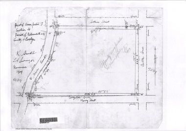
 Eltham District Historical Society Inc
Document - Photocopy, Survey Fleld Notes of Part of Crown Portion 13, Section 4 at Eltham, Parish of Nillumbik, County of Evelyn, 31 May 1907
... Survey Plan... Street Main Road Map Survey Plan A4 printouts, 2 pages Survey ...Portion of land east of Main Road and north of Luck Street bounded by Bible Street Application 36708 K. Arndt, Licensed Surveyor, 31 May 1907application 36708, bible street, eltham, luck street, main road, map, survey plan -
 Eltham District Historical Society Inc
Document - Photocopy, Survey Fleld Notes of Part of Crown Portion 13, Section 4 at Eltham, Parish of Nillumbik, County of Evelyn, November 1909
... Survey Plan... Eltham henry street Main Road Map Survey Plan A4 printout Survey ...Portion of land bounded by Main Road, Arthur Street, Bible Street, Henry Street Application 36708 K. Arndt, Licensed Surveyor, November 1909application 5289, arthur street, bible street, eltham, henry street, main road, map, survey plan