Showing 575 items matching "route map"
-
 Orbost & District Historical Society
map, 1985
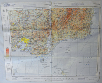
An aeronautical chart is a map designed to assist in navigation of aircraft. Using these charts and other tools, pilots are able to determine their position, safe altitude, best route to a destination, navigation aids along the way, alternative landing areas in case of an in-flight emergency, and other useful information such as radio frequencies and airspace boundaries. World aeronautical charts have a scale of 1:1,000,000 and cover relatively large areas. Orbost Aero Club began in 1969 with Basil Dowie as Chair, David Nixon as Secretary/Treasurer. The group went into recess from 1977-1991 closing in 1997. The mid 1960s were boom years in flying training in Australia and the number of Aero Clubs grew rapidly. The Club played a significant role in the establishment of the small airport at Marlo and in the ongoing operation and development of the airport over the years particularly for patient transfer by aerial ambulance. The Orbost Aero Club Club played a significant role in the establishment of the small airport at Marlo and in the ongoing operation and development of the airport over the years.A laminated map of eastern Victoria. A World Aeronautical Chart. It shows elevations, longitude etc and is designed for pre-flight planning as well as pilotage. Top left hand corner - D.F.N.Nixon VH-FWD 12 Kristine Ct Cheletenham 27/7/87orbost-aero-club aeronautical-map -
 Orbost & District Historical Society
document, BALDWIN SPENCER TRAIL Project Brief 1988, February 1988
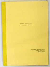
This document was produced by the Department of Conservation, Forests & Land Management, Orbost, to commemorate the visit by Baldwin-Spencer in 1989 as part of the Bicentennial Walking Tracks Project. The Baldwin Spencer Trail closely follows the route of scientist and explorer William Baldwin Spencer. Sir Walter Baldwin Spencer KCMG (23 June 1860 – 14 July 1929) was an English-Australian biologist and anthropologist. this booklet is a useful reference tool.A document of 10 pp with a cream cover, titled, Baldwin Spencer Trail Project Brief Feb 1988. It contains mapsbaldwin-spencer -
 Ringwood and District Historical Society
Entry Form - Walkathon, Wal Elms, Hon Chairman, Walkathon Committee, Maroondah Hospital Family Walkathon records of entry and progress - 1971-72, 1971
... in a family walkathon for the Maroondah Hospital. Qty 2. A map... Hospital. Qty 2. A map of the route is shown on the card ...Form for recording the entry and progress of a person in a family walkathon for the Maroondah Hospital. Qty 2. A map of the route is shown on the card and there is provision for about 20 sponsors. +Additional Keywords: Elms, Wal (Hon Chairman) / McGrath, Keith (Hon Sec) / Gough, Mrs -
 Bendigo Military Museum
Photograph - Johnson Ground Elevation Meter (JGEM) Survey Vehicle - Army Survey Regiment, Fortuna, Bendigo, c1960s
This is a set of 16 photograph of the Royal Australian Survey Corps’ Johnson Ground Elevation Meter (JGEM) Survey Vehicle taken at the Army Survey Regiment, Fortuna, Bendigo. The JGEM vehicle was extensively used by RA Svy within Australia from the late 1960s. A limited number of Ground Elevation Meter (GEM) station wagon type vehicles were manufactured by General Motors Corporation (GMC) in the USA for the United States Geological Survey, Canada’s mapping agencies, RA Svy and National Mapping (Natmap). The GEM was a four-wheel drive, four-wheel steer vehicle. Four-wheel steering was necessary to avoid systematic errors caused by non-tracking of front and rear wheels on conventionally steered vehicles. The manufacturer substituted the rear axle with a front axle and connected them to form the four-wheel steering mechanism. The two Australian GEM vehicles, referred to as Johnson GEMs (JGEMs) were converted into right-hand drive. After delivery in 1964, acceptance Natmap and RA Svy testing and operator training was undertaken at the Army's School of Military Survey located at Balcombe, Victoria. A small fifth wheel was mounted on a cantilever arm suspension midway between the front and rear wheels on the right side of the vehicle. It was lowered to and raised from its operating position by use of a constant pressure air cylinder. A telescopic bar, suspended between the front and rear axles, provided the reference datum for the angle measurement. The wheel provided the velocity or distance signal through a pulse generator system. A sensitive pendulum mounted on this bar provided the angle measurement for each minute distance traversed. The JGEM contained electromechanical instruments used to determine relative elevations, by trigonometric principles, along a traversed path. These relative elevations were obtained through apparatus which measures the instantaneous angle of inclination of the road and the instantaneous velocity of the meter along such a path. Road routes over which the JGEM operated were planned so that each started and ended as near as practicable to an existing point of known elevation (formally referred to as a level traverse bench mark). The difference in height from the bench mark and the road surface alongside the JGEM’s fifth wheel was measured with a level and staff. Along each route, mapping control photo reference points where new elevation values were required were identified on aerial photographs. Under favourable conditions it was possible to survey as much as 160km in an ordinary working day. The first of RA Svy’s JGEM operations was undertaken in 1:250,000 scale map areas of Queensland. CPL John Hook was the JGEM’s main operator in the early 1970s undertaking operations covering 1:250,000 scale map blocks over northern Victoria and central NSW, each requiring 36 points (9 runs of photography and 4 points across. SPR Lyn Thompson and SPR Bob McDonagh teamed with CPL Hook on some of these JGEM operations. When RA Svy was integrated into the Royal Australian Engineers in 1996, the JGEM vehicle with the Survey Corps collection was donated to its museum. It is believed to be the last of the original manufactured fleet in existence. The JGEM has undergone extensive refurbishment to achieve roadworthiness and is currently housed at The Australian Army Museum of Military Engineering, Hoslworthy Barracks, NSW. It can be viewed by making an appointment with the museum’s curator.This is a set of 16 photograph of the Royal Australian Survey Corps’ Johnson Ground Elevation Meter (JGEM) Survey Vehicle taken at the Army Survey Regiment, Fortuna, Bendigo. The photographs were on 35mm slide film and were scanned at 96 dpi. They are part of the Army Survey Regiment’s Collection. .1) - Photo, colour, c1960s, Johnson Ground Elevation Meter (JGEM) Survey Vehicle .2) - Photo, colour, c1960s, JGEM instrumentation, on-board computer. .3) - Photo, colour, c1960s, JGEM instrumentation. .4) - Photo, colour, c1960s, JGEM instrumentation, on-board computer. .5) - Photo, colour, c1960s, JGEM tyre pressure controller .6) - Photo, colour, c1960s, JGEM rear doors, SGT Geoff Briggs. .7) - Photo, colour, c1960s, JGEM 5th wheel distance/angle measurement device in lowered position, SGT Geoff Briggs. .8) - Photo, colour, c1960s, JGEM 5th wheel distance/angle measurement device in lowered position. .9) & .10) - Photo, colour, c1960s, JGEM tyre pressure system, SGT Geoff Briggs. .11) - Photo, colour, c1960s, JGEM tyre pressure system. SGT Geoff Briggs. .12) - Photo, colour, c1960s, JGEM levelling scope, levelling staff, unidentified technicians. .13) & .14) - Photo, colour, c1960s, JGEM levelling scope, unidentified technician. .15) & .16) - Photo, colour, c1960s, probably survey operation adjusted height plotted on block base sheet. .1P to .16P - Some of the equipment is annotated on the frame of the 35mm slides.royal australian survey corps, rasvy, army survey regiment, army svy regt, fortuna, asr, surveying -
 Warrnambool and District Historical Society Inc.
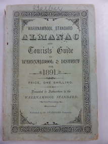
Book, Warrnambool Standard Almanac 1891, 1891
... sheet with a map of Victorian railway routes and many sketches... sheet with a map of Victorian railway routes and many sketches ...This booklet was given to subscribers to the Warrnambool Standard newspaper as an almanac for the year 1891. These Standard Almanacs were produced from 1875 to 1930. They contain much local information on Warrnambool and district about the businesses, government officials, harbour management, churches, banks, schools, societies and organizations etc. The Warrnambool Standard was established in 1872 and continues to this day. This booklet is of high significance as it contains much information about Warrnambool and district for the year 1891. It is an important resource tool for those studying and writing the history of Warrnambool and district. The name ‘Barber’ is on the front cover of this booklet and this appears to refer to George Barber, the son of George Barber, a well-known solicitor who opened a legal practice in Warrnambool in 1855. He died in 1879 and it appears a member or members of his family went to live in the Maryborough district as this booklet came into the collection of the Warrnambool and District Historical Society via the Midlands Historical Society. This is a soft cover booklet of 135 pages, plus pages at the back containing a gardener’s almanac and advertisements. The cover is pale green with black lettering and a decorative black and white border. The cover is a little frayed at the edges and the spine cover is partly torn away. The booklet contains a fold-out sheet with a map of Victorian railway routes and many sketches and illustrations. The name on the front cover is handwritten in pencil. ‘Barber’ warrnambool standard newspaper, history of warrnambool, standard almanac 1891 -
 Warrnambool and District Historical Society Inc.
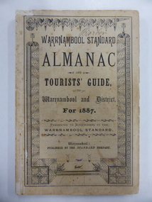
Book, Warrnambool Standard Almanac 1887, 1887
... to Warrnambool is printed in pink. There is a fold-out page with a map...-out page with a map of the railway routes in Victoria ...This booklet was given to subscribers to the Warrnambool Standard newspaper as an almanac for the year 1887. These Standard almanacs were produced from 1875 to 1930. They contain much local information on Warrnambool and district about the businesses, government officials, schools, societies and organizations, harbour management, churches, banks etc. The Warrnambool Standard newspaper was established in 1872 and continues to this day. This booklet is of high significance as it contains much valuable information on Warrnambool and district for the year 1887. It is a very important research tool for those studying and writing the history of Warrnambool and district. This copy has the name ‘Barber’ on the front cover and probably refers to George Barber, the son of George Barber, a well-known solicitor who opened a legal practice in Warrnambool in 1855. He died in 1879 and it appears that a member or members of his family went to live in the Maryborough district. This copy came into the collection of the Warrnambool and District Historical Society via the Midlands Historical Society. This is a soft cover booklet of 73 pages, plus several pages of advertisements. The section on the tourist’s guide to Warrnambool is printed in pink. There is a fold-out page with a map of the railway routes in Victoria. The cover is buff-coloured with black lettering and is slightly frayed. There is some scribble on the first page and the back cover. There are many black and white illustrations and several sketches of Warrnambool and district printed in pink. The name ‘Barber’ is handwritten in black ink on the front cover. ‘Barber’ ‘Miss Duff c/o Mrs Hyslop Farquar Lodge Lysle Street Ladysmith South Africa’warrnambool standard newspaper, history of warrnambool, standard almanac1887 -
 Kiewa Valley Historical Society
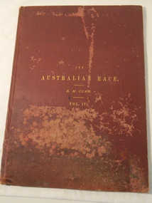
Book & Map - Australian Aborigines' Language, The Australian Race Vol. IV by Edward M. Curr, 1887
This book is the fourth volume of the Australian Race which was printed by the Government printer. The other 3 volumes cover the origin, languages, customs, place of landing in Australia, and the routes by which it spread itself over that continent. This book and map indicate an interest in the Aboriginal Race of Australia during the late 1880s.A local family owned this book indicating an interest in the Aborigines of Australia. The languages of Aboriginal tribes throughout Australia can be compared with those tribes of the Kiewa Valley adding (confirming) to the information sourced from alternative sources.Large thin brownish book with gold embossed title on front cover. 45 pages with blank cover pages. Each page has 8 columns giving the aboriginal word of each tribe giving a comparitive vocabulary of selected English words. Fold out map inserted in flap at rear. It is a map of Continental Australia, showing the routes by which the Aboriginal race spread itself throughout the continent.aborigines; first people of australia; aboriginal language; aboriginal tribes; kiewa valley -
 Eltham District Historical Society Inc
Document - Folder, Wellers of Kangaroo Ground, 1984-2017
Wellers of Kangaroo Ground Vertical File Contents: 1. Article: History of Wellers Restaurant by Sandra Cahir, revised 2017. 7 pages 2. Article: Weller’s Hotel of Kangaroo Ground (final draft) by Jim Allan, 1 June 2017, including feedback email from Sandra Cahir (7 May 2017). 3. Printout of online image - Kangaroo Ground landholders from 1841, Kangaroo Ground Presbyterian Church. (2022, June 29). Retrieved from https://kgpc.pcvic.org.au/images/history_images/Kangaroo-Ground-landholders.jpg 4. Folder of printouts of historical newspaper articles referencing the hotel 1866-1911 https://trove.nla.gov.au/list/163201 5. Printouts (various versions) from Victorian Heritage Database (National Trust and Nillumbik Shire) https://vhd.heritagecouncil.vic.gov.au/ 6. Collection of research notes, copies of records from various publications including EDHS Chronology of Events and Kangaroo Ground: The Highland Taken by Mick Woiwod, pp90, 180-181 (EDHS_01618). 7. Report: Request for ministerial amendment to use the property as a restaurant, includes existing conditions and plan for development, 1 November 1984 8. Papers donated by Diana and Peter Bassett-Smith including: a. Photocopy of Weller’s Hotel, Licensee M. Weller b. Letter: Shire of Eltham to Office of the Secretary for Planning and Environment, 23 Feb 1984 - Information regarding inclusion of Wellers Hotel into the Historic Buildings Register c. Letter: Historic Buildings Council letter to Peter Bassett-Smith seeking historical information on Wellers Hotel, 10 Jan 1985 d. Memo: Peter Bassett-Smith to Robert N. Hendrey on history of Wellers Hotel, 28 Jan 1985 - Includes extract of information about Mary Weller, Dept. of Crown Lands and Survey Map NILLUMBIK showing properties of John Weller and E. Weller and a Diamond Valley News article from 10 April 1973, p11, "Eltham on old coach route" 9. Information about the Weller family including family trees from various sources a. Edward Weller, Pioneer Families in Victoria, http://mepnab.netau.net/w/w09.html, 1 Jan 2017 (link broken) b. The WELLER family tree. (2017, January 1), 2 pages. Retrieved from https://www.weller.org.uk/cgi-bin/FamilyTree/ShowFamily.pl? and 27 pages Retrieved from https://www.weller.org.uk/cgi-bin/FamilyTree/ShowFamily.pl?ListAllPeople=A c. Edward WELLER on the WELLER family tree. (2017, January 1), 1 page. Retrieved from https://www.weller.org.uk/cgi-bin/FamilyTree/ShowFamily.pl?PersonID=516 d. Photograph (print copy), believed to be Edward Weller, 1836-1883 e. Photograph (print copy), Gravestone of Weller family at Kangaroo Cemetery f. Wellers of Kangaroo Ground, 1 page, possibly from History, http://www.wellers.com.au (broken) c.2016 g. Edward and Mary Weller miscellaneous biographical research notes (by Jim Allen?) including from Ancestry.com, and extracts from Chappel file (EDHS_04448) with relevant names highlighted h. Information about the Vernon Pitman family from Ancestry.com 10. Newspaper articles: a. Cobb & Co called here by Marguerite Marshall; Diamond Valley News, May 4, 1982, p2 b. Rich is history, 30 August 1983 (very similar to previous article) c. Weller’s Pub - restaurant, craft store or art gallery? Diamond Valley News, October 22, 1985, p3 d. Despite years of neglect a magical charm lies waiting, Diamond Valley News, October 29, 1985 e. Old pub fate still in doubt, Diamond Valley News, (?) 29 October 1985 f. Renovated Weller’s Pub to begin its new stage of life, DVN 26 January 1988 g. Wellers Restaurant, Lynne Hillier, Network, October 1988, p14 h. Revolution at Wellers, Nillumbik Mail, December 20, 2000 i. Wellers brings on good times, Valley Weekly, June 22, 2005 j. Dine in with ideal outlook, Valley News, 10 August 2005 k. Advertisement: Wellers of Kangaroo Ground, Enjoy lunch, afternoon tea and dinner at Wellers from Tuesday to Sunday, Valley Weekly, Wednesday, August 31, 2005 l. Advertisement: Wellers of Kangaroo Ground, Appearing live; Normie Rowe Fri 24 Feb, Diamond Valley Leader February 22, 2006, p11 m. Advertisement: Wellers of Kangaroo Ground, Lunch Special, Diamond Valley Leader March 27, 2010 n. Braithwaite abounds to Kangaroo Ground, Gig Guide, The Age, Friday, October 8, 2010, p14 o. History up for grabs, Diamond Valley Leader, March 28, 2012 p. Advertisement: Wellers Restaurant, Freehold only for sale, Morrison Kleeman, Diamond Valley Leader, March 28, 2012 q. Restaurant’s crash course, Megan Bailey, Diamond Valley Leader, January 1, 2014, p3. Also accessible online - Staff praised after car crashes through Kangaroo Ground eatery. (2022, June 29). Retrieved from https://www.heraldsun.com.au/leader/north/staff-praised-after-car-crashes-through-kangaroo-ground-eatery/news-story/021c896a1ab6d76bd6b73f2e57dc1854 r. Eatery set for revival, Brittany Shanahan, Diamond Valley Leader 15 February 2017; Also, online as Much-loved Wellers of Kangaroo Ground to be relaunched as Italian restaurant Fondata 1872. (2022, June 29). Retrieved from https://www.heraldsun.com.au/leader/north/muchloved-wellers-in-kangaroo-ground-to-be-relaunched-as-italian-restaurant-fondata-1872/news-story/665777fb347584ef483867ae2b536a8f s. Fondata 1872 proves a big hit with food, Diamond Valley Leader 3 May 2017, p3 11. Wellers of Kangaroo Restaurant Bar Entertainment Functions, tri-fold brochure promotional brochure 12. Website Printout: Wellers Restaurant, Live Guide, (2017, January 5). Retrieved from http://www.liveguide.com.au/Restaurants_Bars/VIC/Kangaroo_Ground/Food_Styles/3... 13. Website Printout: Wellers of Kangaroo Ground, Only Melbourne (2017, January 30). Retrieved from http://www.onlymelbourne.com.au/wellers-of-kangaroo-ground 14. Printouts from Fondata 1872 website and Facebook page including colour photograph of sign in front and business card (2017). Related EDHS Collection items • Wellers Hotel of Kangaroo Ground by Jim Allen, Part 1, Newsletter No. 235, Eltham District Historical Society, August 2017. Retrieved from https://elthamhistory.files.wordpress.com/2017/08/edhs-nl-235-aug-2017.pdf • Wellers Hotel of Kangaroo Ground by Jim Allen, Part 2, Newsletter No. 236, Eltham District Historical Society, October 2017. Retrieved from https://elthamhistory.files.wordpress.com/2017/10/edhs-nl-236-oct-2017.pdf • EDHS_03997 - Slide, Wellers Hotel, Pitmans Corner, Eltham-Yarra Glen Road, Kangaroo Ground, c.1975 https://victoriancollections.net.au/items/5e59e36221ea671798ac40eb • EDHS_03998 - Slide, Wellers Hotel, Pitmans Corner, Eltham-Yarra Glen Road, Kangaroo Ground, c.1975 https://victoriancollections.net.au/items/5e59e39e21ea671798ac9c27 • EDHS_03999 - Slide, Wellers Hotel, Pitmans Corner, Eltham-Yarra Glen Road, Kangaroo Ground, c.1975 https://victoriancollections.net.au/items/5e59e3c721ea671798acd2ef • EDHS_04000 - Slide, Wellers Hotel, Pitmans Corner, Eltham-Yarra Glen Road, Kangaroo Ground, c.1975 https://victoriancollections.net.au/items/5e59e3e021ea671798acfd68 • EDHS_04066-18 - Photograph, Wellers Restaurant, Eltham-Yarra Glen Road, Kangaroo Ground, c.Mar. 1989 https://victoriancollections.net.au/items/610f4dafa346aadcee7ac79c • EDHS_04041-26 - Photograph, Wellers Restaurant, 150 Eltham-Yarra Glen Road, Kangaroo Ground, c.May 1988 https://victoriancollections.net.au/items/610e2f4a7d65e7c945a35e69 • EDHS_04437 – Newsclipping, Renovated Weller's Pub to begin its new stage of life by Linley Hartley, Diamond Valley News, 26 January 1988 https://victoriancollections.net.au/items/5de4913921ea6710a46a85c7 • EDHS_04438 - Newsclipping, Wellers Restaurant by Lynne Hillier, Network, October 1988, p14 https://victoriancollections.net.au/items/5de4916f21ea6710a46aea0f • ArtStreams magazine (from Volume 9, 2004) ‘partnered' with Wellers in promoting and supporting the arts and culture. Various advertisements throughout, particular with live performance acts. Numerous references throughout to art and music performances on site. • Stephen Cummings and Joe Camilleri at Wellers Kangaroo Ground, ArtStreams, Vol. 9, No. 4, Sep/Oct 2004, p17 EDHS_04406 - Journal, ArtStreams: Whittlesea, Banyule, Darebin, Manningham, Nillumbik, Yarra; Vol. 9, No. 4, Sep-Oct 2004 https://victoriancollections.net.au/items/5bcc086021ea6804a82a92a9 • Daryl Braithwaite rocks up at Wellers, Fiona Sievers, ArtStreams, Vol.10 No.2, 2005, pp6-7 EDHS_04409 - Journal, ArtStreams: Vol. 10, No. 2, 2005 https://victoriancollections.net.au/items/60f5416ab06f0c13a9419541 • Ephemeral Sculpture by Peter Dougherty, ArtStreams, Vol.10 No.3, 2005, pp7-9. About sculptures created in or on the grounds of culinary establishments throughout the Shire. - Denise Keele-Bedford constructed ‘Ou Well’ at Wellers Restaurant and Vicky Shukuroglou, also at Wellers set up cotton banners printed and painted with natural dyes from onion skins, spinach, radish beetroot, turmeric and charcoal. EDHS_04410 - Journal, ArtStreams: Vol. 10, No. 3, 2005 https://victoriancollections.net.au/items/60f5436db06f0c13a941ae19 • Music at Wellers Restaurant, ArtStreams, Vol.10 No.4, 2005, p23 EDHS_04411 - Journal, ArtStreams: Vol. 10, No. 4, 2005 https://victoriancollections.net.au/items/60f543e4b06f0c13a941b059 • Weller’s Pub, Diamond Valley sketchbook / text by Brian McKinlay ; drawings by Graham Hawley, 1973, pp42-43 EDHS_00856 - https://victoriancollections.net.au/items/590852edd0ce7b14e8177da3 • Gold Field Coaches Stopped Here, Nillumbik now and then / Marguerite Marshall; photographs Alan King with Marguerite Marshall, 2008, pp86-87 EDHS_00977 - https://victoriancollections.net.au/items/5935f315d0cdd42c80f9cc52 External Links: • Historic Kangaroo Ground venue comes up for rare sale. (2022, June 29). Retrieved from https://www.smh.com.au/business/companies/historic-kangaroo-ground-venue-comes-up-for-rare-sale-20120325-1vshw.html • Wellers, Kangaroo Ground property sold with leaseback. (2022, June 29). Retrieved from https://www.urban.com.au/expert-insights/investing/37735-wellers-kangaroo-ground-property-sold-with-leaseback • Wellers, Kangaroo Ground | With Mark Seymour, at one of his …. (2022, June 29). Retrieved from https://www.flickr.com/photos/robertmilesdesign/4564390893/ • 2016 Notice of proposed deregistration - WELLERS OF KANGAROO GROUND PTY LTD 124 435 409. (2022, June 29). Retrieved from https://publishednotices.asic.gov.au/browsesearch-notices/notice-details/WELLERS-OF-KANGAROO-GROUND-PTY-LTD-124435409/35d43b89-159a-4435-963f-daec688a61ca • Search results for: Websites (archived). (2022, June 29). Retrieved from https://trove.nla.gov.au/search/category/websites?keyword=%22wellers%20restaurant%22 29 June 2022 edward weller, wellers of kangaroo ground, wellers hotel, wellers restaurant, mary weller, pittmans corner, fondata 1812 at wellers, historic buildings register, hotels, john weller, kangaroo ground, pitman's corner, bassett-smith collection -
 Glen Eira Historical Society
Document - Japanese School of Melbourne
Six documents about the Japanese School: 1/The Japanese School of Melbourne Planning Brief document draft February 1984 to the City of Caulfield. Brief includes background of school, current educational standards of school and structure, future plans, including forecast of future student numbers, request to use prefabricated rooms. Also plans for new building and room alterations. Includes appendice which has current and projection graph of students attending. Period covered: January 1968-February 1984 (17 pages). 2/Fourteen page school prospectus, which includes history and location, term dates, school hours, curriculum subjects, teachers qualifications, health department approval and enrolment list. Also includes Division of School Duties, school educational aims and guidance priorities. Period covered: 07/09/1968-13/05/1986. 3/An 11/11/1988 Melbourne Development and Prospectus for the Japanese School of Melbourne, includes purpose of school, development options, planning brief, construction time, and development program. Includes seven plans and maps of school location and bus routes (14 pages). Prepared for the City of Caulfield on its request. 4/List of representatives of the Japanese School of Melbourne that met with City of Caulfield councilors on 23/11/1988. 5/Black and white photo of 'Ian Rob with Japanese students September 1991', six students included. 6/Colour photograph of 'Mayor Ed Biggs with Japanese students February 1992', thirteen adults and young people included.japanese school of melbourne limited, japanese school, caulfield, holy cross catholic, holy cross school, ellington school, keeron street, mockridge stahle and mitchell architects, architects, secondary schools, primary schools, playgrounds, hawthorn road, caulfield south, yaji hidero, japanese community, yazaki yasuo, morita hiroshi, teachers, bloink des, stokes tony, building surveyors, japanese supplementary school of melbourne, school committees, libraries, school houses, brick, bloink clarke harding consulting architects group, anthony stokes and assoc. building surveyors and town planners, rob ian, biggs ed mayor -
 Glen Eira Historical Society
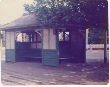
Article - Tram Shelter, Dandenong Road
National Trust of Australia, Victoria, report giving details of tram shelters on the tramways routes of Melbourne; history of cable car system and reasons for tramways amalgamations, includes architectural plan, map and photocopies of two photographs before restoration 1994. Includes bibliography. Two coloured photographs of tram shelter Dandenong Road opposite Hawthorn Road taken in 1978. Detailed history from the Trust News 2000 on history of Melbourne Tram Shelters, various architectural design features, where erected and who design by.dandenong road, hawthorn road, north caulfield, glen eira, flannagan l.s., prahran and malvern tramways trust, street furniture, tram shelters, edwardian style, architectural features, glenhuntly road, caulfield, orrong road, balaclava road, watson stephen, storey rohan, ward andrew -
 Eltham District Historical Society Inc
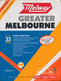
Book, Melway Publishing, Melway Greater Melbourne street directory : including Geelong, Phillip Island, Healesville, Kinglake, Gisborne, Lorne, Wallan, Bacchus Marsh Bellarine & Mornington Peninsulas; Edition 33, 2006, 2005
Edition 33. 2006 Coloured detailed maps accessed by a street or location index. Cover: Totally revised and updated with over 1380 new street listings new maps covering Mount Duneed on the Bellarine Peninsula, Pakenham South and Rythdale. Detailed public transport routes - train, tram, bus, bicycle paths & shared road routes. Eastlink fully detailed new Craigieburn bypass GPS compatible WGS/MGA Grid Special feature: New Hierachy of Roads Street directory with plastic cover, coloured maps, 902 pagesstreets,roads,melbourne,map,melway -
 Eltham District Historical Society Inc
Folder, Pioneers & Painters; Shire of Eltham Historical Society research notes, background information, etc, 1969-1986, 1969-1986
... Members 1866-1871 04768-5 Map showing Gellibrand's likely route... Members 1866-1871 04768-5 Map showing Gellibrand's likely route ...Material pertaining to the production of a history of the Shire of Eltham, "Pioneers & Painters: One Hundred Years of Eltham and its Shire" in recognition of the shire's centenary in 1971 Item Title Caption 04768-1 Newspaper clipping - The Eltham of 1905; Gellibrand our first white visitor? Diamond Valley News, 24 June 1969, p5 04768-2 Newspaper clipping - The Eltham of 1905; Gellibrand our first white visitor? Heidelberger, 25 June 1969 04768-3 Notes on Eltham District Road Board Members 1866-1871 04768-4 Notes on Eltham District Road Board Members 1866-1871 04768-5 Map showing Gellibrand's likely route through district 12-13 February 1836 and Hoddles's route of Febrary 1838 04768-6 Notes by Shire Secretary, M.B. Watson regarding meeting with Reverend Longfield regarding history of St Margaret's Church 04768-7 Alan Marshall's notes from discussion with Mr. F. Barrett regarding SEPP images 611, 635 and 636 SEPP_0611 SEPP_0635 SEPP_0636 04768-8 Transcripts of letter from local residents to Charles Joseph Latrobe requesting a bridge over the Plenty River dated 10 April 1849 and his reply dated 5 May 1849; from Latrobe Library Archives - Land Branch Records 04768-9 Notes on history of Eltham Shire, Centenary events and publication of Pioneers & Painters for release in conjunction of opening of new Library 04768-10 Newspaper clipping - Glossy record of shire's romantic past and the people who made it by Fab Calafuri, Diamond Valley News, Tuesday, December 16, 1986, p18 SEPP_0755-3 Letter: Acknowledgement from Colin J. Bock, Eltham Shire Secretary to A.R. Thomas of Bendigo for copy of 1913 photograph of Shire of Eltham Councilors, 21 May 1973 A.R. Thomas' father Mr. A.G. Thomas, C.E., was the Shire Secretary at the time in 1913. Cross Ref: SEPP_0755 The idea to develop a book on the history of the Shire of Eltham to be edited by noted author, Alan Marshall in celebration of the shire's centenary was initiated in 1969. The Shire of Eltham Historical Society undertook significant research in conjunction with Alan Marshall locating material at various institutions and other societies; interviewing longer term residents and a public campaign through the local press to acquire photographic material for duplication and use in the book. The public campaign received generous response and the material collected became the genesis for the Shire of Eltham Pioneers Photograph collection now held in partnership between Eltham District Historical Society and Yarra Plenty Regional Library (Eltham Library).Paper documents of various sizes and newspaper clippingsa.g. thomas, a.r. thomas, alan marshall, bridge road, charles joseph latrobe, council members, d.w. lachlan, eltham district road board, eltham shire council, ernie orford, f. barrett, francis rogerson, g. bransprone, james donaldson, james johnston, john bell, john thomson, joseph tice gellibrand, lower plenty bridge, m.b. watson, main road, map, patrick turnbull, peter morris, pioneers and painters, post office, rev. longfield, sepp, shire of eltham pioneers photograph collection, shire secretary, st margaret's church, thomas armstrong, thomas bell, thomas sweeney, william bell (1796-1870), centenary celebrations, christmas hills, clifton pugh, david newbury, dudley street, eltham, gareth jones roberts, hurstbridge, john perceval, joy peck, kangaroo ground, kinglake, lower plenty, luther haley general store, montmorency, neil douglas, panton hill, peter glass, research (vic.), sheila ferguson, shire of eltham, st andrews, yarra glen -
 Eltham District Historical Society Inc
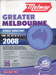
Book, Melway Greater Melbourne street directory 2008 : including Geelong, Phillip Island, Healesville, Kinglake, Gisborne, Lorne, Bacchus March, Wallan, Bellarine & Mornington Peninsulas; Edition 35, 2008, 2007
Edition 35. 2008 Coloured detailed maps accessed by a street or location index. Cover: Totally revised and updated with over 730 additional street listings, new maps extending the Gisbourne and Wallan areas. The most comprehensive public transport routes information - train, tram, bus, walking and bicycle tracks. Eastlink fully detailed, Victoria Racing Club, Flemington enlargement, GPS compatible WGS/MGA Grid displayed, This editon is available in LARGE PRINT format, new eway electronic street directory now available - www.melway.com.au Special feature: New Hierachy of Roads Street directory, coloured maps, indexes, 1201 pagesstreets,roads,melbourne,map,melway -
 Bendigo Military Museum
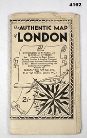
Map - MAP of LONDON, The Authentic Map of London
... Black and white folded street map with transport routes... street map with transport routes/stations marked in orange. Cover ...Map of London with also places of interest. Part of th collection of Frederick Gardner Davey DFC No 410533 RAAF. Refer cCat No 3536P for his service details.Black and white folded street map with transport routes/stations marked in orange. Cover is black and white print, features a scroll and compass design inside a B & W border, written details in black type, street index printed on inside of the cover.map, london -
 Bendigo Military Museum
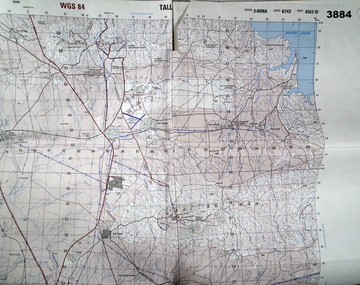
Map - MAP of IRAQ
Four topographical maps taped together of Tall Uwaynat and Tall Musa region of Iraq. Item belonging to Mathew Redwood. Refer Cat No 3891 for his service details.White paper, folded, four maps sticky taped togetherOrange fluoro marking out route taken by Australian forces in escort duties.maps, iraq -
 Bendigo Military Museum
Book, The Edge of the Sword, 1955
The Edge of the Sword - This book is the story of the Gloucestershire Regiment in the Imjin Battle and in captivity.Hard cover, red colour buckram, gold print own spine. 286 pages cut plain. Illustrated black and white photographs. End paper illustrated with map "Battle of the Imjin River" and "Routes followed by the author after capture"books, military history -
 Bendigo Military Museum
Map - MAPS, 1937
Items saved by Maurice Anthony BYRNE RAAF. Refer Cat No 215.9 for service history..1) map details on the map with biro lines marking the route taken by a traveller 1937 .2) map printed both sides Western New Guinea B6 December 1943 .3) map sheet B6 January 1944 top part of Australia .4) map Australia north plotting sheet .5) map C4 June 1943 .6) map Australian Aeronautical C5 June 1943documents - maps, military equipment -
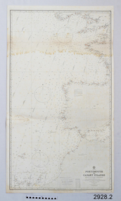 Flagstaff Hill Maritime Museum and Village
Document - Navigation Chart, Portsmouth to Canary Islands, CA. 1928
Navigation charts are drawn by professional hydrographers and describe the geography of land and water, enabling a water based navigator on board vessels such as ships to safely negotiate between ports locally and around the world. They are drawn to a particular standard with common symbols noting landmarks. The charts are used in conjunction with other navigational instruments and tools to calculate the vessel’s exact location and a safe route to its destination.The set of charts and their chart are of significance as examples of equipment and documents used to navigate the oceans of the world, particularly to Australia. Migration to Australia is an important part of this country's history.British Admiralty Navigation Chart - Portsmouth to Canary Islands - printed on rectangular white paper. Published in London by the British Admiralty in 1928.warrnambool, shipwreck coast, flagstaff hill, flagstaff hill maritime museum, flagstaff hill maritime village, chart, map, navigate, navigation, location, vessel, 1928, british admiralty, hydrographer, geography, admiralty chart, portsmouth, canary islands -
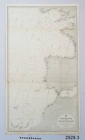 Flagstaff Hill Maritime Museum and Village
Document - Navigation Chart, Portsmouth to Canary Islands, Ca. 1928
This is an Official British Admiralty Navigation Chart, one of a set of 65 charts donated together with a wooden chart case. It was published and printed in London in 1928 by the British Admiralty. Navigation charts are drawn by professional hydrographers and describe the geography of land and water, enabling a water based navigator on board vessels such as ships to safely negotiate between ports locally and around the world. They are drawn to a particular standard with common symbols noting landmarks. The charts are used in conjunction with other navigational instruments and tools to calculate the vessel’s exact location and a safe route to its destination.The set of charts and their chart are of significance as examples of equipment and documents used to navigate the oceans of the world, particularly to Australia. Migration to Australia is an important part of this country's history.British Admiralty Navigation Chart - Portsmouth to Canary Islands - printed on rectangular white paper. Published in London by the British Admiralty in 1928.warrnambool, shipwreck coast, flagstaff hill, flagstaff hill maritime museum, flagstaff hill maritime village, chart, map, navigate, navigation, location, vessel, 1928, british admiralty, hydrographer, geography, admiralty chart, portsmouth, canary islands -
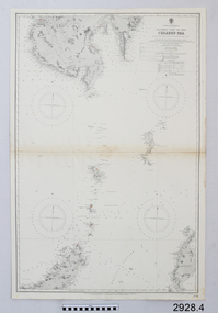 Flagstaff Hill Maritime Museum and Village
Document - Navigation Chart, Eastern Part of the Celebes Sea, Ca. 1928
This is an Official British Admiralty Navigation Chart, one of a set of 65 charts donated together with a wooden chart case. It was published and printed in London in 1928 by the British Admiralty. Navigation charts are drawn by professional hydrographers and describe the geography of land and water, enabling a water based navigator on board vessels such as ships to safely negotiate between ports locally and around the world. They are drawn to a particular standard with common symbols noting landmarks. The charts are used in conjunction with other navigational instruments and tools to calculate the vessel’s exact location and a safe route to its destination.The set of charts and their chart are of significance as examples of equipment and documents used to navigate the oceans of the world, particularly to Australia. Migration to Australia is an important part of this country's history.British Admiralty Navigation Chart - Eastern Part of the Celebes Sea - printed on rectangular white paper. Published in London by the British Admiralty in 1928.warrnambool, shipwreck coast, flagstaff hill, flagstaff hill maritime museum, flagstaff hill maritime village, chart, map, navigate, navigation, location, vessel, 1928, british admiralty, hydrographer, geography, admiralty chart, celebes sea -
 Greensborough Historical Society
Map, Greensborough c 1980s, 1980s
... showing bus routes servicing Eltham College. greensborough - maps ...Map of Greensborough and surrounds showing bus routes servicing Eltham College.Map of Greensborough and surrounds, black print with colour markings."Bundoora Retirement Village" marked in red pen at E20greensborough - maps, eltham college, bus routes, public transport -
![Map - Maps, [John Batman in Melbourne], 1976](/media/collectors/4f729f5697f83e03086015b8/items/60965f673c71fad916b3a651/item-media/60965fc33c71fad916b3a805/item-fit-380x285.jpg) Greensborough Historical Society
Greensborough Historical SocietyMap - Maps, [John Batman in Melbourne], 1976
Photocopies of 4 maps showing aspects of John Batman's time in Melbourne: Map of the settlement of the Yarra 1837; Batman's map of Port Phillip and his route of exploration, 1835, drawn by Wedge; Proposed route of Batman's initial exploratiion, and Enlargement of the Geelong region of Batman's map. No citations on any copy.Photocopy of maps, 4 pages.john batman, melbourne, port phillip -
 Greensborough Historical Society
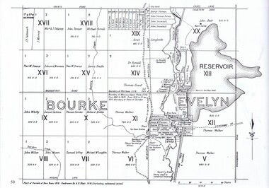
Map, Dianne Edwards, Part of Parish of Yan Yean 1878, 1978
Map includes Crown Portions V - XVII, showing Yan Yean Reservoir, Melbourne-Whittlesea Railway route, names of landowners, roads and various other features west of Greensborough Road. Redrawn by A. R. Blair in 1978.1 p. black and white photocopy of mapyan yean reservoir, yan yean -
 Greensborough Historical Society
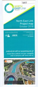
Leaflet, North East Link Authority, North East Link: project map October 2018, 2018_10
... of this project. This map shows the proposed route with major... up to lead development of this project. This map shows ...North East Link Authority was set up to lead development of this project. This map shows the proposed route with major intersections/interchanges. Map, colour text and images.north east link -
 Greensborough Historical Society
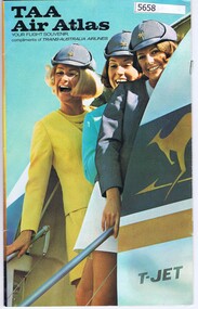
Booklet, TAA Air Atlas, 1972_
Souvenir publication, detailing airline routes, services and aircraft. TAA air atlas: your flight souvenir, compliments of Trans-Australia Airlines.16 p., printed in colour, maps, photographs and text.airlines, trans-australia airlines -
 Greensborough Historical Society
Journal - Article, Journal, Victorian Historical Journal, Batman's route revisited: his exact steps to a new treaty site, 2014_06
... batmans treaty 21 pages, maps. Batman's route revisited: his exact ...Article from the Victorian Historical Journal Vol.85, No.1, June 2014. Discusses John Batman's 1835 visit to Port Phillip and possible alternative sites for signing his treaty with Indigenous people of the area.21 pages, maps.john batman, batmans treaty -
 Greensborough Historical Society
Road Maps, The Herald Road Guide, 1955-1956
Contains maps of Melbourne and surrounding areas as well as routes from Melbourne to other state capitals.Contains maps and descriptions of the Melbourne area in the era before the large scale urbanisation after 1960. Also includes country and day tour maps before highways were common.Book of road maps, 271 pages, in brown plastic carry case.maps, melbourne, victoria, day tours, touring maps -
Glenelg Shire Council Cultural Collection
Flyer - Flyer - The Great Southern Touring Rout Adelaide to Melbourne, n.d
... & Geelong'. Contains map of touring route and information... to Melbourne, via Mt. Gambier & Geelong'. Contains map of touring route ...DL flyer, single sheet folded four times. 'The Great Southern' touring route, Adelaide to Melbourne, via Mt. Gambier & Geelong'. Contains map of touring route and information -
 Geelong RSL Sub Branch
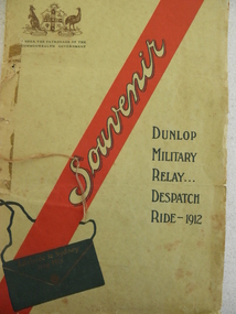
Souviner Program, No makers listed, Dunlop Military Relay ... Despatch Ride 1912, 1912
... . The program details the list of participants, a map of the route taken ...In 1912 there was a Military Relay Despatch Ride through South Australia, Victoria and New South Wales. The purpose of the ride was to deliver a despatch in the quickest possible time by road through the three states mentioned. The ride was carried out under the auspices of the Dunlop Rubber Company and involved cyclists, motor cyclists and motorists.This is an original program of the event that was carried out in 1912. The program details the list of participants, a map of the route taken and statements of appreciation from the Military and the Promoters', there is also a message of greeting from the Military Commandant, South Australia to the Military Commandant, New South Wales.A cardboard cover program with white thick pages inside.On the front cover a Coat of Arms, a red stripe with souviner written in the stripe and Dunlop Military Relay ... Despatch Ride - 1912.military relay, 1912, despatch ride, dunlop rubber company -
 Greensborough Historical Society
Book, Melbourne University Press, Heidelberg: the land and its people 1838-1900; by Donald P. Garden, 1838-1900
This book covers the early history of Heidelberg, Victoria from its beginnings in 1838 to 1900.There is some reference to the 'annexation' of Greensborough in 1875 and the route of the Heidelberg-Eltham railway line, 1893.Hard cover book. 218 p., ill., maps. Slip cover has a drawing based on an early photograph of the Old England Hotel.Property stamps from Nunawading Public Library (cancelled from their collection)heidelberg, greensborough, donald garden