Showing 453 items matching "victoria land use"
-
 Puffing Billy Railway
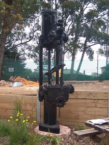
Vertical Pump, Weir, 1948
Weir Pumps - these types of vertical pumps were used extensively with both land and marine steam pumps. The pumps were also used for various duties from pumping oil fuel and feed water for boilers, to draining bilges on steam ship[s They are a single cylinder, double acting vertical pumps used by G. & J. Weir Ltd. , of Cathcart, Glasgow The large pump serial number 231703 was built in 1948 and worked at the old Victoria Brewery in East Melbourne before coming to the Museum in 1985. Historic - Weir Vertical Pump used at the old Victoria Brewery in East Melbourne The large pump serial number 231703 was built in 1948 and worked at the old Victoria Brewery in East Melbourne before coming to the Museum in 1985.Weir Vertical Pump - Large Steel PumpWeir puffing billy, weir vertical pump, victoria brewery -
 Puffing Billy Railway
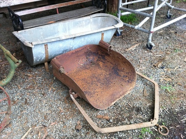
Horse drawn scoop from Hermon’s nursery
Metal Horse drawn scoop from Hermon’s nursery at Menzies Creek. The Land on which the Menzies Creek railway station and Museum are built on was once apart of James Hermon's & his son William Hermon's property on which Horse drawn scoops of this type would have been used. Historic - industrial Farm equipment used on the farm of James Hermon & his son William Hermon on which the museum is built Horse drawn scoop from Hermon’s nursery made of Metal West Footscray Engineering Works Pty Ltdpuffing billy, menzies creek, scoop, hermon -
 Clunes Museum
Document
.1 ENVELOPE AND DOCUMENT - SAFE CUSTODY ENVELOPE CONTAINING LICENCE FOR USE OF LAND BORDERED BY GRANT STREET, VICTORIA STREET AND DICKSON STREET SE 43 .2 LETTER AND FORM FROM ANZ BANK REGARDING SAFETY DEPOSIT BOX .3 CORRESPONDENCE REGARDING DEB BALL HELD ON 21 AUGUST 1987debutanten ball 1987, woolshed dance, tennis club licence for land -
 Tatura Irrigation & Wartime Camps Museum
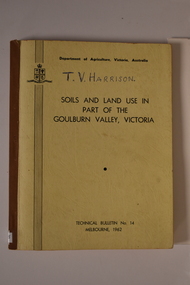
Book, Department of Agriculture Victori, Soil and Land Use in Part of the Goulburn Valley Victoria Technical Bulletin No 14, 1962
Mid sized book with soft cover, brown spine with off white cover. Black writing on back and front. Contains maps. Tech Bulletin No 14.non-fictiongoulburn valley, soil studies victoria, victorian maps -
 Tatura Irrigation & Wartime Camps Museum
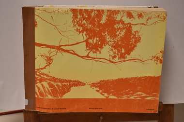
Book - Land Conservation Council Victoria ( Murray Valley Area ), Land Conservation Council Victoria ( Murray Valley Area )
Report on public land use in the Murray Valley area in 1983Mediun size, Yellow and Orange Front Cover. Brown fabric Spine. White back. Heavy white envelope inside back cover that contains mapsnon-fictionReport on public land use in the Murray Valley area in 1983soils and land use -
 Uniting Church Archives - Synod of Victoria
Photograph, undated
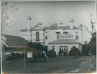
Otira was designed and built in 1887 by architect Mr Crouch, first Secretary of the Institute of Architects for Mr Henry Berry, founder of a successful wholesale grocery business. The house was acquired by the Methodist Church in 1923 for use as a home missionary training college. The house is of faced stone on a bluestone foundation. The large front door is surrounded by lead light windows surmounted by a fan light. The land on which the house stands has now been subdivided.B & W gloss photograph mounted on card of the rear of Otira, the Home Missionary Training College located at 73 Walpole Street Kew. Otira 73 Walpole Street Kew. Home MIssionaries Training College. otira, methodist home missionary training school walpole street kew, henry berr crouch -
 Uniting Church Archives - Synod of Victoria
Photograph, undated
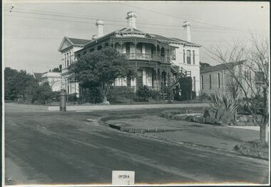
Otira was designed and built in 1887 by architect Mr Crouch, first Secretary of the Institute of Architects for Mr Henry Berry, founder of a successful wholesale grocery business. The house was acquired by the Methodist Church in 1923 for use as a home missionary training college. The house is of faced stone on a bluestone foundation. The large front door is surrounded by lead light windows surmounted by a fan light. The land on which the house stands has now been subdivided.B & W gloss photograph mounted on card of Otira, the Home Missionary Training College located at 73 Walpole Street Kew. The photograph was taken from the street.Otira 73 Walpole Street Kew. Home MIssionaries Training College. otira, methodist home missionary training college walpole street kew, henry berr crouch -
 Victorian Aboriginal Corporation for Languages
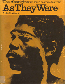
Book, Aldo Massola, The Aborigines of south-eastern Australia : as they were, 1971
Contents: p.1-3; Origins, arrival in Australia; p.4-9; How they lived - camp sites, dating (including carbon dating); p.10-27; Physical appearance, skin colour, hair, clothing, body ornaments, cicatrization; exchange system, distribution of food, marriage &? sexual relations; the tribe - structure, relationship to land, territory, gives map showing locations of tribes, New South Wales, Victoria &? eastern South Australia, leadership, government, division of labour, status of women, estimated population at white settlement, density of population (Victoria); p.28-31; Language - names &? naming, reproduces Wembawemba vocabulary, notes use of secret languages, gives 12 rules for pronounciation; p.32-53; Religion, spirit beliefs, totemism, moieties, phratries, marriage rules; mythology, gives eaglehawk &? crow myth from Lake Victoria &? other myths illustrating origins of fire &? natural rock formations, mythical beasts (Bunyip, Mindie), stellar beliefs; magic, medicine men, powers, native remedies for sickness, describes ceremony held in Melbourne, 1847 to avert evil, sorcery, pointing bone, love magic, rain makers; messengers, appearance, etiquette, message sticks; p.54-71; Rock art, motifs, colours, decorative art, engraving of utensils, rock engravings, manufacture &? use of pigments, engraving techniques; trade system, objects bartered, meeting places for trade (Victoria), map shows possible routes (south east Australia); corroborees, purpose, body ornaments &? decorations, musical instruments; p.72-93; Ceremonial life, marriage, punishment for infidelity, birth, childhood, games &? amusements, initiation, etiquette of visiting tribes, details of ceremony, womens role, earth figures &? ground designs, bull roarers, female puberty ceremonies; p.94-133; Shelters, fire making, cooking, construction of canoes, wooden implements, use of reeds, animal skins &? sinews, shells; stone tools, cylindro conical stones, scrapers, knives &? microliths; hunting weapons, spear, other methods pits, nets; fishing methods &? spears, traps; food sharing, womens responsibilities for collecting, digging stick, cooking methods, insect foods, plant foods, water resources; manufacture &? use of spears, spear throwers, shields, clubs, boomerangs; inter- &? intratribal fighting; p.134-147; Death, disposal of body - eating of the dead, burial, cremation, platform exposure, dendroglyphs (N.S.W.), Aboriginal burial grounds (Darling &? Murray Rivers), mourning, widowhood, kopi caps (N.S.W.), causes of death, inquest ceremonies, revenge expedition, after death beliefs; p.148-157; The end of the tribes white settlement &? its impact on Aboriginal life, friction between natives &? settlers, establishment of Protectorates; copiously illustrated throughout.maps, b&w illustrations, b&w photographswemba wemba, murray river, darling river, lake victoria -
 Victorian Aboriginal Corporation for Languages
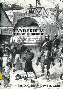
Book, Ian D Clark et al, Tanderrum 'Freedom of the bush' : the Djadjawurrung presence on the goldfields of Central Victoria, 2004
Contents: The pre-contact era: Archaeological heritage in the study area ; Djadjawurrung use of box-ironbark resources The contact and post-contact era: The Djadjawurrung and Port Phillip Aboriginal Protectorate ; Djadjawurrung and the gold rushes.b&w photographs, drawings, listsdjadjawurrung, dja dja wurrung, land dispossession -
 Victorian Aboriginal Corporation for Languages
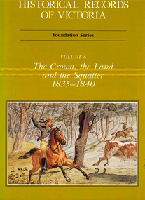
Book, Michael Cannon, Historical records of Victoria : foundation series : volume 6 : the crown, the land and the squatter 1835-1840, 1991
Reproductions of various transactions and reports dealing with squatting, land tenure and agricultural production in Port Phillip in the years 1835-1840. A history of land grants, surveying, squatters? life and land use during this period.maps, b&w illustrations, colour illustrationsvictorian history -
 Victorian Aboriginal Corporation for Languages
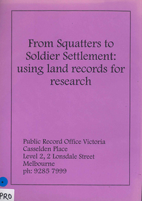
Book, Public Record Office Victoria, From squatters to soldier settlement : using land records for research
A guide to accessing correspondence in Public Record Office Victoria's custody, with advice on accessing other records.document reproductionspublic record office victoria, public records, research, land records, catalogues -
Clunes Museum
Document - REPORT, LAND CONSERVATION COUNCIL OF VICTORIA, FINAL RECOMMENDATIONS - NORTH CENTRAL AREA, FEBRUARY 1981
... , IN ORDER TO PROVIDE FOR THE BALANCED USE OF LAND IN VICTORIA ...THE LAND CONSERVATION COUNCIL WAS ESTABLISHED BY THE LAND CONSERVATION ACT 1970. AS ONE OF ITS THREE FUNCTIONS, IT MAKES RECOMMENDATIONS TO THE MINISTER FOR CONSERVATION WITH RESPECT TO THE USE OF PUBLIC LAND, IN ORDER TO PROVIDE FOR THE BALANCED USE OF LAND IN VICTORIA...BOUND BOOKLET - ORANGE SOFT COVER WITH NAVY BLUE BINDING LAND CONSERVATION COUNCIL, VICTORIA MELBOURNE - FEBRUARY 1981 - INCLUDING MAPSnon-fictionTHE LAND CONSERVATION COUNCIL WAS ESTABLISHED BY THE LAND CONSERVATION ACT 1970. AS ONE OF ITS THREE FUNCTIONS, IT MAKES RECOMMENDATIONS TO THE MINISTER FOR CONSERVATION WITH RESPECT TO THE USE OF PUBLIC LAND, IN ORDER TO PROVIDE FOR THE BALANCED USE OF LAND IN VICTORIA...local history, document, recommendations, land conservation -
Clunes Museum
Sign - DISPLAY PANEL, 2000
COPIES OF DISPLAY PANELS DONATED TO THE PEOPLE OF CLUNES BY THE HUGH WILLIAMSON FOUNDATION.INTERPRETIVE DISPLAY PANEL DEPICTING HISTORY OF SCHOOL DAYS IN CLUNES. WOODEN DISPLAY PANEL AND LAMINATED COPY.SCHOOL DAYS CHILDREN OF EARLY GOLDFIELD TOWNS WERE TAUGHT IN TENT SCHOOLS.THESE SCHOOLS WERE EASILY MOVED TO THE SITE OF THE LATEST GOLDRUSH. WITH GREATER COMMUNITY STABILITY PERMANENT SCHOOLS WERE ESTABLISHED. CLUNES STATE SCHOOL NO. 1552 WAS OPENED IN JULY 1875 ON LAND DONATED BY RIVETT H. BLAND, MANAGER OF THE PORT PHILIP GOLD MINING CO. SHORTLY BEFORE WORLD WAR ONE, THIS SCHOOL BECAME VICTORIA,S THIRD HIGHER ELEMENTARY SCHOOL. TODAY IT IS STILL USED TO EDUCATE THE CHILDREN OF CLUNES STATE SCHOOL NO. 136 WAS BUILT IN 1881 ON THE SITE OF AN EARLIER TEMPORARY SCHOOL THAT WAS BUILT IN 1857. THE DESIGN WAS FIRST USED AT HORSHAM. AND INCLUDES AN EARLY EXAMPLE OF A LARGE SCHOOL VERANDAH. IN 1892 THIS SCHOOL AMALGAMATED WITH STATE SCHOOL NO. 1552 AND WAS USED AS THE INFANT SCHOOL. IT CLOSED ITS DOORS IN 1922 AND WAS LATER USED AS A MILL FOR THE CLUNES KNITTING AND MAUFACTURING CO. LTD. IT NOW HOUSES THE CLUNES BOTTLE MUSEUM THE CLUNES CATHOLIC SCHOOL OPENED IN 1875 AND CLOSED IN 1926 THE LATEST EDUCATIONAL ASSET AT CLUNES IS A CAMPUS OF WESLEY COLLEGE. BLENDINGHISTORIC BUILDINGS AND MODERN ARCHITECTURE THE CAMPUS IS SITUATED IN SERVICE STREETlocal history, civic momentoes, presentations, williamson, hugh foundation -
 Nillumbik Shire Council
Sculpture: Tony Trembath (b.1946 Sale, Victoria), Tony Trembath, The Fences Act 1968 - Location: Edendale Farm (entrance) 30 Gastons Road, Eltham, 1989 - 1994
Eltham Council (now the Shire of Nillumbik) commissioned this work in 1989 to create an entrance / gateway to Edendale Community Farm. It was also aided by a grant from the Ministry of the Arts (now Arts Victoria). The former name of this work was "Gateway to Edendale Farm". Edendale Farm is a demonstration farm modelling sustainable environmental practices, providing support to the local residents of Nillumbik. Established in 1986, the land was purchased in 1970. It was previously an English gentleman's residence and was used for grazing. It consists of 5.6 hectares, with the Diamond Creek meandering through the property. The Victorian Fences Act 1968 governs liability of occupiers of adjoining lands to fence, and deals with disputes between neighbours regarding boundaries fences and costs. This work took into consideration ideas and suggestions from residents and committees, who required the use of recycled materials and that the work celebrate man's relationship with nature, animals and the earth, as well as relate to the fence-line on the far side of the carpark. Trembath also absorbed significant aspects of local history, making references to Eltham's agricultural past, the clearing of the land, the destruction of trees, the ruthless pruning of trees by suburban Councils and incorporated such Australian features as the post and rail fence. 'The Fences Act 1968' is significant for aesthetic, historic and social reasons at a regional level. It makes prominent the historical and social significance of Edendale and the rural aspects of Nillumbik. The use of existing tree stumps and salt pots in the work explores the iconography of the countryside such as the isolated farmhouse, pioneering farming practices, post and rail fencing and the regrowth of lopped trees. The title of the work, as well as the extensive community involvement in its creation, also makes reference to the Victorian Fences Act 1968, which makes neighbours jointly responsible for the cost of construction and maintenance of fences in the partitioning of land for settlement. 'The Fences Act 1968' has been classified as of regional significance by the National Trust of Australia. The work is an installation of wood and metal, approximately twenty five meters long. The design is very informal and rustic and runs the full width of the fence-line. It comprises groups of recycled tree trunks fitted with metal caps (chrome-nickel 'salt pots' that are shaped like tall bowler / top hats). Metal rods protrude from the trunks and some of these rods have metal birds. Two larger, sentinel-like stumps at the two outer ends have metal flame-like wings, which bend inward. To the left of the entrance, a simple architectural element indicates an isolated farmhouse. The rustic fence runs between the groups of tree trunks with native planting in clumps along it. The fence-line incorporates a functional engineered double gate and post and rail fencing. There may be many interpretations of the work and the intention is to stimulate interest and imagination rather than alienate. Interpretation is based on the personal experience that a visitor brings. The artist recommended that no explanation of the design logic be positioned with the work. N/Apublic art, sculpture, edendale, recycled, wood, metal, fences act 1968, gate, trembath, salt pot, tree stumps -
Stawell Historical Society Inc
Book - Report, Grampians: A Report on recreation and Timber Uses of. Too Steep to Graze - Too Rocky to Plough, 1979
1) Conservation & Economics 2) Grampians Study Area 3) Land Use 4) Management 5) Criticisms of the Management Plan Appendix Graphs & MapsGreen Paper cover: Black tape on SpineConservation council of Victoria and Logo -
Koorie Heritage Trust
Booklet, Baxter, Bruce [et al.]. (Aboriginal History Program), Matakupat : the Aboriginal history of the Swan Hill area, 1990
Traditional Aboriginal Society was an oral culture so that the history, stories, and songs and knowledge of Spirituality, Laws, Customs and Values were communicated verbally for thousands of years. The invasion of Europeans caused destruction of tribal groups by disease and killings. It limited the use of language, exchange of stories, land use and the important performance of rituals and ceremonies. Europeans used their world view as a mirror and through their observations, documents, diaries, reports and stories were full of racist comments and ignorant opinions of a lifestyle and culture of which they had little understanding. This book was the result of many months of research by a group of Swan Hill Aboriginal Educators. It is an attempt to present limited information about the history and lifestyles of the Wemba Wemba and Wathi Wathi people, the Tribes of the Swan Hill and Lake Boga areas.20 p. : ill., map ; 21 cm.Traditional Aboriginal Society was an oral culture so that the history, stories, and songs and knowledge of Spirituality, Laws, Customs and Values were communicated verbally for thousands of years. The invasion of Europeans caused destruction of tribal groups by disease and killings. It limited the use of language, exchange of stories, land use and the important performance of rituals and ceremonies. Europeans used their world view as a mirror and through their observations, documents, diaries, reports and stories were full of racist comments and ignorant opinions of a lifestyle and culture of which they had little understanding. This book was the result of many months of research by a group of Swan Hill Aboriginal Educators. It is an attempt to present limited information about the history and lifestyles of the Wemba Wemba and Wathi Wathi people, the Tribes of the Swan Hill and Lake Boga areas.1. aborigines, australian -- victoria -- swan hill -- history -- juvenile literature. 2. aborigines, australian -- victoria -- swan hill -- social life and customs -- juvenile literature. i. baxter, bruce. ii. title., other: wemba wemba tribe -- wathi wathi tribe -- aboriginal educators. -
Whitehorse Historical Society Inc.
Article, Group Garden Turfed Out, 1992
The proposed Government sale of part of Nunawading Youth Residential Centre has forced one of Nunawading's Community Gardens out of its home.The proposed Government sale of part of Nunawading Youth Residential Centre has forced one of Nunawading's Community Gardens out of its home. The families involved are very upset, but the Council has no formal agreement with the Government over the use of the land.The proposed Government sale of part of Nunawading Youth Residential Centre has forced one of Nunawading's Community Gardens out of its home. community gardens, nunawading youth residential centre, community services victoria, nunawading community gardens -
 Whitehorse Historical Society Inc.
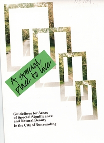
Pamphlet, A Special place to live, 1985 (addendum 1988)
A publication of the City of NunawadingA publication of the City of Nunawading explaining the regulations applying to the Special Residential (Nunawading) Zone No 5. The regulations cover proportions of land which may be built on and identifies trees which must be preserved. An addendum issued in 1988 includes a map of the area and identifies National Trust classified streets in Blackburn and the buffer areas in which less stringent regulations apply.A publication of the City of Nunawadingcity of nunawading, national trust of australia (victoria), special residential (nunawading) zone no. 5, jeffery street, blackburn, laurel grove, linum street, boongarry avenue, hill street, land use, by-laws, town planning, acacia avenue, waratah crescent -
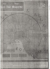 Whitehorse Historical Society Inc.
Article, A Green belt for Melbourne, 1/06/1948 12:00:00 AM
Weekend Magazine of 'The Argus' of 19 June 1948 by Geoffrey HuttonAn article from the Weekend Magazine of 'The Argus' of 19 June 1948 by Geoffrey Hutton calling for a halt to the unending sprawl of Melbourne's suburbs and the creation of a green belt.Weekend Magazine of 'The Argus' of 19 June 1948 by Geoffrey Hutton land use, howard, ebenezer, melbourne, osborn, f.j., webb, (cr), melbourne and metropolitan board of works, tram services, commonwealth scientific and research organisation, victoria. department of agriculture, railways, state electricity commission -
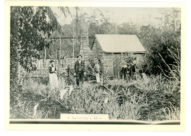 Mt Dandenong & District Historical Society Inc.
Photograph
The Keoghs took up Lot 7 in the Village Settlement in 1905. John Keogh was a big Irishman and cleared many of the giant trees on his Lot 7. They had little water for their crops so grew gooseberries and red currants rather than the more valuable strawberries. Mrs Keogh (nee Cleary) inherited money in 1906 and they built a new weatherboard house. The original bush hut remained as the kitchen. Son James (Jimmie) married Mary Walsh, a teacher at the local school. Jimmie built the small shop on the triangle of land cut off when the CRB road went through. Jimmie and his wife left the district when he joined Victoria Police. Jimmie came back to the area and finally sold the land of Lot 7 to Rimington's Nurseries. He moved his family to Kilsyth. In 1939 the shop was moved across the road to be used as an office by the road builders. It burned down that year.Black and white photograph of a man, woman and young male standing outside a wooden hut. There are crop remnants in the foreground and a wooden paling fence behind the hut. A label on the front reads A SETTLER'S HUT. Reverse of photograph has handwritten description by John Lundy-Clarke.Front: A SETTLER'S HUT Reverse: 1905 Keogh's hut on Falls Road then Main Road. This was later the kitchen of their extended home as described in the narrative "Mountain of Struggle". The figures are - Mrs Keogh. John Keogh settler. Son James Keogh.keogh, john keogh, james keogh, jimmie keogh, mary walsh, cleary, shop, store, gooseberries, rimington's nursery -
Southern Sherbrooke Historical Society Inc.
Council Planning Scheme - Shire of Sherbrooke, "Sherbrooke Planning Scheme 1993", 14-Jul-94
Donated to Southern Sherbrooke Historical Society by Judy Woolfe, Local History Librarian, Eastern Regional Libraries, Belgrave BranchShire of Sherbrooke Planning Scheme, in ring binder, detailing land use zones through the former Shire of Sherbrooke. Two copies.Copy 1: barcode sticker, red "Cancelled" stamp, "031" stamp, "$10.00/Gift/XX/S1" in pencil, stamp "Eastern Regional Library Victoria Australia Received 17 Feb 1995" on first page, sticker on spine "LH/352./96/SHE"/Copy 2: stamp "011" on first page.shire of sherbrooke -
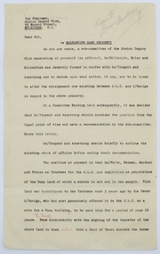 Melbourne Legacy
Letter, Re Balnarring Camp Property, c.1930
Referring to the legal history and transfer of land for the Junior Legacy Club Balnarring camp from Legatee Savige. Melbourne Legacy provided camps for junior legatees - the children of deceased servicemen. It started with outings to the property of Legacy founder, Legatee Stan Savige, who had a place in Balnarring. Permanent camp buildings were built in 1930. Lord Somers (Governor of Victoria) also ran a camp in the area and the area became known as Somers. These documents record the transfer of the land to Legacy. The camps gave the children an opportunity of a summer beach holiday with other Legacy children.An important record of the history of the land owned by Stan Savige that was used for Legacy Camp, it adds to the other material available about Legacy Camp at Somers.White foolscap paper with black typed x 5 pages. Single sided. Black type with red corrections and some grey lead remarks. Addressed to ‘The chairman,/ Junior Legacy Club,/ 55 Market Street,/ Melbourne. C.1. From ‘Yrs Faithfully/ sgd/ J.H. Armstrong and W. A. Tregent. See also collection item 00253. somers camp, properties, land transfer -
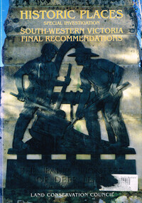 Otway Districts Historical Society
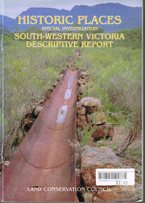
Book, Land Conservation Council, Historic places: special investigation: South-Western Victoria: Final recommendations, January 1997
The Land Conservation Council has carried out an investigation of historic places in public land in South-western Victoria. The report contains the Council's recommendations for the protection, management and future use of more than 700 historic places, out of 2200 places identified during the investigation. The places have been assigned to three categories, A, B and C, representing State, regional and local levels of significance. The report also contains recommendations relating to general historic places management, the processes available in Victoria for the protection of historic places on public land, and Aboriginal historic places.Historic places: Special investigation: South-Western Victoria: Final recommendations. Land Conservation Council. Land Conservation Council; Melbourne (Vic); January 1997. viii, 176 p.; illus.; maps. Soft cover. ISBN 0 7241 9290 5Maps in plastic sleeve.land conservation council; conservation; historic places; public land; aborigines; south west victoria; -
 Otway Districts Historical Society
Book, Land Conservation Council, Historic places: Special investigation: South-Western Victoria: Descriptive report, January 1996
The south-west of Victoria, possessing a rich heritage of the signs of past human activity, is fertile ground for an investigation of historic places on public land. This report includes an initial inventory of almost 2000 places. The report outlines the history and the related heritage of the area, describes in some detail its biophysical attributes and introduces the natural resources and present land use. This information provides a context for understanding the origins of the historical features that are observes today.Historic places: Special investigation: South-Western Victoria: Descriptive report. Land Conservation Council. Land Conservation Council; Melbourne (Vic); January 1966. viii, 180 p.; illus.; maps. Soft cover. ISBN 0 7241 9288 3Maps in plastic sleeve.land conservation council; conservation; south-western victoria; historic places; -
![Vehicle - HMAS Lonsdale [HMVS], Built in 1884](/media/collectors/4f729f7e97f83e03086018d1/items/4fd575aa2162ef0ecc023165/item-media/613b16c26b487cd5e2ab7cba/item-fit-380x285.jpg) Queenscliffe Maritime Museum
Queenscliffe Maritime MuseumVehicle - HMAS Lonsdale [HMVS], Built in 1884
Transported to Victoria as deck cargo aboard s.s. Port Darwin. This vessel was ordered by Government of Victoria and was only used in training exercises in Port Philip and had become outmoded by the time the Royal Australian Navy was formed in 1911.Buried by sand in the grounds of the Queenscliffe Maritime Museum. There is no known record of how the "Lonsdale" ended abandoned on the beach at Queenscliff. Originally the land where the QMM is situated was the foreshore at the back of the houses in Beach Street, Queenscliff. There were two Torpedo boats built in 1884, the Lonsdale and the Nepean.Site of the buried remains of the Torpedo Boat HMAS Lonsdale [HMVS]hmas lonsdale, hmvs lonsdale, victorian navy, port phillip, royal australian navy -
 Bendigo Historical Society Inc.
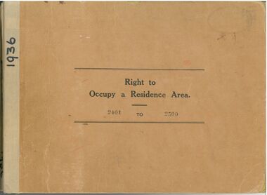
Administrative record - Right to Occupy Certificates
Ten books containing stubs of Right to Occupy Certificates for 1936. Includes name and address of person receiving the Right to Occupy certificate and the description of the land including allotment, Section, City, Town, Borough or Township and Parish name. Two blue covered books used for Substitute Right to occupy certificates. One book, stubs only, dated 1976 - 1981. One with four stubs dated 1981 - 1983. Four stapled bundles of stubs dated 1937 - 1971 issued for Replacement Rights. Includes names and Receipt numbers. Yellow foolscap sheet Listing reord numbers of Rights issued during 1936 and 1937.Some items have pencil and pen marks and ink stains.right to occupy, central victoria -
 Kew Historical Society Inc
Plan, Melbourne & Metropolitan Board of Works : Borough of Kew : Detail Plan No.1576, 1904
The Melbourne and Metropolitan Board of Works (MMBW) plans were produced from the 1890s to the 1950s. They were crucial to the design and development of Melbourne's sewerage and drainage system. The plans, at a scale of 40 feet to 1 inch (1:480), provide a detailed historical record of Melbourne streetscapes and environmental features. Each plan covers one or two street blocks (roughly six streets), showing details of buildings, including garden layouts and ownership boundaries, and features such as laneways, drains, bridges, parks, municipal boundaries and other prominent landmarks as they existed at the time each plan was produced. (Source: State Library of Victoria)This plan forms part of a large group of MMBW plans and maps that was donated to the Society by the Mr Poulter, City Engineer of the City of Kew in 1989. Within this collection, thirty-five hand-coloured plans, backed with linen, are of statewide significance as they include annotations that provide details of construction materials used in buildings in the first decade of the 20th century as well as additional information about land ownership and usage. The copies in the Public Record Office Victoria and the State Library of Victoria are monochrome versions which do not denote building materials so that the maps in this collection are invaluable and unique tools for researchers and heritage consultants. A number of the plans are not held in the collection of the State Library of Victoria so they have the additional attribute of rarity.Original survey plan, issued by the MMBW to a contractor with responsibility for constructing sewers in the area identified on the plan within the Borough of Kew. The plan was at some stage hand-coloured, possibly by the contractor, but more likely by officers working in the Engineering Department of the Borough and later Town, then City of Kew. The hand-coloured sections of buildings on the plan were used to denote masonry or brick constructions (pink), weatherboard constructions (yellow), and public buildings (grey). Development in the 20th century has irreparably altered that part of Kew represented in this plan. In the block bounded by Cotham Road, Charles Street, Wellington Street and Gellibrand; just one house standing in 1903 remains. This block included two of the most historic houses in Kew: ‘Ordsall’ (later ‘Southesk’) and ‘Madford’ (previously ‘Elm Lodge’). Ordsall was the home of the second chairman of Kew, John Halfey. It contained some of the most significant interior murals in Kew, created for Halfey by artists working for Cullen & Co. It was demolished in 1960 to make way for the Kew Civic Centre. Elm Lodge had been built for William Siddeley in ca. 1864. Arthur Septimus King purchased it in 1874. The lower paddocks of Madford were sold in 1905 by his wife to the Borough of Kew and, after landscaping by George and Thomas Pockett, opened as the Alexandra Gardens in 1908. Elm Lodge/Madford was in 1922 to become St. Anthony’s Home for Little Children before its subsequent demolition in the 1980s.melbourne and metropolitan board of works, detail plans, maps - borough of kew, mmbw 1576, cartography -
 Kew Historical Society Inc
Plan, Borough of Kew Detail Plan No.1577, 1904
The Melbourne and Metropolitan Board of Works (MMBW) plans were produced from the 1890s to the 1950s. They were crucial to the design and development of Melbourne's sewerage and drainage system. The plans, at a scale of 40 feet to 1 inch (1:480), provide a detailed historical record of Melbourne streetscapes and environmental features. Each plan covers one or two street blocks (roughly six streets), showing details of buildings, including garden layouts and ownership boundaries, and features such as laneways, drains, bridges, parks, municipal boundaries and other prominent landmarks as they existed at the time each plan was produced. (Source: State Library of Victoria)This plan forms part of a large group of MMBW plans and maps that was donated to the Society by the Mr Poulter, City Engineer of the City of Kew in 1989. Within this collection, thirty-five hand-coloured plans, backed with linen, are of statewide significance as they include annotations that provide details of construction materials used in buildings in the first decade of the 20th century as well as additional information about land ownership and usage. The copies in the Public Record Office Victoria and the State Library of Victoria are monochrome versions which do not denote building materials so that the maps in this collection are invaluable and unique tools for researchers and heritage consultants. A number of the plans are not held in the collection of the State Library of Victoria so they have the additional attribute of rarity.Original survey plan, issued by the MMBW to a contractor with responsibility for constructing sewers in the area identified on the plan within the Borough of Kew. The plan was at some stage hand-coloured, possibly by the contractor, but more likely by officers working in the Engineering Department of the Borough and later Town, then City of Kew. The hand-coloured sections of buildings on the plan were used to denote masonry or brick constructions (pink), weatherboard constructions (yellow), and public buildings (grey). MMBW Plan No.1577 includes some of the most significant houses in Kew: Herbert Henty’s ‘Roxeth’ (now part of Trinity Grammar), ‘Butleigh Wooton’, ‘Bokara’ and ‘Harrow’. It also includes the streets that have since changed their names. That part of College Parade linked to Glenferrie Road is now named College Place, College Parade now extends further north, and Charles Street did not yet reach Barkers Road. Roxeth is one of a number of Henty houses in Kew. Herbert Henty made his home here and was elected a member of Kew Municipal Council in 1864 and mayor in 1868-69. Walter Henry Serle, of Harrow served in the First World War. He was awarded the Military Medal ‘’For conspicuous bravery and devotion to duty. On 29th September near BELLICOURT he showed the greatest bravery and determination when his platoon was attacked by enemy bombing parties. It was due largely to his personal efforts that all the attacks were repulsed. Until wounded, his utter disregard of personal safety and boldness in dealing with the attacks were the means of saving the situation and were an inspiring example to his men.’melbourne and metropolitan board of works, detail plans, maps - borough of kew, mmbw 1577, cartography -
 Kew Historical Society Inc
Plan, Melbourne & Metropolitan Board of Works : Borough of Kew : Detail Plan No.1578, 1904
The Melbourne and Metropolitan Board of Works (MMBW) plans were produced from the 1890s to the 1950s. They were crucial to the design and development of Melbourne's sewerage and drainage system. The plans, at a scale of 40 feet to 1 inch (1:480), provide a detailed historical record of Melbourne streetscapes and environmental features. Each plan covers one or two street blocks (roughly six streets), showing details of buildings, including garden layouts and ownership boundaries, and features such as laneways, drains, bridges, parks, municipal boundaries and other prominent landmarks as they existed at the time each plan was produced. (Source: State Library of Victoria). This plan forms part of a large group of MMBW plans and maps that was donated to the Society by the Mr Poulter, City Engineer of the City of Kew in 1989. Within this collection, thirty-five hand-coloured plans, backed with linen, are of statewide significance as they include annotations that provide details of construction materials used in buildings in the first decade of the 20th century as well as additional information about land ownership and usage. The copies in the Public Record Office Victoria and the State Library of Victoria are monochrome versions which do not denote building materials so that the maps in this collection are invaluable and unique tools for researchers and heritage consultants. A number of the plans are not held in the collection of the State Library of Victoria so they have the additional attribute of rarity.Original survey plan, issued by the MMBW to a contractor with responsibility for constructing sewers in the area identified on the plan within the Borough of Kew. The plan was at some stage hand-coloured, possibly by the contractor, but more likely by officers working in the Engineering Department of the Borough and later Town, then City of Kew. The hand-coloured sections of buildings on the plan were used to denote masonry or brick constructions (pink), weatherboard constructions (yellow), and public buildings (grey). MMBW Plan No.1578 is significant in that it defines the extent of two private schools: Xavier College and Kew High School (now part of Trinity Grammar) by 1904. In relation to the latter, the plan clarifies which buildings the High School operated from behind the mansion ‘Molina’. Established in 1902, Trinity Grammar was to later lease and subsequently buy Molina (now ‘Merritt House’) and ‘Elsinore’ (now ‘Roberts House’). Xavier College had been established in 1872. This 1904 plan delineates the West Wing and the Great Hall (built in 1890).melbourne and metropolitan board of works, detail plans, maps - borough of kew, mmbw 1578, cartography -
 Kew Historical Society Inc
Plan, Melbourne & Metropolitan Board of Works. Borough of Kew Detail Plan No.1579, 1904
The Melbourne and Metropolitan Board of Works (MMBW) plans were produced from the 1890s to the 1950s. They were crucial to the design and development of Melbourne's sewerage and drainage system. The plans, at a scale of 40 feet to 1 inch (1:480), provide a detailed historical record of Melbourne streetscapes and environmental features. Each plan covers one or two street blocks (roughly six streets), showing details of buildings, including garden layouts and ownership boundaries, and features such as laneways, drains, bridges, parks, municipal boundaries and other prominent landmarks as they existed at the time each plan was produced. (Source: State Library of Victoria). This plan forms part of a large group of MMBW plans and maps that was donated to the Society by the Mr Poulter, City Engineer of the City of Kew in 1989. Within this collection, thirty-five hand-coloured plans, backed with linen, are of statewide significance as they include annotations that provide details of construction materials used in buildings in the first decade of the 20th century as well as additional information about land ownership and usage. The copies in the Public Record Office Victoria and the State Library of Victoria are monochrome versions which do not denote building materials so that the maps in this collection are invaluable and unique tools for researchers and heritage consultants. A number of the plans are not held in the collection of the State Library of Victoria so they have the additional attribute of rarity.Original survey plan, issued by the MMBW to a contractor with responsibility for constructing sewers in the area identified on the plan within the Borough of Kew. The plan was at some stage hand-coloured, possibly by the contractor, but more likely by officers working in the Engineering Department of the Borough and later Town, then City of Kew. The hand-coloured sections of buildings on the plan were used to denote masonry or brick constructions (pink), weatherboard constructions (yellow), and public buildings (grey). While MMBW Plan No.1579 does not include many buildings, those that it does show are significant to Kew’s history. These include the ‘Kew [Railway] Station’ in Denmark Street and the ‘Recreation Hall’ and rear courts off Wellington Street. The plan shows the outline of the Recreation Hall, constructed in 1880, at the rear of which is listed a bowling green, two tennis courts, a ‘skittle alley’ and a pavilion. When the Hall was first built, the Kew Cricket Club occupied an adjacent ground, however in 1885 this was acquired by the State Government as the future location of the Kew Railway Station. The Plan also shows a single oval at Xavier College. This oval was completed in 1883. One of the current ovals conforms to this oval’s original shape and position in the school grounds.melbourne and metropolitan board of works, detail plans, maps - borough of kew, mmbw 1579, cartography