Showing 2047 items matching " building plans"
-
 Bendigo Historical Society Inc.
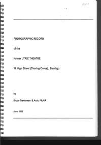
Document - PHOTO RECORD OF THE FORMER LYRIC THEATRE
Spring bound photographic record of the former Lyric Theatre, 19 High Street (Charing Cross), Bendigo, by Bruce Trethowan, B.arch, FRAIA, dated June, 2005. A letter in the front of the document mentions as part of the Bendigo Bank Development, it was necessary to demolish the former Lyric Theatre. Before doing so, the Bank commissioned a heritage architect to produce a photographic record of the building. It is addressed to Mr Jim Evans, President, Bendigo Historical Society and dated 10 August 2005. The beginning has the Historical Background, Building Description and three pages of Plans and Elevations. There are sixty colour photographs of the building depicting the front outside of the building, other outside photos and a number of the interior.buildings, commercial, former lyric theatre, photographic record of the former lyric theatre, bruce trethowan, gallagher jeffs consulting, gallagher jeffs pty ltd, jim evans, bendigo bank development, ted gallagher, richard hasseldine, city of greater bendigo planning department, keogh & austen, state savings banks, sydney smith and ogg, godfrey and spowers, colonial life building, johnson morley warehouse, j g austen, muioof building eaglehawk, george austen, backhaus building, allawah, william cowling, taylor, soilleux, overend, plaza theatre, backhaus trust, princess theatre, the annals of bendigo vol 8 p163, the annals vol 8 p180, fernwood women's health club, bendigo real estate -
 Bendigo Historical Society Inc.
Document - HERITAGE REPORT: FORMER POLICE STATION AND QUARTERS: CALIFORNIA GULLY
Seventeen page Heritage Place Report on the Former California Gully Police Station at 15 Thorpe Street, California Gully. It is the former police station and quarters, former timber stables and timber cottage residence demolished and horse paddock on separate title. Report includes a Statement of Significance, Place History (History of the Area), Policing California Gully Goldfields, History of the Buildings, Chronology of Ownership, Rate Books 1858, - 1867 - 1868, 1895 Borough of Eaglehawk Rates, 1922 Voters Roll, 1952 & 1962 Sands & McDougall Directory Thorpe St California Gully, Comparable Examples, Secondary Sources, Description Conservation Policy Guidelines (Specific), Physical Conditions, Physical Description 1, Map of Early Photo Location, Bendigo Parish Plan circa 1870, Certificate of Title 1950 & 1960. Pge 14 has plans, maps and an aerial photo of 15 Thorpe Street. Page 15 has an aerial photo of 15 Thorpe Street, California Gully with Allotment Size. Page 16 & 17 has photos.heritage, heritage report - former police station and quarters - california gully, city of greater bendigo, wilson & ass, butler, amanda jean, johnson reef shafts no 1 & 2, rose of denmark, princess dagmar, bendigo amalgamated goldfields company, captain frederick standish, royal irish constabulary, e thorpe, campbell, taylor, watson, brown, hosken, mckowne, mcqualter, parker, hicks, eaglehawk municipal council, victorian police force, d bannear, historic mining sites in the sandhurst eaglehawk and raywood mining divisions, department of conservation and natural resources, joshua thorpe, thorpe & co, johnson & co, william thorn, michael thomas, james murdock, edward c brown, francis youlden, gold escort, water police, mounted police, city police (melbourne), geelong police, gold fields police, rural bench constabulary, the people's force, robert haldane, n wild, streets of the borough of eaglehawk, police registration act, william henry mitchell, camp hotel, j o c nieman, j m catarach, g w hosken, margaret hosken nee mckown, majorie alice mcqualter, kellie anne mcqualter, adam joseph doolan, mr hicks, sands & mcdougall, hill george, meeking howard, mcewan frank a, jinks stanley, mccaig mrs eleanor, gordon john l, mcqualter mrs adeline, maher william l, raynor robert, flack john p, whitehead miss a, sang george t, linddsay john p, dyer henry, jackman george a, tibbetts mrs s a, hosken mrs margaret winifred nee mckowne, chaplin frank w, wilson c e, wright george, miller g a, sheyhill basil hugh, marshall r, miles j h, parker w b, barkla w g, nicholls les, cartledge clifford william, cole charles basil, farmers citizens trustees co, bev hanson -
 Bendigo Historical Society Inc.
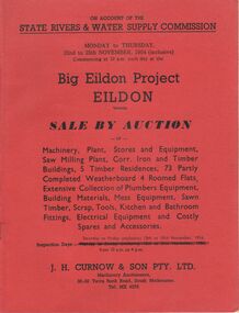
Document - IAN DYETT COLLECTION: AUCTION CATALOGUE - BIG EILDON PROJECT
Two red covered auction catalogues for an auction on account of the State Rivers & Water Supply Commission on the 22nd to 25th November, 1954 (inclusive) held at the Big Eildon Project, Eildon, Victoria. Lots sold include Machinery, plant, stores and equipment, Saw Milling Plant, corr. Iron and timber buildings, 5 timber residences, 73 partly completed weatherboard 4 roomed flats, extensive collection of plumbers equipment, building materials, mess equipment, sawn timber, scrap, tools, kitchen and bathroom fittings, electrical equipment and costly spares and accessories. Catalogue has a Locality Plan of Eildon, photo, locality and description of the Eildon Sawmill. Photos of completed houses, incomplete flats and plan showing layout of flat unit, photo of flat block (Completed). Also Building Kits - Designs and Component Lists.business, auctioneers, j h curnow & son pty ltd, ian dyett collection - auction catalogue - big eildon project, state rivers & water supply commission, j h curnow & son pty ltd, eildon sawmill, prahran telegraph printing co -
 Bendigo Historical Society Inc.
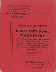
Document - IAN DYETT COLLECTION: AUCTION CATALOGUE - WHITE SWAN RESERVOIR
Three auction catalogues, two with red covers and the third is missing the cover. Sale of Earth Moving Machinery. Spare Parts, Machine Tools, Motor Trucks, Engineering Plant, Concrete Mixing and Batching Plant, Air Compressor Plants, Buildings, Stores and Costly Equipment on 31st March to 5th April 1952 (inclusive) at the White Swan Reservoir, Ballarat, Victoria. J. H. Curnow & Son Pty. Ltd. Were the auctioneers. Included in the catalogue is a Locality Plan showing location of lot areas - access roads, etc. Page 4 has a black and white photo showing Super c Tournapull, Lot 63 and Tractor hauling 12-15 cub. Yd. capacity scoop. Page 9 photo is Lot 209, a Sheep's Foot Roller, Page 12 photo is Lots 258, 259 & 260 - Class 1 tractor hauling two 12-15 c yd Te Tourneau Scrapers, and page 68 has a black & white photo of Lot 2377, the Concrete Batching Plant.business, auctioneers, j h curnow & son pty ltd, ian dyett collection - auction catalogue - white swan reservoir, the ballarat water commissioners, j h curnow & son pty ltd, prahran telegraph printing co -
 Bendigo Historical Society Inc.
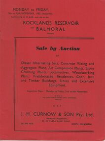
Document - IAN DYETT COLLECTION: AUCTION CATALOGUE - ROCKLANDS RESERVOIR
Red covered catalogue for a Sale by Auction at Rocklands Reservoir near Balmoral, Vic. On the 9th to 13th November, 1953 (inclusive). For sale are Diesel Alternating Sets, Concrete Mixing and Aggregate Plant, Air Compressor Plants, Stone Crushing Plants, Locomotives, Woodworking Plant, Prefabricated Residences, Corr. Iron and Timber Buildings Stores and Extensive Equipment by order of The State Rivers & Water Supply Commission, Melbourne. Pasted in the front of catalogue is a slip to write name, address and phone number on and to give to clerk when making their first purchase. A typed note loose in the front of catalogue mentions that the time for removal of houses and buildings has been increased from four weeks to three months and goods would be at purchaser's own risk after time of sale. Descriptions of some of the items for sale. Catalogue has Ground Plans of the eight different residential houses. J. H. Curnow & Son Pty. Ltd. Were the auctioneers.business, auctioneers, j h curnow & son pty ltd, ian dyett collection - auction catalogue - rocklands reservoir, the state rivers & water supply commission, j h curnow & son pty ltd, balmoral combined women's associations, prahran telegraph printing co -
 Bendigo Historical Society Inc.
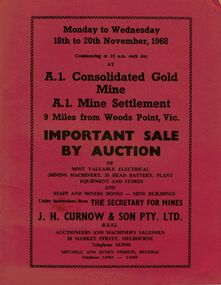
Document - IAN DYETT COLLECTION: AUCTION CATALOGUE - A1 CONSOLIDATED GOLD MINE
Three red covered auction catalogues for a sale on the 18th to 20th November, 1968 at the A.1. Consolidated Gold Mine A.1. Mine Settlement, 9 Miles from Woods Point, Vic. For sale was Most Valuable Electrical Mining Machinery, 20 Head Battery, Plant Equipment and Stores and Staff and Miners Homes - Mine Buildings Under Instruction from The Secretary for Mines. Also for sale was the Lease No. 8317 Beechworth. Catalogue has a Sketch Plan showing Mine Property.business, auctioneers, j h curnow & son pty ltd, ian dyett collection - auction catalogue - a1 consolidated gold mine, the secretary for mines, j h curnow & son pty ltd, f c dyett, l c osborne, clem hill, t apps, bolton's print -
 Queenscliffe Maritime Museum
Plan - Plan for a tide gauge house
An extract from the Board of Land and Works building estimates for 1858 shows an allocation of 500 Pounds for the construction of Tide Gauge Houses at various places. A copy of this plan was obtained from the Hydrographic Survey Office in Queenscliff. https://www.parliament.vic.gov.au/papers/govpub/VPARL1857-58NoB1.pdfCopy of a plan for a tide gauge house at Queenscliff 1858Clerk of works office Geelong 27 July 1858queenscliff, tide gauge house, plan -
 Bendigo Historical Society Inc.
Document - Bendigo Home and Hospital for the Aged, 1860-1970s
The inaugruration of the newly erected Benevolant Asylum took place on 15th March 1860. The asylum is situated on the west side of Commissioner's Gully, Barnard Street, Bendigo. The building itself is the design of Mr Robert A. Love, Architect, the Contractor is Mr Crawford and the Clerk of Works, Mr Wrigley. - from the Bendigo Advertiser 16th March 1860. In the Advertiser Dec 20 1872: the Memorial Stone was added and the design for the front elecvation was carried out as origionally planned with 12 columns of brick and cement each 36 feet high, the bases of which are granite. Typed History of the hospital, and letters regarding classification status and two A4 sized photos of the front of the building.history, national trust bendigo collection, bendigo, benevolant home bendigo, benevolant asylum bendigo, home and hospital for the aged bendigo, ann caudle centre bendigo -
 Bendigo Historical Society Inc.
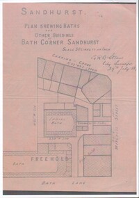
Document - Plan of Buildings and Baths at Bath corner, 19/09/2023
... Plan of Buildings and Baths at Bath corner. ...Photographic copy of Shop layout at Bath corner Sandhurst (Charing Cross, Mitchell Street & Bath Lane); including Men's and Women's public baths dated 29 July 18??Includes singed GRB Steane, City Surveyor 29th July 18??city baths, bath corner, charing cross -
 Bendigo Historical Society Inc.
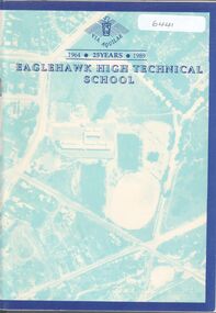
Booklet - Eaglehawk High Technical School, Eaglehawk High Technical School, 1989
64-page booklet - Celebrating 25 years (1964-1989) of the Eaglehawk Technical School. Includes B&W photos of students, staff, buildings and Principals. List of Staff in April 1989 given on p.64. Compiled by Wendy Badman, John Foster, Ian Hamilton, Clare Miszczuck, Geoff Paynter. Inside front cover is an A4 sheet of a Reunion program with a plan of the school. Also, an invitation to the silver Jubilee celebration Inside front cover are 5 signatures. R G Paynter (Deputy Principal), C E Miszczuck, Wendy Badman, Ian Hamilton, one undicipherableeaglehawk high technical school, silver jubilee reunion -
 Bendigo Historical Society Inc.
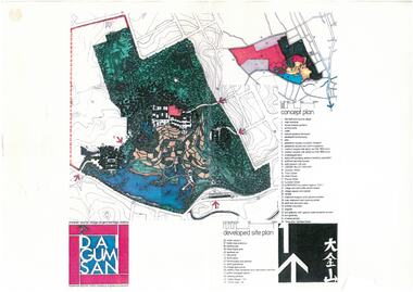
Document - Dai Gum San Concept Plans - Chinese Tourist Village Bendigo Victoria, 1980s
During the first goldrush of the 1850s, Chinese miners referred to the Bendigo region (then Sandhurst) as Dai Gum San 大金山 - literally 'Big Gold Mountain'. The Golden Dragon Museum is situated in the city of Bendigo, Victoria, Australia. The museum is dedicated to the culture and history of Chinese Australians, particularly in the region. Built on the historical site of one of Bendigo's Chinatowns, the museum's precinct also includes Chinese Gardens and a temple to Kuan Yin. Through the museum accreditation program, it was the first accredited museum in Victoria and opened in 1991. These plans are the original plans before the the Golden Dragon Museum was built on its current site.Dai Gum San Concept Plans - Chinese Tourist Village Bendigo Victoria - 4 Sheets in colour by Stephenson and Turner Victoria Architects and Planners Sheet 1 Concept Plan and Developed Site Plan Sheet 2 Arts and Crafts Buildings Sheet 3 Restaurant, Historical Museum and Temple Complex Sheet 4 Motelhistory, bendigo, eaglehawk, chinese, chinese museum, dai gum san -
 Bendigo Historical Society Inc.
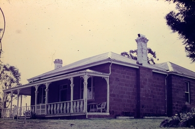
Slide - Adelaide Vale Homestead Fosterville
Adelaide Vale Homestead was begun in 1853 by John Harvey and was later occupied by Edward and Andrew O'Keefe. The building comprises a series of single storey stone buildings arranged behind a simple composed, verandah facade with a centrally located doorway flanked by windows. A central corridor leads from this doorway to a transverse corridor which was probably once an open breezeway. A free- standing octagonal pavilion is located close to the house. This is an interesting homestead dating from early times and constructed of local stone. The front facade is typically composed and the plan reflects the continuous growth of the property throughout the nineteenth century. The octagonal pavillion is a significant and unusual feature. The homestead is picturesquely sited and overlooks the Campaspe River valley, the Burke and Wills expedition camped nearby on their ill-fated expedition north. The old cheese factory is the sole survivor of the once extensive out-buildings. Some of the nineteenth century buildings have been demolished and there have been some later additions and alterations, notably an extensive side wing added in the 1920's. [In Butcher & Flanders, Bendigo Historic Buildings, 1987, the date of the house is given as 1868. Presumably this house replaced an older one on the property.]Adelaide Vale Homestead Fostervillehistory, bendigo, national trust collection bendigo, adelaide vale homestead -
 Bendigo Historical Society Inc.
Document - LYDIA CHANCELLOR COLLECTION: PROPOSED SUNDAY SCHOOL PLAN
A fragile plan rolled in a cardboard tube. Titled 'Proposed Sunday School Russell Street Quarry Hill. For Trustees of Wesleyan Church.'buildings, church, wesleyan church quarry hill, lydia chancellor, collection, uniting church, wesleyan church, quarry hill, sunday school, building, buildings, community, architecture, place -
 Bayside Gallery - Bayside City Council Art & Heritage Collection
Map, H.B. Foot, Plan of the Brighton Estate containing 5120 acres, first special survey at Port Phillip, c. 1842
This plan records the Brighton Estate, also known as Dendy's Special Survey. In 1840 Henry Dendy, a farmer in Surrey, England acquired a "Special Survey" from the Commissioners for Land and Emigration which gave him the right to choose land in Port Phillip for the low price of £1 per acre for 5120 acres. Dendy appointed Jonathan Binns Were, as his agent, who later became a partner. Together, Dendy and Were decided on an area 5 miles south from Melbourne, bounded by North Road, East Boundary Road, South Road and to the west by Port Phillip Bay. Their Brighton Estate was first surveyed by T. S. Townsend in May 1841 and was re-surveyed by Robert Hoddle. Dendy and Were were making plans to sell the land and advertised a 30-guinea prize for the best subdivision which was to be divided into a village, marine residences, suburban and cultivation allotments, with the remainder being divided into country sections. The competition was won by H.B. Foot, who planned the village around a reserve and crescents and a 'green belt' forming the town boundary. brighton estate, dendy's special survey, special survey, henry dendy, jonathan binns were, w.b. were, survey, plan, map, brighton, george ward cole, baker's lithographer, hibernian, subdivision, town planning, cartographic material, h.b. foot -
 Bayside Gallery - Bayside City Council Art & Heritage Collection
Map - print, Melbourne and Metropolitan Board of Works, Interim development order: Brighton, Moorabbin and Sandringham, 1959
The Melbourne and Metropolitan Board of Works (now Melbourne Water) was established in 1891. From that time, as part of their work laying water and sewerage connections, they created detailed plans of houses and other buildings in the Melbourne metropolitan area. In 1956 it acquired powers to construct and maintain highways and bridges, protect and improve the foreshores and create and maintain parks within the metropolitan region. This Interim development order comprises part of the municipalities of Brighton, Moorabbin and Sandringham and was made on 20 October 1959.brighton, moorabbin, sandringham, melbourne and metropolitan board of works, map, town planning, cartographic material, interim development order, bayside -
 Bendigo Historical Society Inc.
Document - Application for a Building Permit, 1959
Parry CollectionApplication for a Building Permit for 26 Raglan Street Bendigo 1. Application for Permit to the City of Bendigo by Mr J Parry 3 Yandoit St Bendigo for a cement shed as detailed. The receipt is attached for 10 shillings. 2. Hand Drawn plan of the laundry (Shed) proposed for Mr J Oudijn, scale 1/4 inch = 1 foot, signed and stamped by the City of Bendigo.history, bendigo, j s parry collection, city of bendigo building permit -
 Bendigo Historical Society Inc.
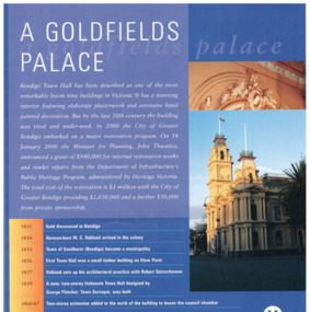
Pamphlet - Bendigo Town Hall Self Tour and conservation timeline brochure, 2003
Parry Collection In 2003, the Bendigo Town Hall was returned to its 19th-century splendour after an extensive restoration and renovation program including plasterworks, murals and gold leaf worked by artists and artisans. The original Bendigo Town Hall was designed in 1859 by Bendigo's town clerk, George Avery Fletcher. A council chamber was added in 1866 and a hall for the trading of grain, known as the Corn Exchange, was added in 1871-72. Although the architecture of the additional buildings adhered to that of the original building, the completed building was unpopular with both the citizens and council of the era. In a series of major works from 1878 to 1902 the Bendigo Town Hall was transformed by the architect William Vahland who was given the task of converting the hall into something worthy of Bendigo's leading position as the "City of Gold".[2] His work included extensive new offices, enlargement of the main hall and council chambers, the introduction of an interior decorative scheme, a clock tower and mansard roof. The exterior facades were also remodelled in the classical style. Vahland commissioned Otto Waschatz, who had just decorated the Royal Palace in Copenhagen, Denmark, to design the hall's interior which featured decorative plaster adorned with 22-carat gold leaf, reflecting the opulence of the "city built on gold". The end result, completed in 1885, was one of Vahland's most significant works and has been considered the finest "boom style" building of its kind in Victoria.Bendigo Town Hall Self Tour and conservation timeline brochure. 1. A yellow paper map with the history of the town hall on one side and a self guide tour and plans on the other side. 2. A glossy 4 page guide to the history of the town hall and timeline.history, bendigo, merle lummis collection, bendigo town hall -
 Bendigo Historical Society Inc.
Magazine - Magazines and brochures
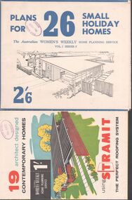
BHS Collection.Eight magazines and brochures. Titles are: Australian House and Garden book of Small Home plans, Best Homes, New horizons in houses, 19 Architect designed contemporary homes, 22 specially selected home plans, Plans for 26 small holiday homes, The Australian Women's weekly's home planning service 28 home plans and an advertising brochure for Daniel Robertson.Phillip Ellison name on several books, and the stamp of the State School No. 1008 Axedale on four others.homes, building -
 Bendigo Historical Society Inc.
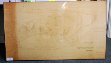
Map - CONTOUR PLAN OF THE GOVERNMENT CAMP SANDHURST 1854, 1994
Contour map (copy) of the Government Camp Sandhurst, 1854. Map is mounted on coreflute and laminated. Written in bottom righthand corner 'Contour Plan of the Government Camp, Sandhurst. Dec 1854. Signed by Richard Larritt, Assistant Surveyor, 11th December 1854.' Shown on map: Pall Mall, Bendigo Creek, Commissioner's Gully, View Place (now View Street), Post Office, Bank of Victoria, District Surgeon, Sandhurst Fire Brigade, Police Hospital, Flagstaff, Gold Office, License Shed, Military Barracks, Stables, Commissioner's Buildings, Police Office. Old Cemetery, Garden. Reference on righthand side: 'Stone or brick buildings are tinted in crimson. Wooden buildings tinted in Indian Ink. Tents and other temporary structures tinted in Burnt Sienna.' Scale of Chains, on bottom of map. Sticker on bottom left hand corner and back of map ' Presented by Survey and Mapping, Victoria, 7th Octber, 1994'.map, bendigo, government camp, pall mall, bendigo creek, commissioner's gully, view place (now view street), post office, bank of victoria, district surgeon, sandhurst fire brigade, police hospital, flagstaff, gold office, license shed, military barracks, stables, commissioner's buildings, police office. old cemetery, garden. , survey and mapping victoria. sandhurst, bendigo. -
 Bendigo Historical Society Inc.
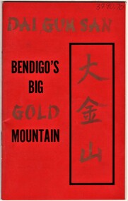
Document - AULSEBROOK COLLECTION: BENDIGO'S BIG GOLD MOUNTAIN TOURIST BOOKLET, 1974
Aulsebrook Collection: Bendigos Big Gold Mountain Tourist Booklet -A5 red cover, 31 pages, -extensive descriptions of Chinese buildings and heritage in Bendigo -Coloured images, -future prospects and plans for Chinese History tourism in Bendigo -
 Buninyong & District Historical Society
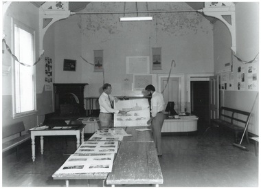
Photograph - Original Photograph and photocopy, Ballarat Courier, Interior Buninyong Court House in 1986 prior to restoration, 1986
Building historyB/W photo interior of Buninyong Court House, prior to restoration, Feb. 1986, with Shire Secretary Alan Helyer discussing plans with Deputy Engineer Bob Wiseman.Identification on reverse.buninyong, courthouse, sgire council -
 Kew Historical Society Inc
Plan, Melbourne & Metropolitan Board of Works : Contour Plan of Melbourne & Suburbs : Melbourne Sewage, 1894
The Melbourne and Metropolitan Board of Works (MMBW) plans were produced from the 1890s to the 1950s. They were crucial to the design and development of Melbourne's sewerage and drainage system. This plan forms part of a large group of MMBW plans and maps that was donated to the Society by the Mr Poulter, City Engineer of the City of Kew in 1989. Within this collection, thirty-five hand-coloured plans, backed with linen, are of statewide significance as they include annotations that provide details of construction materials used in buildings in the first decade of the 20th century as well as additional information about land ownership and usage. The copies in the Public Record Office Victoria and the State Library of Victoria are monochrome versions which do not denote building materials so that the maps in this collection are invaluable and unique tools for researchers and heritage consultants. A number of the plans are not held in the collection of the State Library of Victoria so they have the additional attribute of rarity.Digital copy of an original MMBW plan. This contour plan shows the area identified by the MMBW for purposes of drainage and sewerage in 1894. The suburbs represented extend from Williamstown in the west to Bulleen in the east, and from Preston in the north, south to Sandringham. Suburbs are outlined in coloured ink. Red lines indicate main and branch sewers in existence at the beginning of 1894 in central and inner Melbourne. These extended as far as Williamstown and Brighton, but not yet as far as Kew, where sewering did not commence until 1901. Contour lines show the topography, which was important for indicating the fall of the land for the laying of sewers and drainage channels. Kew appears to be fairly undeveloped at this date except for railway lines and stations (the Kew and Outer Circle lines), main roads, the Kew Lunatic Asylum Reserve and Studley Park. However, the contour plan does not accurately represent the density of settlement, nor the large number of houses, which were being built in Kew and other suburbs from the 1850s to the land boom of the late 1880’s and early 1890’s. This plan is part of a large and historically significant group of MMBW plans and maps that was donated to the Society by the Mr Poulter, City Engineer of the City of Kew in 1989.mmbw contour plan of melbourne and suburbs, melbourne and metropolitan board of works, melbourne sewage, cartography -
 Kew Historical Society Inc
Plan - Subdivision Plan, J R Mathers & McMillan, Myrtle Hill Estate, East Kew, circa 1949, c.1949
The Kew Historical Society's map collection includes a substantial number of real estate subdivision plans, mainly of Kew but also of surrounding suburbs in Melbourne. Most of the subdivision plans date from the 1920s and 1930s when the districts old homes and local farmland were being split up to accommodate residential growth in the postwar period. These early plans were assembled by a local firm, Jas R Mather & McMillan, which had an office in Cotham Road. Many of the plans, and sometimes photos, were annotated by the agents.Subdivision plans are historically important documents used as evidence for the growth of suburbs in Australia. They frequently provide information about when the land was sold as well as evidence relating to surveyors and real estate and financial agents. The numerous subdivision plans in the Kew Historical Society's collection represent working documents, ranging from the initial sketches made in planning a subdivision to printed plans on which auctioneers or agents listed the prices for which individual lots were sold. In a number of cases, the reverse of a subdivision plan in the collection includes a photograph of a house that was also for sale by the agent. These photographs provide significant heritage information relating house design and decoration, fencing and household gardens.The photograph may also be aesthetically significant depending on the importance of the photographic atelier.Myrtle Hill, at 14 Vista Avenue, Kew, is of local historical and architectural significance as a good example of a large and imposing single-storey Italianate house of the early 1870s surviving in Kew. Originally sited on a large allotment overlooking Normanby Road, the setting of the house has been dramatically altered through extensive subdivision and development. The subdivision plan of the ‘Myrtle Hill Estate’ indicates that in one such subdivision, 11 allotments were created fronting Bowyer Avenue, Myrtle Avenue, and Normanby Road. The outline and building profile of Myrtle Hill is shown on the west side of Bowyer Avenue.The full (typed) title of this subdivision plan is :"Plan of SUBDIVISION of part of CROWN PORTION 83. / at KEW / PARISH OF BOROONDARA. / COUNTY OF BOURKE". / "MYRTLE HILL ESTATE / EAST KEW" In addition to the Title and subtitle, the plan also lists the advantages of the subdivision. -
 Kew Historical Society Inc
Plan - Subdivision Plan, Winton Estate, East Kew : Sale of 10 Building Blocks, 1920
... Kew : Sale of 10 Building Blocks Plan Subdivision Plan Jas R ...The Kew Historical Society's map collection includes a substantial number of real estate subdivision plans, mainly of Kew but also of surrounding suburbs in Melbourne. Most of the subdivision plans date from the 1920s and 1930s when the districts old homes and local farmland were being split up to accommodate residential growth in the postwar period. These early plans were assembled by a local firm, Jas R Mather & McMillan, which had an office in Cotham Road. Many of the plans, and sometimes photos, were annotated by the agents.Subdivision plans are historically important documents used as evidence for the growth of suburbs in Australia. They frequently provide information about when the land was sold as well as evidence relating to surveyors and real estate and financial agents. The numerous subdivision plans in the Kew Historical Society's collection represent working documents, ranging from the initial sketches made in planning a subdivision to printed plans on which auctioneers or agents listed the prices for which individual lots were sold. In a number of cases, the reverse of a subdivision plan in the collection includes a photograph of a house that was also for sale by the agent. These photographs provide significant heritage information relating house design and decoration, fencing and household gardens.The photograph may also be aesthetically significant depending on the importance of the photographic atelier.Subdivision plan for the so-called Winton Estate in East Kew. The Estate comprised 10 lots facing Simpson Street and Campbell Street. The estate was auctioned by Jas. R. Mathers, Son and McMillan. campbell street, simpson street, hunter street, normanby road - kew, subdivision plans - east kew, subdivision plans - kew -
 Kew Historical Society Inc
Plaque, Kew City Hall : Opened by The Hon H.E. Bolte M.L.A. Premier of Victoria 23rd April 1960 : Cr H.H. Ferguson J.P. Mayor, 1960
The Municipality of Kew was proclaimed on 19 December 1860, then upgraded to a Borough (1863), a Town (1910) and finally a City (1921). From 1865, its offices were based in the former Athenaeum Hall in Walpole Street, which, although extended in 1883, inevitably became inadequate. Plans for a new purpose-built Town Hall were first mooted in the late 1880s, but fell prey to six subsequent decades of debate. During that time, many sites were considered and rejected, and several schemes prepared. Finally, in 1945, it was resolved to build a new civic centre as a war memorial. The council acquired Southesk, a mansion on the south-west corner of Cotham Road and Charles Street – first mooted as a possible Town Hall site two decades earlier – and plans for a civic precinct were drawn up by John Scarborough. The project stalled until 1957, when a Town Hall Committee was formed and a new architect appointed: Harold Bartlett of Leith & Bartlett. He also proposed an entire civic precinct, of which a large public hall would constitute Stage One. Designed to accommodate almost any public or official function, the space had had a small stage at one end for intimate theatrical productions, a larger stage at the other (with operable sunken orchestra pit) for musical performances, plus the most up-to-date equipment for live TV transmission. The building, befitting its original intent as a war memorial, was also to include a sculpted monument, for which a separate design competition was held. First prize went to George H Allen (1900-1972), long-time head of the Sculpture Department at RMIT and a former war artist himself (the only one, in fact, to have worked in the medium of sculpture). At the time of the Kew project, Allen was best known for his Cenotaph at the Shrine of Remembrance (1955) and a controversial abstract sculpture at Hume House in William Street (1957). Tenders for the new hall were called and the contract (worth £104,986) was awarded to H F Yuncken. The foundation stone was laid by the Mayor, Cr F C O'Brien, on 1 June 1959. Completion (initially scheduled for October) was delayed by the unavailability of certain materials; it was barely finished in time for the official opening (by Premier Henry Bolte) on 23 April 1960. The war memorial was unveiled two days later (Anzac Day) by Bolte's deputy, the Hon A G Rylah. Fittingly, that year also marked Kew's municipal centenary, and many celebratory events were held in and around the new civic centre in December, including a special council meeting (attended by the Prime Minister), a tree planting ceremony and a youth ball. Source: Survey of Built Heritage in Victoria: Stage Two (Built Heritage Pty Ltd., 2010)Plaque commemorating the opening of a new town hall in KewMetal plaque recording the official opening of the Kew City Hall, 23rd April 1960. This plaque was given to the Kew Historical Society in 1991 by the former City of Kew.Kew City Hall / Opened by / The Hon. H.E. Bolte M.L.A. / Premier of Victoria / 23rd April 1960 / Cr. H.G. Ferguson J.P. - Mayor.kew city hall, foundation stones - kew (vic), sir henry bolte, local government -- kew (vic.) -
 Kew Historical Society Inc
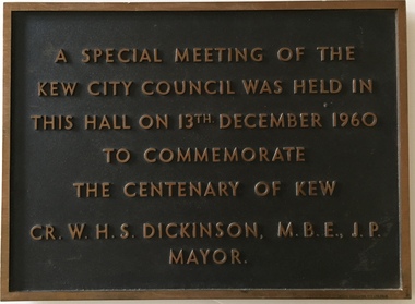
Plaque, A Special Meeting of the Kew City Council Was Held in This Hall on 13th December 1960 to Commemorate the Centenary of Kew : Cr. W.H.S. Dickinson M.B.E., J.P. Mayor, 1960
The Municipality of Kew was proclaimed on 19 December 1860, then upgraded to a Borough (1863), a Town (1910) and finally a City (1921). From 1865, its offices were based in the former Athenaeum Hall in Walpole Street, which, although extended in 1883, inevitably became inadequate. Plans for a new purpose-built Town Hall were first mooted in the late 1880s, but fell prey to six subsequent decades of debate. During that time, many sites were considered and rejected, and several schemes prepared. Finally, in 1945, it was resolved to build a new civic centre as a war memorial. The council acquired Southesk, a mansion on the south-west corner of Cotham Road and Charles Street – first mooted as a possible Town Hall site two decades earlier – and plans for a civic precinct were drawn up by John Scarborough. The project stalled until 1957, when a Town Hall Committee was formed and a new architect appointed: Harold Bartlett of Leith & Bartlett. He also proposed an entire civic precinct, of which a large public hall would constitute Stage One. Designed to accommodate almost any public or official function, the space had had a small stage at one end for intimate theatrical productions, a larger stage at the other (with operable sunken orchestra pit) for musical performances, plus the most up-to-date equipment for live TV transmission. The building, befitting its original intent as a war memorial, was also to include a sculpted monument, for which a separate design competition was held. First prize went to George H Allen (1900-1972), long-time head of the Sculpture Department at RMIT and a former war artist himself (the only one, in fact, to have worked in the medium of sculpture). At the time of the Kew project, Allen was best known for his Cenotaph at the Shrine of Remembrance (1955) and a controversial abstract sculpture at Hume House in William Street (1957). Tenders for the new hall were called and the contract (worth £104,986) was awarded to H F Yuncken. The foundation stone was laid by the Mayor, Cr F C O'Brien, on 1 June 1959. Completion (initially scheduled for October) was delayed by the unavailability of certain materials; it was barely finished in time for the official opening (by Premier Henry Bolte) on 23 April 1960. The war memorial was unveiled two days later (Anzac Day) by Bolte's deputy, the Hon A G Rylah. Fittingly, that year also marked Kew's municipal centenary, and many celebratory events were held in and around the new civic centre in December, including a special council meeting (attended by the Prime Minister), a tree planting ceremony and a youth ball. Source: Survey of Built Heritage in Victoria: Stage Two (Built Heritage Pty Ltd., 2010)Historically significant commemorative plaqueMetal plaque relating to special Council meeting to mark centenary of Kew, 13th December 1960. This plaque was given to the Kew Historical Society in 1991 by the former City of Kew.A Special Meeting Of The / Kew City Council Was Held In / This Hall On 13th December 1960 / To Commemorate / The Centenary of Kew / Cr. W.H.S. Dickinson, M.B.E., J.P., / Mayorkew city hall, foundation stones - kew (vic), cr. w.h.s. dickinson, local government -- kew (vic.) -
Kew Historical Society Inc
Archive (Sub-series) - Subject File, Kew, City of - Management, 1958
City of KewReference, Research, InformationKHS Imposed OrderKew in Victoria was declared a City in 1921, and remained so until it was amalgamated into the City of Boroondara in 1994. This is a single large archive file, primarily comprised of Kew Council documents, a number of which date from an earlier period. Interesting early primary sources include: 1914 Amendments to the Local Government Act of 1903 [copy owned by Mr W.J. Muntz C.E.]; a Cleansing Contract [for the removal of night-soil] (1913); an Annual Statement of Accounts (1923); and By-Law No.66 (1939) [relating to the “Erection Construction and Removal of Buildings, Advertising Signs, Etc.”; and the Councillor’s Handbook (1939). In addition to these, later publications relate to Financial Statements (1986, 1987, 1988); Model Local Laws (1989); a Municipal Emergency Management Plan (1990); Mobile Bin Recycling Trial (1991); a School Project Kit (1991-2); and Committee Minutes (1992). There are also a number of newspaper articles/clippings on Council management issueslocal government - kew (vic) - publications, city of kew - management, city of kew - amendments to the local government act 1903, city of kew - by-laws, city of kew - financial statements, city of kew - councillor's handbook, city of kew - municipal emergency management plan 1990, city of kew - mobile bin recycling trial (1991)local government - kew (vic) - publications, city of kew - management, city of kew - amendments to the local government act 1903, city of kew - by-laws, city of kew - financial statements, city of kew - councillor's handbook, city of kew - municipal emergency management plan 1990, city of kew - mobile bin recycling trial (1991) -
Kew Historical Society Inc
Archive (Sub-series) - Subject File, Development (Kew), 1958
Various partiesReference, Research, InformationSecondary Values (KHS Imposed Order)Subject file consisting largely of newspaper clippings/articles relating to houses in Kew. The earliest original newspaper article dates from 1923 and relates to housing shortages. The file contains some interesting Council records and correspondence relating to community action in response to development. These include the proposed lease of the Ground Floor of the Kew Civic Buildings as a postal delivery centre (1992), the development of flats in Studley Ward (1977), a proposed motel in Studley Park Road (1983)kew post office, heritage, planning and developmentkew post office, heritage, planning and development -
 Kew Historical Society Inc
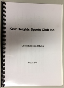
Administrative record - Document, Kew Heights Sports Club Inc: Constitution and Rules, 4th June 2006, 2006
Sports Clubs in Kew in the final decades of the 19th century and in the early 20th century were often umbrella organisations with facilities for a number of sports. Typically in Kew, this included teams in lawn bowls, tennis and croquet. The Kew Bowling Club was formed in 1880 while the privately owned Auburn Heights Recreation Club was opened in 1904. By 1998, the two Clubs decided to amalgamate at the Auburn Heights site in Barkers Road, forming the Kew Heights Sports Club. The combined club was itself taken over by the Melbourne Cricket Club in 2012 becoming MCC Kew Sports Club. In 2017 MCC Kew closed and its landholding was subsequently sold to Carey Baptist Grammar School. Both the Kew and Auburn Heights Clubs assembled important collections. These historically significant and large collections were donated to the Society in 2020. The collections include manuscripts, pictures, trophies, plans, honour boards etc. The combined collections of the four sporting clubs making up the collection number hundreds of items that are historically significant locally. They are also significant to the sporting history of the greater Melbourne area and to the sports of lawn bowls and tennis in Australia in the 19th and 20th centuries. The collection illuminates two of the Victorian historic themes - 'Building community life' through forming community organisations and 'Shaping cultural and creative life' by participating in sport and recreation.Constitution and Rules of the Kew Heights Sports Club Inc. Dated 2006.kew heights sports club - 397 barkers road - kew (vic), kew heights sports club - constitution -
 Kew Historical Society Inc
Administrative record (series), Minute Book, 2004-2006
Gift of MCC Sports Club Kew 2020AdministrationProvenance orderminutes of meetings of the kew Heights Sports Clubkew heights sports club - 397 barkers road - kew (vic), kew heights sports club - minute bookskew heights sports club - 397 barkers road - kew (vic), kew heights sports club - minute books