Showing 4591 items
matching history records
-
 4th/19th Prince of Wales's Light Horse Regiment Unit History Room
Commission Certificate (Photograph), 29/6/1908
A copy of the appointment by Rt Hon H S Baron Northcote GCMG. KGCI Governor General of Australia of Murray William Bourchier Esq to Second Lieutenant on 12 Feb 1907. It is dated 29 June 1908Entered on record in Register of Patents No 3 page 159bourchier, commission -
4th/19th Prince of Wales's Light Horse Regiment Unit History Room
Book, Government Press and Survey of Egypt, A Brief Record of the Advance of the Egyptian Expeditionary Force Under the Command of General Sir Edmund H H Allenby GCB, GCMB. July 1917 to October 1918, 1919
Provides historical information about operations of Australian Light Horse units in the Middle EastSoft covered A4 book, 112 pages plus mapsIn front cover: Joan Rice (Flawley) 41 Arnold Drive Chelsea vic 3196world war 1, middle east, egyptian expeditionary force -
 Eltham District Historical Society Inc
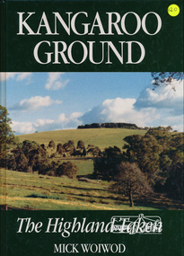
Book, Tarcoola, Kangaroo Ground: The Highland Taken by Mick Woiwod, 1994
"A piece of Scotland in the Australian bush is how author Mick Woiwod describes the "Village" of Kangaroo Ground. Settled in 1841 by a Scottish family, the Donaldsons, the town is the feature of Mrs Woiwod's latest book, "Kangaroo Ground - The Highland Taken" The book follows the history of Kangaroo Ground, from its beginnings as an exclusively Scottish farming community in the middle of nowhere to a town that became the centre of the Yarra Valley region... It took Mr Woiwod six months of intensive research and nine months to write the book on Kangaroo Ground. He spent much of his time searching archives, public records and newspaper files for detailed information on the characters who colour his book." -- Diamond Valley News November 16, 1994 This major history of Kangaroo Ground details the district’s story between 1841 and 1994, describing it as having been unique in the Yarra Valley in that its early settlers were all Scottish and its soils were more fertile than those of surrounding districts. Their soil gave them the sort of power that saw the then extensive Shire of Eltham governed from little Kangaroo Ground for a remarkable 69 years. The author describes the Kangaroo Ground landscape that these farmers worked in the early period as having been already significantly modified by Aboriginal fire-stick farming before their arrival. This publication is a significant title in the recording of the early history of the pioneers of the small area of Kangaroo Ground, VictoriaHardback Book, 312 pagesISBN 0646209000kangaroo ground, mick woiwod, pioneers, donaldson family, thomson family -
 Eltham District Historical Society Inc
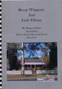
Book, Maureen Jones, Bessie Wingrove and Early Eltham by Maureen Jones, 2016
Bessie Wingrove (1870-1955) was born in Eltham, one of ten children born to Charles Wingrove, former Secretary of the Eltham Roads Board. Much of the publication describes the Wingrove family. Bessie attended University and graduated as a teacher, she travelled and returned to live in Eltham. Includes endnotes and Family Group Record for Charles Symons Wingrove and his wife Katherine Nodin. See also EDHS Newsletter Number 223 July 2015 for article on Bessie Wingrove by Maureen Jones This book is significant in that not only does it document broadly the history of Charles Wingrove a key person in the early history of Eltham but also his family, and specifically his daughter Bessie, ensuring that women's stories are added to the early male dominated and documented history of the area. It also gives an insight into the people and wider Eltham community.Spiral bound. 15 p. includes photographsbessie wingrove, wingrove family, eltham -
 Eltham District Historical Society Inc
Ledger, Eltham Road District. Assessment for the Year ending Oct. 14th, 1858, 1857c
The Eltham Roads Board was established in 1856. This is a unique significant record of early settlers in the Shire of Eltham. One of 6 early rate books. This is among the oldest items in the EDHS collection. An article in the Eltham and Whittlesea Shires Advertiser Friday 21 Nov 1941 Page 5 titled: District's Early History states: "The first rate book which is still in existence at the Shire Office is for the year ending October 14, 1858 and is probably the best record possible to indicate the development of the district. At the time properties were rated as follows: Cultivated land. 6d. per acre; pasture land, 1d. per acre: estimated annual value of buildings, etc., 6d in the (pound). The total amount of rate recorded for the year was (pounds)153/14/8. Properties were described as being situated at Lower Plenty, Yarra Yarra, Eltham, Lower Eltham, Kangaroo Ground, Yarra Flats, Diamond Creek and the Yarra."Ledger with printed columns: Number, Name of Occupier, Description, Where situated, Cultivated land, Pasture land, Estimated annual value of buildings, Rate, Remarks. Ledger filled out by hand with 152 entries (not alphabetically arranged). A number of blank pages are included. Copy re-bound in green hard leather look card by Arnall & Jackson Pty Ltd Brunswick, 1968 Inside cover includes a compliments slip taped to the cover from Arnall & Jackson Pty Ltd. with handwritten inscription: "Ian, I hope the hysterical society doesn't get historical about this". Organised 1968 I. Maynard Inside cover includes pasted printed note: RATE OF ASSESSMENT AS FOLLOWS: Cultivated land 6d per acre Pasture land 1 per acre Estimated Annual Value of Buildings, &c., 6d. in the Pound eltham roads board, rate book, rate payers, transaction, pioneers, settlers, 1858, assessment ledger, eltham road district, public records office victoria (prov), rate books, shire of eltham archives -
 Eltham District Historical Society Inc
Ledger, Eltham Road District. Assessment for the Year ending Oct. 14th, 1859, 1858c
The Eltham Roads Board was established in 1856. This ledger includes the signature of Road Board Secretary and Collector Wingrove, a significant person in Eltham's early history. This is a unique significant record of early settlers in the Shire of Eltham. One of 6 early rate books. This is among the oldest items in the EDHS collection. An article in the Eltham and Whittlesea Shires Advertiser Friday 21 Nov 1941 Page 5 titled: District's Early History states: "The first rate book which is still in existence at the Shire Office is for the year ending October 14, 1858 and is probably the best record possible to indicate the development of the district. At the time properties were rated as follows: Cultivated land. 6d. per acre; pasture land, 1d. per acre: estimated annual value of buildings, etc., 6d in the (pound). The total amount of rate recorded for the year was (pounds)153/14/8. Properties were described as being situated at Lower Plenty, Yarra Yarra, Eltham, Lower Eltham, Kangaroo Ground, Yarra Flats, Diamond Creek and the Yarra."Ledger with printed columns: Number, Name of Occupier, Description, Where situated, Cultivated land, Pasture land, Estimated annual value of buildings, Rate, Remarks, Arrears collected, excused, unoccupied, uncollected and amount actually collected. Ledger filled out by hand with 173 entries (not alphabetically arranged). A number of blank pages are included. Inside cover includes pasted printed note: RATE OF ASSESSMENT AS FOLLOWS: Cultivated land 6d per acre Pasture land 2d per acre Unalienated Pasture Land 8d per Acre Estimated Annual Value of Buildings, &c., 6d. in the Pound eltham roads board, rate book, rate payers, transaction, pioneers, settlers, wingrove, 1859, assessment ledger, eltham road district, public records office victoria (prov), rate books, shire of eltham archives -
 Eltham District Historical Society Inc
Ledger, Eltham Road District. Assessment for the Year ending Oct. 14th, 1860 (Version 1), 1859c
The Eltham Roads Board was established in 1856. This is a unique significant record of early settlers in the Shire of Eltham. One of 6 early rate books. This is among the oldest items in the EDHS collection. An article in the Eltham and Whittlesea Shires Advertiser Friday 21 Nov 1941 Page 5 titled: District's Early History states: "The first rate book which is still in existence at the Shire Office is for the year ending October 14, 1858 and is probably the best record possible to indicate the development of the district. At the time properties were rated as follows: Cultivated land. 6d. per acre; pasture land, 1d. per acre: estimated annual value of buildings, etc., 6d in the (pound). The total amount of rate recorded for the year was (pounds)153/14/8. Properties were described as being situated at Lower Plenty, Yarra Yarra, Eltham, Lower Eltham, Kangaroo Ground, Yarra Flats, Diamond Creek and the Yarra."Ledger with printed columns: Number, Name of Occupier, Description, Where situated, Cultivated land, Pasture land, Estimated annual value of buildings, Rate, Remarks, Arrears collected, excused, unoccupied, uncollected and amount actually collected. Ledger filled out by hand with 177 entries (not alphabetically arranged). A number of blank pages are included. Inside cover includes pasted printed note: RATE OF ASSESSMENT AS FOLLOWS: Cultivated land 6d per acre Pasture land 2d per acre Unalienated Pasture Land 8d per Acre Estimated Annual Value of Buildings, &c., 6d. in the Pound eltham roads board, rate book, rate payers, transaction, pioneers, settlers, wingrove, 1860, assessment ledger, eltham road district, public records office victoria (prov), rate books, shire of eltham archives -
 Eltham District Historical Society Inc
Ledger, Eltham Road District. Assessment for the Year ending Oct. 14th, 1860 (Version 2), 1859c
The Eltham Roads Board was established in 1856. This is a unique significant record of early settlers in the Shire of Eltham. One of 6 early rate books. This is among the oldest items in the EDHS collection. An article in the Eltham and Whittlesea Shires Advertiser Friday 21 Nov 1941 Page 5 titled: District's Early History states: "The first rate book which is still in existence at the Shire Office is for the year ending October 14, 1858 and is probably the best record possible to indicate the development of the district. At the time properties were rated as follows: Cultivated land. 6d. per acre; pasture land, 1d. per acre: estimated annual value of buildings, etc., 6d in the (pound). The total amount of rate recorded for the year was (pounds)153/14/8. Properties were described as being situated at Lower Plenty, Yarra Yarra, Eltham, Lower Eltham, Kangaroo Ground, Yarra Flats, Diamond Creek and the Yarra."Ledger with printed columns: Number, Name of Occupier, Description, Where situated, Cultivated land, Pasture land, Estimated annual value of buildings, Rate, Remarks, Arrears collected, excused, unoccupied, uncollected and amount actually collected. Ledger filled out by hand with 177 entries (not alphabetically arranged). A number of blank pages are included. This version was slight changes to version one. Inside cover includes pasted printed note: RATE OF ASSESSMENT AS FOLLOWS: Cultivated land 6d per acre Pasture land 2d per acre Unalienated Pasture Land 8d per Acre Estimated Annual Value of Buildings, &c., 6d. in the Pound eltham roads board, rate book, rate payers, transaction, pioneers, settlers, 1860, assessment ledger, eltham road district, public records office victoria (prov), rate books, shire of eltham archives -
 Eltham District Historical Society Inc
Ledger, Eltham Road District. Assessment for the Year ending Oct. 14th, 1861, 1860c
The Eltham Roads Board was established in 1856. This is a unique significant record of early settlers in the Shire of Eltham. One of 6 early rate books. This is among the oldest items in the EDHS collection. An article in the Eltham and Whittlesea Shires Advertiser Friday 21 Nov 1941 Page 5 titled: District's Early History states: "The first rate book which is still in existence at the Shire Office is for the year ending October 14, 1858 and is probably the best record possible to indicate the development of the district. At the time properties were rated as follows: Cultivated land. 6d. per acre; pasture land, 1d. per acre: estimated annual value of buildings, etc., 6d in the (pound). The total amount of rate recorded for the year was (pounds)153/14/8. Properties were described as being situated at Lower Plenty, Yarra Yarra, Eltham, Lower Eltham, Kangaroo Ground, Yarra Flats, Diamond Creek and the Yarra."Ledger with printed columns: Number, Name of Occupier, Description, Where situated, Cultivated land, Pasture land, Estimated annual value of buildings, Rate, Remarks, Arrears collected, excused, unoccupied, uncollected and amount actually collected. Ledger filled out by hand with 185 entries (not alphabetically arranged) and summary section. A number of blank pages are included. Inside cover includes pasted printed note: RATE OF ASSESSMENT AS FOLLOWS: Cultivated land 6d per acre Pasture land 2d per acre Unalienated Pasture Land 8d per Acre Estimated Annual Value of Buildings, &c., 6d. in the Pound eltham roads board, rate book, rate payers, transaction, pioneers, settlers, 1861, assessment ledger, eltham road district, public records office victoria (prov), rate books, shire of eltham archives -
 Eltham District Historical Society Inc
Ledger, Eltham Road District. Assessment for the Year ending Oct. 14th, 1862, 1861c
The Eltham Roads Board was established in 1856. This is a unique significant record of early settlers in the Shire of Eltham. One of 6 early rate books. This is among the oldest items in the EDHS collection. An article in the Eltham and Whittlesea Shires Advertiser Friday 21 Nov 1941 Page 5 titled: District's Early History states: "The first rate book which is still in existence at the Shire Office is for the year ending October 14, 1858 and is probably the best record possible to indicate the development of the district. At the time properties were rated as follows: Cultivated land. 6d. per acre; pasture land, 1d. per acre: estimated annual value of buildings, etc., 6d in the (pound). The total amount of rate recorded for the year was (pounds)153/14/8. Properties were described as being situated at Lower Plenty, Yarra Yarra, Eltham, Lower Eltham, Kangaroo Ground, Yarra Flats, Diamond Creek and the Yarra."Ledger with printed columns: Number, Name of Occupier, Description, Where situated, Cultivated land, Pasture land, Estimated annual value of buildings, Rate, Remarks, Arrears collected, excused, unoccupied, uncollected and amount actually collected. Ledger filled out by hand with 184 entries (not alphabetically arranged) and summary section. A number of blank pages are included. Inside cover includes pasted printed note: RATE OF ASSESSMENT AS FOLLOWS: Cultivated land 6d per acre Pasture land 1/2d per acre Unalienated Pasture Land 1/28 per Acre Estimated Annual Value of Buildings, &c., 6d. in the Pound eltham roads board, rate book, rate payers, transaction, pioneers, settlers, 1862, assessment ledger, eltham road district, public records office victoria (prov), rate books, shire of eltham archives -
 Eltham District Historical Society Inc
Ledger, Eltham Road District. Assessment for the Year ending Oct. 14th, 1863, 1862c
The Eltham Roads Board was established in 1856. This is a unique significant record of early settlers in the Shire of Eltham. One of 6 early rate books. This is among the oldest items in the EDHS collection. An article in the Eltham and Whittlesea Shires Advertiser Friday 21 Nov 1941 Page 5 titled: District's Early History states: "The first rate book which is still in existence at the Shire Office is for the year ending October 14, 1858 and is probably the best record possible to indicate the development of the district. At the time properties were rated as follows: Cultivated land. 6d. per acre; pasture land, 1d. per acre: estimated annual value of buildings, etc., 6d in the (pound). The total amount of rate recorded for the year was (pounds)153/14/8. Properties were described as being situated at Lower Plenty, Yarra Yarra, Eltham, Lower Eltham, Kangaroo Ground, Yarra Flats, Diamond Creek and the Yarra."Ledger with printed columns: Number, Name of Occupier, Description, Where situated, Cultivated land, Pasture land, Estimated annual value of buildings, Rate, Remarks, Arrears collected, excused, unoccupied, uncollected and amount actually collected. Ledger filled out by hand with 181 entries (not alphabetically arranged) and summary section. A number of blank pages are included. Inside cover includes pasted printed note: RATE OF ASSESSMENT AS FOLLOWS: Cultivated land 6d per acre Pasture land 1/2d per acre Unalienated Pasture Land 1/28 per Acre Estimated Annual Value of Buildings, &c., 6d. in the Pound eltham roads board, rate book, rate payers, transaction, pioneers, settlers, 1863, assessment ledger, eltham road district, public records office victoria (prov), rate books, shire of eltham archives -
 Eltham District Historical Society Inc
Photograph, Entrance to Shire of Eltham Memorial Park, Garden Hill, Eltham-Yarra Glen Road, Kangaroo Ground, c.1923
View to south-east from Shire of Eltham Soldiers' Memorial Park showing the carriageway from the road to top of Memorial Park. Accompanying notes state that the entry gate was put in place in May 1921. Eltham and Whittlesea Shire Advertiser and Diamond Creek Valley Advocate Fri 21 May 1920 p 2 reported: Kangaroo Ground Memorial Park "It was decided to arrange for a working bee on Saturday, 29th inst., for the purpose of forming and gravelling the track leading to the Park, and of carrying out other necessary works." A history summary of the Shire of Eltham Soldiers’ Memorial Park • The summit at Garden Hill was a popular tourist lookout and picnic spot from the 1880s. Virtually the entire Shire of Eltham and beyond could be viewed from this location. • A local farmer, Mr Walter A. D. Wippell is credited as being the first to propose the idea of a war memorial park and offered £50 towards the purchase of the land. • The earliest public reference to this project is to be found in the local Advertiser newspaper edition of August 9th, 1918. A report of the August Council meeting records the Eltham Shire President, Cr. Robert White, saying: "some time back it was proposed that the Council obtain and place on an Honour Board in the Council Chamber [at Kangaroo Ground] containing names of the lads who had enlisted. Just recently however, it had been suggested that a more fitting memorial would be the obtaining of a piece of land on the summit of Garden Hill, Kangaroo Ground, and the formation of a memorial park in which a monument could be erected to represent the whole of Shire. If a couple of acres could be obtained a gentleman had promised to donate 50 pounds, and another one would fence it, and other contributions, he was sure, could be obtained." • Councillors were favourable of the proposal and the President, Shire Secretary and Shire Engineer were deputised to wait on Messrs Mess Bros. (the owners of the Garden Hill farm) and ascertain if they would gratuitously give the land. The Mess Bros. land adjoined the farm/stud of Mrs Fanny White (Cr Robert White’s mother), daughter of Andrew Harkness who established their property on Garden Hill around 1846. • Access to the land came in February 1919 when several Councillors and the Shire Engineer surveyed the actual two acres of '5 chains along the road and 4 chains deep'. The Engineer volunteered his services free to do this task. The Mess brothers however demanded £100 per acre but eventually agreed to take £50 per acre. • Entry from the Kangaroo Ground-Yarra Glen road was seen to be a problem and Mrs. White, who owned the land beside the park, was asked to donated a triangle of her property to allow this access. • By September 1919 returned soldiers were employed by the Shire and volunteers were called to clear the hilltop by ploughing up the rocks and clearing the area, the fencing was put into place and in May 1921 the Council erected three gates, within an archway, at the entrance to the drive and pathway to the summit. • Public subscriptions were sought through the Advertiser newspaper to beautify the site. The views of the Curator of the Melbourne Botanical Gardens were sought as to the ‘class of ornamental trees most suitable for planting in the Park area”. • The Memorial Park or Shire of Eltham Soldiers’ Memorial Park was officially opened by Mr. W.H. Everard, M.L.A., 3 September 1921. • In 1922 plans were made to place a War Memorial in the Park. Funds were donated by the Council of £250 and a challenge to the community, to match this money with contributions was met. • On Anzac Day 1923, 1,000 people gathered on the summit in the park for a memorial service. A much smaller group of about 50 people gathered around a newly constructed cairn and flagstaff in the afternoon of Anzac Day 1924 amidst rain and a squally southerly wind, the morning service being cancelled. • A meeting for those interested in establishing a War Memorial monument within the park was held in January 1924 and the Eltham Shire War Memorial League was formed and a design competition decided upon. • The Shire of Eltham War Memorial tower was built in 1926 at a cost of £1,023 and 5 shillings with locally quarried stone donated by Dr Ethel and Professor William Osborne. It was formally known as the ‘Shire of Eltham War Memorial’ and was unveiled on 11 November 1926. The large bronze inscription above the entrance to the tower states: SHIRE OF ELTHAM WAR MEMORIAL THESE MEN DIED FOR THEIR COUNTRY 1914 IN REMEMBRANCE THIS TOWER WAS BUILT 1918 • The Caretaker’s hut was built in 1927 with left over from the tower construction. • A returned soldier was appointed to act as caretaker for the memorials. Tiny Carrol, a huge man, was the first caretaker and lived in the stone hut. There was a push to have alterations made at one stage to provide additional rooms for a married caretaker but was rejected. • A new Caretaker Cottage was built in 1951 at a cost £2,500. The cottage had been subjected to raids by thieves three times during construction until a guard from the Returned Servicemen’s League was posted until its opening. • The War Memorial tower was re-dedicated by Sir Dallas Brooks on 8 November 1951, unveiling new bronze plaques containing the names of those who fell during the Second World War. Sir Dallas also officiated the opening of the new Caretaker’s Cottage. • A toilet block was built in 1965. • A further dedication of the Shire of Eltham War Memorial tower took place 11 November 2001 to recognise the men who fell in subsequent campaigns up to and including Vietnam. • Four land titles are involved: o The purchase of the two acres from owners Ruth Gosling, Alexander Mess, James Johnson Mess and Joseph Mess is recorded in two actions, the first being the payment of £100 for the two acres, the second showing that the Shire of Eltham did not get a transfer of title until 14th January 1952. o The access land donated by Mrs. Fanny White is dated 26 February 1924. A further need to widen the entry came after the deepening of the road cutting and another land donation was given by Sir Herbert Gepp, title dated 15th May 1952. This would have been about the time he sold off the former White ‘Garden Hill’ property. o The land reserve to increase the area and possibly allow a circuit road to be put in place on the western side of the park was purchased by the Shire of Eltham, title dated 16th February 1973. Rare photograph of the entrance to the Shire's Memorial Park during early stages of development prior to the erection of the Shire of Eltham War MemorialSepia photograph printed with white border with slight crack lower left hand corner and three significant vertical cracks fanning from lower centre edge to upper edge Digitally enhanced version to minimise impact of crackseltham-yarra glen road, entrance gate, garden hill, kangaroo ground, shire of eltham memorial park, shire of eltham war memorial, kangaroo ground war memorial park -
Eltham District Historical Society Inc
Newspaper - Newsclipping, Nillumbik Mail, "A Memorial Avenue of Honour", A Journey in Time: A column about Nillumbik's history, Nillumbik Mail, 24 May 2000, p4, 2000
Main Road, Eltham, south from Brougham Street to Dalton Street, c.1911 View looking down Policeman’s Hill on Maria Street (Main Road) from near Brougham Street towards Dalton Street, site of the Avenue of Honour established in 1916-1917 in memory of the soldiers who served in the First World War, 1914-1918. At the bottom of the hill on the right is White Cloud Cottage, home of the Jarrold family, three women standing out front observing the photographer. The road passes over a culvert which runs to the west in front of the cottage. The cottage was originally located closer to the Diamond Creek but was subject to flooding. It was dragged by horse to the present site shown, which was chosen for the higher ground that had been created as a result of land fill being deposited here from the quarry further around the bend on Main Road (site of present-day Eltham Primary School carpark) where the stone had been quarried for building the State School in Dalton Street. Immediately at the end of the straight section of the main road can be seen the gas streetlamp in front of the Jarrold home and the pond at the bottom of Dalton Street. The cottage had previously been rented for use as a Police Station / residence prior to the building of the permanent police house and station at the corner of Maria and Brougham streets in 1859. At the time of collection of photos for the centenary of the Shire of Eltham (1971) the cottage was owned by the Skipper family and remains in the family to present day (2021). On the left is the Grant house on the corner of Main Road and Dalton Street now the present-day site of Eltham Clinic. Photographer: J.H. Clark John Henry Clark was the youngest of three boys born to William Henry Clark (1823-1877) and Maria White (1843-1914). He and his brothers, William Charles Clark (1872-1945), Clement Kent Clark (1874-1912) operated a photography business (Clark Bros.) from 25 Thomas Street, Windsor near Prahran during the period c.1894 to 1914. Following death of Clement in September 1912 and their mother in 1914, the Clark Bros business appears to have dissolved, the premises demolished, and a new house was under construction in 1915. John set up business independently in 1914 operating out of 29 Moor Street, Fitzroy where he is registered in the 1914 and 1915 Electoral Rolls. By 1916 John had relocated to Eltham where he continued his practice as a photographer and took many of the early images around the district of Little Eltham. Around 1930 John changed professions and opened a small cobbler's shop in 1931 near the pond opposite Dalton Street adjacent to the Jarrold family cottage. He never married and continued his profession as a bootmaker from this little shop, maintaining a close relationship with Mrs Jarrold for the rest of their lives. His bootmaker shop remains today beside the Whitecloud cottage and is one of only three remaining shops in the area from the early 20th century. There are a couple of images of Eltham taken by Clark Bros. in the Eltham District Historical Society collection, one such example being Hunniford’s Post Office with Miss Anne Hunniford out front (EDHS_00140 - marked on the back of the print, Clark Bros., 25 Thomas St. Windsor), which would date this image between c.1894 and 1914. Other early images of Eltham taken by John Henry Clark are marked on the face “J. H. Clark Photo” and it is assumed these are dated between 1914 and 1930. It is noted that the Grant of Probate for John H Clark of Eltham South dated 5 April !957 (513/387) records his occupation as "X Photographer".Newsprint pageNillumbik Mail publication details; Edition 4, 24 May 2000, p4dalton street, avenue of honour, eltham clinic, gas lamp, grant house, j.h. clark photo, jarrold cottage, jarrold family, main road, shire of eltham pioneers photograph collection, white cloud cottage -
 Eltham District Historical Society Inc
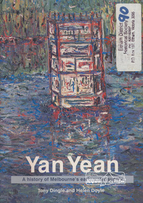
Book, Tony Dingle et al, Yan Yean : a history of Melbourne's early water supply / Tony Dingle and Helen Doyle, Monash University, 2003
Book commissioned by Melbourne Water to mark the 150th anniversary of the commencement of the Yan Yean Reservoir.Paperback; vii, 127 p. : ill. (some col.), maps (some col.), ports. ; 23 cm.[written on flyleaf] To Eltham District Historical Society, best wishes Helen Doyleyan yean reservoir -
 Eltham District Historical Society Inc
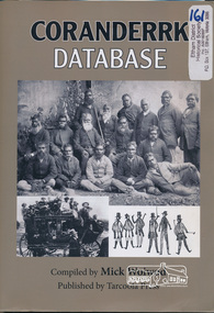
Book, Tarcoola Press, Coranderrk Database compiled by Mick Woiwod, 2012
Database of information on Coranderrk 1835 to 1995.Winner of the Local History Project Award (for activities that enhance access to records of significance to local communities) as part of the Victorian Community History Awards 2012 242 pages : illustrations ; 30 cm + 1 CD-ROM (4 3/4 in.) PDF, Word files.ISBN 9780987157416green, john., bon, anne fraser, 1838-1936., coranderrk aboriginal station. -
 Eltham District Historical Society Inc
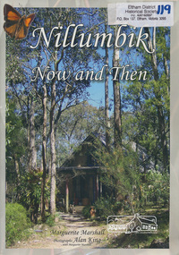
Book, Marguerite Marshall, Nillumbik now and then / Marguerite Marshall; photographs Alan King with Marguerite Marshall, 2008
Nillumbik Now and Then takes the reader on a journey from when the Aboriginal people were this area's sole inhabitnats, to the present day. Nillumbik's history - told in this collection of 96 stories, which are nearly all based on sites - mirrors those of the wider Australian community. It includes tales of the Wurundjeri people, a former convict, farmers, a bushranger, gold-mining, soldiers, artists, intellectuals, environmentalists and sportspeople. Each story is illustrated with a photograph. As a journalist with the former Diamond Valley News, Marguerite Marshall wrote a series of articles on local places of historic interest, later published as the small book "Eltham Shire - Historic Buildings and Places". Many years later an expanded version was published under the title "Nillumbik Now and Then". This is a much larger version of "Nillumbik Now and Then", including significant rewriting and many additional articles. The new publication was made possible by financial support from the Victorian Public Records Office, Bendigo Bank and Nillumbik Shire Council. EDHS and other historical societies in Nillumbik assisted with content for many of the stories. The book was launched at the Eltham Library on Wednesday 19th November 2008. Source: EDHS Newsletter No 183, November 2009 The front cover art depicts The former house of naturalist and artist Neil Douglas at Bend of Islands, photographer Marguerite Marshall. This collection of almost 130 photos and stories about places and people within the Shire of Nillumbik, an urban and rural municipality in Melbourne's north, contributes to an understanding of the history of the Shire. Published in 2008 immediately prior to the Black Saturday bushfires of February 7 2009, it documents sites that were impacted, and in some cases destroyed by the fires. It includes photographs taken especially for the publication, creating a unique time capsule representing the Shire in the early 21st century. It remains the most recent comprehenesive publication devoted to the Shire's history connecting local residents to the past. Paperback; x, 198 p. : ill., ports. ; 30 cm.Signed by the authornillumbik shire, houses, buildings, weller's hotel, landmarks, bend of islands -
 Eltham District Historical Society Inc
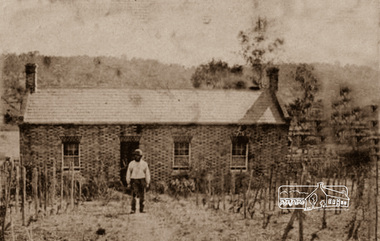
Photograph, Thomas Cochrane in front of his family home, in Little Eltham, c.1865
Originally catalogued around 1998 as John Cochrane in front of Shillinglaw Cottage, this is now believed to be Thomas Cochrane born 1817 in Ireland. The photograph is a reproduction of a low-resolution, poor-quality photograph. Shillinglaw Cottage is significant to Eltham’s local history. It is one of the earliest known buildings still in existence. Records suggest that the cottage was built circa 1859 by a man named Cochrane, believed to be Thomas Cochrane, in conjunction with George Stebbings though it is not known what Stebbings’s contribution was. It is believed Stebbings owned the cottage between 1874 and 1888. According to Margaret Ball’s (2017) book "Shillinglaw Family of Eltham 1660-2007", Thomas Cochrane and family lived there from 1867 to 1874 however this is contrary to the records of assessable rates levied by the Eltham District Road Board, established in 1858, which shows Cochrane was the owner occupier (in Little Eltham) of approximately 25 acres of cultivated land and 25 acres of pastureland upon which a hut was sited in 1860. It is suspected that George Stebbings may have acquired the property from Cochrane in 1874 as it is noted that he had a tenant for a period, James Rossiter, who was the editor for the Evelyn Observer in Kangaroo Ground in 1874 (LATE SHIRE OFFICE AT KANGAROO GROUND (1934, February 16). Advertiser (Hurstbridge, Vic. : 1922 - 1939), p. 5. Retrieved February 25, 2022, from http://nla.gov.au/nla.news-article56743657). In 1881 Phillip Shillinglaw became the ratepayer for the cottage though Stebbings retained ownership until 1888 at which time it was transferred to Shillinglaw. Thomas Cochrane was born in Ireland in 1817 and died at Collingwood 1877. He married Sarah Jane Casey at St James, Melbourne in 1846. They had eight children: • Elizabeth Jane Cochrane born 1847, Keelbundoora • Sarah Cochrane born 1849, Keelbundoora • William John Cochrane born 1854, Eltham • Isabella Mary Cochrane (Cochren) born 1855, Eltham, my Great grandmother • Mary Cochrane born 1857, Eltham • Thomas Cochrane born 1859, Eltham • William James Cochrane born 1861, Eltham • Margaret Anne Cochrane (Cochran) born 1863, Eltham Information received from Richard Stone in 2019, a 2nd-great grandson of Thomas Cochrane suggests that during the early 1930s, one of Isabella’s daughters and her family attended cricket matches at Eltham. The mother and a daughter (Richard’s cousin) would wander around Eltham and a cottage in the main street backing onto the cricket ground. The cousin remembers well her mother telling her that her mother, Isabella Cochrane, lived in the cottage as a young girl. The family also had a similar or the same photo of a man standing in front of the cottage. When the Cochrane family left the cottage in 1874, Thomas Snr would have been 57 and Thomas Jnr 15 and William 13. The man in the photo has a dark and substantial beard. Therefore, it is unlikely to be Thomas Jnr or William and most likely Thomas Snr. The photo is of poor quality and low resolution however, there is little grey evident in his beard. It was possibly taken when Cochrane was a younger man shortly after the cottage was built, circa 1865. When the Eltham District Road Board was established in 1858, the forerunner to Eltham Shire Council, Thomas Cochrane was listed as the occupier/owner of two assessable parcels of farmland in Little Eltham: one of 21 acres of pastureland and another 22 acres of cultivation land. George Stebbings was not recorded as an occupier or landowner. In 1859 and 1860 a Joseph/Joshua Stebbings was recorded as the occupier of a hut owned by G. Atkinson. A hut was recorded on Cochrane’s pastureland parcel in 1860 and this parcel increased in size to 36 acres in 1861 and grew further in size by 1863. George Stebbings first appears as the owner/occupier of a hut in Eltham in 1861, also 1862 and 1863. This is most likely his cottage (still standing in present day) in Pitt Street adjoining the Eltham Hotel property owned by Benjamin Wallis where he was residing in 1867 when they both sued each other for trespass. (POLICE. (1867, August 9). The Argus (Melbourne, Vic. : 1848 - 1957), p. 7. Retrieved February 25, 2022, from http://nla.gov.au/nla.news-article5774640) Thomas Cochrane was appointed one of the original trustees of the ground set aside for Eltham Cemetery in Feb 1860 (GOVERNMENT GAZETTE. (1860, February 11). The Argus (Melbourne, Vic. : 1848 - 1957), p. 7. Retrieved February 25, 2022, from http://nla.gov.au/nla.news-article5676991)A very early photo of Shillinglaw Cottage with its original builder and owner/occupier, Thomas Cochrane. Cochrane was also a founding Trustee of the Eltham Cemetery Trust. Reproduction of sepia photographshillinglaw cottage, eltham, eltham cemetery trust, evelyn observer, george stebbings, james rossiter, little eltham, phillip shillinglaw, thomas cochrane -
 Eltham District Historical Society Inc
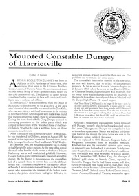
Folder, Constable Dungey, 1889
Constable Arthur Eggleston Dungey was a member of the Victoria Police Force and served in Harrietville before serving at Eltham, where he was involved in risking his life in the apprehension of a thief in 1891. Folder of information on Constable Dungey, Eltham 1889 Also includes Gilham Folder 61 Collection of photocopies possibly from the Victoria Police Museum. Copy of journal article fom Journal of Police History Winter 1997 pages 19 - [22] . Mounted Constable Dungey of Harrietville Photocopy unsourced detailing incident involving Constable Dungey in 1891 Photocopy of Police records (4 pages) - application for recognition for risking his life in the apprehension of "Frenchman Joe" and associated paperwork, 1892Folder of information on Constable Dungey, Eltham 1889arthur eggleston dungey, victorian police, harry gilham collection, constable dungey -
 Doncaster RSL Sub Branch
The All Australian Memorial, Shovelton and Storey, The All Australian Memorial;
The All - Australia Memorial (Victoria Edition)A Historical Record of National Effort during World War One. Australia's Roll of Honour 1914 - 1916 History, Heroes and HelpersDetails of the Campaigns at Gallipoli and the Western front, also at sea and the effort at home. Includes many photographs. The Regimental Register of the Australian Imperial Force 1914 - 1915Large book with reddish brown leather outer cover with gold lettering and motifDedicated to Francis J Williams, son of George and Emma Williams of Canterbury; Husband of Ada Williams of Box Hill. Pvt Williams killed in action October 4th 1917. Foreword by Senator G.F.Pearce,Minister of State for Defence -
 Warrnambool and District Historical Society Inc.
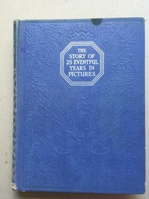
Book, Odhams Press Ltd, The story of 25 Eventful years in Pictures, early 20th century
A collection of photographs of events of the years from 1911 to 1935. It shows many world wide events such as events around Worls War 1,sports events such as horse racing and cricket,scouting, flights over Mt Everest, fashion the fall of the tzars in Russia and other world events such as the vote for women. . It is mainly a British perspective with a number of items relating to the royal family and British politics of the time.This book has historical and social significance as it records in photographs many events which occurred in a very turbulent period of world history. While it has no direct link to Warrnambool it would have been of general interest to local people.Blue cover with silver print on front cover and spine. Front cover has embossing in a floral pattern.Inside front and back covers the paper is patterned in silver and blue with crowns and flags.512 pages with mainly photographs in sepia colours.the story of 25 eventful years in pictures, -
 Warrnambool and District Historical Society Inc.
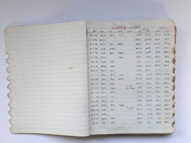
Book, Ledger Woollen Mill - Departmental Weekly Reports, 1930s
This is an exercise book, probably purchased from a local stationers, which was used at the Warrnambool Woollen Mill in the 1930s to record weekly operations in each of the Mill’s departments. The Warrnambool Woollen Mill was established in 1910 in South Warrnambool by a local company, with the building erected on a site that formerly housed another woollen mill destroyed by fire in 1882. The Warrnambool Woollen Company operated successfully for many years with over 700 employees in the 1940s and a good national reputation for quality goods. It made blankets and other woollen goods and was the first company in Australia to manufacture electric blankets. In the 1960s the mill was sold to the Dunlop Company and for the next thirty years it was bought and sold several times, finally closing in 2000 after 90 years of operation. This exercise book is of some importance as it belonged to the Warrnambool Woollen Mill, a dominant and important industry in Warrnambool for most of the 20th century. Many present and past residents of Warrnambool and district were employed at the Mill. It is one of many items in our collection that outlines the mill’s day-to-day operations and contains information that may be useful to researchers. This is an exercise book which belonged to the Warrnambool Woollen Mill and appears to be two exercise books joined together as there is a black cover in the middle of the pages. The original black covers at the front and back are missing. The pages are lined in blue and most used pages have ruled red lines. The entries are in black ink and include the date and other information on the processes of the spinning, carding, scouring etc. The page edges on the right have been serrated in an oval shape to make tabs for the various departments in the Mill – Engineers, Scouring. Dyeing, Warehouse etc. and the book contains weekly entries regarding Mill operations from 1930 to 1936.Edge of book: ‘Records’warrnambool woollen mill, history of warrnambool -
 Warrnambool and District Historical Society Inc.
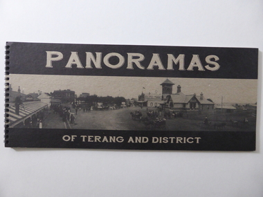
Book, Panoramas of Terang and District, Early 21st century
This is a book containing early 20th century photographs of the town of Terang in the Western District of Victoria. Most of the photographs were taken by Robert Frederick Scott (1877-1953). He was born in Koroit and came to Terang in his early years. He took up coach building and in 1906 he moved to Cobden where he continued coach building with W.J. Silvester. He was regarded at the time as a clever mechanical engineer and was a pioneer in the motor garage business. In the 1930s he was a representative for the Melbourne firm of A.H. McDonald & Co. in the machinery business. He installed milking machines in the Western District and Gippsland. His hobby was photography and he took many photographs in the Western District and supplied photographs to the Victorian Railways for inclusion in the train carriages. This book is of considerable interest as a record of the town of Terang in the early 20th century. The photographs are of high quality and the book will be useful to researchers.This is a soft cover book of 52 pages. It contains black and white photographs of early 20th century Terang and district. The photographs are set in a grey-coloured frame and on the page opposite the photograph is a description of the photograph. The cover is made of lightweight cardboard and the front cover has the title of the book and a black and white photograph of the town of Terang. The book is bound with plastic spirals.history of terang, robert frederick scott, history of western district, warrnambool history -
 Warrnambool and District Historical Society Inc.
Booklet, Narranda & District Netball Ass 1840-1970, 2011
This is a booklet giving information on the Nirranda & District Netball Association Inc. It is a 40th anniversary publication. This association was formed in 1971 with Nirranda, Nirranda South, AllansForest, Curdievale and Commingle the competing teams. In 1991 the competing teams were AllansForest, Nullawarre North, Nirranda and Nirranda South and these clubs continued until 2010 when a new format saw individual teams playing under the administration of the Association. The Association continues today.This book is of interest as a record of the Nirranda & District Netball Association. Nirranda is a small settlement 28 kilometres south east of Warrnambool and its history and activities are of interest to the surrounding districts. Netball is the most popular sport for women in the area and the clubs are mostly allied with the local football teams. This is a soft cover booklet of 52 pages. The cover has a white background with a stylized sketch of two netballers (wire sculptures) standing on a windmill frame and throwing at a netball ring with decorative columns on the side. The sketch is in black, green and grey tonings. The booklet contains a Foreword, Personal Profiles, Extracts from Association Minutes and records of competition winners. The pages are stapled.Front Cover: ‘40 Years Nirranda & District Netball Association Inc, 40th Anniversary Re-union’. nirranda & district netball association, history of nirranda, warrnambool history -
 Warrnambool and District Historical Society Inc.
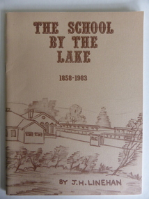
Booklet, The School by the Lake 1858-1983, 1983
This book gives information on the history of Terang Primary School which opened as a National School in 1858. It then became Terang Common School No. 617. It was destroyed by fire in 1871 and rebuilt, becoming, after 1872, Terang State School. Peter Carmichael was the Head Teacher from 1859 to 1884. The book was written to celebrate the 125th anniversary of the school’s foundation. The school is now part of a dual campus P-12 school known as Terang CollegeThis book is of some interest as a record of the Terang Primary School up to 1983. Terang is one of the towns in the Western District that has some connection to Warrnambool because of its relative closeness to the latter city. This is a soft cover book of 56 pages. It has a buff-coloured cover with a sketch of Terang Primary School in brown tonings. The sketch encompasses both the front and the back covers. The book has Acknowledgements, a Foreword, a list of Head Masters, printed information on Terang Primary School and a Bibliography. It contains black and white photographs, plans and sketches. The book is bound with metal staples.Front Cover: ‘The School by the Lake, 1858-1983, by J.H.Linehan.’terang primary school, history of terang, warrnambool history -
 Warrnambool and District Historical Society Inc.
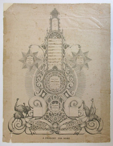
Document - Document The family keepsake Meek family, 1865
This certificate has been designed and drawn by James McKain Meek, one of several produced by him to sell to local families in Warrnambool and district as a means of raising money to support his family. James Meek (1815-1899) was a fish canner, fisherman, fishmonger, storekeeper, café proprietor, explorer, gold digger, accountant, writer, librarian and above all an outstanding calligrapher. After being a pioneer settler in the Ballarat area and residing also in Port Melbourne he came to Warrnambool and lived in the area in the 1850s and 60s. He explored much of the Terang area and the Otway Ranges, speaking and writing of the great potential of the latter area. One of Meek’s calligraphy works won an award in the International Exhibition of Melbourne in 1861 and some of his works are in various art galleries and museums today. Thomas Fidler was a Warrnambool butcher who married Fanny Cockman in 1849 in London.This certificate is of great significance as one of the calligraphy works of James Meek, a 19th century resident of Warrnambool, celebrated today as a talented calligrapher. The certificate was displayed in 2015 in a James Meek exhibition at Ballarat Art Gallery. The item is also of social significance showing how the more affluent 19th century families recorded and preserved their family history. This is a certificate hand drawn by James Meek. It is a template that enables the owner to insert the details of a family tree, in this case the 19th century family of Thomas Fidler and Fanny Cockman. The certificate is in grey and black shadings with highly ornamental scrolls and patterns. The document has been produced in black ink. It has a central column with spaces for names and side tablets to include more information. The side tablets are star-shaped and the central column has attachments of various shapes – circles, rectangles etc. The base of the column has further ornamental scrolls, swirls and lacework and features sketches of three emus on one side and three kangaroos on the other side. The certificate is mounted on white cardboard. Some of the Fidler family names have been produced in printed letters and some names have been added later by a family member. ‘Th. os Fidler’s Family Register 1865’ ‘The Family Keepsake’ ‘A Present For Home’thomas fidler and fanny cockman, james meek, history of warrnambool -
 Warrnambool and District Historical Society Inc.
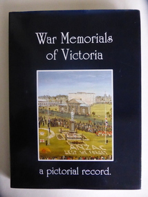
Book, War Memorials of Victoria, 1994
This book gives information on 1,100 War Memorials in Victoria. It was compiled by Bradley, Christey et al and produced for the Returned and Services League of Victoria. War Memorials were established in most settlements in Australia after World War One and added to after World War Two and succeeding conflicts. The number of War Memorials reflect the historical importance of Australia’s involvement in world wars and because of our distance from the battlefields they have become sacred places in Australia – de facto war cemeteries. The book includes information on the Warrnambool War Memorial and those in our area. This book is of interest as it gives details on War Memorials and includes all those in the Western District of Victoria. It will be useful to researchers of social and military history. This is a hard cover book with a blue cover and gold printing on the spine. The dust cover is dark blue with a colour sketch of the Portland War Memorial and white printing on the front cover and an outline of the map of Australia on the back cover. The book has 240 pages, black and white and colour illustrations, a Foreword, Dedication, Acknowledgements, Introduction, Contents, Bibliography and Index and information in alphabetical order of the War Memorials in Victoria. It also has reproductions of 20 oil paintings of Victorian War Memorials by Dacre Smyth.Spine: ‘War Memorials of Victoria’ R.S.L. Victorian Branch’ Front Cover: ‘War Memorials of Victoria, a Pictorial Record’ war memorials in victoria, warrnambool war memorial, history of warrnambool -
 Warrnambool and District Historical Society Inc.
Book, Description & plans of title & grants
This book contains certificates of title and Crown grants which record local changes of ownership.many are in the township of Warrnambool while others relate to areas such as Nullawarre, Purnim and Framlingham. These documents come under the Transfer of lands act of 1890.The significance of this book lies in the many names and the land to which they were connected. Deep maroon paper over card cover with dark green fabric binding.Alphabetical index at the front followed by 200 pages which record details of the Certificates of title and Crown Grants from around the period of warrnambool, warrnambool history, certificate of title, crown grant warrnambool -
 Warrnambool and District Historical Society Inc.
Book, The Tinkers at War, Early 21st century
This booklet contains information on the Tinker families who served in World Wars One and Two. The Tinker family lived in South Warrnambool and four sons enlisted in World War One with James Tinker killed in action. There are records in the booklet of two members of the Tinker family who served in World War Two. This booklet is of interest as it gives information about the war services of members of the Tinker family who lives at South Warrnambool. It also has good examples of the cards and letters sent home to Warrnambool from soldiers in the World Wars. This is a booklet of 134 pages produced by a Tinker family member. It contains information (cards, newspaper reports, letters etc) on members of the Tinker families who enlisted in World Wars One and Two. It has black and white and colour photographs, poems, cards, documents, certificates and illustrations. It has a clear plastic cover and red plastic ring binding and a red back cover. tinker families, history of south warrnambool, history of warrnambool -
 Warrnambool and District Historical Society Inc.
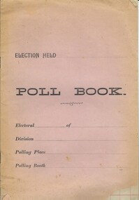
Document, Poll Book, Mid 20th century
This booklet has been produced to record information in connection with an election, presumably that of a local Council. As the title page and the inside pages are blank it is not possible to speculate in what year and for which Council election this booklet was intended for use. This booklet is of no particular importance but may be useful for display. This is a soft cover booklet of 10 pages. The cover is pink but faded around the edges and torn at the corners. The printing on the front is in black type. The pages are ruled with red lines but are blank. There is some silverfish damage on the first page. The pages are bound with metal staples. Front Cover: ‘Election Held’ ‘Poll Book’ ‘Electoral…. of …’ ‘Division…’ ‘Polling Place…’ ‘Polling Booth…’ council elections, history of warrnambool -
 Warrnambool and District Historical Society Inc.
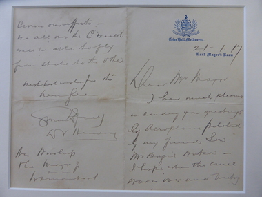
Document, Ist Airmail letter 1917, 1917
This letter, the first air mail letter sent to Warrnambool, was written by the Lord Mayor of Melbourne, Sir David Valentine Hennessy and carried by the aviator, Basil Watson on the first flight to Warrnambool January 24th 1917. The letter was delivered to the Mayor of Warrnambool, Cr Webb.There were several other letters delivered at the same time but this is the important official one. Basil Watson was a pioneer aviator who built his own aeroplane which was 18 feet long with a wing span of 26 feet and it had a 7 cylinder 50 H.P. Rotary Gnome engine. Watson flew from Point Cook to Warrnambool in one hour 55 minutes, an Australian cross-country flying record at the time. In Warrnambool Watson amazed the crowd with his dare-devil aerial acrobatics, looping the loop 14 times over the Warrnambool Racecourse. Basil Watson died when he crashed his plane into the sea near Point Cook, just two months after he landed in Warrnambool. This letter is of the utmost significance being the first air mail letter delivered to Warrnambool. It is an important memento of the first aeroplane flight into Warrnambool by the pioneer aviator Basil Watson. This is a cream-coloured sheet of paper folded in two to make four pages. It has handwriting in black ink on two pages. The writing is a little faded. The first page has the logo of the Melbourne Town Hall. The pages are partly torn at the folds. ‘Town Hall, Melbourne, 21/1/17. Lord Mayor’s Room, Dear Mr Mayor, I have much pleasure in sending you greetings by aeroplane piloted by my friend’s son, Mr Basil Watson. I hope when the cruel war is over and victory crowns our efforts, we all in the C’wealth will be able to fly from one state to the other. With best wishes for the New Year, …….. (signature indecipherable), D.V. Hennessy. His Worship the Mayor of Warrnambool.’pioneer aviation in the western district, basil watson, history of warrnambool