Showing 4068 items matching " surveys"
-
 Kilmore Historical Society
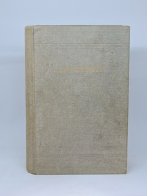
THE VICTORIAN MAGISTRATE, 1924
A survey and classification of the Statute Law, case law, procedure and practice applicable to Police Magistrates, Coroners, Justices of the Peace and special magistrates, and to Courts of Petty Sessions, Courts of general sessions, Coroner's Courts and Children's Courts.Grey-green cloth-bound hardcover book, faded spine and front cover, wear at corners. Minor insect damage inside front & back cover & flyleaves. Foxing back & front flyleaves. Structurally sound condition. 723 pp.Pencil inscription inside front cover, 'Received 16/10/24'.victorian, magistrate, kilmore court house library -
 Bendigo Military Museum
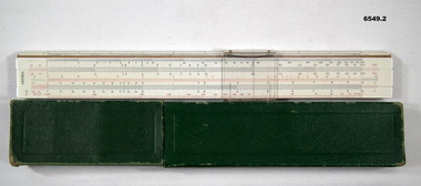
Instrument - SLIDE RULE, 12inch, AW Faber Castell, Circa 1954
The slide rule was used for less accurate quick mathematical calculations. It was light weight and easy to use in the field. This slide rule was used by members of 4 Fd Svy Sqn circa 1960 for quick Survey calculations..1 12 Inch Slide Rule, multi-function Calculator .2 Protective box and carry case for Slide Rule. Green cardboard box.royal australian survey corps, rasvy, fortuna, army survey regiment, army svy regt, asr, 4 fd svy sqn -
 Bendigo Military Museum
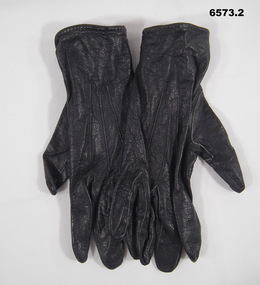
Uniform - GLOVES, WRAAC, Australian Army, Womens Royal Australian Army Corps (WRAAC) Uniform Gloves, 1976
Black Leather Gloves formed part of the WRAAC Uniform. When WRAAC disbanded on 1 September 1983, the gloves continued to form part of the women's uniform. This was the case for those serving in the Royal Australian Survey Corps.A pair of black kid leather women's military uniform gloves with a metal stud clipDated 1976royal australian survey corps, rasvy, fortuna, army survey regiment, army svy regt, gloves -
 Bendigo Military Museum
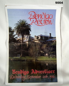
Newspaper - Bendigo Review - "Fortuna" A vital Army Link, Bendigo Advertiser Newspaper, 24 Sep 1986
A comprehensive article by the Army Survey Regiment's CO, LtCol Don Swiney MBE about the workings of the "Regiment." The "Regiment" occupied Fortuna Villa since 1942. There is also a one-page article about "The Ghost of Fortuna."Newspaper Article of 6 pages, A3 sizeroyal australian survey corps, rasvy, fortuna, army survey regiment, army svy regt -
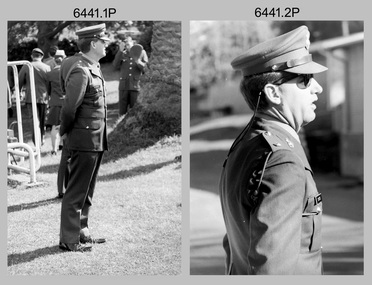 Bendigo Military Museum
Photograph - Lithographic Squadron Group Photos, Army Survey Regiment, Fortuna Villa, Bendigo, 1990
This is a set of 15 photographs of personnel posted to Lithographic Squadron at the Army Survey Regiment, Fortuna Villa, Bendigo Victoria, on the 1st of October 1990. These informal and formal group photos were taken on the day of a CO’s Parade. It is not known why sunglasses were worn at the Squadron parade outside the Litho huts. Photos of the other three Squadrons, the Officers, and Warrant Officers/Sergeants from this set of negatives are catalogued in item 6440.11P. This is a set of 15 photographs of personnel posted to Lithographic Squadron at the Army Survey Regiment, Fortuna Villa, Bendigo Victoria, on the 1st of October 1990. The photographs are on 35mm negative film and were scanned at 96 dpi. They are part of the Army Survey Regiment’s Collection. .1) &.2) - Photo, black & white, 1990. OC MAJ Bob Coote. .3) - Photo, black & white, 1990. Front rank L to R: SPR Ken Labouchardiere, SPR Doug Whiteside, SPR Mark McCullogh. Centre rank L to R: SPR Andrew Woodman. Rear rank L to R: CPL Geoff Webb, CPL Daryl South. .4) - Photo, black & white, 1990. Front rank L to R: SSGT Russ Mollenhauer, SGT Kim Reynolds, SGT Brian Paul, unidentified, SPR Ken Labouchardiere, SPR Doug Whiteside, Centre rank L to R: SPR Graeme Spong, SPR Andrew Woodman. Rear rank L to R: SGT Steve Burke, CPL Geoff Webb. .5) - Photo, black & white, 1990. WO1 Trevor Osborne. .6) - Photo, black & white, 1990. LCPL Damien Cole. .7) - Photo, black & white, 1990. L to R: WO2 Rhys De Laine, WO2 Steve Egan, WO2 Keith Fenton RE UK Exchange, WO2 Rob Bogumil, WO1 Bill Jones. .8) - Photo, black & white, 1990. L to R: SPR Shane ‘Smily’ Campbell, SPR Andrew Woodman, CPL Daryl South. .9) - Photo, black & white, 1990. LT Greg Tolcher. .10) - Photo, black & white, 1990. SGT Steve Burke. .11) - Photo, black & white, 1990. Lithographic Squadron: Back row L to R: SPR Ross Anza, SGT Brian Fauth, unidentified, SPR Andrew Arman, SGT Gary Kerr, SPR Doug Whiteside, SSGT Russ Mollenhauer, CPL Peter Swandale, CPL Roy Hicks, SPR Shane ‘Smily’ Campbell, SPR Graeme Spong. Jones. 3rd row L to R: SSGT Garry Drummond, SGT Kim Reynolds, unidentified, SGT Brian Paul, CPL Gavin Mclean, SPR Mark McCullogh, CPL Le-Anne (Smallshaw) Shirley, CPL Geoff Webb, SPR Gary Lord, SSGT Di Chalmers, CPL Peter Dillon, LCPL Damien Cole, SGT Steve Burke. 2nd row L to R: SSGT Peter Imeson, SPR Gary Sievers, unidentified, CPL Daryl South, SPR Greg Howell, SPR Janet Murray, SPR Michelle Withers, SPR Ken Labouchardiere, SPR John Bragg, SPR Andrew Morrison-Evans, CPL John ‘Flash’ Anderson, CPL Trevor King. Front row L to R: WO2 Steve Egan, WO1 Trevor Osborne, LT Greg Tolcher, WO2 Rob Bogumil (standing), OC MAJ Bob Coote, LT Marty Lyons, WO2 Rhys De Laine, WO2 Keith Fenton RE UK Exchange, WO2 Jeff Willey. .12) & .13) - Photo, black & white, 1990. Lithographic Squadron: Back row L to R: SPR Ross Anza, SGT Brian Fauth, unidentified, SPR Andrew Arman, SGT Gary Kerr, SPR Doug Whiteside, SSGT Russ Mollenhauer, CPL Peter Swandale, CPL Roy Hicks, SPR Shane ‘Smily’ Campbell, SPR Graeme Spong. Jones. 3rd row L to R: SSGT Garry Drummond, SGT Kim Reynolds, unidentified, SGT Brian Paul, CPL Gavin Mclean, SPR Mark McCullogh, CPL Le-Anne (Smallshaw) Shirley, CPL Geoff Webb, SPR Gary Lord, SSGT Di Chalmers, CPL Peter Dillon, LCPL Damien Cole, SGT Steve Burke. 2nd row L to R: SSGT Peter Imeson, SPR Gary Sievers, unidentified, CPL Daryl South, SPR Greg Howell, SPR Janet Murray, SPR Michelle Withers, SPR Ken Labouchardiere, SPR John Bragg, SPR Andrew Morrison-Evans, CPL John ‘Flash’ Anderson, CPL Trevor King. Front row L to R: WO2 Steve Egan, WO1 Trevor Osborne, LT Greg Tolcher, WO2 Rob Bogumil, OC MAJ Bob Coote, LT Marty Lyons, WO1 Bill Jones, WO2 Rhys De Laine, WO2 Keith Fenton RE UK Exchange, WO2 Jeff Willey. .14) - Photo, black & white, 1990. L to R: WO2 Rob Bogumil, unidentified, OC MAJ Bob Coote, CPL Daryl South, unidentified (x3), CPL Roy Hicks, SSGT Di Chalmers, WO2 Jeff Willey, WO2 Keith Fenton RE UK Exchange, SPR Ken Labouchardiere, WO2 Rhys De Laine. .15) - Photo, black & white, 1990. L to R: SPR Greg Howell, SPR Gary Sievers, unidentified, SPR Ross Anza, unidentified (x4), SSGT Russ Mollenhauer, SPR Doug Whiteside, SGT Brian Paul, unidentified (x7), WO2 Jeff Willey, unidentified, WO2 Keith Fenton RE UK Exchange, WO2 Rhys De Laine, SPR Shane ‘Smily’ Campbell..1P to .15P – no annotationsroyal australian survey corps, rasvy, army survey regiment, army svy regt, fortuna, asr, litho sqn -
 Kew Historical Society Inc
Plan, Melbourne & Metropolitan Board of Works : Borough of Kew : Detail Plan No.1561, 1905
The Melbourne and Metropolitan Board of Works (MMBW) plans were produced from the 1890s to the 1950s. They were crucial to the design and development of Melbourne's sewerage and drainage system. The plans, at a scale of 40 feet to 1 inch (1:480), provide a detailed historical record of Melbourne streetscapes and environmental features. Each plan covers one or two street blocks (roughly six streets), showing details of buildings, including garden layouts and ownership boundaries, and features such as laneways, drains, bridges, parks, municipal boundaries and other prominent landmarks as they existed at the time each plan was produced. (Source: State Library of Victoria). This plan forms part of a large group of MMBW plans and maps that was donated to the Society by Mr Poulter, City Engineer of the City of Kew in 1989. Within this collection, thirty-five hand-coloured plans, backed with linen, are of statewide significance as they include annotations that provide details of construction materials used in buildings in the first decade of the 20th century as well as additional information about land ownership and usage. The copies in the Public Record Office Victoria and the State Library of Victoria are monochrome versions which do not denote building materials so that the maps in this collection are invaluable and unique tools for researchers and heritage consultants. A number of the plans are not held in the collection of the State Library of Victoria so they have the additional attribute of rarity.Original survey plan, issued by the MMBW to a contractor with responsibility for constructing sewers in the area identified on the plan within the Borough of Kew. The plan was at some stage hand-coloured, possibly by the contractor, but more likely by officers working in the Engineering Department of the Borough and later Town, then City of Kew. The hand-coloured sections of buildings on the plan were used to denote masonry or brick constructions (pink), weatherboard constructions (yellow), and public buildings (grey). MMBW Detail Plan 1561 outlines those residences in the area bordered by Burke Road, Loxton Street, Mount Street and Barkers Road that had been constructed by 1905 when the land was surveyed. At this time, the area nearest Burke Road had been subdivided and developed whereas the lands to the west were as yet undeveloped. The houses represented are not named on the Plan.melbourne and metropolitan board of works, detail plans, mmbw 1561, cartography -
 Bendigo Historical Society Inc.
Document - BENDIGO AND VICTORIA HILL REPORT ON GEOLOGY
Report, 8 pages, on the geology of Bendigo district and Victoria Hill, produced by the Geological Survey Dept., Victorian Government. G.J. Medwell, Geologist. 19.10.1967. On front 'Geological Survey of Victoria. Mines Department Victoria. Report on Geology of Bendigo and of Victoria Hill Area' Letter attached inside front cover to J.C.Balfour, Minister of Mines to G.A. Lambert, Liberal Party, Sunshine, Victoria, sent with book for his information. Report contains: Cobaw batholith and North Harcourt Bendigo goldfield generally Trought, reefs, saddles and spurs Victoria Hill mines; Victoria Consols, Great Central Victoria, Victoria Quartz, Lansells 180, North Old Chum. Maps attached show part of New Chum line of reef and a handdrawn map of Rae's Cutting.bendigo, mining, victoria hill, bendigo goldfield -
 Bendigo Historical Society Inc.
Map - HUSTLER'S ROYAL RESERVE NO 2 MINE - PLAN OF THE HUSTLER'S ROYAL RESERVE NO 2 MINE
Plan of the Hustler's Royal Reserve No 2 Mine Bulletin No 33, Plate No V. Plan shows the Hustler's Royal Reserve No 2 (Main Shaft), Hustler's Royal Reserve No 2 (Park Shaft.), the Royal Hustler's, the Imperial Hustler's and the Extended Hustler's Freehold on the Hustler's Line of Reefs. Also mentioned is the Lightning Hill Line of Reefs. Map shows some of the levels, approximate boundary of lease and the boundary of Lease No 8892 and 8897. There are also street names and the locations of jail, lagoons, Post Office, Rosalind Park and the State School, High School and Continuation School. Geological Survey of Victoria emblem. H. Herman Director, W. Dickson, Secretary of Mines and The Hon. J. Drysdale Brown MLC, Minister of Mines. Signed by zh Whitdan, Underground Survey Office, Bendigo, September 1913.mining, parish map, hustler's royal reserve no 2 mine, royal hustler's, imperial hustler's, extended hustler's freehold, geological survey of victoria, h herman, w dickson, the hon j drysdale brown, h whitdan, hustler's line of reefs, lightning hill line of reefs -
 Bendigo Military Museum
Photograph - Bones Day - Army Survey Regiment Versus RAAF School of Radio. Fortuna, Bendigo, c1982
These four photographs were taken at Bones Day, an annual sports competition between the Army Survey Regiment and the RAAF School of Radio at Bendigo c1982. The two units took turns each year to host the event. The day competition usually comprised basketball, cross country, golf, sailing, squash, softball, tennis, touch football, rifle shooting, tug-of-war and volleyball. The two sports featuring in these photos are touch football and tug-of-war. The “big bone” trophy comprising a large bone from a beast housed inside a wooden framed glass case, was awarded to the winner of the day competition. The evening competition often included darts, carpet bowls, hookey, quoits and billiards/snooker. The “little bone” (a mounted chicken bone) was the consolation trophy awarded to the winner of the evening competition. The 3-hour bus trip for the visiting unit on their return was typically very raucous. The history of the Bones Day competition is best described in the booklet titled - Bones of Contention Souvenir Program. 1965. Refer to Item 6267.These four photographs were taken at Bones Day, an annual sports competition between the Army Survey Regiment and the RAAF School of Radio at Bendigo c1982. The photographs are on 35mm negative film. They are part of the Army Survey Regiment’s Collection. The photographic negatives were scanned at 96 dpi. There are additional photos in this set that have not been scanned due to poor quality or low historical value. .1) - Photo, black & white, 1982, Touch Football Team Back Row L to R: Brian Fauth, Bruce Bowers, Bob Mason, Paul Baker, Danny Galbraith, John Hook, Scott Payne. Front Row L to R: Roy Hicks, Peter Imeson, Alan Glanville, John Gilbert, Wally Chilcott. .2) - Photo, black & white, 1982, Tug-of-War Team Back Row L to R: Cliff Webb, Peter Treble, John Lane, Andy Wilson, Rick Warren, Rusty Williams, Brian Paul. Front Row L to R: Brian Fauth, Rick Downie, unidentified, Ken Slater, Rhys De Laine, John Smith, unidentified. .3) - Photo, black & white, 1982, Tug-of-War Team L to R: Peter Treble, Brian Paul, Rusty Williams, Rhys De Laine, unidentified (2), John Smith. Army personnel in background standing L to R: Rick van der Bom, Paul Hopes, Ian Nelson, Mick Dempster, John ‘Flash’ Anderson, Geoff Havelberg, John ‘Stormy’ Tempest, Bruce Gordon, Dan Cirsky, Neil Jones, Gerry Gates, Peter Main, Bob Thrower, Barry Miller, Gill Park. Army personnel in background seated L to R: Roger Pearson, Mick Gillham, Penny Knott, Leanne Shirley. .4) - Photo, black & white, 1982, Tug-of-War Team L to R: Rick Warren, Cliff Webb, Andy Wilson, Peter Treble, Brian Paul, Rusty Williams, Rhys De Laine, unidentified. Army personnel in background standing L to R: Rick van der Bom, Ian Nelson, Mick Dempster. .1P to .4P – No personnel are identified.royal australian survey corps, rasvy, army survey regiment, army svy regt, fortuna, raaf school of radio, bones day -
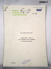 Bendigo Military Museum
Administrative record - Royal Australian Survey Corps Report on Operation Aright 88 conducted by 1 Field Survey Squadron 1988, 1 Fd Svy Sqn, 9 Feb 1989
Comprehensive Operation Report containing all aspects of OP Aright 88 in the Gulf of Carpentaria region of Queensland. Chapters include: General Information, Operations, Operational Support, Admin and Logistics, Communications, Conclusion and Recommendations. There are four Annexes, Area of Operations, Technical Summary, Nominal Roll, Det 1 Fd Svy Sqn and Air Support Contact Details.Unbound A4 Paper Report held together by a staple top LH corner. Typed pages and diagrams. 6364.1 is copy number 11, 6364.2 is copy number 12 6364.1 is copy number 11, "FOR AIR SURVEY RECORDS" "Tech WO", "Aero Trig", "ADJ", "SGT REES for Records" 6364.2 is copy number 12 "Placed on File and circulated", "Circular Received 15 Feb 1989" on back page. royal australian survey corps, rasvy, fortuna, army survey regiment, army svy regt, asr -
 Melbourne Tram Museum
Document - Research Notes, H. S. McComb, Bourke St to Nicholson St line, Brunswick East line, c1930
... Surveys ...Notes 10 pages, pinned together, giving details, opening dates, terminals, depot entries, sheave pits, curves, for the Bourke St to Nicholson St line, Brunswick East, including the connection into Spencer St. Includes 2 pages pinned together for the Gertrude, Smith St to Queens Parade line. Items 2064 to 2075 within box 72.3 in a brown folder marked "MT&O Co." red pencil on the front cover.trams, tramways, mto co, cable trams, drawings, reports, surveys, bourke st, nicholson st, gertrude st, smith st, queens parade -
 Melbourne Tram Museum
Document - Research Notes, H. S. McComb, High St Dundas St terminal, Nicholson St line, c1930
... Surveys ...Single page sketch for the Wellington St, Fitzroy St, Esplanade to Acland St line, three pages of notes on the High St Dundas St terminal, Nicholson St line, Items 2064 to 2075 within box 72.3 in a brown folder marked "MT&O Co." red pencil on the front cover.trams, tramways, mto co, cable trams, drawings, reports, surveys, st kilda, acland st, the esplanade, wellington st, nicholson st -
 Melbourne Tram Museum
Document - Research Notes, H. S. McComb, development and timing of the "PMTT" - part 5, 1950's
... Surveys ...Set of papers, handwritten concerning the development and timing of the "PMTT", Prahran and Malvern - about 20 sheets. Prepared by H. S. McComb - gives layout of the PMTT system, primarily of Burke Road, sketches of track layout, opening dates, sketches of various junctions, bridges, track miles, junctions, reconciliation of track lengths from various sources includes High St Malvern, extension to Punt Road, Dandenong Road, Wattle Tree Road, including its duplication Items 2041 to 2052 within box 72.3 in a brown folder marked "PMTT" in red pencil.trams, tramways, pmtt, malvern, routes, track, surveys, wattle tree rd, punt rd, dandenong rd, high st, duplications -
 Orbost & District Historical Society
map/poster, Victorian Government Printer, 22.4.1926
The Department of Crown Lands and Survey was originally established in 1857 as part of the Board of Land and Works. In 1964 it ceased to be controlled by the Board. The Department functioned for almost twenty more years before being combined with other Ministries to form the Department of Conservation, Forests and Land. It was responsible for the management of the State's Crown land and pastoral estates. This map was used by Don Mehlert after 1928. The VERMIN AND NOXIOUS WEEDS ACT 1928 was an Act to consolidate the Law relating relating to Vermin and Noxious Weeds. E. J. E. G. Pemberton who published this poster was Superintendent of Field Staff, Dept. of Lands and Survey. This map and posters are significant records of early settlement history in Murrangower, between Cabbage Tree and Orbost,A paper map of Murrangower showing settlement subdivisions. This is glued onto the back of four overlapping cloth poster of "Notices of Vermin Destruction". All print is black."DON MEHLERT" in black pen. Pike's block shaded in blue. School site marked in blue pencil. on poster "MURRANGOWAR" along side.map-murrangower poster-vermin-and-noxious-weeds murrangower-settlement -
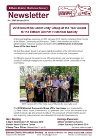 Eltham District Historical Society Inc
Newsletter, Newsletter, No. 238 February 2018
Contents: • 2018 Nillumbik Community Group of the Year Award to the Eltham District Historical Society • February Meeting • March Excursion – Eltham cemetery Artworks • Eltham 1950s – Childhood Reminiscences – Part 2 by Ann Constable • William Shillinglaw’s Homework Book by Richard Pinn • Early Eltham Shire Boundaries by Russell Yeoman • Wanted – a Treasurer • My Early Eltham Recollections – Part 1 by Alex Smith • Members On-line Survey – December 2017 • Neil Douglas by Wendy Wilson • News of Eltham England by Russell Yeoman • Webster Survey Group • ….and also • Contacts for the Eltham District Historical SocietyThe Shire of Eltham Historical Society was formed in October 1967. The first newsletter of the Society was issued May 1978 and has been published continuously ever since on a bi-monthly basis. With the cessation of the Shire of Eltham in late 1994, the Society's name was revised to Eltham District Historical Society and this name first appeared with issue No. 103, July 1995. The collection of the Society's newsletters provides a valuable resource on the history of the Society's activities, office bearers and committee members, guest speakers and subjects of historical interest pertinent to the former Shire of Eltham and the Eltham District.A4 newsletter distributed to membersnewsletter, eltham district historical society, shire of eltham historical society -
 Bendigo Military Museum
Manual - National Research Council of Canada, Division of Applied Physics - Strip triangulation of measured points, National Research Council of Canada, Nov 1961, Dec 1966, Oct 1966, Jan 1967
The Royal Australian Survey Corps, Army Survey Regiment used transformations of Aerial Photographic strip and block coordinates to accurately calculate setup parameters for the extraction of topographical features on Wild B8 stereo plotters. This manual describes the methods and "Fortran" computer programming language solutions. Chapter 1 - Transformation and adjustment of strip coordinates by electronic computation. Chapter 2 - An Introduction to Analytical Strip Triangulation with a "Fortran" program. Chapter 3 - A "Fortran" program for the adjustment of Strips and Blocks by Polynomial Transformations. Chapter 4 - A modified "Fortran" (IBM 1620) program for the adjustments of Strip coordinates.Hard Covered Manual containing Chapter 1 - 8 x pages, Chapter 2 - 84 x pages, Chapter 3 - 33 x pages, Chapter 4 - 29 x pages.Distribution stamps and labels on front cover.royal australian survey corps, rasvy, fortuna, army survey regiment, army svy regt -
 Bendigo Military Museum
photograph - Fortuna - 1st Year of Army Occupation in Bendigo, 1942
This is a set of 17 photographs taken during the first year of Army occupation at Fortuna, Bendigo in 1942. The photos provide an insight into the preparatory work performed on the Fortuna Villa and surrounding buildings, by the Working Party 5th Army Troop and Ordnance Training Depot, before its occupation by personnel from LHQ Cartographic Company, Royal Australian Survey Corps. The annotation on the back of Photos .9P and .10P is misspelt. The correct spelling is ‘Nell Gwynne’. The poppet head of the Central Nell Gwynne mine is still an iconic landmark in Bendigo, lying just down the road from the poppet head lookout at Victoria Hill. The Central Nell Gwynne was the premier mine of Bendigo's 1930s mining revival and is of high historical value, due to the extensive and relatively intact features which remain at the site. The annotation on the back of Photo .17P is incorrect. The location of HQ 5th Army Troop was ‘Reynard St, Coburg.’ By late 1941 as Japan extended its control throughout Indo-China, resolving the accommodation problem of AHQ Cartographic Company located in Melbourne became more urgent. The steady Japanese advance made the bombing of Melbourne no longer a remote possibility, and in accordance with a general policy of dispersion, the Deputy Chief of the General Staff, Major General Sidney Rowell instructed Major William Sarll, in the interests of security of plant and to provide against possible damage of air attack, to investigate suitable safer inland accommodation for AHQ Cartographic Company. Major Sarll inspected many properties before finding one that would meet the requirements of the Cartographic Company. In late 1941, he came to inspect Fortuna, a rambling old mansion with about fifteen acres of ground in central Bendigo. Initially there was no intention to occupy the site beyond the end of the war, although Major Sarll's report to the Director of Survey noted many advantages in moving the Company to Bendigo. Major General Rowell quickly approved the selection of Fortuna before other authorities, which were investigating the evacuation of school children, could get in ahead of the Cartographic Company. On 23 March 1942, the Commonwealth of Australia, under the provisions of the National Security Act of 1939, took possession of the house, the old battery buildings and the fifteen acres of grounds. Under Warrant Officer J. Trist’s direction, over fifty Parks and Works tradesmen completed building works necessary to accommodate the Survey Corps’ military, map making and printing requirements. The building program was still under way when the first officer, Lieutenant Ralph Westgarth, arrived in May 1942 with the advance party which received and positioned all equipment as it came up from Melbourne in semi-trailers. Once the equipment was installed the rest of the Cartographic Company completed its shift to Bendigo by 11th June 1942. The first year of the Survey Corps’ occupation of Fortuna is covered in more detail with additional historic photographs, in pages 17-22 of Valerie Lovejoy’s book 'Mapmakers of Fortuna – A history of the Army Survey Regiment’ ISBN: 0-646-42120-4.This is a set of 17 photographs taken during the first year of Army Occupation at Fortuna, Bendigo in 1942. The black and white photographs were printed on photographic paper and are part of the Army Survey Regiment’s Collection. The photographs were scanned at 300 dpi. .1) - Photo, black & white, 1942. Bendigo Parks and Works tradesmen at Fortuna. L to R: Cliff Day, Ernie Arnold, Norm? .2) - Photo, black & white, 1942. “Don” - possibly SGT Don Sutcliffe. Fortuna, Bendigo. .3) - Photo, black & white, 1942. Parks and Works tradesmen in garden at Fortuna, Bendigo. L to R: Fred & Ernie. .4) - Photo, black & white, 1942. Benny Jack Williams at Fortuna, Bendigo. Accommodation tents were erected above the lake, which later became the parade ground. .5) - Photo, black & white, 1942. Working dress - Giggle suits. Parks and Works tradesmen at Fortuna, Bendigo. L to R: Cliff and Harry on big roof. .6) - Photo, black & white, 1942. Parks and Works tradesmen at Fortuna, Bendigo. Ted on big roof. .7) - Photo, black & white, 1942. Gold crusher battery just behind Fortuna. .8) - Photo, black & white, 1942. Scene of Bendigo from Fortuna. .9) - Photo, black & white, 1942. Nell Gwynne Mine from mullock heap at Victoria Hill near Fortuna, Bendigo. .10) - Photo, black & white, 1942. Nell Gwynne Mine and crusher near Fortuna, Bendigo. .11) - Photo, black & white, 1942. Sluicing for gold at Eaglehawk. .12) - Photo, black & white, 1942. Fortuna, Bendigo taken from the far side of tennis courts. .13) - Photo, black & white, 1942. Fortuna, Bendigo & its reflection from across the lake. .14) - Photo, black & white, 1942. Fortuna, Bendigo from the fishpond. .15) - Photo, black & white, 1942. Fortuna, Bendigo. .16) - Photo, black & white, 1942. First Fortuna Football Team at unknown location. L to R: 5th Bob Wright, 11th SGT Don Sutcliffe. .17) - Photo, black & white, 1942. Working Party from 5th Army Troop and Ordnance Training Depot at Fortuna, Bendigo.Some personnel are identified. Annotated with date within photos. .1) – Annotated on back ‘Cliff, Ernie, Norm, Dec ‘42. Cliff Day - dairy farmer, plasterers’ labourer. Ernie Arnold – hard plasterer. Norm? - QM Store for tools etc. QM Store was the Stables.’ .2) - Annotated on back ‘Don. Fortuna 1942’ .3) - Annotated on back ‘Fred & Ernie. Dec 1942. Carpenters. Note the state of the gardens.’ .4) - Annotated on back ‘Benny Jack Williams Fortuna Bendigo. Tents were erected where present day parade ground is above the lake.’ .5) - Annotated on back ‘Working dress - Giggle suits. June 42. Cliff and Harry on big roof. This photo was taken as the ventilating ridge was being installed on the building housing the printing machines. The machines were installed later by civilian labour when building was complete.’ .6) - Annotated on back ‘Ted on big roof Fortuna Bendigo.’ .7) - Annotated on back ‘Gold crusher battery – Bendigo for slay heap – 1942. 12 stamp battery. Just behind Fortuna. Was working at night when the “Army” came to Bendigo. Later removed to “Coolgardie - WA. Present site of Southern Cross TV.’ .8) - Annotated on back ‘Scene of Bendigo from Fortuna. June 1942.’ .9) - Annotated on back ‘Nell Gwyne Mine from mullock heap (Victoria Hill) Sept 1942.’ .10) - Annotated on back ‘Nell Gwyne Mine and crusher September 1942.’ .11) - Annotated on back ‘Sluicing for gold at Eaglehawk. August 1942.’ .12) - Annotated on back ‘Fortuna Bendigo 1942. Taken from far side of tennis courts.’ .13) - Annotated on back ‘ “Fortuna” across the lake & reflection.’ .14) - Annotated on back ‘Fortuna from fishpond June 1942.’ .15) - Annotated on back ‘Fortuna Dec 1942.’ .16) - Annotated on front ‘X’ x2. Annotated on back First Fortuna Football Team 1942‘Bob Wright’, ‘SGT Don Sutcliffe’. .17) - Annotated ‘Working Party at Fortuna before one of the drafts’, Working Party 5th Army Troop and Ordnance Training Depot Showgrounds, now the Sportsground Bendigo’, ‘HQ of 5th Army Troop was Reynards Rd, Coburg.’royal australian survey corps, rasvy, army survey regiment, army svy regt, fortuna, asr -
 Bendigo Military Museum
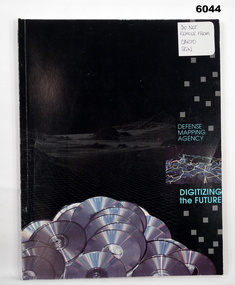
Manual - Defense Mapping Agency (US) - Digitizing the Future Third Edition, c1990
Digitizing the Future Third Edition, An information booklet describing the types of new digital geographic products produced by the US Defense Mapping Agency. The Australian Army Survey Regiment went on to also produce many of these digital productsSoft Cover Book, Paper Pages, 3 parts with Numerous Sections in each Part, Text, Diagrams and Photographs, Data Information Sheets, DMA Stock No: DDIPDIGITALPACFront Cover, "DO NOT REMOVE FROM CARTO SQN"royal australian survey corps, rasvy, fortuna, army survey regiment, army svy regt, asr -
 City of Moorabbin Historical Society (Operating the Box Cottage Museum)
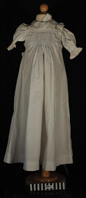
Clothing - Clothing, baby's nightgown, c1900
The pioneer settlers and market gardeners who came to the Brighton area after the 1841 Dendy Special Survey had to be self reliant. The women made most of the clothing for their families and many items on display exhibit their skill and craftsmanshipThis is a typical garment made by the women pioneer settlers in the Brighton area after the sale of land in the Dendy Special Survey 1841. By 1900 the area was known as Moorabbin Shire and the successful market gardeners were supplying the population of Melbourne with produce.This is a baby's long white cotton nightgown with a frilled collar and waist ties, typical of that made c 1900 an worn in Moorabbin Shiremelbourne, brighton, moorabbin, dendy henry, market gardeners, dressmakers -
 Vision Australia
Audio - Sound recording, Results and Observations from Research into Employment Levels in Australia - overview document, March 2007
In 2007, research was taken into employment levels of people who are blind or have low vision via a survey and interviews with a variety of people. This report was commissioned to provide primary evidence on the employment and unemployment situtation, and compare this to ABS data. 1 CD with 9 sound filesvision australia, employment, david baldwin -
 National Communication Museum
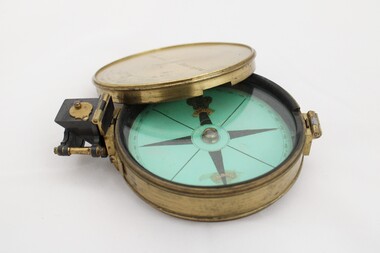
Equipment - Prismatic compass, Alfred E Sawtell, before 1872
After years of precursory surveying, debate and proposals the most ambitious civil engineering project of the day, the Overland Telegraph Line, began construction in September 1870. Superintendent of Telegraphs, Sir Charles Todd led the construction through “terra incognita,” guided by the precursory surveys of John McDowall Stuart and technologies such as his prismatic surveying compass. The unknown and hostile landscape claimed the lives of several men and scores of transport animals in the dogged pursuit of telegraphic connection to the rest of the world. Completed in August 1872, the Line connected Australia to the world via telegraph wires running 3,200 kilometres from Port Augusta in South Australia, to Darwin, then connecting via submarine cable to Java and beyond. The “earth [had been] girdled with a magic chain” according to the then Governor of New South Wales, Sir Hercules Robinson. How does it work? For use in surveying, the sight vane and prism are turned up on their hinge and the instrument is held horizontally either in the palm of one's hand or on a tripod. Two small discs of red and green glass attached to the prism can be flipped down over the sight line to reduce glare. The objective is to bring the subject into the sightline created by the prism, aligning with the thread of the sight-vane until the subject is bisected evenly. Once aligned, the division on the card may be read through the prism. This reading provides the magnetic azimuth, used for calculating the bearings of distant landmarks. Circular instrument mounted in a brass case with glass window and brass lid. The compass card face four black compass points printed on mint green paper; on the underside the magnetic needle would be affixed, all held in place by a brass knob at the centre. The arched labels of "Sawtell" and "Adelaide" and the Prince of Wales feathers appear to have been affixed with adhesive which has since yellowed in the areas of application on the compass card. The compass face is printed with numbers, every 10 degrees from 10 - 360, printed in reverse indicating this compass would have once held a mirror at the sighting bracket. On one side of the brass case is a brass hinged sighting-prism, possibly of ebonite. The sighting-prism is mounted in a hinged brass bracket on one edge of the brass case. It has two flip-type filter glasses (red and green) and folds down into a retracted travelling position. A hinged brass bracket on the opposite edge would have held the sighting bracket - carrying the sighting vane and mirror - which is now missing or removed. Under the hinge is a lever, possibly related to the movement of the bracket. Underneath the brass case is an indented circle with screw threads, possibly for attachment to a tripod, and indistinguishable marks scratched into the surface.Etched on to the centre of the lid, "Sawtell ADELAIDE / No 792." Affixed to the paper compass face, possibly from separate pieces of paper, "SAWTELL / ADELAIDE" with the Prince of Wales Feathers above "SAWTELL". Underneath on remains of white tape in red: "159."surveying, compass, charles todd, overland telegraph line, telegraph -
 Bendigo Military Museum
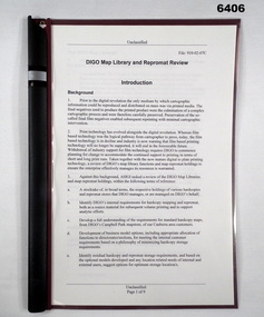
Administrative record - DIGO Map Library and Repromat Review 2004, Geospatial Analysis Centre, Bendigo, 25 Oct 2004
Prior to the digital revolution the only medium by which cartographic information could be reproduced and distributed on mass was via printed media. The final negatives (repromat) used to produce the printed products were the culmination of a complex cartographic process and were therefore carefully preserved and stored. Preservation of the so-called final negatives enabled subsequent reprinting with minimal cartographic intervention. Since the arrival of the Land Headquarters Cartographic Company at Fortuna in 1942 the repromat for all products produced by the Australian Survey Corps were carefully stored. With the disbandment of the Army Survey Regiment in 1996 the Defence Imagery and Geospatial Organisation (DIGO) inherited that repromat archive. It was immanent that the support for film based printing was ending so on 25 October 2004 a review was required to determine the way ahead for the repromat and paper maps stored in the DIGO Map Libraries. Most of these maps were produced by the Royal Australian Survey Corps. This report is the result of that review. The report recommends the disposal of the repromat and the retention of single map copies. A4 plastic covered report, plastic clip bound, front page clear and rear page red. 9 x page document about the future of repromat and map printing.royal australian survey corps, rasvy, fortuna, army survey regiment, army svy regt, asr -
 Ringwood and District Historical Society
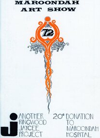
Document, Packet: Ringwood Jaycees - Art Show Programmes 1975; Development Project 1962-1963; Junior Jaycees Art Show 1972; Survey 1967
Packet includes the following: . Ringwood Junior Chamber of Commerce- Community Development Project, 1962-63. . 1967 Ringwood Community Survey- conducted by the Ringwood Jaycees. . Maroondah Art Show 1972. . Maroondah Art Show 1969. . Programme- Junior Chamber International Senate Award for Stan Morris, March 20th, 1969. . Maroondah Art Show 1975. -
 Federation University Historical Collection
Book, The Colliery Engineer Company, Coal and Metal Miners' Pocket Book, 1893, 1893
This book was specially compiled and prepared for the convenient use of mine officials, mining engineers, and students preparing themselves for certificates of competency as mine inspectors or mine foremen.Dark, hard covered book. Contents include arithmetic, weights and measures, Cylinders, Geometry, Mensuration, Surveying, strength and Weight of Materials, wire ropes, chains, Colliery management, precious metals, ventilation, hydrostatics, hydraulics, mine railways, Friction of mine cars, colliery machinery, steam raising, rules for engine drivers, faults, electricity, glossary of Mining terms.mining, coal, metal, colliery, definitions, brook, advertisements -
 Ringwood and District Historical Society
Document - Copy of Lands Department Field Notes - Subdivision of Ringwood, Victoria, Field Notes 1904/188 - Part of O.P. R72D Surveyed 28.4.1904
Foolscap size photocopy of survey map with handwritten notations. References include Mount Dandenong Road to Lilydale, M. Dickson (sold), Church of England, P. Schonnenberger, Helen Lindsay, W.B. iron roof & shingles, I certify that this is a correct copy of the recorded observations and measurement made by me and my assistant (signed) W. Thorn 12/5/04 -
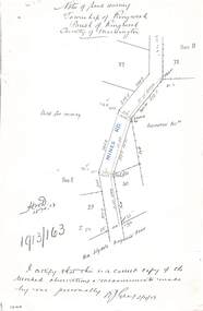 Ringwood and District Historical Society
Document - Copy of Lands Department Field Notes - Township of Ringwood, Victoria, Field Notes 1913/163 - Part of O.P. R72D surveyed April 1913
5612b Foolscap size photocopy of survey map with handwritten notations. References include Mines Road, New Lilydale Road (Maroondah Highway), (area) Held for mining, Recreation Reserve, Sec D, Sec E, I certify that this is a correct copy of the recorded observations & measurements made by me personally (signed) R.J. Gray 2/4/13. -
Bendigo Historical Society Inc.
Map - NERRING : COUNTY OF BENDIGO, August 1952
Map. Nerring, County of Bendigo, Yarraberb, Leichardt, Marong, Sandhurst, Huntly, Neilborough, Bendigo and Swan Hill Railway, Bendigo and Kulwin Railway, Loddon Valley Highway. By authority J.J. Gourley, Government Printer, Melbourne. Drawn and reproduced at the Department of Lands and Survey, Melbourne, Victoria. August 1952. Price $1.00. (number 76 in map cupboard 1)J.J. Gourley, Government Printer, Melbourne.map, bendigo, nerring -
Bendigo Historical Society Inc.
Map - MILLOO : COUNTY OF BENDIGO, 29-2-24
Map. Milloo, County of Bendigo. Wanurf, Dingee, Kamarooka, Pannoomilloo, Waranga Mallee Channel, Elmore to Kerang Road, Pannoo Estate. By authority A.J. Mullett, Govt. Printer. Photo-Lithographed at the Department of Lands and Survey, Melbourne, by W.J. Butson, 29-2-24. Price 1/-. Janiember to Rochester Road. (number 72 in map cupboard 1)A.J. Mullett, Government Printer.map, bendigo, milloo -
 Bendigo Historical Society Inc.
Document - TAMBOUR MAJOR MINE
Six page document describing resources found in a search for 'Tambour major' and 'Mine' with Informit databaxse, VPI&E (formerly ELIXIR) and AESIS Databases. For example, record 1: Author Caldwell, J.J. Melbourne Geological Survey of Victoria 1946 3 figs, 3 microfiche frames, 2 negatives. Subject: Bendigo Major Mine, transverse section.bendigo, mining, tambour major -
Bendigo Historical Society Inc.
Map - POWLETT : COUNTY OF BENDIGO, 2-12-15
Map. Powlett, County of Bendigo, County of Gladstone, Janiember West, Janiember East, Yarrayne, Salisbury West, Kurting, Korong, River Loddon. By Authority Albert J. Mullett, Government Printer, Melbourne. Photographed at the Department of Lands and Survey, Melbourne by W. J. Butson.2-12-15. Price 1/-. (number 119 in map cupboard 1)Albert J. Mullett, Government Printermap, bendigo, powlett