Historical information
The Royal Australian Survey Corps, Army Survey Regiment used transformations of Aerial Photographic strip and block coordinates to accurately calculate setup parameters for the extraction of topographical features on Wild B8 stereo plotters. This manual describes the methods and "Fortran" computer programming language solutions.
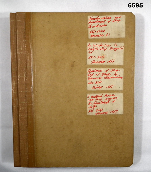
Chapter 1 - Transformation and adjustment of strip coordinates by electronic computation.
Chapter 2 - An Introduction to Analytical Strip Triangulation with a "Fortran" program.
Chapter 3 - A "Fortran" program for the adjustment of Strips and Blocks by Polynomial Transformations.
Chapter 4 - A modified "Fortran" (IBM 1620) program for the adjustments of Strip coordinates.
Physical description
Hard Covered Manual containing Chapter 1 - 8 x pages, Chapter 2 - 84 x pages, Chapter 3 - 33 x pages, Chapter 4 - 29 x pages.
Inscriptions & markings
Distribution stamps and labels on front cover.