Showing 365 items
matching day, david
-
 Kew Historical Society Inc
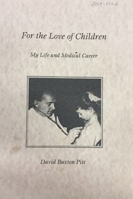
Book, For the Love of Children: my life and medical career / by David Buxton Pitt, 1999, 1999
Dr David Pitt was Australian paediatrician. In 1959, he joined the Kew Cottages workforce, where he practised for 17 years and improved the conditions for the children. He was a pioneer in the identification of rare syndromes using computers. The Cottages anabled him to contribute to the day to day care of disadvantaged people in the Australian community, while continuing his research. Pitt left Kew in 1976. (Source: Wikipedia). This book by David Pitt once formed part of the collection of Dr Cliff Judge, resident psychiatrist at the Cottages, and was donated by a daughter in 2018.xiv, 208 p. : ill., ports. ; 30 cm.mental health - victoria - history, chidren's cottages - kew, dr cliff judge, dr david pitt -
 Kew Historical Society Inc
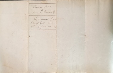
Legal record (Item), Thomas Judd to James Bonwick: Agreement for Sale of Land at Parish of Boroondara, 1853, 28/02/1853
James Bonwick (1817-1906), the Victorian educator and historian, acquired land in Kew on which to establish a home and school in 1853, not 1854 as more commonly stated. Bonwick returned to England in 1859 for a period, later returning to Melbourne and settling in St Kilda. He was the author of a number of histories and an official transcriber of Government records.This newly acquired document, from a former owner of 'Parkhill' (20 Hillcrest Avenue, Kew), is of statewide importance as it is the original copy of the agreement made between Thomas Judd of Parkhill and James Bonwick in 1853 for the purchase of land in Kew. Both Thomas Judd and James Bonwick were significant pioneers of Victoria.TRANSCRIPT [TITLE] Thomas Judd to James Bonwick Agreement for Sale of Land at Parish of Boroondara [PAGE 1] Articles of agreement made and entered into this the Twentyth eighth day of February One thousand Eight Hundred and fifty three Between Thomas Judd of Melbourne in the Colony of Victoria Gentleman of the one part and James Bonwick of Melbourne in the Colony of Victoria Gentleman of the other part whereby the said Thomas Judd agrees to sell unto the said James Bonwick who hereby agrees to purchase a piece or parcel of land containing two and half acres be the land more or less part of Portion Number Eighty five of the Parish of Boroondara in the County of Bourke commencing at a point on the Northern boundary line of the said Portion Seventeen Chains fifty links East from the North West angle of the same and bounded on the East by other part of said Portion in a line bearing South Eight Hundred and sixty two feet on the South by other part of said Portion Eighty five in a line bearing West one Hundred twenty six and half feet on the West by other part of said Portion Eighty five in a line bearing North Eight Hundred and Sixty two feet on the North by the Northern boundary line of the said Portion Eighty five in a line bearing East one Hundred twenty six and half feet to the commencing point at or for the price or sum of one [PAGE 2] One Hundred Pounds to be paid and payable in the manner hereinafter mentioned that is to say the Sum of Thirty pounds to be paid on the day of the date hereof and the sum of forty pounds by the acceptance of the said James Bonwick for that sum at three months bearing interest thereon after the rate of Eight Pounds per centum per annum and the Sum of Thirty pounds by the acceptance of the said James Bonwick for that sum after Six months with interest thereon after the rate of Eight pounds per centum per annum It is furthermore agreed that the said James Bonwick shall have access by a right of way fifteen feet wide reserved by the said Thomas Judd to the Government Road being the Southern Boundary of Portion Eighty five. That in case default shall be made in the payment of any of any of the Acceptances above mentioned the amount paid shall be actually forfeited to the said Thomas Judd who shall be at liberty to resell the premises. That upon payment of the whole amount of the purchase money the said Thomas Judd shall execute a conveyance of the premises to the said James Bonwick Such conveyance to be prepared by and at the expense of the said James Bonwick who - [PAGE 3] who shall also pay the cost of any attested copies he may require. ---- As witness the hands of the said parties this the twenty first day of February one thousand Eight Hundred and fifty Three. ----- [Signature] T. Judd [Signature] Jas Bonwick Witness [Signature illegible] £ Received Cash on account of the above 30.0.0 Thirty Pounds Bill at three Months with interest 42.4.0 Bill at Six Months with interest 31.4.0 _____ £103.8.0 _____ [Signature] T. Judd [Signature] Jas Bonwick ------------ Transcribed David White 25/08/2020 james bonwick, thomas judd, land titles - kew (vic), pioneers - kew - victoria -
 Kew Historical Society Inc
Journal, Kewriosity : February 1987
... / Peter Davies p2. Kew Festival - eat your way through Fun Day ...Kew's Premier Youth Theatre in performance / p1. SEC act threatens [street] trees / p1. Dates for February / p2. [Community] Notices / p2&8. Commentary - a challenging year ahead / Cr Joe Ormando, Mayor of Kew p3. Good gardening / Peter Davies p2. Kew Festival - eat your way through Fun Day / p3. Profile - Cr David Timms / p4. Calling artisans and craft persons [Senior Citizens' Week] / p3. After School program for Kew Primary School / p5. A gentle reminder about Kew's By-Laws [Mini bike riding] / p5. Get your entry in! [Images of Kew competition and exhibition] / p5. Kinder for there year olds [North Kew Municipal Kindergarten, 152 Pakington Street] / p5. Kew Community House [A new year starts; Volunteer tutoring for adult literacy; 1st semester pamphlet; Now open on Wednesdays] / Rhonda McCaw p6. Gymbaroo offers early learning / p6. Hassle free apprenticeship training [Inner Eastern Group Apprenticeship Training Scheme] / p7. Children's Services update [Kew Children's Services Consultative Committee] / p7. Care-Force needs volunteers [Care-Force Family Support Services] / p7. Footy news [Kew Football Club] / p8. Keeping you informed [Citizens' Advice Bureau] / p8. Babysitting? [Babysitting clubs] / p8.Kewriosity was a local newsletter combining Kew Council and community news. It was published between November 1983 and June 1994, replacing an earlier Kewriosity [broad] Sheet (1979-84). In producing Kewriosity, Council aimed to provide a range of interesting and informative articles covering its deliberations and decision making, together with items of general interest and importance to the Kew community and information not generally available through daily media outlets.non-fictionKew's Premier Youth Theatre in performance / p1. SEC act threatens [street] trees / p1. Dates for February / p2. [Community] Notices / p2&8. Commentary - a challenging year ahead / Cr Joe Ormando, Mayor of Kew p3. Good gardening / Peter Davies p2. Kew Festival - eat your way through Fun Day / p3. Profile - Cr David Timms / p4. Calling artisans and craft persons [Senior Citizens' Week] / p3. After School program for Kew Primary School / p5. A gentle reminder about Kew's By-Laws [Mini bike riding] / p5. Get your entry in! [Images of Kew competition and exhibition] / p5. Kinder for there year olds [North Kew Municipal Kindergarten, 152 Pakington Street] / p5. Kew Community House [A new year starts; Volunteer tutoring for adult literacy; 1st semester pamphlet; Now open on Wednesdays] / Rhonda McCaw p6. Gymbaroo offers early learning / p6. Hassle free apprenticeship training [Inner Eastern Group Apprenticeship Training Scheme] / p7. Children's Services update [Kew Children's Services Consultative Committee] / p7. Care-Force needs volunteers [Care-Force Family Support Services] / p7. Footy news [Kew Football Club] / p8. Keeping you informed [Citizens' Advice Bureau] / p8. Babysitting? [Babysitting clubs] / p8. publications -- city of kew (vic.), kewriosity, council newsletters, community newsletters -
Kew Historical Society Inc
Journal, The Kewriosity Sheet Vol.3 No.1 : July 1981
Fete [Kew Elder Citizens] / p1. Televising the service of worship [Uniting Church East Kew] / p1. Desperately needed [7th Kew Cub Pack] / p1. For sale ... The Artists of Kew [Elizabeth Mackie; Kew Historical Society] / p1. Art exhibition [Australian art] / p1. Afternoon movie [Missionary Sisters of St Peter Claver] / p1. Movement and dance in Special education [Caritas Centre] / p3. Day Care Centre [Caritas Centre] / p3. What is a blitz? [Yarra Bend Pakr; South African Boneweed]/ p3. The David Allen Memorial Scholarship [Concert; Old Presbyterian Church, Kew; Ian Frederick Lowe, Kaye Allen, Miriam Leuba] / p4. Kew Garden Club / p4. Child development and play - Eastern Region / p4. Caregivers needed [Family Day Care Centre] / p4.The Kewriosity Sheet (1979-83) was first published in the City of Kew (Victoria) in June 1979 as a two-sided 'community newssheet'. It aimed to: 'share news about Kew happenings and Kew people, and to exchange ideas about living in Kew'. Later issues gradually evolved into a 4-page, quarto sized publication. The Kewriosity Sheet was superseded by the Kew Council publication 'Kewriosity' (1983-1994).non-fictionFete [Kew Elder Citizens] / p1. Televising the service of worship [Uniting Church East Kew] / p1. Desperately needed [7th Kew Cub Pack] / p1. For sale ... The Artists of Kew [Elizabeth Mackie; Kew Historical Society] / p1. Art exhibition [Australian art] / p1. Afternoon movie [Missionary Sisters of St Peter Claver] / p1. Movement and dance in Special education [Caritas Centre] / p3. Day Care Centre [Caritas Centre] / p3. What is a blitz? [Yarra Bend Pakr; South African Boneweed]/ p3. The David Allen Memorial Scholarship [Concert; Old Presbyterian Church, Kew; Ian Frederick Lowe, Kaye Allen, Miriam Leuba] / p4. Kew Garden Club / p4. Child development and play - Eastern Region / p4. Caregivers needed [Family Day Care Centre] / p4. community publications --- kew (vic.), the kewriosity sheet, newsletters - kew (vic.) -
Kew Historical Society Inc
Journal, Newsletter No.147, June 2024
Tram tracks in Boroondara [electrification of] / Robert Baker pp1-2. History News - Conservation [Henty Family Costume Collection, Community Heritage Grant application - National Library of Australia]; New Members; Donations to the Collection / p3. The Voyage of the John Bunyan / David White pp4-5. Family records: The diary of Mrs Henry Henty of Tarring / Suzanne McWha pp6-8. Sir Rupert 'Dick' Hamer AC KCMG ED / John Torpey pp8-9. As it happened 100 years ago [H.C.A. Harrison, Empire Day, Motor accident, Widening of High Street [Kew], Death of Cr [Sir] Henry [de Castres] Kellett, Bt / David White p.9. Branching out: the Coles family of Kew / Desley Reid pp.10-11. Membership and Donations / p12.Published quarterly since 1977, the newsletters of the Kew Historical Society contain significant research by members exploring relevant aspects of the Victorian and Australian Framework of Historical Themes. Frequently, articles on people, places and artefacts are the only source of information about an aspect of Kew, and Melbourne’s history.non-fictionTram tracks in Boroondara [electrification of] / Robert Baker pp1-2. History News - Conservation [Henty Family Costume Collection, Community Heritage Grant application - National Library of Australia]; New Members; Donations to the Collection / p3. The Voyage of the John Bunyan / David White pp4-5. Family records: The diary of Mrs Henry Henty of Tarring / Suzanne McWha pp6-8. Sir Rupert 'Dick' Hamer AC KCMG ED / John Torpey pp8-9. As it happened 100 years ago [H.C.A. Harrison, Empire Day, Motor accident, Widening of High Street [Kew], Death of Cr [Sir] Henry [de Castres] Kellett, Bt / David White p.9. Branching out: the Coles family of Kew / Desley Reid pp.10-11. Membership and Donations / p12.kew historical society (vic.) -- periodicals., kew historical society (vic.) -- newsletters, kew historical society (vic.) -- journals -
 Kew Historical Society Inc
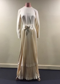
Clothing - Evening Dress, Simona Couture, 1970s
Evening dress owned and donated by Kew architect, and Life Member of the Kew Historical Society, Dione McIntyre. The dress was created by the Sydney company Simona Couture, founded 1963 by Inge Fonagy. Inge Fonagy trained in Switzerland and migrated to Australia in 1950. The chief designer of the company from the late 1960s was her son, John Recek. The fashion house won a number of awards including: David Jones' Supreme Award for Fashion Excellence (1972); David Jones Award for High Grade Fashion (1972); and David Jones Award for Pret-a-porter (1973),The McIntyre Collection of clothing and clothing accessories forms one of the largest single donations to our Fashion & Design collection. It includes clothing and clothing accessories worn by four women in the Cohen and McIntyre families across three generations. The items worn by Melbourne architect, and Kew resident, Dione McIntyre date from the 1960s and 1970s, and include evening wear, day wear, hats and shoes. As Dione McIntyre often accompanied her husband, fellow architect Peter McIntyre, to formal events, there are a number of pieces of evening wear among the items. The McIntyre Collection also includes items worn by women of an earlier generation: by Lilian Cohen, Dione McIntyre's mother, and by her mother-in-law, the wife of the architect Robert McIntyre. At the other end of the chronological spectrum are a number of outfits belonging to, worn and donated by Annie McIntyre. These include outfits created by notable late 20th century Australian and/or international fashion designers. The McIntyre Collection is significant historically and artistically as it includes examples of design that demonstrate changing tastes in fashion over an 80-year period. The collection is also significant in that it includes the work of a large number of Melbourne designers from the 1960s to the 1990s. Cream coloured long sleeve evening gown with cross-grain same colour trim and belt. The skirt features heat-treated sunray pleats.Label: Simona Couturemcintyre collection, evening wear, women's clothing, australian fashion - 1970s, simona couture -
 Glen Eira City Council History and Heritage Collection
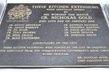
Plaque, commemorative
Plaque, bronze with polished bronze border, relief lettering and City of Caulfield ensign, and brown textured background. The plaque commemorates the official opening of kitchen extensions by His Worship the Mayor Cr Nicholas Gold on 25th January 1994. It lists Councillors of the City and Chief Executive. THESE KITCHEN EXTENSIONS / WERE OFFICIALLY OPENED / BY / HIS WORSHIP THE MAYOR / CR. NICHOLAS GOLD / THIS 25TH DAY OF JANUARY 1994 / CR. SANDY ANDERSON CR. JAMES BARRETT CR. ED BIGGS CR. TONY BROWNE CR. NOEL ERLICH CR. ALAN GROSSBARD CR. DANIELLE HASTINGS CR. VERONIKA MARTENS CR. DAVID MICHELSON CR. DAVID SPENCER CR. HEATHER WELSH / COUNCILLORS OF THE CITY / THESE KITCHEN EXTENSIONS WERE FUNDED BY THE CITY OF CAULFIELD / WITH ASSISTANCE FROM THE COMMONWEALTH GOVERNMENT'S LOCAL CAPITAL / WORKS PROGRAM / MR DOUGLAS AYLEN / CHIEF EXECUTIVE OFFICER -
Glen Eira City Council History and Heritage Collection
Document (Item) - Newspaper (digital), Caulfield Contact
The Caulfield Contact was the official newspaper of the City of Caulfield from 1976-1994. The City of Caulfield was the Municipal Council for an area of the South Eastern suburbs of Melbourne, including Brighton East, Carnegie, Caulfield, Elsternwick, Gardenvale, Glen Huntly, McKinnon, Murrumbeena, Ormond and St Kilda East. Following the amalgamation of City of Caulfield and parts of the City of Moorabbin in 1994, the municipality was renamed the City of Glen Eira. The Caulfield Contact was replaced by the Glen Eira News. 320-001-1976-001-001-07-28 Vol 1 edition 1 July 1976 Twenty-fifth (25th) anniversary of home help service; Profiles on Councillors Ray Mann, David Nolan; Murray and Wells call out for historical material; Resident's proposal for ward boundary changes accepted by Council, Profiles Councillor Bert Caldwell, Stan Hunter Town Hall Reprieve, History of Caulfield First Caulfield Arbor Day, Results of Council Elections held on 26 August 1976 city of caulfield, caulfield, history of caulfield, glen eira -
 Surrey Hills Historical Society Collection
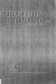
Book, Early history of Canterbury and District, c 1900-1930s
A collection of stories about early Canterbury and Balwyn (Boroondara) compiled by Crosbie Morrison.A collection of stories about early Canterbury and Balwyn (Boroondara) compiled by Crosbie Morrison.Title page: top of page; "1Please return to/Jocelyn Hall/for Alec Martin" in Jocelyn's writing in lead pencil butchers, boot makers, railways, empire day, festivals and celebrations, pong quong, outer circle railway, cycle shop, crosbie morrison, natale b cerini, george robinson, walter gathercole, mr armstrong, alice camm, ethel pascoe, david staig, mr wahanel, mr cook, will tanners, james snedden, john morris, j w terry, j d mclean, j w lowe, c r swan, cr a d renton, a n hendy, t r b morton, morton & coghill, jack kenneally, albert nelson, j rasmussan, tom keating -
 Surrey Hills Historical Society Collection
Photograph, Frank Cornell of 'Casallenroc,' 4-8 Lorne Parade
Frank and Blanche Cornell had their home built in 1904. Mr Cornell was a keen gardener, usually doing 2 hours’ work before going to work. He was a director of Buckley & Nunn, Bourke Street, having worked up from a position as shipping clerk. Frank was a great supporter of and worker for the Empire Day celebrations in the 1905-1911 period and also of the bowling club. He was also a keen photographer. Frank Cornell was first listed in Surrey Hills in 1906 at (6) Lorne Parade. In 1908 the listing gives his occupation as a clerk. He was born in 1869 in Richmond, Victoria and died 15 April 1917 in Surrey Hills from a stroke. His wife Blanche Annie Parsons Cornell (nee Bracher) was born in 1869 in Hokitika, New Zealand; she died on 21 January 1940. Children were: Gilbert Frank Cornell (b1894, Hawthorn; d1908, at Frankston beach, an accidental drowning) Ruth Amelia Cornell (b 1899, Kew; d 29 May 1977, Kew) Lorna Amy Cornell (b 1906, Surrey Hills; d unknown) Patience Blanche Cornell (b1907, Surrey Hills; d unknown). Frank and wife Blanche are buried in Box Hill Cemetery - CE-*-1058. Ruth Amelia married David Ellis, c1922 in Surrey Hills. David was a dentist who practised in Surrey Hills for many years. Patience (Pat) Blanche married Norman Henry Brewer (1893–1975) in 1931 in Surrey Hills.A black and white photograph of a man dressed in a 3 piece suit with flowers in his buttonhole, and a bow tie. He is also sporting a moustache.(mr) frank cornell, buckley and nunn, empire day celebrations, house names, lorne parade, surrey hills, (mrs) blanche amy parsons cornell, box hill cemetery, surrey hills bowling club, 'casallenroc' -
 Surrey Hills Historical Society Collection
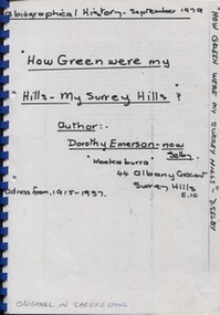
Book, Dorothy Selby (nee Emerson), How green were my hills - my Surrey Hills, September 1979
A biographical history by Dorothy Selby (nee Emerson) recollecting the people she came into contact with during her time in Surrey Hills from 1915-1937.A4, comb binding, 9 pageshouse names, kookaburra, albany crescent, surrey hills, (miss) dorothy emerson, (mrs) dorothy emerson, warrigal road, boundary road, st stephen's presbyterian church, (mrs) - gillies, (mr) tom ward, dentist, (mrs) - bowen, edwardian style, royal hotel, broughton road, (mrs) - brogan, (mr) - brogan, (mr) - tuckett, tacey's butcher, (mr) james tait, draper, (mr) alfred rose, state savings bank, surrey college, tower house college, balmoral crescent, (mr) - clewett, (mr) percy blood, stenning and holyoak, grocers, (mr) - pell, greengrocer, confectioner, fishmonger, (mr) tommy everon, (miss) beatrice bligh, (mr) - lyons, (mr) - ray, surrey hills station, transport, (ms) kitty mcewan, golfer, taxis, (mr) - collins, surrey hills primary school, (dr) (mr) - forsythe, (dr) (mr) - gandever, windsor crescent, valonia avenue, victoria avenue, (mr) john blogg, progress association, rechabite hall, (mr) claude wardle, (miss) beatrice oakley, empire day, (mr) robert gordon menzies, girl guides, (ms) nancy steele, (ms) hattie steele, (dr) (mr) - blaikie, (mr) - richards, stationmaster, crime, (mr) - cockerill, (mr) horrie breedon, first enlistment, (mr) (rev) brazier, (mr) (rev) - oakes, (mr) (rev) - gillies, (mr) (rev) - mudford, (mr) (rev) - millikan, (mr) (rev) - cockett, (mr) (rev) alfred gifford, (mr) (fr) david gleeson -
 Surrey Hills Historical Society Collection
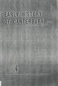
Book, Early history of Canterbury and District, c 1900-1930s
A collection of stories about early Canterbury and Balwyn (Boroondara) compiled by Crosbie Morrison.A collection of stories about early Canterbury and Balwyn (Boroondara) compiled by Crosbie Morrison.butchers, boot makers, railways, empire day, festivals and celebrations, pong quong, outer circle railway, cycle shop, crosbie morrison, natale b cerini, george robinson, walter gathercole, mr armstrong, alice camm, ethel pascoe, david staig, mr wahanel, mr cook, will tanners, james snedden, john morris, j w terry, j d mclean, j w lowe, c r swan, cr a d renton, a n hendy, t r b morton, morton & coghill, jack kenneally, albert nelson, j rasmussan, tom keating -
 Surrey Hills Historical Society Collection
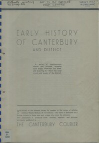
Book - Booklet, Early history of Canterbury and District, 1950
Foreword by Councillor A. D. Renton. A photocopy of a few pages of the Canterbury Courier. A series of reminiscences, stories and pictures from the Canterbury Courier.A series of reminiscences, stories and pictures from the Canterbury Courier.(mr) david staig, canterbury, surrey hills, southern cloud, first football club, first librarian, first pictures, first post office, canterbury football club, (mr) james bennett, 1934, empire day, surrey hills station, 1884, 1906, 1883, kenneally's farm, (mr) george robinson, sanitation -
 Federation University Art Collection
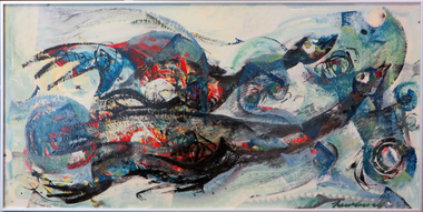
Oil, 'Migratory Birds' by David Newbury, 1956 /1958
David NEWBERRY (1925-2003) Born Eltham, Victoria David Newbury's painting career started with late 1950s abstraction. He worked for four decades, until 1997, when his final works were created on his last trip to Venice. Newberry was the son artist A.E. Newbury, and painting after World War 2 at RMIT, teaching there from 1955 - 1959,. He then taught at Bendigo Teachers College 1959 - 61 and Melbourne Teachers' College/Melbourne College of Advanced Education 1962 - 83. Among his students were Robert Jacks, Peter Smales and Gareth Sansom. ‘You must capture change. One day the landscape is violet, another it’s bluer or it has pinkness, its darker or lighter. Things change in front of you.’ (David Newbury c.1985) This item is part of the Federation University Art Collection. The Art Collection features over 2000 works and was listed as a 'Ballarat Treasure' in 2007.Framed painting.art, artwork, david newbury, birds, newbury -
 Federation University Art Collection
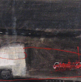
Painting - Artwork, Black Day, 2012
'Black Day' was part of a series of paintings drawn from a larger body of work produced over a four-year period exploring the 'harsher side' of the Australian landscape and the aftermath of extreme weatehr events and climatic occurences of fire, flood, drough and wind. Although loosely based on real places and events, the works are essentially fictional with ideas gleaned from popular media - telveision, Internet, magazines and newspapers. While my return to abstraction and landcape painting from figuration has been relatively recent, the natural environment has always been informed by my artistic practice regardless of subject matter, and has had always informed my artistic practice regardless of subject matter, and has had a long-standing influence on the aesthetics, the compositional structre and imagery in my work. The flattening of the picture plane and the prominent horizontal and vertical marks in my composition are informed by a response to both natural and man-made interventions in the land - the muted and restricted colour palette echoing my response to extrems in environmental changes, particulalry of cental and western ditrict Victoria. Created in the studio environment, I consisder this boxy of work as being imaginative 'conglomerates' which reflect varying perspectives and textural interpretrations of the land - defining and expresssing my response to particular and significant climatic, environmental events and my personal experiances. September 2012Tarli GLOVER Tarli Glover undertook a Bachelor of Arts at Ballarat College of Advanced Education [now Federation University] between 1980 and 1983, majoring in Fine Art Painting. Based in Central Victoria, she has been practicing professionally for over three decades and has exhibited widely throughout Australia. While Tarli's work covers a wide range of creative disciplines’ she concentrate’s primarily on painting, drawing and multi-media works with a focus on both landscape and figurative genres. Her work leans toward semi abstract symbolism and representation. This item is part of the Federation University Art Collection and was purchased for the collection by Vice Chancellor David Battersby. The Art Collection features over 2000 works and was listed as a 'Ballarat Treasure' in 2007.Acrylic on canvas paintingart, artwork, glover, tarli glover, bushfire, alumni, available -
Vision Australia
Audio (item) - Sound recording, Royal Victorian Institute for the Blind, Around the Institute: May 2, 2000
Around the Institute was a weekly program designed to keep clients and staff informed of events, activities and thoughts relating to low vision and blindness. It consisted of interviews undertaken by Jo Matthews, with sound engineer Ed Gamble, designed to inform, educate and explore on a variety of topics. May 2: Did You Know – Malcolm Fraser and David Ditchfield (Olinda special), Driving – Janet Cronin, Mother’s Day ideas at VisEquip – Christine Simpson. royal victorian institute for the blind, radio shows -
 Vision Australia
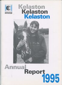
Administrative record - Text, Association for the Blind of Victoria 'Kelaston' 38th Annual Report 1995, 1995
Annual report on activities and financial performance of Kelaston, including the transition in funding model, launch of the Centenary Appeal to raise $1M to rebuild Kelaston, a staff team won the Ekiden Relay around Lake Wendouree, new service opened in Warracknabeal, long time committee member David Baird received an OAM, four residents enjoyed a holiday to Tye Estate at Romsey, two residents sailed on the tall ship 'Alma Doepel, two bantam hens and one rooster to the existing Cam and Sam cats as pet therapy, National Centre for Ageing and Sensory Loss chose Kelaston to be the location for it's training video, development of a attendant button when in the lounge of an evening when there is less staff, companion visiting program has begun, a Kelaston team won the Victorian A Grade Blind Bias Bowls in regional and state finals, and 'Keloca' Day centre in Avoca officially opened by Hon Rob Knowles, Minister for Aged care and Housing.1 printed volume with illustrationskelaston home (ballarat), association for the blind, corporation records -
 Vision Australia
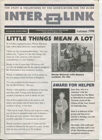
Magazine - Text, Inter Link Autumn 1998
Newsletter created to share information between branches, staff and volunteers on achievements at the AFB. This issue includes: Wendy Bateman and her role as an Elanora nurse, volunteer June Day receiving the Citizen of the Year award for Murchison on Australia Day, Victoria's triumphant blind bowls team who, when tied with their SA competitors, decided to share the Catchpole trophy by keeping it for 12 months then sending it back to South Australia for 12 months, Julie Deutscher has won the tender to clean Kelaston, staff members Margaret Caldwell, Ada Fox, Maureen Gleeson and Lorelle McGain have completed five years of service with the AFB, Gale Burns, Glenys Drewitt, Fiona Jackson, Gena Kyne, Anne Menzel and Margaret Tozer have completed 10 years of service and Margary Paynter has completed 15 years of service with the AFB, Dennis Smith from the George Vowell Centre helping out as barman and waiter, RPH volunteers David Ditchfield and wife Janet received a special award for their service to the station, Judy Sutherland, Chrisi Tsafso and Jo Sisley were present for awards handed to police who had held a self defence course for vision impaired, the AFB boat in the Moomba Dragon Boat Race, Sherry Cuthbert and James Nevein toast to Ernie Stewart's 102nd birthday, Susan Marshall with her children, Dorothy Cleeland and John Dowdle hand of a $25,000 cheque, Easter Bunny promoting the world's largest Easter Egg hunt as part of the Tattersall's Kooyong fair, Elenoar Scott and her mum Julie and Roberta Ashby, the use of teleconferencing by Palm Mitchell, with Shane McCarthy and Joy Lindsay in the background, aims for the year ahead including a possible name change, staff members Esther Lalor and Alex Capporilli learning Braille, and the Braille and Talking Book Library party with Mieke Mellars, Rose Blustein, Julia Simmons, Beryl Simmons, Emma Pritchard, Lorna Hayter and Alison Forbes.8 pages of text and images about AFB clients, staff and volunteersnon-fictionFor Staff & Volunteers of the Association for the Blind Inter Link Print Post No. 327855/00001 Association for the Blind A.C.N. 007 428 284 7 Mair Street, Brighton 3186 Autumn 1998elizabeth maxwell, neil maxwell, association for the blind, palm mitchell, shane mccarthy, mieke mellers, emma pritchard, lorna hayter, alison forbes, rose blustein, julie simmons, beryl simmons, stephen jolley, allan heywood, esther lalor, alex capporilli, elanoar scott, julie scott, roberta ashby, dorothy cleeland, john dowdle, susan marshall, sherry cuthbert, james nevein, david ditchfield, janet ditchfield, judy sutherland, christi tsafso, jo sisley, dennis smith, julie deutscher, june day, wendy bateman -
 Lilydale RSL Sub Branch
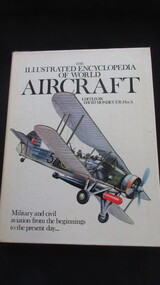
Book, David Mondey E.R. Hist.S, The Illustrated Encyclopedia of World Aircraft - Military and civil aviation from the beginnings to the present day, 1979
... to the present day Book David Mondey E.R. Hist.S Quarto Publishing Ltd ...Book -
 Lilydale RSL Sub Branch
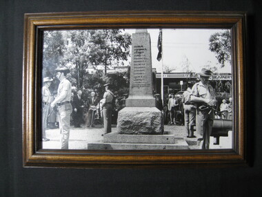
Photograph, David Fowler (Lilydale & Upper Yarra Post), Remembrance Day 1992, 11/11/1992
... -valley-and-the-dandenong-ranges Framed Photograph Remembrance Day ...Framed Photograph -
University of Melbourne, Burnley Campus Archives
Album - Black and white and colour prints, Staff Photographs, c. 1990
Collection of 110 photographs and some negatives, mostly colour. Some ID photographs, some at functions or taking classses. Identified by Ala Shtrauser, Ross Payne, Andrew Smith. Found in James Pearson's former office 2015 by Ross Payne. (1) Peter McSweeney, Kevin Blaze, Ross Payne, Ed Smart, Phil Kenyon, Paula Cave, John Delpratt, Peter May, Ian Winstone. (2) Geoff Olive, Ian Winstone, John Brereton, John Delpratt, Ross Hall. (3) Peter McSweeney, Nick Bailey, Phil Kenyon, Brian Shields, Geoff Olive, Ian Winstone, John Brereton, John Delpratt, Ross Hall, James Hitchmough, David Aldous. (4) Geoff Connelan, Jamie Pearson, Ross Payne, Ed Smart, Peter May, James Hitchmough, Nick Bailey, Ross Hall, Catherine Jaggs. (5) James Will, Bata Thomas. (6) John Delpratt, John Rayner. (7) Phil Mayle, James MacIntyre (student), James Will, Jayne Lindholm. (8,19) David Aldous, Eric Littlejohn. (9) John Rayner. (10) Nick Bailey. (11) Alex Campbell. (12,13) Ala Hires (Shtrauser). (14) Michael Green. (15) Ross Hall, Peter McSweeney, James Hitchmough, Kevin Blaze. (16,44) Brian Shields. (17,18) Kylie Cannon, Karen Geyeregger, Nick Osborne, Jim Pleasance. (20) John Delpratt. (21) Ian Winstone and student working on Student Gardens. (22) Geoff Olive, Ed Smart. (23) Robina Duggan, Michèle Adler. (24) Catherine Jaggs, Peter May. (25,26) Mark MacNamara, Kelvin McKenzie, Ruth Beilin, Ed Smart. (27) Rosemary McConell, Elizabeth Hill. (28) Fred Taylor, Mike Nechwatal. (29) Claire Scott, Nick Bailey, Ross Hall. (30,66) John Brereton. (31) Rosemary McConell, Mark MacNamara. (32) Mike Nechwatel, Bata Thomas, Graham Sterry. (33) Geoff Olive, Phil Tulk. (34) Ed Smart, Ruth Beilin, Ian Winstone. (35) James Will with students. (36,37) Peter McSweeney. (38) Alex Campbell, Jamie Pearson, Ross Payne. (39) Geoff Connellan. (40) Richard Green, Darryl Gibbs. (41) John Rayner, Karen Geyeregger. (442) Ross Payne. (43) Jamie Pearson, Jim Pleasance. (45-49) Claire Scott. (50-54) Ian Winstone. (55) Michelle Dall, Kylie Cannon, James Will, Catherine Jaggs, Nick Bailey, Jamie Pearson, John Brereton, Peter May, Rosemary McConell, Ed Smart, Greg Moore, Ian Winstone, David Aldous, Brian Shields "Sept 1990". (56) Brian Shields, Peter May, Kelvin McKenzie, Fred Taylor, Phil Tulk, Richard Green, Graham Sterry, Ross Payne "Sept 1990". (57,58) James Will, Jill Kellow 1987/88 on Grampians excursion with Associate Diploma students staying in Shearers' quarters. (59,60) James Will, John Delpratt. (61,62) Denise Johnstone. (63-65) Michèle Adler, Ian Winstone, Greg Moore, Jenny Leereveld, Geoff Connellan, Catherine Jaggs, Rod McMillan, Peter Esdale, Peter Sheppard, Nick Bailey, James Hitchmough, Rosemary McConnell, David Aldous, Ruth Beilin, Clive Sorrell, Tony Westmore, Peter May, Ivo Dean, Kevin Blaze, James Will, Ross Hall, Peter McSweeney, Ed Smart, Phil Kenyon, John Delpratt, John Brereton, Geoff Olive, Darryl Gibbs. (67) David Aldous, Greg Moore, Brian Shields, Peter May. (68,69) Preparing Landscape Shed 1990's. (70) Building Quad 6. (71) Leigh Stone. (72) Pruning Day. (73,74) Staff Group , Jim Davis, Principal. (75) Peter Esdale. (76) Tess Hernan. (77) Ruth Beilin. (78) Alex Campbell. (79) Ala Hires (Shtrauser). (80) Karen Geyeregger. (81) Catherine Jaggs. (82) Mark MacNamara. (83) Peter McSweeney. (84) David Aldous. (85) Cassandra McLean. (86) Barry Dimelow. (87) Phil Tulk. (88) Corinne Leadbeatter. (89) Cinnamon Evans. (90) Martin Stevens. (91) Ian Winstone. (92) Tony Westmore. (93) Robyn Middleton. (94) Alan Shanks. (95) Robin Haylett. (96) Mike Wilson. (97) Gail Murphy. (98) Tanuja Ali. (100) Julie Cocksedge. (101) Sheh-Mae Ho,. (102) Kerry Pantzopolous. (103) Michele Dall. (104-107) James Pearson. (108) Ross Payne. (109) Robina Duggan. (110) Meg Probin, Michèle Adler, Graham Sterry. Found in Jamie Pearson's former office 2015.functions, classses, ala shtrauser, ross payne, andrew smith, james pearson, peter mcsweeney, kevin blaze, ross payne, ed smart, phil kenyon, paula cave, john delpratt, peter may, ian winstone, geoff olive, ian winstone, john brereton, john delpratt, ross hall, nick bailey, phil kenyon, brian shields, james hitchmough, david aldous, geoff connelan, catherine jaggs, james will, bata thomas, john rayner, phil mayle, james macintyre, jayne lindholm, eric littlejohn, alex campbell, ala hires, michael green, peter mcsweeney, kylie cannon, karen geyeregger, nick osborne, jim pleasance, students, robina duggan, michèle adler, mark macnamara, kelvin mckenzie, ruth beilin, rosemary mcconell, elizabeth hill, fred taylor, mike nechwatal, claire scott, graham sterry, geoff connellan, richard green, darryl gibbs, michelle dall, catherine jaggs, greg moore -
 University of Melbourne, Burnley Campus Archives
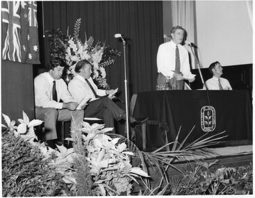
Photograph - Black and white print, Graduation Ceremony 1973, 1973
Black and white photograph. Graduation Ceremony 1973 speeches, 4 men on the stage in the Hall. Left to right: Hon. Ian Smith, Minister for Agriculture, Hon. R.J. Hamer, Premier of Victoria, David Wishart, Director-General of the Department Of Agriculture, giving a speech, Eric B. Littlejohn, Principal.graduation day, 1973, speeches, hon. ian smith, minister for agriculture, hon. r.j. hamer, premier of victoria, david wishart, director-general of the department of agriculture, e.b. littlejohn, principal, opening of student amenities building -
 Falls Creek Historical Society
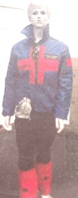
Uniform - Falls Creek Ski Patrol
The first ski patroller in Falls Creek was Brian Caddy with two casual ski patrollers Rob Sarroff and David Crooke in the 1960s. In 1972 the “official” Falls Creek Ski Patrol was created under the advisement of Dr Rodney Moss with the support of the Management Committee. By 1977 there were six or seven patrollers, and currently there are around 40 patrollers on the team with 13-14 rostered on each day during peak season. In 1974 the Australian Ski Patrol Association (ASPA) was formed. On the 14th March 1975, the Falls Creek Tourist Area Management Committee applied for membership to ASPA. At that time, Falls Creek Ski Patrol was known as Falls Creek Ski Rescue. This item is significant because it is representative of a critical service at Falls Creek.Falls Creek Ski Patrol jacket, pants, under sweater and gloves from the early 1980s.falls creek ski patrol, safety falls creek, falls creek services -
Canterbury History Group
Ephemera - Highfield Road Uniting Church Anniversary, 1/08/2013 12:00:00 AM
Don Gibb was invited to launch the book compiled for the anniversary. This is the order of service from that dayOrder of service for the 100th Anniversary Service of the Highfield Road Uniting Church August 2013canterbury, highfield road, churches, highfield road uniting church, huggett> penny, tan> david, black> alison, nicholson> peter, wootton> dan, gador-whyte> peter (rev) -
 Beechworth RSL Sub-Branch
Postage cylinder, c. 1923
This cylinder was constructed for the postage of two documents (0060.2 and 0060.3), to notify the family of Pte James Thomas Newton (945215) 3rd Battalion, Australian Imperial Force, of his passing. The documents appear to be addressed to M A Newton, though James Thomas Newton's next of kin is listed as David Newton, his father. James Thomas enlisted on 18 July 1916, joining the 3rd battalion, first in "B" Company and . James Thomas' service records indicate that he died on 9 October 1916 in a field hospital, Liverpool, NSW. He was ailed by bronchial pneumonia for 13 days before succumbing to the illness. A telegram suggests that the family were notified on the day of his death and received the cylinder and documents in the post 6 years later. Brown card cylinder which appears to have been formed from a single sheet of card, taped in place. Paper label contains the name of the recipient, several other stamps cover the cylinder. Label reads "M A Newton/Whitfield/Vict.". Round postage stamp reads "PAID - AT - MELBOURNE VIC/ 12 MR23/8". Other stamps include "DO NOT CRUSH" and a handwritten annotation, possibly added later "BILL KELLY."post, postal, postage, death notice, certificate, private james thomas newton, 3rd battalion, australian imperial force, first world war, world was i, world war 1 -
 Beechworth RSL Sub-Branch
Certificate, c. 1923
This cylinder was constructed for the postage of two documents (0060.2 and 0060.3), to notify the family of Pte James Thomas Newton (945215) 3rd Battalion, Australian Imperial Force, of his passing. The documents appear to be addressed to M A Newton, though James Thomas Newton's next of kin is listed as David Newton, his father. James Thomas enlisted on 18 July 1916, joining the 3rd battalion, first in "B" Company and . James Thomas' service records indicate that he died on 9 October 1916 in a field hospital, Liverpool, NSW. He was ailed by bronchial pneumonia for 13 days before succumbing to the illness. A telegram suggests that the family were notified on the day of his death and received the cylinder and documents in the post 6 years later. Cream coloured card paper rolled into scroll for transport inside card cylinder (0060.1). Certificate is printed with standard text and British crest above which is a "G V R" indicating the certificate was issued by King George V. Certificate features handwritten calligraphy notation of the recipient's name at the bottom of the text block.Handwritten notation reads "Pte. James Thomas Newton/3rd Bn A.I.F."post, postal, postage, death notice, certificate, private james thomas newton, 3rd battalion, australian imperial force, first world war, world was i, world war 1 -
 Beechworth RSL Sub-Branch
Certificate, c. 1923
This cylinder was constructed for the postage of two documents (0060.2 and 0060.3), to notify the family of Pte James Thomas Newton (945215) 3rd Battalion, Australian Imperial Force, of his passing. The documents appear to be addressed to M A Newton, though James Thomas Newton's next of kin is listed as David Newton, his father. James Thomas enlisted on 18 July 1916, joining the 3rd battalion, first in "B" Company and . James Thomas' service records indicate that he died on 9 October 1916 in a field hospital, Liverpool, NSW. He was ailed by bronchial pneumonia for 13 days before succumbing to the illness. A telegram suggests that the family were notified on the day of his death and received the cylinder and documents in the post 6 years later. Cream coloured card paper rolled into scroll for transport inside card cylinder (0060.1). Note bears embossed stamp of the British crest above red printed text "BUCKINGHAM PALACE". A signature from King George V is at the bottom of the text.Handwritten signature "George R. I."post, postal, postage, death notice, certificate, private james thomas newton, 3rd battalion, australian imperial force, first world war, world was i, world war 1 -
 Carlton Football Club
Scrap Book, 1995 Grand Final Scrap Book, 1995
A Scrap Book dedicated to Carlton's 1995 GF Triumph defeating Geelong A almost complete record of Newspaper Articles dedicated to Carlton's GF win over Geelong in 1995. It was Carlton's 16th Premiership after 16 wins in a row and became known as "sweet sixteen" In 1995 the AFL would admit the 16th team to the competion, the Fremantle Dockers. This would continue the expansion of the traditional VFL, after the West Coast Eagles and Brisbane Bears had been admitted in 1987 and the Adelaide Crows had been admitted in 1991. Carlton won their 16th Premiership in 1995 by defeating Geelong by 61 points in front of over 90,000 fans at the MCG. Over the season, the Blues would set a new benchmark for dominance in a single season with only 2 losses relatively early in the season, to lowly placed St Kilda and Sydney, with a string of 16 successive wins to take their 16th premiership. The season itself was just brilliant to watch as a fan, with stars in defence (Silvagni, Dean, Sexton), midfield (Williams, Bradley, Ratten) and attack (Kernahan, Pearce and Spalding), and all led by Captain Stephen Kernahan. There was a great blend of seasoned veterans (Silvagni, Kernahan and Williams) to young up & comers, including the brilliant Anthony Koutoufides who would have a breakout year at the start of a stellar career. By season's end, Carlton would be 4 games clear of the next best team, Geelong, demonstrating how far above the rest of the competition we were. Throughout the year, our only losses were to Bottom 8 teams, St Kilda and Sydney, and we did not drop a game to any team that played in the finals. In the finals, we defeated Brisbane, the Kangaroos and Geelong, with the Brisbane game being the tightest as the young Bears gave their all. If anything, the 1995 Finals campaign was a testament to Stephen Silvagni who would give up only 1 goal in the 3 games, keeping Darryl White (Brisbane), Wayne Carey (Kangaroos) and Gary Ablett (Geelong) well held. On the day itself, the Blues were supreme as they pounded the Cats into submission. Greg Williams would win the Norm Smith Medal for his 32 possessions and 5 goals, to add to his two Brownlow medals and now Premiership Medal. It was a fantastic year to be a Carlton fan. Come season's end, Coach David Parkin went on record to say that to maintain our success changes would be required. Troy Bond, Ben Harrison and James Cook, each having played games in 1995 but not making it for the Grand Final, would be traded (plus some draft picks) in return for Adrian Hickmott, Justin Murphy, Craig Devonport and Ben Sexton. A4 Scrap Book -
 Tarnagulla History Archive
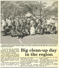
Article: Big Clean Up Day In The Region, March 7, 1995
David Gordon Collection. Page from The Advertiser with article. -
Tarnagulla History Archive
Facsimiles of 3 historic pamphlets
David Gordon Collection. Compiled by David Gordon. Black display folder with facsimiles of three booklets: 1. Souvenir Flower Day booklet (1918) - contains names and information on achievements of men who served from Tarnagulla and other towns in district. 2. Tarnagulla State School Roll of Honour (WWI) 3. The Church Life of Arnold 1911-1976