Showing 316 items
matching eastern hill
-
 Whitehorse Historical Society Inc.
Photograph, Cook Family
William Cook was one of the earliest settlers in Vermont. Having returned from the W.A. goldfields he married Jane Maggs in 1880 at Wickliffe, Victoria and his only child, Amy, was born in 1881 at Box Hill. William Cook's property fronted Whitehorse Road, Mitcham and ran north almost to the Mullum Mullum Creek. He shared part of his eastern boundary with the Schwerkolt family. William Cook specialised in cherries and became known as 'The Cherry King'Sepia photograph mounted on card of a woman and a girl standing in front of a wooden house with iron lace on the verandah. A path leads down the side of the house.cook, amy, jane, orchards -
 Ballarat Heritage Services
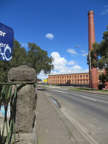
Photograph - Photograph - Colour, Sunnyside Mill Bridge over the Yarrowee, Hill Street, Ballarat, 2016, 17/09/2016
"A joint meeting of city and town ratepayers, convened by Messrs Francis Jago and Henry Johns, interested in the formation of a cart bridge in Hill street, over the Yarrowee Creek, was held on Saturday evening, in the Societies Hall, corner of Skipton and South streets, with the view of taking united action in the matter. Mr Morris was voted to the chair, : and about 60 persons were present. The chairman stated that the object of the meeting was that united influence should be brought to bear upon the City and Town Councils, so that a cartbridge should be erected. He said that Mount Pleasant would no doubt be thickly populated in a few years, and the bridge would prove a great boon to the inhabitants of the locality. By means of a cart bridge drays, would be enabled to save on their journeys to and fro between the mount and the batteries, at least a mile and a half each time. He hoped that the councillors for the south ward would assist them in this matter. Mr Jago, as one of the conveners of the meeting, said that united action on the part of both eastern and western ratepayers was requisite, so as to exert a strong pressure upon the City and Town Councils, in order that the work should be carried but. Mr Grainger moved the first resolution as follows;—“ That the construction of a cart bridge over the Yarrowee Creek at Sunnyside, to facilitate communication between the residents of the city and town, is urgently necessary, and that in the interests of both municipalities the two councils be asked to at once jointly carry out the work. In doing so he said that the necessity of a cart-bridge for the residents of Mount Pleasant would be apparent when the number of batteries, tanneries, and also the Woollen Mill, in the district were considered. The place was of growing import ance, and ready communication should at once be established. Another reason was that an immense saving in time would be effected. It was quite a common occurrence to see one, two, or three drays stuck in the bed of the creek which had gone that way to make a short cut. Now, what with the horses floundering about and breaking their harness, it seemed a wonder to him that life had not been destroyed before now, just through the want of a cartbridge. Mr Johns seconded the resolution. Mr Robert Calvert supported the resolution, and said that it was disgraceful action on the part of the representatives of the south ward that the work had not been executed long ago. They should come together like men and demand that the work should be done, and if not done they should not pay rates until it was. (A voice—“But they’ll make us.” Laughter.) The wooden footbridge across the creek was “only a wooden fabric, not fit for a Christian to walk across, and steps should be taken to remedy this also. Mr Blight, a resident of Mount Pleasant, said that, in common with others, he had been opposed to the erection of the bridge two years ago, but his views had since been altered. Cr. Morrison, who was present, said that the fault of the cartbridge not being erected over the Yarrowee at Hill street lay not with the City Council, but with their neighbors, who had always been opposed to its erection there. In 1874 a motion was carried at a meeting of ‘the City Council" by which the sum of £5OO had been voted to carry but the work. As the bridges over the Yarrowee were joint undertakings of the city and town, they had, by the provisions of an act of Parliament, called upon the Town Council to assist them in the erection of the bridge. In consequence, a conference of the two corporate bodies had taken place, when a motion was moved by Cr Howard, the representative of the south ward, and seconded by Cr Turpie, of Ballarat East—“ That the bridge should be erected at Hill street.” The motion was rejected, principally through the eastern representatives, who wanted the bridge lower down. Since then the two councils had often met to consider, the question of bridges over the Yarrowee Creek, but nothing had been done at the meetings, as the Eastern Council wanted the bridge in one place and the City Council in another. He had himself, when first elected to the council, given notice of motion affirming the desirability of a bridge, at the place now fixed upon. The Woollen Company was growing in importance, and a direct, road to its works would greatly advance its interests. For the working, expenses of each ward £400 was annually, appropriated; and this amount would not be sufficient carry out the work. They would have to obtain a special grant of about £900, as Hill street would require a culvert to be erected therein, as now it was virtually an open drain which carried the drainage of the western plateau to the Yarrowee. He advised that strong pressure should be exerted, specially upon the Eastern Council, and then the work might be carried out. He thought that if the foot bridge was repaired, and large stones thrown into the creek, it would do until the bridge could be erected. The chairman then put the resolution, and it was unanimously carried. Mr Hamilton moved the second resolution— “That Messrs Fern, Greenwood, Peirce, and Jago be deputed by the meeting to wait upon the City and Town Councils and present the first resolution; also that petitions in its favor be signed by all ratepayers interested.” Mr Haigh seconded the resolution, which was carried. Votes of thanks to Cr Morrison for his attendance, and to the chairman for presiding, were passed, and the proceedings terminated." (Ballarat Star, 9 August 1881, page 3) "WOOLLEN MILL BRIDGE YARROWEE IMPROVEMENTS Though brief the official ceremony of opening the bridge across the Yarrowee Creek, near the Sunnyside Woollen Mills, was of an interesting character. It took place at noon yesterday in the presence of the Mayors and councillors of the City and Town. Hon. F. Hagel thorn (Minister of Agriculture).Hon Brawn. M.L.C., Lt-Col Morton (Acting City Clerk). Mr J. Gent (Town Clerk of Ballarat East), Mr A. Farrer (City Engineer), Lt. L. Finch (who is about to leave for the Front, and who assisted Messrs A. Farrer and G. Maughan in carrying out the project, Mr W. Hurdsfield (Clerk of Works) and others. An apology was received from Mr J. McClelland, contractor for the work. Mayor Hill expressed pleasure in Introducing Mr Hagelthorn, who had at great personal sacrifice and inconvenience come from Melbourne to perform the opening ceremony of that beautiful bridge, which was of great improvements that had been effected.When Mr Hagelthorn was Minister of Pubic works he visited Ballarat specially to see the condition of the creek, which at that time was in a disgusting state from a sanitary standpoint. After viewing the position, and realising the justice of the claim. Mr Hagelthorn made strong representations to the Government of which the was a member with the result that it voted £17,000 for the work. That action had been the means of turning a plague spot into a thing of beauty. They therefore owed a deep debt of gratitude to Mr Hagelthorn and the Government of which he was a member, and they were particular grateful to Mr Hagelthorn for coming to Ballarat to perform the open ceremony. Mayor Levy said he could bear testimony to the good work Mr Hagelthorn had always done for Ballarat. In him Ballarat and district always had a good friend. He thought Mr Hagelthorn would feel amply gratified at seeing the good work that had been done. It would serve as some reward for the expenditure, on behalf of the residents of Bal larat, of the amount of money made available through Mr Hagelthorn's instrumentality for the two municipalities. Otherwise the City and Town councils would not have been able to carry out so necessary and so beneficial a work. There was a great amount of work yet to be done, and when the financial market became low stringent Mr Hagelthorn would no doubt be pleased to take the necessary steps to have money provided for further works which could not be undertaken at the present time. The adjacent woollen mill was a standing monument to what was being done in Ballarat, and what ever the City and Town Councils or the Government could do to encourage such manufacturing enterprise should be done, and he was glad to be able to say that was being done as far as finances would permit. He concluded by presenting Mr Hagelthorn with a gold mounted pocket-knife with which to cut the ribbon stretched across the centre of the structure as a bar to traffic. The Hon. F. Hagelthorn, who was greeted with applause said before him was a good work well done in the interests of the public. Real prosperity could only be achieved by a movement carried out by the people to increase natural productiveness. Most of them had been made aware, on account of the war par tiularly, that the people who were best equipped, the industries that were best organised, and the Governments that were most intelligently controlled would get the most of this world's goods and some of its luxuries that Would be denied other people less efficient. Any thing the Government could do to promote industry and to increase the reward of those engaged in it, both employer and employee, would be done. Most Governments would do but little in that regard. ... " (Ballarat Courier, 13 September 1916, page 4)Bluestone and iron bridge over the Yarrowee River at Hill Street, Ballarat.sunnyside mill, sunnyside woollen mill, ballarat woollen mill, bridge, yarrowee creek, francis jago, mount pleasant, yarrowee river, robert calvert -
 Ballarat Heritage Services
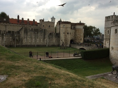
Digital photograph, Dorothy Wickham, Tower of London, 2016
The Tower of London, officially Her Majesty's Royal Palace and Fortress of the Tower of London, is a historic castle located on the north bank of the River Thames in central London. It lies within the London Borough of Tower Hamlets, separated from the eastern edge of the square mile of the City of London by the open space known as Tower Hill. It was founded towards the end of 1066 as part of the Norman Conquest of England. The White Tower, which gives the entire castle its name, was built by William the Conqueror in 1078, and was a resented symbol of oppression, inflicted upon London by the new ruling elite. The castle was used as a prison from 1100 (Ranulf Flambard) until 1952 (Kray twins),[3] although that was not its primary purpose. A grand palace early in its history, it served as a royal residence. As a whole, the Tower is a complex of several buildings set within two concentric rings of defensive walls and a moat. There were several phases of expansion, mainly under Kings Richard the Lionheart, Henry III, and Edward I in the 12th and 13th centuries. The general layout established by the late 13th century remains despite later activity on the site. The Tower of London has played a prominent role in English history. It was besieged several times, and controlling it has been important to controlling the country. The Tower has served variously as an armoury, a treasury, a menagerie, the home of the Royal Mint, a public record office, and the home of the Crown Jewels of England. From the early 14th century until the reign of Charles II, a procession would be led from the Tower to Westminster Abbey on the coronation of a monarch. In the absence of the monarch, the Constable of the Tower is in charge of the castle. This was a powerful and trusted position in the medieval period. In the late 15th century the castle was the prison of the Princes in the Tower. Under the Tudors, the Tower became used less as a royal residence, and despite attempts to refortify and repair the castle its defences lagged behind developments to deal with artillery. The peak period of the castle's use as a prison was the 16th and 17th centuries, when many figures who had fallen into disgrace, such as Elizabeth I before she became queen, Sir Walter Raleigh, and Elizabeth Throckmorton were held within its walls. This use has led to the phrase "sent to the Tower". Despite its enduring reputation as a place of torture and death, popularised by 16th-century religious propagandists and 19th-century writers, only seven people were executed within the Tower before the World Wars of the 20th century. Executions were more commonly held on the notorious Tower Hill to the north of the castle, with 112 occurring there over a 400-year period. In the latter half of the 19th century, institutions such as the Royal Mint moved out of the castle to other locations, leaving many buildings empty. Anthony Salvin and John Taylor took the opportunity to restore the Tower to what was felt to be its medieval appearance, clearing out many of the vacant post-medieval structures. In the First and Second World Wars, the Tower was again used as a prison, and witnessed the executions of 12 men for espionage. After the Second World War, damage caused during the Blitz was repaired, and the castle reopened to the public. Today the Tower of London is one of the country's most popular tourist attractions. Under the ceremonial charge of the Constable of the Tower, it is cared for by the charity Historic Royal Palaces and is protected as a World Heritage Site.(Wikipedia) A World Heritage Site is a landmark which has been officially recognized by the United Nations, specifically by UNESCO. Sites are selected on the basis of having cultural, historical, scientific or some other form of significance, and they are legally protected by international treaties. UNESCO regards these sites as being important to the collective interests of humanity. More specifically, a World Heritage Site is an already classified landmark on the earth, which by way of being unique in some respect as a geographically and historically identifiable piece is of special cultural or physical significance (such as either due to hosting an ancient ruins or some historical structure, building, city, complex, desert, forest, island, lake, monument, or mountain) and symbolizes a remarkable footprint of extreme human endeavour often coupled with some act of indisputable accomplishment of humanity which then serves as a surviving evidence of its intellectual existence on the planet. And with an ignoble intent of its practical conservation for posterity, but which otherwise could be subject to inherent risk of endangerment from human or animal trespassing, owing to unmonitored/uncontrolled/unrestricted nature of access or threat by natural or accelerated extinction owing to local administrative negligence, hence it would have been listed and demarcated by the United Nations Educational, Scientific and Cultural Organization (UNESCO) to have been identified or recognised and officially christened and internationally elevated through multilateral declaration by UNESCO as a universally protected zone. [1] The list is maintained by the international World Heritage Programme administered by the UNESCO World Heritage Committee, composed of 21 UNESCO member states which are elected by the General Assembly. (Wikipedia)The Tower of London is a UNESCO world heritage site.tower of london -
 Ballarat Heritage Services
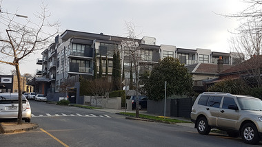
Photograph - Digital photograph, Lisa Gervasoni, Derby Street Flats, Kew. 2017, 2017
Kew is an eastern suburb of MelbourneColour photograph od a recently constructed block of flats in Derby Street, Kew.building, derby street, kew, residential, flats -
 Ballarat and District Irish Association
Photograph - Colour, Clare Gervasoni, Crossley near 'Hillside" McCartney's Lane, 2014, 04/04/2014
Before 1941 "Hillside", McCartney's Road was associated with the Carroll Family. Patrick Edmund Carroll, his wife Mary Matilda Fitzgerald, and children Kathleen, Ronald and Rosemary were the last members of the family to live at and work "Hillside". Stanislaus Kelly and his wife Margaret (nee Gorman) bought the farm from the Carroll family. The couple raised six children on the land: May, Mary, Leo, Ray (Lofty), Daniel (Tich) and Bernadette. The family grew spuds and onions on the hill and milked cows, with the little dairy located on the eastern side of the house. (information from Mary Kelly)Colour digital photographs of Crossley, Victoria, near McCartney's Lane. The house depicted is "Hillside" in McCartney's Lane. The views towards an extinct volcano is Tower Hill.crossley, hillside, carroll, tower hill, mccartney's lane -
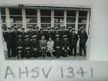 Ambulance Victoria Museum
Photograph, Ambulance Officers Training School, Mayfield, Malvern, September 1964, 1964
Names of participants signed on reverse of photograph: Jim Mason, Goulburn Valley, Shepparton Trevor Jobling (?), Murray Valley, Swan Hill Alf Bainbridge (?), Glenelg Ambulance, Hamilton Keith Thomas, Victorian Civil Ambulance Service Ray Harris(?) , W.D.A.S., Horsham Stan Barnes, Geelong & District Ambulance Service Doug Harper (?), North Eastern, Wangaratta Jim Woolgoo (?), Penninsula, Dandenong Morrie Denham (?), St John, Adelaide Geoff Ryan, CVDAS, Bendigo Charlie James, Penninsula, Frankston Terry Edwards, V.C.A.S., Cheltenham Stewart Ferguson, Latrobe Valley, Morwell Ben Kingsley, V.C.A.S. Bert Cluff, Ballarat & District Ambulance Service Charlie Williams, South Gippsland, Korumburra Robert Stewart, V.C.A.S. Jack Bourke, Geelong Harold Berry, Training Officer Faye JamesonBlack and White photograph of ambulance officer trainees -
 Southern Sherbrooke Historical Society Inc.
Information folder - Menzies Creek
Information folder containing items pertaining to the history of Menzies Creek. Contents: -document, "Menzies Creek, Now...And Then", by Pam Dennis, written for Eastern Regional Libraries History Writing Competition, 11 pages -single page from 'Australian Places' (Monash University), extracted 21st May 2004 -article, 'Following Tradition...', about Bill Hermon's retirement, The Trader, 19th July 1984, 2 copies -article, 'Museum draws first shots', re. the possible removal of the Puffing Billy Museum, Free Press, 9th August 1989 -article, 'There's gold in the Dandenongs!', re. Hancock's Nursery, Retirement, Issue 64, September 1998 -article, 'To remember...', re. Bill and Jean Hermon, Hills Trader, 1st August 1990 -article, 'Family honoured for community service', Free Press, 8th August 1990 -article, '30 years and still going strong', re. Puffing Billy, Knox-Sherbrooke Post, 29th July 1992 -article, "Daffodil delights", Free Press, 2nd Sep 1998, inc. photo of Rex Breen -article, 'People of the century', re. Hermon family, Ranges Trader Mail, 14th December 1999 -article, 'Pages from the past', re. the opening of John's Hill Reservoir in 1981, Ranges Trader Mail, 18th April 2000 -article, 'Historic reunion for family', re. Johns family, Ranges leader, 30th January 2002 menzies creek, gold-mining, timber, road transport, early settlers, menzies creek state school, puffing billy railway, st cuthbert's church, menzies creek rural fire brigade, menzies creek hall -
Southern Sherbrooke Historical Society Inc.
Information folder - "McDonalds Proposed Restaurant In Belgrave", 1991-1994
Articles collected by Belgrave branch of Eastern Regional LibrariesFolder containing items pertaining to the proposed establishment of a McDonalds restaurant in Belgrave, 1991-1994. Also items pertaining to McDonalds development in Tecoma in 2000s. Contents: -Article, "McDonald's c[asts] eye over hills", Free Press, 13 November 1991 -Article, "McDonald's to press on over Belgrave site", Free Press, 20 November 1991 -Article, "Chance for submissions"/Article, "Boon for hills" -Article, "Fear lingers", all Free Press, 20 January 1992 -Article, "Students show support", Free Press, 21 February, 1992 -Article, "McDonald's bid for site in Belgrave", Free Press, 20 May 1992, 2 copies -Article, "'Big Mac' now in the box seat", Free Press, 4 November 1992, 3 copies -Article, "Anger greets go-ahead", Free Press, 21 December 1992 -Article, "War Of Words", Free Press, 27 January 1993, 3 copies -Article, "Have your say", Hills Trader, 2 February 1993 -Article, "The hamburger fight" -Article, "Whose error?", both Sunday Age, 28 March 1993 -Article, "Maccas goes to hearing", Free Press, 31 March 1993, 2 copies -Article, "Proposed Big M site is 'horrible': builder", Free Press, 12 May 1993 -Article, "Six-week wait for Big Mac finding", Free Press, 7 July 1993 -Article, "Burger giant blow", Free Press, 29 July 1993 -Article, "'Big Mac' bides time in restaurant saga" -Article, "'Big Mac' pos.....", both Free Press, 12 August 1993, 2 copies -Article, "'Big Mac' to appeal", Free Press, 9 September 1993 -Article, "Cop-out on McDonald's 'so typical'", Free Press, 16 September 1993, 2 copies -Article, "Park challenge for McDonald's Belgrave proposal". Free Press, 26 January 1994 -Article, "Belgrave Maccas a likely prospect" -Article, "Bunfight in the hills", Herald Sun, 15 March 1994 -Article, "Zone opens doors", both Free Press, 25 May 1994 -Article, "People power wins", Free Press, 24 August 1994, 2 copies -Article, "New battle looms", Free Press, 31 August 1994 -Sherbrooke Fair Press, February 1993 -letter, Administrative Appeals Tribunal of Victoria to Frank Reid, dated 15th August 1994, re. withdrawal of appeal against refusal to grant a permit -articles, "Thousands protest" and "Maccas face the music", Mail, 5th March 2013, re. proposed Tecoma developmentbelgrave, mcdonald's, coffee palace, shire of sherbrooke -
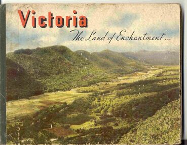 Ballarat Tramway Museum
Book, Nu-color-vue or Nucolorvue Productions, "Victoria The Land of Enchantment", c1950
Book with hardcovers, 48 pages titled "Victoria The Land of Enchantment". Sewn in three sections, with a green strip of cloth and self end papers and printed outer paper, sides glued onto board covers. Consists of 43 colour photographs (full and half page) with captions, detailed text, and two black and white photos printed in blue on end covers. Photos of Mt Buffalo, Gippsland lakes, Mornington Beach, Yarra River, Flinders St. station from the Yarra, Collins and Spring St (with two W2's - see image No. 2), Parliament House, Kiewa Hydro scheme, Eildon Weir, Swan Hill Murray River Bridge, Bendigo Post Office, Melbourne Botanical Gardens, Ballarat - Grenville and Sturt St (No. 22 - see image No. 3), Lorne, Yallourn Power Station, Hume Weir, Maroondah Weir, Great Ocean Road, Warrnambool, Portland Beach, A timber train (see image No. 4), Mildura, flax mills, Eastern Geelong and the Prime Ministers Ave, Ballarat. Produced by Nucolorvue Productions, c1950. See also Reg Item 2925 for the same photo of No. 22 and Reg Item 5354 for a postcard. Purchased via eBay site - see attached sheets and packing slip. Purchased 10/2/2005 for A$12.50 including postage, from Virginia Georgopoulos of West Brunswick. eBay sheets and envelope with worksheet file. Has Swains 123 Pitt St, Sydney sticker on bottom left hand corner page 2trams, tramways, ballarat, sturt st, grenville st, bogie trams, geelong, bendigo, melbourne -
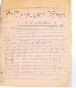 Ballarat Tramway Museum
Magazine, Australian Electric Traction Association (AETA), "The Trolley Wire", Vol 1, No. 3, "The Trolley Wire", Vol 1, No. 4, "The Trolley Wire", Vol 1, No. 7, "The Trolley Wire", Vol 1, No. 8, "The Trolley Wire", Vol 1, No. 10, 1952
5685.1 - Spirit duplicated magazine, 4 quarto pages, single sided - " The Trolley Wire", Vol 1, No. 3, April 1952, stapled down along the left hand side. Has items on Sydney trams, a Map of Ballarat tramways (See image i2), Newcastle News, and a discussion of the influx of transport experts into Sydney from England. 5685.2 - Spirit duplicated magazine, 7 quarto pages, single sided - " The Trolley Wire", Vol 1, No. 4, May 1952, stapled down along the left hand side. Has notes on use of tramway power for pumping stations, map of Bendigo (see image i4), news from Brisbane, Sydney news, association news, tramcar painting letters, Newcastle Destination roll 5685.3 - Spirit duplicated magazine, 7 quarto pages, single sided - " The Trolley Wire", Vol 1, No. 7, August 1952, stapled down along the left hand side. Has notes on Brisbane, Association news, map of the La Perouse - Botany - Mascot district, Ryde Cemetery, Sydney R 1890 runaway, North Sydney destination roll (1910) 5685.4 - Spirit duplicated magazine, 8 quarto pages, single sided - " The Trolley Wire", Vol 1, No. 8, September 1952, stapled down along the left hand side. Has notes on Association news, (left hand side very faded), map of the Enfield's lines, Brisbane Trolley Bus system 1952, Sydney news, and Eastern Suburbs roll. 5285.5 - Spirit duplicated magazine, 9 quarto pages, single sided - " The Trolley Wire", Vol 1, No. 10, November 1952, stapled down along the left hand side. Has notes on Brisbane, Wylde St trolley bus route in Sydney, Sydney news, association notes, Proposed lines in Sydney - Haberfield to Dobroyd, use of triple trams in Sydney, Broken Hill destination roll, Fort Macquarie depot track drawing and Newcastle news. See Reg Item 5685 for other Vol 1 issues and Reg Item 5686 for Vol. 2 issues.Vol 1, No. 4 has pencil inscription of "H. H. Matthews" in top right hand corner.trams, tramways, tramway news, history, sydney, newcastle, broken hill, brisbane, ballarat, bendigo, map -
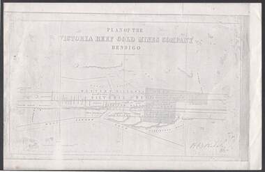 Bendigo Historical Society Inc.
Document - VICTORIA REEF GOLD MINES COMPANY BENDIGO PLAN
Photocopy of a Plan of the Victoria Reef Gold Mines Company, Bendigo. Shaded area is the Victoria Reef Gold Mines Company Lease No. 2 and Lease No. 3. The gullies are named Happy Valley, Long, Derwent, Providence and Ironbark Gullies. The reefs are: Western Victoria, Victoria, Eastern Victoria and Prince Albert Reef. Between the Eastern Victoria Reef and the Prince Albert Reef is the White Lead. Mount Korong Road is at the bottom of the plan. Other Leaseholders are: Burrows, Wybrant, Ballerstedt, Jackson,Roberts & Co, Ashley, Grant, ?rpe, ?eau, Woodward, Coath, Taylor, Cranshaw, Roberts, Gould & Co, Midway, Witscheibe, Endeavour Co, Albert Co, Ballerstedt & Son, Late Iron Bark Quartz Mining Co, McDougall, Specimen Hill Co, Hygrect?, Wheadon, Evans and Bannerman. Signed by H. B. Nicholas. Location of Ballerstedt, Luffsman, Midway Co, Witscheibe and Rae & Co engine locations. Hills are shown as hatch shading. Written at the bottom left ocrner is: Accompanying prospectus issued in Nov. 1859. Signed H.B. Nicholas.plan, bendigo, victoria reef gold mines company, victoria reef gold mines company bendigo - plan, h b nicholas, burrows, wybrant, ballerstedt, jackson, roberts & co, ashley, grant, ?rpe, ?eau, woodward, coath, taylor, cra-shaw, roberts, gou-d & co, midway, witscheibe, endeavour co, albert co, ballerstedt & son, late iron bark quartz mining co, mcdougall, specimen hill co, hyo?, wheadon, evans, bannerman. -
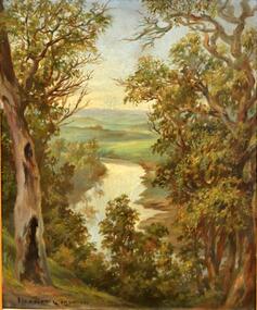 Kew Historical Society Inc
Painting, Herbert J Woodhouse, River Yarra Near Dights Falls, c.1892
Herbert James Woodhouse (1854-1937) was born in Essex and arrived in Australia with his family in 1857. A painter-lithographer like his father and three of his brothers, he was a prizewinner in the South Australian Society of Arts exhibition of 1885. He also received commendations in exhibitions at the Victorian Academy of Arts and the New South Wales Arts Society. At an exhibition of his paintings at Scott’s Hotel in Collins Street in 1892, the reviewer for Table Talk noted that the ‘artist paints almost solely in the open air, and his studies are generally carried out during the trips of the Victorian Sketching Club’. One of the paintings singled out for praise was: ‘A very effective river scene at Willsmere, aptly named A Midstream Mirror, ... a picture powerful in its effective reflection of sunlight in the river.’ Herbert Woodhouse died in Geelong in June 1937, aged 82, and was buried in the Eastern Cemetery. A number of his sketchbooks are held in the collection of the State Library of Victoria.Framed oil painting on board of the River Yarra at Studley Park, Kew, by Herbert James Woodhouse (1858-1937). The artist has framed the narrow painting with trees in the foreground and a view of the Yarra River and rolling hills in the background. Verso, written by artist: "River Yarra Near Dights Falls"australian art - 19th century, herbert james woodhouse (1854-1937), yarra river - studley park -
Kew Historical Society Inc
Journal, Kewriosity : August 1989
Cricket with a difference [Kooyong Cricket Club, St Paul's School] / p1. No election for Kew / p1. Dates for August / p2. Changes to baby capsule loan scheme / p2. Council seeks comments on Area 7 Traffic Plan [Studley Park] / p2. Council to monitor Government policy on Kew Cottages Plan [deinstitutionalisation] / p3. Walpole Hill parking / p3. Fire and incinerator by-law under review / p3. Notices / p4. Local office gives tenants information [Inner Eastern Housing and Tenants' Information Service] / p4. New two-year-old session of occasional care [Kew Occasional Care Centre] / p4. Help for people with head injuries / p4. Free advice to home and business owners [Heritage Advisory Service] / p4. Images of Melbourne on local view [Ian Napier, Raya Gallery] / p5. "Sharps" Disposal Scheme planned for Kew / p5. Flowers from Friends of Bodalla / p5. Kew Community House / p6. Write about life / p6. Council supports free public libraries / p6. Senior Citizens' Week 1990 / p7. Extra school crossing supervisors for Kew / p7. Give blood for life / p7. Council may vaccinate "staff at risk" [Hepatitis B] / p7. Asbestos scheduled for removal from Council Offices / p7. Neighbourhood Watch / p8. Greenfingers change venue [Kew Garden Club] / p8. New production of The Lilac Domino [Viola Music Society] / p8. Why not croquet? [Kew Croquet Club] / p8. Footy News [Kew Football Club] / p8. Greenlink Kew / p8.Kewriosity was a local newsletter combining Kew Council and community news. It was published between November 1983 and June 1994, replacing an earlier Kewriosity [broad] Sheet (1979-84). In producing Kewriosity, Council aimed to provide a range of interesting and informative articles covering its deliberations and decision making, together with items of general interest and importance to the Kew community and information not generally available through daily media outlets.non-fictionCricket with a difference [Kooyong Cricket Club, St Paul's School] / p1. No election for Kew / p1. Dates for August / p2. Changes to baby capsule loan scheme / p2. Council seeks comments on Area 7 Traffic Plan [Studley Park] / p2. Council to monitor Government policy on Kew Cottages Plan [deinstitutionalisation] / p3. Walpole Hill parking / p3. Fire and incinerator by-law under review / p3. Notices / p4. Local office gives tenants information [Inner Eastern Housing and Tenants' Information Service] / p4. New two-year-old session of occasional care [Kew Occasional Care Centre] / p4. Help for people with head injuries / p4. Free advice to home and business owners [Heritage Advisory Service] / p4. Images of Melbourne on local view [Ian Napier, Raya Gallery] / p5. "Sharps" Disposal Scheme planned for Kew / p5. Flowers from Friends of Bodalla / p5. Kew Community House / p6. Write about life / p6. Council supports free public libraries / p6. Senior Citizens' Week 1990 / p7. Extra school crossing supervisors for Kew / p7. Give blood for life / p7. Council may vaccinate "staff at risk" [Hepatitis B] / p7. Asbestos scheduled for removal from Council Offices / p7. Neighbourhood Watch / p8. Greenfingers change venue [Kew Garden Club] / p8. New production of The Lilac Domino [Viola Music Society] / p8. Why not croquet? [Kew Croquet Club] / p8. Footy News [Kew Football Club] / p8. Greenlink Kew / p8. publications -- city of kew (vic.), kewriosity, council newsletters, community newsletters -
 Kew Historical Society Inc
Plan - Subdivision Plan, Wimba Estate, Kew, c.1925-c.1929, ca. 1925-ca. 1929
Pru Sanderson, in her groundbreaking ‘City of Kew Urban Conservation Study : Volume 2 - Development History’ (1988), summarised the periods of urban development and subdivisions of land in Kew. The periods that she identified included 1845-1880, 1880-1893, 1893-1921, 1921-1933, 1933-1943, and Post-War Development. These periods were selected as they represented periods of rapid growth or decline in urban development. An obvious starting point for Sanderson’s groupings involved population growth and the associated economic cycles. These cycles also highlighted urban expansion onto land that was predominantly rural, although in other cases it represented the decline and breakup of large estates. A number of the plans in the Kew Historical Society’s collection can also be found in other collections, such as those of the State Library of Victoria and the Boroondara Library Service. A number are however unique to the collection.Subdivision plans are historically important documents used as evidence of the growth of suburbs in Australia. They frequently provide information about when the land was sold on which a built structure was subsequently constructed as well as evidence relating to surveyors and real estate and financial agents. The numerous subdivision plans in the Kew Historical Society's collection represent working documents, ranging from the initial sketches made in planning a subdivision to printed plans on which auctioneers or agents listed the prices for which individual lots were sold. In a number of cases, the reverse of a subdivision plan in the collection includes a photograph of a house that was also for sale by the agent. These photographs provide significant heritage information relating house design and decoration, fencing and household gardens.In 1925, the City of Kew called for tenders for the construction of Wimba Avenue, Cadow Street and Lalla Street. Subsequent advertisements for the sale of land in Wimba Avenue continued from 1926 to 1929. The 18 lots (and a further five allotments on the eastern side of the street) offered for sale were unofficially described in the subdivision plan as the ‘Wimba Estate’. These lots began in Park Hill Road and extended almost to Cotham Road. The subdivision took its name from the house ‘Wimba’ in Cotham Road, which may have formed the southern boundary of the subdivision. (Wimba, at 235 Cotham Road was constructed between 1862-70). The Plan highlights the proximity and advantage of ‘electric’ trams in Cotham and Glenferrie Roads, and the Kew and Glenferrie Railway Stations. An oddity in the Plan is the reference to the electric tram terminus at Burke Road, given that the tramline had already been extended to Mont Albert in 1916.wimba estate, subdivision plans - kew, parkhill road – kew (vic.), normanby road – kew (vic.), wimba avenue – kew (vic.) -
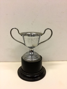 Kew Historical Society Inc
Award, Eastern Suburban Protestant Churches Football Association, SHUF Premiers 1931, A.C. Seidel, 1931
South Hawthorn United were premiers of A Division, Eastern Suburban Protestant Churches FA in 1931. Scores EHU 8-9 d Box Hill United 6-12. (No goal or best players recorded) Other teams in A Division were Balwyn Baptist, Box Hill Combine, Hawthorn C/C, Prahran/Malvern C/C, Highfield Rd, C/C (Glen Iris), Surrey Hills Methodist. Holy Trinity Kew competed in B Division. (Research: Ian Job)Small silver plated trophy on a brown bakelite stand, awarded to A.C. Seidel who was part of the South Hawthorn United Football Club premiership team in 1931. "S.H.U.F.C / Premiers 1931 /A. C. Seidel"south hawthorn united football club, a c seidel, eastern suburban churches football association, trophies -
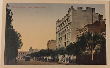 Kew Historical Society Inc
Postcard, Collins Street East, Melbourne, c.1912
Collection of thirty-nine postcards donated by Jillian Rigby which had been owned by her grandparents, George and Edith Weir, who from c.1917 lived at 84 Princess Street, Kew. The mostly 'mint' postcards were purchased in Victoria and while travelling overseas. The sole dated postcard is dated from 1929. The postcards are numbered sequentially from 2017.0058.01-39. The remainder of the collection donated by Jill Rigby which was once owned by the Weirs of Broken Hill and Kew consist of costumes, costume accessories, photographs, and documents.The postcards in the Weir collection, especially those purchased on a trip or trips to the mother country, i.e. United Kingdom, represent a representative sample of sites that were considered significant to those Australians undertaking a reverse grand tour by member of the erstwhile colonies. Those postcards which are early views of Melbourne must have been produced commercially for some decades from the early part of the 20th century.The eastern part of Collins Street. Coloured postcard of early Melbourne. Weir collection."Collins Street East, Melbourne"postcards, collins street - melbourne, george and edith weir, weir collection -
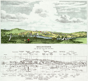 Freemasons Victoria - The Lodge of Australia Felix No 1
Melbourne 1839
Painting of Melbourne at the time the Lodge held it's inaugural meeting on 23 December 1839 Melbourne Viewed from the south bank of the Yarra RiverThe Lamb in inn the painting is the first meeting place of the Lodge of Australia Felix on 23 December 1839 felix, australi felix, uglv -
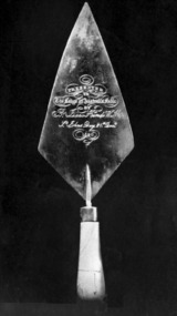 Freemasons Victoria - The Lodge of Australia Felix No 1
Lodge Trowel
-
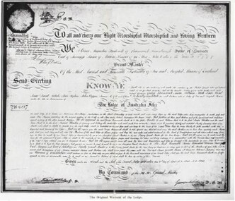 Freemasons Victoria - The Lodge of Australia Felix No 1
Original Warrant
-
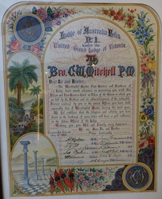 Freemasons Victoria - The Lodge of Australia Felix No 1
Past Master's Certificate, Australia Felix Past Master's Certificate
-
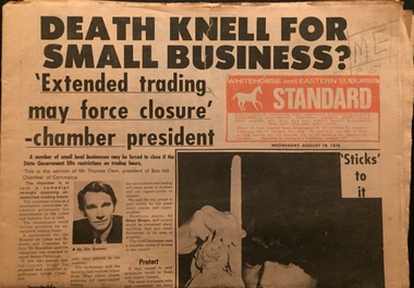 Kew Historical Society Inc
Newspaper, Whitehorse and Eastern Suburbs Standard, 1976
Copy of suburban newspaperA complete copy of the Whitehorse and Eastern Suburbs Standard, dated 18 August 1976 with an article on Mavis Washfold on page 5.non-fictionCopy of suburban newspapernewspapers - box hill, christian-washfold collection -
 Surrey Hills Historical Society Collection
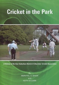
Book, G.I.Printing and Graphics Pty Ltd, Cricket in the Park: a history of the East Suburban District and Churches' cricket association, 2009
The cricket body first founded in the Eastern Suburbs to provide cricket for those associated with the churches in that area, was the Eastern Suburbs Sunday Schools' Association. It later combined with the Camberwell Districts Churches Association in 1925. This book covers Part 1 and Part 2 of their history. The cricket body first founded in the Eastern Suburbs to provide cricket for those associated with the churches in that area, was the Eastern Suburbs Sunday Schools' Association. It later combined with the Camberwell Districts Churches Association in 1925. This book covers Part 1 and Part 2 of their history.east suburban churches cricket associations, cricket, camberwell districts, churches associations, 1925 -
 Sunbury Family History and Heritage Society Inc.
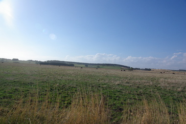
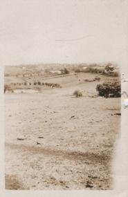
Photograph
A portrait view overlooking Sunbury township taken from a hill above the Goonawarra vineyard at the eastern end of the settlement. A sepia photograph with a cream frame of a portrait view of a rural landscape.sunbury township., goonawarra winery -
 Surrey Hills Historical Society Collection
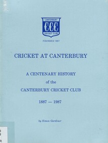
Book, Cricket at Canterbury: a centenary history of the Canterbury Cricket Club 1887-1987, c1987
... warmbrun (mr) w lachlan deepdene canterbury box hill surrey hills ...A history of Canterbury Cricket Club from 1887. Each chapter dedicated to a decade through to the 1980's. Includes appendices and results, awards, achievements. 58p. photosA history of Canterbury Cricket Club from 1887. Each chapter dedicated to a decade through to the 1980's. Includes appendices and results, awards, achievements. 58p. photosFrontis page: Given to Surrey Hills Historical / Society 15/7/14 / Simon Gardiner(mr) simon gardiner, (mr) sid mackie, (mr) keith silvers, (mr) len larkin, (mr) clyde ingram, (mr) frank gion, cricket, sport, (mr) n nesbit, (mr) s bisset, (mr) w grubb, (mr) r falconer, (mr) f leach, (mr) - slater, "tuss" curtis, (mr) stan self, (mr) maurie webb, (mr) norm shores, (mr) geoff matthews, (mr) wally bates, (mr) t mackie, (mr) harry swan, (mr) r mcconchie, (mr) r vaux, (mr) a pearson, (mr) - walduck, (mr) mick maguire, (mr) bob trengrove, (mr) lindsay ridgwell, (mr) john mccarthy, (mr) ewan mccarthy, camberwell union cricket club, canterbury cricket club, (mr) s parry, (mr) w lauchlan, (mr) e yeomans, (mr) a cooper, (mr) h gates, (mr) - gittus, (mr) f sheppard, (mr) - walker, (mr) a abud, (mr) - bishop, (mr) a. leach, (mr) - edgoose, (mr) - allan, (mr) a brooks, (mr) c swan, reporter competition, north balwyn, mont albert, (mr) s stevens, (mr) j carlson, (mr) c yeo, (mr) e hosken, (mr) j smart, (mr) n booth, (mr) l warmbrun, (mr) w lachlan, deepdene, canterbury, box hill, surrey hills, eastern suburbs cricket assoc., (mr) t alway, (mr) k briggs, (mr) n thackeray, (mr) r rudd, (mr) r littlefield, (mr) (cr) r dimmick, (mr) g guiver, (mr) t cameron, (mr) ian coles, (mr) gerry hegarty, 1960-1969 -
 Surrey Hills Historical Society Collection
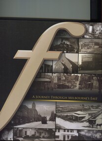
Book, A journey through Melbourne's east, 2008
Pictorial representation of the development of Melbourne's eastern suburbs. A collection of photographs of the local eastern area of Melbourne showing a lot of 'then' and 'now' photographs.A collection of photographs of the local eastern area of Melbourne showing a lot of 'then' and 'now' photographs.fletcher and parker, fletchers, real estate agents, melbourne, hawthorn, balwyn, camberwell, kew, land use, ashburton, montagnana-wallace, (mr) neil wallace, (mr) neil montagnana -
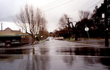 Surrey Hills Historical Society Collection
Photograph, 111-113 Union Road intersection with Windsor Crescent, 1985
There are earlier photos of this building both in this collection and one on the SLV website. James Sneddon's real estate business was an earlier occupant. Doubleday's occupied the site for nearly 3 decades. Later uses were as a kitchen showroom and a cafe.Colour photo taken on a wet winter's day showing Doubleday Real Estate Agents on the north eastern corner of the intersection. The opposite corner of Windsor Crescent is not visible. Rear in blue biro: "Union Road - Windsor Crescent". Handwriting not recognised. -
 Surrey Hills Historical Society Collection
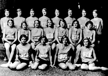
Photograph, Eastern Suburbs Athletic Team, c1934
The team practiced at the Recreation Oval in Guildford Road. Back row: I. Clamp, Emma Atkinson, Chris Graydon, … Slade, … Billings, … Scott. Centre row: Catherine Swaab, Amy Hall, Ruby Eacott, Gwen Milner, Doris Clamp?, … Chandler, … Front row: H. Day, …, …, Dorothy Beard. A black and white photograph of 19 girls dressed in sports uniforms.clamp, i. (ms), atkinson, emma (mrs), graydon, chris (ms), slade, - (ms), billings, - (ms), scott, - (ms), swabb, catherine (ms), hall, amy (ms), eacott, ruby (ms), milner, gwen (ms), clamp, doris (ms), chandler, - (ms), day, h. (ms), beard, dorothy (ms) -
 Surrey Hills Historical Society Collection
Photograph, Philip Warren-Smith at J&V Warren-Smith Auto Service, 1991
The land along the eastern side of the Union Road shops between Montrose Street and the railway line was originally owned by the Zeplin family. It was subdivided in 1914 and offered for sale as individual sites. Building did not occur until after WW1 and after the creek across Union Road had been barrelled. The garage was built at 145 Union Road in 1925. It has had continuous use as a garage since then. Originally there were petrol bowsers on the footpath. The façade of the building is remarkably the same as it was in 1925 when David Denholm was the first proprietor. He remained until c1950 and was followed by Benchley Motors P/L, then Spenden Motors P/L. John and Val Warren-Smith purchased it in c1980. In 2019 their family, including Philip and Glenn Warren-Smith and 2 of Philip's sons, still operate it as J&V Warren-Smith Auto Service.The Union Road shopping strip was assessed for heritage protection by Lovell Chen in June 2011 (Surrey Hills and Canterbury Hill Estate Heritage Study: Union Road Commercial Precinct Citation). Within this report two buildings were mentioned as, unusually, still performing their original role. These were Dartnell’s Pharmacy at 376-378 Canterbury Road (contributory) and the motor garage at 145 Union Road (contributory). This is one of a number of 3 images taken in 1991 which document the interior and function of the building.A colour photo of a man in green overalls inside the workshop of a garage. There are two cars up on hoists and three towards the back of the workshop.philip warren-smith, val warren-smith, john warren-smith, j&v warren-smith auto service, benchley motors p/l, spenden motors p/l, garages, union road, businesses, glenn warren-smith, cars -
 Surrey Hills Historical Society Collection
Photograph - Black and White Photograph, J & V Warren-Smith Auto Service, 1991
The land along the eastern side of the Union Road shops between Montrose Street and the railway line was originally owned by the Zeplin family. It was subdivided in 1914 and offered for sale as individual sites. Building did not occur until after WW1 and after the creek across Union Road had been barrelled. The garage was built at 145 Union Road in 1925. It has had continuous use as a garage since then. Originally there were petrol bowsers on the footpath. The façade of the building is remarkably the same as it was in 1925 when David Denholm was the first proprietor. He remained until c1950 and was followed by Benchley Motors P/L, then Spenden Motors P/L. John and Val Warren-Smith purchased it in c1980. In 2019 their family, including Philip and Glenn Warren-Smith and 2 of Philip's sons, still operate it as J&V Warren-Smith Auto Service.The Union Road shopping strip was assessed for heritage protection by Lovell Chen in June 2011 (Surrey Hills and Canterbury Hill Estate Heritage Study: Union Road Commercial Precinct Citation). Within this report two buildings were mentioned as, unusually, still performing their original role. These were Dartnell’s Pharmacy at 376-378 Canterbury Road (contributory) and the motor garage at 145 Union Road (contributory). This is one of a number of 3 images taken in 1991 which document the interior and function of the building.A colour photo of a man in green overalls working on a car with its bonnet up.john warren-smith, val warren-smith, philip warren-smith, glenn warren-smith, j&v warren-smith auto, union road, businesses, garages, cars, mechanics -
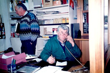 Surrey Hills Historical Society Collection
Photograph, Wally Hoersch of J&V Warren-Smith Auto, 1991
The land along the eastern side of the Union Road shops between Montrose Street and the railway line was originally owned by the Zeplin family. It was subdivided in 1914 and offered for sale as individual sites. Building did not occur until after WW1 and after the creek across Union Road had been barrelled. The photo was taken in the office of the garage which was built at 145 Union Road in 1925. It has had continuous use as a garage since then. Originally there were petrol bowsers on the footpath. The façade of the building is remarkably the same as it was in 1925 when David Denholm was the first proprietor. He remained until c1950 and was followed by Benchley Motors P/L, then Spenden Motors P/L. John and Val Warren-Smith purchased it in c1980. In 2019 their family, including Philip and Glenn Warren-Smith and 2 of Philip's sons, still operate it as J&V Warren-Smith Auto Service. The man on the phone is Walter Kurt (Wally) Hoersch. Warmly regarded and often mistakenly thought to be Philip's father, he was not a member of the family. Wally had an interesting background, not known to many. He was born in the German Templer colony of Sarona in Palestine. It had been established in Ottoman Palestine in 1871 and is now a suburb of Tel Aviv. In July 1941, 188 people from Sarona were deported to Australia on the Queen Elizabeth. Wally's family were amongst them. They were interned in Tatura in Central Victoria until 1947. Wally lived in Mont Albert North and later Templestowe; he died on 21/7/2002.The Union Road shopping strip was assessed for heritage protection by Lovell Chen in June 2011 (Surrey Hills and Canterbury Hill Estate Heritage Study: Union Road Commercial Precinct Citation). Within this report two buildings were mentioned as, unusually, still performing their original role. These were Dartnell’s Pharmacy at 376-378 Canterbury Road (contributory) and the motor garage at 145 Union Road (contributory). This is one of a number of 3 images taken in 1991 which document the interior and function of the building.A colour photo of a man sitting behind a desk in an office on the phone. There is another man standing behind him to his right.john warren-smith, val warren-smith, philip warren-smith, glenn warren-smith, walter hoersch, wally hoersch, j&v warren-smith auto, union road, businesses, garages, benchley motors p/l, spenden motors p/l,