Showing 365 items
matching p. land
-
 Koorie Heritage Trust
Book, Broome, Richard, Arriving, 1984
Tells the story of immigrants, from settlement at Port Phillip to date. It also describes the interaction with the Aboriginal people who were already here it spans 50,00 years. First chapter of each volume is an overview of traditional life at the time of contact concentrating on Aboriginal economic life altering/?managing of environment, with discussions of original population estimates and extent of decimation due to; disease in colonial times - smallpox, V.D., Aboriginal and white attitudes, friendships/?violent conflict, continued depopulation, missions/?reserves - 19th/?20th cent. incldg Lake Tyers, contemporary Aboriginal identity, welfare/?land rights programs.v-xiv; 258 P.; : ill. (some col.). ; maps; figs.; notes; index; 26 cm.Tells the story of immigrants, from settlement at Port Phillip to date. It also describes the interaction with the Aboriginal people who were already here it spans 50,00 years. First chapter of each volume is an overview of traditional life at the time of contact concentrating on Aboriginal economic life altering/?managing of environment, with discussions of original population estimates and extent of decimation due to; disease in colonial times - smallpox, V.D., Aboriginal and white attitudes, friendships/?violent conflict, continued depopulation, missions/?reserves - 19th/?20th cent. incldg Lake Tyers, contemporary Aboriginal identity, welfare/?land rights programs.social identity - aboriginality. | religions - christianity - missions. | settlement and contacts - colonisation - 1788-1850. | daily life. | demography - population dynamics. | government policy - integration. | government policy - state and territory - victoria. | health - infectious diseases - smallpox. | land rights. | socioeconomic conditions - living conditions. | race relations - violent - massacres, murders, poisonings etc. - to 1900. | race relations - racism - stereotyping. | reproduction. | technology. | bung yarnda /? lake tyers (e vic gippsland sj55-07) victoria. | victoria -- history. -
Koorie Heritage Trust
Book, Library Council of Victoria, Trespassers and intruders : the Port Phillip Association and the founding of Melbourne, 1982
Catalogue for an exhibition held at the State Library of Victoria in 1982 presenting the documents (housed in the La Trobe Library) which led to the founding of Melbourne. Scattered references to Aboriginal people. Deals with early settlement and the founding of Melbourne. Brief descriptions of personalities involved at that time, detailed annotations.[26] p. : ill., facsims. ; 25 cm. Catalogue for an exhibition held at the State Library of Victoria in 1982 presenting the documents (housed in the La Trobe Library) which led to the founding of Melbourne. Scattered references to Aboriginal people. Deals with early settlement and the founding of Melbourne. Brief descriptions of personalities involved at that time, detailed annotations.la trobe library -- catalogs. | port phillip association. | libraries. melbourne. la trobe library. stock: documents associated with port phillip association | land settlement -- victoria -- melbourne -- bibliography -- catalogs. | land settlement -- victoria -- melbourne -- bibliography. | land settlement -- victoria -- melbourne -- exhibitions. -
Koorie Heritage Trust
Book, Blake, Les, Land of the Lowan : 100 years in Nhill & West Wimmera, 1976
[vii], 268 p., [14] leaves of plates ; 23 cm.1. local history -- nhill -- wimmera. -
Koorie Heritage Trust
Book, Behrendt, Larissa, Aboriginal Dispute Resolution, 1995
Discusses the importance of Indigenous communities being able to implement their own models of dispute resolution which take into account traditional values and decision-making structures; proposes a model which could be adapted for use in traditional, rural and urban communities.115 p. : ill. ; 20 cm.Discusses the importance of Indigenous communities being able to implement their own models of dispute resolution which take into account traditional values and decision-making structures; proposes a model which could be adapted for use in traditional, rural and urban communities.law - indigenous - dispute management | law - relation to anglo australian law | law enforcement | social organisation - elders | aboriginal australians -- legal status, laws, etc. | arbitration and award -- australia. | aboriginal australians -- land tenure. | dispute resolution (law) -- australia. -
Koorie Heritage Trust
Book, Brambuk Living Cultural Centre, A Journey Through Time, 1990
Intro.: Brambuk welcomes you to a journey through time. A journey that will take you through the experiences of our people the Yardwadjali and Djap Wurrung the traditional owners of the land in and around the magnificent and powerful mountain range of Gariwerd our ancient name for the Grampians...15 p. : ill. (some col.) ; 21 x 30 cm.Intro.: Brambuk welcomes you to a journey through time. A journey that will take you through the experiences of our people the Yardwadjali and Djap Wurrung the traditional owners of the land in and around the magnificent and powerful mountain range of Gariwerd our ancient name for the Grampians...community organisations -- cultural activities (including preservation and/or promotion of traditional culture). other: brambuk living cultural centre -- budja budja -- gariwerd -- halls gap. -
Koorie Heritage Trust
Document - Printed Sheets, F.CA.A.T.S.I.; Earlwood, NSW. n.d, Aboriginal Land Rights Campaign- Background Material
... talks or writing letters on the Land Rights Campaign. 17 P ...The fact sheets are to assist with material to use as background for people making sppeeches, giving talks or writing letters on the Land Rights Campaign.17 P.; appendices; 34 cm.The fact sheets are to assist with material to use as background for people making sppeeches, giving talks or writing letters on the Land Rights Campaign.landrights campaign-aboriginal australians, background materials. -
Koorie Heritage Trust
Book, Brennan, Frank, 1954, Sharing the country : the case for an agreement between black and white Australians, 1991
Frank Brennan, a lawyer, Jesuit priest and Aboriginal affairs advisor to Australia's Catholic bishops, explains what needs to be done in law and social justice to create an agreement for the future between black and white Australians.176 p. ; 20 cm.Frank Brennan, a lawyer, Jesuit priest and Aboriginal affairs advisor to Australia's Catholic bishops, explains what needs to be done in law and social justice to create an agreement for the future between black and white Australians.aboriginal australians -- land tenure. | aboriginal australians -- civil rights. | aboriginal australians -- government relations. -
Whitehorse Historical Society Inc.
Document, Department of Crown Lands and Survey, 1983
Research guide of historical resources of the Department of Crown Lands and Survey. Compiled by P. Cabena, Aug 1983Research guide of historical resources of the Department of Crown Lands and Survey. Compiled by P. Cabena, Aug 1983Research guide of historical resources of the Department of Crown Lands and Survey. Compiled by P. Cabena, Aug 1983crown land, land surveys, victorian government -
 Whitehorse Historical Society Inc.
Document, Land Subdivision Policy, 24/08/1998 12:00:00 AM
... of Whitehorse.Ordinary council meeting 24/8/1998, Item 12.1.5 p. 42-43 Land ...Land subdivision policyLand subdivision policy: approved by City of Whitehorse.Ordinary council meeting 24/8/1998, Item 12.1.5 p. 42-43Land subdivision policyland subdivision, city of whitehorse -
Whitehorse Historical Society Inc.
Document, Land for leisure, 1978
Papers presented at the annual conference of the Australian Institute of Parks and Recreation at Burnie, Tasmania, 1978.Papers presented at the annual conference of the Australian Institute of Parks and Recreation at Burnie, Tasmania, 1978. Includes paper by John P. Brandenburg titled 'Community participation with land use - a Nunawading example.'Papers presented at the annual conference of the Australian Institute of Parks and Recreation at Burnie, Tasmania, 1978. brandenburg, john p, nunawading community gardens, royal australian institute of parks and recreation -
Whitehorse Historical Society Inc.
Document, Register of Sales, 1910 - 1911
Pages 1 - 73 of Register of Sales in and around Melbourne, 1910 - 1911Pages 1 - 73 of Register of Sales in and around Melbourne, 1910 - 1911 of T.R.B. Morton & Coghill, Auctioneers, p. 13 - 22 record Blackburn sales.Pages 1 - 73 of Register of Sales in and around Melbourne, 1910 - 1911 t.r.b. morton & coghill, land sales, blackburn -
Whitehorse Historical Society Inc.
Certificate - Land Title, McCracken Orchards, 2000
Collection of Certificates of Title and lodged plans covering the land used as an orchard by the McCracken Family 1898 - 1962, comprising Cert. of Title vol 2699, Fol 660; Crown Portion 96, 1864 (part), Crown Portion 96, 1996; lodged plans 3681, 19126, 22255, 22256, 33386, with brief history prepared by P. Simmenauer.mccracken, john, mccracken, george, blackburn south, orchard grove, blackburn south, mccracken avenue, blackburn south, stewart avenue, blackburn south, lawrence street, blackburn south, wilton, edward, canterbury road, blackburn south, barns street, blackburn south, ralph street, blackburn south, horkings street, blackburn south, st ninians uniting church, blackburn south -
Whitehorse Historical Society Inc.
Document, History of Blackburn North State School No 4715, c1970
Document re establishment of Blackburn North Primary School on 5 acres of land on the North Side of Springfield Road. Opened 5 April 1954 with initial enrolment of 237 pupils, also listing staff and school committee members.blackburn north primary school, primary schools, jenkins, p, cole, j -
Whitehorse Historical Society Inc.
Legal record - Land Title, Norris Court Blackburn, 1889-1963
Certificates of Titles supplied.Certificates of Title Vol. 2105 Fol. 823 to Freehold Investment and Banking Co P/L, 1889; Vol. 3485 Fol. 696892 to Florence Adelaide Bellingham, 1911; Vol. 4474 Fol. 894734 to Charles and William Richard Norris, 1921; Vol. 8393 Fol.709 to William Richard Norris, 1963. With covering letter from donor.Certificates of Titles supplied.whitehorse road blackburn, canterbury road blackburn, blackburn road blackburn, naughton grove blackburn, norris court blackburn, emslie, blackburn road blackburn, mogolong, blackburn road blackburn, bellingham, florence adelaide, norris, charles, norris, william richard, freehold investment and banking company of australia ltd -
 Whitehorse Historical Society Inc.
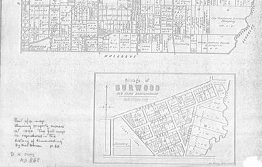
document - Map, Village of Burwood, 1892
Map on the village of Burwood.Village of Burwood : old name Ballyshanassy (with southern section of Nunawading). Area bounded by Chapman, Ireland and Evans Streets). Victorian Shire Map. co. 26 November 1892. Scale: 8 chains = 1 inch. The full map is reproduced in 'The History of Nunawading' by Niall Brennan, p. 62.Map on the village of Burwood.burwood, land settlement -
 Whitehorse Historical Society Inc.
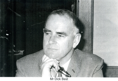
Photograph, Dick Best
Richard Best was an Australian Textile industry agent and Businessman. While travelling in Belgium he contacted the de Stoop family, textile manufacturers, whose business had been closed down by German occupation after the 2nd World War. They took up Dick Best's offer to relocate and join with him to set up a textile factory in Australia. Land was purchased in Blackburn North and when the de Stoop and Best Aust P/L traded, Dick best was in charge of marketing their products.2 Black and white photograph of the head and shoulders of Richard Best. He has a pair of glasses in his right hand(on smaller photocopy) Mr Dick Bestbest, richard, weaving mills, de stoop and best aust, p/l -
 Whitehorse Historical Society Inc.
Photograph, Archibald McArthur`
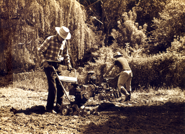
Archibold McArthur originally owned 6 acres and produced flowers which were sold at the Victoria Market, and vegetables which were sold at a roadside stall outside his property in Canterbury Road , Forest Hill.Eastside Plants established a plant nursery as p[art of the property in 1979 and later added 'Archies Cafe' in 1987. In 2007 the nursery closed its doors and in 2008 units were built on the property.Sepia photo of Archibald McArthur and one other tilling land on his property in Canterbury Forest Hillmcarthur archibald, forest hill, plant nurseries, eastside plants, archies cafe -
 Ballarat Heritage Services
Photograph - Photograph - Colour, Clare Gervasoni, Koroit Post Office, 2015, 21/12/2015
The town borrows its name from the Koroitch Gundidj people who occupied the area prior to European settlement. (https://en.wikipedia.org/wiki/Koroit, accessed 21 December 2016) Koroit was first surveyed as a township in 1847. Around the 1850 the district had the highest population of Irish immigrants in rural Australia. The Koroit Post Office was designed by architect and engineer John Mason of Port Fairy. (Moyne Shire Heritage Study 2006 Stage 2, Volume 2: Environmental History, Prepared for Moyne Shire Council Helen Doyle in association with Context Pty Ltd, 2006.) Rosebrook Bridge, Rosebrook (1853; replaced) Post Office buildings, Bank Street, Port Fairy (c.1857) The author Henry Handel Richardson lived in the Koroit Post Office as a child after her family moved to Koroit in 1878. Remembering Koroit from her youth, the third volume in her The Fortunes of Richard Mahony trilogy is set in the town. When the author was six, her father Walter died in Koroit on 1 August 1879 and was buried at the Koroit cemetery. (https://en.wikipedia.org/wiki/Koroit, accessed 21 December 2016) In 1878 Mary Richardson was appointed postmistress of the Koroit Post Office at a salary of 72 pounds with free quarters, firewood and kerosene. She lived at the back of the Post Office. (From a Green and Pleasant Land by H. McCorkell and P. Yule.) Photographs showing the bluestone Koroit Post Office, phone box and postbox. It is located at 99 Commercial Road, Koroit. "Historic Area Statement of Significance: The significance of Koroit derives from its role as the urban centre of one of the most concentrated Irish Roman Catholic rural districts in Australia, noted for its mixed livestock and cropping argicultural patterns. This is reflected in two separate and distinctive areas in the town - the administrative/commercial area and the church precinct. The administrative and commercial area (focussing on the Boundary-Commercial Road/High Street intersection and the Koroit Hotel) consists of a number of significant public buildings and leads to a street of relatively intact humble shopfronts and kerbline verandahs, visually punctuated by opposing bank facades. The church precinct is dominated by a group of Catholic buildings larger in scale and more complete in range than those in any comparably sized Victorian town." http://vhd.heritagecouncil.vic.gov.au/places/69338#sthash.ELLuSMvg.dpuf, accessed 21 December 2016."koroit, post office, phone box, payphone, bluestone, henry handel richardson, koroit post office -
 Ballarat Heritage Services
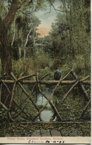
Postcard, Ballarat Botanical Gardens, c1908
"Within six years of its first land sales in 1852, founder members had challenged council over horticultural decisions and Ballarat's main thoroughfare contained fences squares, trees and flower beds. The major works that projected the Garden City image were the street plantings, parks and botanical gardens ..." Reference: Michael Taffe, Growing a garden City: Ballarat Horticultural Society 1859-2009, BHS Publishing, 2014, p. 10.This postcard shows how the botanical gardens in Ballarat, famous for being a Garden City.Coloured postcard Forest Scene, Botanical Gardens, Ballarat printed in red at bottom of card. Elaine 30-11-08 handwritten in black ink underneath.botanical gardens, ballarat, forest scene, gardens, botanical, -
 Mt Dandenong & District Historical Society Inc.
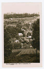
Photograph, View at Sassafras, Vic, c1930
View down the Main Street of Sassafras looking south with the Mechanics Institute in the centre of the picture. The raspberry patch in the foreground belonged to Woniger Hansen who built Mountain Rest (Rostrevor). The land was subdivided after his death in 1923. The raspberry patch is in the area of the current Mason Grove.Black and white Rose Series postcard P. 4765 looking south down the Main Street of Sassafras with buildings either side and berry patches in the foreground.On reverse POST CARD. THE "ROSE' SERIES DELUXE. A REAL PHOTOGRAPH PRODUCED IN AUSTRALIA. PUBLISHED BY 'THE ROSE STENOGRAPHS" Armadale. Victoria sassafras, rose series, rostrevor, woniger hansen, hansen, mechanics' institute, raspberry, raspberry crop, mountain rest, mason grove -
 Mt Dandenong & District Historical Society Inc.
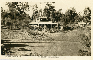
Photograph, The Chalet, Olinda, Victoria
Rose Series Postcard depicting "The Chalet" guest house at Olinda. Built c1906, The Chalet was situated at the southern corner of Chalet and McCarthy Roads. The building was destroyed by fire in 1935 and Ted Woolrich acquired the land.On front: The Rose Series P. 397the chalet, rose series, olinda, guesthouse, guest house -
 Ballarat Tramway Museum
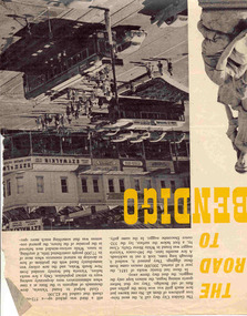
Newspaper, The Walkabout Magazine, "The Road to Bendigo", Oct. 1974
Yields information about the final day of the Bendigo tramways and some of the tramcars used.Three double sided sheets from "The Walkabout" magazine, October 1964, titled "The Road to Bendigo". Five printed pages featuring photographs of Bendigo, its buildings, its history stories, gold mining days and other information, including three illustrations containing trams. .1 - Charing Cross with bogies and single trucker - taken early 1960's. Photo by A. Doney. Features the intersection, with Ezywalkin store. Note the "Jeffrey's bread" roof advertisement on the single trucker. .2 - Bogie tram on the Eaglehawk route prior to any nearby housing development - reclaimed mining land - has Castrol roof advertisement - photo by Claver P Carroll. .3 - No. 6 outside The Beehive stores - 3BO - photo by Claver P Carroll. bendigo, eaglehawk, charing cross -
 Otway Districts Historical Society
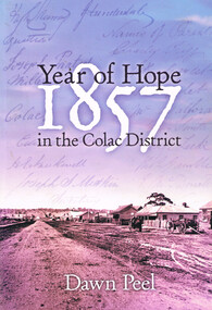
Book, Year of hope: 1857 in the Colac District, 2006
The land, the settlers, and the social institutions which found or altered the character of the small settlement of Colac, Victoria, and its district.Year of hope: 1857 in the Colac district. Dawn Peel. 1st ed. Colac (Vic); Dawn Peel; 2006. x, 212 p.; illus, bibliography. Soft cover. ISBN 0 646 46270 9For Irene - a fellow historian. Dawn Peel. 6/10/06.1857; dawn peel; land; politics; aborigines; religion; history; social institutions; -
 Otway Districts Historical Society
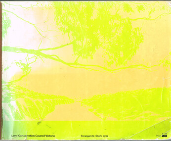
Book, Land Conservation Council, Report on the Corangamite Study Area, May 1976
The Report describes and assesses the natural resources of public land in the Corangamite study area, and provides a factual basis on which members of the community may base their submissions to the Council.Report on the Corangamite study area. Land Conservation Council. Melbourne; Land Conservation Council; May 1976. x, 310 p.; illus, maps (separate). Soft cover.land conservation council; corangamite; geology; physiography; climate; water resources; soils; vegetation; fauna; -
 Otway Districts Historical Society
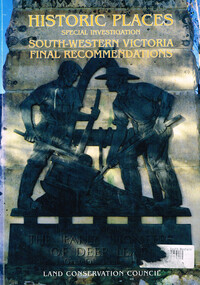
Book, Land Conservation Council, Historic places: special investigation: South-Western Victoria: Final recommendations, January 1997
The Land Conservation Council has carried out an investigation of historic places in public land in South-western Victoria. The report contains the Council's recommendations for the protection, management and future use of more than 700 historic places, out of 2200 places identified during the investigation. The places have been assigned to three categories, A, B and C, representing State, regional and local levels of significance. The report also contains recommendations relating to general historic places management, the processes available in Victoria for the protection of historic places on public land, and Aboriginal historic places.Historic places: Special investigation: South-Western Victoria: Final recommendations. Land Conservation Council. Land Conservation Council; Melbourne (Vic); January 1997. viii, 176 p.; illus.; maps. Soft cover. ISBN 0 7241 9290 5Maps in plastic sleeve.land conservation council; conservation; historic places; public land; aborigines; south west victoria; -
 Otway Districts Historical Society
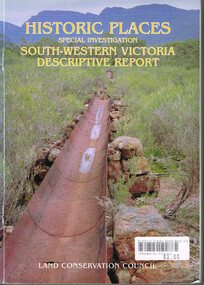
Book, Land Conservation Council, Historic places: Special investigation: South-Western Victoria: Descriptive report, January 1996
The south-west of Victoria, possessing a rich heritage of the signs of past human activity, is fertile ground for an investigation of historic places on public land. This report includes an initial inventory of almost 2000 places. The report outlines the history and the related heritage of the area, describes in some detail its biophysical attributes and introduces the natural resources and present land use. This information provides a context for understanding the origins of the historical features that are observes today.Historic places: Special investigation: South-Western Victoria: Descriptive report. Land Conservation Council. Land Conservation Council; Melbourne (Vic); January 1966. viii, 180 p.; illus.; maps. Soft cover. ISBN 0 7241 9288 3Maps in plastic sleeve.land conservation council; conservation; south-western victoria; historic places; -
 Otway Districts Historical Society
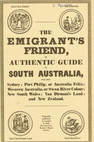
Book, Reader's Digest Services Pty Limited, The emigrant's friend, or authentic guide to South Australia, 1974
This book is a replica of a booklet printed in the United Kingdom. In 1848, when it was published in London as a guide to prospective emigrants, 23,904 people left the United Kingdom for the Australian colonies and New Zealand. In 1847, with the failure of potato crops threatening famine in Ireland and growing political unrest at home, the British Government had once again encouraged emigration by offering free passage to candidates of 'good character'. Immigration, particularly by the labouring classes, was intended to relieve both the overburdened Mother Country and the colonies which had acute labour shortages. The booklet gives some history of each colony as well as the sale of lands, mines and mining, produce, the price of living, wages and, generally, the situation. The emigrant's friend, or authentic guide to South Australia including Sydney: Port Phillip, or Australia Felix: Western Australia, or Swan River Colony: New South Wales: Van Dieman's Land: and New Zealand. Reprint. Reader's Digest Services Pty Limited; Surrey Hills (NSW); 1974. 40 p. Soft cover. australia; colonies; settlement; nsw; port phillip; western australia; south australia; van dieman's land; new zealand; emigration; immigration; -
 Otway Districts Historical Society
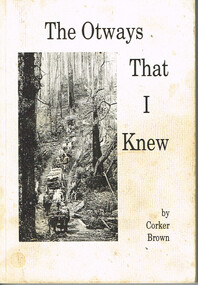
Book, Merimbula Easiprint, The Otways that I knew, 1993
Condensing 100 years of Otway history the author tries to give an insight into the thoughts and ways of the settlers in opening the western Otway Ranges. It gives some indication of the mental pressure, hand-in-hand with the physical stress, as a settler cleared the land and made a living for his family. It covers how the rail link brought in the timber mills and their workers which made timber the main industry of that era, and covers the changes that took place in the 1930s as the mills closed down and the district raised crops, dairying and grazing.The Otways that I knew. Ronald Charles 'Corker' Brown. 1st ed. Corker Brown; np; 1993. 216 p.; illus; maps. Soft cover. ISBN 0 646 16798 7otway ranges; corker brown; otway lighthouse; aborigines; beech forest; farming; grazing; crops; railways; roads; timber; -
 Otway Districts Historical Society
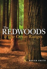
Book, Lothian Custom Publishing, The redwoods of the Otway Ranges. Roger Smith, January 2015
This book is the remarkable story of the world's tallest tree species, the Redwood, growing in the Great Otway National Park in Victoria's south-west. It was originally planted by Victorian foresters for experimental purposes on land abandoned by the early settlers. The Coast Redwood, native of California, is now thrives in the Otways alongside the famous eucalypt, the towering Mountain Ash. The majestic Otway Redwoods, still in their youthful growth phase, have withstood adversity caused by fire, landslide, lighting and chainsaws, while the ongoing political debate about the conservation of the valuable forest resources continues.The redwoods of the Otway Ranges. Roger B. Smith. Lothian Custom Publishing; Middle Park (Vic); 2015. ii, 202 p.; illus., maps, appendices, notes. IBSN 978 1 921737 13 8. Soft cover.With best wishes from Roger Smith. -
 Bendigo Historical Society Inc.
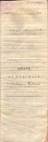
Document - JOHANSON COLLECTION: GRANT BY PURCHASE WILLIAM ROBERTS
Legal document. On front: Dated 17th December 1855. Ac1 R1 P 1. ( acres, roods, perches ) Grant by purchase to William Roberts. In pencil Allot 7 of Sec 12. Inside: 'Victoria - Township Lot. Grantee W. Roberts. Document details purchase of land by above William Roberts of Heathcote, for the sum of two pounds, 12 shillings. Allotment 7, section 12, Township of Heathcote. Land sold as Lot 14. Dated 30 July 1855. Signed by C.W. Hotham ( Sir Charles Hotham ) Property is now 42 Beauchamp Street, Heathcote ( Landata research, 28.3.2017, https://www.landata.vic.gov.au/tpc_confirm_map.aspx?pfi=45257085 )heathcote, land sale, william roberts