Showing 12396 items matching "railway"
-
 Victorian Railway History Library
Book, Langford, Weston, Victorian Railway Station Diagrams 1956-1960 - North Eastern District, 1956-1960
Railway diagrams of all the stations in the North Eastern district of Victoria in 1956 to 1960.maps, p.132.non-fictionRailway diagrams of all the stations in the North Eastern district of Victoria in 1956 to 1960.railroad infrastructure - victoria, railroads - victoria -
 Victorian Railway History Library
Book, Langford, Weston, Victorian Railway Station Diagrams 1956-1960 - Northern and Midland District, 1956-1960
Railway diagrams of all the stations in the Northern and Midland district of Victoria in 1956 to 1960.maps, p.43.non-fictionRailway diagrams of all the stations in the Northern and Midland district of Victoria in 1956 to 1960.railroad infrastructure - victoria, railroads - victoria -
 Victorian Railway History Library
Book, Langford, Weston, Victorian Railway Station Diagrams 1956-1960 - North Western District, 1956-1960
Railway diagrams of all the stations in the North Western district of Victoria in 1956 to 1960.maps, p.84.non-fictionRailway diagrams of all the stations in the North Western district of Victoria in 1956 to 1960.railroad infrastructure - victoria, railroads - victoria -
 Victorian Railway History Library
Book, Langford, Weston, Victorian Railway Station Diagrams 1956-1960 - South Western District, 1956-1960
Railway diagrams of all the stations in the South Western district of Victoria in 1956 to 1960.maps, p.76.non-fictionRailway diagrams of all the stations in the South Western district of Victoria in 1956 to 1960.railroad infrastructure - victoria, railroads - victoria -
 Victorian Railway History Library
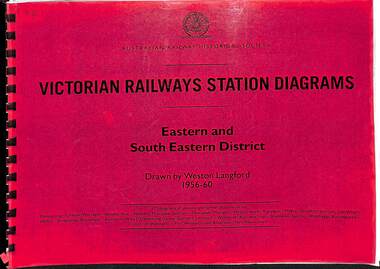
Book, Langford, Weston, Victorian Railway Station Diagrams 1956-1960 - Eastern and South Eastern District, 1956-1960
Railway diagrams of all the stations in the Eastern and South Eastern district of Victoria in 1956 to 1960.maps, p.67.non-fictionRailway diagrams of all the stations in the Eastern and South Eastern district of Victoria in 1956 to 1960.railroad infrastructure - victoria, railroads - victoria -
 Stawell Historical Society Inc
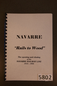
Book, D.A. Robson - Ararat, Navarre "Rails to Wood". The opening and closing of the Navarre Railway Line 1914-1954`, 2000
The History of the Navarre Railway LineClear Plastic Cover, over Grey card with title.Navarre "Rails to Wood" The Opening and closing of the Navarre Railway Line 1914-1954stawell, transport -
 Stawell Historical Society Inc
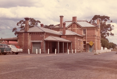
Photograph, Railway Station Stawell viewed from Napier Street 1988 -- 2 Photos -- Coloured, Sept 8 1988 & Dec 1974
Two colour photos of Stawell Railway Station. View from Napier Street 1988.2 Coloured Photgraphs of Stawell Railway station looking WestLarger Photo: On the back in blue Ink. Stawell Station Sept 8 1988 Small Photo: In a Yellow Diamond "Pedestrians" on the back Dec 24 Stawell Station St.stawell railways transport -
 Stawell Historical Society Inc
Book, Lost Railway Stations of the Pyrenees
Railway Stations, PyreneesFront Cover: Navarre Railway Station, Steam Train 16/12/1953. Back Cover: Seppia Photo: Car Goods at Joel 7/1/1953. Walker railway car at Eversley- Ben Nevis Background 1/1957 -
 Whitehorse Historical Society Inc.
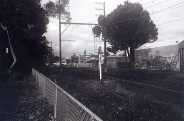
Photograph, Railway Station from Car Park, 1/06/2009
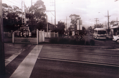
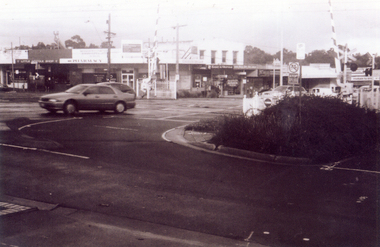
One of a collection of photographs taken of the Nunawading Railway Station prior to the lowering of the railway line and building of the new railway station on the western side of Springvale Road so that the Springvale Road Rail Crossing can be eliminated.Black & white photograph of the precinct surrounding the Nunawading Station and the Springvale Road Railway crossing. This photograph is of the station taken from the car park on west side of Springvale Road, north of railway line behind Recreation Centre. See NP 3545 to NP3567 for the complete set of photographsnunawading railway station, springvale road nunawading, redevelopment of railway line/springvale road, nunawading recreation centre -
 Whitehorse Historical Society Inc.
Photograph, Pedestrian Crossing & Nunawading Railway Station, 1/06/2009
One of a collection of photographs taken of the Nunawading Railway Station prior to the lowering of the railway line and building of the new railway station on the western side of Springvale Road so that the Springvale Road Rail Crossing can be eliminated.Black & white photograph of the precinct surrounding the Nunawading Station and the Springvale Road Railway crossing. This photograph is looking over the south side of the intersection in Springvale, to the pedestrian crossing and the Railway Station. The shopping centre is on the right hand side. See NP 3545 to NP3567 for the complete set of photographsnunawading railway station, springvale road nunawading, redevelopment of railway line/springvale road. -
 Stawell Historical Society Inc
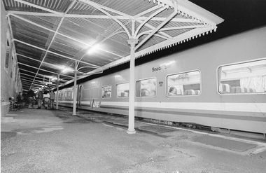
Photograph, Brett Leslie, V/Line train Stawell Railway Station
Two photographs of V/Line train at Stawell Railway Station. Group of Youth are Stawell Jaycee members. July 1989railway, transport -
 Otway Districts Historical Society
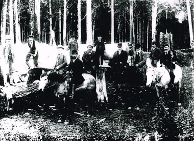
Photograph, Railway Survey Camp, Beech Forest, 4 Apr 1897, 4 April 1897
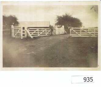
On the 18th August, 1896, the question of selecting localities for the permanent survey of a narrow-gauge line to Beech Forest from Colac was mooted. Two potential lines were examined. In a memorandum to the Minister for Railways, dated 23rd March, 1897, the Engineer-in-Chief recommended that the eastern and longer route via Lardner's Track be adopted. The second route, while identical from Colac to Gellibrand River, differed. By a more direct route the Beech Forest terminus is reached 5 miles sooner and cost approximately L24,500 less. The direct line would also serve a larger lot of settlers and would obtain a larger lot of traffic than the alternate proposal. The Parlimentary Standing Committee on Railways examined the proposal in situ and recommended that the direct route from Gellibrand to Beech Forest should be adopted and the Lardner's Track route should be abandoned at once.Photograph, Railway Survey Camp, 4 April 1897. Inspection of alternative routes by Parliamentary Committee on Railways.People named in the photograph.beech forest; railway; survey; victorian parliament; calcutt; fraser; e.h. cameron; d. mciville; a. harris; n. mcinnes; j.s. white; j. wood; t. baker; j. gardner; t.g. watson; standing committee; -
 Ballarat Heritage Services
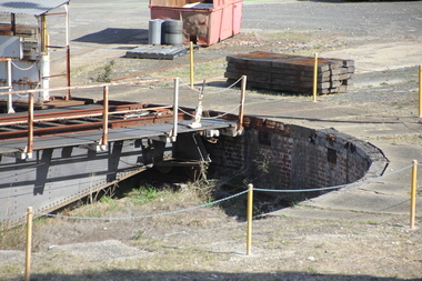
Photograph - Photograph - Colour, L.J. Gervasoni, Railway at Turntable at Ballarat East, 2016, 15/05/2016
Ballarat East Railway StationColour photographs showing the train turntable at Ballarat East.ballarat east railway, turntable, railway -
Tatura Irrigation & Wartime Camps Museum
Photograph, W. Purcell, Park Street Railway Crossing
photograph of group of men at Park Street Railway Crossing Tatura.Black and white photograph of group of men at Park Street Railway Crossing Tatura. -
 Whitehorse Historical Society Inc.
Photograph, Railway crossing on Springvale Road, 1/06/2009
One of a collection of photographs taken of the Nunawading Railway Station prior to the lowering of the railway line and building of the new railway station on the western side of Springvale Road so that the Springvale Road Rail Crossing can be eliminated.Black & white photograph of the precinct surrounding the Nunawading Station and the Springvale Road Railway crossing. This photograph is the railway crossing with Springvale Road, Nunawading, taken from the north west corner looking over crossing to some of the Nunawading shops. See NP 3545 to NP3567 for the complete set of photographsnunawading railway station, springvale road nunawading, redevelopment of railway line/springvale road., nunawading recreation centre -
 Sunbury Family History and Heritage Society Inc.
Photograph, 17 December 1985
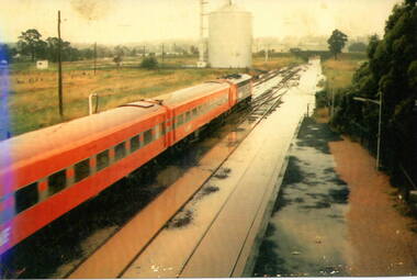
On 17th December 1985 record torrential rain fell in Sunbury, which flooded the main Melbourne Bendigo rail line and disrupted traffic. The photograph is looking to the north of the station and takes in the historic Macedon Street bridge and the open ground with the storage silo on the west side of the railway line. A coloured photograph of a former V Line train stopped at a station where the railway line has been flooded. A storage silo occupies vac ant ground adjacent to the railway line.sunbury railway station, storage silos, horne street -
 Eltham District Historical Society Inc
Newspaper clipping, 3. A part of the new railway line.; New Railway Line: Eltham to Hurst's Bridge; The Weekly Times, 24 Feb 1912, p27, 1912
Pages from a scrapbook belonging to Heather Jenkins (nee Sargeant) who lived as a child in the Police Residence at 728 Main Road, Eltham in the 1920s. Images featured are 1. A peep on the road, nearing Research. 2. The Main Road at Eltham (opposite Railway Station). 3. A part of the new railway line. 4. The mail coach leaving for Kangaroo Ground.Heather Sargeant was the daughter of Constable W.C. Sargeant, the local police officer in residence at Eltham, 1922-1927Detail from large newspaper clipping (half page), very aged and fragile with sticky tape holding it together with 4 images of early Elthameltham, heather jenkins (nee sargeant), railway, railway line, edendale farm, mummery's -
 Victorian Interpretive Projects Inc.
Photograph - Colour, Clare Gervasoni, Ballarat Railway Station Weighbridge, 2011, 27/03/2011
The weighbridhe is heritage listed and was believed to have been used to weigh train carriages carrying wheat.Colour photographs of the Ballarat Railway Station weighbridge and associated building. The building was destroyed by fire in November 2014.ballarat railway station, weighbridge, scales, tracks, railway, wheat -
 Tatura Irrigation & Wartime Camps Museum
Photograph, Tatura Railway station
Three photos of Tatura Railway station & one of the Rosella Siding, with steam engines.Three photos of Tatura Railway station & one of the Rosella Siding, with steam engines. -
 Ringwood and District Historical Society
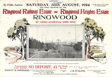
Flyer, Auction Sale Advertisement - Ringwood Railway Estate and Ringwood Heights Estate, Ringwood, Victoria - August, 1924
Refer also to Reg. No. 5183 for Ringwood Railway Estate (September 1923) and Reg. No. 5184 for Ringwood Heights Estate previous release (March 1924)Folded double-sided brochure advertising public auction of Final Sections of Ringwood Railway Estate and Ringwood Heights Estate on Saturday, 30 August, 1924, with town photographs, location map, terms of sale, and summary of local features and services.Subdivision includes Whitehorse Road, Sherbrooke Avenue, Burwood Avenue, Bon View Avenue, Grant Crescent, Hillcrest Avenue, Heatherbrae Avenue, Margaret Street, and Mary Street. (Agents) Knight & Harwood, 315 Collins Street, Melbourne, Phones Central 10615, 10616, in conjunction with J.B. McAlpin, Opposite Railway Station, Ringwood, Phone Ringwood 7. Footnote - "Will sell as above under instructions from the Owner, Mr. Thomas Grant, J.P.". -
 Stawell Historical Society Inc
Photograph, Railway Station Stawell Looking Across the Tracks
Two colour photographs Stawell Railway Station when used as Bus Station Feb 1995B/W Photograph of the Stawell Railway Station Looking acroos the tracks at the Platformstawell railways transport -
 Sunbury Family History and Heritage Society Inc.
Photograph, 25th July 1986
Heavy snow fell across Melbourne and surrounding suburbs, including Sunbury, on 25th July 1985. The photograph taken from the pedestrian bridge at Sunbury Railway Station is looking north to the historic Macedon Street bridge. The widespread snow across the metropolitan area on that day caused much chaos.A coloured photograph of widespread snow across a railway line and the surrounding area.sunbury railway station, extreme weather events, snow storms -
 Kew Historical Society Inc
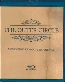
Film - Digital Video Disc, Evolving Communications & Shack West, The Outer Circle: Melbourne's forgotten railway, 2014
Documentary on the Outer Circle Railway, which ran from Oakleigh to Fairfield, and was opened in 1891, with the last train running in 1943. Features Dr David Beardsall, Dr Crystal Legacy, Rod Atkins, Kevin O'Shaughnessy, Sr Helen-Mary Langlands2-disc DVD on Outer Circle Railway.railways, outer circle railway, train lines -- melbourne (vic.) -
 Marysville & District Historical Society
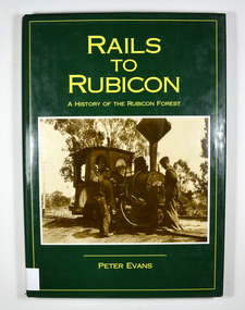
Book - Hardcover book, Peter Evans, Rails to Rubicon-A History of the Rubicon Forest, 1994
Hardcover. Green dust cover. Front cover photograph is Krauss 0-4-OWT, builder's No. 2459 of 1891, takes water at the western end of Rubicon Lane in 1934. Driver Bob Rees attends to his engine while brakeman Hayden looks on. End papers show a photograph of a man standing besides a timber railway trolley holding onto the brake lever. There is a group of men, some sitting and some standing, on piles of cut timber under a large, open shed in the background. There are also some small, timber, tent like structures standing next to the railway tracks. There is a forest in the far background. Written in white is the line "Mr Clarke & Kidd's Sawmill". non-fictionrubicon, timber, sawmill, railway, tramway, clarke and pearce, evans, peter, marysville, krause, forest, mountain -
 Federation University Historical Collection
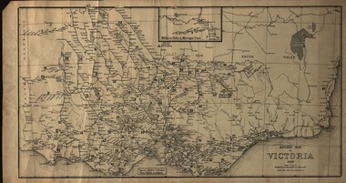
Map, Railway Map of Victoria, 1930
Cardboard map of Victorian railway system in 1930. Maps out all train-lines in Victoria and into New South Wales. map, railway, train-lines, victoria, victorian railways, railway lines -
 Tarnagulla History Archive
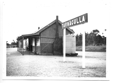
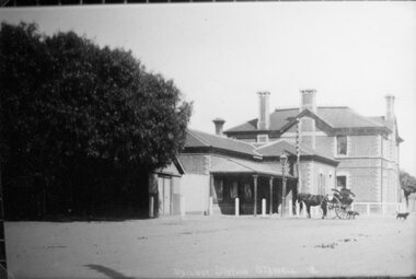
Photograph of former Tarnagulla Railway Station, Former Tarnagulla Railway Station, circa 1890 to 1940
Murray Comrie Collection. Monochrome photograph depicting the railway station formerly at Tarnagulla. This is a good copy of an older original. Copy probably made in the 1970s. tarnagulla, railway, rail, transport, trains, station -
 Greensborough Historical Society
Photograph, Railway Gates at Grimshaw Street Greensborough, 1930c
Two women are standing at the railway crossing gates, ready to open or close the gates [Possibly Iredale family?]. Originally thought to be the rail crossing at Grimshaw Street and Old Greensborough Road. In 2023, there is doubt that this is the case due to the double rail line and building in background. Please contact the Society if you have any idea where this is located.Copy of photo of railway gates. Sepia.On back: "Godwill from Val Wilson"railway gates, rail crossing, iredale -
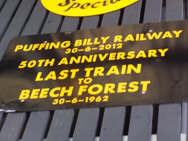 Puffing Billy Railway
Locomotive Head Board - 50th Anniversary Last Train to Beech Forest
Historic - Puffing Billy Railway Locomotive Head Board used in the Celebration of the Last Train to Beech Forest 50th Anniversary Last Train to Beech Forest 30 - 6 1962 G42 ran from Belgrave to Gembrook to commemorate the 50th Anniversary of the closure of the Beech Forest Railway. Puffing Billy Railway, Victoria, 30th June, 2012. The Beech Forest line was opened in 1902 and later extended to Crowes. The line was closed in sections with the last section being between Colac and Beech Forest. The last train was hauled by locomotive G 42, which also hauled the re-enactment train in 2012.Historic - Puffing Billy Railway Locomotive Head Board used in the Celebration of the Last Train to Beech Forest 50th Anniversary Last Train to Beech Forest 30 - 6 1962 G 42 ran from Belgrave to Gembrook to commemorate the 50th Anniversary of the closure of the Beech Forest Railway. Puffing Billy Railway, Victoria, 30th June, 2012.Wooden - Locomotive Head Board - 50th Anniversary Last Train to Beech Forest Puffing Billy Railway 30- 6 - 2012 50th Anniversary Last Train to Beech Forest puffing billy, head board, last train to beech forest -
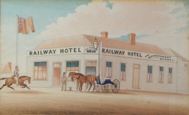 Creswick Museum
watercolour painting, Railway Hotel and Refreshment Rooms, c. 1870
The Railway Hotel in Creswick later became a hostel for Dutch immigrants just after WW2. It is now demolished.Paintings by William Tibbits are relatively rare. They are valuable as a record of life in Creswick (and other towns) in the colonial period.Watercolour painting on paper by William Tibbits depicting the Railway Hotel, Creswick, in about 1870.william tibbits, railway hotel, creswick, colonial art, watercolour -
 Stawell Historical Society Inc
Photograph, Railway Station Stawell
Stawell railway Station with horse and buggy in front. Large trees to left of photo. Engraved "Railway Station Stawell 12.B/W/ Photgraph of the Stawell Railway Station. form the front, A large tree to the left of the station, also a Horse and Trap, also a Gaslight.stawell railways transport, mark dadswell