Showing 1472 items matching "view hill"
-
 Eltham District Historical Society Inc
Photograph, Upper Yarra Dam, Spring Tour, 22 Oct 1995, 22/10/1995
... bridge at Warrandyte we headed through Wonga Park with views... bridge at Warrandyte we headed through Wonga Park with views ...EXPLORING THE UPPER YARRA (Newsletter No. 105, November 1995, by Bettina Woodburn) We enjoyed the Spring Excursion, this year "Exploring the Upper Yarra" - in spite of the constant rain and the countryside under the cloud cover, especially in the valleys, being mainly shiny shades of green. The occasional fields of buttercups, clumps of arum lilies and splendid rhododendron and other flowering bushes became very special. The Cobb and Co coach was warm and a cosy retreat as we zig-zagged on the highways and byways to glimpse the Yarra River, upstream and down, its secret places, and particularly the many bridges. Russell excelled as 'Poet Laureate', reading from Dacre Smyth's book. This 1979 publication includes paintings of all the bridges along the river with poems and brief descriptions of each one. Some of the bridges are in out of the way places and are not very well known. We looked forward to hearing the poetry as much as seeing the ' constructions'…Big Pat (was he short or tall, lean or fat? He did win the two hundred pound reward for discovering gold and had the creek named after him), about the 'Eddies'?, and the disliked 'meccano' bridge in Warburton, etc. etc. The hot roast lunch in the old Reefton Hotel was also most welcome. It was easy to imagine it peopled by miners and early settlers. Starting by crossing the new (1974) concrete bridge at Warrandyte we headed through Wonga Park with views to the Christmas Hills and to the escarpment of the Yering Gorge, which causes flood waters to back up through the Yarra Glen plain, so avoiding disasters downstream. At the end of a long driveway we found the wooden, privately owned Henley Bridge (1935 after the 1934 floods). This facilitates access to different parts of Henley Farm and to Lilydale. Everard Park, named after Blanche Shallard's father, a State Member for 17 years, below the Highway Yarra crossing was in need of care. It is 10 miles from Yarra Glen by road but, as "Yarra Marra” canoeists well know, 32 winding miles down by water. After more delightful countryside scenes we joined the Warburton Highway at Woori Yallock. From the old Railway Station at Launching Place the Centennial Trail for walkers, cyclists and ' horse riders has replaced the rails. The line from Lilydale was opened in 1901, and the last diesel freight train ran to Warburton in 1965. It continued to rain as we had morning tea in Warburton in a shelter between footbridges. From here we continued upstream past the Bridge to O'Shannasy Lodge and Reservoir, Starvation Creek, and the Peninsular tunnel (miners dug it as at Pound Bend) which we visited (scrambling down those steps!) on our return after lunch. Our furthermost point was the Upper Yarra Dam Reserve (and vast catchment area). Finished in 1957 after ten years work and 100 years after Yan Yean, it supplies much of Melbourne's water. After crossing the 30m Launching Place Bridge to the Eltham side of the Yarra and Healesville, we saw in the distance the Yarra Glen Timber Trestle Bridge over the river flats "the longest for years in the land it was said!" Harry's dream of "better weather over the Divide" unfortunately didn't come true, but I'm sure we 36 members will retain happy memories of a day that was wet and green and filled with Bridges. Bettina Woodburn - October 1995 Record of the Society's history of activities - Spring 1995 excursionRoll of 35mm colour negative film, 4 of 5 stripsKodak Gold 400-5shire of eltham historical society, activities, upper yarra dam, henley bridge -
 Eltham District Historical Society Inc
Photograph, Upper Yarra Dam, Spring Tour, 22 Oct 1995, 22/10/1995
... bridge at Warrandyte we headed through Wonga Park with views... bridge at Warrandyte we headed through Wonga Park with views ...EXPLORING THE UPPER YARRA (Newsletter No. 105, November 1995, by Bettina Woodburn) We enjoyed the Spring Excursion, this year "Exploring the Upper Yarra" - in spite of the constant rain and the countryside under the cloud cover, especially in the valleys, being mainly shiny shades of green. The occasional fields of buttercups, clumps of arum lilies and splendid rhododendron and other flowering bushes became very special. The Cobb and Co coach was warm and a cosy retreat as we zig-zagged on the highways and byways to glimpse the Yarra River, upstream and down, its secret places, and particularly the many bridges. Russell excelled as 'Poet Laureate', reading from Dacre Smyth's book. This 1979 publication includes paintings of all the bridges along the river with poems and brief descriptions of each one. Some of the bridges are in out of the way places and are not very well known. We looked forward to hearing the poetry as much as seeing the ' constructions'…Big Pat (was he short or tall, lean or fat? He did win the two hundred pound reward for discovering gold and had the creek named after him), about the 'Eddies'?, and the disliked 'meccano' bridge in Warburton, etc. etc. The hot roast lunch in the old Reefton Hotel was also most welcome. It was easy to imagine it peopled by miners and early settlers. Starting by crossing the new (1974) concrete bridge at Warrandyte we headed through Wonga Park with views to the Christmas Hills and to the escarpment of the Yering Gorge, which causes flood waters to back up through the Yarra Glen plain, so avoiding disasters downstream. At the end of a long driveway we found the wooden, privately owned Henley Bridge (1935 after the 1934 floods). This facilitates access to different parts of Henley Farm and to Lilydale. Everard Park, named after Blanche Shallard's father, a State Member for 17 years, below the Highway Yarra crossing was in need of care. It is 10 miles from Yarra Glen by road but, as "Yarra Marra” canoeists well know, 32 winding miles down by water. After more delightful countryside scenes we joined the Warburton Highway at Woori Yallock. From the old Railway Station at Launching Place the Centennial Trail for walkers, cyclists and ' horse riders has replaced the rails. The line from Lilydale was opened in 1901, and the last diesel freight train ran to Warburton in 1965. It continued to rain as we had morning tea in Warburton in a shelter between footbridges. From here we continued upstream past the Bridge to O'Shannasy Lodge and Reservoir, Starvation Creek, and the Peninsular tunnel (miners dug it as at Pound Bend) which we visited (scrambling down those steps!) on our return after lunch. Our furthermost point was the Upper Yarra Dam Reserve (and vast catchment area). Finished in 1957 after ten years work and 100 years after Yan Yean, it supplies much of Melbourne's water. After crossing the 30m Launching Place Bridge to the Eltham side of the Yarra and Healesville, we saw in the distance the Yarra Glen Timber Trestle Bridge over the river flats "the longest for years in the land it was said!" Harry's dream of "better weather over the Divide" unfortunately didn't come true, but I'm sure we 36 members will retain happy memories of a day that was wet and green and filled with Bridges. Bettina Woodburn - October 1995 Record of the Society's history of activities - Spring 1995 excursionRoll of 35mm colour negative film, 3 stripsKodak Gold 200-4shire of eltham historical society, activities, upper yarra dam, henley bridge -
 Eltham District Historical Society Inc
Photograph, Upper Yarra Dam, Spring Tour, 22 Oct 1995, 22/10/1995
... bridge at Warrandyte we headed through Wonga Park with views... bridge at Warrandyte we headed through Wonga Park with views ...EXPLORING THE UPPER YARRA (Newsletter No. 105, November 1995, by Bettina Woodburn) We enjoyed the Spring Excursion, this year "Exploring the Upper Yarra" - in spite of the constant rain and the countryside under the cloud cover, especially in the valleys, being mainly shiny shades of green. The occasional fields of buttercups, clumps of arum lilies and splendid rhododendron and other flowering bushes became very special. The Cobb and Co coach was warm and a cosy retreat as we zig-zagged on the highways and byways to glimpse the Yarra River, upstream and down, its secret places, and particularly the many bridges. Russell excelled as 'Poet Laureate', reading from Dacre Smyth's book. This 1979 publication includes paintings of all the bridges along the river with poems and brief descriptions of each one. Some of the bridges are in out of the way places and are not very well known. We looked forward to hearing the poetry as much as seeing the ' constructions'…Big Pat (was he short or tall, lean or fat? He did win the two hundred pound reward for discovering gold and had the creek named after him), about the 'Eddies'?, and the disliked 'meccano' bridge in Warburton, etc. etc. The hot roast lunch in the old Reefton Hotel was also most welcome. It was easy to imagine it peopled by miners and early settlers. Starting by crossing the new (1974) concrete bridge at Warrandyte we headed through Wonga Park with views to the Christmas Hills and to the escarpment of the Yering Gorge, which causes flood waters to back up through the Yarra Glen plain, so avoiding disasters downstream. At the end of a long driveway we found the wooden, privately owned Henley Bridge (1935 after the 1934 floods). This facilitates access to different parts of Henley Farm and to Lilydale. Everard Park, named after Blanche Shallard's father, a State Member for 17 years, below the Highway Yarra crossing was in need of care. It is 10 miles from Yarra Glen by road but, as "Yarra Marra” canoeists well know, 32 winding miles down by water. After more delightful countryside scenes we joined the Warburton Highway at Woori Yallock. From the old Railway Station at Launching Place the Centennial Trail for walkers, cyclists and ' horse riders has replaced the rails. The line from Lilydale was opened in 1901, and the last diesel freight train ran to Warburton in 1965. It continued to rain as we had morning tea in Warburton in a shelter between footbridges. From here we continued upstream past the Bridge to O'Shannasy Lodge and Reservoir, Starvation Creek, and the Peninsular tunnel (miners dug it as at Pound Bend) which we visited (scrambling down those steps!) on our return after lunch. Our furthermost point was the Upper Yarra Dam Reserve (and vast catchment area). Finished in 1957 after ten years work and 100 years after Yan Yean, it supplies much of Melbourne's water. After crossing the 30m Launching Place Bridge to the Eltham side of the Yarra and Healesville, we saw in the distance the Yarra Glen Timber Trestle Bridge over the river flats "the longest for years in the land it was said!" Harry's dream of "better weather over the Divide" unfortunately didn't come true, but I'm sure we 36 members will retain happy memories of a day that was wet and green and filled with Bridges. Bettina Woodburn - October 1995 Record of the Society's history of activities - Spring 1995 excursionRoll of 35mm colour negative film, 2 stripsKodak Gold 100-4shire of eltham historical society, activities, upper yarra dam, henley bridge -
 Eltham District Historical Society Inc
Photograph, Upper Yarra Dam, Spring Tour, 22 Oct 1995, 22/10/1995
... bridge at Warrandyte we headed through Wonga Park with views... bridge at Warrandyte we headed through Wonga Park with views ...EXPLORING THE UPPER YARRA (Newsletter No. 105, November 1995, by Bettina Woodburn) We enjoyed the Spring Excursion, this year "Exploring the Upper Yarra" - in spite of the constant rain and the countryside under the cloud cover, especially in the valleys, being mainly shiny shades of green. The occasional fields of buttercups, clumps of arum lilies and splendid rhododendron and other flowering bushes became very special. The Cobb and Co coach was warm and a cosy retreat as we zig-zagged on the highways and byways to glimpse the Yarra River, upstream and down, its secret places, and particularly the many bridges. Russell excelled as 'Poet Laureate', reading from Dacre Smyth's book. This 1979 publication includes paintings of all the bridges along the river with poems and brief descriptions of each one. Some of the bridges are in out of the way places and are not very well known. We looked forward to hearing the poetry as much as seeing the ' constructions'…Big Pat (was he short or tall, lean or fat? He did win the two hundred pound reward for discovering gold and had the creek named after him), about the 'Eddies'?, and the disliked 'meccano' bridge in Warburton, etc. etc. The hot roast lunch in the old Reefton Hotel was also most welcome. It was easy to imagine it peopled by miners and early settlers. Starting by crossing the new (1974) concrete bridge at Warrandyte we headed through Wonga Park with views to the Christmas Hills and to the escarpment of the Yering Gorge, which causes flood waters to back up through the Yarra Glen plain, so avoiding disasters downstream. At the end of a long driveway we found the wooden, privately owned Henley Bridge (1935 after the 1934 floods). This facilitates access to different parts of Henley Farm and to Lilydale. Everard Park, named after Blanche Shallard's father, a State Member for 17 years, below the Highway Yarra crossing was in need of care. It is 10 miles from Yarra Glen by road but, as "Yarra Marra” canoeists well know, 32 winding miles down by water. After more delightful countryside scenes we joined the Warburton Highway at Woori Yallock. From the old Railway Station at Launching Place the Centennial Trail for walkers, cyclists and ' horse riders has replaced the rails. The line from Lilydale was opened in 1901, and the last diesel freight train ran to Warburton in 1965. It continued to rain as we had morning tea in Warburton in a shelter between footbridges. From here we continued upstream past the Bridge to O'Shannasy Lodge and Reservoir, Starvation Creek, and the Peninsular tunnel (miners dug it as at Pound Bend) which we visited (scrambling down those steps!) on our return after lunch. Our furthermost point was the Upper Yarra Dam Reserve (and vast catchment area). Finished in 1957 after ten years work and 100 years after Yan Yean, it supplies much of Melbourne's water. After crossing the 30m Launching Place Bridge to the Eltham side of the Yarra and Healesville, we saw in the distance the Yarra Glen Timber Trestle Bridge over the river flats "the longest for years in the land it was said!" Harry's dream of "better weather over the Divide" unfortunately didn't come true, but I'm sure we 36 members will retain happy memories of a day that was wet and green and filled with Bridges. Bettina Woodburn - October 1995 Record of the Society's history of activities - Spring 1995 excursionRoll of 35mm colour negative film, 4 of 5 stripsKodak Gold 400-5shire of eltham historical society, activities, upper yarra dam, henley bridge -
 Eltham District Historical Society Inc
Photograph, Spring Excursion, Exploring the Upper Yarra, 22 October 1995, 22/10/1995
... we headed through Wonga Park with views to the Christmas... we headed through Wonga Park with views to the Christmas ...[article by Bettina Woodburn in EDHS Newsletter No. 105, November 1995:] EXPLORING THE UPPER YARRA - We enjoyed the Spring Excursion, this year "Exploring the Upper Yarra" - in spite of the constant rain and the countryside under the cloud cover, especially in the valleys, being mainly shiny shades of green. The occasional fields of buttercups, clumps of arum lilies and splendid rhododendron and other flowering bushes became very special. The Cobb and Co coach was warm and a cosy retreat as we zig-zagged on the highways and byways to glimpse the Yarra River, upstream and down, its secret places, and particularly the many bridges. Russell excelled as 'Poet Laureate', reading from Dacre Smyth's book. This 1979 publication includes paintings of all the bridges along the river with poems and brief descriptions of each one. Some of the bridges are in out-of-the-way places and are not very well known. We looked forward to hearing the poetry as much as seeing the 'constructions'… Big Pat (was he short or tall, lean or fat? - he did win the £200 reward for discovering gold and had the creek named after him), about the 'Eddies'?, and the disliked 'meccano' bridge in Warburton, etc. etc. The hot roast lunch in the old Reefton Hotel was also most welcome. It was easy to imagine it peopled by miners and early settlers. Starting by crossing the new (1974) concrete bridge at Warrandyte we headed through Wonga Park with views to the Christmas Hills and to the escarpment of the Yering Gorge, which causes flood waters to back up through the Yarra Glen plain, so avoiding disasters downstream. At the end of a long driveway we found the wooden, privately owned Henley Bridge (1935 after the 1934 floods). This facilitates access to different parts of Henley Farm and to Lilydale. Everard Park, named after Blanche Shallard's father, a State Member for 17 years, below the Highway Yarra crossing was in need of care. It is 10 miles from Yarra Glen by road but, as "Yarra Marra” canoeists well know, 32 winding miles down by water. After more delightful countryside scenes we joined the Warburton Highway at Woori Yallock. From the old Railway Station at Launching Place the Centennial Trail for walkers, cyclists and horse riders has replaced the rails. The line from Lilydale was opened in 1901, and the last diesel freight train ran to Warburton in 1965. It continued to rain as we had morning tea in Warburton in a shelter between footbridges. From here we continued upstream past the Bridge to O'Shannassy Lodge and Reservoir, Starvation Creek, and the Peninsular tunnel (miners dug it as at Pound Bend) which we visited (scrambling down those steps!) on our return after lunch. Our furthermost point was the Upper Yarra Dam Reserve (and vast catchment area). Finished in 1957 after ten years' work and 100 years after Yan Yean, it supplies much of Melbourne's water. After crossing the 30m Launching Place Bridge to the Eltham side of the Yarra and Healesville, we saw in the distance the Yarra Glen Timber Trestle Bridge over the river flats "the longest for years in the land it was said!" Harry's dream of "better weather over the Divide" unfortunately didn't come true, but I'm sure we 36 members will retain happy memories of a day that was wet and green and filled with Bridges.Two colour photographsactivities, upper yarra, upper yarra dam -
 Eltham District Historical Society Inc
Photograph, Yarra River from Henley Bridge, Kangaroo Ground, Spring Excursion, Exploring the Upper Yarra, 22 October 1995, 22/10/1995
... we headed through Wonga Park with views to the Christmas... we headed through Wonga Park with views to the Christmas ...[article by Bettina Woodburn in EDHS Newsletter No. 105, November 1995:] EXPLORING THE UPPER YARRA - We enjoyed the Spring Excursion, this year "Exploring the Upper Yarra" - in spite of the constant rain and the countryside under the cloud cover, especially in the valleys, being mainly shiny shades of green. The occasional fields of buttercups, clumps of arum lilies and splendid rhododendron and other flowering bushes became very special. The Cobb and Co coach was warm and a cosy retreat as we zig-zagged on the highways and byways to glimpse the Yarra River, upstream and down, its secret places, and particularly the many bridges. Russell excelled as 'Poet Laureate', reading from Dacre Smyth's book. This 1979 publication includes paintings of all the bridges along the river with poems and brief descriptions of each one. Some of the bridges are in out-of-the-way places and are not very well known. We looked forward to hearing the poetry as much as seeing the 'constructions'… Big Pat (was he short or tall, lean or fat? - he did win the £200 reward for discovering gold and had the creek named after him), about the 'Eddies'?, and the disliked 'meccano' bridge in Warburton, etc. etc. The hot roast lunch in the old Reefton Hotel was also most welcome. It was easy to imagine it peopled by miners and early settlers. Starting by crossing the new (1974) concrete bridge at Warrandyte we headed through Wonga Park with views to the Christmas Hills and to the escarpment of the Yering Gorge, which causes flood waters to back up through the Yarra Glen plain, so avoiding disasters downstream. At the end of a long driveway we found the wooden, privately owned Henley Bridge (1935 after the 1934 floods). This facilitates access to different parts of Henley Farm and to Lilydale. Everard Park, named after Blanche Shallard's father, a State Member for 17 years, below the Highway Yarra crossing was in need of care. It is 10 miles from Yarra Glen by road but, as "Yarra Marra” canoeists well know, 32 winding miles down by water. After more delightful countryside scenes we joined the Warburton Highway at Woori Yallock. From the old Railway Station at Launching Place the Centennial Trail for walkers, cyclists and horse riders has replaced the rails. The line from Lilydale was opened in 1901, and the last diesel freight train ran to Warburton in 1965. It continued to rain as we had morning tea in Warburton in a shelter between footbridges. From here we continued upstream past the Bridge to O'Shannassy Lodge and Reservoir, Starvation Creek, and the Peninsular tunnel (miners dug it as at Pound Bend) which we visited (scrambling down those steps!) on our return after lunch. Our furthermost point was the Upper Yarra Dam Reserve (and vast catchment area). Finished in 1957 after ten years' work and 100 years after Yan Yean, it supplies much of Melbourne's water. After crossing the 30m Launching Place Bridge to the Eltham side of the Yarra and Healesville, we saw in the distance the Yarra Glen Timber Trestle Bridge over the river flats "the longest for years in the land it was said!" Harry's dream of "better weather over the Divide" unfortunately didn't come true, but I'm sure we 36 members will retain happy memories of a day that was wet and green and filled with Bridges.Colour photographactivities, upper yarra, henley bridge -
 Eltham District Historical Society Inc
Photograph, Peter Bassett-Smith, Upper Yarra Dam, Spring Tour, 22 Oct 1995, 22/10/1995
... bridge at Warrandyte we headed through Wonga Park with views... bridge at Warrandyte we headed through Wonga Park with views ...EXPLORING THE UPPER YARRA (Newsletter No. 105, November 1995, by Bettina Woodburn) We enjoyed the Spring Excursion, this year "Exploring the Upper Yarra" - in spite of the constant rain and the countryside under the cloud cover, especially in the valleys, being mainly shiny shades of green. The occasional fields of buttercups, clumps of arum lilies and splendid rhododendron and other flowering bushes became very special. The Cobb and Co coach was warm and a cosy retreat as we zig-zagged on the highways and byways to glimpse the Yarra River, upstream and down, its secret places, and particularly the many bridges. Russell excelled as 'Poet Laureate', reading from Dacre Smyth's book. This 1979 publication includes paintings of all the bridges along the river with poems and brief descriptions of each one. Some of the bridges are in out of the way places and are not very well known. We looked forward to hearing the poetry as much as seeing the ' constructions'…Big Pat (was he short or tall, lean or fat? He did win the two hundred pound reward for discovering gold and had the creek named after him), about the 'Eddies'?, and the disliked 'meccano' bridge in Warburton, etc. etc. The hot roast lunch in the old Reefton Hotel was also most welcome. It was easy to imagine it peopled by miners and early settlers. Starting by crossing the new (1974) concrete bridge at Warrandyte we headed through Wonga Park with views to the Christmas Hills and to the escarpment of the Yering Gorge, which causes flood waters to back up through the Yarra Glen plain, so avoiding disasters downstream. At the end of a long driveway we found the wooden, privately owned Henley Bridge (1935 after the 1934 floods). This facilitates access to different parts of Henley Farm and to Lilydale. Everard Park, named after Blanche Shallard's father, a State Member for 17 years, below the Highway Yarra crossing was in need of care. It is 10 miles from Yarra Glen by road but, as "Yarra Marra” canoeists well know, 32 winding miles down by water. After more delightful countryside scenes we joined the Warburton Highway at Woori Yallock. From the old Railway Station at Launching Place the Centennial Trail for walkers, cyclists and ' horse riders has replaced the rails. The line from Lilydale was opened in 1901, and the last diesel freight train ran to Warburton in 1965. It continued to rain as we had morning tea in Warburton in a shelter between footbridges. From here we continued upstream past the Bridge to O'Shannasy Lodge and Reservoir, Starvation Creek, and the Peninsular tunnel (miners dug it as at Pound Bend) which we visited (scrambling down those steps!) on our return after lunch. Our furthermost point was the Upper Yarra Dam Reserve (and vast catchment area). Finished in 1957 after ten years work and 100 years after Yan Yean, it supplies much of Melbourne's water. After crossing the 30m Launching Place Bridge to the Eltham side of the Yarra and Healesville, we saw in the distance the Yarra Glen Timber Trestle Bridge over the river flats "the longest for years in the land it was said!" Harry's dream of "better weather over the Divide" unfortunately didn't come true, but I'm sure we 36 members will retain happy memories of a day that was wet and green and filled with Bridges. Bettina Woodburn - October 1995 Record of the Society's history of activities - Spring 1995 excursionColour photographactivities, upper yarra dam, 1995, peter bassett-smith -
 Eltham District Historical Society Inc
Photograph, Peter Bassett-Smith, Upper Yarra Dam, Spring Tour, 22 Oct 1995, 22/10/1995
... bridge at Warrandyte we headed through Wonga Park with views... bridge at Warrandyte we headed through Wonga Park with views ...EXPLORING THE UPPER YARRA (Newsletter No. 105, November 1995, by Bettina Woodburn) We enjoyed the Spring Excursion, this year "Exploring the Upper Yarra" - in spite of the constant rain and the countryside under the cloud cover, especially in the valleys, being mainly shiny shades of green. The occasional fields of buttercups, clumps of arum lilies and splendid rhododendron and other flowering bushes became very special. The Cobb and Co coach was warm and a cosy retreat as we zig-zagged on the highways and byways to glimpse the Yarra River, upstream and down, its secret places, and particularly the many bridges. Russell excelled as 'Poet Laureate', reading from Dacre Smyth's book. This 1979 publication includes paintings of all the bridges along the river with poems and brief descriptions of each one. Some of the bridges are in out of the way places and are not very well known. We looked forward to hearing the poetry as much as seeing the ' constructions'…Big Pat (was he short or tall, lean or fat? He did win the two hundred pound reward for discovering gold and had the creek named after him), about the 'Eddies'?, and the disliked 'meccano' bridge in Warburton, etc. etc. The hot roast lunch in the old Reefton Hotel was also most welcome. It was easy to imagine it peopled by miners and early settlers. Starting by crossing the new (1974) concrete bridge at Warrandyte we headed through Wonga Park with views to the Christmas Hills and to the escarpment of the Yering Gorge, which causes flood waters to back up through the Yarra Glen plain, so avoiding disasters downstream. At the end of a long driveway we found the wooden, privately owned Henley Bridge (1935 after the 1934 floods). This facilitates access to different parts of Henley Farm and to Lilydale. Everard Park, named after Blanche Shallard's father, a State Member for 17 years, below the Highway Yarra crossing was in need of care. It is 10 miles from Yarra Glen by road but, as "Yarra Marra” canoeists well know, 32 winding miles down by water. After more delightful countryside scenes we joined the Warburton Highway at Woori Yallock. From the old Railway Station at Launching Place the Centennial Trail for walkers, cyclists and ' horse riders has replaced the rails. The line from Lilydale was opened in 1901, and the last diesel freight train ran to Warburton in 1965. It continued to rain as we had morning tea in Warburton in a shelter between footbridges. From here we continued upstream past the Bridge to O'Shannasy Lodge and Reservoir, Starvation Creek, and the Peninsular tunnel (miners dug it as at Pound Bend) which we visited (scrambling down those steps!) on our return after lunch. Our furthermost point was the Upper Yarra Dam Reserve (and vast catchment area). Finished in 1957 after ten years work and 100 years after Yan Yean, it supplies much of Melbourne's water. After crossing the 30m Launching Place Bridge to the Eltham side of the Yarra and Healesville, we saw in the distance the Yarra Glen Timber Trestle Bridge over the river flats "the longest for years in the land it was said!" Harry's dream of "better weather over the Divide" unfortunately didn't come true, but I'm sure we 36 members will retain happy memories of a day that was wet and green and filled with Bridges. Bettina Woodburn - October 1995 Record of the Society's history of activities - Spring 1995 excursionColour photographactivities, upper yarra dam, 1995 -
 Eltham District Historical Society Inc
Newspaper - Newsclipping, Nillumbik Mail, "A Memorial Avenue of Honour", A Journey in Time: A column about Nillumbik's history, Nillumbik Mail, 24 May 2000, p4, 2000
... Street, c.1911 View looking down Policeman’s Hill on Maria... Street, c.1911 View looking down Policeman’s Hill on Maria ...Main Road, Eltham, south from Brougham Street to Dalton Street, c.1911 View looking down Policeman’s Hill on Maria Street (Main Road) from near Brougham Street towards Dalton Street, site of the Avenue of Honour established in 1916-1917 in memory of the soldiers who served in the First World War, 1914-1918. At the bottom of the hill on the right is White Cloud Cottage, home of the Jarrold family, three women standing out front observing the photographer. The road passes over a culvert which runs to the west in front of the cottage. The cottage was originally located closer to the Diamond Creek but was subject to flooding. It was dragged by horse to the present site shown, which was chosen for the higher ground that had been created as a result of land fill being deposited here from the quarry further around the bend on Main Road (site of present-day Eltham Primary School carpark) where the stone had been quarried for building the State School in Dalton Street. Immediately at the end of the straight section of the main road can be seen the gas streetlamp in front of the Jarrold home and the pond at the bottom of Dalton Street. The cottage had previously been rented for use as a Police Station / residence prior to the building of the permanent police house and station at the corner of Maria and Brougham streets in 1859. At the time of collection of photos for the centenary of the Shire of Eltham (1971) the cottage was owned by the Skipper family and remains in the family to present day (2021). On the left is the Grant house on the corner of Main Road and Dalton Street now the present-day site of Eltham Clinic. Photographer: J.H. Clark John Henry Clark was the youngest of three boys born to William Henry Clark (1823-1877) and Maria White (1843-1914). He and his brothers, William Charles Clark (1872-1945), Clement Kent Clark (1874-1912) operated a photography business (Clark Bros.) from 25 Thomas Street, Windsor near Prahran during the period c.1894 to 1914. Following death of Clement in September 1912 and their mother in 1914, the Clark Bros business appears to have dissolved, the premises demolished, and a new house was under construction in 1915. John set up business independently in 1914 operating out of 29 Moor Street, Fitzroy where he is registered in the 1914 and 1915 Electoral Rolls. By 1916 John had relocated to Eltham where he continued his practice as a photographer and took many of the early images around the district of Little Eltham. Around 1930 John changed professions and opened a small cobbler's shop in 1931 near the pond opposite Dalton Street adjacent to the Jarrold family cottage. He never married and continued his profession as a bootmaker from this little shop, maintaining a close relationship with Mrs Jarrold for the rest of their lives. His bootmaker shop remains today beside the Whitecloud cottage and is one of only three remaining shops in the area from the early 20th century. There are a couple of images of Eltham taken by Clark Bros. in the Eltham District Historical Society collection, one such example being Hunniford’s Post Office with Miss Anne Hunniford out front (EDHS_00140 - marked on the back of the print, Clark Bros., 25 Thomas St. Windsor), which would date this image between c.1894 and 1914. Other early images of Eltham taken by John Henry Clark are marked on the face “J. H. Clark Photo” and it is assumed these are dated between 1914 and 1930. It is noted that the Grant of Probate for John H Clark of Eltham South dated 5 April !957 (513/387) records his occupation as "X Photographer".Newsprint pageNillumbik Mail publication details; Edition 4, 24 May 2000, p4dalton street, avenue of honour, eltham clinic, gas lamp, grant house, j.h. clark photo, jarrold cottage, jarrold family, main road, shire of eltham pioneers photograph collection, white cloud cottage -
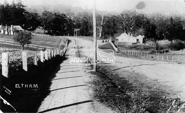 Eltham District Historical Society Inc
Negative - Photograph, J.H. Clark, Main Road, Eltham, south from Brougham Street to Dalton Street, c.1911
... Street, c.1911 View looking down Policeman’s Hill on Maria... Street, c.1911 View looking down Policeman’s Hill on Maria ...Main Road, Eltham, south from Brougham Street to Dalton Street, c.1911 View looking down Policeman’s Hill on Maria Street (Main Road) from near Brougham Street towards Dalton Street, site of the Avenue of Honour established in 1916-1917 in memory of the soldiers who served in the First World War, 1914-1918. At the bottom of the hill on the right is White Cloud Cottage, home of the Jarrold family, three women standing out front observing the photographer. The road passes over a culvert which runs to the west in front of the cottage. The cottage was originally located closer to the Diamond Creek but was subject to flooding. It was dragged by horse to the present site shown, which was chosen for the higher ground that had been created as a result of land fill being deposited here from the quarry further around the bend on Main Road (site of present-day Eltham Primary School carpark) where the stone had been quarried for building the State School in Dalton Street. Immediately at the end of the straight section of the main road can be seen the gas streetlamp in front of the Jarrold home and the pond at the bottom of Dalton Street. The cottage had previously been rented for use as a Police Station / residence prior to the building of the permanent police house and station at the corner of Maria and Brougham streets in 1859. At the time of collection of photos for the centenary of the Shire of Eltham (1971) the cottage was owned by the Skipper family and remains in the family to present day (2021). On the left is the Grant house on the corner of Main Road and Dalton Street now the present-day site of Eltham Clinic. Cross Ref: 0749 for another view of the Jarrold family home Photographer: J.H. Clark John Henry Clark was the youngest of three boys born to William Henry Clark (1823-1877) and Maria White (1843-1914). He and his brothers, William Charles Clark (1872-1945), Clement Kent Clark (1874-1912) operated a photography business (Clark Bros.) from 25 Thomas Street, Windsor near Prahran during the period c.1894 to 1914. Following death of Clement in September 1912 and their mother in 1914, the Clark Bros business appears to have dissolved, the premises demolished, and a new house was under construction in 1915. John set up business independently in 1914 operating out of 29 Moor Street, Fitzroy where he is registered in the 1914 and 1915 Electoral Rolls. By 1916 John had relocated to Eltham where he continued his practice as a photographer and took many of the early images around the district of Little Eltham. Around 1930 John changed professions and opened a small cobbler's shop in 1931 near the pond opposite Dalton Street adjacent to the Jarrold family cottage. He never married and continued his profession as a bootmaker from this little shop, maintaining a close relationship with Mrs Jarrold for the rest of their lives. His bootmaker shop remains today beside the Whitecloud cottage and is one of only three remaining shops in the area from the early 20th century. There are a couple of images of Eltham taken by Clark Bros. in the Eltham District Historical Society collection, one such example being Hunniford’s Post Office with Miss Anne Hunniford out front (EDHS_00140 - marked on the back of the print, Clark Bros., 25 Thomas St. Windsor), which would date this image between c.1894 and 1914. Other early images of Eltham taken by John Henry Clark are marked on the face “J. H. Clark Photo” and it is assumed these are dated between 1914 and 1930. It is noted that the Grant of Probate for John H Clark of Eltham South dated 5 April !957 (513/387) records his occupation as "X Photographer".This photo forms part of a collection of photographs gathered by the Shire of Eltham for their centenary project book,"Pioneers and Painters: 100 years of the Shire of Eltham" by Alan Marshall (1971). The collection of over 500 images is held in partnership between Eltham District Historical Society and Yarra Plenty Regional Library (Eltham Library) and is now formally known as the 'The Shire of Eltham Pioneers Photograph Collection.' It is significant in being the first community sourced collection representing the places and people of the Shire's first one hundred years.Digital image 4 x 5 inch B&W Negshire of eltham pioneers photograph collection, eltham, main road, jarrold family, dalton street, j.h. clark photo, white cloud cottage, avenue of honour, eltham clinic, gas lamp, grant house, jarrold cottage, 1900 -
 Eltham District Historical Society Inc
Photograph, Henley Bridge, Spring Excursion, Exploring the Upper Yarra, 22 October 1995, 22/10/1995
... we headed through Wonga Park with views to the Christmas... we headed through Wonga Park with views to the Christmas ...[article by Bettina Woodburn in EDHS Newsletter No. 105, November 1995:] EXPLORING THE UPPER YARRA - We enjoyed the Spring Excursion, this year "Exploring the Upper Yarra" - in spite of the constant rain and the countryside under the cloud cover, especially in the valleys, being mainly shiny shades of green. The occasional fields of buttercups, clumps of arum lilies and splendid rhododendron and other flowering bushes became very special. The Cobb and Co coach was warm and a cosy retreat as we zig-zagged on the highways and byways to glimpse the Yarra River, upstream and down, its secret places, and particularly the many bridges. Russell excelled as 'Poet Laureate', reading from Dacre Smyth's book. This 1979 publication includes paintings of all the bridges along the river with poems and brief descriptions of each one. Some of the bridges are in out-of-the-way places and are not very well known. We looked forward to hearing the poetry as much as seeing the 'constructions'… Big Pat (was he short or tall, lean or fat? - he did win the £200 reward for discovering gold and had the creek named after him), about the 'Eddies'?, and the disliked 'meccano' bridge in Warburton, etc. etc. The hot roast lunch in the old Reefton Hotel was also most welcome. It was easy to imagine it peopled by miners and early settlers. Starting by crossing the new (1974) concrete bridge at Warrandyte we headed through Wonga Park with views to the Christmas Hills and to the escarpment of the Yering Gorge, which causes flood waters to back up through the Yarra Glen plain, so avoiding disasters downstream. At the end of a long driveway we found the wooden, privately owned Henley Bridge (1935 after the 1934 floods). This facilitates access to different parts of Henley Farm and to Lilydale. Everard Park, named after Blanche Shallard's father, a State Member for 17 years, below the Highway Yarra crossing was in need of care. It is 10 miles from Yarra Glen by road but, as "Yarra Marra” canoeists well know, 32 winding miles down by water. After more delightful countryside scenes we joined the Warburton Highway at Woori Yallock. From the old Railway Station at Launching Place the Centennial Trail for walkers, cyclists and horse riders has replaced the rails. The line from Lilydale was opened in 1901, and the last diesel freight train ran to Warburton in 1965. It continued to rain as we had morning tea in Warburton in a shelter between footbridges. From here we continued upstream past the Bridge to O'Shannassy Lodge and Reservoir, Starvation Creek, and the Peninsular tunnel (miners dug it as at Pound Bend) which we visited (scrambling down those steps!) on our return after lunch. Our furthermost point was the Upper Yarra Dam Reserve (and vast catchment area). Finished in 1957 after ten years' work and 100 years after Yan Yean, it supplies much of Melbourne's water. After crossing the 30m Launching Place Bridge to the Eltham side of the Yarra and Healesville, we saw in the distance the Yarra Glen Timber Trestle Bridge over the river flats "the longest for years in the land it was said!" Harry's dream of "better weather over the Divide" unfortunately didn't come true, but I'm sure we 36 members will retain happy memories of a day that was wet and green and filled with Bridges. Situated on the Yarra River, 5.5 kms south of Christmas Hills on private property. This timber trestle bridge is said to have been built some time after 1907 by Melbourne master-builder, David Mitchell (the father of Dame Nellie Melba), to connect his two "Henley Farm" properties with Lilydale. In earlier days, when the McPhersons owned the property, their children used a punt to cross the river to attend Yering Primary School. This private bridge is best viewed from the end of Wendy Way. - Source: Christmas Hills Past and Present, Yarra Glen & District Historical Society, 2004.Two colour photographsactivities, henley bridge, upper yarra -
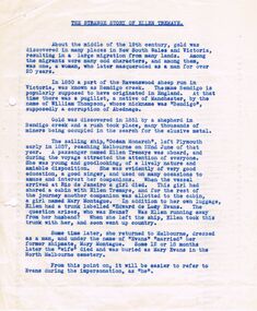 Bendigo Historical Society Inc.
Document - DE LACY EVANS/ELLEN TREMAYE
... , Allingham Drapers, View Grove Cottage Quarry Hill, Mrs Lofts Denmark..., View Grove Cottage Quarry Hill, Mrs Lofts Denmark Cottage ...Edward (Edmund) de Lacy Evans was really Ellen Tremaye; and in 1856 she married her fellow passenger on her voyage to Australia, Mary Delahunty; under the assumed name of EDMUND De Lacy. In 1859 he/she married Sarah Moore. They were married for eight years when in 1867 she died in childbirth. In 1868 after Sarah had died; Ellen, now known as EDWARD de Lacy Evans married Julia Mary Marquand in Ballarat. From the Melbourne Argus Friday 5th Sept 1879, Page 7 THE EXTRAORDINARY PERSONATION CASE. [BY ELECTRIC TELEGRAPH. FROM OUR OWN CORRESPONDENT.) SANDHURST, THURSDAY. The De Lacy Evans case has created great excitement here. The man-woman having resided in the district for about 20 years, was well known amongst the miners, but no one appeared ever to have supposed that she was other than as she represented herself to be, and the discovery of her sex has caused the greatest astonishment. The police have not yet moved in the matter of the discovery of her antecedents, but from the result of inquiries I have made, there seems to be no room to doubt that the woman is identical with the girl Ellen Tremaye, referred to in yesterday's telegram as having arrived at Melbourne by the ship Ocean Monarch in June, 1857. The nurse at the hospital, Mrs. Holt, is positive she is the same, and says the opinion was held amongst those on board the vessel that Tremaye had been well connected, and that she had left home in consequence of some misconduct. The Ocean Monarch was an immigrant vessel, and on the voyage Tremaye and another young woman, named Rose Kelly, were very intimate, but the latter, being seized with a dangerous illness, was left at Rio Janiero. Mrs. Evans, the wife of the supposed man, states that she frequently heard Evans say that she came out by the Ocean Monarch. But the most satisfactory information of Evans' previous history yet received has been obtained from a Mrs. Thompson, a charwoman at Myers' Creek, who was also a shipmate of the girl Tremaye. At the time she made the voyage she was unmarried, and was accompanied by Miss Mary Ann Delahunty, a young lady who was very well connected, and who came from the same village as herself, named Monakine, on the north bank of the river Suir, in Kilkenny. Miss Delahunty was an orphan and brought with her about £900. After Rose Kelly was taken ill, Tremaye resorted to Miss Delahunty's berth, and the passengers appeared to think there was something strange about the manner in which Tremaye conducted herself, and she had been observed to wear a man's under-clothing. Upon the arrival of the ship in Hobson's Bay, Tremaye declared herself to be a man, and told Mrs. Thompson she intended to marry Miss Delahunty. The next Mrs. Thompson saw of Ellen Tremaye was at Peg-leg Gully, Eaglehawk. Tremaye had just established herself in a house there under the name of Edward de Lacy Evans, and Mrs. Thompson went to serve them with milk. When she went to the house, she saw Evans sitting inside dressed in male attire, and immediately recognised him as her fellow passenger, Ellen Tremaye. Evans had, at this time, married his second wife, Miss Moore, who was then present. Evans re-marked to her—"I think I know you." To which Mrs. Thompson replied—"I know you, too," and added something to the effect that Ellen (referring to Tremaye) was a queer girl." Oh, said Evans, evidently anxious that his then wife should not understand Mrs. Thompson's reference, "It's a good job she is gone back to the old country." Mrs. Thompson inquired as to what had become of Miss Delahunty, and Evans replied, "Oh, my poor wife and boy both died of consumption, and are buried in the North Melbourne cemetery. " In reply to an inquiry as to what had been done with her (Delahunty's) money, Evans said she had sent it home to a nunnery. Evans's then wife had been absent during a portion of this conversation, but at this point she returned, and Evans went outside to the milkwoman, and said, "For your life don't mention my dead wife's name ; call me Mr. Evans. This missus of mine is death on the Roman Catholics, and she can't bear to hear my dead wife's name mentioned." This conversation took place about 12 or 14 years ago, and Mrs. Thompson seems to have quite believed that Evans had personated a woman under the name of Ellen Tremaye on the voyage out and was really a man. She lost sight of Evans soon afterwards, and took no further notice of the affair.Ballarat, Information re De Lacy Evans/Ellen Tremaye - various printed accounts of male impersonator, De Lacy Evans and his marriages and life in Bendigo and elsewhere. Filed under 'De Lacy Evans': a.Typescript - 'The strange story of Ellen Tremaye' (2 pp,); b.Newspaper cuttings (newspaper unknown): September 4, 1879 and 23rd July 1879. names mentioned on this report are; Evans, Stewart, The Trumpeter Clock, Mr. J. W. Moody, Edward De Lacy Evans, Samuels, Holdsworth, Dr. Cruikshank, Dr J. Boyd, Mr. Sterry J.P. (mayor), Mr. Osborn J.P. Elizabeth Marchment, Cornish United Company Long Gully, Constable Hayes, Mr. F. J. Duffy, Mr. J. Quick. C.Bendigo Advertiser 4th Sept 1879 (12 pages) - pp, 1-9 ''Extraordinary case of the concealment of sex'' (pp. 10-12) ''Interview with Mrs Evans''. Names on these sheets are; Edward De Lacy Evans, Sandhurst (Bendigo), Mr. Samuels, Mr. Holdsworth, Dr. Cruikshank, Dr. J. Boyd, Bendigo Hospital, Mr. Gundry (Warder), Irish, France, Dr. Poland, Mr. Bayne, Mr. Strickland, Kew Lunatic Asylum, Argus (newspaper), Sandhurst Hospital, Bendigo Hospital, County Kilkenny Ireland, Mrs Holt (Matron), Ellen Tremayne, Treneage, Eaglehawk, Sarah Moore, Mr. John J. Hall, Mr. George Willan, Buick Henderson and Co,. Pall Mall, Miss Julia Marquahand, Ballarat, Presbyterian Church, Rev. W. Henderson, Paris, Ellen McCormick, , Duncan Uquhart, Anne Dora (Welshman), Pleasant Creek, New Chum Extended Company, Julia Mary, Quarry Hill, Constable Bradley, General Sir Charles De Lacy Evans, Francis Bros Drapers of Pall Mall, Stawell, Allingham Drapers, View Grove Cottage Quarry Hill, Mrs Lofts Denmark Cottage Hargreaves Street, Jersey Cottage off Russell Street Quarry Hill, Great Southern Company, Sea Company, d.Single column entry, Bendigo Advertiser Dec 15th 1879: ''De Lacy Evans''. Names in the article; Ellen Tremayne, Sandhurst, Stawell, The Herald, Mr. F. Hilton, Diorama and Mirror of Australia, Horsham, The Horsham Times, Ireland. e. Newspaper article, by David Horsfall, Bendigo Advertiser Jan 10th 1990 (Title??) with photo of De Lacy Evans (standing); f.Newspaper article (poor legibility) Bendigo Advertiser Aug 27th 1901 ''Death of De Lacey Evans''; g.Newspaper article (undated) by Frank Cusack: ''Forgotten Bendigonians - Bendigo Goldfields und…??'' h.Journal article(3 pp.), The Medical Journal of Australia, Aug 26, 1978 by J R B Ball & R Emmerson: ''A case of personation'';i. copy of page #210 from unknown book (heading:'' Mount Royal Hospital'' j.27 pp.headed ''The Man-Woman Mystery'' (from bound book - binding visible - and copy in the Mitchell Library, publisher; W. Marshall, Royal Lane, Melbourne and Record Office, Emerald Hill with page (no page number) referring to two relevant documents ''The originals of these documents can be seen in the Hall'';Bendigo Advertiserjohn baptiste loridan, ellen tremaye, sarah moore, julia mary marquand, mary delahunty, de lacy evans, de lacy, edward de lacy evans, edmund de lacy, bendigo -
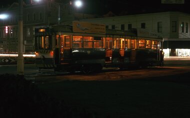 Ballarat Tramway Museum
Slide - 35mm slide/s - set of 32, Noel Simons, 25/02/1971 12:00:00 AM
... terminus. 1201.23 - No. 26 at Quarry Hill terminus, view of front... at Quarry Hill terminus, view of front portion of tram only from ...Set of 31 transparencies taken on 25/2/1972 on Kodak mounts. 1201.1 - Bendigo No. 26 in Bond St. just after leaving Long Gully en route for Quarry Hill. Has Norris Supermarket in background. Has two SEC roof ads. 1201.2 - No. 26 climbing View St. from Charing Cross en route to Eaglehawk. Has ANZ bank and AMOCO service station in background. 1201.3 - as for 1201.3, but after tram has passed photographer. Has buildings west of Mackenzie St. in photograph. 1201.4 - Tram stop and centre of the road pole with two "CARS STOP BY REQUEST" signs mounted on pole at the corner of Mackenzie St. 1201.5 - same position as for 1201.3, but with No. 5 descending the street. 1201.6 - same position as for 1201.2, but with No. 5 descending the street. Photo taken after tram has passed photographer. 1201.7 - No. 7 in Nolan St. from across the park at Lake Weeroona. 1201.8 - No. 7 entering McCrae St from Nolan St. - distant view. Note "TRAM "sign on left hand side under tree and overhead in McCrae St. from former track that once was in this street. 1201.9 - No. 7 in High St. with Cathedral in background. Tram en route to North Bendigo. Note scaffolding around Cathedral main spire area. 1201.10 - No. 7 crossing Bendigo Creek bridge in High St. near Golden Square. Has a Caltex Service station in the background. 1201.11 - No. 7 at Golden Square terminus with Sunburst Fruit Juices and a Peters Ice cream delivery vans alongside. 1201.12 - as for 1201.11 but photo taken from behind tram, with the end of the rails in the photograph. 1201.13 - No. 7 and 21 in Pall Mall at Charing Cross with No. 5 in the background. Taken some distance away from the location. 1201.14 - No. 7 at Golden Square terminus, taken a short distance from the tram terminus. Shows Milk Bar on right hand side and the hotel on the left hand side. Taken from the south side of the roadway. 1201.15 - as from 1201.14 but taken from the north side of the roadway. 1201.16 - No 5 waiting at California Gully loop. Distant photo showing surrounds 1201.17 - No. 5 en route for Quarry Hill crossing No. 26 at California Gully. 1201.18 - No. 26 at Eaglehawk terminus with Eaglehawk Town Hall and Post Office in background. 1201.19 - No. 21 arriving at Charing Cross en route to North Bendigo. Has Alexandra Fountain in the background, ANZ bank RACV building, and other buildings on the north side of Pall Mall or Nolan St. 1201.20 - No. 26 en route for Quarry Hill at Charing Cross, with crew standing by front door. Has Colonial Mutual life building, Armstrong Tyre Service (Firestone) and a sign for Cohns Drinks in the background. 1201.21 - as for 1201.20 but with No. 5 en route to Eaglehawk now in photograph. 1201.22 - No. 26 at Quarry Hill terminus. 1201.23 - No. 26 at Quarry Hill terminus, view of front portion of tram only from a gate at the Bendigo cemetery. 1201.24 - Track at the end of the Quarry Hill line showing the point blades of the former "Y" terminus and the overhead for this. 1201.25 - No. 2 at the Quarry Hill terminus, looking along the former Trackwork. 1201.26 - as for 1201.25 1201.27 - number not used. 1201.28 - Golden Square terminus from some distance from the actual terminus, showing the Warning sign "TRAM" for motorists from the south. No. 7 at the terminus. 1201.29 - No. 7 passing through the Golden Square shopping centre. Numerous cars and pedestrians. Tram en route for North Bendigo. 1201.30 - No. 7 in High St. Golden Square, en route for North Bendigo. Photo taken after tram has passed photographer. 1201.31 - No. 7 in High St. just past Wattle St. with the Cathedral in the background. Tram has two SEC roof ads good side on photo, 'Everything's fine in my all electric kitchen' and 'Electrical cooking - clean, quick, economical'. 1201.32 - No. 7 in High St. nearing Wattle St. Has Cathedral in the background. Photo taken after tram has passed photographer.Information written on in black ink and date stamped on purple ink. 1201.1 - "No. 26 in Bond St just after leaving Long Gully" 1201.2 - "No. 26 climbing View St. from Charing Cross" 1201.3 - "No. 26 ascending View St. from Charing Cross (At Mackenzie St.)" 1201.4 - "View St. & Mackenzie St." 1201.5 - "No. 5 in View St. near Mackenzie St." 1201.6 - "No. 5 in View St. nearing Charing Cross." 1201.7 - "No. 7 in Nolan St. seen from Lake Weeroona Park." 1201.8 - "No. 7 entering McRae St. from Nolan St. Note "TRAM" warning sign on left. 1201.9 - "No. 7 in High St. passing Short St." 1201.10 - "No. 7 crossing Bendigo Creek bridge in High St. near Golden Square." 1201.11 - "No. 7 at Golden Square terminus" 1201.12 - "No. 7 at Golden Square terminus" 1201.13 - "No 7, 21 and 5 at Charing Cross" 1201.14 - "No. 7 at Golden Square terminus" 1201.15 - "No. 7 at Golden Square terminus" 1201.16 - "No 5 waiting at California Gully loop." 1201.17 - "Nos. 5 and 26 crossing at California Gully loop" 1201.18 - "No. 26 at Eaglehawk terminus" 1201.19 - "No. 21 arriving at Charing Cross from Golden Square" 1201.20 - "No. 26 at Charing Cross" 1201.21 - "Nos. 5 and 26 at Charing Cross." 1201.22 - "No. 26 at Quarry Hill terminus" 1201.23 - "No. 26 at Quarry Hill terminus seen through the gates of the Bendigo Cemetery." 1201.24 - "Quarry Hill terminus showing remains for former double track layout abandoned before 1964." 1201.25 - "No. 2 at Quarry Hill terminus" 1201.26 - "No. 2 at Quarry Hill terminus" 1201.28 - "The Southern approach to Golden Square with No. 7 standing at the terminus, "TRAM" warning sign on the left. 1201.29 - "No. 7 passing through Golden Square Shopping Centre" 1201.30 - "No. 7 in High St. Golden Square" 1201.31 - "No. 7 in High St. passing Wattle St." 1201.32 - "No. 7 in High St. nearing Wattle St."tramways, trams, bendigo, bond st., view st., nolan st., high st., eaglehawk, california gully, charing cross, quarry hill, trackwork, tram 2, tram 5, tram 7, tram 21, tram 26 -
 Eltham District Historical Society Inc
Archive Box, Shire of Eltham War Memorial
... article. View from the hill is a thrill. Heidelberg and Diamond... article. View from the hill is a thrill. Heidelberg and Diamond ...Material relating to the Shire of Eltham War Memorial located at Garden Hill, Kangaroo Ground. Also known as The Eltham Shire War Memorial Tower, Shire of Eltham Soldiers' Memorial and Kangaroo Ground War Memorial Park. Includes photocopies, newspaper clippings, correspondence and more beginning from early history 1919-2009. Contents: Archive Box 1 Folder 1 (Publication Proofs) The Tower of Remembrance and War Memorial Park On Garden Hill at Kangaroo Ground, Victoria 1919-2010 Folder 2 (Up to 1960) 1. Binder with plastic pockets. Photocopies. Minutes of the Kangaroo Ground War Memorial Bazaar Committee, 1922-1926 EDHS Newsletter No. 123 November 1998 PRESIDENT'S REPORT ACQUISITION FROM NILLUMBIK SHIRE'S MEMORABILIA Recently found in a storage box of old Shire of Eltham items was a school size, blue lined black covered writing book. It is recognized as the minute book and cash receipt book of the period 1922-1926 when the Memorial Park Committee, who it seems were part of the Shire of Eltham Soldier's Memorial League, was requested to raise funds for building the Shire of Eltham War Memorial Tower at Kangaroo Ground. History tells us that the tower, which is currently being refurbished, was officially opened by the Governor General of Australia, Lord Stonehaven on 11.11.26. The ladies invited to the first meeting at the Shire Hall did so on 21st September 1922. The minutes book reads: Present: Mesdames Bell, Bourchier, McMahon, Gosling, Cockcroft, Wraight, E Coutie, R Rogers, A Jones, AH White, Davies, Everitt and the Misses Lacey, Harris, N Weller, Gosling, Bell and D and G J Bourchier. These people became the Kangaroo Ground Memorial Bazaar Committee along with others named at further meetings. They conditionally accepted the role of raising funds, their condition being that the Bazaar Committee be given representation on any committee empowered to deal with the memorial in proportion to the amount of money raised by the bazaar'. The Andrew Ross Museum has the original book. We at Eltham District Historical Society have two photocopies for public perusal. 2. Transcriptions of newspaper articles 1919-1920. 6 pages. 3. Photocopy of program for thanksgiving service July 6th, 1919 held at Public Hall, Panton Hill. 4. Photocopies: a. Kangaroo Ground, The Advertiser, 17 Oct 1919 (working bee) b. The Advertiser August 1920 – advertisement for coach between Eltham and KG. c. Anzac Memorial Service, The Eltham & Whittlesea Shires Advertiser & Diamond Creek Advertiser, April 14, 1922 and April 28, 1922 d. Anzac Day services. April 27, 1923 e. Photocopy Anzac Commemoration, local newspaper, May 2, 1924 f. Shire of Eltham Memorial Service, The Advertiser April 23, 1926 g. Eltham Shire War Memorial Advertiser August 13,1926 h. Eltham Shire War Memorial The Advertiser October 26, 1926 i. Eltham The Advertiser, December 17, 1926 j. Kangaroo Ground April 26, 1929 5. Photocopy. Eltham War Memorial Tower article, The Advertiser, November 19, 1926 6. Typed transcription of parts of newspaper articles for three titles, November 1926 7. Transcription. Public Notice, October 16, 1926 8. Photocopy Kangaroo Ground Armistice Day local newspaper, November 25, 1927 9. Photocopy Kangaroo Ground Armistice Day local newspaper, November 16, 1928 10. Photocopy Kangaroo Ground, local newspaper, April 26 1929 11. 3 Original Copies. One Hardback. Dedication of memorial official brochure, 1951 original but damaged 12. Photocopy with notes from G.G. relating to the land transfer/acquisition/contract via White and Gepp. Folder 3 (1961-1970) 1. Original newspaper article: Place with a view at Kangaroo Ground, The Age, May 11, 1963, p18 Folder 4 (1981-1990) 1. Newspaper article, Memorial a fire watch. Diamond Valley News, March 16, 1982, 2 original copies. 2. Newspaper article. An Obvious Monument by Russell Yeoman article with photo: Network Nov/Dec 1984, p14. Folder 5 (1991-2000) 1. Original newspaper article: “Kangaroo Ground Tower is top spot”. Thought to be from a tourist information free newspaper, Mountain Country, Summer [1993] p39. 2. Newspaper article with reference to quoins – a contrasting edging or corner stone on the façade of a stone or brick house. Age August 2000 3. Program. Service program for Remembrance Day commemoration ceremony, 1996. 4. Speech by Harry Gilham for Remembrance Day commemoration ceremony, 1996 5. Newspaper article: Remembrance, Diamond Valley News, 20 November 1996 6. Word Document. A Tower of Strength by Dean Stewart April 1997 7. Newspaper articles: Tower group needed, Diamond Valley News, September 17, 1997, p3 and advertisement “Nillumbik, Nominations for Kangaroo Ground Memorial Tower and Grounds Advisory Committee”, Diamond Valley News, September 17, 1997 8. Newspaper article: Council apology; scaling new heights, 1997 about Aboriginal Reconciliation. Probably Diamond Valley News ca 1997. 9. Photocopy / Newspaper Article: Two newspaper clippings, “Memorial with a view” 30 April 1997 and “Funds boost to restore tower to its former glory”, Diamond Valley News, 3 December 1997. 10. Newspaper article: Kangaroo Ground Tower of Remembrance Nillumbik Mail, 9th August 2000 and Research notes (July 2000) by Harry Gilham pertaining to photo in August 2000 newspaper article. 11. Photocopy. Newspaper article: New lease of life for tower (Concept plan) Nillumbik Mail, September 27, 2000 12. Photocopy: 4 pages, War Memorials of Victoria; a pictorial record, c.1994 Folder 6 (2001-2010) 1. Newspaper article: $10,000 to start refurbishment, Nillumbik Mail, Feb 21, 2001 2. Circular. KG War Memorial Advisory committee circular August 2001 3. Newspaper article: Tower group retained 4. Program for re-dedication of the Kangaroo Ground War Memorial Tower 8th November 2001 with copies of pages 65-70 of from The Tower of Remembrance and War Memorial Park 1919-2001 (see Folder 1) - Speaking notes from the day from Nillumbik Shire Mayor, Cr. Sigmund Jorgensen and Harry Gilham and Speech by John Landy, Governor of Victoria 5. 2 pages of Harry Gilham notes – Draft of ‘book’ notes ‘Thank you’ for rededication ceremony to be held Thursday, Nov 8, 2001 - list of invitations, notifications and acknowledgements. 6. Proposed running sheet. Re-dedication of KGT. November 8, 2001 7. Newspaper article (2 copies) Century of war service, DVL November 14, 2001 page 6 8. Letter. Gov. John Landy to Harry Gilham. Thank you for visit. [2001] 9. Newsletter Clipping: Governor of Victoria re-dedicates KG War memorial Tower, Nillumbik News (NSC) Christmas 2001 10. Newspaper article: War Memorial to be restored: DVL November 19, 2003 11. Newspaper article: Memorial Facelift Sept 29 2004. 12. Folder. Collection of maps and context Yarra Water proposal to build water tanks 13. Newspaper clipping. Pressure on with new tank. Re installation of water tank near site. DVL March 2, 2005 14. Folder of emails and designs from Dennis Ward re poppies and prostrate rosemary for formal garden around base of tower April 2005 15. Folder. Letters and paperwork re the Victorian Government “Community Cabinet” and invitation for community groups to speak directly with a government minister. Actual submission not included in folder. 16. Newspaper clipping. Time to remember among the poppies, Diamond Valley Leader, 9 November 2005, p1 and 17. Newspaper clipping. Lone pine company for souls. DVL 9 November 2005 18. Folder. Restoring Community War Memorials Grants Program. Application and associated paperwork 2005/2006 January 2006 19. Newspaper article. Shared views. Valley Weekly, June 21 2006 20. Newspaper article: Kangaroo Ground, Restoration on schedule, DVL October 2006? 21. Newspaper article. Towering over the terrain. The Age August 8, 2009 22. Photocopy. Nillumbik Shire Council. Policy and service report re lease of land to Victoria Police for police radio communications and re-building of radio tower. December 9, 2009 23. Schematics: A3 photocopies, Kangaroo Ground memorial Tower, front and rear view, Tom Manley, 17 Apr 2001 Folder 7 (2011 on) 1. Magazine article and cover. Cover story – The Kangaroo Ground Memorial Tower, The Genealogist, March 2010 2. Newspaper article. (2 copies) Photo and caption. Diamond Valley Leader, July 14, 2010 3. Newspaper notice: Notice of application for a planning permit to construct radio communications tower, DVL, October 10, 2012 4. Copy. Reference enquiry to National Film and Sound Archive. 10 September 2012 5. Copy letter. Quotation/estimate for Shire of Nillumbik on renovation and underpinning of old care takers cottage, KG. 30 September, 2012 6. Story. The Kangaroo Ground Tower of Remembrance by Amy Shaw. Yarrambat Primary School Year 6 History speech, 2014. 7. Program: Remembrance Day service, 11th November 2014 8. Newspaper article. Tribute to bravery DVL, November 19, 2014. 9. Minutes. MAC meeting. 2 September 2016. Folder 8 (Interpretative Signs Grant 2000-2001) 1. Folder. Various including Letters. EDHS Grant project: Kangaroo Ground Park and Tower of Remembrance interpretative signage from Parks Victoria 2000-2001. Folder 9 (Miscellaneous) 1. Folder Gilham collection. Google earth images of Tower, Extract describing history of Tower, including honour roll for WW1 and WW2, 8 pages, Extract describing history of Tower, including honour roll for WW1 and WW2, 3 pages, 2002 and 2004; Kangaroo Ground Tower; Southwell-Keely M.; WAR MEMORIALS IN AUSTRALIA; 8 pages, https://web.archive.org/web/20080722161554/http://www.skp.com.au/memorials2/pages/30054.htm) 2. Letter. Undated, unsigned re application to council to proposed work to police radio masts behind caretaker’s cottage. 3. Brochure: Heritage Nillumbik. Includes cover photo and other information about site. Published by Nillumbik Shire Council. About 2006. 4. Folder of notes and photocopies of various Certificates of Title for property 5. Inward loan documents. Two. Andrew Ross Museum inward loan for collection items from “War Memorial Tower” 2003 6. Photocopies of postcards of Soldiers War Memorial: One taken c.1926 before completion around base, on colour print on paper (enlarged) of Soldiers War Memorial postcard c.1930s prior to gun placements with typed text pasted on and additional detail version mounted on card with handwritten explanatory notes by Harry Gilham. 7. Photocopy of photo of tower 1944 with guns in place from Gordon and explanatory notes plus A4 photo paper print of image (photoshopped cleaned up). 8. Miscellaneous photocopies of photos taken by Harry Gilham of Memorial Park entrance, model tower in font of tower entrance, caretaker’s cottage, spiral staircase, Menin Gate sign and possibly planting of Lone Pine. Folder 10 (Fire Spotting Operations) 1. Biographical notes on Herman Motschall 1969-1981 2. Newspaper article, Memorial Tower top site for fire spotter, Diamond Valley News, May 15, 1973. 3. Proper Officer's report on an addition to the Kangaroo Ground Memorial Tower for Fire Spotting purposes: "This report covers the history of the tower, its uses, and reasons why it should be put to greater use, benefiting the Shire Council and ratepayers" Includes detailed commentary around the proposal to use the Shire of Eltham War Memorial at Kangaroo Ground for fire spotting. From Shire of Eltham archives. H. J. Masefield Property Officer. 4. Eltham Shire Council meetings 14 and 24 September 1973 references to fire watching facilities. Summary of end of season reports from spotters 1965-1973. 5. Newspaper clipping; Memorial a fire watch by Marguerite Marshall Diamond Valley News 16 March 1982 6. Letter: Cover letter from Dennis Ward 20 Feb 2006 architect for CFA Cabin design and Proposal to upgrade the fire spotting cabin, 2007 including a cost and concept plan dated 7 February 2009. 7. Newspaper article. From that first puff of smoke – horror. Diamond Valley Leader, Feb 25, 2009, p. 7 8. Invitation: State Government announcement of refurbishment of KGWM Fire spotting tower 19 October 2009 9. Newspaper article. Tower– up, Black Saturday watch. Cover and page. Diamond Valley Leader, October 28, 2009 10. Invitation. Opening of newly upgraded fire spotting tower, 11 April 2010 11. Newspaper article. Incredible luxury at fire spotting tower, Diamond Valley Leader, April 21, 2010, p, 5 12. Printout of plan of base of tower including comms cabinet and ladder to CFA cabin. Dated 17/6/2010 Archive Box 2 Folder 11 (Moor-rul Viewing Platform) 1. Agenda. Planning and building committee 12 March 2003 Application for construction of a viewing platform and road entry refurbishment and coach parking bay. 2. Envelope. Letters, paperwork and emails, mainly from Dennis Ward re roof design for the viewing platform and order for poppy seeds. 2005 3. Newspaper article (enlarged and laminated). Stolen Red gum seats sap new project’s momentum. (Local paper), April 3, 2007 4. Convenor’s Notes – Opening of the Viewing Platform at Kangaroo Ground, Shire of Nillumbik 5. Folder. Nillumbik Reconciliation Charter. Opening of the Moor-rul viewing platform 17.4.2008. Compiled by Harry Gilham. Includes newspaper clipping, speech, photocopy of photos with captions. 6. Newspaper article. View from the hill is a thrill. Heidelberg and Diamond Valley Weekly, April 22, 2008 7. Newspaper article. A platform towards reconciliation. Diamond Valley Leader, 23 April 2008. 8. Newspaper article: 6 reasons to visit Hurstbridge, The Age, Jun 6 2012 9. Article: Aboriginal cultural values and heritage management issues 10. Folder: Material relating to design and construction of viewing platform Folder 12 - Shire of Nillumbik Advisory Committee 1. 2011 Diary, Harry Gilham, Kangaroo Ground Advisory Committee 2. Photocopy. Newspaper clipping. Nillumbik Council seeking nominations for new Kangaroo Ground Memorial Tower and grounds advisory committee. DVN 17 Sept 1997 3. Letter. From NSC to Dean Stewart re heritage listing status. 12 July 1998. 4. Business paper for NSC Council meeting: KG Memorial Tower and Grounds advisory committee, 12 March 2002. Includes Terms of Reference Folder 13 - Friends of Kangaroo Ground War Memorial Park Inc. 1. KG Tower and land occupational health & Safety (guidelines) for volunteers 2. Supplementary notes (not related to fire spotting) from Friends group or advisory group of Kangaroo Ground War Memorial Park including design of seating, proposed budget for works, hand written notes from meeting by H.G. about 1999. Folder 14 - Soldiers. 1. Folder of material pertaining to men from the Shire of Eltham who enlisted in WW1 and for whom the Shire of Eltham War Memorial was dedicated. 2. Folder on residents from Shire of Eltham who died in WW2 1939-1945 with listings of each from Commonwealth War Graves Commission, WW2 Nominal Roll for Eltham 3. Newspaper article: Mates join to recall past, Diamond Valley News, November 16, 1994 4. Newspaper article: Board replaced, Diamond Valley News, September 2, 1998 about Hurstbridge RSL Honour Roll Board 5. Newspaper article: Keeping the memories alive; VP Day honoured, Valley Weekly, August 17, 2005 6. Newspaper article: In our hearts; Tributes for war heroes, Diamond Valley Leader, November 9, 2005, p1 7. Newspaper article: Service honoured, Diamond Valley News, Leader, April 23, 2008 8. Newspaper article: Salute to last men standing, Diamond Valley Leader, April 20, 2011, p1 and Last of the world warriors, pp8-9 9. Newspaper article: We will remember, Diamond Valley Leader, April 25, 2012, p3 10. Newspaper article: Family legacy builds whole town, Diamond Valley Leader, Oct, 2013, p15 11. Photos and details of Honour Boards in the shire 12. Miscellaneous notes by Harry Gilham Folder 15 – Welcome Home Committee Meeting Minutes. 1. Extracts from Welcome Home Committee Meeting Minutes 18 August 1917 to 14 August 1919. Folder 16 – World War One Local Enlistments. 1. Lever arch binder containing records of local enlistments by name from the Diamond Valley including extracts from Commonwealth War Graves Commission records. Includes Newspaper article clipping "Digger's marker of respect: Temporary cross a poignant find after eight decades in dusty garage"; Sunday Herald Sun, November 10, 2024, p33 concerning Private Harry Conway who died April 1918 and whose tempory grave marker cros now housed at Montmorency-Eltham RSL. Archive Box with documentsharry gilham collection, fire spotting, kangaroo ground, shire of eltham war memorial, masefield h. j., cfa, kangaroo ground war memorial park, shire of eltham soldiers' memorial, eltham shire war memorial tower, harry conway, montmorency-eltham rsl sub-branch -
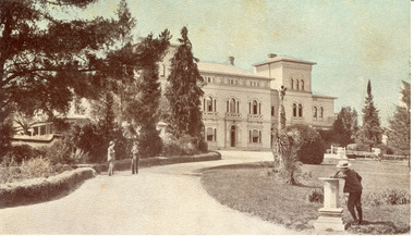 The Beechworth Burke Museum
Photograph - Postcard, George Rose, c. 1910
Produced c. 1910 by The Rose Stereograph co. This colourised photographic postcard shows the exterior of the administrative buildings at Mayday Hills mental hospital with three young boys in the foreground. This postcard forms part of the extensive Rose Series. (P. 4689) of postcards being produced by the Rose Stereograph co. which depicted landmarks from across Australia. Despite the early date attributed to this image, according to Walsh dates from this series place the postcards being produced typically between 1920-54. Mayday Hills Hospital, then known as the Beechworth Lunatic Asylum was constructed between 1864-67 designed by The Public Works Department. The hospital is made up of a number of buildings, landscaping, ha-ha, workshops, laundry, administrative facilities and farmland, it was constructed in 'Italianate' style by a team of up to two hundred and fifty workers (Woods p. 122). The asylum was established in response to the need for the regional shire to locally care for those particularly affected by their time working the Ovens goldfield during the Indigo Shire gold rush era where poor living conditions and isolation were significantly affecting the welfare of a great many people through poverty and lack of resources. The gaol and orphan labour systems were not able to effectively support to give housing, rehabilitation and ongoing care for the mentally ill, and transporting to Melbourne by waggon was a time consuming and counter-productive solution when the metro facilities were already overcrowded. According to Woods (A Titan's Field p. 122), between 1901 and 1911 a large percentage (thirty five percent in 1901 and twenty four in 1911) of the Beechworth population were either patients or inmates of Beechworth institutions, Mayday Hills accounted for some six hundred and seventy four patients in 1901, Beechworth's Mayday Hills was chosen as the site of Victoria's newest asylum, at the time, due to the landscape and altitude. The hilltop atmosphere and the native fauna, it was argued, would assist in the cure of the patients kept at the hospital (Wood 1985, 122). The positioning of the hospital had a beneficial effect on the rural town and the large volume of people living at the hospital and contributing to this population growth is counted as reason for the survival of Beechworth as a regional township. Mayday Hills continued to function as a mental hospital up until 1995 when it was sold to LaTrobe university. The building and grounds are listed on the Victorian Heritage Register under criterion A, B, D, E and F. Through the colourisation of the photograph and through the unusual choice of the subject matter being used as a postcard, we can get a good indication of aesthetic interests of the time.Rectangular coloured photograph printed as postcardObverse: Beautiful / Beechworth / (Vic.) / 1800 ft. / above / Sea / Level / - / Asylum / for / insane / (Front / View) / Copyright. / F. / Foxcroft / Photo Reverse: 1997.2454 / Postcard / THIS / SPACE / MAY / BE / USED / FOR / CORRESPONDENCE: / THIS / SPACE / FOR / NAME / AND / ADDRESS / STAMPpostcard, rose series, mayday hills hospital, mayday hills, beechworth lunatic asylum, photographic postcard, george rose, the rose stereograph co., social welfare, welfare services, ovens goldfield, lunatic asylum, the public works department, australian landmark, regional shire, indigo shire council, gold rush, beechworth institution, victorian heritage register