Showing 277 items matching " aboriginal names"
-
 Tarnagulla History Archive
News clipping: Name Is Gaelic - Not Aboriginal, Name Is Gaelic - Not Aboriginal, September 15, 1981
... News clipping: Name Is Gaelic - Not Aboriginal...Name Is Gaelic - Not Aboriginal... Is Gaelic - Not Aboriginal News clipping: Name Is Gaelic ...Murray Comrie Collection. A double page from the Castlemaine Mail newspaper of September 15, 1981 with article about the origins of place names in the district. Claims that Tarnagulla, Bealiba, Bet Bet, Waanyarra and Laanecoorie are Aboriginal but Tarrengower is Gaelic. Written by non-Indigenous historian John J. Alderson. Discusses Indigenous history of the region. tarnagulla, waanyarra, laanecoorie, bet bet, central victoria, dja dja wurrung, djadjawurrung, indigenous australians, indigenous history, traditional owners, names, naming -
 Wodonga & District Historical Society Inc
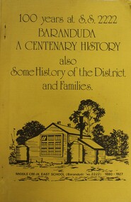
Booklet - 100 YEARS AT S.S. 2222 BARANDUDA: a centenary history, Rosemary Boyes, 1980
This booklet tells the story of Baranduda State School 2222 and was produced to celebrate its centenary. It also includes information about the history of the district and some of its pioneer families. Baranduda pastoral run was taken up in 1845 and it is thought that the name was derived from an Aboriginal expression relating to a swamp or a water rat. A few kilometres south-west there is the beginning of the Baranduda Range, of which the summit is Mount Baranduda. Baranduda was a rural hamlet with numerous German farm selectors, who came from South Australia. Beginning with the grazing of cattle and later dairying and sawmilling were added, serving markets in Wodonga and providing timber sleepers for railway construction. The primary school was opened in 1880.non-fictionThis booklet tells the story of Baranduda State School 2222 and was produced to celebrate its centenary. It also includes information about the history of the district and some of its pioneer families. Baranduda pastoral run was taken up in 1845 and it is thought that the name was derived from an Aboriginal expression relating to a swamp or a water rat. A few kilometres south-west there is the beginning of the Baranduda Range, of which the summit is Mount Baranduda. Baranduda was a rural hamlet with numerous German farm selectors, who came from South Australia. Beginning with the grazing of cattle and later dairying and sawmilling were added, serving markets in Wodonga and providing timber sleepers for railway construction. The primary school was opened in 1880.baranduda state school, education victoria, community history baranduda -
 Wodonga & District Historical Society Inc
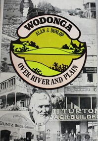
Book - Wodonga Over River and Plain, Alan J. Dunlop, 1976
A great local history of the Wodonga area. Starts with discussion of the Aboriginal inhabitants of the region and early contacts with European explorers and settlers. Explains the establishing of a customs post with its twin city Albury on the other side of the Murray River. The town grew subsequent to the opening of the first bridge across the Murray in 1860. Originally named Wodonga, its name was changed to Belvoir then later back to Wodonga.non-fictionA great local history of the Wodonga area. Starts with discussion of the Aboriginal inhabitants of the region and early contacts with European explorers and settlers. Explains the establishing of a customs post with its twin city Albury on the other side of the Murray River. The town grew subsequent to the opening of the first bridge across the Murray in 1860. Originally named Wodonga, its name was changed to Belvoir then later back to Wodonga.victoria. wodonga, settlers wodonga, indigenous australians wodonga -
 City of Kingston
Photograph - Colour, Paul Tresize, 1998
The name Mordialloc was derived from the name Moody Yallock, which comes from the Bunurong language. The Bunurong Peoples are the Traditional Owners of this area. The name means “high water” or “high creek”. In 1839, colonial authorities declared the mouth of the creek, and an additional 830 odd acres as an Aboriginal Reserve, although this proclamation was never gazetted. The reserved land included part of the Carrum Carrum Swamp which was abundant with wild life and natural resources. Regular encroachments, including land sales which began in 1863, were made on the land until 1878 when the Reserve was declared closed, and the land was opened up to land sales. Market gardening and suburban house lots quickly began to develop, and Mordialloc became a renowned picnic and holiday site. Mordialloc Creek is a popular bay side destination for local and visitors, and is a site for boating, kayaking, fishing and swimming, along with many other activities.Colour photograph of Mordialloc Creek, looking out to the bay. Many small fishing and leisure craft are moored on either side of the banks of the creek. To the right hand side can be seen parklands, while the left hand side has a small inlet in which more small crafts are moored.mordialloc, bunurong, traditional owners, suburbs, boats, fishing, waterways -
 City of Kingston
Photograph - Colour, 1998
The name Mordialloc was derived from the name Moody Yallock, which comes from the Bunurong language. The Bunurong Peoples are the Traditional Owners of this area. The name means “high water” or “high creek”. In 1839, colonial authorities declared the mouth of the creek, and an additional 830 odd acres as an Aboriginal Reserve, although this proclamation was never gazetted. The reserved land included part of the Carrum Carrum Swamp which was abundant with wild life and natural resources. Regular encroachments, including land sales which began in 1863, were made on the land until 1878 when the Reserve was declared closed, and the land was opened up to land sales. Market gardening and suburban house lots quickly began to develop, and Mordialloc became a renowned picnic and holiday site. Mordialloc Creek is a popular bay side destination for local and visitors, and is a site for boating, kayaking, fishing and swimming, along with many other activities.Colour photograph of Mordialloc Creek, looking inland.Small fishing and leisure boats are moored on either side of creek, with a view of the Mordialloc Bridge Hotel in the background.mordialloc, bunurong, traditional owners, suburbs, boats, fishing, waterways, hotel -
City of Kingston
Photograph - Colour, Paul Tresize, 1998
The name Mordialloc was derived from the name Moody Yallock, which comes from the Bunurong language. The Bunurong Peoples are the Traditional Owners of this area. The name means “high water” or “high creek”. In 1839, colonial authorities declared the mouth of the creek, and an additional 830 odd acres as an Aboriginal Reserve, although this proclamation was never gazetted. The reserved land included part of the Carrum Carrum Swamp which was abundant with wild life and natural resources. Regular encroachments, including land sales which began in 1863, were made on the land until 1878 when the Reserve was declared closed, and the land was opened up to land sales. Market gardening and suburban house lots quickly began to develop, and Mordialloc became a renowned picnic and holiday site. Mordialloc Creek is a popular bay side destination for local and visitors, and is a site for boating, kayaking, fishing and swimming, along with many other activities.Colour photograph of Mordialloc Creek, looking inland. Boats are moored on either side of the creek and the Bridge Hotel is visible in the background.mordialloc, bunurong, traditional owners, suburbs, boats, fishing, waterways, hotel -
 City of Kingston
Photograph - Colour, Paul Tresize, 1998
The name Mordialloc was derived from the name Moody Yallock, which comes from the Bunurong language. The Bunurong Peoples are the Traditional Owners of this area. The name means “high water” or “high creek”. In 1839, colonial authorities declared the mouth of the creek, and an additional 830 odd acres as an Aboriginal Reserve, although this proclamation was never gazetted. The reserved land included part of the Carrum Carrum Swamp which was abundant with wild life and natural resources. Regular encroachments, including land sales which began in 1863, were made on the land until 1878 when the Reserve was declared closed, and the land was opened up to land sales. Market gardening and suburban house lots quickly began to develop, and Mordialloc became a renowned picnic and holiday site. Mordialloc Creek is a popular bay side destination for local and visitors, and is a site for boating, kayaking, fishing and swimming, along with many other activities.Colour photograph of Mordialloc Creek with boats moored on both sides of the street and Pompei's boat yard visible on the right hand side of the creek., Main Street and St Brigid's Catholic Church are visible in backgroundmordialloc, bunurong, traditional owners, suburbs, boats, fishing, waterways, hotel, church -
City of Kingston
Photograph - Colour, Paul Tresize, 1998
The name Mordialloc was derived from the name Moody Yallock, which comes from the Bunurong language. The Bunurong Peoples are the Traditional Owners of this area. The name means “high water” or “high creek”. In 1839, colonial authorities declared the mouth of the creek, and an additional 830 odd acres as an Aboriginal Reserve, although this proclamation was never gazetted. The reserved land included part of the Carrum Carrum Swamp which was abundant with wild life and natural resources. Regular encroachments, including land sales which began in 1863, were made on the land until 1878 when the Reserve was declared closed, and the land was opened up to land sales. Market gardening and suburban house lots quickly began to develop, and Mordialloc became a renowned picnic and holiday site. Mordialloc Creek is a popular bay side destination for local and visitors, and is a site for boating, kayaking, fishing and swimming, along with many other activities.Colour photograph of Mordialloc Creek with boats moored on both sides of the street and Pompei's boat yard visible on the right hand side of the creek., Main Street and St Brigid's Catholic Church are visible in background.mordialloc, bunurong, traditional owners, boats, fishing -
 Melbourne Legacy
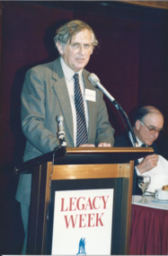
Photograph - Photo, Legacy Week 1988, 1988
A photo of Professor Geoffrey Blainey speaking at a the public launch of Legacy Week at the ANZ Pavilion at the Victorian Arts Centre. The date is 23 August 1988. Also a photo of John Lady and Terry Hawksley. The attached label says: " Melbourne Legacy held its first official public launch - a luncheon for Melbourne's leading business community at the ANZ Pavilion at the Victorian Arts Centre to highlight 'Legacy Week'. Professor Geoffrey Blainey, AO, addressed the guests and was joined by Legacy's 1988 personality, Australia's first under 4 minute miler, John Lady." They were in a folio of photos from 1988. (see also 001042 to 01049) From Wikipedia: "Geoffrey Norman Blainey AC, FAHA, FASSA (born 11 March 1930) is an Australian historian, academic, philanthropist and commentator with a wide international audience. Biographer Geoffrey Bolton argues that he has played multiple roles as an Australian historian: He first came to prominence in the 1950s as a pioneer in the neglected field of Australian business history....He produced during the 1960s and 1970s a number of surveys of Australian history in which explanation was organized around the exploration of the impact of the single factor (distance, mining, pre-settlement Aboriginal society).... Blainey next turned to the rhythms of global history in the industrial period.... Because of his authority as a historian, he was increasingly in demand as a commentator on Australian public affairs." From the name badges the attendees included: 1. Geoffrey Blainey. 2. John Landy and Terry Hawksley. 3. A girl and L/ Geoff Swan. 4. L/ David Millie and Jim Madden. 5. John ? and L/ Colin Bannister. 6. Patsy Adam-Smith (?) and artist Geoffrey Mallett. 7. ? and Jim Dickson. 8. Peter Prior and Abe Birmingham. 9. President Chas Wilks speaking. 10. President Chas Wilks and Rupe Thomas.A record of celebrities being involved in promoting Legacy Week in 1988 and an official launch at Victorian Arts Centre.Colour photo x 10 of public launch of Legacy Week in 1988.Yellow paper label explaining the event in black type.legacy week, legacy promotion, speakers -
 Lakes Entrance Historical Society
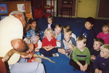
Photograph, Lakes Post Newspaper, 2002
Children named as Ronald Allen, Alexander Chilton, Darcy Charleston, Taylah Scott, Aymgn Cornell, Chandler Whelan, Christopher Lunny.Colour photograph Koori elder Uncle Max Solomon showing group of named children from Pre School a 'burning snake' ceremony. Lakes Entrance Victoriaschools, aboriginals -
 Port Fairy Historical Society Museum and Archives
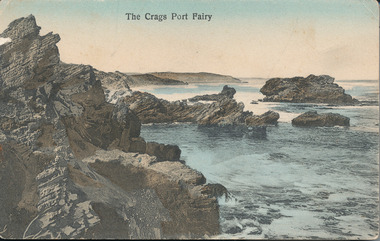
Postcard, A.C. Aberline, The Crags
This photograph is of “The Crags” an area on the coast half way between Port Fairy and Yambuk. The name is an abbreviation of McKechnies Craigs/Crags owners of property in the vicinity. it is close to ancient aboriginal campsites but these are not accessible to the public. Because of the nature of the geology in this area this photograph shows a seascape that it is not possible to see now.Hand coloured photograph used as postcardThe Crags Port Fairyseascape, sea, beach, the crags, mckechnie’s crags or craigs -
 Eltham District Historical Society Inc
Photograph - Digital Photograph, Alan King, Golden King Mine poppet-head, Yarrambat Primary School, 1 February 2008
The Golden King Mine poppet-head stands at the school’s Yan Yean Road exit gate. Published: Nillumbik Now and Then / Marguerite Marshall 2008; photographs Alan King with Marguerite Marshall.; p23 Early Yarambat - Tanck's Corner Its early settlers, who in the 1840s were amongst the first non-Aboriginal people in the area, found life tough as they grazed their sheep and cattle. Yarrambat was then known as Tanck’s Corner or Reynolds Corner, after wood carter, Frederick Tanck, who owned land north of Ironbark Road, at the corner of Yan Yean Road, and Thomas Reynolds, owner of the opposite property. After Reynolds sold his land, the corner became known as Tanck’s Corner. In 1929 the district’s name was changed to Yarrambat, believed to mean ‘high hill’ in the Wurundjeri language. Tanck’s Corner was in the centre of gold-bearing country and the district is honeycombed with old tunnels and shafts. However although gold played a dominant role for decades, there was insufficient to develop a substantial township. Meat and agricultural produce made a greater impact. Until the mid-20th century the only substantial building was the primary school. The first gold rush occurred around 1860, the second after 1900; then during the Depression, the Government paid men to pan for gold. The first rush attracted hundreds of Chinese people to Smugglers Gully, who constructed round diggings to keep away spirits. Alluvial miners lived along the Plenty River in tents or humpies - some fenced with gardens - and some miners distilled their own ‘plonk’. It was a wild time and bushrangers - and later gangster Squizzy Taylor - were said to hide4 in the old Pioneer Tunnel in Dunne’s Gully between Heard Avenue and Pioneer Road. Mines opposite Tanck’s Corner included Beer’s Line, Golden Crown and Golden Stairs. Some of the big mines had batteries and stampers to process quartz. At first there was plenty of alluvial gold, as much as two ounces to the ton. At times gold was exposed after heavy rains so fossickers panned for gold around orchard irrigation trenches. Gold was mined until 1984 when Yarrambat’s last operating goldmine, the Golden King Mine, in North Oatlands Road, closed. The Clayton family operated it full-time, making a comfortable living and in the 1960s it was the only private family gold mine in Victoria.5 Gold was such an important part of Yarrambat’s history that a gold poppet-head is the Yarrambat Primary School’s logo. The Golden King Mine poppet-head stands at the school’s Yan Yean Road exit gate. However this school was built in 1988. The original school No 2054, at the corner of Ironbark and Yan Yean Roads, was opened in 1878 and modified to its present form in the 1920s. In 2000 it was relocated to the Heritage Museum at Yarrambat Park.7 The school, whose first head teacher was Charles Planner, consisted of one room with a three-roomed residence. The school was also the community centre. On Saturday nights it was crammed for dances or euchre parties, community singing or other social events. On Sundays, services for different denominations took turns each week. However the school had its teething problems. Parents accused Charles Planner of neglecting his duties and the school closed several times. When it closed in 1892, only church services continued. Social activities moved elsewhere, such as the tennis club to the Stuchbery tennis court opposite. A sports day and woodchop on Boxing Day around 1900 was held at the Evelyn Hill Hotel, also called Evelyn Arms and Tunnel Hill Hotel, on the Greensborough–Diamond Creek Road. An annual agricultural show in Diamond Creek paraded through the town, and New Year’s Day picnics at the Yan Yean Reservoir included highland dancing and competitions. Also popular were the Indian hawkers who visited every three months, selling trinkets, clothing and other items. One called Jimmy ‘Allem dem Bedi’, gave presents and told stories, played draughts and sold delicious curries he cooked over his camp fire at night.This collection of almost 130 photos about places and people within the Shire of Nillumbik, an urban and rural municipality in Melbourne's north, contributes to an understanding of the history of the Shire. Published in 2008 immediately prior to the Black Saturday bushfires of February 7, 2009, it documents sites that were impacted, and in some cases destroyed by the fires. It includes photographs taken especially for the publication, creating a unique time capsule representing the Shire in the early 21st century. It remains the most recent comprehenesive publication devoted to the Shire's history connecting local residents to the past. nillumbik now and then (marshall-king) collection, golden king mine, tanck's corner, yarrambat primary school -
 Eltham District Historical Society Inc
Photograph - Digital Photograph, Alan King, Memorial to Peter Brock, Ferguson's Paddock, Hurstbridge, 23 January 2008
Ferguson’s Paddock, Hurstbridge. A plaque on a boulder commemorates Peter Brock. Published: Nillumbik Now and Then / Marguerite Marshall 2008; photographs Alan King with Marguerite Marshall.; p167 On a rock in Ferguson’s Paddock, Hurstbridge, a plaque commemorates Peter Brock. It includes the words: ‘Boy from Hurstbridge without special privileges, grew to become champion of racetracks around the world but he never forgot his beginnings’. Brock came from a well-established local family. Born in Hurstbridge in 1945, he lived in Anzac Avenue as a child, attended the Hurstbridge Primary and Eltham High Schools and lived in the district most of his life. His father Geoff owned the Diamond Valley Speed Shop in Greensborough. Brock’s forbears were amongst the area’s earliest settlers. From Scotland, the Brocks arrived in Tasmania in 1830, to graze sheep. Family members moved to Sunbury, then Preston, grazing sheep in the Bundoora area. John Brock owned Janefield, possibly named after his wife. In 1855 he granted around two acres (0.8ha) of his estate for a school.1 In 1866 Lewis Brock bought 264 acres (107ha) in Nutfield, the first non-Aboriginal person to own that land. They planted an orchard, then from around 1935, Brock’s uncle Sandy and his grandfather Lewis, ran a dairy on the property. In the 1980s Brock and his then partner Bev, bought most of the property, which they sold after their separation in 2006. Brock’s father was a Hurstbridge Football Club President, but Brock’s uncle Sandy, of Brocks Road, Doreen, has been particularly active in local affairs. He was President of the Mernda Football Club (then Plenty Rovers), President of the Panton Hill Football League and he founded the Arthurs Creek and District Landcare Group. He also gave more than 50 years of service to the Whittlesea Agricultural Society, the Volunteers for Australian Football and the Doreen Rural Fire Brigade. Community service was important to Brock too. Brock, with his then partner Bev, established the Peter Brock Foundation in 1997, the year he retired from full-time V8 Supercar racing. The Foundation’s grants have included $100,000 towards the upgrade of a walking track in the Hurstbridge Parklands and other projects include a holiday house for the families of child cancer victims. Brother Lewis saw Brock as a spiritual person, who had a great affinity with people. He saw Brock as a role model of someone who could achieve their dreams. ‘The family didn’t have much money, yet that didn’t stop Peter realising his dreams. He was strong and didn’t let difficult times crush him.’ Despite his later successes, Brock’s most treasured trophy was for running 100 yards (91.4m)at his primary school in 1955, and he appreciated his head master Ted Griffiths’ encouragement of his sporting endeavours. At high school Brock became captain of Everard House. In his first year he bought a 1928 Austin 7 for £5. He cut the car into a box shape with an axe and enjoyed driving it – despite it having no brakes - at his grandparents’ farm at Nutfield. The turning point in Brock’s life came at age 23, when he built an Austin A30 in an old henhouse in Wattle Glen, using a Holden engine. He was laughed at until it won the Australian Sports Sedan Championship in 1968. Brock’s career then took off and he became a professional driver. Brock won Australian motor sport’s best-known event, the Bathurst 1000, nine times. Brock endured a bitter split from Holden in 1986 over control of his Holden-backed vehicle modification business and a car performance-enhancing device he called the ‘energy polariser’– despite it having no scientific evidence to support its claims. But Brock returned to Holden in 1994. Then in 1997, aged 52, Brock retired from fulltime V8 Supercar racing. However he continued to race at motor sport events. Brock won several awards, including an Order of Australia Medal in 1980, the Australian Sports Medal in 2000, and the Centenary Medal. On September 8, 2006, Brock died; after his car hit a tree during the Targa West Rally in Western Australia.This collection of almost 130 photos about places and people within the Shire of Nillumbik, an urban and rural municipality in Melbourne's north, contributes to an understanding of the history of the Shire. Published in 2008 immediately prior to the Black Saturday bushfires of February 7, 2009, it documents sites that were impacted, and in some cases destroyed by the fires. It includes photographs taken especially for the publication, creating a unique time capsule representing the Shire in the early 21st century. It remains the most recent comprehenesive publication devoted to the Shire's history connecting local residents to the past. nillumbik now and then (marshall-king) collection, ferguson's paddock, hurstbridge, peter brock memorial, peter brock -
Lakes Entrance Historical Society
Book, Mallacoota and District Historical Society, Mallacoota Memories, 1980
Record of the history of Mallacoota Victoria from Aboriginal occupation to approximately 1970 includes early settlers industries commerce tourism shipwrecks and a list of local place names.township, aboriginals, settlers, industrial -
 Eltham District Historical Society Inc
Photograph - Digital Photograph, Alan King, Maroondah Aqueduct Siphon Bridge over the Plenty River, 26 January 2008
... , which mushroomed along its route. Named after the Aboriginal..., which mushroomed along its route. Named after the Aboriginal ...Opened in 1891, the bridge formed part of the Maroondah Aqueduct carrying water from Watts River near Healesville to the reservoir at Preston where it joined Melbourne's metropolitan water system. Covered under Heritage Overlay, Nillumbik Planning Scheme. Published: Nillumbik Now and Then / Marguerite Marshall 2008; photographs Alan King with Marguerite Marshall.; p99 Built to supply thirsty Melbourne in the late 19th century, the siphon bridge spanning the Plenty River off Leischa Court, Greensborough, was part of an engineering masterpiece. Opened in 1891, the bridge formed part of the Maroondah Aqueduct carrying water from the Watts River near Healesville to the reservoir at Preston where it joined the metropolitan distribution system. A major link in Melbourne’s water supply, it also had a huge impact on communities, which mushroomed along its route. Named after the Aboriginal word for the area around the Maroondah Reservoir, the Maroondah Aqueduct was fully operational until the 1970s. Since the 1980s the land along parts of the aqueduct have been used for walking and bicycle riding, shaded in places by Monterey Pine trees planted to stabilise the surrounding ground. From 1857 the Yan Yean Reservoir supplied Melbourne’s water but the growing city needed additional catchments.1 In 1886 work began on a weir on the Watts River to enable the aqueduct to carry most of the river water 41 miles (66km) to Melbourne. The aqueduct, built by the Board of Works, is the oldest remaining aqueduct near Melbourne and was probably the first built with concrete.2 Although the aqueduct is now only used between the Maroondah and Sugarloaf Reservoirs, it can still be traced across the Shire. It extends from the Maroondah Reservoir through Christmas Hills, Kangaroo Ground, Research, Eltham, St Helena and then previously wound west through Greensborough to Reservoir.3 Built by horse and manpower the aqueduct gravity fed 25 million gallons (113.6ML) of water a day to Melbourne along a gradient of one foot to the mile. It included 25 miles (41km) of open concrete and brick channel, six miles (10km) of tunnels, and nine miles (15km) of 14 inverted siphons of riveted wrought-iron across creeks. Bricks for the aqueduct were made from clay found near the sites and remains of several kilns can still be found between Kangaroo Ground and Christmas Hills. Building the aqueduct transformed local communities. An abattoir was established at Christmas Hills. Grog shanties and labourers’ camps sprang up and local courts dealt with cases of ‘petty pilfering and boisterous behaviour’.4 The Kangaroo Ground school population jumped to 91, crammed into a room with one teacher. Miners who built the tunnels camped just north of Churinga in Greensborough – then called Tunnel Hill Camp – and adjacent to the Evelyn Arms Hotel. The miners’ high spirits were sometimes quenched in horse troughs or by a ‘welt under the ear and kick on the behind’ as the local constable calmed them down rather than lock them up.5 But the growing city of Melbourne needed more water, so the O’Shannassy catchment, east of Warburton, was added to the system in 1914. In 1920 work began on the present concrete Maroondah Dam one mile (1.6km) from the weir on the Watts River. The aqueduct capacity was thus doubled to 50 million gallons (227ML) a day.6 Intense land development threatened to pollute the open water supply, so channel sections were replaced with large pipes. In the late 1960s a large water main was built from the tunnel outlet at Research and extended through St Helena and Greensborough, so this section of the aqueduct was taken out of use. Long sections of the unused open channels in Greensborough and Bundoora were destroyed, but the old channel in Research and Eltham North remained largely intact. In the 1970s, the Sugarloaf Reservoir was constructed, inundating 445 hectares of land in Christmas Hills. Sugarloaf was officially opened in 1980 and serves as a water storage and treatment plant supplying Melbourne. In the early 1980s pipes replaced the section from Sugarloaf Reservoir to the tunnel entrance at Kangaroo Ground. The Research-Kangaroo Ground tunnel operates as part of the pipeline system.This collection of almost 130 photos about places and people within the Shire of Nillumbik, an urban and rural municipality in Melbourne's north, contributes to an understanding of the history of the Shire. Published in 2008 immediately prior to the Black Saturday bushfires of February 7, 2009, it documents sites that were impacted, and in some cases destroyed by the fires. It includes photographs taken especially for the publication, creating a unique time capsule representing the Shire in the early 21st century. It remains the most recent comprehenesive publication devoted to the Shire's history connecting local residents to the past. nillumbik now and then (marshall-king) collection, maroondah aqueduct, pipe bridge, siphon bridge -
 Eltham District Historical Society Inc
Photograph - Digital Photograph, Alan King, The Robins, 13 Kangaroo Ground-Warrandyte Road, North Warrandyte, 2 March 2008
... and the family hold three of his portraits of her. *Possibly named after... and the family hold three of his portraits of her. *Possibly named after ...Built by noted artist Theodore Penleigh Boyd, father of architect Robin Boyd. Covered under National Estate, National Trust of Australia (Victoria) Local Significance and Heritage Overlay, Nillumbik Planning Scheme. Published: Nillumbik Now and Then / Marguerite Marshall 2008; photographs Alan King with Marguerite Marshall.; p111 The Robins at Warrandyte,* was once home to a member of a famous family and is also one of the first reinforced concrete houses in Victoria. The builder, Theodore Penleigh Boyd, born in 1890, was a talented painter1 noted for his works of the Warrandyte bush. He was the father of architect Robin Boyd, author of the Australian Ugliness and the uncle of painter, Arthur Boyd. Penleigh Boyd’s great grandfather was Sir William A’Beckett, Victoria’s first Chief Justice. Penleigh Boyd is considered by some to be an ‘unsung hero’ overshadowed by more famous members of his family. Mornington Gallery Director Andrea May said many believed Boyd ‘had never received the national acclaim that he deserved’.2 Classified by the National Trust3 and part of the Australian National Heritage,4 The Robins is set well back near the end of Kangaroo Ground – Warrandyte Road, unobserved by passers-by. Built in 1913, The Robins has some Art Nouveau influences and is a descendant of the Queen Anne style. It is covered in stucco and has a prominent attic, which Boyd used as a studio. Some parts of the house are up to 33 centimetres thick and built in part with pisé (rammed earth) and in part with reinforced concrete. Amazingly, Boyd built The Robins without an accessible driveway, and only a narrow track along which he had to cart building materials. The journey was uphill and Boyd terraced the land with Warrandyte rock5 without the aid of machinery. At only 33 years, Boyd was killed in a car accident in 1923. He was buried in Brighton near the home of his parents. Several people have since owned the house, including political journalist, Owen Webster. Boyd was born at Penleigh House, Wiltshire, and studied at Haileybury College, Melbourne and The Hutchins School, Hobart. He attended the Melbourne National Gallery School and in his final year exhibited at the Victorian Artists’ Society. He arrived in London in 1911 and his painting Springtime was hung at the Royal Academy. He painted in several studios in England and then worked in Paris.6 There he met painter Phillips Fox through whom he met artists of the French modern school and also his wife-to-be, Edith Anderson, whom he married in Paris in 1912. After touring France and Italy, the couple returned to Melbourne. In 1913 Boyd held an exhibition and won second prize in the Federal Capital site competition, then the Wynne Prize for landscape in 1914. In 1915 Boyd joined the Australian Imperial Force, and became a sergeant in the Electrical and Mechanical Mining Company. However he was severely gassed at Ypres and invalided to England. In 1918 in London Boyd published Salvage, writing the text and illustrating it with 20 black-and-white ink-sketches of army scenes. Later that year he returned to Melbourne, and, despite suffering from the effects of gas, he held several successful one-man shows, quickly selling his water-colour and oil paintings. In his short career Penleigh Boyd was recognized as one of Australia’s finest landscape painters. He loved colour, having been influenced early by Turner and McCubbin. His works are in all Australian state galleries, the National Collection in Canberra as well as in regional galleries.7 His wife Edith was also an artist having studied at the Slade School, London, and in Paris with Phillips Fox. After her marriage she continued to paint and excelled in drawing. In later years she wrote several dramas, staged by repertory companies, and radio plays for the Australian Broadcasting Commission, in which she took part. She was the model for the beautiful red-haired woman in several of Phillips Fox’s paintings and the family hold three of his portraits of her. *Possibly named after the Aboriginal words warran, meaning ‘object’ and dyte, meaning ‘thrown at’.This collection of almost 130 photos about places and people within the Shire of Nillumbik, an urban and rural municipality in Melbourne's north, contributes to an understanding of the history of the Shire. Published in 2008 immediately prior to the Black Saturday bushfires of February 7, 2009, it documents sites that were impacted, and in some cases destroyed by the fires. It includes photographs taken especially for the publication, creating a unique time capsule representing the Shire in the early 21st century. It remains the most recent comprehenesive publication devoted to the Shire's history connecting local residents to the past. nillumbik now and then (marshall-king) collection, kangaroo ground-warrandyte road, north warrandyte, the robins -
 Eltham District Historical Society Inc
Photograph - Digital Photograph, Marguerite Marshall, 'Landscape', 60 Lavender Park Road, Eltham South, 24 June 2008
Built by artist and cartoonist Percy Leason in 1927 in what was then New Street but renamed Lavender Park Road in the late 1950s/early 1960s. Covered under Heritage Overlay, Nillumbik Planning Scheme. Published: Nillumbik Now and Then / Marguerite Marshall 2008; photographs Alan King with Marguerite Marshall.; p121 Said to be a genius, cartoonist Percy Leason’s career was at its peak when in 1925 to 1926 he built his home at New Street (now Lavender Park Road) Eltham. The Herald newspaper owner, Sir Keith Murdoch, had hired Leason for his newly acquired Melbourne Punch magazine at a salary of £1750, making him ‘one of the highest paid cartoonists in the world’.1 With this salary and financial help from Murdoch, Leason was able to build his lovely home in Eltham. At the crest of a sweeping drive, the home now two-storey in white brick with a gabled grey slate roof and dormer windows is flanked by an extension built by another owner in the 1980s. Leason lived in the home with his wife, Isabel and children, until 1937, when he left for the United States of America, where he lived until his death in 1959. The four-bedroom house and garden would have been well-suited to bringing up his family and to entertaining their friends in style. Large airy rooms have high ceilings with moulded plaster, timber floors and several are brightened with bay windows. Leason made friends with many of the artists and personalities who gravitated to Eltham. Around 1931 Justus Jörgensen, founder of the Montsalvat Artists’ Colony, helped Leason build his large studio at the back of the house. Another friend was journalist Mervyn Skipper, father of jeweller and sculptor Matcham, and artists Helen and Sonia. Leason’s teacher, artist Max Meldrum, also visited and rented accommodation in Eltham, opposite Wingrove Park. Punch folded in 1925, but Leason continued as cartoonist for Table Talk. In 1926 Leason began the cartoons of a mythical Australian town Wiregrass, which were inspired by Kaniva, his home town. The art gallery in Main Road Eltham was named Wiregrass in Leason’s honour. Leason completed 1000 drawings from 1919 to 1937, which author Garrie Hutchinson claimed, were technically unsurpassed and had regional and universal interest. Leason’s acute observations of country life stemmed from his childhood in Kaniva in Victoria’s western Wimmera, where he was born, the son of a selector, in 1889. Meldrum claimed that Leason could name every plant and the habits of every animal.2 Leason also painted 28 portraits of the last full-blooded aboriginals in Victoria at Lake Tyers in Gippsland, most of which are in a private collection. In Sydney Leason illustrated Henry Lawson’s Selected Poems and worked for The Bulletin. Leason had begun his career at 13 as an apprentice lithographic artist at Sands and MacDougall. He attended night classes at the National Gallery and the Victorian Artists Society. Leason first visited Eltham in 1910 to paint with fellow artist William ‘Jock’ Frater. They camped near Bible and Pitt Streets and along the Diamond Creek on the site of the present Eltham Retirement Centre. Despite his success as a cartoonist, Leason wanted to be recognised as a serious painter and for his anthropological work.3 He was also conservative and felt uncomfortable with the modern art scene in Melbourne.4 So he left for the United States of America to work as a painter. Ironically his time in New York saw the burgeoning of modern art, notably by artists such as Jackson Pollock. But Leason found his niche by running an art school, painting society portraits and illustrating books and magazines.This collection of almost 130 photos about places and people within the Shire of Nillumbik, an urban and rural municipality in Melbourne's north, contributes to an understanding of the history of the Shire. Published in 2008 immediately prior to the Black Saturday bushfires of February 7, 2009, it documents sites that were impacted, and in some cases destroyed by the fires. It includes photographs taken especially for the publication, creating a unique time capsule representing the Shire in the early 21st century. It remains the most recent comprehenesive publication devoted to the Shire's history connecting local residents to the past. nillumbik now and then (marshall-king) collection, landscape, lavender park road, percy leason, new street -
 Eltham District Historical Society Inc
Photograph - Digital Photograph, Marguerite Marshall, Smith Dam, Karingal Drive, Eltham, 19 September 2006
The dam at the entrance to the Nerreman Gateway in Eltham was built according to an internationally acclaimed theory developed by the builder's father. In 1920, Victorian engineer B.A. Smith was awarded the American Society of Civil Engineers J. James R. Cross Gold Medal for his Technical Paper titled 'Arched Dams'. It was the first time this medal had been awarded outside the United States. The concrete arched dam across the Eltham West Drain was built in 1940 by B.A. Smith's son and engineer, D. B. (Bernie) Smith to water the 24 acre (9.75 ha) hobby farm owned by himself and new wife, Isa Smith. Upon completion of the dam a pump-house was constructed beside the creek but before the water could be pumped up the hill they had to dig a trench and lay 500m of 100mm water main to an elevated holding tank. The Smiths made the pump-house their home for several years until they constructed their home at the top of the hill overlooking Eltham and views extending to Kinglake. Following Bernie's death in 1983, Nerreman Park was subdivided between 1993 and 1995. Gordon Ford designed the landscaping and the pump-house was demolished. Covered under Heritage Overlay, Nillumbik Planning Scheme. Published: Nillumbik Now and Then / Marguerite Marshall 2008; photographs Alan King with Marguerite Marshall.; p137 The dam at the entrance to the Nerreman Gateway in Eltham, was built according to an internationally acclaimed theory developed by the builder’s father. In 1920, Victorian engineer B A Smith was awarded the American Society of Civil Engineers J. James R. Croes Gold Medal, for his Technical Paper titled Arched Dams. It was the first time this medal had been awarded outside America. An international example of the application of Smith’s work can be found in the design of the Hoover Dam on the Colorado River, Nevada, USA. Built between 1930 and 1936, it is recognised by the ASCE as one of ‘America’s Seven Modern Civil Engineering Wonders’.1 The concrete arched dam across the Eltham West Drain was built by B A Smith’s son and engineer, D B (Bernie) Smith. Bernie’s dam followed his father’s theory, having a curvature that takes maximum advantage of concrete’s great strength in compression. The water load is carried into the abutments because of this curvature, which permits a wall thickness of only 225 millimetres thick at its crest, despite the dam’s capacity of more than 4.5 megalitres. The Eltham dam was designed to water the 24 acre (9.75 ha) hobby farm belonging to newly married couple Bernie and Isa Smith. Bernie, from Armadale, and Isa, from a farm at Tyntynder near Swan Hill, were attracted to the hilly topography and the creek running through the property. It extended from Ryans Road, Eltham, to Karingal Drive, Montmorency and was adjacent to Meruka Park. The Smiths named it Nerreman Park using the Aboriginal word Nerreman meaning ‘River Bend’ as their creek had a pronounced bend.2 In 1940 the first thing Bernie did was to build a dam, and with Isa’s help, a pump-house, to secure a water supply for their cattle, pigs, chickens, orchard and vegetable gardens. It was also available for the fire-plugs, which they placed all over the property in case of bushfire. The couple built the pump-house beside the creek and installed a Tange three-plunger pump, which had originally supplied the City of Wodonga with water. But before the Smiths could pump water up the hill from the dam they had to dig a trench and lay about 550 yards (500m) of a four-inch (100mm) water main up to an elevated holding tank. The trench was dug with a single furrow plough drawn by an old draught horse. Living in rough conditions did not deter the Smiths, who made the pump-house their home, where they still lived when their first child was born in 1944. They later built their home at the top of their property overlooking Eltham, with magnificent views to Kinglake, the Dandenong Ranges and Melbourne. From 1946 it took them almost 20 years to complete the 36-square house with its 12-foot (3.6m) high ceilings. Material for the concrete roof and walls faced with sandstone, was ripped out of the ground on their property by plough pulled by tandem Clydesdale horses. Isa was a strong woman – two days before their second child was born – she set three huge sandstone boulders in place in the bottom wall of the garage. She also mixed all the cement for the house. A collapsed kitchen wall did not discourage her from rebuilding it in a week, while her husband was away working in the country. She later recalled: ‘We stood back to admire this beautiful wall we’d built and while we were looking at it, it came tumbling down’.3 Following Bernie’s death in 1983, Nerreman Park was subdivided, between 1993 and 1995. Local Gordon Ford designed the landscaping and the pump-house was pulled down. But the dam remains as a reminder of exceptional engineering4 – and of a remarkable couple.This collection of almost 130 photos about places and people within the Shire of Nillumbik, an urban and rural municipality in Melbourne's north, contributes to an understanding of the history of the Shire. Published in 2008 immediately prior to the Black Saturday bushfires of February 7, 2009, it documents sites that were impacted, and in some cases destroyed by the fires. It includes photographs taken especially for the publication, creating a unique time capsule representing the Shire in the early 21st century. It remains the most recent comprehenesive publication devoted to the Shire's history connecting local residents to the past. nillumbik now and then (marshall-king) collection, eltham, karingal drive, smiths dam, bernie smith, gordon ford, isa smith, nerreman gateway, nerreman park estate, dams -
 City of Moorabbin Historical Society (Operating the Box Cottage Museum)
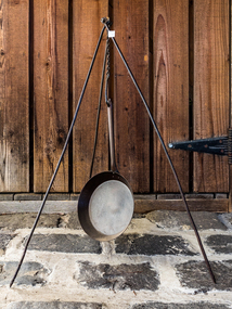
Functional object - Kitchen Equipment, billy holder, c1880
A billycan, is a lightweight cooking pot which is used on a campfire or a camping stove, particularly associated with Australian usage, but is also used in the UK and Ireland. It is widely accepted that the term "billycan" is derived from the large cans used for transporting bouilli or bully beef on Australia-bound ships or during exploration of the outback, which after use were modified for boiling water over a fire. However there is a suggestion that the word may be associated with the Aboriginal billa (meaning water; cf. Billabong In Australia. The billy has come to symbolise the spirit of exploration of the outback. To boil the billy most often means to make tea. "Billy Tea" is the name of a popular brand of tea long sold in Australian grocers and supermarkets. Billies feature in many of Henry Lawson's stories and poems. Banjo Paterson's most famous of many references to the billy is surely in the first verse and chorus of Waltzing Matilda: "And he sang as he looked at the old billy boiling", which was later changed by the Billy Tea Company to "And he sang as he watched and waited 'til his billy boiled”. Early settlers , market gardeners and blacksmiths would use this portable iron stake to hold their Billies at meal times when out working their fields, travelling for work or pleasure.c1880 A molded, iron tripod stake that would hold a 'Billy can' of water over a camp or kitchen fireearly settlers, pioneers, market gardeners, moorabbin, bentleigh, brighton, cheltenham, tools, blacksmiths -
 Eltham District Historical Society Inc
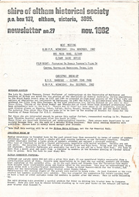
Newsletter, Newsletter, No. 27 November 1982
Contents: • November meeting – Film night: featuring Dr. Donald Thomson’s films of Central Australian Aboriginal tribal life • Christmas break-up • Eltham Community Festival • “Healesville – History in the hills” The Shire of Eltham Historical Society was formed in October 1967. The first newsletter of the Society was issued May 1978 and has been published continuously ever since on a bi-monthly basis. With the cessation of the Shire of Eltham in late 1994, the Society's name was revised to Eltham District Historical Society and this name first appeared with issue No. 103, July 1995. The collection of the Society's newsletters provides a valuable resource on the history of the Society's activities, office bearers and committee members, guest speakers and subjects of historical interest pertinent to the former Shire of Eltham and the Eltham District.A4 photocopied newsletter distributed to membersnewsletter, eltham district historical society, shire of eltham historical society -
 Eltham District Historical Society Inc
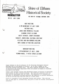
Newsletter, Newsletter, No. 61 September 1988
Contents: • Next meeting, guest speaker; Sandy Atkinson: Aboriginal Cultural Heritage • Recent Activities • Eltham Courthouse • Other Society Activities The Shire of Eltham Historical Society was formed in October 1967. The first newsletter of the Society was issued May 1978 and has been published continuously ever since on a bi-monthly basis. With the cessation of the Shire of Eltham in late 1994, the Society's name was revised to Eltham District Historical Society and this name first appeared with issue No. 103, July 1995. The collection of the Society's newsletters provides a valuable resource on the history of the Society's activities, office bearers and committee members, guest speakers and subjects of historical interest pertinent to the former Shire of Eltham and the Eltham District.A4 photocopied newsletter distributed to membersnewsletter, eltham district historical society, shire of eltham historical society -
 Bendigo Historical Society Inc.
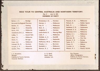
Photograph - PETHARD COLLECTION: PHOTOGRAPH RESO TOUR
... of the party are also named includes: George Pethard / Aboriginal camp... of the party are also named includes: George Pethard / Aboriginal camp ...George Pethard Collection including references to Taraxale Brewing Company Pty brown covered 29x19mm photographic album bound with gold string / 52 black and white Photographs of Reso tour to central Australia and Northern Territory / includes Aboriginal camps , camel trains / landscapes , war cemetery at Adelaide River / May 13- June 13 1947 / the 40 members of the party are also named includes: George Pethard / Aboriginal camp , Jay Creek consisting of makeshift tents / crowd playing 'Two Up ' Photo of the ship 'Meggs' at Darwin / Manton Dam - Darwin's water supply photo. Reso Tour to Central Australia and Northern Territory.Roy Dunstan Publicity and Tourist services Victoria Railwaysphotograph, person, male, george pethard / taraxale brewing company pty ltd / aboriginal camps / camel trains / war cemetary at adelaide river photo of the ship 'meggs' at darwin / manton dam - darwin's water supply photo -
 Bendigo Military Museum
Banner - PENNANT - HMAS ARUNTA
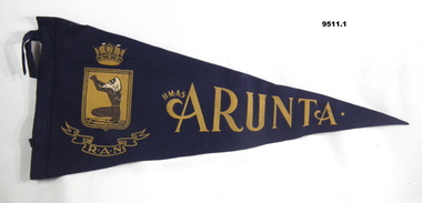
HMAS ARUNTA was commissioned in 1942 and was a destroyer. Part of the collection of "William Anthony Theodore DSM". Refer cat No. 7926P for service details.Navy blue triangular pennants with imagery and writing primarily is gold on one side. 1. Picture of an aboriginal elder squatting down on a gold shield. Above shield is a crown and below is R.A.N. on a ribbon and name of ship to right. 2. Picture of an aboriginal elder squatting down on a gold shield. Above shield is a crown and below is R.A.N. on a ribbon and name of ship to right, also included is listed, in white, all the areas of conflict in which it served. Both have two loose straps at end.Inscribed H.M.A.S. ARUNTA on both. On 9511.2 is also listed in white, all the zones served during WW2.hmas arunta, pennants, william anthony theodore dsm -
Moorabbin Air Museum
Machine - GAF Ikara Boeing (GAF / Asta) Collection)
... was an Australian ship-launched anti-submarine missile, named after... was an Australian ship-launched anti-submarine missile, named after ...Historical Details: . Description: The Ikara missile was an Australian ship-launched anti-submarine missile, named after an Australian Aboriginal word for "throwing stick". It launched an acoustic torpedo to a range of 10 nautical miles (19 km), allowing fast-reaction attacks against subma. Level of Importance: Nationals/n TN98 date 11/66 -
 Warrnambool and District Historical Society Inc.
Book, Exercise book Winnie Goodall, Early 20th century
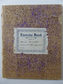
This exercise book has been used by Winnifred (Winnie) Goodall in 1916 when she was a pupil at the Warrnambool Technical School. The material in the book mostly consists of letter-writing practice for business purposes. The Goodalls were pioneer settlers in the Warrnambool district with William and Ellen Goodall arriving in the area in the late 1840s. Eventually they had a property named Wanstead on the Allansford Road in East Warrnambool. One son, William, was an early manager of the Framlingham Aboriginal Settlement. Another son, Thomas, was a Warrnambool law clerk and Winnie, (born 1901 to mother Leah), was his granddaughter. The Warrnambool Technical School was established in 1913.This exercise book is of interest as an example of school work completed by a Warrnambool Technical School student in 1916. It is also of interest because it belonged to Winnie Goodall, a member of an important pioneering family in the Warrnambool district. This is a school exercise book with a cardboard cover and 17 double pages. The cover has a mottled pattern of brown and mauve and the pages have been attached by metal staples but the staples have been removed. The pages have blue ruled lines with handwritten material in blue and black ink. Some of the pages have red hand-drawn lines. The cover is slightly torn. On the first page two cartoon sketches from a newspaper have been pasted in. The front cover has a printed label in blue and white colouring pasted on, with handwritten information on the label. There is a has a circular black , white and blue logo pasted on the inside front cover.‘Exercise Book Written by Winnie Goodall, Commenced 9th February 1916’. Inside cover Logo: Sons of Temperance Warrnambool Division Instituted March 11 1870 Be Firm and Faithful Love Purity Fidelity winnifred goodall, warrnambool technical school, sons of temperance warrnambool -
 Stawell Historical Society Inc
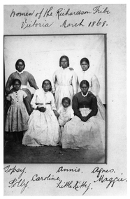
Photograph, First Nations Women of the Richardson Tribe Victoria1868 -- Named
First Nation Women of the Richardson Tribe Victoria 1868 Copyright Museum of Victoria printed on back Writing on this photograph is the same as no 5563-1 in records and possible the group is from Carrs Plains.Black and white photograph of a group of First Nation women in European dress. Five adults one younger and one child.Women of the Richardson Tribe Victoria March 1868. Topsy, Annie, Agnes. Caroline Maggie Polly Little Kitty Copyright of Victorian Museum (printed on back)stawell aboriginal portrait -
Ballarat Heritage Services
Work on paper - Printmaking - Silkscreen, Fruit Bats by Roy Burnyila
Roy BURNYILA (31/12/1954- ) Skin name: Bangardi Language: Ganalbingu Dreaming: Yirritja Clan: Gurrumba Gurrumba Region: Arnhem Land Burnyila learnt to paint from his father. The Arafura Swamp and personal totems such as the Yalman (water lilies), Gumang (magpie geese), Warrnyu (flying fox), Banda (Longneck turtles) and Bapi (snakes) are featured inhis work. Burnyila is renowned for his single coloured lined rarrk (cross hatching). Screenprint of fruit bats, printed in colour inks, from multiple stencils. The work features cross hatching (rarrk).roy burnyila, aboriginal -
 Whitehorse Historical Society Inc.
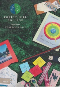
Booklet, Forest Hill College Yearbook 2013, 2013
... with the magazine's new name "Bunderra", an aboriginal word which means "Among... with the magazine's new name "Bunderra", an aboriginal word which means "Among ...Forest Hill College Yearbook 201368 pagesnon-fictionForest Hill College Yearbook 2013forest hill college, secondary schools -
 The Beechworth Burke Museum
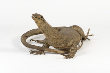
Animal specimen - Sand Goanna, Trustees of the Australian Museum, 1860-1880
Sand goannas are the second largest species of carnivorous lizards found across mainland Australia. They can grow up to 160cm in length and can weigh as much as 6kg. Their common name is derived from "iguana", since early European bush settlers in Australia likened goannas to the South American lizards. Goannas retain special cultural and historic significance within Australian folklore and Indigenous culture. They were an important traditional native food source and are commonly represented in Aboriginal Dreamtime stories. In some Aboriginal languages, the sand goanna is called "bungarra"; a term also commonly used by non-Aboriginal people in Western Australia. In Pitjantjatjara and other central Australian languages, goannas are called "tingka". This specimen is part of a collection of almost 200 animal specimens that were originally acquired as skins from various institutions across Australia, including the Australian Museum and the National Museum of Victoria, as well as individuals such amateur anthropologist Reynell Eveleigh Johns between 1860-1880. These skins were then mounted by members of the Burke Museum Committee and put-on display in the formal space of the Museum’s original exhibition hall where they continue to be on display. This display of taxidermy mounts initially served to instruct visitors to the Burke Museum of the natural world around them, today it serves as an insight into the collecting habits of the 19th century. This specimen is part of a significant and rare taxidermy mount collection in the Burke Museum. This collection is scientifically and culturally important for reminding us of how science continues to shape our understanding of the modern world. They demonstrate a capacity to hold evidence of how Australia’s fauna history existed in the past and are potentially important for future environmental research. This collection continues to be on display in the Museum and has become a key part to interpreting the collecting habits of the 19th century.Small goanna with a streamlined body and textured scaly skin in different shades of olive and brown. It has a long neck and a long tail which narrows towards the tip. The goanna has four short, stocky legs which meet with large, curled claws. Its mouth is slightly slightly open, and it has two black glass eyes.On tag: BMM / 5892 /taxidermy mount, taxidermy, animalia, burke museum, beechworth, australian museum, skin, reynell eveleigh johns, lizard, goanna, sand goanna, monitor lizard, various gouldii -
 Lakes Entrance Historical Society
Photograph - Kurnai Tide Lakes Entrance, 1/06/1990 12:00:00 AM
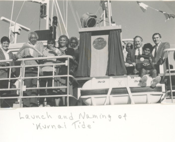
Black and white photograph taken at official ceremony naming the Esso oil rig supply vessel Kurnai Tide at Eastern Wharf Lakes Entrance Victoria. Also two black and white photographs taken at same event showing Albert Mullett, Jack Jacko Johnson, Corey Simpson, Mark Boon: Daryl Archibald of Esso, Shane Doyle crew member and Brian Miers Minister of Aboriginal Affairs celebrations, local government, buildings