Showing 273 items matching "lower plenty - maps"
-
 Greensborough Historical Society
Maps, Greensborough. Parish Plan 1860, 1860c
This plan show Green's subdivision of Greensborough, north of Grimshaw Street.Enlargements of Parish plan circa 1860?One copy possibly from 1860, containing lot numbers for a government road, now Main Street, and surrounding streets.greensborough, grimshaw street greensborough, edward bernard green -
 Greensborough Historical Society
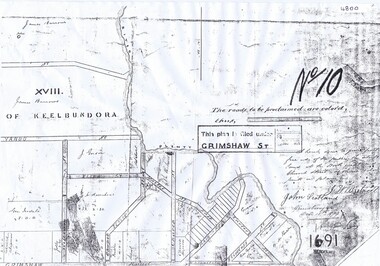
Map, Greensborough Map with Rail Line Plan, 1970s
Central Greensborough area, including railway line and some landowners. Basic map made c. 1902; annotations dated to circa 1970sTwo copies of planParish of Keelbundora, County of Bourke. Central Greensborough areagreensborough, greensborough railway station -
 Greensborough Historical Society
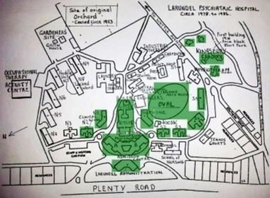
Photograph - Digital Image, Marilyn Smith, Larundel map and sign, 05/09/2017
This photograph shows the signs at the old Larundel site. Some buildings on this site are heritage listed on the Victorian Heritage Database.Digital copy of colour photographlarundel hospital -
 Greensborough Historical Society
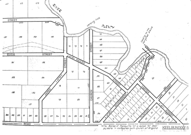
Plan, Parish Plan Map of Land North of Grimshaw Street, 11/12/1879
Part of Parish plan of land north of Grimshaw Street bounded by the Plenty River. Includes annotation signed by John Scotland and J. W. Britnell, dated Dec. 11th 1879.Photocopy of part of Parish plan of land north of Grimshaw Street bounded by the Plenty River. Includes annotation signed by John Scotland and J. W. Britnell, dated Dec. 11th 1879greensborough, grimshaw street greensborough, jonah britnell, john scotland -
 Greensborough Historical Society
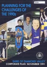
Pamphlet, Planning for the challenges of the 1990s: Shire of Diamond Valley Corporate Plan, 1991_11
Shire of Diamond Valley Corporate Plan 1991. Includes Shire map and statistics with plans for services to the community.16p. text and coloured photographsshire of diamond valley -
 Greensborough Historical Society
Article, Dawn Bennetts (nee Petts), Eltham Community Market, 1978o
A history of the Eltham Community Market by stallholder Dawn Bennetts. The Market began in 1978 and Dawn joined in 1985.7 typed pages, col. illus. and maps.eltham community market, dawn bennetts -
 Greensborough Historical Society
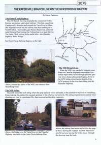
Article, Journal, Keith Patterson, The Paper Mill branch line on the Hurstbridge Railway, by Kevin Patterson, 2012_12
A branch line from the Outer Circle Line was built for the delivery of coal and paper pulp to the Australian Paper Mill at Fairfield. It operated as a branch from the Hurstbridge line until the 1970s, when the Australian Paper Mill plant changed to power by Bass Strait oil. 3 p., text , map and coloured photographs, pp. 4-6 of Nillumbik Custodian December (?) 2012husrstbridge railway line, outer circle railway line, australian paper mill -
 Greensborough Historical Society
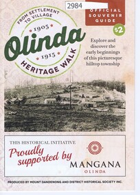
Pamphlet, Olinda Heritage Walk: official souvenir guide, by Mount Dandenong and District Historical Society Inc, 2016_
Walking guide to early Olinda buildings 1905-191524 p. pamphlet, map, photographs, with accompanying postcard from Patricia Hogan to Noel Withersolinda, mount dandenong -
 Greensborough Historical Society
Maps, Greensborough west of Plenty River, 1840o
Areas of Greensborough, west of the Plenty River, showing land holdings in the 1840s. Comprises Sections 8, 9, 10, 14, 15, 16, 17, 18, 19, 20 Parish of KeelbundoraOne A4 photocopy, one A3 enlargementgreensborough, watsonia, lower plenty, janefield -
 Greensborough Historical Society
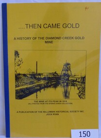
Book, Then came gold: a history of the Diamond Creek Gold Mine: by Jock Ryan, 2001_
The Diamond Creek Gold Mine was active from the 1860s and by 1912 had 12 known shafts. This book outlines ownership and contains anecdotes about the mine.A short history of the Diamond Creek Gold MineBook, 9 pages. Black and white illustrations and maps. Yellow front page with clear plastic cover.John Mackey in pencil inside front cover.diamond creek, john l ryan, jock ryan, diamond creek gold mine, gold discoveries victoria -
 Greensborough Historical Society
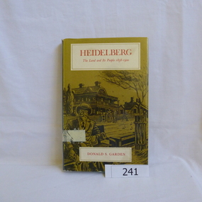
Book, Melbourne University Press, Heidelberg: the land and its people 1838-1900; by Donald P. Garden, 1838-1900
This book covers the early history of Heidelberg, Victoria from its beginnings in 1838 to 1900.There is some reference to the 'annexation' of Greensborough in 1875 and the route of the Heidelberg-Eltham railway line, 1893.Hard cover book. 218 p., ill., maps. Slip cover has a drawing based on an early photograph of the Old England Hotel.Property stamps from Nunawading Public Library (cancelled from their collection)heidelberg, greensborough, donald garden -
 Greensborough Historical Society
Report, Melbourne Parks and Waterways, Happy Hollow Farm Complex : Conservation Strategy [excerpts], 1996_07
This report was commissioned by the Melbourne Parks and Waterways in 1996. It contains a history of the place and building, and garden and landscape features. There is a Statement of Cultural Heritage Significance. Happy Hollow was occupied (and probably built) by Emmett Whatmough in 1893, and owned by John Cully McLaughlin. There are other family connections among the Greensborough district pioneers.Copy of document, 16 pages plus maps.happy hollow, whatmough, bell, mclaughlin, melbourne parks and waterways. cultural heritage significance -
 Greensborough Historical Society
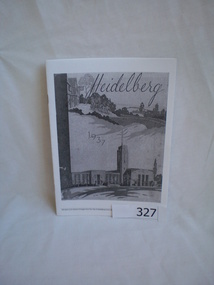
Booklet, Heidelberg 1937 - excerpts, 1937_04
Copy of parts of 1937 booklet to commemorate the official opening of the City of Heidelberg Civic Centre - Town Hall and Municipal Offices.A snapshot of the Heidelberg area in 1937, includes photos of local homes and civic amenities12 pages, photocopied and folded to A5 size. Black and white photos, maps.This flyer is an extract of images from the City of Heidelberg Civic Centre Official Opening Booklet "Heidelberg 1937" [footnote on each page]heidelberg municipal offices, heidelberg town hall, the centre ivanhoe -
 Greensborough Historical Society
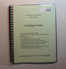
Folder, Grimshaw Family, 1849o
... Plenty Lower Plenty melbourne Passenger indexes; maps; mortgage ...Passenger indexes; maps; mortgage document 1873 Grimshaw and Britnell; history of Aaron and Joshua Grimshaw; Greensborough murder: transcript of the trial of Josiah Grimshaw for the murder of John Mitchell.History of the origins of this Greensborough family.20-page plastic binder, spiral bound, clear cover. Contains documents relating to the Grimshaw family.Collected by Greensborough Historical Society. Folder commenced 2012.grimshaw family -
 Greensborough Historical Society
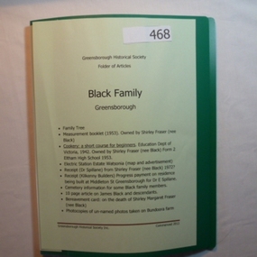
Folder, Black Family - Greensborough, 1900o
Contents: Family tree; small school books from family member; copy of map and advertisement for Watsonia Electric Station Estate; receipts; cemetery information; article on James Black and descendants; copies of un-named photos taken on Bundoora farm.The Black family owned a large portion of land from Greensborough to Watsonia. This collection is partly from family members.20-page plastic binder, green cover. Contains documents relating to the Black family of Greensborough and Watsonia.Collected by Greensborough Historical Society. Folder commenced 2012black family, shirley fraser, james black, watsonia electric station estate -
 Greensborough Historical Society
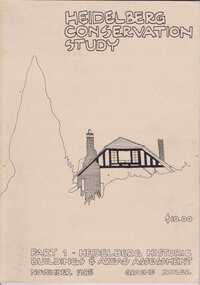
Book, Heidelberg Conservation Study: Part 1 Historic Buildings and Areas Assessment, 1985_
Report prepared by Graeme Butler on behalf of City of Heidelberg and Heidelberg Heritage Advisory Committee. Area covered is from Eaglemont in the south to Macleod in the north.This study identifies neighbourhood character, documents past development and the capacity of the environment for future development.Part one of set of three books. Paperback, 189 pages, Illus., maps. 2 copies.Stamps: Yarra Plenty Regional Library Service, and, Withdrawnheidelberg, macleod, heidelberg heritage advisory committee, graeme butler, plenty river, eaglemont -
 Greensborough Historical Society
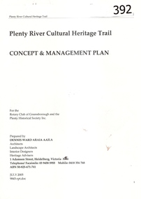
Report, Plenty River Cultural Heritage Trail : Concept & management plan, 2005_07
Prepared for the Rotary Club of Greensborough and Plenty Historical Society by Dennis Ward, this report outlines the heritage importance of the Plenty River Trail around Greensborough.This is an ongoing project by Dennis Ward. This report is an early version of the 2011 Squatters, speculators and settlers: Plenty River Cultural heritage trail. (Item 258) 66 page report, Illus, (some col.) , maps. In red 2-ring binder.Some handwritten notes in last pages.plenty river cultural heritage trail, dennis ward, rotary club of greensborough, plenty historical society, plenty river -
 Greensborough Historical Society
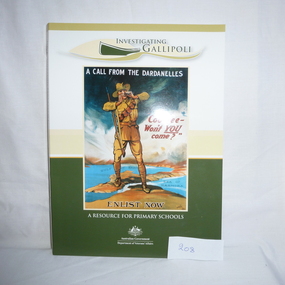
Book and CD, Australia. Department of Veterans Affairs, Investigating Gallipoli : a resource for secondary schools, 2010
Educational worksheets and activities used to teach children about Australia's role in the Gallipoli Campaign.Book: 80 p., illus. (some col.), maps, worksheets. Includes 2 discs: Disc 1 (video) Australians at War Episode 2; Disc 2 (DVD-ROM) Interactive activities and ABCs Gallipoli: the First Day website.australia department of veterans affairs, gallipoli, world war i, educational aids -
 Greensborough Historical Society
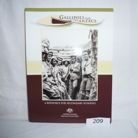
Book - Book and CD, Australia. Department of Veterans Affairs, Gallipoli and the ANZACS : a resource for secondary schools, 2010_
Educational worksheets and activities used to teach children about Australia's role in the Gallipoli Campaign.Book: 120 p., illus. (some col.), maps, worksheets. Includes 2 discs: Disc 1 (video) Australians at War Episode 2 and, Revealing Gallipoli; Disc 2 (DVD-ROM) Interactive activities and ABCs Gallipoli: the First Day website.australia department of veterans affairs, gallipoli, world war i, educational aids -
 Greensborough Historical Society
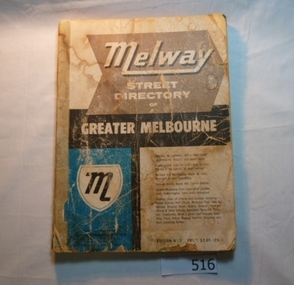
Book, Melway Street Directory of Greater Melbourne. Edition 1, 1966_
The first edition of this iconic Melbourne street directory published in 1966. The directory is accompanied by an outline of the history of the concept and publication of Melway.A surviving first edition of the Melway is rare as these directories are designed to be updated each year. Of interest in this edition is maps of the Greensborough area before large scale subdivision of the land in the late 1960s and 1970s.Soft cover street directory. Coloured maps.189 pages.melway, street directories, melbourne. -
 Greensborough Historical Society
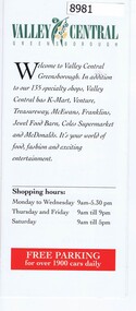
Pamphlet - Advertising pamphlet, Valley Central Greensborough, 1980s
Early advertising and list of tenants for Valley Central, now known as Greensborough Plaza. Gloss colour pamphlet and black and white mapgreensborough shopping centre, greensborough plaza, valley central -
 Greensborough Historical Society
Card - Advertising Card, Diamond Valley Community, Greensborough Community Market 2008, 2008
Advertising Card about the Greensborough Community Market moving to La Trobe University in 2008. This market is managed by Diamond Valley Community Support.Coloured Advertising Card - 2 sided with mapmarkets, greensborough community market, diamond valley community support -
 Greensborough Historical Society
Pamphlet, Lower Plenty Shopping Centre, 2007
... with calendar and map Lower Plenty Shopping Centre Pamphlet Pamphlet ...Coloured pamphlet from Lower Plenty Shopping Centre with list of shops, map and 2008 CalendarColour pamphlet with calendar and maplower plenty shopping centre, calendars, lower plenty -
 Eltham District Historical Society Inc
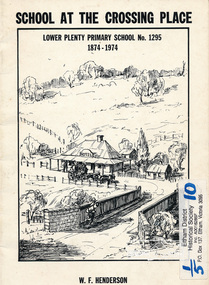
Book, School at the crossing place : Lower Plenty Primary School no. 1295, 1874-1974 / W.F. Henderson, 1974c
23 pages including information on inside covers. Text with black and white illustrations and photographs and map. Contents: Crossing Place Need for a school Residence for the teacher Closure A View of Lower Plenty 1918 Moving day at the Village The Golf Club Depression 1931 Vandals Electricity Grass Fires Cows at School Mothers' Club Women's liberation 1950's Lower Plenty after 1945 Swimming Pool - drowned dreams Long Grass - snakes - meadow hay - Fire Brigade The Royal Visit 1954 School Band Community Centre Our School Hall Trees and Gardens The Library Education 1874-1974 A Teacher's View The Second generation - children of ex-pupils (photo with names) The Third generation - Grandchildren of ex-pupils (photo with names) Head Teachers (list with dates) The Staff 1974 (photo with names) The sketch on the cover shows the Lower Plenty Bridge, toll house and the Plenty Bridge hotel, both no longer there. The bridge is listed in the Banyule Heritage Study and has recently been restored by Banyule Council as a pedestrian bridge - NL 137 March 2001 Paperback; [24] p. : ill. ; 25 cm.lower plenty, state school no. 1295, lower plenty primary school -
 Heidelberg Golf Club
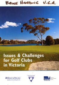
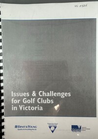
Book, Ernst & Young, Issues and challenges for golf clubs in Victoria, 2004
Ernst & Young produced this report on the issues and challenges in Victorian golf clubs for the Victorian Golf Association in 2004. The report aims to assist golf clubs to identify issues and plan for the future. Bruce Harding was a V.G.A. councillor from 1999-2010.Bruce Harding is a past HGC President and was involved with Victoria's junior teams, the Victorian Golf Association and was a rules official..140p., col. Illus., graphs, maps."Bruce Harding V.G.A." handwritten on cover.bruce harding, victorian golf association, golf clubs- victoria -
 Heidelberg Golf Club
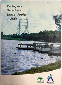
Book, Greening Australia Victoria, Planting near transmission lines in Victoria: a guide, 1997c
Guidelines for planting on or near a transmission line easement.Relevant to HGC due to the transmission lines running through property.20 pages, col. illus., maps.tree planting, transmission lines -
 Heidelberg Golf Club
Book, Melbourne Parks and Waterways, Lower Plenty River concept plan: Maroondah Pipe Track to Yarra River, 1994
Lower Plenty River concept plan: Maroondah Pipe Track to Yarra River. Includes suggestion of Plenty River Trail along the west boundary of the Heidelberg Golf Club.66 p., illus., colour map. Also, Draft copy of document.plenty river trail, lower plenty river, heidelberg golf club, mmbw, melbourne parks and waterways -
 Heidelberg Golf Club
Book, Ernst & Young, Issues and challenges for golf clubs in Victoria, 2004
Ernst & Young produced this report on the issues and challenges in Victorian golf clubs for the Victorian Golf Association in 2004. The report aims to assist golf clubs to identify issues and plan for the future. 140p., col. Illus., graphs, maps.victorian golf association, golf clubs- victoria -
 Heidelberg Golf Club
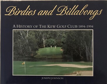
Book, Kew Golf Club, Birdies and billabongs: a history of the Kew Golf Club 1894-1994, 1994
A history of the first 100 years of Kew Golf Club in Belford Road, East Kew, founded in 1894.206 p., illus. (some col.), maps.non-fictionA history of the first 100 years of Kew Golf Club in Belford Road, East Kew, founded in 1894.golf clubs - kew, golf clubs - history, kew golf club -
 Heidelberg Golf Club
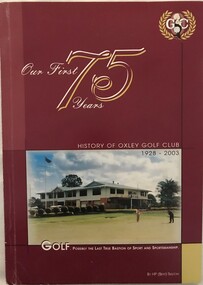
Book, Oxley Golf Club, Our first 75 years: history of Oxley Golf Club 1928-2003, 2003
A history of Oxley Golf Club, Oxley, Queensland, founded 1928.140 p., illus. (some col,), maps.non-fictionA history of Oxley Golf Club, Oxley, Queensland, founded 1928.golf clubs - history, golf clubs - queensland, oxley golf club,