Showing 902 items
matching reservoirs
-
 Malmsbury Historical Society
Photograph (Item), "M.H.S. Exhibition At Town Hall, Photos", Malmsbury c1991
Associated with - M.H.S. Buildings - "Town Hall, Reservoir" People - "Crowe, Mrs" -
 Melbourne Water
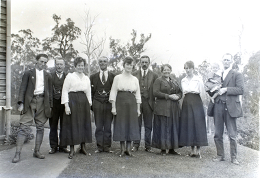
Transparency, Staff and Chauffeurs at the O'Shannassy Weir Quarters, 8th April, 1921
The O'Shannassy Weir was a small Weir created in 1911 and completed in 1913, and was the originating point of outflow into the Aqueduct. In 1928, it was replaced by the much larger O'Shannassy Reservoir. The Weir had water moving along the Aqueduct to the Surrey Hills Reservoir. Many structures at the Weir precinct have survived and remain in-situ.The O'shannassy Weir and Aqueduct contains a wide range of intact and diverse features. This demonstrates the way in which the Board constructed and managed the water supply that flowed through farmland and forest areas subject to timber milling. The caretakers residences that are located along the aqueduct were utilised by caretakers who were responsible for maintaining one of their four sections of the channel. This transparency is significant for its historic association to the establishment of the weir and to those who worked on the project, and at the quarters. weir, o'shannassy, aqueduct, reservoir, melbourne water, mmbw, staff -
 Greensborough Historical Society
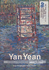
Book, Public Records Office Victoria et al, Yan Yean: a history of Melbourne's early water supply, by Tony Dingle and Helen Doyle, 2003_
Formation of Yan Yean Reservoir and its part in Melbourne's water supply system128 p. paperback, black and white and colour illus.yan yean reservoir, water supply -
 Halls Gap & Grampians Historical Society
Photograph - B/W
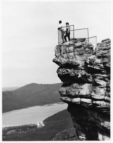
The two men are standing at The Pinnacle Lookout, overlooking Bellfield Reservoir in the Fyans ValleyTwo men standing behind cyclone wire three panel fence. Man on left is wearing a white shirt and long pants, the other in a checked shirt and long dark pants. They are on top of a large rocky outcrop overlooking a body of water and another mountain range scenery, lookouts -
 Malmsbury Historical Society
Postcard (Item), Postcard Outlet Tower Malmsbury Reservoir Kodak Postcard, Malmsbury c1915
Associated with - Kodak Postcard Buildings - Outlet Tower Reservoir People - Sutton Photo? -
 Whittlesea Historical Society Inc.
Photograph, Margaret Mann, Toorourrong Reservoir Wallaby Weir and Cascades, April 2012
15 photographs of a tour of Toorourrong Reservoir, Wallaby Weir and the Cascades April 2012.15 colour photographstoorourrong reservoir, wallaby weir, the cascades -
 Melton City Libraries
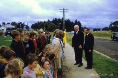
Photograph, Governor of Victoria Sir Rohan Delacombe and Lady Delacombe, c.1962
Governor of Victoria Sir Rohan Delacombe opened the Djerriwarrh Reservoir and pipeline in 1963. Governor of Victoria Sir Rohan Delacombe and Lady Delacombe visiting Melton.council, local significant events -
 Bendigo Military Museum
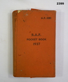
Book - BOOK, RAF, 1937
Item belonged to Maxwell Lennox Matheson No 418447 RAAF. Refer Cat No 1959 for his service history. RAF Pocket Book 1937, AP 1081 Stamped inside cover M L MATHESON, 87 Reservoir Strathdale Bendigo 3550. Orange vinyl colour with inside pocket containing copy of appendix V Booklet.On Book Plate “M MATHESON”books reference, military history - airforce, raf -
Tatura Irrigation & Wartime Camps Museum
Photograph, 1936
Photo taken by the photographer for Victoria State Rivers and Water Supply CommissionMedium sized black and white photograph. Eildon Reservoir dam wall / rock and earth fill wall from above / round concrete tower lower left / water above right / tree covered hill topgoulburn, irrigation, photo, victoria state rivers and water supply commission, eildon, eildon weir -
Tatura Irrigation & Wartime Camps Museum
Photograph, 19/12/1946
Taken by photographer for State Rivers and Water Supply Commission.Medium sized black and white photograph. Waranga Reservoir main outlet - Western main channel looking downstream to Waranga. Concrete bridges and control structure join earthen banks of channel. Windmill mid-left of picture.goulburn weir, victorian state rivers and supply commission -
Tatura Irrigation & Wartime Camps Museum
Map, State Rivers and Water Supply Commission, Goulburn Irrigation System, C 1940
A map showing the extent of Goulburn irrigation C. 1940. Also indicated by shading are: natural water resources, proposed extensions, existing stock and domestic supply areas, reservoirs, main channels, principal distribution channels, and railways.Irrigation Rivers Victoria.irrigation, victoria state rivers and water supply commission, map -
 Eltham District Historical Society Inc
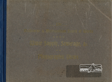
Book, The Melbourne & Metropolitan Board of Works Water Supply, Sewerage, etc. Photographic Views, 1908
... reservoirs ...In 1908 the Melbourne & Metropolitan board of Works published this book to illustrate its many constructions to provide Melbourne with its reticulated water and sewerage systems.This is now is a rare copy.Photographic images, landscape dimensions, hardboard cover, grey green colour Nilmmbw, weirs, dams & pumping stations, reservoirs, aqueducts -
 Eltham District Historical Society Inc
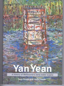
Book, Tony Dingle et al, Yan Yean : a history of Melbourne's early water supply / Tony Dingle and Helen Doyle, Monash University, 2003
Book commissioned by Melbourne Water to mark the 150th anniversary of the commencement of the Yan Yean Reservoir.Paperback; vii, 127 p. : ill. (some col.), maps (some col.), ports. ; 23 cm.[written on flyleaf] To Eltham District Historical Society, best wishes Helen Doyleyan yean reservoir -
Malmsbury Historical Society
Photograph (Item), "M.H.S Exhibition, Forests & Fishes, Coliban System", Malmsbury 1991
Associated with - M.H.S. Buildings - "Town Hall, Coliban Reservoir System" People - "Slimmon, Richard" -
Malmsbury Historical Society
Photograph (Item), "M.H.S Exhibition, Glass, Coliban Reservoir System", Malmsbury 1991
Associated with - M.H.S. Buildings - "Town Hall, Coliban Reservoir System" People - "Slimmon, Barb" -
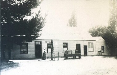 City of Ballarat Libraries
Photograph - Card Box Photographs, White Swan Hotel, Ballarat circa 1870
The site is now the White Swan Reservoir. The person pictured could be the licensee, Mrs Ritchie. white swan hotel, white swan reservoir, building, commerical, hotel, person -
 Whittlesea Historical Society Inc.
Photograph, Matt Dickinson, Toorourrong Reservoir, 14 Dec 2006
A photograph of smoke from bushfires on the ranges on Toorourrong Reservoir, bushfires 80 mile distance.1 colour photographbushfire, toorourrong reservoir -
Stawell Historical Society Inc
Photograph, Water storage tanks part of reservoir in reefs road -- Coloured
Coloured Photo showing two water storage tanks part of reservoir in reefs roadDirt road in foreground power pole and water tanks. stawell -
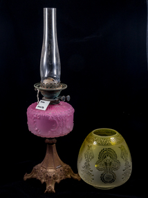
 Mont De Lancey
Lamp - Kerosene
1. Lamp has clear glass chimney, an amber glass reservoir with historical map design and amber glass base. One screw at side to adjust the flame. 2. Small blue glass night light with glass chimney.kerosene lamps, lamps -
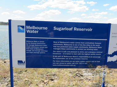 Eltham District Historical Society Inc
Photograph, Sugarloaf Reservoir, Christmas Hills, 16 January 2015, 16 January 2015
Sugarloaf Reservoir is situated on former farmland. This large water storage was completed in 1982 and serves Melbourne's northern suburbs. Within the visitor areas are two picnic grounds and other recreational facilities. Below its massive rock embankment is located the Winnecke Treatment Plan designed to purify its water before being piped into Melbourne. The dam partly inundated the old firing ranges of the former Christmas Hills Rifle Club. Source: Christmas Hills Now and then: Yarra Glen & District Historical Society, 2004. Born DigitalMelbourne Water Sugarload reservoir Melboure Water is owned by the Victorian Government. We manage Melbourne's water supply catchments, remove and treat most of Melbourne's sewrage, and manage waterways and major drainage systems. Most of Melbourne's water comes from uninhabited, forested catchments. Melbourne is one of the few cities in the world that has protecyed water supply catchments. Melbourne Water manages these catchments to protect our drinking water. Our water is safe and pleasant to drink, and undergoes minimal treatment - it is better to start witht he highest quality source. A key part of Melbourne Water's responsibility is to encourage the sustainable use of this precious resource. For more inforamtio on our water supply and on how you can conserve water, call 131 722 or visit www.melbournewater.com.auchristmas hills, sugarloaf reservoir, sign, melbourne water -
 Eltham District Historical Society Inc
Photograph, View of Reservoir from Kinglake
View is of Yan Yean Reservoir, probably taken from Council land (1970) on Ganglehoffs Road.This photo forms part of a collection of photographs gathered by the Shire of Eltham for their centenary project book,"Pioneers and Painters: 100 years of the Shire of Eltham" by Alan Marshall (1971). The collection of over 500 images is held in partnership between Eltham District Historical Society and Yarra Plenty Regional Library (Eltham Library) and is now formally known as the 'The Shire of Eltham Pioneers Photograph Collection.' It is significant in being the first community sourced collection representing the places and people of the Shire's first one hundred years.Digital image and 4 x 5 inch B&W Negsepp, shire of eltham pioneers photograph collection, kinglake, reservoir, ganglehoffs road, yan yean reservoir -
 Eltham District Historical Society Inc
Document - Folder, Maroondah Acqueduct, 2008
Pages copied from the The Heidelberg Historian, newsletter of the Heidelberg Historical Society, February and June 2008 isues relating to guest speaker Lindsay Mann, President of Whittlesea Historical Society and his subject Yan Yean Reservoir: 150 years. - Folder 82 from Harry Gilham Collection. Material merged with folder on Maroondah Reservoir Various pagesyan yean reservoir, lindsay mann, heidelberg historical society, water supply, maroondah reservoir -
 Mont De Lancey
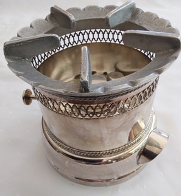
Functional object - Methylated Spirits Tea Warmer, Unknown
These tea warmers were used to keep the teapot warm when it was filled with tea, hence the name. This one was owned and used by Mrs M Larer, New Gisborne "Elderslie" in the 1920's.A silver plated round single burner tea warmer with a removable top grid with five support arms. It has a retractable metal 'wick' operated by turning a small round flat knob attached to the side. This knob is joined to the 'wick' with a long silver rod on the outside of the mechanism so the operator does not burn their fingers. The reservoir has two curved small handles on the side and an ornate filigree style pattern at the top rim. Inside the 'wick' section there is also a small knob with a tiny hole in the top to turn which releases pressure in the reservoir. stamped on the base is 'EPNS A1 London'containers, teapots, teapot warmers, tea accessories, pots -
 Eltham District Historical Society Inc
Negative - Photograph, J.A. McDonald, Hurstbridge Water Scheme, 11 May 1961
Downstream view of V notch 11 May 1961 http://wikimapia.org/10473910/Running-Creek-ReservoirRecord of various Shire of Eltham infrastructure works undertaken during the period of 1952-1962 involving bridge and road reconstruction projects, sometimes with Eltham Shire Council Project Reference numbers quoted. It was during this period that a number of significant improvements were made to roads and new bridges constructed within the shire that remain in place as of present day (2022). In many situations, the photos provide a tangible visible record of infrastructure that existed throughout the early days of the Shire. The album was put together by or under the direction of the Shire Engineer, J.A. McDonald.infrastructure, road construction, shire of eltham, 1961-05-11, hurstbridge water scheme -
 Greensborough Historical Society
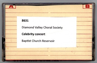
Audio - Audio Cassette, Diamond Valley Choral Society, Celebrity concert: performed by Diamond Valley Choral Society, 1980s
A recording of a concert performance by the Diamond Valley Choral Society. Performed at the Reservoir Baptist Church, there is no date given.1 audio cassette in clear plastic caseHandwritten on insert: "Celebrity Concert"diamond valley choral society, concerts, reservoir baptist church -
 City of Moorabbin Historical Society (Operating the Box Cottage Museum)
Lights, Victorian kerosene banquet lamp, c1900
The kerosene lamp is a type of lighting device that uses kerosene as a fuel. Kerosene lamps have a wick or mantle as light source, protected by a glass chimney or globe; lamps may be used on a table, or hand-held lanterns may used for portable lighting. There are three types of kerosene lamp: traditional flat wick, central draught (tubular round wick), and mantle lamp. The side screws adjust the length of the wick and hence the strength of the flame / light produced. Prior to the introduction of gas and electricity these lamps provided light in households after sunset.Prior to the introduction of gas and electricity these lamps provided light after sunset for the early settlers, as they established their farms and businesses, in Moorabbin Shire.A Victorian kerosene banquet lamp, with a gilded metal quad footed base, cranberry glass oil reservoir with geometric patterns, original etched, yellow, glass globe shade and clear glass chimney. There are 2 side screws for adjusting the flame.early settlers. pioneers, follett w, moorabbin, bentleigh, brighton, ormond, market gardeners, kerosene, paraffin, lights, lamps, candles -
Bendigo Historical Society Inc.
Document - MINING REPORTS - MINES ACT 1890, ALTERATION OF REGULATIONS
Printed document Mines Act 1890, Alteration of Regulations. Refers to an addition to clause 20 of the Regulations relating to licences to cut, construct, and use races, drains, dams, and reservoirs. The additional Regulations shall extend to all Water-right Licences.document, gold, mining reports, mining reports, mines act 1890 alteration of regulations, mr munro, mr shiels, sir f t sargood, mr duffy, mr wheeler, mr davies, mr outtrim, mr fraser, g wilson brown, robt s brain -
Bendigo Historical Society Inc.
Map - CAMPBELL COLLECTION: BENDIGO & DISTRICT MAPS, 22-3 29
Map. Marong, Parishes of Marong, Lockwood and Mandurang. Scale 20 chains to an inch. Total area 5106 acres. Crusoe Reservoir on right. Compiled in W.P.B. from Field Survey and Parish Plans (number 373 in map cupboard 1)G.W.Lmap, bendigo, allotments -
Bendigo Historical Society Inc.
Map - CAMPBELL COLLECTION: BENDIGO AND DISTRICT MAPS
Map. Marong, Parishes of Marong, Lockwood and Mandurang. Scale 20 chains to an inch. Total 5106 acres. Compiled in W.P.B. from Field Survey and Parish Plans. Crusoe Reservoir to the right of map. (number 362 in map cupboard 1)map, bendigo, parish plan -
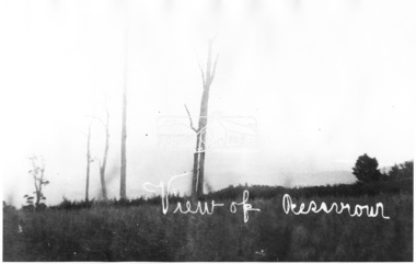
Tatura Irrigation & Wartime Camps Museum
Photograph, 1918
Taken by photographer for State Rivers and Water Supply Commission.Medium sized black and white photograph. Sugarloaf Reservoir construction 22/2/1918 / Round concrete control tower and the spillway under construction / Traction engine and pump under timber cover middle foreground / Mount Sugarloaf in background.victorian state rivers and supply commission, sugarloaf reservoir