Showing 1131 items
matching survey map
-
 Bendigo Military Museum
Photograph - Speedmaster Printing Press Media Announcement and Army Survey Regiment Open Day, Fortuna Villa, Bendigo, 1990
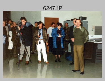
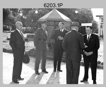
The first photograph was probably taken at a media event announcing the introduction of the Heidelberg Speedmaster printing press in late 1990. LTCOL Rene van den Tol was the CO of the Army Survey Regiment from 1989 to 1991. Partly obscured behind the CO was Mr Bruce Reid, who was the newly elected federal member for Bendigo. The media event was held in Wayzgoose Hall, Lithographic Squadron’s new purpose-built building constructed to house the Speedmaster 102 printing press. The remaining 29 photographs were taken at an Army Survey Regiment Open Day at Fortuna Villa, Bendigo on the 24th of February 1990. This occasion was one of several events held to commemorate the 75th anniversary of the formation of the Royal Australian Survey Corps. Although historical tours of Fortuna occurred on a regular basis, this was the first technical open day since 1972. The Royal Australian Survey Corps recognised that an Open Day was the best way for the local community in Bendigo to gain an insight into the unit’s important role as Defence’s map production agency, its technical equipment, and its economic importance to Bendigo. It also gave them an opportunity to tour through historic Fortuna Villa. This occasion is covered in more detail in page 143 of Valerie Lovejoy’s book 'Mapmakers of Fortuna – A history of the Army Survey Regiment’ ISBN: 0-646-42120-4. Refer to Item 6291.6P for more photos of the Open Day.The first photograph was probably taken at a media event announcing the introduction of the Speedmaster printing press at Army Survey Regiment Fortuna Villa, Bendigo in late 1990. The remaining 29 photographs were taken at an Open Day on the 24th of February 1990. The colour and black & white photographs were printed on photographic paper and are part of the Army Survey Regiment’s Collection. The photographs were scanned at 300 dpi. .1) - Photo, colour, 1990. L to R: Unidentified civilian visitor/media, SSGT Ian Nichols, unidentified (x2), SGT Dale Hudson (white top), unidentified (x2), MAJ John South, MHR Mr. Bruce Reid, CO LTCOL Rene van den Tol. .2) - Photo, black & white, 1990. WO1 Gary Warnest, civilian visitors. .3) to .4) - Photo, colour, 1990. WO2 Adrian 'Charlie' Creedy, civilian visitors. .5) - Photo, colour, 1990. Civilian visitors. .6) to .7) - Photo, colour, 1990. Civilian visitors, CPL Peter Peterson. .8) - Photo, black & white, 1990. L to R: LCPL Sandy Winn, civilian visitor. .9) - Photo, colour, 1990. L to R: CPL Steve McGuiness, civilian visitors. .10) - Photo, black & white, 1990. Display of digital storage media. .11) - Photo, colour, 1990. L to R: Mr Pat Thwaites outlining utilisation of satellite imagery to civilian visitors. .12) - Photo, colour, 1990. MAJ Peter Clarke with civilian visitors. .13) - Photo, colour, 1990. Unidentified technician with civilian visitors. .14) - Photo, colour, 1990. SGT Barry Hogan with civilian visitors. .15) - Photo, colour, 1990. SPR Ian Baldwin with civilian visitors. .16) - Photo, black & white, 1990. SPR Ian Baldwin with civilian visitors. .17) - Photo, black & white, 1990. SGT Sherri (Dally) Burke with civilian visitors. .18) - Photo, colour, 1990. L to R: SPR Jeanette (Lane) Dury-Lane, CPL Diane (Thomas) Soutar with civilian visitors. .19) - Photo, colour, 1990. L to R: unidentified technician, CPL Col McInnes, LCPL Charmian McKean. .20) - Photo, black & white, 1990. CAPT Peter Parkes. .21) - Photo, black & white, 1990. L to R: LCPL Janet Murray, MAJ Bob Coote, SPR Gary Lord. .22) - Photo, black & white, 1990. LT Marty Lyons with civilian visitors. .23) - Photo, colour, 1990. LT Marty Lyons with civilian visitors. .24) - Photo, black & white, 1990. SSGT Ian Nichols, CPL Dale Hudson, Planeta printing press, with civilian visitors. .25) - Photo, colour, 1990. Cars parked in Chum Street outside entrance to Fortuna Villa. .26) - Photo, colour, 1990. Civilian visitors near Fortuna Villa’s front door viewed from back gate. .27) - Photo, colour, 1990. Civilian visitors enjoying views of the garden from Fortuna Villa’s rooftop. .28) - Photo, colour, 1990. Civilian visitors enjoying views of the garden from Fortuna Villa’s verandah and rooftop. .29) - Photo, colour, 1990. Civilian visitors enjoying BBQ cooked by CPL Paul Baker and SPR Shona Hastie outside Lithographic Squadron. .30) - Photo, colour, 1990. BBQ cooked by CPL Paul Baker outside Lithographic Squadron..1P to .30P – no annotationsroyal australian survey corps, rasvy, army survey regiment, army svy regt, fortuna, asr, printing, litho -
 Bendigo Military Museum
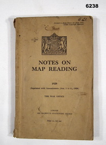
Manual - Notes on Map Reading 1929 - The War Office, 30.06.1939
... of the ground from a map product Royal Australian Survey Corps RASvy ...Instruction in Map reading. The object of map - reading is to tender possible the clear and accurate visualization of the ground from a map productBrown Cardboard book, A5 Size, Several insets. Reprinted with Amendments 1-4 1939, 95 pages.royal australian survey corps, rasvy, fortuna, army survey regiment, army svy regt, asr -
 Bendigo Military Museum
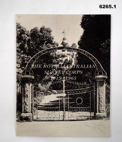
Booklet - The Royal Australian Survey Corps 1915-1965, Army Headquarters Survey Regiment, 14.11.1965
A booklet produced to commemorate the 50th (Jubilee) Anniversary of the Royal Australian Survey Corps, contains an historical record of the Corps units, nominal roll of AHQ Survey Regiment unit members during the Jubilee year, photos and plans of Fortuna Villa.Booklet, 16 pages 6265.1 Front cover has black and white photo of the gated entrance to Fortuna Villa 6265.2 Front cover has an extract from the 1:100,000 map of Canberra, ACT. 6265.2 Internal contents are a reprint of 6265.1Inside of the booklet is signed by LtCol JK Nolan CO AHQ Svy Regt, later Director of the Survey Corps.royal australian survey corps, rasvy, fortuna, army survey regiment, army svy regt, asr -
 Bendigo Military Museum
Photograph - Army Survey Regiment - Regimental Training Field Phase, 1995
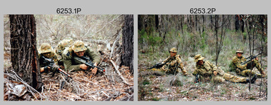
This is a set of twenty photographs of the Army Survey Regiment undertaking regimental training in state forest north of Costerfield, Victoria, 1995. The state forest is now part of the Heathcote-Graytown National Park. The aim of the training was to provide personnel practical revision of infantry and minor tactics at the section level, navigation and map reading, RATEL and Survival in the Field. This was the Army Survey Regiment’s last military skills field training exercise before disbandment of RA Svy and the weather on the last day was wet and cold. It provided soldiers who decided to continue their military service essential military skills revision and for those who chose to discharge from the Army, it reinforced their decision to leave. LTCOL Duncan Burns was the last CO of the Army Survey Regiment from 1994 to 1996 and WO1 Ken Johnston OAM MM from RA Inf was the RSM for one year in 1995.This is a set of twenty photographs of the Army Survey Regiment undertaking regimental training in state forest north of Costerfield, Victoria, 1995. The photographs were printed on photographic paper and are part of the Army Survey Regiment’s Collection. The photographs were scanned at 300 dpi. .1) - Photo, colour, 1995, unidentified personnel. .2) - Photo, colour, 1995, L to R: Derek Percival, Damien Cole, unidentified. .3) - Photo, colour, 1995, L to R: unidentified, Chris ‘Charlie’ Brown, unidentified (x2). .4) - Photo, colour, 1995, unidentified personnel. .5) - Photo, colour, 1995, unidentified. .6) - Photo, colour, 1995, unidentified personnel. .7) - Photo, colour, 1995, unidentified personnel. .8) - Photo, colour, 1995, L to R: Jim Ash, Syd Anstee, unidentified, Rob Bogumil. .9) & 10) - Photo, colour, 1995, L to R: Steve Hill OAM CSM, Rob Bogumil, Brian Paul, Jim Ash, Syd Anstee, Colin Davidson. .11) - Photo, colour, 1995, L to R: Paul ‘Hutch’ Hunter, Stu Ridge, Chris ‘Charlie’ Brown. .12) - Photo, colour, 1995, RSM WO1 Ken Johnston OAM MM. .13) - Photo, colour, 1995, Peter Imeson. .14) - Photo, colour, 1995, L to R: Stu Ridge, Alan Virtue. .15) - Photo, colour, 1995, CO LTCOL Duncan Burns. .16) - Photo, colour, 1995, unidentified personnel. .17) - Photo, colour, 1995, L to R: Tony Harder, CAPT Sutiman (Indonesian Exchange Officer), Kasey ‘Tiges’ Northausen, unidentified (x2), Mick Duggan. .18) - Photo, colour, 1995, CAPT Sutiman (Indonesian Exchange Officer). .19) & 20) - Photo, colour, 1995, unidentified personnel..1P to .20P – No personnel are identified.royal australian survey corps, rasvy, army survey regiment, army svy regt, fortuna, asr -
 Bendigo Military Museum
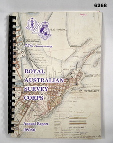
Administrative record - 75th Anniversary of the Royal Australian Survey Corps - Annual Report 1989/90, Royal Australian Survey Corps, 1990
Royal Australian Survey Corps Annual Report 1989/90 of all mapping and charting carried out during that periodAn A4 booklet, glossy pages, map index of all mapping scales, 17 pages and Annexes, plastic ring bindingroyal australian survey corps, rasvy, fortuna, army survey regiment, army svy regt, asr -
 Bendigo Military Museum
Administrative record - Joint Committee for the exchange of Information on ADP within the RASvy Corps, Activities Jun- Dec 1985, Army Survey Regiment, December 1985
Automated Computer Processing (ADP) was instrumental to the successful operation of the Royal Australian Survey Corps Mapping capability and production. This paper describes elements of the ADP with a comprehensive description of each. They Include, PDP 11/70 Memory, Map Stock Control System, Digital Terrain Elevation Data, Digital Terrain Model Package, ASMAPS, ASTIS, Reflectance Hill Shading, Aerial Triangulation and Terrain Analysis.Two page paper report about Automated Data Processing, unstapledHand annotated "Folio 74" in top right hand cornerroyal australian survey corps, rasvy, fortuna, army survey regiment, army svy regt, asr -
 Bendigo Military Museum
Map - Map Extract - Charterhouse of Mendip, John James Raisbeck, Unknown
Map extract showing the towns of Cheddar, Rodney Stoke, Westbury and a smaller town of Easton. The area depicted is part of Somerset, England. Map is hand drawn by J.J. Raisbeck date unknown. John James RAISBECK was born on 4 July 1880 at Christchurch New Zealand. He served 4 years (Citizen Military Force - CMF) in 9th Australian Light Horse Regiment in Central VIC with the rank 2nd Lieutenant. He was the first Australian appointed to the Survey Section RAE, on 16 April 1910, as a draughtsman which was his civilian profession, with the rank Warrant Officer, honorary 2nd Lieutenant. He was required to resign his commission in the CMF. He supervised the draughting work of the Section in Melbourne and was largely responsible for the mapping standards and specifications set in the production of the Cowes one-inch-to-one-mile military map, which became the enduring Australian standard. He was also responsible for supervising the printing of the maps by the Victorian Government Printer. He was appointed 2nd Lieutenant in the AIF Survey Corps draft on 6 December 1917 (from Melbourne) embarking for England on 22 December 17. He was attached to the Australian Corps Topographic Section in France from 21 April 1918 to 5 March 1919 serving as Second-in-Command and as Officer Commanding. He was promoted Lieutenant 15 October 1918, attending the AIF Survey School, Southampton in 1919, returning to Australia 23 June 1919, before his AIF appointment was terminated 17 July 1919. He went on to serve the Survey Section RAE and Australian Survey Corps, including in the Second World War, having been promoted Captain then Major and Officer Commanding Army Headquarters Cartographic Section until February 1940. He retired after 33 years of service to military survey, and after serving the Corps in two world wars, on 4 July 1943 with the retired rank Lieutenant-Colonel. He was the author of the article ‘A Short History of the Military Survey of Australia, 1907-1936’, published in The Australian Surveyor, Sept 1, 1937Map extract slightly larger than A4. Scale: One Inch to One and a half Mile. 1:31680, 9 x copiesSignature of "J.J. Raisbeck" bottom right-hand cornerroyal australian survey corps, rasvy, fortuna, army survey regiment, army svy regt, asr -
 Bendigo Military Museum
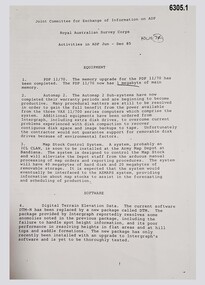
Administrative record - Army Survey Regiment - Mallee Country Project, Army Survey Regiment, 30.01.1987
This is a reconnaissance report for the Mallee Country Project supporting Operation Raleigh 4 Mar - 26 May 1987. Operation Raleigh is a scheme for International Venturers (Scouts) to develop leadership, self-reliance, initiative and team work while studying Mallee Fowl, Mammal Trapping and Cross Country Trekking. Four Annexes containing sketch maps, personnel lists, photographs and stores lists.A4 Report, soft covers front and back. Plastic ring bindingroyal australian survey corps, rasvy, fortuna, army survey regiment, army svy regt, asr -
 Bendigo Military Museum
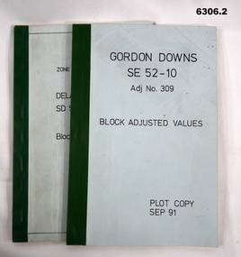
Administrative record - Report on the Block Adjustment of the Gordon Downs and Delemere 1:250,000 Maps, Army Survey Regiment, 1 Sep 1991, .2 Jan 1988
... and Delemere 1:250,000 Maps Army Survey Regiment ...All mapping produced at this time were produced using Aerial Photography. These booklets contain the adjusted mathematical solution to joining this group of photographs together..1 Blue covered booklet with green tape binding. Block adjusted values for Gordon Downs SE 52-10 1:250 000 map Adjustment number 309 Sep 1991 .2 Blue covered booklet with green tape binding. Block adjusted values for Delamere SD 52-16 1:250 000 map Adjustment number 272 Jan 1988royal australian survey corps, rasvy, fortuna, army survey regiment, army svy regt, asr -
 Bendigo Military Museum
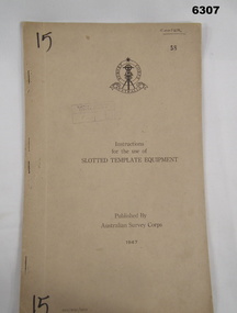
Manual - Australian Survey Corps 1947 - Instructions for the use of Slotted Template Equipment, Australian Survey Corps, 1947
This is an instruction manual describing in detail the construction of the templates used for producing map compilation sheets from aerial photographs, and how the system works.Foolscap size, soft carboard covers, 9 x numbered pages, 3 x fold out pages containing two photos on each. Australian Survey Corps Badge on cover. Stapled and re-stapled on Left hand edge.Front Cover, "15" Top Left and Bottom Left corner, "COOPER" and stamped "58" in Top Right, "AHQ/Misc/0015" Bottom Left Corner, Stamped "Eastern Command Survey Service copy 5"royal australian survey corps, rasvy, fortuna, army survey regiment, army svy regt, asr -
 Bendigo Military Museum
Photograph - Detachment - Army Survey Regiment, Bonegilla, Victoria, c1973
This is a set of three photographs of personnel from the Detachment - Army Survey Regiment taken in front of its main map production building at Bonegilla, Victoria in c1973. This cartographic map production sub-unit of the Army Survey Regiment operated in buildings owned by the School of Military Survey from 17th of June 1970 to the 30th of September 1985. A total of 800 topographic maps ranging in scale from 1:25,000 to 1: 250,000 scale were completed. A major focus of production in the 1970s was the cartographic completion of the Papua-New Guinea 1:100,000 map series and the Flexiflow quality control system was developed as a tool to coordinate production. The Flexiflow system comprised a series of job plans and charts linked to a task allocation to resource magnetic planning board. Using critical path analysis and task prioritisation, complex job planning was efficiently scheduled, and re-prioritisations readily made. Reproduction requirements were effectively coordinated by way of weekly courier to the Army Survey Regiment at Bendigo. Supervisors and technicians fully embraced the system as they could understand their role, others around them and the positive production achievements. WO1 Bill Boyd (who does not appear in this photograph) was the technical warrant officer for 11 years at the Detachment was awarded the OAM, the Order of Australia Medal for leading the development and the implementation of the Flexiflow system. By mid-1982, production of maps at these scales was undertaken digitally on Bendigo’s AUTOMAP 2 system and the Detachment reverted to production of small-scale large format RAAF aeronautical charts. Detachment personnel managed to produce 18 charts in the following two years, which was an impressive achievement for the staff, given major differences in format, specification and scales. Development of digital production of aeronautical charts in 1984-85 led to gradual reduction in production output and contracting out production was instigated to meet the shortfall and as a consequence the Detachment closed in September 1985. See pages 177 to 180 of Valerie Lovejoy’s book 'Mapmakers of Fortuna – A history of the Army Survey Regiment’ ISBN: 0-646-42120-4. for more information on the history of the Detachment at Bonegilla.This is a set of three photographs of the Detachment - Army Survey Regiment taken in front of the main map production building at Bonegilla, Victoria in c1973. The photographs were printed on photographic paper and are part of the Army Survey Regiment’s Collection. The photographic proofs were scanned at 600 dpi. .1) to .3) - Photo, black & white c1973. Back Row L to R: Peter Simpson, Chris Edwards, unidentified (x2), Colin Harden, Rowan Gillies, Bob Rowley OAM, Steve Hansen, Stu Thaxter. Centre Row L to R: Kevin Boehm, Dennis McCarthy, Peter Cross, unidentified, Brian Ryan, unidentified, Ian Marner, unidentified, Phil Smalley. Front Row L to R: Geoff Haynes, Bruce Wetzig, Dave Thompson, unidentified, OC Bob Roche, Ike Lever, John McCulloch, Dick Barwald, unidentified. There are no personnel annotated.royal australian survey corps, rasvy, army survey regiment, detachment - army survey regiment, army svy regt, asr -
 Bendigo Military Museum
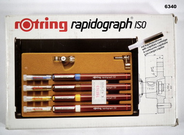
Equipment - Rotring Rapidograph Iso Pen set, Circa 1980
Used extensively within the Royal Australian Survey Corps for the compilation of maps and for map overlay production. These pens produced lines of consistent line widths for cartographic ink work and these replaced the earlier "Crow Quill" ink nib pens. These pens were donated by 310762 WO1 PJ Presser (dec) who served in the Royal Australian Survey Corps from 11 Feb 1970 - 12 Feb 1990.Rotring box Rapidograph Iso pen set with four pens in a plastic case and two compass adaptors. Pen sizes: 0.25mm, 0.35mm, 0.50mm, 0.70mm, with instructionsroyal australian survey corps, rasvy, fortuna, army survey regiment, army svy regt, asr -
 Bendigo Military Museum
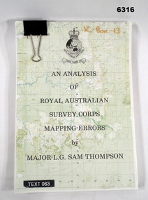
Administrative record - An analysis of Royal Australian Survey Corps mapping errors by Major LG Sam Thompson, Major LG Sam Thompson US Army Corps of Engineers at Army Survey Regiment, circa 1978
The purpose of the report is to analyze and study the map making procedures at the Army Survey Regiment to quantify the accuracy of the mapping to see if they meet acceptable accuracy standards. This was achieved through the study of possible errors.A4 loose leaf booklet held together with a "bulldog" paper clip. Cover part of an a RASvy 1:50,000 map. 1x Cover, 7x Introductory pages, 103x report pages.Marked on front cover "X - Box - 13", "TEXT 063"royal australian survey corps, rasvy, fortuna, army survey regiment, army svy regt, asr -
 Bendigo Military Museum
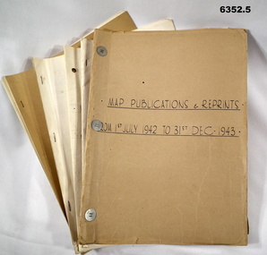
Administrative record - LHQ Cartographic Coy - Map Printing and Reprints 1 July 1942- 31 Dec 1947, LHQ Cartographic Coy, 1942-1947
The Land Headquarters Cartographic Company relocated to Fortuna Villa, Bendigo in 1942. With printing presses acquired from a number of civilian organizations it printed the maps needed for the Australian WW11 war effort. These records detail which maps were printed during those years. Photographs of the printing machines and the printers who used them are shown in Victorian Collections item 6148 LHQ Carto Coy Souvenir Booklet. 6352.1 Map Publishing and Reprinting Reports 1 July 1942 - 31 Dec 1943 6352.2 Map Publishing and Reprinting Reports 1 July 1943 - 31 Dec 1944 6352.3 Map Publishing and Reprinting Reports 1 July 1944 - 31 Dec 1945 6352.4 Map Publishing and Reprinting Reports 1 July 1945 - 31 Dec 1946 6352.5 Map Publishing and Reprinting Reports 1 July 1946 - 31 Dec 1947Five Manilla Folders containing Map Printing ReportsHand written on the Folder covers: 6352.1 Map Publishing and Reprinting Reports 1 July 1942 - 31 Dec 1943 6352.2 Map Publishing and Reprinting Reports 1 July 1943 - 31 Dec 1944 6352.3 Map Publishing and Reprinting Reports 1 July 1944 - 31 Dec 1945 6352.4 Map Publishing and Reprinting Reports 1 July 1945 - 31 Dec 1946 6352.5 Map Publishing and Reprinting Reports 1 July 1946 - 31 Dec 1947royal australian survey corps, rasvy, fortuna, army survey regiment, army svy regt, asr -
 Bendigo Military Museum
Administrative record - "Project Cutlass" - Project Report Mapping Control Survey of New Ireland (PNG), Major SW Snow RASvy Corps, 1957
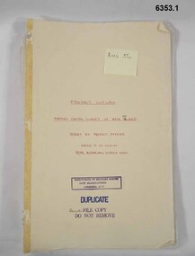
Item .1 "Project Cutlass" - Project Report Mapping Control Survey of New Ireland (PNG) is a report by the Project Officer Major SW Snow RASvy Corps. The Project commenced in August 1956 and concluded 29 Nov 1957. Traversing and Base line measurement used vehicles and two ships and included nearby islands. Includes two photographs. Item .2 Photograph of Bob Skitch Project Cutlass 1956/57 with theodolite Item .3 Photograph of Chas Beach project Cutlass 1957 Patlangat West Base (cemetery). 6353.1 Manilla Folder containing 49 foolscap sized loose page paper report. 12 pages of Intital report followed by 37 pages of Annexes and Appendices. Last page is map of Project Area. 6353.2 B/W Photograph Bob Skitch with Wild T2 Theodolite Project Cutlas 1956/1957 6353.3 B/W Photograph Chas Beach PATLANGAT WEST BASE (Cemetary) Project Cutlass 1957"Aug 56" on front coverroyal australian survey corps, rasvy, fortuna, army survey regiment, army svy regt, asr -
 Bendigo Military Museum
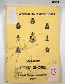
Administrative record - Royal Australian Survey Corps - Operation Tropic Shores, 1 Field Survey Squadron 1978, 31 Aug 1978
Operation Tropic Shores was conducted in 2 phases, Sep 1977 and May / Jun 78. The Operation was the field completion of Cape York 1;50,000 Mapping North of latitude 15 degrees S. Plotting was undertaken by 2, 4 and 5 Fd Svy Sqns with 1Fd Svy Sqn undertaking the mounting and Management of the field completion phase. Re-visiting and targeting of existing trig stations was also carried out as an opportunity task.Booklet, A4 cream cardboard cover, stapled Left Hand side, containing a report and plotted maps. Cover has Title and the Badges of the Australian Army Corps who participated in the Operation. 2 fd svy sqn, 4 fd svy sqn, 5 fd svy sqn, royal australian survey corps, 1 field survey squadron, 1fd svy sqn, rasvy, fortuna, army survey regiment, army svy regt, asr -
 Bendigo Military Museum
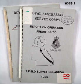
Administrative record - Royal Australian Survey Corps Report on Operation Aright 85 / 86 1 Field Survey Squadron 1986, 1986
Operation ARIGHT 85 was mounted by 1 Fd Svy Sqn 14 May to 8 Aug 1985 and 1 May to 15 May 1986. In the 1:250,000 SG54-15 Rutland Plains map area. In addition 18 X 1:50 000 maps were field completed.6359.1 Copy 1. 6359.2 Copy 2. A4 Cardboard cover, grey, plastic ring binder, report, diagrams, maps, plastic ring binder.royal australian survey corps, 1 field survey squadron, 1fd svy sqn, rasvy, fortuna, army survey regiment, army svy regt, asr -
 Bendigo Military Museum
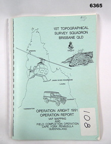
Administrative record - Royal Australian Survey Corps Report on Operation Aright 91 conducted by 1 Field Survey Squadron 1991, 1 Fd Svy Sqn, 7 Oct 1991
Royal Australian Survey Corps Operation Aright 91 (Field Completion) was a Field Verification and Vital Assets Protection (VAP) Mapping Operation conducted in Far North Queensland during the period 18 Jun - 29 Jul 1991 by 1 Fd Svy Sqn. The Operation covered the 1:250,000 Map area of SD54-16 Hann River and SE54-7 Normanton.Pale Blue cover with motifs of North Queensland, crocodile, RASvy Corps Badge, Army Helicopter and Land rover. Contains an A4 paper report of typed pages and diagrams secured by a plastic binder.Cover Hand annotated "ASS 108" (Air Survey Sqn, copy 108)royal australian survey corps, rasvy, fortuna, army survey regiment, army svy regt, asr -
 Bendigo Military Museum
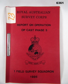
Administrative record - Operation Op Cast Phase 3 1986 - Operation Report, 1 Fd Svy Sqn
This is a report on the Royal Australian Survey Corps Survey Operation to Field verify two 1:50,000 maps 9541-3 TYALGUM and 9541-2 GREVILLIA conducted by 1 Fd Svy Sqn during the period 8 Nov -20 Nov 1986.Red light Cardboard Covers containing an 8 x page paper report held together with and ARNOS Fastenerroyal australian survey corps, rasvy, fortuna, army survey regt, army svy regt, asr -
 Bendigo Military Museum
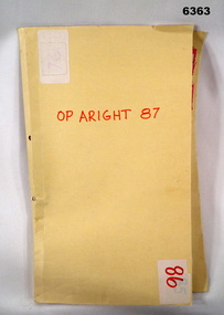
Administrative record - Royal Australian Survey Corps Report on Operation Aright 87 conducted by 1 Field Survey Squadron 1987, 1 Fd Svy Sqn, 26 Aug 1987
1 Fd Svy Sqn in conjunction with 2 Fd Svy Sqn conducted Operation Aright 87 in the Cape York Peninsula area over the period 8 May - 18 Jun 1987. The aim of the Survey Operation was to field verify the 70 x 1:50,000 map sheets which comprised the area of operations. This report details the activities conducted and the results achieved. Manilla Folder with title "OP ARIGHT 1987" containing a paper report of typed pages and diagrams bound together with an ARNOS fastener."OP ARIGHT 87" on front coverroyal australian survey corps, rasvy, fortuna, army survey regiment, army svy regt, asr -
 Bendigo Military Museum
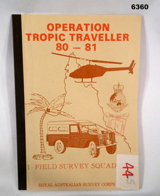
Administrative record - Operation Tropic Traveller 80 - 81 1 Field Survey Squadron, 1981
Project report, Operation Tropic Traveller 1980/81 was mounted to field complete the North Queensland Tac map area during the periods 25 Feb to 11 Nov 1980 and 3 Mar to 13 Oct 1981 Buff colored, A4 Folder, Mosaic in brown of Nth Qld, Helicopter, Corps badges, Land rover.1 field survey squadron, 1 fd svy sqn, royal australian survey corps -
 Bendigo Military Museum
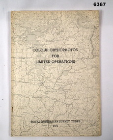
Administrative record - Royal Australian Survey Corps - Colour Orthophotos for Limited Operations 1971, Army Survey Regiment, Bendigo, 1971
This is a report on the experimental production of the colour Orthophoto Map 1:25,000 7924 - 3 - SW Northwood during 1971 conducted at the Army Survey Regiment Bendigo. The report covers all aspects of production including cartographic enhancement, test proofing, platemaking and printing. While Annexes A and C are listed in the contents, they are missing from the document.Soft covered A4 sized booklet stapled along the left hand side. Title and a greyed map image printed on cover.royal australian survey corps, rasvy, fortuna, army survey regiment, army svy regt, asr -
 Bendigo Military Museum
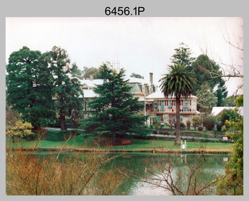
Photograph - Army Survey Regiment - Fortuna & Surrounds, Bendigo, c1985
This set of 30 photographs of the Army Survey Regiment’s Fortuna Villa and surrounding facilities was taken circa 1985. The photos feature much of Fortuna’s exterior and most of the out-buildings spread over the property’s fifteen acres of grounds. After Defence took possession of Fortuna in 1942, the Q-store and engineering workshops were added during the wartime period. Soldiers were accommodated in tents during WW2 for 20 years next to the parade ground before the construction of accommodation buildings in 1962. In 1990 most of the weatherboard buildings in the Q-store area were replaced. A climate-controlled building was also constructed to house a map library and digital data media. This photo set also includes the exterior of Air Survey Squadron’s Building 16 and two modular buildings -16A and 16B that were added in the early 1980s to accommodate map production and technical services. See item 6457.22P for photos of Fortuna Villa’s interior that were taken at the same time.This set of 30 photographs of the Army Survey Regiment’s Fortuna Villa and surrounding facilities was taken circa 1985. The colour photographs were printed on photographic paper and are part of the Army Survey Regiment’s Collection. The photographs were scanned at 300 dpi. .1) - Photo, colour, c1985. Fortuna Villa – view from the lake. .2) to .4) - Photo, colour, c1985. Fortuna Villa – front view. .5) - Photo, colour, c1985. Fortuna Villa – balcony view of transport compound and Air Survey Squadron. .6) - Photo, colour, c1985. Fortuna Villa – balcony view of Q-store and transport compound. .7) - Photo, colour, c1985. Fortuna Villa – balcony view of transport compound and Bendigo. .8) - Photo, colour, c1985. Fortuna Villa – balcony view of Q-store buildings. .9) - Photo, colour, c1985. Fortuna Villa – Pompeii Fountain and Stables. .10) - Photo, colour, c1985. Fortuna Villa – coach house. .11) - Photo, colour, c1985. Lithographic Squadron delivery docks. .12) - Photo, colour, c1985. Fortuna Villa - Original Roman Bath entry. .13) - Photo, colour, c1985. RAEME and carpentry buildings. .14) - Photo, colour, c1985. Q-store buildings. .15) - Photo, colour, c1985. Q-store buildings. .16) - Photo, colour, c1985. Transport compound. .17) - Photo, colour, c1985. Fortuna Villa’s original laundry, gardeners’ building. .18) - Photo, colour, c1985. Duty Room. .19) - Photo, colour, c1985. L to R: Side of Duty Room, RAP building. .20) - Photo, colour, c1985. Transport compound, Q-store in background. .21) - Photo, colour, c1985. Air Survey Squadron’s Building 16 viewed from carpark. .22) - Photo, colour, c1985. Technical Services, Building 16B. .23) - Photo, colour, c1985. Air Survey Squadron’s Building 16 courtyard. .24) - Photo, colour, c1985. Technical Services, Building 16B viewed from Building 16 courtyard. .25) - Photo, colour, c1985. Air Survey Squadron’s Building 16A and fernery viewed from walkway. .26) - Photo, colour, c1985. Officers Accommodation. .27) - Photo, colour, c1985. Other Ranks (OR’s) ‘New’ Barracks. .28) - Photo, colour, c1985. OR’s Kitchen and Dining Room. .29) & .30) - Photo, colour, c1985. Army Survey Regiment - Front Entry GateThere are brief descriptions on a note behind each photograph.royal australian survey corps, rasvy, army survey regiment, army svy regt, fortuna, asr -
 Bendigo Military Museum
Photograph - A Section, 1st Topographic Survey Troop, Vung Tau, Vietnam, 1966
... compilation and map revision; Engineer Survey Support in the camp... compilation and map revision; Engineer Survey Support in the camp ...This is a set of 12 photographs of A Section, 1st Topographic Survey Troop taken from the 25th of May to the 12th of June 1966 during their deployment to Vung Tau, Vietnam. Led by OC CAPT Bob Skitch, the ten personnel from A Section 1st Topo Svy Tp and six personnel from supporting units were the first contingent from the Royal Australian Survey Corps deployed to provide topographic support to the Australian Task Force in Vietnam. They arrived in Saigon, Vietnam on the 10th of June 1966 enroute to the Australian Reinforcement Unit (ARU) “back beach” camp in Vung Tau. The ten RA Svy technical personnel from 1st Topo Svy Tp deployed were: WO2 David Christie, SGT Stan Campbell, SGT Dave King, CPL Jim Roberts, CPL Dennis Duquemin, CPL Des Ceruti, SPR Derek Chambers, SPR Brian Firns, SPR Joe O’Connor and SPR Ron Smith. External personnel deployed were: WO2 Snow Rollston from Northern Command Field Survey Unit, T/CPL Peter Clarke – orderly room corporal, T/CPL Alan Carew – Technical Storeman, SPR Stan Johns – Map Storeman, SPR Boots Campbell – batman/driver and PTE BNF Brunning – cook. The ship featured in photos .1P and .2P was the aircraft carrier HMAS Sydney on its 4th voyage to Vietnam. On board were SGT Stan Campbell and SPR Brian Firns, tasked to manage A Section’s stores and equipment. The rest of A Section deployed to Vietnam by air on the chartered Qantas 707B ‘City of Longreach'. A Section’s main tasks were to establish a Theatre Grid, map compilation and map revision; Engineer Survey Support in the camp and to the civil community; give assistance to the Cordon Search Missions by producing large scale plots from aerial photos with every house and fence etc plotted; and then reproduce these by silk screening usually, within a 24-hour period. RA Svy’s support concluded with the withdrawal of Australian troops from Vietnam in 1972. More information on the A Section, 1st Topographic Survey Troop and the Army Survey Regiment’s supporting role is provided in pages 89 to 94 of Valerie Lovejoy’s book 'Mapmakers of Fortuna – A history of the Army Survey Regiment’ ISBN: 0-646-42120-4.This is a set of 12 photographs of A Section, 1st Topographic Survey Troop (1st Topo Svy Tp), taken from the 25th of May to the 12th of June 1966 during their deployment to Vung Tau, Vietnam. The black and white photographs were printed on photographic paper and are part of the Army Survey Regiment’s Collection. The photographs were scanned at 300 dpi. .1) &.2) - Photo, black & white, 1966. HMAS Sydney departing Woolloomooloo wharf en-route to Vietnam. .3) - Photo, black & white, 1966. A Section 1 Topo Svy Tp relaxing in a bar before deployment. OC CAPT Bob Skitch in centre of photo. .4) - Photo, black & white, 1966. Unidentified A Section 1 Topo Svy Tp personnel and troops from other units relaxing in a bar before deployment. .5) - Photo, black & white, 1966. A Section 1 Topo Svy Tp personnel arrival by bus at Saigon (Tan Son Nhut) Airport. OC CAPT Bob Skitch 4th from right. .6) - Photo, black & white, 1966. A Section 1 Topo Svy Tp personnel boarding the USAF Hercules aircraft enroute from Saigon (Tan Son Nhut) Airport to Vung Tau Airfield. OC CAPT Bob Skitch on left. .7) - Photo, black & white, 1966. A Section 1 Topo Svy Tp personnel and troops from other units boarding the USAF Hercules aircraft enroute from Saigon (Tan Son Nhut) Airport to Vung Tau Airfield. .8) & .9) - Photo, black & white, 1966. A Section 1 Topo Svy Tp personnel arrive at the Australian Reinforcement Unit (ARU) “back beach” camp. .10) - Photo, black & white, 1966. A Section 1 Topo Svy Tp personnel in oppressive conditions work on map products. .11) - Photo, black & white, 1966. Group photo of A Section 1 Topo Svy Tp. OC CAPT Bob Skitch on far right. .12) - Photo, black & white, 1966. Group photo of A Section 1 Topo Svy Tp. OC CAPT Bob Skitch 3rd from right.Annotated with the photo set - ‘ DET 1 Topo Svy Tp Vung Tau 25 May to 12 of Jun 66’royal australian survey corps, rasvy, army survey regiment, army svy regt, fortuna, asr, 1st topographical survey troop -
 Bendigo Military Museum
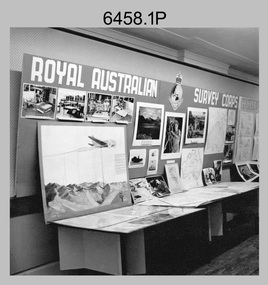
Photograph - Royal Australian Survey Corps role and technical capabilities display, c1960s
This is a collection of four photographs taken in the 1960s of Royal Australian Survey Corps displays promoting its role and technical capability to acquire, process and disseminate topographic information to the Australian Defence Force. Map products formed a large part of this topographic Support. The photos may have been taken at a Careers Expo or a Department of Defence promotion. It is possible the photos were taken at separate events. This is a collection of four photographs taken in the 1960s of Royal Australian Survey Corps displays promoting its role in Defence and technical capabilities. The black and white photographs were printed on photographic paper and are part of the Army Survey Regiment’s Collection. The photographs were scanned at 300 dpi. .1) to .4) - Photo, black & white, 1960s. Royal Australian Survey Corps Display at unknown location.There are no annotations.royal australian survey corps, rasvy, army survey regiment, army svy regt, fortuna, asr -
 Bendigo Military Museum
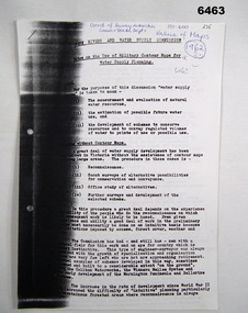
Administrative record - Use of Military maps for water supply planning, 1962
These are typed notes on the use of Military maps for water supply planning. This demonstrates the value of Military Mapping containing accurate relief information that can then be used for water supply planning.5 x A4 pages of typed notes, poorly photocopiedroyal australian survey corps, rasvy, fortuna, army survey regiment, army svy regt, asr, state rivers and water supply commission -
 Bendigo Military Museum
Photograph - Lithographic Squadron with DCP Students, Army Survey Regiment, Fortuna Villa, Bendigo, 1985
This is a set of six photographs of Lithographic Squadron personnel with Defence Cooperation Program (DCP) students at the Army Survey Regiment, Fortuna Villa, Bendigo Victoria, 1985. These informal and formal group photos were taken on the day of a CO’s Parade. Litho Squadron provided printing and photographic reproduction to the two DCP students. RA Svy also provided technical training to DCP students in map production skills such as, cartography and photogrammetry at the Army Survey Regiment and the School of Military Survey, Bonegilla. The Australian Defence Force over several years sponsored international students from counties such as Indonesia, Malaysia, Papua New Guinea, Philippines, Solomon Islands and Vanuatu. It is not known which South Pacific country these DCP students came from.This is a set of six photographs of Lithographic Squadron personnel with Defence Cooperation Program (DCP) students at the Army Survey Regiment, Fortuna Villa, Bendigo Victoria, 1985. The photographs are on 35mm negative film and were scanned at 96 dpi. They are part of the Army Survey Regiment’s Collection. .1) Photo, black & white, 1985. L to R: Warren ‘Waldo’ Shirley, Per Andersen, Trevor Osborne, Roy Hicks, Lance Strudwick, Steve Burke, Dale Hudson, Paul Baker, Ralph Chant, Peter Breukel, John ‘Flash’ Anderson, Chad Hardwick, Peter Imeson, DCP student John or Henry, unidentified, Greg Rowe, John South, unidentified, Mick ‘Buddha’ Ellis, John ‘Junior’ Whaling, Terry King, Daryl South, DCP student John or Henry, Bronwyn Jones, John Bateman, Kerron South, unidentified officer, Peter Dillon, Kim Reynolds, Rob Jones, unidentified, Jeff Lynch, Garry Hudson, Mark ‘Dogs’ Doherty, Jim Ash, Gavin Neilson, Jeff Willey, unidentified, Graham Johnston, Steve Egan, Peter Barrett, George Austen, Dave Miles. .2) - Photo, black & white, 1985. L to R: Warren ‘Waldo’ Shirley, Per Andersen, Trevor Osborne, Roy Hicks, Lance Strudwick, Steve Burke, Dale Hudson, Paul Baker, Ralph Chant, Peter Breukel, John ‘Flash’ Anderson, Chad Hardwick, Peter Imeson, DCP student John or Henry, unidentified, Greg Rowe, John South, unidentified, Mick ‘Buddha’ Ellis, John ‘Junior’ Whaling, Terry King, Daryl South, DCP student John or Henry, John Bateman, Kerron South, unidentified officer, Peter Dillon, Kim Reynolds, Rob Jones, unidentified, Jeff Lynch, Garry Hudson, Mark ‘Dogs’ Doherty, Jim Ash, Gavin Neilson, Jeff Willey, unidentified, Graham Johnston, Steve Egan, Peter Barrett, Dave Miles, George Austen. .3) - Photo, black & white, 1985. Photo Troop L to R: Steve Burke, Garry Hudson, Warren ‘Waldo’ Shirley, Ralph Chant, Gavin Neilson, DCP student John or Henry, Paul Baker, Trevor Osborne, Peter Imeson, Mick ‘Buddha’ Ellis, unidentified, John ‘Junior’ Whaling, DCP student John or Henry, Chad Hardwick, Terry King, Dave Miles, Graham Johnston, Kerron South, Bronwyn Jones, Rob Jones, unidentified. .4) - Photo, black & white, 1985. L to R: WO1 Jeff Lynch, DCP student John or Henry, CAPT John South, unidentified officer, DCP student John or Henry, WO2 Dave Miles. .5) & .6) - Photo, black & white, 1985. Print Troop L to R: Per Andersen, Daryl South, Lance Strudwick, Peter Dillon, DCP student John or Henry, Jeff Willey, John Bateman, Roy Hicks, Paul Davis, Dale Hudson, Kim Reynolds, Greg Rowe, Jim Ash, DCP student John or Henry, Mark ‘Dogs’ Doherty, Peter Breukel, Peter Barrett, unidentified, unidentified officer, Steve Egan, George Austen.No personnel are identified. Date and DCP students noted on film negative sleeve.royal australian survey corps, rasvy, army survey regiment, army svy regt, fortuna, asr, litho sqn, litho -
 Bendigo Military Museum
Photograph - Typesetting Equipment and Personnel, Army Survey Regiment, Fortuna, Bendigo, c1968 to 1979
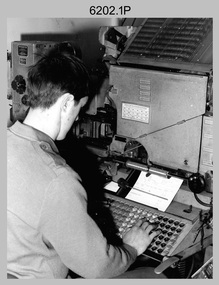
This is a set of nine photographs of cartographic typesetting equipment and personnel in Cartographic Squadron at the Army Survey Regiment, Fortuna, Bendigo circa 1968 to 1979. The rooms on the top floor of Fortuna Villa where the photos were taken were formally the nursery and boys bedrooms during the Lansell family’s occupation of the building. The Fotosetter type setting machine replaced the letterpress method of type production in 1956. Its operator entered the text using a type order provided by cartographic draughtsmen/ draughtswomen. The type was output on a film positive, which was contacted onto strip film. The text was cut out by cartographic draughtsmen/ draughtswomen and affixed onto type sheets using bees wax. Cartographic Squadron’s CPL Arty Lane specialised in the operation of the Fotosetter type setting machine for many years, as shown in photos .3P and .4P. For more information on the Fotosetter, see page 71 of Valerie Lovejoy’s book 'Mapmakers of Fortuna – A history of the Army Survey Regiment’ ISBN: 0-646-42120-4. The computer based Editwriter Model 7500 typesetting system was introduced in 1975 as a replacement to the aging Fotosetter. It was operated by a specialised technician, who generated a large variety of map type styles and sizes quickly and reliably, as well as text panels. Output on Copy proof adhesive backed stripping type film replaced messy wax and spray adhesives in 1978. The Editwriter capability supported all RASvy units and its contractor type setting requirements. SGT Jim McDonald operated the Editwriter for a couple of years in the late 1970’s. He is seen in photos .7P and .8P. reading off a type order and entering text into the computer. See item 6181.23P, photo .1P for a reduced scale photo of SGT Jim McDonald undertaking this task. Also see item 6123.12P photos .1P and .2P featuring CPL Paul Richards, who was another technician that operated the Editwriter for several years in the 1980s. The Editwriter was also operated by SSGT Pat Lumsden, as featured in photo .9P taken in 1979. The Monotype Photolettering Machine seen in photos .5P and .6P is understood to be in service for a shorter period, as it was not as productive compared to the Fotosetter and Editwriter. This is a set of nine photographs of cartographic typesetting equipment at the Army Survey Regiment, Fortuna, Bendigo, c1968 to c1979. Black and white photos are on photographic paper and scanned at 300 dpi. .1) - Photo, black & white, c1960s, Fotosetter type setting machine, unidentified technician. .2) - Photo, black & white, c1960s, Fotosetter type setting machine. .3) to .4) - Photo, black & white, c1968, Fotosetter type setting machine, CPL Arty Lane. .5) to .6) - Photo, black & white, c1970s, Monotype Photolettering Machine, unidentified technician. .7) to .8) - Photo, black & white, c1979, Typesetting machine, ‘Editwriter’ Model 7500, SGT Jim McDonald. .9) - Photo, black & white, 1979, Typesetting machine, ‘Editwriter’ Model 7500, SSGT Pat Lumsden.Personnel and equipment are identified in photos .1P to .3P. on a card. A description is provided: ‘Fotosetter: This model was used from 1956 to 1974. Where photograph was taken: Army Survey Regiment. Person in Photograph: Arty Lane. Approx date photograph taken: 1968. Any Misc Information: All type on maps was set on this machine. The operator of the machine (Ex SGT Lane) joined the Army in 1956 and was discharged in 1977. Also with Survey from 1942 to 1946. Information given by: Arty Lane’. Photo .9P is dated 1979 on the back.’royal australian survey corps, rasvy, army survey regiment, army svy regt, fortuna, asr, carto -
 Bendigo Military Museum
Photograph - AHQ Survey Regiment Open Day, Fortuna Villa, Bendigo, c1958
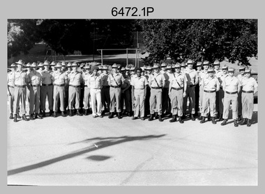
This is a set of three photographs of an Open Day held at the AHQ Survey Regiment, Bendigo c1958. It’s evident in the background of these group photos there were displays of field surveying equipment. It is known an Open Day was held on the 2nd of November 1958. As the CO LTCOL Lindsay Lockwood MID is positively identified, it’s highly probable these photos were taken at that time. LTCOL Lindsay Lockwood was the CO of the AHQ Survey Regiment from 1951 to 1962. As the longest serving commanding officer of the unit, there was many changes implemented under his command. He decided an Open Day was the best way for the local community in Bendigo to gain an insight into the unit’s important role as Defence’s map production agency, its technical equipment, and its economic importance to Bendigo. It also gave them an opportunity to tour through historic Fortuna Villa. In the background of photo .1P above the man on the right is a sign with the following text: ‘STAR OBSERVING EQUIPMENT.’ LTCOL Lindsay Lockwood’s period as CO is covered in more detail in pages 48-49 of Valerie Lovejoy’s book 'Mapmakers of Fortuna – A history of the Army Survey Regiment’ ISBN: 0-646-42120-4. Also refer to page 75 for more detailed information on the Open Day held in 1958. This is a set of photographs of an Open Day held at the AHQ Survey Regiment, Bendigo c1958. The photographs were printed on photographic paper and are part of the Army Survey Regiment’s Collection. The photographs were scanned at 300 dpi. .1) - Photo, black and white. Unidentified civilian visitors, 2nd from left: LTCOL Lindsay Lockwood MID. .2) - Photo, black and white. Unidentified Army Padre (centre) and civilian visitors. .3) - Photo, black and white. Unidentified civilian visitors..1P – annotated on back ‘COL LOCKWOOD’ .2P – no annotations .3P – annotated ‘Bishop Rich-e-a-‘royal australian survey corps, rasvy, army survey regiment, army svy regt, fortuna, asr -
 Bendigo Military Museum
Photograph - Photogrammetric Equipment – Army Survey Regiment, Fortuna, Bendigo, c1960s to c1980s
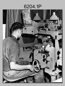
This is a set of eight photographs of technicians operating photogrammetric equipment in Air Survey Squadron, Army Survey Regiment, Fortuna, Bendigo. c1960s to c1980s. The Wild A9 Stereocomparator and Wild B9 stereo plotter were introduced in 1962. The Wild B8 stereo plotter was introduced in 1966. Technicians used the Wild A9 Stereocomparator to accurately measure between pass, tie, and survey control points on aerial photographs. The Wild B9 and B8s were used for plotting topographic detail and contours. These analogue machines were manually controlled by adjusting the control knobs for the orientation of the 3D image. The B9s used a four and a half square, and the B8s used a nine-inch square photo image on a film or glass diapositive which allowed highly accurate extraction of map features. At first, plotting with B8 and B9 stereo plotters was undertaken at the aerial photography scale of 1:80,000 in pencil onto a controlled plotting sheet. Sheets were then inked up and reduced photographically to the 1: 100,000 publication scale for scribe impression production. In the early days topographic detail and contours were plotted with a pencil or ink pen mounted at the far end of the pantograph arm. The plotting procedure was upgraded to direct plotting in ink with photographic reduction to publication scale. In 1975 four B8s were upgraded with tri-axis locaters as part of the Input Sub-system to enable digital extraction to AUTOMAP 1’s topographic database. When AUTOMAP 2 was introduced in 1982 these B8s were upgraded, and additional machines added to expand the Army Survey Regiment’s digital capture capability. This is a set of eight photographs of technicians operating photogrammetric equipment in Air Survey Squadron, Army Survey Regiment, Fortuna, Bendigo. c1960s to c1980s. Black and white and colour photos are on photographic paper and scanned at 300 dpi. .1) - Photo, black & white, c1965. Unidentified technician operating a Wild A9 Stereocomparator. .2) - Photo, black & white, c1965. Unidentified technician operating a Wild B9 stereo plotter. .3) - Photo, black & white, c1967. L to R: Unidentified technician, SPR Ken Jeffery operating a Wild B9 stereo plotter. .4) - Photo, colour, c1974. Unidentified technician, operating a Wild B8 stereo plotter. .5) - Photo, black & white, c1974. Unidentified technician operating a Wild B8 stereo plotter. .6) to .7) - Photo, black & white, c1979. Unidentified technicians operating a Wild B8 stereo plotter. .8) - Photo, black & white, c1985. Unidentified technician in AUTOMAP 2 operating a Wild B8 stereo plotter..1P, .2P, .4P, .5P, .7P – no annotations. .3P – annotated ‘Standing - , Seated SPR Ken Jefferies (sic). .6P – annotated with date ‘1979’ .8P – annotated ‘AUTOMAP 2’royal australian survey corps, rasvy, army survey regiment, army svy regt, fortuna, asr, air survey, photogrammetry