Showing 3212 items
matching road maps
-
 Surrey Hills Historical Society Collection
Book, Camberwell Council - Open Space Strategy: paper 10, 1982
Series title: Camberwell Council Leisure study: discussion papers on leisure; 10 126p.; maps; This discussion paper only present draft policies, and are published in this form to obtain the opinions of the community, councillors, field-workers and experts.126p.; maps; This discussion paper only present draft policies, and are published in this form to obtain the opinions of the community, councillors, field-workers and experts.open spaces, camberwell, victoria, recreational use -
 Surrey Hills Historical Society Collection
Book, On these pleasant slope's: a story of Surrey Hills, 2015
Sourced via conversations with those interested in Surrey Hills History. Including Alan Holt, Jack McLean, Frank Bamford, Jocelyn Hall. Includes: Topographical maps, first Elgar Survey. First Wesleyan Church in Surrey Hills. Bibliography on P.50 (last numbered page) Provides a chronological history of Surrey Hills. Includes: First settlers, location, early land sales, commerce and trade.Provides a chronological history of Surrey Hills. Includes: First settlers, location, early land sales, commerce and trade.Back of Title page: To the Surrey Hills Historical / Arthur E. Tonkinfreehold investment and banking company, windsor park estate, (mr) dennis delany, mont albert village, surrey hills - history, royal hotel, surrey hills, humberstone's hotel, chatham state school, holy trinity church, lydswood, lugano, (mr) john butler maling, (mr) john hanlon knipe, mont albert primary school, (mr) james sneddon, (mr) arthur tonkin -
 Surrey Hills Historical Society Collection
Book, Medlow Garden Survey and Landscape capability study 1983, Oct-83
Includes: Plan of Subdivision, Detailed plan, map of garden, Auctioneer's plan for 1854 sale, Botanical plan of Medlow & Landscape history notes. Full title : Medlow Garden survey and landscape capability survey. A report for the National Trust of Australia (Victoria) A report giving a detailed landscape survey of Medlow Garden estate. Includes landscape story, cultural significance, particulars about vegetarian, garden, rehabilitation and plans.Copy of a report giving a detailed landscape survey of Medlow Garden estate. Includes landscape story, cultural significance, particulars about vegetarian, garden, rehabilitation and plans. 38 pages with illustrations.land surveys, medlow garden, bismark estate, rosalie estate, warrigal road, surrey hills, bismarck avenue, warwick avenue, t p payne, (mr) hugh glass, boroondara, (mr) (maj) - cairncross, (mrs) mary jane cairncross, (dr) (mr) richard joseph bull, (mrs) catherine grace bull, (miss) norma bull, (mr) ronald richard bull, medlow -
 Surrey Hills Historical Society Collection
Book, Historic Places Investigation Draft Proposals Paper, 2015
Draft Proposals paper for Victorian Environmental Assessment Council's (VEAC) Historic Places investigation, written for community consultation purposes.Draft Proposals paper for Victorian Environmental Assessment Council's (VEAC) Historic Places investigation, written for community consultation purposes. colour illus. mapshistory buildings, historic sites, public lands -
 Surrey Hills Historical Society Collection
Book, Connie's Story: Commemorating the life of Mrs Edward (Plorn) Dickens, 2014
Purchased by the Surrey Hills Historical Society for the Surrey Hills Neighbourhood Centre History collection. Includes: illustrations, maps, portraits. Connie Dickens is believed to have spent some of her last year(s) in Surrey Hills. Traces the life of Mrs Edward (Plorn) Dickens, born in 1859 at River-View, Kangaroo Point, Tasmania, the third daughter of Alfred and Emily Desailly (nee Stanfield).Traces the life of Mrs Edward (Plorn) Dickens, born in 1859 at River-View, Kangaroo Point, Tasmania, the third daughter of Alfred and Emily Desailly (nee Stanfield).(mrs) constance emily rose dickens, (mrs) edward (plorn) dickens, (dr) (mr) francis desailly, (mr) alfred desailly, (miss) constance emily rosa desailly, (miss) emily desailly, (miss) florence eva desailly, (mrs) (ann) nancy sophia desailly, box hill cemetery -
 Surrey Hills Historical Society Collection
Book, Medlow Garden Survey and Landscape capability study 1983, Oct-83
Includes: Plan of Subdivision, Detailed plan, map of garden, Auctioneer's plan for 1854 sale, Botanical plan of Medlow & Landscape history notes. Full title : Medlow Garden survey and landscape capability survey. A report for the National Trust of Australia (Victoria) A report detailing the landscape survey of Medlow Garden estate. Includes landscape history, cultural significance, particulars about vegetarian, garden, rehabilitation and plans.A report detailing the landscape survey of Medlow Garden estate. Includes landscape history, cultural significance, particulars about vegetarian, garden, rehabilitation and plans. 38 p illland surveys, medlow garden, bismark estate, rosalie estate, warrigal road, surrey hills, bismarck avenue, warwick avenue, t p payne, (mr) hugh glass, boroondara, (maj.) (mr) - cairncross, (mrs) mary jane cairncross, (dr)(mr) richard joseph bull, (mrs) catherine grace bull, (miss) norma bull, (mr) ronald richard bull, medlow, house names, (mr) rex swanson, landform australia -
 Surrey Hills Historical Society Collection
Photograph, Grovedale Road Quarry in the 1920s - looking south, c1920
The quarry was part of John Butler Maling's property. He was one of the original settlers of the area and farmed the area between Weybridge Street and Whitehorse Road. Clay was quarried from part of this area and used to make the bricks used in the construction of his home, known as 'Ancyra'. This is still extant at the corner of Weybridge and James Streets. Maling grazed cows and used the quarry as a water source. He was the uncle of John Butler Maling, Mayor of Camberwell. He was married to Kate Conlon in 1882. They had 3 children: Silas Young, Alick and Zillah. Maling was born in c1829 in Shepreth, Cambridgeshire; he died in Surrey Hills on 9 October 1912 and is buried in Box Hill Cemetery - CE-*-0586. Mrs Kate Maling (born c1859 in Co Meath, Ireland) died at the property on 8 March 1921. She is buried in Brighton General Cemetery. Probate was valued at over 10,000 pounds and included other properties in Sandringham, Hawthorn and Macedon. At the time of her death the Surrey Hills property was described as being 23 acres with 2 brick houses, 1 cow, 2 heifers and 40 fowls or chickens. The property was subdivided after her death. The property was subdivided into 110 house blocks in c1923 - see Maling's Estate subdivision flyer on the State Library of Victoria's website. This shows that the Grovedale Park site had been acquired by Camberwell Council by this time. An attached newspaper clipping documents prices realised for a cross-section of blocks. The MMBW map of 1925, also on the SLV website, shows the outline of the clayhole / quarry. The quarry was filled in after several drownings or near drownings and the land is now occupied by a park and playground, known as Grovedale Road Park, maintained by the City of Boroondara. Beckett Park is sited on horizon to the left beyond the trees. This documents the landscape prior to close settlement and is material to early building and farming in the Surrey Hills area.Black and white photo of the quarry between Grovedale Road and James Street taken in the 1920s and looking south. In the foreground is an area of water with reeds in the LH corner. Beyond on the high banks there are single storey houses in the background and (?) some light poles. An object that looks like a tank on posts is in a cutting on the far bank.quarries, grovedale road, james street, clay quarries, farming, kate conlon, kate maling, john butler maling, ancyra -
 Surrey Hills Historical Society Collection
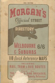
Book, Morgan's Official Street Directory, c1940s
incl.index. This Street Directory of Melbourne and suburbs, c1940s, includes a list of suburbs, their mileage from the city and how to reach them; an index to localities as well as the index to streets appearing on the maps. It also shows bus routes, railways and tramways routes on the maps.incl.index. This Street Directory of Melbourne and suburbs, c1940s, includes a list of suburbs, their mileage from the city and how to reach them; an index to localities as well as the index to streets appearing on the maps. It also shows bus routes, railways and tramways routes on the maps.melbourne metropolitian area, suburbs, cities and towns, maps -
 Surrey Hills Historical Society Collection
Folder of information, Libby Cavenagh's 1990 building census of Wandsworth Road, Surrey Hills, 1990
Libby Cavenagh was Secretary of the Surrey Hills Historical Society. She completed this study as part of a Diploma of Local History she was undertaking at the University of New England. At the time she lived in Wandsworth Road.This is a unique analysis of the housing stock of a complete street at one point in time. Many of the houses have been altered since the study was completed and quite a number have been demolished.Blue folder of A4 size. This contains an analysis of each house in Wandsworth Road in 1990 with details regarding building style, approximate age, materials used, fence design, presence or absence of a garage or carport and some comment on the garden elements. For most entries there is a coloured photo taken from the street. For some there are photocopies of real estate advertisements. There are a number of appendices including s a map of the breakdown of styles and materials; date of construction and other information from the Camberwell Building registers 1890-1934; entries re owners from Sands & McDougall directories, 1897-1937; map from Land Titles Office showing sub-division information; land auction advertisements; information re W J Vine; list of builders; references.wandsworth road, libby cavenagh -
 Surrey Hills Historical Society Collection
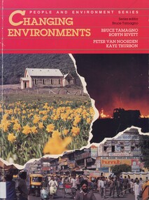
Book, Changing environments, 1990
There is a chapter dedicated to the physical and built environment of Surrey Hills and surrounding area. It includes maps drawn from the work of Alan Holt. The late Robyn Rivett (Rhodes) taught geography before becoming a curriculum adviser within the Education Department. She lived in Surrey Hills.Surrey Hills Neighbourhood Centre - historyhuman ecology, anthropo - geography, (mr) bruce tamango, people and environment series, streetscapes, (mrs) robyn rivett, (mrs) robyn rhodes, (mr) alan holt, surrey hills -
 Surrey Hills Historical Society Collection
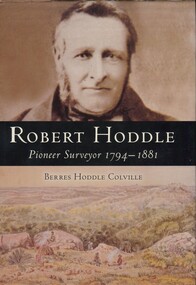
Book, Robert Hoddle: pioneer surveyor 1794-1881, 2004
(Ms) Berres Hoddle Colville is a local Surrey Hills resident and is a descendant of Robert Hoddle. Robert Hoddle was the first Surveyor General of Victoria. He arrived in Australia in 1823 and was one of the very earliest surveyors to explore, measure and map large areas of this vast, varied and difficult countryside, in a burgeoning era of pastoral settlement. 1837 saw him appointed Surveyor in Charge of the Port Phillip District. This book is based firmly on substantial extracts from Hoddle's own diary and other writings. Includes black and white sketches, maps and colour pages.Robert Hoddle was the first Surveyor General of Victoria. He arrived in Australia in 1823 and was one of the very earliest surveyors to explore, measure and map large areas of this vast, varied and difficult countryside, in a burgeoning era of pastoral settlement. 1837 saw him appointed Surveyor in Charge of the Port Phillip District. This book is based firmly on substantial extracts from Hoddle's own diary and other writings. Includes black and white sketches, maps and colour pages.Front endpaper: SURREY HILLS HISTORICAL / SOCIETY / PURCHASED FROM / THE AUTHOR ON THE OCCASION / OF HER TALK ON ROBERT HODDLE / TO THIS SOCIETY ON 17-10-[20]05 Title page: signed by the author: Berres Hoddle Colville / 17 October 2005 /(mr) robert hoddle, surveyors, (ms) berres hoddle colville -
 National Wool Museum
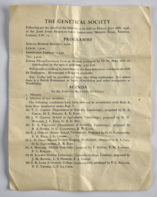
Document - The Genetical Society, 1946
This item is associated with the Secretary of the New South Wales Graziers Association, Mr J. W. AllenFour page folded leaflet outlining the agenda for a business meeting. A map is printed on the back page.Front: THE GENETICAL SOCIETY / Following are the details of the MEETING to be held on FRIDAY, JULY 26th, 1946, / at the JOHN INNES HORTICULTURAL INSTITUTION, MOSTYN ROAD, MERTON, / LONDON, S.W. 19. -
 Vision Australia
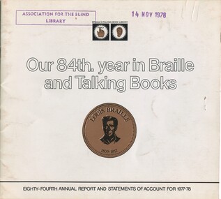
Administrative record - Text, Our 84th year in Braille and Talking Books: eighty-fourth annual report and statements of account for 1977-78, 1978
Annual report of the Braille & Talking Book Library including Minutes of the AGM, Board of Director's Report, President's report and financial statements. Items also included are: acknowledgement of the work on Thomas Luxton as foundation president, having a stand at the Royal Melbourne Show, acknowledgement of Joan Cunnington for working 50 years as a transcribing and producing the most volumes (789) of any transcriber, display of a thermoform map designed by 2nd year Architecture students of the Melbourne University campus, Sir Paul Hasluck winning the Braille Book of the Year award, first edition of Library Talk audio magazine, congratulations from the Federation of Blind Citizens on providing 2 track cassettes, retirement of Alice McClelland and Geoffrey Wilson, and a delegate attending the Australian and New Zealand Association of Teachers of the Visually Handicapped conference,1 volume of illustrations and textbraille and talking book library, annual reports -
 Vision Australia
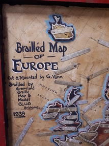
Map - Object, Brailled Map of Europe, 1939
This tactile map of Europe was created in 1939, and brailled by the Queensland Braille Map and Model Club. Cut and mounted by G. Vann with geographical inforamtion provided by Miss E Southern. The Queensland Braille Map and Model Club was a volunteer organisation which produced tactile maps from the 1920s to the late 1940s. These were sent as presents to schools, organisations and missions for people who were blind or vision impaired around Australia, New Zealand, Syria, India, Canada, Papua New Guinea and Africa. Due to free postage of Braille obtained by Tilly Aston and her compatriots, the maps were transported gratis within Australia and at a cheap rate overseas. When this map was made, East Prussia, Danzig and the Levant States were all separate countries. Some information about each country (name, area in sq miles and population) is written on a small door on the right hand side, which can be opened to reveal the same information in Braille. At the base is a braille and handwritten note "Information about maps gratis from Miss E Southern "Kingsley" George St, Brisbane. "For lending to the Blind" is written at the base of the wooden frame.1 paper attached to wooden mount with metal labels, on the right hand side a small door with country information on the front and opens to reveal the same in Braille. queensland braille map and model club, r.f. tunley -
 Vision Australia
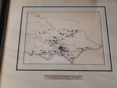
Map - Object, Victorian railways map
A black and white map of Victoria showing the railway lines where mail is transported and the individual towns listed next to the dot that provides location of such. Underneath is written "Map of Victoria showing the localities beyond the suburbs of Melbourne to which library books are sent to blind members. Books are carried over the railways FREE there is no charge to the readers." Through the work of Tilly Aston, braille postage was provided free by the Victorian Railways which greatly assisted the Braille Library in reaching members who resided outside of Melbourne. This map was produced to show the extent of the work by the Victorian Association of Braille Writers and the need for reading materials across the state.Paper of Victorian railway lines mounted in framevictorian association of braille writers, marketing -
 Vision Australia
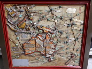
Map - Object, Map of Australia, Polynesia, Melanesia and Malaysia, 1939
... Vision Australia 454 Glenferrie Road Kooyong melbourne ...Tactile map of Australian states and territories, as well as various countries and islands in the South Pacific region, including Papua New Guinea, Indonesia and the Malay peninsula. 1 paper map with tactile metal markers in red and brown framesqueensland braille map and model club, r.f. tunley -
 Vision Australia
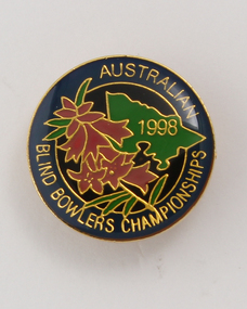
Badge - Object, Australian Blind Bowlers Championships 1988, 1988
Gold circular badge with enamel front, back pin and part of the map of Victoria in green. Floral design in pink and green on dark blue background with gold lettering.Gold enamel circular badge with gold writing and outline of Victoria and pink heath (state emblem)Australian Blind Bowlers Championships 1988recreation, badges -
 Vision Australia
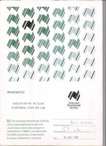
Certificate - Text, Association for the Blind: Bicentennial River Run 1988, 1987
Certificate reads "Awarded to Association for the Blind Bicentennial River Run 1988. By the Australian Bicentennial Authority which was established to plan and coordinate a nationwide program of celebrations in 1988 to commemorate the 200th anniversary of permanent European settlement in Australia" Signed by the Chairman: Victoria Council (illegible) and Executive Director (illegible), dated 30th July 1987. All text on this certificate is located on the bottom half of the document. The top half is populated by a repeated stylised graphic of a map of Australia, in various shades of green and gold. There is also a gold version of the same logo, labelled with "Endorsed Bicentennial Activity" , situated above the official signatures. 1 certificate with Australia imageryassociation for the blind, awards -
 Vision Australia
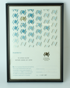
Award - Text, Certificate awarded by the Australian Bicentennial Authority, 2 July 1987
Certificate reads "Awarded to Association for the Arthur Wilkins Northern Suburbs Day Centre. By the Australian Bicentennial Authority which was established to plan and coordinate a nationwide profram of celebrations in 1988 to commemorate the 200th anniversary of permanent European settlement in Australia" Signed by the Executive Director (illegible), dated 2nd July 1987. All text on this certificate is located on the bottom half of the document. 1 x paper certificate from Australian Bicentennial AuthorityThe top half is populated by a repeated stylised graphic of a map of Australia, in various shades of green and gold. There is also a gold version of the same logo, labelled with "Endorsed Bicentennial Activity" , situated above the official signatures. arthur wilkins centre, essendon, association for the blind -
 Vision Australia
Administrative record - Text, The Association for the Blind, Blind Members' Council meeting minutes 24/2/1986 to 25/9/91, 1986-1991
These meetings were held at the Kooyong office and the minutes include Present, Chair, Apologies, Minutes, Matter arising from minutes, Correspondence, Life governors, Election of members, Nominations, Reports from Regional Blind Members groups. Some highlights include: 27/10/1986 it was reported that tactile maps of the Melbourne Metropolitan Railway network are now available. 6/2/1987 as special meeting had been called to discuss in detail what action should be taken regarding the proposed $2 coin. John Cook advised that BMC had been invited to send a representative to Canberra to meet with other Blind consumers and representatives from the Mint and Treasury. The BMC agreed the coins needed further testing. 29/2/1988 The Treasury received further letters regarding the $2.00 coin. It was agreed this matter could not be pursued any further. 26/11/1990 it was reported that the commissioned by BMC of the Association's founder Miss Tilly Aston, was officially unveiled by Mrs Jean Ross and Mrs Diana Jones at the 95th Birthday Celebration Concert. The portrait was then hung in the foyer of the Vision Resource Centre. Suitably framed photographs of the founder's portrait to be circulated to all branches. The visits to primary schools by BMC members continued as part of the School's program as did the BMC radio program on 3RPH. Minute book for Blind Members Councilassociation for the blind, blind members council -
Vision Australia
Text, The Association for the Blind, Blind Members' Council meeting minutes 25/3/1991 to 7/2/1994, 1991-1994
These meetings were held at the Kooyong office and the minutes include Present, Chair, Apologies, Minutes, Matter arising from minutes, Correspondence, Life governors, Election of members, Nominations, Reports from Regional Blind Members groups. Some highlights include: 27/7/1992 Mr Ian Moore reported where possible a volunteer driver will be provided to transport members to and from day centres. Where a volunteer driver is not available a taxi will be arranged at the member's expense, with financial hardship cases assisted. 4/3/26/4/1993 a tactile map of AFB Centres has been produced with the assistance of Mr. Danby for members' information. 31/5/1993 it was reported a donation by Mr John Wicking of $50,000 was received to enable the History of the Association to be written by Mr John Wilson. 1 bookassociation for the blind -
 Port Fairy Historical Society Museum and Archives
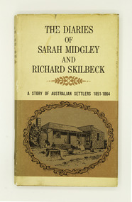
Book, Cassell Australia, The Diaries Of Sarah Midgley And Richard Skilbeck: A Story of Australian Settlers 1851-1864, 1967
The diary of Sarah Midgley -- Letters -- The diary of Richard Skilbeck -- Afterword -- Richard Skilbeck's obituary.viii, 208 p., [17] p. of plates : ill., maps (lining-papers), ports ; 25 cm.non-fiction The diary of Sarah Midgley -- Letters -- The diary of Richard Skilbeck -- Afterword -- Richard Skilbeck's obituary.midgley, sarah, 1831-1893 -- diaries, skilbeck, richard, 1838-1924 -- diaries, frontier and pioneer life -- victoria, koroit (vic.) -- history -- sources, book -
 Port Fairy Historical Society Museum and Archives
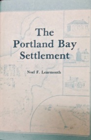
Book, The Historical Committee Of Portland, The Portland Bay Settlement, 1934
Aboriginal resistance to settlement, Native Police Force, G.A. Robinsons proposal to re-settle Flinders Island people and extracts fom his 1841 expedition report. Contents I. The early navigators and explorers II. Sealers and whalers and tales of the sea III. The Hentys and Victoria's first permanent settlement IV. Early incidents and personalities V. Under government control Vi. Social life and activities VII. The story of the press VIII. Business, professions and industry IX. Hotels and roads X. Sport XI. Environs of Portland XII. Miscellaneous historical items.8vo; pp. x, 285; frontispiece, numerous b/w illustrations, plans and maps two of which are folding, index, appendices including "List of Purchasers at original land sale", "First Election List", "Subscription lists for both First Church of England and First Presbyterian Church", original blue cloth, title in gilt on spinenon-fictionAboriginal resistance to settlement, Native Police Force, G.A. Robinsons proposal to re-settle Flinders Island people and extracts fom his 1841 expedition report. Contents I. The early navigators and explorers II. Sealers and whalers and tales of the sea III. The Hentys and Victoria's first permanent settlement IV. Early incidents and personalities V. Under government control Vi. Social life and activities VII. The story of the press VIII. Business, professions and industry IX. Hotels and roads X. Sport XI. Environs of Portland XII. Miscellaneous historical items.robinson, george augustus, 1791-1866., government policy - initial period and protectionism - 1788-1850., government policy - state and territory - victoria., law enforcement - police - native police., race relations - violent - massacres, murders, poisonings etc. - to 1900., sport., pioneers -- victoria -- portland., portland (w vic sj54-11), portland (vic.) -- history., book -
 Port Fairy Historical Society Museum and Archives
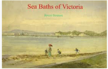
Book, Bennett, Bruce, Sea Baths of Victoria, 2013
This is the story of the sea baths in Victoria from earliest settlement in 1837. Their development and growth followed the prosperity of Victorian society for nearly a hundred years.152 pages : illustrations (some colour), maps ; 22 x 31 cm. Includes bibliographical references (pages 146-150) and index.This is the story of the sea baths in Victoria from earliest settlement in 1837. Their development and growth followed the prosperity of Victorian society for nearly a hundred years.baths, sea -- history., bathing beaches -- australia -- victoria -- history., public baths -- australia -- victoria -- history., public baths., sea., bathing beaches -- australia., public baths -- victoria -- 19th century., public baths -- victoria -- 20th century., sea -- australia -- victoria -- history., book -
 Port Fairy Historical Society Museum and Archives
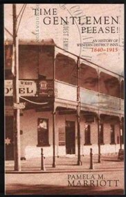
Book, Pam Marriott, Time gentlemen please! : an history of Western District inns, 1840-1915, 2001
Time Gentlemen Please! : A History of Western District Inns 1840-1915 An historical record of the public houses, which flourished in Belfast and Western District during the timeframe, complete with licensees.xix, 327 p. : ill., map, ports. ; 24 cm. Includes indexnon-fictionTime Gentlemen Please! : A History of Western District Inns 1840-1915 An historical record of the public houses, which flourished in Belfast and Western District during the timeframe, complete with licensees.bars (drinking establishments) -- victoria -- western district, victoria -- social life and customs -- 1901-1945, victoria -- social life and customs -- 1834-1900, book -
 Port Fairy Historical Society Museum and Archives
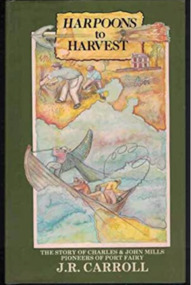
Book, Warrnambool Institute Press, Harpoons to harvest : the story of Charles and John Mills, pioneers of Port Fairy / J.R. Carroll, 1989
The story of Charles and John Mills, pioneers of Port Fairy. Includes genealogical information.xv, 286 p., [12] p. of plates : ill., geneal. tables, maps, ports. Includes index. Geneal. tables on lining papers. Bibliography: p. 225-260non-fictionThe story of Charles and John Mills, pioneers of Port Fairy. Includes genealogical information. maritime, mills, john brabyn, 1810-1877, charles frederick, 1812-1855, mills family, pioneers -- victoria -- port fairy -- biography, pioneers -- tasmania -- biography, australian history, biography, exploration, genealogy, harbour master, mills : charles and john, mills brothers, port fairy, shipping, warrnambool history, whaling, wrecks, book -
 Port Fairy Historical Society Museum and Archives
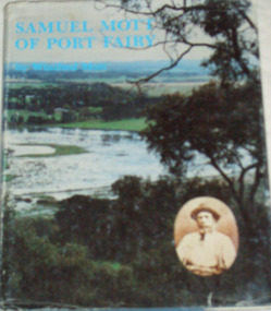
Book, Roebuck, Samuel Mott of Port Fairy, 1984
Samuel Mott of Port Fairy, his background and descendantsviii, 266 p. : ill., facsims., geneal. tables, maps, ports. ; 27 cm. Map and geneal. tables on lining papers. Bibliography: p. viii.non-fictionSamuel Mott of Port Fairy, his background and descendantsmott, ca1790-1873. samuel, mott family, victoria -- genealogy, port fairy history, book -
 Port Fairy Historical Society Museum and Archives
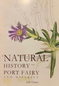
Book, Port Fairy Historical Society, A Natural History of Port Fairy and District, 2009
Natural history of Port Fairy Includes bibliographical references and index136 p. : ill., maps, ports. ; 22 cm.non-fictionNatural history of Port Fairy Includes bibliographical references and indexnatural history -- victoria -- port fairy., natural history, honan jodie, book -
 Vision Australia
Photograph - Image, Jack Chamberlain reading a tactile map of Sydney with Val Hickey, 1970?
Jack Chamberlain (P.R.O.) feeling a relief map of Sydney's CBD, with Val Hickey (Publicity Officer).2 x B/W photographs of man looking at transit map4/70414 and 6/70414royal blind society of nsw, jack chamberlain, val hickey, maps -
 Vision Australia
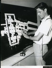
Photograph - Image, Ron Goodwin reading a map of Wynyard train station, 1969?
Ron Goodwin reads a tactile map of Wynyard Railway Station in Sydney's CBD. The map was made at the Sydney Tesol College with wood working machinery and painting/decorating sections. In front of Ron sits a ultrasonic torch.B/W photograph of man looking at relief map of Wynyard Station14/69051 Ann. Report Orientation - historicalroyal blind society of nsw, ron goodwin, maps