Showing 15563 items
matching stillwell-valley
-
 Bendigo Historical Society Inc.
Document - ANCIENT ORDER OF FORESTERS NO. 3770 COLLECTION: ACCOUNT/RECEIPT
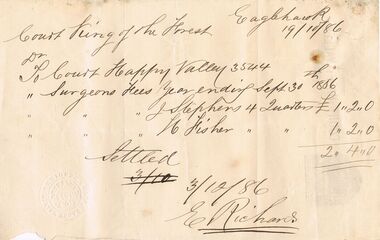
Account/receipt written on the back of a piece of memo paper with the Court Happy Valley name and logo on the back. Dated 19/10/86. Dr. To Court Happy Valley 3544. To Surgeons Fees Year ending Sept 30 1886. Surgeons Fees J. Stephens 4 Quarters £1.2.0 and ? Fisher 4 Quarters £1.2.0. Total £2.4.0. Settled 3/12/86 signed E. Richards. In the bottom left corner is a round impression:- Court Happy Valley. Bendigo and in the centre:- A.O. F. 3544 Eaglehawk.societies, aof, correspondence, ancient order of foresters no. 3770 collection - account/receipt, court king of the forest, court happy valley 3544, j stephens, ? fisher, e richards -
 Kew Historical Society Inc
Photograph - Yarra Valley Floods: Kew East, 1916
Flooding of the Yarra Valley, including that section of the Yarra bordering Kew and Kew East in the north and west of the municipality, was a regular occurrence. Extreme flood events of the Yarra River are recorded to have occurred in 1891, 1901, 1916, 1923 and 1934. The Municipality of Kew's response to these floods was to enact planning decisions restricting residential development in flood prone areas following the floods of 1916, 1921 and 1934. While floods continued after the development of the Upper Yarra Reservoir (construction 1948-57), the regularity and extent of these inundations diminished. During the nineteenth century, the land abutting the south side of the Yarra in Kew was devoted to dairy farming. In the twentieth century, before and after the construction of the Eastern Freeway, much of this low-lying area was used as golf courses and public parks.One of a collection of photographs of flooding in the Kew section of the Yarra Valley which are in important research resource for the location and extent of flooding in the first half of the twentieth century. Flooding of the Yarra Valley at East Kew in 1916. The view is taken from a street (maybe Birdwood Avenue) intersecting with Kilby Road looking northeast across the flood waters to Ivanhoe and Heidelberg. The extensive flooded area shown in the photograph would have included remnant dairy farms and the Kew Golf Club. Verso: "Floods / Yarra River / East Kew / Kilby Road / 1917? / 87"yarra river, yarra valley, floods -- kew, kilby road -- kew (vic.), kew golf club -
 Bendigo Historical Society Inc.
Postcard - POSTCARD. PICTURESQUE ROCKY VALLEY TINTAGEL
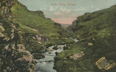
2 Postcards. Picturesque Rocky Valley Tintagel. Rear. Both addressed to Miss Alice Absalon, Lester Street, Eaglehawk, Bendigo. -
 Uniting Church Archives - Synod of Victoria
Decorative object - Presbytery Banner, Late 1970s
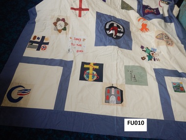
Handmade patchwork banner with mid-blue cotton backing and edging. The patches ae from churches within the Presbytery of Yarra Valley.yarra valley presbytery -
 Hume City Civic Collection
Photograph, c late 1980s
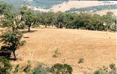
The series of photographs show a number of sites included in the Rupertswood Estate. By 1851 William Clarke had acquired 31,375 acres of land in the Sunbury district. The foundation stone for Rupertswood Mansion was laid on 29th August 1874 by Mrs. W. J. Clarke, daughter-in-law of 'Big Bull'. The Salesian Fathers bought the Rupertswood property in June 1927 and established Salesian College.A coloured photograph of an open valley with scrub which is part of the original Rupertswood Estate. This land is north of the mansion and existing Salesian College.rupertswood estate, clarke, william j. t. 'big bull', salesian brothers, george evans collection -
 Lakes Entrance Regional Historical Society (operating as Lakes Entrance History Centre & Museum)
Book, Gippsland Heritage Journal, 1993
No 15 of a series of Journals showcasing areas of Gippsland Victoria history includes items on Cassilis, Maffra, Yallourn, Omeo and Tarra Valley.periodicals, township -
Lakes Entrance Regional Historical Society (operating as Lakes Entrance History Centre & Museum)
Book, Davidson W H, Back to Heyfield 1971, 1981
This book attemps to capture some of the memories of a man whose life spans nearly 90 years of the Tambo Valley near Omeosettlement -
 National Wool Museum
Photograph
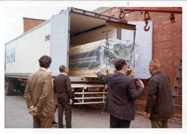
Unloading Sulzer looms at John Foster Valley, 1970s. Man pointing is possibly the late Jack StQuenton, Jack was Engineer in this period. -
Whitehorse Historical Society Inc.
Article, Bypass Plan Disastrous, 4/12/1991 12:00:00 AM
Public meeting held to demand that the State Government implement package of alternatives and proposed extension to preserve Koonung and Mullum Mullum Valleys.Public meeting held to demand that the State Government implement package of alternatives and proposed extension to preserve Koonung and Mullum Mullum Valleys.Public meeting held to demand that the State Government implement package of alternatives and proposed extension to preserve Koonung and Mullum Mullum Valleys.freeways, koonung mullum forestway association, public transport users association of victoria, conservation council of victoria, hartwell, ross, spyker, peter -
Lakes Entrance Regional Historical Society (operating as Lakes Entrance History Centre & Museum)
Photograph, Lakes Post Newspaper, 1/05/1999 12:00:00 AM
Colour photograph showing presentation of Wilderness Tourism Award for Premium Accommodation to representatives of Cann Valley Motel East Gippsland Victoriatourism -
 Bendigo Historical Society Inc.
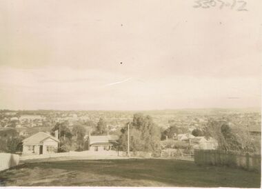
Photograph - JORDAN COLLECTION: PHOTO OF LANDSCAPE BENDIGO
Black and white photo of landscape view of Bendigo. Appears to be taken from an elevated position, looking across the valley. Indistinct features.bendigo, streetscape, general street views -
 Marysville & District Historical Society
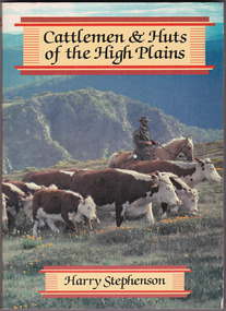
Book - Paperback book, Harry H. Stephenson, Cattlemen & Huts of the High Plains, 1980
A book that records the early development of Victoria's alpine regions by the pioneer cattlemen.Paperback book. The cover photograph shows snow plains, wildflowers, cattle, cattlemen and the mountain scenery across the Howqua Valley in Victoria.non-fictionA book that records the early development of Victoria's alpine regions by the pioneer cattlemen.cattle, victoria, beeding, history, hill farming, mountain life, cattlemen -
 Kiewa Valley Historical Society
Photographs – Set of 4 black and white photographs. One of a wooden church and three of rural homes and farmland. Area not identified
Europeans arrived in the Kiewa and Ovens Valleys in the 1830's and 40's. Following the drought of 1838-44, seeking out the rich pastures in the fertile Valleys. It proved to be perfect conditions for dairy farming and the raising of cattle. Miners Cottages and other similar wooden structures were a common sight in the area as they were a modest form of accommodation for their period, were quick to erect and economical as they made use of locally available building materials such as local timbers.These photographs provide a snapshot into the early dwellings and architecture of the Kiewa and Ovens Valley regions, including buildings such as the church, which provided an important gathering place for social interaction, especially in these isolated areas.1-Wooden church building with no identification. Large tree in the foreground in front of church 2&3- Black and white photographs of farmland and assorted dwellings, mostly miners style cottages in a valley with mountains in the background. A bridge with wooden railings is visible over the river in the middle of the photograph, also a more modern dwelling is visible in the north east of the photograph close to the river. 4-Black and white photograph of residential homes and farmland with an unsealed road running through the middle. Foreground shows a field which has been semi cleared of trees (stumps remaining). In the background are larger farming properties with the road disappearing into the distant hills. This might be Old Tallangatta before the town was moved in 1956. 1-3 - No inscriptions 4- Signature written on back in lead pencil - Sandra Templebuildings; church; farmland -
Tatura Irrigation & Wartime Camps Museum
Book - Family History, Agnes Mary Brown (Nessie), Closer Settlement Days
Story of three Scottish immigrant families - Geals, Stark and Forbes. Arrived in Australian 1924.White plastic front cover, black spine and back cover. Black letters. Title Closer Settlement Days in the Goulburn Valley by Agnes Mary Brown (Nessie).geals family, stark family, forbes family, agnes mary brown (nessie), scottish migrants -
 Melbourne Tram Museum
Slide, Keith Caldwell, 10/03/1966 12:00:00 AM
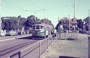
Agfa colour blue white plastic mount, photo by Keith Caldwell of SW6 861 in Royal Parade Brunswick, about to cross into Sydney Road at Brunswick Road. Tram running a route 19, North Coburg. Has adverts for T&G insurance and Stillwells Ford. In the view are the Bundy clock, with tram stop signage, a steel shelter, a drinking fountain and a statue on the plantation. 10/3/1966In ink "10 iii 66"trams, tramways, sw6 class, north coburg, route 19, sydney rd, brunswick rd, royal parade, bundy clock, shelters, tram 861 -
 Kiewa Valley Historical Society
Letter & Envelope - Kiewa Valley Rifle Club
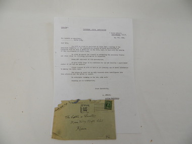
The Kiewa Valley Rifle Club belonged to the Australian Rifle Clubs. They were in Military District No. 304 and operated as early as the 1920's. In 1876, an Australian Rifle Team, consisting of shooters from N.S.W. and Victoria, was the first team ever to officially represent Australia in any sport in international competition. In 1885, the first civilian Rifle Club was formed. After 1901 Rifle Clubs came under army control. In 1921, they were reconstituted as a purely civilian organisation where they have remained ever since.This letter is evidence that the Kiewa Valley Rifle Club existed in 1946 enabling its members to participate in a sport that had 12232 members and 313 Rifle Clubs in Victoria by 1939.Letter- Dated: May 9th 1946 from Acting Secretary, A. Jordan of Victorian Rifle Association re requirements of Rifle Clubs. Black type on yellowed paper. Folded horizontally in half and then into thirds. Envelope: Greenish yellow addressed to "The Captain or Secretary / Kiewa Valley Rifle Club / Kiewa / Vic. dated 13 May 1946 from Melbourne with a 1d and halfpenny Australian stamp. kiewa valley. rifle club. community. -
 Bendigo Military Museum
Award - TROPHY, SIGNALLING, c.1926
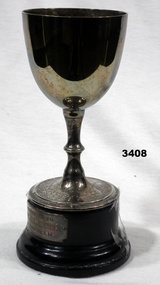
Metal trophy cup on dark wooden base. Inscription on the cup & small metal plaque attached to the base.On cup: "WON BY 38TH BATT TEAM, SIGNALING, SEYMOUR 1926, CAPT W L TRESSIDDER, SGT R BEATTIE, PTE D STILLWELL, B SILKE, R CLARKE" On base: "PRESENTED TO CAPT W L TRESSIDDER BY THE TEAM"trophy, award, signalling 38th -
 Kiewa Valley Historical Society
Book - Voters' Roll - South Riding (excluding Mt Beauty) 1960/61, South Riding (excluding Mt Beauty)
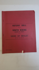
Voters' Rolls for the South Riding excluding Mt Beauty of the Shire of Bright for the years 1960/61The Shire of Bright includes towns in the Kiewa Valley. Names and occupations are of historical interest.Red book with black print on over and 3 staples holding 4 pages. Alphabetical listing of Residents in the Ovens and Kiewa Valleys and their occupations.No.s in pen written beside some residents.bright shire, voters' roll 1960, tawonga, tawonga south -
Glenelg Shire Council Cultural Collection
Plan - Plan - subdivision at Cape Bridgewater, n.d
Black and white photocopy of a 1990s plan of a subdivision at Cape Bridgewater - 'Heritage Valley'. Twenty-eight lots . In two halves, not joined togethertown planning, residential, sub divide, cape bridgewater -
 Kiewa Valley Historical Society
Letter - Medical Society - 9th July 1962
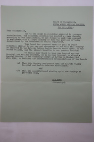
Ron White's Collection. The Kiewa Hydro Scheme included a Board of Management for the Kiewa Works Medical Society whose constitution required an amalgamation with a larger Society or be deregistered by the Commonwealth Health Department.Historically significant as the Kiewa Hydro Electric Scheme had been completed and Mt Beauty had been handed over to the Shire.Green A4 paper dated 2nd July 1962 re Kiewa Works Medical Society amalgamating with Latrobe Valley Health Service.ron white, kiewa works medical society -
 Bright & District Historical Society operating the Bright Museum
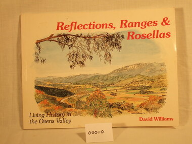
Book, David Williams, Reflections, Ranges and Rosellas, 1995
Book of illustrations by David Williams. Black and white illustrations of significant buildings and views of the Ovens Valley. Short descriptive article for each illustration.ISBN O 646 259741book, illustrations, ovens valley, david williams -
Bendigo Historical Society Inc.
Photograph - TRAINS THREE DISCS
DVD. Trains. Three Discs. a. Staem Rail Victoria. b. Bendigo includes Diamond Valley. c. Railways Changing 86's. -
Tatura Irrigation & Wartime Camps Museum
Book, The Local Heroes - Real People, Real Lives, Real Stories, June 2012
Large book, many photographs, stories of individuals of note in the Goulburn and Murray Valleys. Stories of 40 people. Book comes in a red case. -
Lakes Entrance Regional Historical Society (operating as Lakes Entrance History Centre & Museum)
Book, History ofMcDougall, McAlliser and Sandy families, 1990
Printed copy of manuscript on disc of 'Forty-'leven Youngsters' family history of the McDougall, McAlliser and Sandy families of the Tambo Valley area, Victoriagenealogy -
Lakes Entrance Regional Historical Society (operating as Lakes Entrance History Centre & Museum)
Book, Blakeman Elizabeth, A Proposal for a Fast Railway between Sydney Canberra and Melbourne, 2017
A collection of oral and written aneedates and other documentation about life from settlement to recent times in the Wairewa Valley East Gippsland Victoriasettlers, education, arts -
 Whitehorse Historical Society Inc.
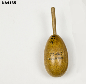
Functional object - Stocking darner, 1950's
Used for darning ladders in nylon stockingsUsed for darning ladders in nylon stockingOval wooden stocking darner, 2cm valley cut down the centre,& 6cm handle for holding while darning ladders in nylon stockings.Pic - Quick - URGM989116domestic items, sewing -
 Whitehorse Historical Society Inc.
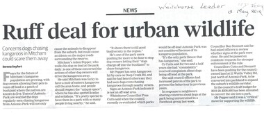
Article, Ruff Deal For Urban Wildlife
No. 490 - 500 Burwood Highway, Vermont South is for sale again after selling for almost $30 million two years ago. Heritage protection applies to the building and garden.Dogs illegally off-leash are chasing wild life in Antonio Park. No. 21 Wattle Valley Road will be converted into parkland to support wildlife.No. 490 - 500 Burwood Highway, Vermont South is for sale again after selling for almost $30 million two years ago. Heritage protection applies to the building and garden.wild life, antonio park mitcham, wattle valley road, mitcham no. 21 -
 Hume City Civic Collection
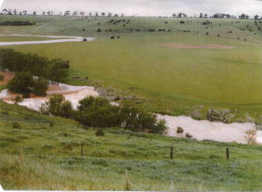
Photograph, Mill Falls
The photograph is of the Jacksons Creek taken in the vicinity of Mill Falls, near the former 'Springvale' winery, which was downstream from the Sunbury township. In 1971 the Shire of Bulla purchased 'Springvale' site and established the town's sewerage plant.The former 'Springvale' winery was one of a number of wineries that were established in Sunbury in the 19th century.A scanned coloured photograph with rounded corners of a valley with a meandering stream with a small dammed section in the foreground. There is a line of trees across the distant hilltops. mill falls, springvale winery, jacksons creek -
Lakes Entrance Regional Historical Society (operating as Lakes Entrance History Centre & Museum)
Photograph, Lakes Post Newspaper, 1/06/1999 12:00:00 AM
Colour photograph of Whelans truck being loaded with rock and gravel during flood response program in the Tambo Valley East Gippsland Victoriafloods, caravan parks -
 Australian Army Museum of Western Australia
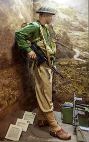
Diorama, 2015
This diorama is the introductory feature in the World War 2 Gallery - New Guinea and Islands area. A private soldier is shown in mixture of green and khaki uniforms, US style long leggings, long trousers with Thompson and Owen guns.The diorama shows the gradual introduction of green uniform elements and recognition of passive anti malaria measures (long sleeve and long pants)1:1 scale diorama showing soldier of Australian soldier of the 7th Division at the time of the advance into the Markham and Ramu Valleys, September 1943ramu, markham, shaggy ridge, 7th division, 9th division