Showing 310 items
matching construction worker
-
![Construction of the electric tram line in Cotham Road [Kew]](/media/collectors/550653872162f11fb04854aa/items/662890b16214a76cee3ec4c2/item-media/662891076214a76cee3ed17d/item-fit-380x285.jpg) Kew Historical Society Inc
Kew Historical Society IncPhotograph - Construction of the electric tram line in Cotham Road [Kew], E.J. Dower, 1913
One of a small album of six photographs of the construction of the Cotham Road tramline in Kew, taken by Edgar James Dower in the second decade of the twentieth century. The reverse of each photo contains notes, written over time by the photographer, which are contained in the 'Inscriptions' field. Born and raised in Olinda, Dower's family later moved to Surrey Hills. He worked as an adult as a clerk in the city office of the Metropolitan Gas Company, and in his role as a 'collector', he was able to photograph scenes including the construction of tram and train lines and associated buildings in Kew, Hawthorn, Camberwell and Surrey Hills. Later he established a real estate agency with his brother - the E.J. Dower Real Estate Agency, Dandenong Office. The album as a whole can be viewed separately as the parent file.The image is an historically significant record of the development of transport infrastructure which was used to connect Victorians in the first two decades of the twentieth century. This development resulted from increases in population and the consequent extension of Melbourne's suburbs. The photographs in the album, as well as Dower's single photos mounted on card, individually and collectively richly detail the labour of workers and the tools and machinery used to create and extend Melbourne's tram and train networks in the years preceding and during World War 1.The fifth of six annotated photos in an album of photographs of the construction of the St Kilda to Kew electric tram line, taken in Cotham Road, Kew, by the amateur photographer, Edgar James Dower, in 1913. The album contains images detailing the preparation for the laying of the tracks plus work laying the line. The photographer notes on a number of the photos that the metal tracks were collected from the Hawthorn railway siding. The album, together with other phots by E.J. Dower has been made available by the owners for the Kew Historical Society to digitise and publish online and in print.Annotation verso: "Preparing tram line Cotham Road Kew for electric trams, looking west / 1913"keywords, theme -- connecting victorians by transport and communications, theme -- travelling by tram, photographers -- edgar james dower, cotham road -- kew (vic.) -
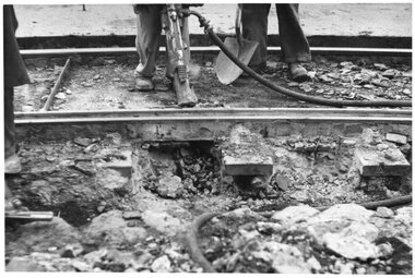
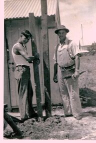
![Construction of the electric tram line in Cotham Road [Kew]](/media/collectors/550653872162f11fb04854aa/items/6628917c6214a76cee3ee29e/item-media/662891d96214a76cee3eeacb/item-fit-380x285.jpg) Kew Historical Society Inc
Kew Historical Society IncPhotograph - Construction of the electric tram line in Cotham Road [Kew], E.J. Dower, 1913
One of a small album of six photographs of the construction of the Cotham Road tramline in Kew, taken by Edgar James Dower in the second decade of the twentieth century. The reverse of each photo contains notes, written over time by the photographer, which are contained in the 'Inscriptions' field. Born and raised in Olinda, Dower's family later moved to Surrey Hills. He worked as an adult as a clerk in the city office of the Metropolitan Gas Company, and in his role as a 'collector', he was able to photograph scenes including the construction of tram and train lines and associated buildings in Kew, Hawthorn, Camberwell and Surrey Hills. Later he established a real estate agency with his brother - the E.J. Dower Real Estate Agency, Dandenong Office. The album as a whole can be viewed separately as the parent file.The image is an historically significant record of the development of transport infrastructure which was used to connect Victorians in the first two decades of the twentieth century. This development resulted from increases in population and the consequent extension of Melbourne's suburbs. The photographs in the album, as well as Dower's single photos mounted on card, individually and collectively richly detail the labour of workers and the tools and machinery used to create and extend Melbourne's tram and train networks in the years preceding and during World War 1.The sixth of six annotated photos in an album of photographs of the construction of the St Kilda to Kew electric tram line, taken in Cotham Road, Kew, by the amateur photographer, Edgar James Dower, in 1913. The album contains images detailing the preparation for the laying of the tracks plus work laying the line. The photographer notes on a number of the photos that the metal tracks were collected from the Hawthorn railway siding. The album, together with other phots by E.J. Dower has been made available by the owners for the Kew Historical Society to digitise and publish online and in print.Annotation verso: "Preparing tram line Cotham Road Kew for electric trams / 1913 / The metal was brought by horse and drays, from Hawthorn railway siding".keywords, theme -- connecting victorians by transport and communications, theme -- travelling by tram, photographers -- edgar james dower, cotham road -- kew (vic.) -
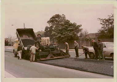 Kew Historical Society Inc
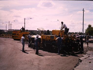
Photograph - Studley Park Road Reconstruction, 1968
One of a series of photographs donated by the City Engineer of the former City of Kew, relating to road works. The photos variably include council workers, signage and equipment.One of a series of photographs of core local government services as practised by the City of Kew. The photographs are an accurate record of street works of the period. This example is one of the few shot in colour in the 1960s. Original colour photographic positive of roadworks in Studley Park Road in the former City of Kew. A tip truck carrying bitumen unloads it contents on the road which is then levelled by a tray. Road workers supervise the road making. "STUDLEY PARK ROAD RECONSTRUCTION / 1 1/2" NOM [sic] SIZE BIT BINDER COURSE / JANUS CONSTRUCTIONS / 9TH OCT 1968"city of kew, local government -- city of kew, road works, street works, studley park road -- kew (vic.) -
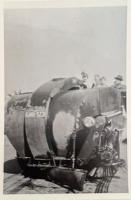 Kew Historical Society Inc
Photograph - City of Kew steamroller and workers, c. 1960
Tom Bentley (1912-1993) was born in Lancashire (UK). From circa 1951, he was the Overseer/Superintendent of Outdoor Works for Kew City Council. Until his retirement in the 1970s, he was based at the Kew Council Depot, located in the former MTB Horse Tram Depot on the corner of Disraeli and High Streets, Kew. Accompanying the set of twelve photographs is a 12-page illustrated biography of the Bentley and Plumridge families, separately kept in the 'Bentley' subject file.Duplicate black and white positive print photograph of road works in Studley Park Road, Kew, carried out under the supervision of Tom Bentley, Overseer/Superintendent of Outdoor Works for the City of Kew. The photograph shows a Council-owned steamroller used for road construction.city of kew, public works, tom bentley, road works, steamrollers -
![Sustenance workers, Susso Drive [Yarra Boulevard], 1930s](/media/collectors/550653872162f11fb04854aa/items/58cf0689d0ce9809d870b7dd/item-media/58cf5a5cd0ce6633142774c9/item-fit-380x285.jpg) Kew Historical Society Inc
Kew Historical Society IncPhotograph, Herald Sun, Sustenance workers, Susso Drive [Yarra Boulevard], 1930s
The Yarra Boulevard was a major depression era public works project.Sustenance workers, Susso Drive [Yarra Boulevard], 1930s. Attached green postit: "In Herald Sun. Richmond section not Kew. Check with Richmond Historical Society.yarra boulevard, susso drive, road construction 1930s, the great depression (kew) -
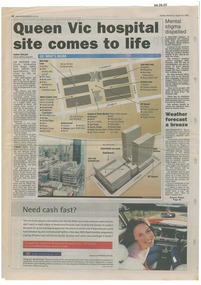 Queen Victoria Women's Centre
Newspaper excerpt, Queen Vic hospital site comes to life, 24 August 2003
... construction and demolition workers newspaper articles Sunday Herald ...newspaper articles Sunday Herald Sun page 28. colour photograph of the construction works bottom left of article's images. Graphic images of the the construction works and what would be included in the centre.town planning, historic building, retail trade, restaurants, construction and demolition workers -
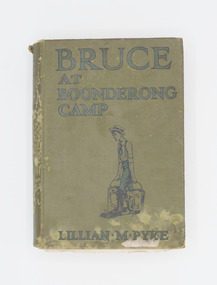 Port Fairy Historical Society Museum and Archives
Book, Ward, Lock & Co., Limited, Bruce of the Boonderong Camp, 1920
... stories. railroad construction workers -- queensland -- juvenile ...Juvenile Fiction held in Reference Section. Illustrated by J. Macfarlane.256 p., [8] leaves of plates : ill. ; 19 cm.non-fictionJuvenile Fiction held in Reference Section. Illustrated by J. Macfarlane. lillian pyke, country life -- queensland -- juvenile fiction., railroads -- construction -- juvenile fiction., children's stories., railroad construction workers -- queensland -- juvenile fiction., railroads -- design and construction -- juvenile fiction., australia -- social life and customs -- juvenile fiction., target audience, book -
 Federation University Art Collection
La Perruque, 2018
Laresa KOSLOFF Laresa Kosloff makes performative videos, Super-8 films, hand-drawn animations, sculpture, installations and live performance works, all linked by an interest in the body and its agency within the everyday. Recurrent themes include humour and tension between received cultural values, individual agency and free will. La Perruque won the 2018 Guirguis New Art Prize. ‘Laresa is a worthy winner having been dedicated to her practice over many years and creating a work that is intelligently structured and steeped in satire, epitomising what we all either know or experience at work or in office life. By her clever collaging of characters, editing and story adaptation, Laresa has created an impressive fictional and insightful work that by way of its very construction cleverly illustrates and articulates aspects of Australian culture,’ (Shelley Hinton, Curator Federation University’s Post Office Gallery)A USB and a portable hard drive in a black archival box with a signed certificate. Her short film La Perruque is made entirely out of commercial stock footage, generic material produced for corporate advertising, which is strangely artificial, simplistic and loaded with images of success and productivity. Kosloff uses this footage to tell the tale of an office worker who is secretly trying to write a novel during work hours. The silent footage has been dubbed using voice actors and assembled into a story that subverts commercial representations of office life. The title refers to a French term that translates into 'wearing the wig', used to describe a situation of secretly working on personal projects during work time.guirguis new art prize, video -
Canterbury History Group
Photograph - Canterbury Station c 1969, Merlo, Hazel, c1969
... Construction and Demolition Workers A coloured photograph ...A coloured photograph of the demolition of the platform on the eastern side of Canterbury Stationcanterbury, canterbury station, canterbury road, shops, construction and demolition workers -
 Melton City Libraries
Photograph, Melton Railway Bridge, c.1884
"The Melton Viaduct, opened in 1886, is of State heritage significance as a very large and visually distinctive wrought iron, lattice girder trestle bridge over the Werribee River (now Melton Reservoir). It comprises 18.3 and 9.1 metre spans, in a generally alternate arrangement, of total length 375 metres, and standing 38 metres over the Werribee River. Wrought iron small section iron was used to build tension trussed trestle legs, which supported four lines of rivetted wrought-iron deck-type double lattice trusses. It has bluestone abutments and pier bases of coursed rock-faced bluestone with drafted margins. The larger half-piers, now usually submerged in the Melton Reservoir have sharp tapered cutwaters and curved coping at the tops. While designed to carry two rail tracks it has only ever been used as a single track line. Despite several alterations to its deck structure, it remains an outstanding example of a lighter structural design employing open metal trestle supports and metal truss girders. The direct Melbourne to Ballarat railway link of which the Melton viaduct was the major engineering work contributed significantly to the history and development of Victoria. This new link reflected Ballarat’s diversifying economy as well as the commercial and political influence of the metropolis. Construction of the bridge, and the associated large workers camp, were extensively photographed, documenting an important episode in local history. The railway enabled the development of new industries in the Melton area, notably the timber industry and a chaff industry of national importance, greatly facilitated the later transition of the Shire from a pastoral to a farming economy, and struck a major blow to Melton township’s era as a wayside town servicing Ballarat road (especially coach) traffic". Melton Railway Bridge being built across the Werribee Rivertransport -
 Melton City Libraries
Document, Minns Family Reunion, 2004
"A perpetual spring in the adjacent creek provided a steady supply of fresh water to the site on which the homestead is built. Although we can not be certain of the identity of the builder, the first stage of ‘The Willows’ homestead appears to have been constructed in the mid 1850s. The house is situated on Crown Allotment No.1 (No Section), Parish of Kororoit, an allotment of 5 acres 3 roods 4 perches. Although it had surveyed the land, the Crown did not offer it for sale until 22nd November 1861, at which time it was purchased by Charles March Williams. (Although the property is directly opposite and immediately adjacent to the Township of Melton, and was sold as ‘Suburban Allotment 33’, it was situated within the Shire of Braybrook rather than the Shire of Melton until 1917.) Considerable improvements had taken place on the land prior to the Crown sale. When CM Williams purchased the allotment in November 1861 he paid £23.5.0 for the land itself, and valued the improvements at £400. Even allowing for some exaggeration by Williams, this is an extremely high valuation for improvements, and must have included a house. Some local research has claimed that in 1858 Williams had taken over the interest of a Mr Parkinson in the property, and that Parkinson built the house upon taking possession of the land c.1855. It was definitely built by 1861, when a map shows a square building on the site marked as ‘House’. The property is important in the district for its association with the establishment of the pound. The district pound had been established in 1854, when George Scarborough of Mount Cottrell (Mt Cottrell Road, south of Greigs Road) was appointed pound-keeper. Scarborough resigned in 1857. The pound was moved to Melton following agitation from local farmers and Charles March Williams appointed pound-keeper on 26th April 1858. Williams, the son of a doctor, had been born in London. Reminiscences of local residents of the time, as recorded in the Express newspaper, note Williams’ success in breeding horses on the property. Sales of up to 60 guineas were noted. Whether this was from Williams’s own stock or from unclaimed pound stock is not made clear. Williams appeared before a government inquiry in 1860 and advocated registration of all stock brands in the State. Williams died in 1862 leaving a widow, Catherine, and five living children aged 15 years to five months. At the time of his death Williams had entered negotiations with one Matthew Devenish and had a mortgage of £100 on allotments 1 and 2, Parish of Kororoit. Catherine Williams was appointed pound-keeper on 2 September 1863, with her eldest son Charles as her assistant. Her tenure was short for on 22nd March 1864 George Minns senior paid Matthew Devenish £135 for allotments 1 and 2 Parish of Kororoit (considerably less than Williams had claimed the property was worth in 1861) and on the same day paid William Tullidge £45 for the adjoining allotments 3 and 4. In April 1867, James Ebden Minns, the newly married son of George senior became the owner of The Willows property having entered into a mortgage arrangement with his father to the extent of £200. At the time George Minns was residing in Kaarimba having left Melton in 1867 for a short trip to England and upon his return having taken up a selection in the Kaarimba district with his son Frederick who had a hotel licence there. James paid out the mortgage on 2-1-1873. James Minns was appointed pound-keeper in 1872; in 1885 the pound was moved elsewhere and Minns purchased the old pound site and added it to his farm. The Willows residence underwent a major change about this time. A two room extension, similar in style but with a lower elevation was added to the original rear of the house with a chimney matching the distinctive originals. Window arrangements did not match the original but became a feature of the façade when the new addition became the front of the building. Six buttresses were attached to the east and west walls of the old building, two to the south wall and the whole rendered with mortar to give the appearance of dressed stonework around the windows. Galvanized iron was placed over the shingles and a verandah added on three sides. By 1876 The Willows was the homestead for a thriving mixed farm of 340 acres of which 156 was rented from a H. Ruck. In October of that year the Australasian travelling reporter visited and reported on the property. In common with the nearly every other property in the district the farm had ‘recently’ (generally within the last two years) abandoned cultivation of crops, and turned over completely to cattle pasture. Butter making was the principal occupation of the farm, which had about 50 head of cattle, a large proportion of which were milking cows. The reporter also noted that a ‘large number of pigs are kept upon this farm and are found to be very profitable stock’. Their manure was used in an orchard and garden in which ‘large quantities of lucerne and prairie grass are grown for the use of stock when ordinary feed is scarce’. Two bores attached to deep brick lined wells supplied water for the house in addition to the farm. A commodious timber barn and necessary sheds had also been constructed. Access to the property was improved following the construction of the bluestone ford across the creek c.1887, when the recreation ground came into use. Prior to this date it may have been that the crossing referred to as ‘Mr Minns bridge’ was used. This appears to have been a flimsy structure and has but two references in Council reports in the Melton Express in the 1880’s. It is believed that in the late 1890’s a timber building was added near the rear of the building to house a kitchen, ablutions and laundry rooms and rooms for seasonal workers. This was attached to the house by means of a trellised walkway using the original front entry to the house (long since the back door). A photograph of this building appears in a local history of Melton. This was demolished in recent decades during the period when the house was tenanted (after the Minns family had left). James Minns son, George, took over the property following his marriage to Alice Walsh in 1903. James and Caroline moved into a house on the former JH Games property at the eastern end of Henry Street. George held the position of Shire Secretary for Melton for 40 years. He was a most prominent member of the community being Secretary to, among others, the Melton Coursing Club, the Shooting Club and the Cemetery Trust. He also rode with the hunting parties who sported across the Plains and were entertained at Mount Kororoit. George and Alice had one son, Norman who followed his father into local government and became Secretary of the Shire of Werribee completing a record term in this position. George retired to Werribee in 1951, where he died in 1965. The National Trust records note that James Ebden Minns and his sons were ‘leading men of the district, Justices of the Peace, and Shire Councillors’. It claims that Sir Thomas Bent was a frequent visitor. The Willows passed into the hands of George’s grandson, Bruce Minns and the property was let for a number of years. In the 1960s it became vacant and was subject to vandalism. Major structural problems arose with the part demolition of the roof, the loss of windows and doors and holes dug into and under the floorboards. The outbuildings were particularly targeted. Following widespread public support, the Shire of Melton purchased the house, with 3.75 acres of land, in 1972. In 1975 the Shire of Melton and the Melton and District Historical Society were successful in nominating the building for National Trust classification, and then the Australian Heritage Commission’s Register of the National Estate. The AHC particularly noted its ‘townscape importance’. It was envisaged that the farmhouse would form ‘a picturesque centrepiece to Melton’s planned … historical park, along with Dunvegan bluestone cottage … and similar structures as they become available.’ In a time of great Melton’s ‘satellite city’ development the Council spelt out its broader vision in its submission to the AHC: ‘Melton is destined to become, by the end of the present century, a city of between 75,000 and 100,000 people. Significant relics of the past, such as ‘The Willows’, regrettably will be rare in that situation. It is essential that sufficient tangible links with Melton’s pioneering days remain to promote in the new community a sense of history and continuity’. Under the direction of ‘The Willows’ Restoration Committee and consultant architect John Hitch, all outbuildings, with the exception of the garage and toilet, were demolished and the dwelling house restored. Finances were provided by the Shire of Melton and the National Estate Grants Program, and considerable amount of voluntary labour was provided by the local community. The orchard was removed, and remaining wooden buildings were relocated to provide an open vista for visitors to the Park. The property was furnished with donations from district families keen to preserve this example of pioneer life in the area. The Willows became the headquarters of the Melton and District Historical Society". Invitation to the family reunion at the Willowslocal identities, pioneer families -
 Tarnagulla History Archive
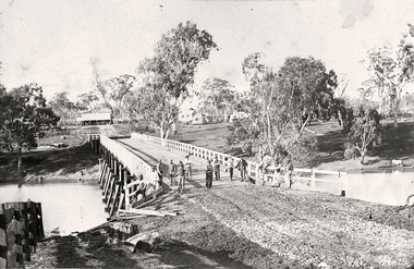
Photograph of the newly completed bridge at Newbridge, Victoria, c.1894, The newly completed bridge at Newbridge, Victoria, c.1894, 1894
... river infrastructure construction roads workers farms people ...Murray Comrie Collection. This photograph is a well-preserved original. Monochrome photograph depicting the newly completed wooden bridge at Newbridge, Victoria. Thirteen men are in the image, standing at one end of the bridge. These are most likely men who worked on constructing the bridge. Position of photographer is on the west bank of the Loddon, looking east.newbridge, bridge, loddon river, infrastructure, construction, roads, workers, farms, people -
 Tarnagulla History Archive
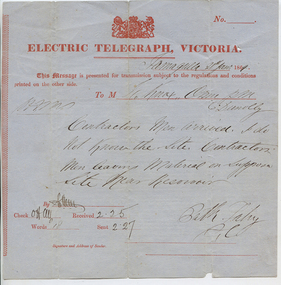
Telegram: Fahy to Dunolly, 21st January 1864
... . tarnagulla post office telegrams chief secretary fahy construction ...Murray Comrie Collection. A telegram sent from a Bill (?) Fahy in Tarnagulla to a recipient in Dunolly on 21st Jan 1864. Notifies recipient that 'contractors men arrived'. Author says 'i do not know the site. Contractors men leaving material on supposed site near Reservoir'.tarnagulla, post office, telegrams, chief secretary, fahy, construction, reservoir, recreation reserve, workers, work -
 Wodonga & District Historical Society Inc
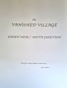
Booklet - The Vanished Village - Ebden Weir / Mitta Junction, Lyn Larkin, 2004
This publication tells the story of the village of Mitta Junction which was established in about 1920 on the Victorian side of the Hume Dam construction site. The town was built to house workers and their families during the construction of the Hume Weir. It included houses, a shop, hall and school as well as tennis courts. After the completion of the weir the village and all its contents was sold at auction in June 1936 for £7000. The Mitta Junction school continued to operate until the mid 1980s. The book also documents aspects of the history of the Clark family of Bonegilla.A small publication by a local author. A4 size including photographs and a map.This publication tells the story of the village of Mitta Junction which was established in about 1920 on the Victorian side of the Hume Dam construction site. The town was built to house workers and their families during the construction of the Hume Weir. It included houses, a shop, hall and school as well as tennis courts. After the completion of the weir the village and all its contents was sold at auction in June 1936 for £7000. The Mitta Junction school continued to operate until the mid 1980s. The book also documents aspects of the history of the Clark family of Bonegilla.mitta junction township, hume weir construction, clark family bonegilla -
 Wodonga & District Historical Society Inc
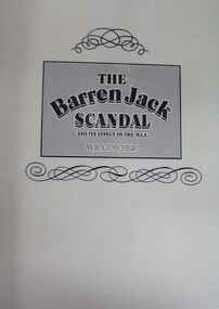
Book - The Barren Jack Scandal and its Effects on the M.I.A, W. R. Cowper, 1987
... and workers engaged during the construction of Burrinjuck Dam... and workers engaged during the construction of Burrinjuck Dam ...This book outlines the issues and controversy around the construction of the Barren Jack (Burrinjuck) Water Supply Dam as part of the infrastructure of the Murrumbidgee Irrigation Authority (M.I.A) and its subsequent abandonment. It has now fallen into disrepair,non-fictionThis book outlines the issues and controversy around the construction of the Barren Jack (Burrinjuck) Water Supply Dam as part of the infrastructure of the Murrumbidgee Irrigation Authority (M.I.A) and its subsequent abandonment. It has now fallen into disrepair,irrigation -- government policy, murrumbidgee irrigation area (n.s.w.) -- history, barren jack dam, burrinjuck, yass valley -
 Wodonga & District Historical Society Inc
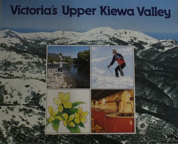
Booklet - Victoria's Upper Kiewa Valley, State Electricity Commission, C. 1984
This booklet is one of several publications from the State Electricity Commission during the period it was responsible for the running of the Kiewa Hydro Electric Scheme. It promotes tourism and depicts key features of the region in the 1980s.non-fictionThis booklet is one of several publications from the State Electricity Commission during the period it was responsible for the running of the Kiewa Hydro Electric Scheme. It promotes tourism and depicts key features of the region in the 1980s.victoria. kiewa valley, kiewa river valley (vic.) -- description and travel., kiewa hydro -
 Wodonga & District Historical Society Inc
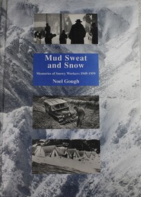
Book - Mud Sweat and Snow: Memories of Snowy Workers 1949-1959, Noel Gough, 1994
This book tells the human story of the first decade of building the great Snowy Mountains Hydro-Electric Scheme, with adventures and anecdotes told by the workers themselves, and illustrated with unusual photographs. Appendices give further information about the project and list the workers named in Snowy records. The author began his 10 years with the Electrical and Mechanical Division at the age of 20. The construction of the Snowy Mountains Hydro-electric Scheme is a well-documented part of our nation’s history and a leading example of Australian innovation and ingenuity. As far back as the 1880s, Australians had been considering diverting water from some of Australia’s best-known rivers – the Murray, Murrumbidgee, Snowy and Tumut – to drought-proof parts of NSW and Victoria. It was not until 1944 that Commonwealth and State governments formed a committee to examine the development of water resources in the Snowy Mountains area. As a result of their work, on 7 July 1949, the Commonwealth Parliament passed legislation to establish a Statutory Authority and start construction of the Snowy Scheme. NSW. Construction was completed in 1974 at a total cost of $820 million. On completion, the Scheme consisted of seven power stations, 16 major dams, 80 kilometres of aqueducts and 145 kilometres of interconnected tunnels.non-fictionThis book tells the human story of the first decade of building the great Snowy Mountains Hydro-Electric Scheme, with adventures and anecdotes told by the workers themselves, and illustrated with unusual photographs. Appendices give further information about the project and list the workers named in Snowy records. The author began his 10 years with the Electrical and Mechanical Division at the age of 20. The construction of the Snowy Mountains Hydro-electric Scheme is a well-documented part of our nation’s history and a leading example of Australian innovation and ingenuity. As far back as the 1880s, Australians had been considering diverting water from some of Australia’s best-known rivers – the Murray, Murrumbidgee, Snowy and Tumut – to drought-proof parts of NSW and Victoria. It was not until 1944 that Commonwealth and State governments formed a committee to examine the development of water resources in the Snowy Mountains area. As a result of their work, on 7 July 1949, the Commonwealth Parliament passed legislation to establish a Statutory Authority and start construction of the Snowy Scheme. NSW. Construction was completed in 1974 at a total cost of $820 million. On completion, the Scheme consisted of seven power stations, 16 major dams, 80 kilometres of aqueducts and 145 kilometres of interconnected tunnels.snowy mountains hydro-electric scheme, hydroelectric power plants, snowy mountains -
 Wodonga & District Historical Society Inc
Photograph - Mitta Junction Township
... featuring the village of Mitta Junction, built to house workers... of Mitta Junction, built to house workers on the construction ...Mitta Junction which was established about 1920 on the Victorian side of the Hume Dam construction site (originally called the Mitta Junction Reservoir). The town was built to house workers and their families. It included houses, private and government boarding houses, a shop, hall and school as well as tennis courts and a cricket pitch. Mitta Junction was a thriving community with many activities, including Balls and Euchre Nights, held at the Hall which opened in February 1922. The community also fielded a very successful football team in the local competition. After the completion of the Dam, the village and all its contents were sold at auction in June 1936 for £7,000. Individual houses sold at about £40 for removal to nearby towns. The Mitta Junction School which opened in 1922 continued to operate with very small numbers after the village was moved. Its numbers were boosted in the early 1980s by the children of Army staff at the nearby Latchford Barracks Army Apprenticeship School. It finally closed in December 1985.These images are significant because they capture the history of an important vanished town whose residents played a vital role in the construction of the Hume Dam.A collection of black and white images and a sketch map featuring the village of Mitta Junction, built to house workers on the construction of the Hume Dam. Some of the photographs have been mounted on heavy card.mitta junction township, hume dam construction, hume dam history -
 Forests Commission Retired Personnel Association (FCRPA)
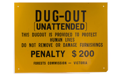
Dugout sign, Post 1966
Considered in terms of both loss of property and loss of life, the Black Friday bushfires on 13 January 1939 were one of the worst disasters to have occurred in Australia and certainly the worst bushfire up to that time. The fires burnt 2 million hectares, 69 sawmills were destroyed, 71 people died, and several towns and sawmills were entirely obliterated. Among those killed were four men from the Commission The subsequent Royal Commission conducted by Judge Leonard Stretton has been described as one of the most significant inquiries in the history of Victorian public administration. Its recommendations led to sweeping changes. In addition to building dams and water points, the Stretton Royal Commission recommended expanding and controlling the use of bushfire dugouts at forest sawmills. Well-constructed dugouts had saved the lives of many sawmill workers and their families during the 1939 bushfires. But in some locations, they had proved fatal. Dugouts became mandatory for those few sawmills that remained in the forest after the 1939 fires. Many remote logging coupes and FCV roading camps also had dugouts. The local District Forester was required to make annual pre-season inspections of all dugouts on State forests and those within the Fire Protected Area (FPA). Some were built privately on private land. Most were primitive construction with a log or corrugated iron roof covered with earth. A hessian bag often hung at the entrance to keep the heat and smoke out. But they were dark and damp with snakes and other creepy crawlies often lurking inside. By 1940-41 there were 19 new dugouts constructed by the Commission and a further 128 by forest licensees. Ten years later there were 8 new Commission dugouts and 21 new ones built by other interests. By 1960-61 the rate of new builds was declining but the Commission still managed 103 dugouts while 127 were looked after by others. However, as the forest road network improved and gave all-weather access to modern two-wheel-drive vehicles the reliance on dugouts receded.Large metal sign that was positioned near forest dugoutsbushfire, forest signs, forests commission victoria (fcv) -
 Melbourne Tram Museum
Photograph - Last day of original Essendon Airport tram terminus, Ron Scholten, 7-10-1976
The original line to the Essendon Aerodrome was constructed in 1943 to serve the airport and aircraft construction. It was funded by the Commonwealth Government. By 1976, patronage to the airport terminus in Vaughan St had dropped, the crossing of the highway to the Tullamarine Airport opened in 1970, was dangerous, and the highway needed to be widened. The new terminus was a short distance to the north between Mathews Ave and the Highway. This series of photographs show the last day of operations to the original terminus and the changeover, which was done in about 7 hours. No buses were required. It was done by workers of the Melbourne and Metropolitan Tramways Board. The line was later extended to Airport West. .1 - W5 789, (Essendon Airport Route 59) about to turn from Mathews Ave into Vaughan St. Has new track and footbridge in the foreground. .2 - W5 791 on the siding or spur at the airport terminus, the last tram to use this facility. .3 - W2 571, at the Airport terminus alongside Vaughan St on the last morning of the use of this terminus. The Bundy clock can be seen behind the pole on the lefthand side and the Brick passenger shelter. Shows buffer stops, and Forestair hanger behind. .4 - W2 595 turning from Vaughan St into Mathews Ave. Has the tram stop No. 55 in the view. .5 - W5 839 turning from Vaughan St into Mathews Ave. Shows the flashing yellow light that gave some protection to the trams. .6 - W2 247 about to turn into Vaughan St. Driver about to reboard the tram. Note the new copper trolley wire is up for the new track but has been pulled to the west side using rope. .7 - W5 805, turning from Mathews Ave into Vaughan St, to the old Essendon Airport terminus. Has a new track in the foreground, and the overhead for the curves is still in position. .8 - W6 991 turning from Vaughan St into Matthews Ave, at 855am, the last tram from the old terminus. The track gang has commenced work to remove the outbound curve. Would appear four passengers waiting at the tram stop, two with lunch bags. Note the cattle grid in the foreground between the rails. New rails on the ground on the left-hand side. See Reg Item 6163 for further photos of this event.Yields information about the last day of the operation of the original Essendon Airport tram line.Set of 8 Kodachrome cardboard mount colour slides of the relocation of the Essendon Airport tram terminus 7-10-1976, by Ron Scholten.All slides have detailed descriptions on the reartrams, tramways, essendon aerodrome, essendon airport, closure, new tramways, route 59, w5 789, w5 791, w2 571, w2 595, w5 839, w2 247, w5 805, w6 991, w2 class, w5 class, w6 class, mmtb, trackwork -
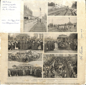 Kew Historical Society Inc
Article, The New Electric Tramway, Malvern to Kew
One of a group of photographs, including three within a published photo collage , taken by Edgar James Dower in the second decade of the twentieth century. Born and raised in Olinda, Dower later moved to Surrey Hills. He worked as an adult as a clerk in the city office of the Metropolitan Gas Company, and in his role as a 'collector', he was able to photograph scenes including the construction of tramlines, railways and associated buildings in Kew, Hawthorn, Camberwell and Surrey Hills. Later he established a real estate agency with his brother - the E.J. Dower Real Estate Agency, Mount Dandenong Office.The photo collage is an historically significant record of the development of transport infrastructure which was used to connect Victorians in the first two decades of the twentieth century. This development resulted from increases in population and the consequent extension of Melbourne's suburbs. The photographs, both individually and collectively, richly detail the labour of workers and the tools and machinery used to create and extend Melbourne's public transport network in the years preceding and during World War 1.Photo collage, published in The Leader newspaper in 1913, to commemorate the opening of the Malvern to Kew Tramway. The numbered photos are: 1. Kew Railway Gates at Glenferrie. 2. Burke Road Terminus. 3. Final Stages. 4. Ladies at the Official Opening. 5. The Acting Mayoress of Kew Cutting the Ribbon at the Kew Boundary. 6. Mayor and Councillors at the Kew Terminus. 7. The Cutting the First Ribbon. 8. Guests at the Hawthorn Town Hall.Inscribed in ink by Edgar J Dower top left: "The 3 top photographs were taken by E J Dower. No.3 Cotham Road Kew near Glenferrie Road"theme -- connecting victorians by transport and communications, theme -- travelling by tram -
 Kiewa Valley Historical Society
Photos - Mills Family x 15
Brian and Jill Mills lived with their children at Lakeside Ave. Mt Beauty. Brian was in the airforce.4 photos were taken during the construction of the Kiewa Hydro Electric Scheme. 1. The "Mills Kids" beside the river - show the fashion of the time and how families spent their recreational time. 2.& 3. The "70 Lakeside Ave" photos show the type of housing provided by the SECV and that the garden hadn't been created. 4. SEC marshalling yards, Mt Beauty c 1940s-50s. An historic photo of 1940s/50s buses used to transport KHES workers to their work sites, some of which were on the High Plains.15 large photos scanned in colour. 5 have labels written on the backOn the back "Brian Mills" (in airforce uniform); "Mills Kids / 78 L/side Ave"; "70 Lakeside Ave"; "70 L/side Ave" and "SEC Marshalling yards - Mt Beauty (and Donor's name and address.lakeside ave mt beauty, brian mills -
 Ballarat Tramway Museum
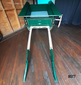
Photograph - Colour Print/s, c1979
Yields information the construction of the depot fan extensions for four and five roads and has a strong association with the workers in the photograph.Colour print of Dave Macartney raking ballast on the extension of track for four and five roads, c 1979. Three road extension pig sty ski jump can be seen in the background. (Note photo of the same type as Reg item 4679 and 4680) 1979 - 1980 Annual Report shows a photograph on the front cover of the trackwork nearing completion.trams, tramways, depot construction, btps, trackwork -
 Melbourne Tram Museum
Photograph - Set of 15 Black & White Photograph/s, Melbourne & Metropolitan Tramways Board (MMTB), 1950's
Series of 15 black and white photographs of the track works to reconstruct tram lines showing various methods and works during the 1960's. .1 - Jackhammers concrete out around wooden sleepers - the rails have been bolted to them. .2 - Excavated track or temporary track next to newly relaid track - Hawthorn Road by Caulfield Park? .3 - Partly completed work - nearest track relaid, second track still has wood blocks? and then a temporary track. .4 - Excavated previously concreted and bolted track. Appears to be new rail. .5 - Compacting a new track bed with work laying track in the background. .6 - Rail being craned into position onto small concrete blocks - Nicholson St North Fitzroy at Church St - the church is now Melbourne City Mission Palliative care centre. 1955/56 - construction of the replacement track. Note the Hail bus stop sign on the corner. .7 - Thermite welding being set up. .8 - after a Thermite welding joint completed. .9 - track reading for pouting concrete, with a rebuilt track alongside and temporary track on the other side. .10 - ditto .11 - Concrete being poured .12 - ditto - could be Maribyrnong Road bridge replacement. .13 - Screeding off the concrete - possibly Nicholson St North Fitzroy .14 - completed surface - location as above .15 - completed surface with cloth covers to assist the concrete being cured. Has a MMTB hut and two worker amenity buses alongside. - location as above.Some photos have pencil marks on rear.trams, tramways, trackwork, rails, track materials, track repairs, sleepers, equipment, concrete, welding, nicholson st, new tramway, buses -
 Melbourne Tram Museum
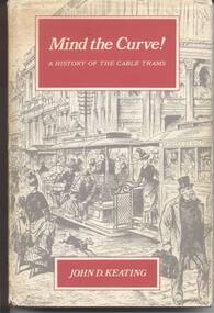
Book, John D Keating, "Mind the Curve", 1970
Hard bound book, 172 pages, including end covers, 10 sections, title "Mind the Curve", with subtitle "A history of the Cable Trams", stitch bound to hard red Rexene covers with gold block title on the spine only. Dust cover has the title, author, drawing of Bourke St and details of the book and author on the returns. Written by John D Keating, published by the Melbourne University Press in 1970. Has index, acknowledgements, table of contents, list of illustrations and references Looks at the establishment, construction, operation and demise of the cable tram system in Melbourne. Provides location details of the engines houses, tramcars, ticketing, management, politics, the Northcote line and the workers. 2nd copy added from the collection of Colin Jones - title page signed by John Keating - see image i5/trams, tramways, melbourne, mmtb, cable trams, mto co, horse trams -
 Flagstaff Hill Maritime Museum and Village
Vehicle - Tip Dray, Prior to 1930s
A Dray is a type of dead axle wagon that was used to transport heavy loads or objects. They had a flat level floor and while some had no sides, others had box bodies and sides. Tip Drays (also known as Tip Carts, Muck Cart, Scotch Cart, Tumbrel or Putt in different parts of England) were smaller than other drays as their loads were heavy and usually only pulled by one horse. Their basic design included two wheels, a tipping body and shafts. The Tip Dray has a unique mechanism that allows the top to tip backwards to tip the load out of the back of the dray. The tipper was activated by a handle at the front allowing the driver to operate it while still having control over the horse. A Tip Dray was an indispensable piece of equipment in the days before tractors and mechanical trucks. They were used by farmers and carters to transport hay, rocks, bricks, gravel and rubbish etc. and because they were useful for dumping loads, they were favoured for use in road and railway construction. A photo in the collection of the Lorne Historical Society shows a tipping dray being used during the construction of the Great Ocean Road. They were part of the daily street traffic in towns and cities around Australia from the early days of settlement. In Australia in the early 1900's, carters began to join unions to protect their jobs and pay. N.S.W. had a "Trolley, Draymen and Carters Union", Queensland had a "Tip Dray Men's Association" and in W. A. the "Top Dray Driver's Union" had a "cessation of work" in 1911 when they were fighting for an increase in their day's wages. In 1910 a meeting of Tip Carters was held in Geelong at the Trades Hall to discuss the formation of a union (The Geelong Tip Dray Carters) which was a success and a schedule of rates for all carting, whether by contract or day labor, was fixed. By 1912 they had "labelled" more than 50 drays and had representatives on the "Trades Hall and Eight Hours Committee". By the mid 1930's and early 1940's, tip drays were being superseded by mechanical trucks and utes. However tip drays continued to be used in some circumstances. They were a practical solution to the problem of petrol rationing during W. W. 2. It was noted in a letter to the editor in the "Sunshine Advocate" in 1938 that a positive argument for continued use of Tip Drays for rubbish collection related to the idea that a horse drawn vehicle involved with lots of stops and starts at different houses (very like a milkman's delivery route) often involved the horse "driving itself" while the driver picked up the rubbish - something a motor truck was unable to do! Another article written in August 1935 and published in the Age in a parliamentary report into the rubber industry noted "tip drays had almost disappeared and in their place, metal was carted in 5 ton motor trucks" but the report went on to say that as a part of the Government relief work (during the Great Depression) the Government had "to some extent reintroduced the tip drays so that a greater number of men would be employed". This particular tip dray was owned by Mr. Oswald (Jack) Bourke. He used it to deliver dry goods from Sunbury to the Queen Victoria Market in Melbourne several times a week in the 1930's and then (between 1945 and 1962) Mr. Bourke used it on the garbage round in Springvale Victoria for the Springvale Council. The Council owned three drays and the "No. 3" painted on this dray is in recognition of its original number. After the death of Mr. Bourke in 1990, one of Mr. Bourke's sons (Andy) found the dray in a shed and restored it. The sign writing on the back and side panels were added during the restoration. This Tipping Dray is a significant example of a horse drawn vehicle that was used by workers from the early days of white settlement through to the 1940's and even into the early 1960's. It was used in a range of "working class" occupations - road construction, railway construction, carting goods, rubbish collection etc. and would have been found in cities, country towns and on farms.A wooden and metal tipping dray with a box body and four sides. It has two iron and wooden wheels (with 14 spokes), two wooden shafts and a metal tipping mechanism. The back panel folds down to allow loads to be dumped out. It is painted in green and cream with sign writing on one of the sides and on the front and back panels. It features decorative painted lines and designs in burgundy, cream and light blue on most of the wooden parts. The tipping mechanism is on the front of the dray's left side and consists of a metal pin secured with a metal ring, and a lever.Front of dray - "No. 3" Side of dray - "A. & M. BOURKE / Contractors / LONGWARRY" Back of dray - "G.T. ANDREWS / QUEEN VICTORIA MARKET - Stand C23 / Phone DANDENONG 225"flagstaff hill maritime museum and village, warrnambool, shipwreck coast, tipping dray, dray, tip dray, tip cart, vehicles, horse drawn vehicle, springvale council, jack bourke, muck cart, scotch cart, tumbrel, putt, box body, oswald bourke, sunbury, queen victoria market, melbourne, no. 3 -
Canterbury History Group
Book, faircountmediagroup, VicRoads Centenary: Keeping Victorians connected for 100 years
A history of VicRoads, the Country Roads Board, the Motor Registration Branch and the other organisations that have contributed to connecting Victoria for 100 years.141 pages; Includes many coloured and black and white photographs and a poster.non-fictionA history of VicRoads, the Country Roads Board, the Motor Registration Branch and the other organisations that have contributed to connecting Victoria for 100 years. jellie> david, vicroads, road construction and maintenance, bridges, road safety, road workers, engineers, roads and streets -
 Victorian Railway History Library
Book, John Fogarty, Railway construction workers during the railway age in Australia, 1988
... Railway workers - Australia Railway construction ...presents an intuitive picture of conditions in the railway construction industry up to the end of the 1920sp.21.non-fictionpresents an intuitive picture of conditions in the railway construction industry up to the end of the 1920srailway workers - australia, railway construction - australia -
 Whitehorse Historical Society Inc.
Photograph - B/W Photograph, Railway Parade, Blackburn
... Railway Parade Blackburn Construction Workers at Railway ...Workers at Railway Parade Blackburnrailway parade, blackburn, construction -
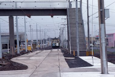
 Kew Historical Society Inc
Photograph - Construction of the Eastern Freeway (F19), Ron Setford, February 1972
Ron Setford and his wife Grace Setford lived in Tanner Avenue, East Kew, from c.1946 to c.1995. A keen photographer, he recorded the changing face of Kew over a 20 year period. Apart from 30 photographs of built structures and places in Kew dating from 1960 and 1961, 145 of his 35mm colour slides chronicle the development of the F19 (later renamed Eastern) Freeway through the Yarra Valley in Kew over a five year period from c.1972 to c.1977. This important collection was donated to the Society by his granddaughter in 2025.This collection of 175 35mm slides is of local and statewide significance, owing to its subject matter, particularly the major development of road transport infrastructure during the 1970s with the construction of the Eastern Freeway. The photographer also took care to annotate and date most of his slides which enable the researcher to pinpoint temporal and spatial locations.Workers and equipment at the beginning of construction of the Eastern (F19) Freeway in 1972. The site was identified by the photographer as being at the corner of the Chandler Highway, Earl Street and Princess Street."Eastern Fwy / Cnr Princess Sr Chandler Hwy Earl St / Feb 72"ron setford, eastern freeway, f19 freeway