Showing 870 items
matching road traffic
-
 Ringwood and District Historical Society
Pamphlet, Planning for the Future of Ringwood District Centre 2001 and Beyond - October 1987
A4 size 6-page multi-fold consultants' report outlining Ringwood's central structure plan for the new millennium. Topics: Traffic Circulation and Parking, Regional Retailing Focus, Entertainment Precinct, Office Precinct, Railway Precinct, Residential Conservation Zones, Retail Specialty Core, Commercial Boulevard, Possible Station Street Upgrading. Planning consultants - Wolinski Planners Pty. Ltd., were commissioned by Ministry for Planning and Environment, City of Ringwood and the Ministry of Transport in 1986 to prepare and exhibit the plan for public comment. After consideration of responses, the Working Group will make recommendations to the Council and Ministers subject to hearings of any formal submissions. -
 City of Moorabbin Historical Society (Operating the Box Cottage Museum)
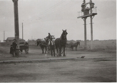
Photograph - Plateway (Wheelway) Steel, circa 1885
By the later 1800s the dirt roads in the then out-lying areas of the City of Moorabbin became dangerous, and almost impassable due to huge potholes and muddy swampy areas. The heavily laden market gardener’s carts regularly broke axles and wheels, and horses foundered on their way to the Melbourne markets. Even worse, the heavier “iron maidens”, carrying their malodorous loads of sewage from Melbourne’s inner suburbs for dumping in the outlying areas of the City of Moorabbin, also got bogged in the mire. It was decided that a practical solution to this problem was to install a metal plateway on the side of the problematic roads. In about 1887 the Moorabbin Shire Centre Road, in the Brighton East area, two parallel metal rails were installed so that the wheels of carts could run along smoothly, the horse travelled in the filled, middle area between the rails. Point Nepean Road plateway was removed in 1930 and Centre Dandenong Road plateway was removed in 1934-35. The worn plateway along Centre Road, East Brighton (now known as Bentleigh), was gradually taken up in several pieces, commencing in the the1920s, when its condition deteriorated and it caused a hazard to bikes, pedestrians, motor-cycles and the few early cars. The early steel plateway, constructed by David Munro, and opened on 23rd March 1885 by Thomas Bent, was built along Nepean Highway, between Asling St. and Bay St. The Point Nepean Track was subsequently extended into Moorabbin with branches along Centre, Cumins, South, Wickham, and Keys Roads, the total length was 13 miles. In 1908-1909 plates were laid along Centre Dandenong Road to Ross Street Bentleigh This innovative solution proved successful and was used until gradually the main roads were upgraded, and motorised vehicles started to appear. Two parallel metal rails were installed in the right hand side of a few main roads in the Shire of Moorabbin so that the wheels of heavily-loaded market gardener's carts on their way to markets in Melbourne could run along smoothly. The horse pulling the carts travelled in the filled, middle area between the rails. The Steel Plateway was constructed by David Munro, and opened on 23rd March 1885 by Thomas Bent. The wheelway first only ran along Nepean Highway, but it soon extended from Centre Dandenong Road, along Nepean road to its junction with Chapel Street, St Kilda. Later branch lines were built along Centre Road, Bentleigh as far as Warrigal Road and, according to early photographs, along Wickham Road Moorabbin as well. This innovative solution proved successful and was used until gradually the main roads were upgraded, and motorised vehicles started to appear. There was a problem with the wheelway : there was only a single set of rails and this was established on the right-hand side of the Nepean Road, travelling towards the city. Traffic FROM the city travelled on the correct or left-hand side of the road. The exception to this rule was the malodorous iron-clads, heavily riveted iron carts, generally travelling in convoy, carrying several tons of human effluent out of Melbourne to be trenched-in in the sandy soil of the Moorabbin district. Moorabbin City Council donated and installed a small section of Plateway at Box Cottage Museum in 1984melbourne, brighton, moorabbin, roads, plateway, wheelway, transport, st kilda, bent thomas, munro david, market gardens, steelway, carts horse-drawn, iron maidens, point nepean track -
 Bendigo Historical Society Inc.
Book - BENDIGO SALEYARDS COLLECTION: BENDIGO SALEYARDS RELOCATION STUDY - PLANNING REPORT AND ENVIRONMENT
Bendigo Saleyards Relocation Study - Planning Report and Environment Effects Statement for the City of Bendigo by A E Huefner & Associates Pty Ltd in association with Meldrum Burrows & Partners. Book has a light brown cover with black plastic binder spine. Green and yellow pages separate some sections. The front cover has a sketch of a stock transport with a pig, sheep and cattle behind gates. Contents include: Introduction, Summary, Recapitulation on the Feasibility Report which includes The Need for Action, the Site and Existing Uses Adjacent to the Site, The Proposal which includes Concept, Project Description, Components, Siting of Facilities, Land Clearing, Earthworks, Darainage, Buildings and Structures, Roads and Pavements, Services, Landscaping, Soil Profile and Construction Programme. Invironmental Effects which include Visual Impact Dust, Odours, Effluent, Effluent Treatment System, Traffic, Artificial Lighting, Noise, Operational Failures and Nature Conservation Effects. Statutory Planning Considerations which includes Zoning Controls and Suggested Procedure for Initiating I.D.O. Amendment. Appendices are: A.- Copy of Tit;e, B - Soil Investigation, C - Acoustic Assessment and D - Suggested Draft Amendment to Shire of Marong I.D.O. Contains a photo of the area - View of the Site, looking South and a number of drawings. Copies of various Council Reports referring to the Saleyards Relocation Project. It has a bright yellow cover and a hard plastic type spine. Mentioned in the reports is the cost to bring the old saleyards up to standard and list of improvements. Reports are as at 16th July, 1984. Mustard coloured book with plastic spine titled Bendigo Saleyards Relocation Study Feasibility Report by Meldrum Burrows & Partners in association with A E Huefner & Associates Pty Ltd and Acil Australia Pty Ltd dated September, 1983. Items mentioned are: Introduction, Summary, Background, Role in Livestock Marketing for the Bendigo Saleyards (Acil Australia Pty. Ltd., Saleyard Relocation: Strategic Considerations, Financial Implications and Conclusion. Appendix 1: Estimation of Livestock Population in Catchment Area. Drawings in Fig 1 Existing Bendigo Saleyards and Surrounding Land Uses, Fig 2 Catchment Area for Bendigo Saleyards 1983, Fig 4.1 Estimated Sheep Populatiuon in Catchment Area 1976 - 77 to 1981 - 82, Fig 4.2 Estimated Cattle Population in Catchment area 1976 -77 to 1981 -82, Fig 3 Possible Saleyard Relocation Areas, Fig 4, Directions from which access to possible Saleyard Locations would be obtained - Estimated percentage of sheep to cattle stock, Fig 5 Possible Saleyard Locations - Northern Area, Fig 6 Possible Locations of Saleyards - Inner West, Fig 7 Possible Locations of Saleyards - Outer West. Considerations were made as to renovate the existing saleyards or to move them elsewhere. Effluent, transport and stock movement, and condition of the yards were a problem.bendigo, council, cattle markets, bendigo saleyards collection - bendigo saleyards relocation study - planning report and environment effects statement, a e huefner & associates pty ltd, meldrum burrows & partners, city of bendigo, state electricity commission, mal styles, bendigo college of advanced education, n j fieldew, pryce goodale & duncan pty ltd, p b swift, shire of marong -
 Bendigo Historical Society Inc.
Document - NORMAN OLIVER COLLECTION: SPEECH NOTES 1955 POLICY SPEECH. LEGISLATIVE ASSEMBLY OF VICTORIA
The Norman Oliver collection. Norman Oliver was three times Mayor of Bendigo - 1950-51, 1964-65, 1970-71. Twenty one pages of typed speech notes for 'my policy speech on the occasion of this 1955 election for the Legislative Assembly of the State of Victoria'. Corrections and additions in black ink. Topics and policies mentioned in the speech include : Rotary, Housing, old people, gaols and institutions, roads and motor cars, parking and traffic confusion, education (university for Bendigo), industries, libraries, power and transport, water supply, sewerage, swimming pools, and the dangers of Communism. Norman Oliver was standing as a candidate for the Country Party. There is a front page with '1955 Election' written in blue pen.bendigo, hospital, speech notes, norman joseph oliver , councillor norman oliver. mayor of bendigo. victorian state election 1955. country party. -
 Bendigo Historical Society Inc.
Document - NORMAN OLIVER COLLECTION: SPEECH NOTES 1 AUGUST 1951
The Norman Oliver collection. Norman Oliver was three times Mayor of Bendigo - 1950-51, 1964-65, 1970-71. Sixteen pages of typed notes headed the Mayoral Report 1 August 1951.Topics include : council finances, the Health report, public conveniences, land for the School for Deaf Children, the width of roads, the Charing Cross bridge, and traffic control lights.bendigo, council, speech notes, norman joseph oliver , councillor norman oliver. mayor of bendigo. 3bo 'the mayor speaks'. school for deaf children. -
 Bendigo Historical Society Inc.
Document - BASIL MILLER COLLECTION: TRAMS - PLAN FOR REDECKING OF CHARING CROSS
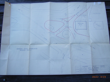
Temporary traffic channelling of Charing Cross, Stage 3 - Country Roads Board.person, individual, basil miller -
 Bendigo Historical Society Inc.
Document - BILL ASHMAN COLLECTION: VACUUM MAP OF TASMANIA
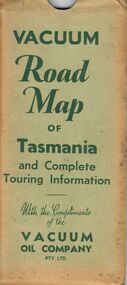
Vacuum Road Map of Tasmania and Complete Touring Information with the Compliments of the Vacuum Oil Company Pty Ltd. Coloured map of Tasmania with trucks, aeroplane, oil bottles and petrol bowsers in the margins. Alphabetical Index of Towns, Lakes, Mountains, Bays, Capes, etc., with key and Licensed Public Aerodromes in Tasmania and Their Location. On the back is Outlets of Hobart, Outlets of Launceston, What to See in Hobart, Beauty Spots and Tourist Information, What to See in Launceston, Vacuum Products, Traffic Hints, Super Plume or Plume, Making Sure of a Trouble-Free Trip and the front cover picture of a lady, child and a man in their car at the petrol bowser. Map folds up and is kept in a light green folder.map, bill ashman collection - correspondence, vacuum road map of tasmania and complete touring information, vacuum oil company pty ltd -
 Bendigo Historical Society Inc.
Document - BILL ASHMAN COLLECTION: VACUUM MAP OF SOUTH AUSTRALIA
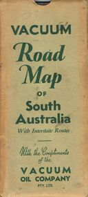
Vacuum Road Map of South Australia with Interstate Routes with the Compliments of the Vacuum Oil Company Pty. Ltd. Coloured map of S.A. with car, trucks, aeroplane and petrol bowsers on the map. Map only shows the Southern half of S.A. On the back is Adelaide-Melbourne Routes, Traffic Hints, Eucla to Perth, Tours Around Adelaide, Acknowledgement to the Royal Automobile Association of South Australia, Inc., Darwin-Adelaide Routes, Outlets of Adelaide, Vacuum Products, What to See in Adelaide, Super Plume Ethyl, Making Sure of a Trouble-Free Trip, and the front cover. Also folded in the map is a small map from Hancock's Garage, Kingston with routes from Melbourne to Adelaide and distances. On the back is an advertisement for Hancock's Garage and a map of Kingston. Map folded and kept in a light green cover.map, bill ashman collection - correspondence, vacuum road map of south australia, vacuum oil company pty ltd, commissioner of crown lands for south australia, royal automobile association of south australia, inc. -
 Bendigo Historical Society Inc.
Document - BILL ASHMAN COLLECTION: VACUUM ROAD MAP OF NEW SOUTH WALES
Vacuum Road Map of New South Wales with Interstate Routes with the Compliments of the Vacuum Oil Company Pty. Ltd. Coloured map of NSW with car, trucks, aeroplane and petrol bowsers around the margin. Has a list of principal Towns and Distances from Sydney. On the back is Beauty Spots around Sydney, Traffic Hints, Sydney-Melbourne Routes, Short Tours Around Sydney, Outlets of Sydney, Canberra and Newcastle, What to See in Sydney, Vacuum Products, Making Sure of a Trouble-Free Trip, Super Plume or Plume and the front picture of the folded map which has a car with a lady, child and a man at the petrol bowser. Map folds up and has a brown card pocket to keep it in.map, bill ashman collection - correspondence, vacuum road map of new south wales, vacuum oil company pty ltd, clive barass -
 Port Melbourne Historical & Preservation Society
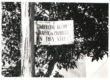
Photograph - Prohibited goods sign, Ross Street, Port Melbourne, Glen Stuart
Sign on lamp post in Ross Street - "Timber, coal, briquette traffic is prohibited in this street", also information re sign (Digital image on database)engineering - roads streets lanes and footpaths, ross street -
 Ballaarat Mechanics' Institute (BMI Ballarat)
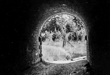
Film - Photograph by Herb Richmond. ca 1971, Creswick- Three Arch Bridge carrying the railway embankment. Two traffic lanes and a waterway. West of Creswick off the road to Bald Hills
Ballarat History35mm B&W Kodak Plus X Pan Film.ballarat, ballaraat, creswick, three, arch, bridge -
 Ballaarat Mechanics' Institute (BMI Ballarat)
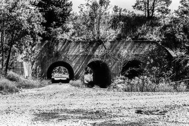
Film - Photograph by Herb Richmond. ca 1971, Creswick- Three Arch Bridge carrying the railway embankment. Two traffic lanes and a waterway. West of Creswick off the road to Bald Hills
Ballarat History35mm B&W Kodak Plus X Pan Film.ballarat, ballaraat, creswick, three arch, bridge -
 Ballaarat Mechanics' Institute (BMI Ballarat)
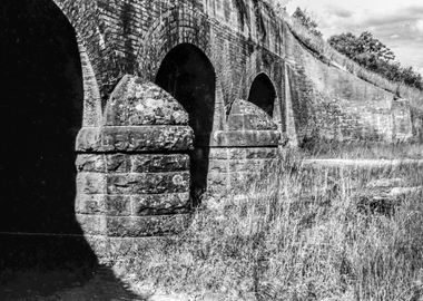
Film - Photograph by Herb Richmond. ca 1971, Creswick- Three Arch Bridge carrying the railway embankment. Two traffic lanes and a waterway. West of Creswick off the road to Bald Hills
Ballarat History35mm B&W Kodak Plus X Pan Film.ballarat, ballaraat, creswick, three, arch, bridge -
 Ballaarat Mechanics' Institute (BMI Ballarat)
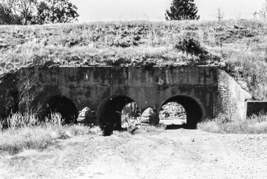
Film - Photograph by Herb Richmond. ca 1971, Creswick- Three Arch Bridge carrying the railway embankment. Two traffic lanes and a waterway. West of Creswick off the road to Bald Hills
Ballarat History35mm B&W Kodak Plus X Pan Film.ballarat, ballaraat, creswick, three, arch, bridge -
 Ballaarat Mechanics' Institute (BMI Ballarat)
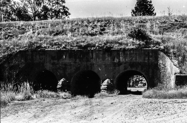
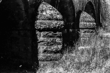
Film - Photograph by Herb Richmond. ca 1971, Creswick- Three Arch Bridge carring the Railway Embankment , Two Traffic Lanes, and a Waterway. West of Creswick off the road to Bald Hills
Ballarat History35mm B&W Kodak Plus X Pan Film.ballarat, ballaraat, creswick, arch, bridge -
 Ballaarat Mechanics' Institute (BMI Ballarat)
Film - Photograph by Herb Richmond. ca 1971, Creswick- Three Arch Bridge carring the Railway Embankment , Two Traffic Lanes, and a Waterway. West of Creswick off the road to Bald Hills
Ballarat History35mm B&W Kodak Plus X Pan Film.ballarat, ballaraat, creswick, arch, bridge -
 Port Melbourne Historical & Preservation Society
Plan - Traffic census, Port Melbourne, 6 Mar 1947
Traffic census 6th March 1947 showing intersections at Ingles Street and Williamstown Road (no 84), Lorimer Street and Salmon Street )no 90) Beach Street and Bay Street (no 113) Williamstown Road and Beach Road (no 112), Railway Crossing Graham Street (no 77)engineering - roads streets lanes and footpaths -
Port Melbourne Historical & Preservation Society
Plan - Concept, Boulevard upgrade at Sandridge Beach, traffic treatment, 2003
Plans. Traffic treatment. Concept for the Boulevard upgrade at Sandridge Beach. Dated October 2003local government - city of port melbourne, engineering - roads streets lanes and footpaths -
 Bendigo Historical Society Inc.
Newspaper - JENNY FOLEY COLLECTION: WORKS PLANNED
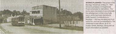
Bendigo Advertiser ''The way we were'' from Monday, July 11, 2005. Works planned: this photo in the Bendigo Advertiser of May 31, 1967 shows businesses on Eaglehawk Road scheduled for demolition. The works were necessary to accommodate the realignment of the Long Gully bend which had been declared a traffic hazard.newspaper, bendigo advertiser, the way we were -
 Bendigo Historical Society Inc.
Postcard - ACC LOCK COLLECTION: ESTAIRES AFTER GERMAN OFFENSIVE, POST, 1914-1918
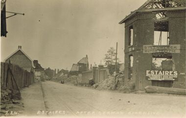
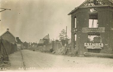
Postcard, WW1, B&W image of Estaires after a German offensive. Damaged/ruined buildings on sides of road. Two signs on building at right - 'Steenwerck Motor Traffic' and 'Estaires'. The latter has two arrows pointing in opposite directions to other towns. Copy Z 24 See also Copy 1401.73postcard, postcard, ww1, france, estaires, ruins -
 Bendigo Historical Society Inc.
Postcard - ACC LOCK COLLECTION: ESTAIRES AFTER GERMAN OFFENSIVE, POSTCARD, 1914-1918
Postcard, WW1, B&W image of Estaires after a German offensive. Damaged/ruined buildings on sides of road. Two signs on building at right - 'Steenwerck Motor Traffic' and 'Estaires'. The latter has two arrows pointing in opposite directions to other towns. Copy Z 24 See also Copy 1401.108postcard -
 Bendigo Historical Society Inc.
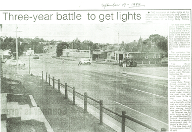
Newspaper - LONG GULLY HISTORY GROUP COLLECTION: INSTALLATION OF TRAFFIC LIGHTS EAGLEHAWK RD/CREETH ST
Copy of a newspaper article titled three-year battle to get lights printed on yellow paper. Date written at the top is September 19 - 1984.Photo shows Eaglehawk Rd with a man crossing the street and a car going past. A tractor is on the corner. The accompanying article mentions that residents have been campaigning to get the lights for over three years.bendigo, history, long gully history group, the long gully history group - installation of traffic lights eaglehawk rd/creeth st, long gully primary school, the road construction authority, ted coleman, bendigo city council, rite-way -
 Monbulk RSL Sub Branch
Book, Aurum Press Ltd, The secret listeners : The men and women posted across the world to intercept the secret german codes for Bletchley Park, 2012
Before Bletchley Park could break the German war machine's code, its daily military communications had to be monitored and recorded by 'the Listening Service', the wartime department whose bases moved with every theatre of war (Cairo, Malta, Gibraltar, Iraq, Cyprus) as well as having listening stations along the eastern coast of Britain to intercept radio traffic in the European theatre. This is the story of the - usually very young - men and women sent out to farflung outposts to listen in for Bletchley Park, an oral history of exotic locations and ordinary lives turned upside down by a sudden remote posting - the heady nightlife in Cairo, filing cabinets full of snakes in North Africa, and flights out to Delhi by luxurious flying boat.Index, ill, map, p.354.non-fictionBefore Bletchley Park could break the German war machine's code, its daily military communications had to be monitored and recorded by 'the Listening Service', the wartime department whose bases moved with every theatre of war (Cairo, Malta, Gibraltar, Iraq, Cyprus) as well as having listening stations along the eastern coast of Britain to intercept radio traffic in the European theatre. This is the story of the - usually very young - men and women sent out to farflung outposts to listen in for Bletchley Park, an oral history of exotic locations and ordinary lives turned upside down by a sudden remote posting - the heady nightlife in Cairo, filing cabinets full of snakes in North Africa, and flights out to Delhi by luxurious flying boat.world war 1939-1945 - great britain - intelligence, world war 1939-1945 - cryptography -
 Bendigo Historical Society Inc.
Newspaper - LONG GULLY HISTORY GROUP COLLECTION: THREE-YEAR BATTLE TO GET LIGHTS
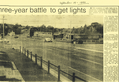
Copy of a newspaper article titled Three-year battle to get lights. Paper dated September 19, 1984. Article mentions there will be an installation of traffic lights at the intersection of Eaglehawk Rd and Creeth St. after a three year campaign. The intersection would cater fully for pedestrians and make it a lot safer for the school children.bendigo, history, long gully history group, the long gully history group - three-year battle to get lights, long gully primary school, the road construction authority, mr ted coleman, bendigo city council, rite-way -
 Bendigo Historical Society Inc.
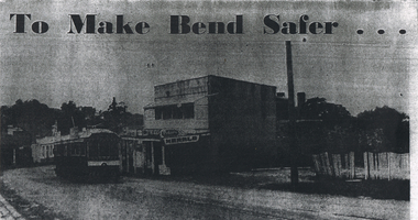
Newspaper - LONG GULLY HISTORY GROUP COLLECTION: EAGLEHAWK ROAD - LONG GULLY
Copy of a newspaper photo titled To Make Bend Safer. Photo shows a tram passing a newsagent shop. On the right is a dilapidated picket fence. Allso hand written paper on one side is: Approx 1966 ? One of the last trams No 18 to run up Main Street of Long Gully (Bond Street) Now known as Eaglehawk Road. On Left - Post Office - now Gents Hairdresser & Rose of No 3 Australia Hotel. On Right - Les & Marie Norris Newsagency & Mixed Business. 2 story building was Commercial Hotel. No 26 Tram was the last to run between Bendigo, Long Gully & Eaglehawk. Still running as a Tourist. Donated by Alan Crossley. tram in Bendigo 1987 1985. On the other side is written: One building has already been demolished and the proprietor of the Newsagency & mixed business Mr. L W Norris, will also demolish and rebuild further back from the road in preparation for eventual re-alignment of the Long Gully bend by the Country Roads Board. The Board declared an alignment some years ago for the corner - a severe traffic hazard - but, the assistant Divisional Engineer, Mr G Marshallsea said yesterday the Board had no immediate plans. These were one of the last Trams to run through Long Gully.bendigo, history, long gully history group, the long gully history group - eaglehawk road - long gully -
Dutch Australian Heritage Centre Victoria
Board game (bordspel), Spika, Wie krijgt voorrang (Who gives way)
Lid illustrated with box contents. Box contains board marked with traffic game. Counters, cards, one dice. Instructions and description. Spika Made in DGReducational board game, traffic game -
 Dutch Australian Heritage Centre Victoria
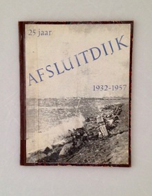
Book, 25 Jaar Afsluitdijk 1932-1957 (25 years of the Enclosure Dike), 1957. A stamp - 5 mei 1958 - indicates the library acquired it the following year
The book commemorates the opening of the Afsluitdijk in 1932. Shutting off the North Sea created the IJsselmeer and connected the provinces of North Holland and Friesland. It has remained an essential traffic artery every since.The book records the cultural, economic and social impact of the Afsluitdijk on the Netherlands. A 56page rectanguar book commemorating the opening of the Afsluitdijk. The cover is of thick card while within the pages of text are illustrated with black and white photographs.Originally owned and eventually deregistered by "De Utrechtse Openbare Bibliotheek" (Utrecht Public Library). Another stamp. "Filiaal Elinkwijk" shows it was used by the library branch in Elinkwijk. Full title is "Vijfentwintig Jaar Afsluitdijk". Authors and illustrators are B. Den Oudsten en P.Terpstra with an introduction by the Queen's representative in Friesland, Mr.H.P.Linthorst Homan. Publisher is Algmeen Publiciteit Kantoor, Oosterkade 20b, Leeuwarden. -
 National Vietnam Veterans Museum (NVVM)
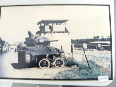
Photograph, Tank And A Bike
... of a road. A bike rests against the front of the tank. The tank... and there is civilian traffic on the road Tank And A Bike Photograph Photograph ...A mounted coloured photograph of a tank parked on the side of a road. A bike rests against the front of the tank. The tank is outside a Military compound and there is civilian traffic on the roadphotograph, military compound, armoured vehicle -
 St Kilda Historical Society
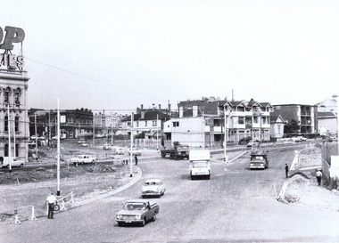
Photograph, St kilda Junction Construction Barkly Street, c. 1968
black and white matt photograph good condition unmountedhandwritten on back: High St (St Kilda Road) left and Barkly Street, right. Detours opened to traffic. Photo filed 27.3.1968. Copyright. This photograph may not be reproduced without permission in writing from the Editor of "The Age". 250 Spencer Street, Melbourne and 39/41 York st, Sydney. -
 Puffing Billy Railway
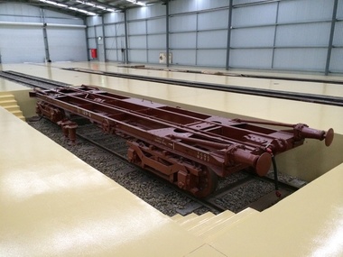
Victorian Railways 2'6" Transporter wagon 129Q, 1926
The Q class were introduced as bogie flatwagons in the 1870's. Large Q wagons as shown were built to the 1920's In the early 1900's, some Q wagons were modified for Pintsch Gas traffic with a small pump motor cabin at one end and a tank for carrying the gas. Other conversions for traffic were as required. Examples were: sheet glass, skeletal underframes between workshops In 1926 the railways built two narrow gauge Garratt locomotives. As normal wagons were unsuitable for moving these locomotives a special skeletal wagon was built. The engines were split into units for transportation. It featured axle bearings and boxes from steam engines, had hinged buffers that could drop out of the way during loading/unloading. It also featured 'strap' rail along the deck. The wagon was Q 129. This wagon was also available for general narrow gauge rolling stock. Q wagons were numbered from 1 to 136. Service History: *Q 129.VA - 1/ 6/1926 NWS Built new H/brake & drop buffers. For traffic of Narrow Guage stock 31/ 1/1931 NWS Into Workshops - 16/ 6/1931 NWS Out of Workshops (50 days) 6/11/1931 NWS Into Workshops - 27/11/1931 NWS Out of Workshops (22 days) 24/ 8/1936 NWS Into Workshops - 10/ 9/1936 NWS Out of Workshops (18 days) 27/11/1936 NWS Into Workshops - 26/ 2/1937 NWS Out of Workshops (Light repairs) circa 1960 - Photograph SL20 p32, loaded with 7NA / /1975 - Photograph #393 / /1976 - Photograph #553, #554 19/ 3/1979 - Condemned - 10/ 4/1979 - Off Register - 10/ 4/1979 - Sold (to) ETR, Belgrave / /1989 EME Body [GRE]. [SXC]: 29/3/92, MEL127E5, Puffing Billy at station Historic - Victorian Railways - Transporter wagon used to carry and transfer 2' 6" Narrow gauge rolling stock over Victorian broad gauge (1,600 mm (5 ft 3 in) main lines to the narrow gauge lines. Q 129 was unique, it was built to transport narrow gauge locomotives. Transporter Wagon made of Steel and wrought Iron129Q129q, puffing billy, transporter wagon