Showing 26859 items matching " 'road district'"
-
 Whitehorse Historical Society Inc.
Document, Constituting a road district to b a shire, 1857, 1862, 1872
... Constituting a road district to b a shire.......Nunawading Road District...(v) Extract from Victorian Government Gazette, 7 Aug 1857 - Proclamation of Nunawading Road District (vi) Public meeting for election of members for Nunawading District Roads Board....(v) Extract from Victorian Government Gazette, 7 Aug 1857 - Proclamation of Nunawading Road District (vi) Public meeting for election of members for Nunawading District Roads Board....(v) Extract from Victorian Government Gazette, 7 Aug 1857 - Proclamation of Nunawading Road District (vi) Public meeting for election of members for Nunawading District Roads Board. ...Extract from Government Gazette(iv)Extract from Government Gazette No 25, 3 May 1872 - Proclamation of Shire of Nunawading. (v) Extract from Victorian Government Gazette, 7 Aug 1857 - Proclamation of Nunawading Road District (vi) Public meeting for election of members for Nunawading District Roads Board.Extract from Government Gazette local government, nunawading road district, shire of nunawading, barkly, henry sir -
 Sunshine and District Historical Society Incorporated
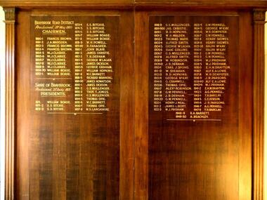
Honour Board - Braybrook Road District Honour Board Unveiling, Unveiled 15 March 1940
... Braybrook Road District Honour Board Unveiling...braybrook road district...Local government for the area began on 28th May 1860 when the BRAYBROOK ROAD BOARD DISTRICT was proclaimed, however this authority was soon superseded on 23rd January 1871 when the SHIRE OF BRAYBROOK came into existence. ...Contains in gold coloured lettering the names of people who served as CHAIRMEN of the BRAYBROOK ROAD DISTRICT and as PRESIDENTS of the SHIRE OF BRAYBROOK during the years 1860 to 1950....Braybrook Road District. Proclaimed 28th May 1860. Names: Francis Brown, J.A. ...Honour Board Braybrook Road District Honour Board Unveiling ...By around circa 1850 Braybrook was already well established, and during the gold rush period also became a staging point for prospectors on their way to the diggings. Local government for the area began on 28th May 1860 when the BRAYBROOK ROAD BOARD DISTRICT was proclaimed, however this authority was soon superseded on 23rd January 1871 when the SHIRE OF BRAYBROOK came into existence. The Shire of Braybrook continued as the local government authority for the district until the CITY OF SUNSHINE was proclaimed in 1951. This Honour Board was unveiled on Monday 18th March 1940 at 8:30 p.m., and was hung in the Council Chamber, at the Shire of Braybrook Hall, Sunshine.The Honour Board is a historical record of the people who served as heads of local government in the district from 1860 to 1950.Letter to special quests inviting them to the unveilingof the honour board on the 18th March 1940 at 8:30pm Photograph of large brown stained wooden structure comprised of two board sections positioned side by side to make one display board. Contains in gold coloured lettering the names of people who served as CHAIRMEN of the BRAYBROOK ROAD DISTRICT and as PRESIDENTS of the SHIRE OF BRAYBROOK during the years 1860 to 1950.Braybrook Road District. Proclaimed 28th May 1860. Names: Francis Brown, J.A. Marsden, W.J. Clarke, William Boase, S.S. Ritchie, W.H. Powell, R. Faragher, John Blair, James Christie, T.B. Derham, George Mclagan, James Dickson, George Graham, William Hopkins, W.C. Barnett, Richard Manning, James Howatson, G.S. Mullenger, Thomas Opie, W.S. Lancashire, R.D. Hopkins, W.H.Waldon, Thomas Warr, Alfred Smith, Isaac Collins, W. Robinson, J.B. Derham, Chas J. Spong, W. Sheahan, George McKay, G.Cranwell, Alexander Robinson, G.W. Pennell, Henry J. Neal, James L. Scott, W.J. Pridham, W.R. Dempster, Henry Skewes, Ralph McKay, E.M.H. Drayton, Alf E.A. Lowe, J.R. Parsons, A.G. Pennell, T.R. Barclay, G.E. Dobson, R.A. Barrett, A. Beachley.braybrook road district, shire of braybrook, chairmen, presidents -
 Bacchus Marsh & District Historical Society
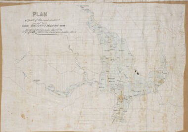
Map, Plan of part of the road district of Bacchus Marsh circa 1856-1862
... Plan of part of the road district of Bacchus Marsh circa 1856-1862......Bacchus Marsh Road District...By 1856 the local committee in Bacchus Marsh was constituted as the Bacchus Marsh Road District. This entity continued until 1862 when the name changed to the Bacchus Marsh and Maddingley Road District. ...A single page paper map showing a plan of part of the road district of Bacchus Marsh. The map is pasted into a bound volume containing 76 maps or plans in total. ...Bacchus Marsh Victoria Maps Bacchus Marsh Road District Local government Road Districts Irrigation A single page paper map showing a plan of part of the road district of Bacchus Marsh. ...Local government in much of Victoria including the Bacchus Marsh area began with the formation of 'local committees'. These local committees could make representations to a Central Road Board regarding plans for road construction. Road construction and maintenance were seen as the essential tasks of these early local government authorities. By 1856 the local committee in Bacchus Marsh was constituted as the Bacchus Marsh Road District. This entity continued until 1862 when the name changed to the Bacchus Marsh and Maddingley Road District. This new entity lasted until 1871 when the local government authority in accordance with new statewide legislation became known as the Shire of Bacchus Marsh. The title of this plan being a plan of 'a portion of the road district of Bacchus Marsh' suggests that the plan was produced sometime between 1856 and 1862. The main purpose of this map was to shown the irrigable land in the district and the sources from which water for irrigation could be drawn. Bacchus Marsh was an early irrigation district in Victoria. Irrigation trusts were formed in the 1880s and 1890s to manage irrigation districts. But this was the culmination of many years of earlier attempts to construct irrigation systems in the Bacchus Marsh area and create a system to manage irrigation more broadly. This map dating from around 1856-1862 is an important cartographic document which provides evidence of how the early planning for irrigation was developing in the Bacchus Marsh region.A single page paper map showing a plan of part of the road district of Bacchus Marsh. The map is pasted into a bound volume containing 76 maps or plans in total. High resolution digital image stored on BMDHS computer network. bacchus marsh victoria maps, bacchus marsh road district, local government, road districts, irrigation -
Whitehorse Historical Society Inc.
Document, Nunawading Road District, 1857
... Nunawading Road District......Nunawading Road District...A copy from Ivan Southall's 'A Tale of Box Hill', proclamation by Sir Henry Barkly, Governor of the Colony of Victoria, the name of Nunawading Road District. 6 Aug 1857. Extract from Victoria Government Gazette no 91....Nunawading Road District Document Document ...A copy from Ivan Southall's 'A Tale of Box Hill', proclamation by Sir Henry Barkly, Governor of the Colony of Victoria, the name of Nunawading Road District. 6 Aug 1857.A copy from Ivan Southall's 'A Tale of Box Hill', proclamation by Sir Henry Barkly, Governor of the Colony of Victoria, the name of Nunawading Road District. 6 Aug 1857. Extract from Victoria Government Gazette no 91.A copy from Ivan Southall's 'A Tale of Box Hill', proclamation by Sir Henry Barkly, Governor of the Colony of Victoria, the name of Nunawading Road District. 6 Aug 1857.local government, nunawading road district, barkly, henry (sir) -
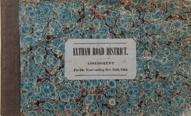
 Eltham District Historical Society Inc
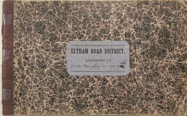
Ledger, Eltham Road District. Assessment for the Year ending Oct. 14th, 1858, 1857c
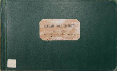
... Eltham Road District. Assessment for the Year ending Oct. 14th, 1858......Eltham Road District...Copy re-bound in green hard leather look card by Arnall & Jackson Pty Ltd Brunswick, 1968 Eltham Road District. Assessment for the Year ending Oct. 14th, 1858 Ledger Arnall & Jackson Pty ltd ...The Eltham Roads Board was established in 1856. This is a unique significant record of early settlers in the Shire of Eltham. One of 6 early rate books. This is among the oldest items in the EDHS collection. An article in the Eltham and Whittlesea Shires Advertiser Friday 21 Nov 1941 Page 5 titled: District's Early History states: "The first rate book which is still in existence at the Shire Office is for the year ending October 14, 1858 and is probably the best record possible to indicate the development of the district. At the time properties were rated as follows: Cultivated land. 6d. per acre; pasture land, 1d. per acre: estimated annual value of buildings, etc., 6d in the (pound). The total amount of rate recorded for the year was (pounds)153/14/8. Properties were described as being situated at Lower Plenty, Yarra Yarra, Eltham, Lower Eltham, Kangaroo Ground, Yarra Flats, Diamond Creek and the Yarra."Ledger with printed columns: Number, Name of Occupier, Description, Where situated, Cultivated land, Pasture land, Estimated annual value of buildings, Rate, Remarks. Ledger filled out by hand with 152 entries (not alphabetically arranged). A number of blank pages are included. Copy re-bound in green hard leather look card by Arnall & Jackson Pty Ltd Brunswick, 1968 Inside cover includes a compliments slip taped to the cover from Arnall & Jackson Pty Ltd. with handwritten inscription: "Ian, I hope the hysterical society doesn't get historical about this". Organised 1968 I. Maynard Inside cover includes pasted printed note: RATE OF ASSESSMENT AS FOLLOWS: Cultivated land 6d per acre Pasture land 1 per acre Estimated Annual Value of Buildings, &c., 6d. in the Pound eltham roads board, rate book, rate payers, transaction, pioneers, settlers, 1858, assessment ledger, eltham road district, public records office victoria (prov), rate books, shire of eltham archives -
 Eltham District Historical Society Inc
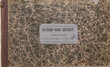
Ledger, Eltham Road District. Assessment for the Year ending Oct. 14th, 1859, 1858c
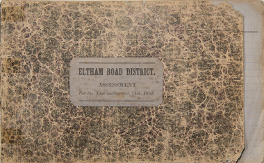
... Eltham Road District. Assessment for the Year ending Oct. 14th, 1859......Eltham Road District...A number of blank pages are included. Eltham Road District. Assessment for the Year ending Oct. 14th, 1859 Ledger ...The Eltham Roads Board was established in 1856. This ledger includes the signature of Road Board Secretary and Collector Wingrove, a significant person in Eltham's early history. This is a unique significant record of early settlers in the Shire of Eltham. One of 6 early rate books. This is among the oldest items in the EDHS collection. An article in the Eltham and Whittlesea Shires Advertiser Friday 21 Nov 1941 Page 5 titled: District's Early History states: "The first rate book which is still in existence at the Shire Office is for the year ending October 14, 1858 and is probably the best record possible to indicate the development of the district. At the time properties were rated as follows: Cultivated land. 6d. per acre; pasture land, 1d. per acre: estimated annual value of buildings, etc., 6d in the (pound). The total amount of rate recorded for the year was (pounds)153/14/8. Properties were described as being situated at Lower Plenty, Yarra Yarra, Eltham, Lower Eltham, Kangaroo Ground, Yarra Flats, Diamond Creek and the Yarra."Ledger with printed columns: Number, Name of Occupier, Description, Where situated, Cultivated land, Pasture land, Estimated annual value of buildings, Rate, Remarks, Arrears collected, excused, unoccupied, uncollected and amount actually collected. Ledger filled out by hand with 173 entries (not alphabetically arranged). A number of blank pages are included. Inside cover includes pasted printed note: RATE OF ASSESSMENT AS FOLLOWS: Cultivated land 6d per acre Pasture land 2d per acre Unalienated Pasture Land 8d per Acre Estimated Annual Value of Buildings, &c., 6d. in the Pound eltham roads board, rate book, rate payers, transaction, pioneers, settlers, wingrove, 1859, assessment ledger, eltham road district, public records office victoria (prov), rate books, shire of eltham archives -
 Eltham District Historical Society Inc
Ledger, Eltham Road District. Assessment for the Year ending Oct. 14th, 1860 (Version 1), 1859c
... Eltham Road District. Assessment for the Year ending Oct. 14th, 1860 (Version 1)......Eltham Road District...A number of blank pages are included. Eltham Road District. Assessment for the Year ending Oct. 14th, 1860 (Version 1) Ledger ...The Eltham Roads Board was established in 1856. This is a unique significant record of early settlers in the Shire of Eltham. One of 6 early rate books. This is among the oldest items in the EDHS collection. An article in the Eltham and Whittlesea Shires Advertiser Friday 21 Nov 1941 Page 5 titled: District's Early History states: "The first rate book which is still in existence at the Shire Office is for the year ending October 14, 1858 and is probably the best record possible to indicate the development of the district. At the time properties were rated as follows: Cultivated land. 6d. per acre; pasture land, 1d. per acre: estimated annual value of buildings, etc., 6d in the (pound). The total amount of rate recorded for the year was (pounds)153/14/8. Properties were described as being situated at Lower Plenty, Yarra Yarra, Eltham, Lower Eltham, Kangaroo Ground, Yarra Flats, Diamond Creek and the Yarra."Ledger with printed columns: Number, Name of Occupier, Description, Where situated, Cultivated land, Pasture land, Estimated annual value of buildings, Rate, Remarks, Arrears collected, excused, unoccupied, uncollected and amount actually collected. Ledger filled out by hand with 177 entries (not alphabetically arranged). A number of blank pages are included. Inside cover includes pasted printed note: RATE OF ASSESSMENT AS FOLLOWS: Cultivated land 6d per acre Pasture land 2d per acre Unalienated Pasture Land 8d per Acre Estimated Annual Value of Buildings, &c., 6d. in the Pound eltham roads board, rate book, rate payers, transaction, pioneers, settlers, wingrove, 1860, assessment ledger, eltham road district, public records office victoria (prov), rate books, shire of eltham archives -
 Eltham District Historical Society Inc
Ledger, Eltham Road District. Assessment for the Year ending Oct. 14th, 1860 (Version 2), 1859c
... Eltham Road District. Assessment for the Year ending Oct. 14th, 1860 (Version 2)......Eltham Road District...This version was slight changes to version one. Eltham Road District. Assessment for the Year ending Oct. 14th, 1860 (Version 2) Ledger ...The Eltham Roads Board was established in 1856. This is a unique significant record of early settlers in the Shire of Eltham. One of 6 early rate books. This is among the oldest items in the EDHS collection. An article in the Eltham and Whittlesea Shires Advertiser Friday 21 Nov 1941 Page 5 titled: District's Early History states: "The first rate book which is still in existence at the Shire Office is for the year ending October 14, 1858 and is probably the best record possible to indicate the development of the district. At the time properties were rated as follows: Cultivated land. 6d. per acre; pasture land, 1d. per acre: estimated annual value of buildings, etc., 6d in the (pound). The total amount of rate recorded for the year was (pounds)153/14/8. Properties were described as being situated at Lower Plenty, Yarra Yarra, Eltham, Lower Eltham, Kangaroo Ground, Yarra Flats, Diamond Creek and the Yarra."Ledger with printed columns: Number, Name of Occupier, Description, Where situated, Cultivated land, Pasture land, Estimated annual value of buildings, Rate, Remarks, Arrears collected, excused, unoccupied, uncollected and amount actually collected. Ledger filled out by hand with 177 entries (not alphabetically arranged). A number of blank pages are included. This version was slight changes to version one. Inside cover includes pasted printed note: RATE OF ASSESSMENT AS FOLLOWS: Cultivated land 6d per acre Pasture land 2d per acre Unalienated Pasture Land 8d per Acre Estimated Annual Value of Buildings, &c., 6d. in the Pound eltham roads board, rate book, rate payers, transaction, pioneers, settlers, 1860, assessment ledger, eltham road district, public records office victoria (prov), rate books, shire of eltham archives -
 Eltham District Historical Society Inc
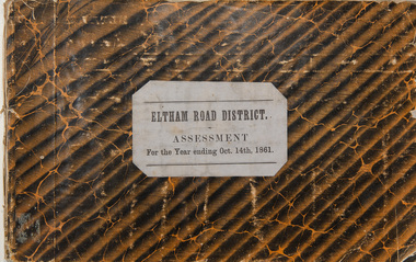
Ledger, Eltham Road District. Assessment for the Year ending Oct. 14th, 1861, 1860c
... Eltham Road District. Assessment for the Year ending Oct. 14th, 1861......Eltham Road District...A number of blank pages are included. Eltham Road District. Assessment for the Year ending Oct. 14th, 1861 Ledger ...The Eltham Roads Board was established in 1856. This is a unique significant record of early settlers in the Shire of Eltham. One of 6 early rate books. This is among the oldest items in the EDHS collection. An article in the Eltham and Whittlesea Shires Advertiser Friday 21 Nov 1941 Page 5 titled: District's Early History states: "The first rate book which is still in existence at the Shire Office is for the year ending October 14, 1858 and is probably the best record possible to indicate the development of the district. At the time properties were rated as follows: Cultivated land. 6d. per acre; pasture land, 1d. per acre: estimated annual value of buildings, etc., 6d in the (pound). The total amount of rate recorded for the year was (pounds)153/14/8. Properties were described as being situated at Lower Plenty, Yarra Yarra, Eltham, Lower Eltham, Kangaroo Ground, Yarra Flats, Diamond Creek and the Yarra."Ledger with printed columns: Number, Name of Occupier, Description, Where situated, Cultivated land, Pasture land, Estimated annual value of buildings, Rate, Remarks, Arrears collected, excused, unoccupied, uncollected and amount actually collected. Ledger filled out by hand with 185 entries (not alphabetically arranged) and summary section. A number of blank pages are included. Inside cover includes pasted printed note: RATE OF ASSESSMENT AS FOLLOWS: Cultivated land 6d per acre Pasture land 2d per acre Unalienated Pasture Land 8d per Acre Estimated Annual Value of Buildings, &c., 6d. in the Pound eltham roads board, rate book, rate payers, transaction, pioneers, settlers, 1861, assessment ledger, eltham road district, public records office victoria (prov), rate books, shire of eltham archives -
 Eltham District Historical Society Inc
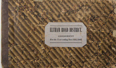
Ledger, Eltham Road District. Assessment for the Year ending Oct. 14th, 1862, 1861c
... Eltham Road District. Assessment for the Year ending Oct. 14th, 1862......Eltham Road District...A number of blank pages are included. Eltham Road District. Assessment for the Year ending Oct. 14th, 1862 Ledger ...The Eltham Roads Board was established in 1856. This is a unique significant record of early settlers in the Shire of Eltham. One of 6 early rate books. This is among the oldest items in the EDHS collection. An article in the Eltham and Whittlesea Shires Advertiser Friday 21 Nov 1941 Page 5 titled: District's Early History states: "The first rate book which is still in existence at the Shire Office is for the year ending October 14, 1858 and is probably the best record possible to indicate the development of the district. At the time properties were rated as follows: Cultivated land. 6d. per acre; pasture land, 1d. per acre: estimated annual value of buildings, etc., 6d in the (pound). The total amount of rate recorded for the year was (pounds)153/14/8. Properties were described as being situated at Lower Plenty, Yarra Yarra, Eltham, Lower Eltham, Kangaroo Ground, Yarra Flats, Diamond Creek and the Yarra."Ledger with printed columns: Number, Name of Occupier, Description, Where situated, Cultivated land, Pasture land, Estimated annual value of buildings, Rate, Remarks, Arrears collected, excused, unoccupied, uncollected and amount actually collected. Ledger filled out by hand with 184 entries (not alphabetically arranged) and summary section. A number of blank pages are included. Inside cover includes pasted printed note: RATE OF ASSESSMENT AS FOLLOWS: Cultivated land 6d per acre Pasture land 1/2d per acre Unalienated Pasture Land 1/28 per Acre Estimated Annual Value of Buildings, &c., 6d. in the Pound eltham roads board, rate book, rate payers, transaction, pioneers, settlers, 1862, assessment ledger, eltham road district, public records office victoria (prov), rate books, shire of eltham archives -
 Eltham District Historical Society Inc
Ledger, Eltham Road District. Assessment for the Year ending Oct. 14th, 1863, 1862c
... Eltham Road District. Assessment for the Year ending Oct. 14th, 1863......Eltham Road District...A number of blank pages are included. Eltham Road District. Assessment for the Year ending Oct. 14th, 1863 Ledger ...The Eltham Roads Board was established in 1856. This is a unique significant record of early settlers in the Shire of Eltham. One of 6 early rate books. This is among the oldest items in the EDHS collection. An article in the Eltham and Whittlesea Shires Advertiser Friday 21 Nov 1941 Page 5 titled: District's Early History states: "The first rate book which is still in existence at the Shire Office is for the year ending October 14, 1858 and is probably the best record possible to indicate the development of the district. At the time properties were rated as follows: Cultivated land. 6d. per acre; pasture land, 1d. per acre: estimated annual value of buildings, etc., 6d in the (pound). The total amount of rate recorded for the year was (pounds)153/14/8. Properties were described as being situated at Lower Plenty, Yarra Yarra, Eltham, Lower Eltham, Kangaroo Ground, Yarra Flats, Diamond Creek and the Yarra."Ledger with printed columns: Number, Name of Occupier, Description, Where situated, Cultivated land, Pasture land, Estimated annual value of buildings, Rate, Remarks, Arrears collected, excused, unoccupied, uncollected and amount actually collected. Ledger filled out by hand with 181 entries (not alphabetically arranged) and summary section. A number of blank pages are included. Inside cover includes pasted printed note: RATE OF ASSESSMENT AS FOLLOWS: Cultivated land 6d per acre Pasture land 1/2d per acre Unalienated Pasture Land 1/28 per Acre Estimated Annual Value of Buildings, &c., 6d. in the Pound eltham roads board, rate book, rate payers, transaction, pioneers, settlers, 1863, assessment ledger, eltham road district, public records office victoria (prov), rate books, shire of eltham archives -
Whitehorse Historical Society Inc.
Map, Nunawading Road District, 01/04/1863
... Nunawading Road District...Nunawading Road District...Proclaimed Roads 149. Nunawading Road District Roads and Streets Plan of proposed new road - April 1863 & estimated expenses. ...Plan of proposed new road - April 1863 & estimated expenses.Plan of proposed new road - April 1863 & estimated expenses. Scale 20 chains per inch. Proclaimed Roads 149.Plan of proposed new road - April 1863 & estimated expenses.nunawading road district, roads and streets -
Whitehorse Historical Society Inc.
Document, Constituting a road district to be a shire, 1872
... Constituting a road district to be a shire...Copy from Ivan Southall's 'A Tale of Box Hill', constitution of Nunawading District Road Board to the Shire of Nunawading, extract from Government Gazette, 3 May 1872....Constituting a road district to be a shire Document Document ...Copy from Ivan Southall's 'A Tale of Box Hill', constitution of Nunawading District Road Board to the Shire of Nunawading, extract from Government Gazette, 3 May 1872.Copy from Ivan Southall's 'A Tale of Box Hill', constitution of Nunawading District Road Board to the Shire of Nunawading, extract from Government Gazette, 3 May 1872.Copy from Ivan Southall's 'A Tale of Box Hill', constitution of Nunawading District Road Board to the Shire of Nunawading, extract from Government Gazette, 3 May 1872.local government, nunawading district roads board, shire of nunawading -
Whitehorse Historical Society Inc.
Document, Nunawading and District local government records
... ...Nunawading Road District...from Road District 1857 through to City of Nunawading 1994 and lists of location of records for each period within the Public Record Office. ...Records of the municipalities of Nunawading and Box Hill districts from Road District 1857 through to City of Nunawading 1994 and lists of location of records for each period within the Public Record Office. ...Local Government Nunawading Road District Shire of Nunawading Borough of Box Hill City of Box Hill Shire of Blackburn and Mitcham City of Nunawading Victoria. ...Records of the municipalities of Nunawading and Box Hill districtsRecords of the municipalities of Nunawading and Box Hill districts from Road District 1857 through to City of Nunawading 1994 and lists of location of records for each period within the Public Record Office. Extracts from PRO lists of holdings.Records of the municipalities of Nunawading and Box Hill districts local government, nunawading road district, shire of nunawading, borough of box hill, city of box hill, shire of blackburn and mitcham, city of nunawading, victoria. public record office -
 Sunshine and District Historical Society Incorporated
Document - Shire of Braybrook Invitation 1940 Unveiling of an honour board containing the names of Chairmen of Braybrook District Road Board and past presidents of the Shire, 1940
... Shire of Braybrook Invitation 1940 Unveiling of an honour board containing the names of Chairmen of Braybrook District Road Board and past presidents of the Shire...Shire of Braybrook Invitation 1940 Unveiling of an honour board containing the names of Chairmen of Braybrook District Road Board and past presidents of the Shire...Typed document inviting exShire of Braybrook presidents to the unveiling of an honour board containing the names of Chairmen of Braybrook District Road Board and past presidents of the Shire The document is dated 15th March 1940...Shire of Braybrook President Chairman Typed document inviting exShire of Braybrook presidents to the unveiling of an honour board containing the names of Chairmen of Braybrook District Road Board and past presidents of the Shire The document is dated 15th March 1940 Shire of Braybrook Invitation 1940 Unveiling of an honour board containing the names of Chairmen of Braybrook District Road Board and past presidents of the Shire Document Shire of Braybrook Invitation 1940 Unveiling of an honour board containing the names of Chairmen of Braybrook District Road Board and past presidents of the Shire ...Typed document inviting exShire of Braybrook presidents to the unveiling of an honour board containing the names of Chairmen of Braybrook District Road Board and past presidents of the Shire The document is dated 15th March 1940shire of braybrook, president, chairman -
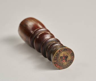 City of Greater Bendigo - Civic Collection
Ceremonial object - Common Seal, Campaspe District Road Board Seal
... Campaspe District Road Board Seal...Campaspe District Road Board...Remnants of red wax remain in seal. Campaspe District Road Board Seal Ceremonial object Common Seal ...Wax seals have been used since the Middle Ages and are primarily used for legitimising and authenticating official documents. This wax seal was used by the Campaspe Road Board (later the Huntly Council). The first president of the Campaspe Road Board was Sir James Joseph Casey who was a member of the municipal council of Sandhurst prior to holding this position in 1861.Circular, brass seal with wooden handle. Remnants of red wax remain in seal. Campaspe District Road Boardhuntly shire (1866-1994), city of greater bendigo administration item -
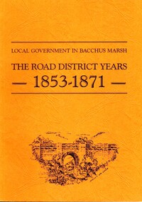 Bacchus Marsh & District Historical Society
Book, John Lloyd, The Road District Years, 1853-1871: Local Government in Bacchus Marsh
... The Road District Years, 1853-1871: Local Government in Bacchus Marsh...Year and place of publication is 1986, Bacchus Marsh, Victoria. The Road District Years, 1853-1871: Local Government in Bacchus Marsh Book John Lloyd ...This work describes the early evolution and history of local government in the Bacchus Marsh area. Local government bodies in Victoria and in other places had their origins in committees and local boards which were established to regulate over pressing local issues, raise revenue, and expend it in a limited range of social and economic ways. The early areas of responsibility were dominated by the need for local roads and this book primarily looks at this period of local government history in the Bacchus Marsh area. Overtime the range of areas local government bodies took responsibility for expanded and this work begins to trace this transformation in its earliest stages. It is a fascinating and detailed account of the early history of local government in Bacchus Marsh containing many amusing anecdotes among the wealth of administrative historical data. The author who was at one time an employee of the Shire of Bacchus Marsh has drawn directly from the early local records such as minutes of meetings, records of expenditure, newspaper reports and notices in the Victoria Government Gazette.Soft cover foolscap size book. 128 pages with b & w illustrations, maps and plans. No publisher is indicated in the work but it is likely to have been privately published by the author John Lloyd. Year and place of publication is 1986, Bacchus Marsh, Victoria.non-fictionThis work describes the early evolution and history of local government in the Bacchus Marsh area. Local government bodies in Victoria and in other places had their origins in committees and local boards which were established to regulate over pressing local issues, raise revenue, and expend it in a limited range of social and economic ways. The early areas of responsibility were dominated by the need for local roads and this book primarily looks at this period of local government history in the Bacchus Marsh area. Overtime the range of areas local government bodies took responsibility for expanded and this work begins to trace this transformation in its earliest stages. It is a fascinating and detailed account of the early history of local government in Bacchus Marsh containing many amusing anecdotes among the wealth of administrative historical data. The author who was at one time an employee of the Shire of Bacchus Marsh has drawn directly from the early local records such as minutes of meetings, records of expenditure, newspaper reports and notices in the Victoria Government Gazette.bacchus marsh shire council, local government bacchus marsh history -
 Sunshine and District Historical Society Incorporated
Honour Board - Braybrook Chairmen and Presidents Honour Boards, 1951
... ... Braybrook Road District...Two large honour boards of the Braybrook Road District Chairmen and Shire of Braybrook Presidents. ...Shire of Braybrook Braybrook Road District Honoue Board Names: Francis Brown, J.A. ...Erected in council offices to commemorate past civic leaders. Put up after the Shire of Braybrook was converted into the City of Sunshine in 1951. Removed after most of the City of Sunshine was absorbed into City of Brimbank on 15 December 1994. Salvaged by Sunshine & District Historical Society Inc.Two large honour boards of the Braybrook Road District Chairmen and Shire of Braybrook Presidents. Names and dates are in gold lettering.Names: Francis Brown, J.A. Marsden, W.J. Clarke, William Boase, S.S. Ritchie, W.H. Powell, R. Faragher, John Blair, James Christie, T.B. Derham, George Mclagan, James Dickson, George Graham, William Hopkins, W.C. Barnett, Richard Manning, James Howatson, G.S. Mullenger, Thomas Opie, W.S. Lancashire, R.D. Hopkins, W.H.Waldon, Thomas Warr, Alfred Smith, Isaac Collins, W. Robinson, J.B. Derham, Chas J. Spong, W. Sheahan, George McKay, G.Cranwell, Alexander Robinson, G.W. Pennell, Henry J. Neal, James L. Scott, W.J. Pridham, W.R. Dempster, Henry Skewes, Ralph McKay, E.M.H. Drayton, Alf E.A. Lowe, J.R. Parsons, A.G. Pennell, T.R. Barclay, G.E. Dobson, R.A. Barrett, A. Beachley.shire of braybrook, braybrook road district, honoue board -
 Ringwood and District Historical Society
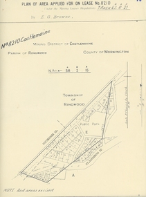
Map, Department of Mines, Plan of area applied for under the mining leases regulations in the township of Ringwood between Maroondah Highway and Mt. Dandenong Road. Mining District of Castlemaine, County of Mornington, Parish of Ringwood T Area 58(A) 2 (R)15(P) Acres, Roods, Perches. 1934, 20-Feb-34
... Dandenong Road. Mining District of Castlemaine, County of Mornington, Parish of Ringwood T Area 58(A) 2 (R)15(P) Acres, Roods, Perches. 1934...Dandenong Road. the area applied for on lease No.8210 by E.G.Browne.Mining District of Castlemaine, County of Mornington, Parish of Ringwood T Area 58(A) 2 (R)15(P) Acres, Roods, Perches....Dandenong Road. Mining District of Castlemaine, County of Mornington, Parish of Ringwood T Area 58(A) 2 (R)15(P) Acres, Roods, Perches +Additional Keywords: Browne E.G....Dandenong Road. Mining District of Castlemaine, County of Mornington, Parish of Ringwood T Area 58(A) 2 (R)15(P) Acres, Roods, Perches +Additional Keywords: Browne E.G. ...Map of the township of Ringwood with subdivisions between Maroondah Highway and Mt. Dandenong Road. the area applied for on lease No.8210 by E.G.Browne.Mining District of Castlemaine, County of Mornington, Parish of Ringwood T Area 58(A) 2 (R)15(P) Acres, Roods, Perches.Buff coloured sheet foolscap with black printing showing map of the township of Ringwood between Maroondah Highway and Mt. Dandenong Road. Mining District of Castlemaine, County of Mornington, Parish of Ringwood T Area 58(A) 2 (R)15(P) Acres, Roods, Perches +Additional Keywords: Browne E.G. -
 Eltham District Historical Society Inc
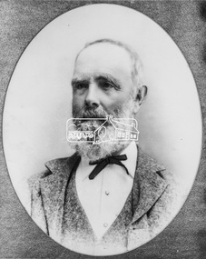
Photograph, C.S. Wingrove, Secretary, Eltham District Road Board 1858-1871; Shire Secretary, Shire of Eltham 1871-1904, 1858-1871
... Wingrove, Secretary, Eltham District Road Board 1858-1871; Shire Secretary, Shire of Eltham 1871-1904......eltham district road board...In 1857 he was appointed as Secretary to the Eltham District Roads Board only one year after its foundation. ...In 1857 he was appointed as Secretary to the Eltham District Roads Board only one year after its foundation. ...Charles Symons Wingrove, J.P. (1829-1905) arrived in Victorian in 1851. He had trained as an engineer, but tried his luck on the goldfields. In 1857 he was appointed as Secretary to the Eltham District Roads Board only one year after its foundation. He was to hold the position with the Board and later the Eltham Shire Council for total of 47 years. He also held the position of engineer for a large part of this period. During part of this time he was also secretary to the Heidelberg Shire Council. Over this period he was responsibly for an area stretching from Clifton Hill to Healesville, along the northern bank of the Yarra River. Other positions included Secretary to the Victorian Agricultural Society over along period.Wingrove was a main figure in the Municipal Association of Victoria. By the time he retired he was recognized as the “Grand Old Man” of Victorian local government. In 1858 Wingrove had a brick cottage built in Main Road near the State School and he lived here until his death. One room was uded as the Board and Council office. His descendants owned the house until 1974. It was later used as a psychiatric clinic. The park opposite the cottage has been named Wingrove Park in his honour. He is buried at St Helena with other members of his family. Age (Melbourne, Vic. : 1854 - 1954), Tuesday 18 July 1905, page 5 ABOUT PEOPLE. A conspicuous figure in northern municpal history, Mr. Charles Symons Wingrove, has passed away. He was for many years secretary and engineer for the shire of Eltham, and prior to the formation of the shire held the position under the old road board, his official connection with the district dating from beyond 1857. For about twelve years he also filled the position of shire engineer for Heidelberg council while retaining his other post, and the immense territory under his professional control, reaching from the boundary of Collingwood up to Healesville, was a matter of fatherly pride and interest to him. He arrived in Victoria in 1851, and was 76 years of age at his death. Mr. Wingrove retired from the position in the Eltham council only about a year ago. The interment will take place in St. Helena Cemetery, near Eltham township, today. Secretary, Eltham District Road Board 1858-1871 Secretary for the Shire of Eltham 1871-1904. Nearly 50 years service to the local community. For about twelve years he also filled the position of shire engineer for Heidelberg council. Reproduced Page 137 "Pioneers & Painters" This photo forms part of a collection of photographs gathered by the Shire of Eltham for their centenary project book,"Pioneers and Painters: 100 years of the Shire of Eltham" by Alan Marshall (1971). The collection of over 500 images is held in partnership between Eltham District Historical Society and Yarra Plenty Regional Library (Eltham Library) and is now formally known as the 'The Shire of Eltham Pioneers Photograph Collection.' It is significant in being the first community sourced collection representing the places and people of the Shire's first one hundred years.Digital image Print 25 x 20 cmc.s.wingrove, charles symons wingrove, eltham district road board, sepp, shire of eltham pioneers photograph collection, shire secretary, wingrove cottage, pioneers and painters, shire of eltham, councilor, municipal officer -
Whitehorse Historical Society Inc.
Document, Electing members of the District Road Board, 1862
... Electing members of the District Road Board...Copy from Ivan Southall''s 'A Tale of Box Hill', public meeting for the election of members of the Nunawading District Road Board, for fixing the rate for the current year and appointing auditors. ...Whitehorse Historical Society Inc. 2-10 Deep Creek Road Mitcham melbourne Extract from Road Board minute book, 10 Sept 1862. Local government Nunawading District Roads Board Copy from Ivan Southall''s 'A Tale of Box Hill', public meeting for the election of members of the Nunawading District Road Board, for fixing the rate for the current year and appointing auditors. ...Copy from Ivan Southall''s 'A Tale of Box Hill', public meeting for the election of members of the Nunawading District Road Board, for fixing the rate for the current year and appointing auditors.Copy from Ivan Southall''s 'A Tale of Box Hill', public meeting for the election of members of the Nunawading District Road Board, for fixing the rate for the current year and appointing auditors. Extract from Road Board minute book, 10 Sept 1862.Copy from Ivan Southall''s 'A Tale of Box Hill', public meeting for the election of members of the Nunawading District Road Board, for fixing the rate for the current year and appointing auditors.local government, nunawading district roads board -
 Eltham District Historical Society Inc
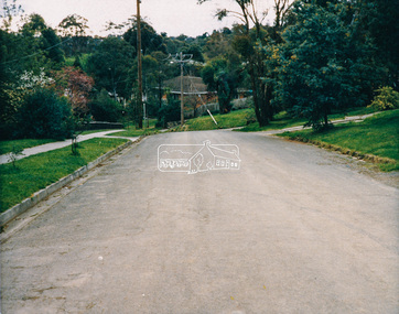
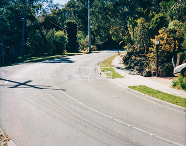
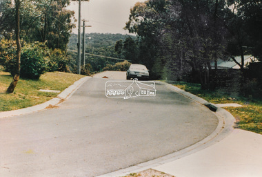
Photograph - Colour Print, Eltham Shire Council, Unidentified road, Eltham district, c.Oct. 1987
... Unidentified road, Eltham district...Eltham District Historical Society Inc 728 Main Rd Eltham melbourne Date based on other similar display panels visible in images of the Shire of Eltham display at the Eltham Community Festival, 7 November 1987. 20 x 25 cm Shire of Eltham Engineering Department Providing the resources to undertake • Survey, design, consultation • Road construction and maintenance • Bridge construction and maintenance • Street sweeping • Drain and pit cleaning • Traffic engineering installation and maintenance • Garbage collection • Tip management, land reclamation and beautification • Maintenance of community buildings • Provision of community and recreation facilities Unidentified Display panel Eltham Festival Footpaths and gutters Infrastructure Residential Roads shire of eltham streets 1987 Colour print on commercial photo paper Unidentified road, Eltham district Photograph Colour Print Eltham Shire Council ...Date based on other similar display panels visible in images of the Shire of Eltham display at the Eltham Community Festival, 7 November 1987. 20 x 25 cm Shire of Eltham Engineering Department Providing the resources to undertake • Survey, design, consultation • Road construction and maintenance • Bridge construction and maintenance • Street sweeping • Drain and pit cleaning • Traffic engineering installation and maintenance • Garbage collection • Tip management, land reclamation and beautification • Maintenance of community buildings • Provision of community and recreation facilitiesunidentified, display panel, eltham festival, footpaths and gutters, infrastructure, residential, roads, shire of eltham, streets, 1987 -
 Eltham District Historical Society Inc
Photograph - Colour Print, Eltham Shire Council, Unidentified road, Eltham district, c.Oct. 1987
... Unidentified road, Eltham district...Eltham District Historical Society Inc 728 Main Rd Eltham melbourne Date based on other similar display panels visible in images of the Shire of Eltham display at the Eltham Community Festival, 7 November 1987. 20 x 25 cm Shire of Eltham Engineering Department Providing the resources to undertake • Survey, design, consultation • Road construction and maintenance • Bridge construction and maintenance • Street sweeping • Drain and pit cleaning • Traffic engineering installation and maintenance • Garbage collection • Tip management, land reclamation and beautification • Maintenance of community buildings • Provision of community and recreation facilities Unidentified Display panel Eltham Festival Footpaths and gutters Infrastructure Residential Roads shire of eltham streets 1987 Colour print on commercial photo paper Unidentified road, Eltham district Photograph Colour Print Eltham Shire Council ...Date based on other similar display panels visible in images of the Shire of Eltham display at the Eltham Community Festival, 7 November 1987. 20 x 25 cm Shire of Eltham Engineering Department Providing the resources to undertake • Survey, design, consultation • Road construction and maintenance • Bridge construction and maintenance • Street sweeping • Drain and pit cleaning • Traffic engineering installation and maintenance • Garbage collection • Tip management, land reclamation and beautification • Maintenance of community buildings • Provision of community and recreation facilitiesunidentified, display panel, eltham festival, footpaths and gutters, infrastructure, residential, roads, shire of eltham, streets, 1987 -
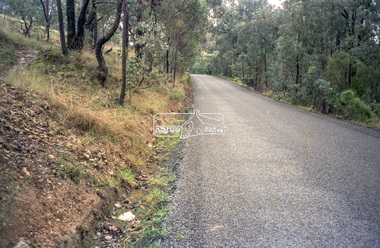
 Eltham District Historical Society Inc
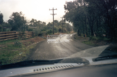
Photograph - Black and White Print, Unidentified road, Eltham district, possibly Montmorency, c. Sep. 1966
... Unidentified road, Eltham district, possibly Montmorency...Eltham District Historical Society Inc 728 Main Rd Eltham melbourne Infrastructure Roads Unidentified Originally located in a Filmpro King Size Prints processing envelope $3.01 Shire of Eltham 9/9/66 and noted as Calrossie Ave area and crossed out Eltham-Yarra Glen Road, Bridge Street to Elsa Court existing conditions mid 1967 Black and white photographic print Unidentified road, Eltham district, possibly Montmorency Photograph Black and White Print ...Black and white photographic printOriginally located in a Filmpro King Size Prints processing envelope $3.01 Shire of Eltham 9/9/66 and noted as Calrossie Ave area and crossed out Eltham-Yarra Glen Road, Bridge Street to Elsa Court existing conditions mid 1967infrastructure, roads, unidentified -
 Eltham District Historical Society Inc
Photograph - Black and White Print, Unidentified road, Eltham district, possibly Montmorency, c. Sep. 1966
... Unidentified road, Eltham district, possibly Montmorency...Eltham District Historical Society Inc 728 Main Rd Eltham melbourne Infrastructure Roads Unidentified Originally located in a Filmpro King Size Prints processing envelope $3.01 Shire of Eltham 9/9/66 and noted as Calrossie Ave area and crossed out Eltham-Yarra Glen Road, Bridge Street to Elsa Court existing conditions mid 1967 Black and white photographic print Unidentified road, Eltham district, possibly Montmorency Photograph Black and White Print ...Black and white photographic printOriginally located in a Filmpro King Size Prints processing envelope $3.01 Shire of Eltham 9/9/66 and noted as Calrossie Ave area and crossed out Eltham-Yarra Glen Road, Bridge Street to Elsa Court existing conditions mid 1967infrastructure, roads, unidentified -
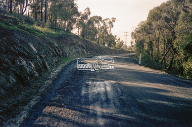
 Eltham District Historical Society Inc
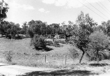
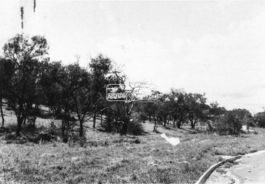
Negative - Photograph, Eltham Shire Council, Unidentified road, Eltham district, c.1985
... Unidentified road, Eltham district...Eltham District Historical Society Inc 728 Main Rd Eltham melbourne One of a series of images on roll of film shot by Eltham Shire Council officers focussing on road and street infrastructure maintenance and upgrades and new rollover kerb and channel profiles Infrastructure Road construction road drainage Road Sealing Roadworks shire of eltham streets Streetscape Kodak CP100 5094 Roll of 35mm colour negative film, 4 strips Unidentified road, Eltham district Negative Photograph Eltham Shire Council ...One of a series of images on roll of film shot by Eltham Shire Council officers focussing on road and street infrastructure maintenance and upgrades and new rollover kerb and channel profilesRoll of 35mm colour negative film, 4 stripsKodak CP100 5094infrastructure, road construction, road drainage, road sealing, roadworks, shire of eltham, streets, streetscape -
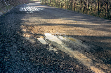
 Eltham District Historical Society Inc
Negative - Photograph, Eltham Shire Council, Unidentified road, Eltham district, c.1985
... Unidentified road, Eltham district...Eltham District Historical Society Inc 728 Main Rd Eltham melbourne One of a series of images on roll of film shot by Eltham Shire Council officers focussing on road and street infrastructure maintenance and upgrades and new rollover kerb and channel profiles Infrastructure Road construction road drainage Road Sealing Roadworks shire of eltham streets Streetscape Kodak CP100 5094 Roll of 35mm colour negative film, 4 strips Unidentified road, Eltham district Negative Photograph Eltham Shire Council ...One of a series of images on roll of film shot by Eltham Shire Council officers focussing on road and street infrastructure maintenance and upgrades and new rollover kerb and channel profilesRoll of 35mm colour negative film, 4 stripsKodak CP100 5094infrastructure, road construction, road drainage, road sealing, roadworks, shire of eltham, streets, streetscape -
 Eltham District Historical Society Inc
Negative - Photograph, Eltham Shire Council, Unidentified road, Eltham district, c.1985
... Unidentified road, Eltham district...Eltham District Historical Society Inc 728 Main Rd Eltham melbourne One of a series of images on roll of film shot by Eltham Shire Council officers focussing on road and street infrastructure maintenance and upgrades and new rollover kerb and channel profiles Infrastructure Road construction road drainage Road Sealing Roadworks shire of eltham streets Streetscape Kodak CP100 5094 Roll of 35mm colour negative film, 4 strips and associated colour print Unidentified road, Eltham district Negative Photograph Eltham Shire Council ...One of a series of images on roll of film shot by Eltham Shire Council officers focussing on road and street infrastructure maintenance and upgrades and new rollover kerb and channel profilesRoll of 35mm colour negative film, 4 strips and associated colour printKodak CP100 5094infrastructure, road construction, road drainage, road sealing, roadworks, shire of eltham, streets, streetscape -
 Eltham District Historical Society Inc
Negative - Photograph, Eltham Shire Council, Unidentified road, Eltham district, c.1985
... Unidentified road, Eltham district...Eltham District Historical Society Inc 728 Main Rd Eltham melbourne One of a series of images on roll of film shot by Eltham Shire Council officers focussing on road and street infrastructure maintenance and upgrades and new rollover kerb and channel profiles Infrastructure Road construction road drainage Road Sealing Roadworks shire of eltham streets Streetscape Kodak CP100 5094 Roll of 35mm colour negative film, 4 strips and associated colour print Unidentified road, Eltham district Negative Photograph Eltham Shire Council ...One of a series of images on roll of film shot by Eltham Shire Council officers focussing on road and street infrastructure maintenance and upgrades and new rollover kerb and channel profilesRoll of 35mm colour negative film, 4 strips and associated colour printKodak CP100 5094infrastructure, road construction, road drainage, road sealing, roadworks, shire of eltham, streets, streetscape