Showing 62 items matching " 50 view street"
-
 Surrey Hills Historical Society Collection
Photograph - 50 View Street, Surrey Hills, The Street Where You Live Project
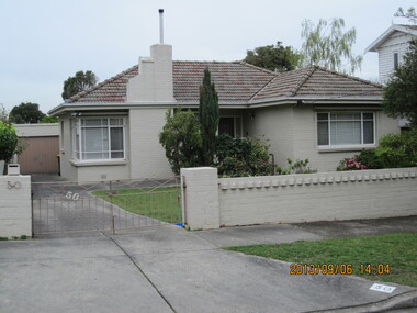
... 50 View Street, Surrey Hills...The Street Where You Live Project Photograph 50 View Street, Surrey Hills ...Photos documenting this address as part of a photographic series undertaken by volunteer photographers during 2013 and 2014 for The Street Where You Live Project. This was organised through the Surrey Hills Neighbourhood Centre and covered the postcode 3127 in the cities of Boroondara and Whitehorse.These photos provide a snapshot of real estate in the suburbs of Mont Albert and Surrey Hills during a period of rapid change with many properties on large blocks demolished to create higher density residential development or renewal of single dwellings. At particular risk were properties not covered by heritage overlays, especially interwar housing and post 1950's housing. -
 Bendigo Historical Society Inc.
Document - MASONIC SHADE'S HOTEL - MENU, 1874-1922
... ... 50 View Street...Masonic Shade's Hotel [under the Masonic Hall building], now the Bendigo Capital Theatre, 50 View Street, Bendigo. 1874; Harrie Johnson 1888; W J Milburn 1911; Closed 18/12/1922. ...Masonic Shade's Hotel [under the Masonic Hall building] now the Bendigo Capital Theatre 50 View Street Bendigo. 1874; Harrie Johnson 1888; W J Milburn 1911; Closed 18/12/1922. ...Masonic Shade's Hotel - Menu. Unused Menu Card. Markings: 5/- 100 8/- 200. Masonic Shade's Hotel [under the Masonic Hall building], now the Bendigo Capital Theatre, 50 View Street, Bendigo. 1874; Harrie Johnson 1888; W J Milburn 1911; Closed 18/12/1922. More information on the history of the hotel on the two A4 pages included.buildings, hotel, masonic shade's hotel, masonic shade's hotel - menu. unused menu card. markings: 5/- 100 8/- 200. masonic shade's hotel [under the masonic hall building], now the bendigo capital theatre, 50 view street, bendigo. 1874; harrie johnson 1888; w j milburn 1911; closed 18/12/1922. more information on the history of the hotel on the two a4 pages included. -
 Bendigo Historical Society Inc.
Pamphlet - Bendigo Regional Arts Centre Pamplet, 1997
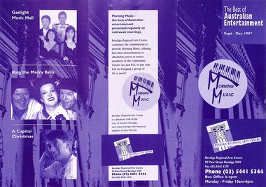
... 'The Best of Australian Entertainment' 'Sept-Dec 1997' 'Morning Music' 'Bendigo Regional Arts Centre, 50 View Street Bendigo 3550' 'Fax (03) 54416375; Phone (03) 54415344' 'Box Office is open Monday - Friday 10am-6pm'...Heidi Teague Collection Bendigo Bendigo Regional Arts Centre 'The Best of Australian Entertainment' 'Sept-Dec 1997' 'Morning Music' 'Bendigo Regional Arts Centre, 50 View Street Bendigo 3550' 'Fax (03) 54416375; Phone (03) 54415344' 'Box Office is open Monday - Friday 10am-6pm' Pamphlet in purple and white printing advertising program of events for Bendigo Regional Arts Centre 1997. ...Pamphlet advertising musical programs for Bendigo Regional Arts Centre held on mid-week mornings.Pamphlet in purple and white printing advertising program of events for Bendigo Regional Arts Centre 1997.'The Best of Australian Entertainment' 'Sept-Dec 1997' 'Morning Music' 'Bendigo Regional Arts Centre, 50 View Street Bendigo 3550' 'Fax (03) 54416375; Phone (03) 54415344' 'Box Office is open Monday - Friday 10am-6pm'heidi teague collection, bendigo, bendigo regional arts centre -
 Bendigo Historical Society Inc.
Photograph - NICHOLAS CAIRE VIEWS OF BENDIGO
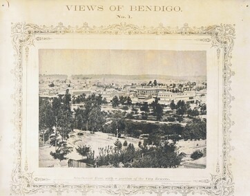
... Paul's Church tower looking north eastward. 49) Township of Eaglehawk 50) View of Mitchell Street, Sandhurst. 51) Botanical gardens near the White Hills. 52) View Point, Sandhurst....Paul's Church tower looking north eastward. 49) Township of Eaglehawk 50) View of Mitchell Street, Sandhurst. 51) Botanical gardens near the White Hills. 52) View Point, Sandhurst. ...Full set (52 photos) of Nicholas Caire ''Views of Bendigo'' photographs. 1) Sandhurst East with a portion of the City Reserve. 2) New Chum line of reef. 3) Sandhurst-North part as seen from the top of the Masonic Hall. 4) The Hustler's line of reef seen from Redan Hill. 5) Battery of stampers for crushing quartz 6) View of Sandhurst as seen from the top of the New Masonic Hall. 7) Excavation of quartz reef near Ironbark Hill. 8) St. Paul's Church, tower and belfry. 9) View of the Camp Reserve as seen from the Court House. 10) View of North Old Chum showing surface excavations. 11) View as seen from the Camp Hill near the lodge. 12) Garden Gully amalgamated claims. 13) Shamrock Hotel, Sandhurst. 14) View as seen from Court House showing the willows & East Pall Mall. 15) Wesleyan Church, Golden Square. 16) Savings bank, Sandhurst. 17) The Bendigo district hospital. 18) Interior of the Wesleyan Church, Golden Square. 19) View of Golden Square township. 20) The Town Hall, City of Sandhurst. 21) The City Hotel, Sandhurst. 22) Pall Mall, Sandhurst. 23) Sandhurst City Market. 24) Pall Mall, Sandhurst looking west. 25) View from Camp Hill looking north - east 26) View of Charing Cross, Sandhurst. 27) View of Sandhurst as seen from Knipe's Castle. 28) Township of Long Gully. 29) View taken from St. Paul's tower. 30) View of the Sandhurst cemetery at back creek. 31) Kock's pioneer quartz crushing plant, Long Gully. 32) The New Masonic Hall, Sandhurst. 33) The Bendigo benevolent asylum and industrial school. 34) Bendigo flat as seen from Wattle Hill. 35) View of Old Chum Hill. 36) New Chum Gully as seen from Specimen Hill. 37) Township of Eaglehawk. 38) View from St. Paul's tower looking south west. 39) View of the railway tunnel through the Big Hill, near Mt. Herbert. 40) View taken from St. Paul's looking south. 41) Scene taken from St. Paul's tower looking eastward. 42) View of Sandhurst from St. Paul's tower looking north-west. 43) The great extended Hustler's co's. quartz mining claim. 44) View from the Big Hill showing the line of railway to Melbourne. 45) View from St. Paul's Church tower looking westward. 46) View from St. Paul's Church tower looking north-west. 47) Scene near the Big Hill ranges taken from Mr. Buick's residence. 48) View from St. Paul's Church tower looking north eastward. 49) Township of Eaglehawk 50) View of Mitchell Street, Sandhurst. 51) Botanical gardens near the White Hills. 52) View Point, Sandhurst.bendigo, streetscape, various views, nicholas cairne -
 Australian Queer Archives
Audio, 2SER 107.3 FM (Radio Station : Sydney, NSW) : Gaywaves : 4/8/1983 : Enola Gay special on disarmament, 1983
... Australian Queer Archives 79-81 Fitzroy Street St Kilda melbourne Produced for Enola Gay's participation in Hiroshima Day, Sat 6 August 1983, assembling at Belmore Park at 10 am under the Enola Gay banners. 0:00: Introduction and song; 3:50: Japanese instrumental music; 9:08: Commentary resumes - history of the bombing of Hiroshima, 6 Aug 1945, and Nagasaki 3 days later; 15:30: Music Tomorrow never comes until it's too late; 19:45: Commentary including accounts from survivors; 26:58: Music, Take the toys from the boys; 29:25: Commentary regarding arms race, including voice of Fabian LoSchiavo regarding dissident religious views in the USA; 33:05: Music, California dreaming; 36:10: Commentary re the practicalities of bomb shelters; 38:00: Music, Cancer, cancer; 41:40: Commentary re peace marches in Europe, health effects of radiation, civil defense in nuclear war, music; 47:35: Music, Universal soldier (cut off towards end), anti-war parody of Yankee Doodle Uncle Sam with Australian refs (Omega, Pine Gap etc); 59:10: Commentary regarding nuclear bomb testing at Marilinga (SA) and Monte Bello islands; 1:01:15: Music, 'But I aint a marchin' any more'; 1:04:05: Commentary re costs of arms race - refs to gay and feminist anti-war groups overseas; 1:05:58: Music, Down by the riverside/Aint gonna study war no more, promo for Enola Gay and prep for Hiroshima Day, instrumental music, music US forces (Midnight Oil), Soft touch (Poison Girls); 1:26:56: Music, Thank Christ for the bomb, eerie instrumental music, Maralinga (Midnight Oil), Not another bomb song, ending at 1:39:00. ...Produced for Enola Gay's participation in Hiroshima Day, Sat 6 August 1983, assembling at Belmore Park at 10 am under the Enola Gay banners. 0:00: Introduction and song; 3:50: Japanese instrumental music; 9:08: Commentary resumes - history of the bombing of Hiroshima, 6 Aug 1945, and Nagasaki 3 days later; 15:30: Music Tomorrow never comes until it's too late; 19:45: Commentary including accounts from survivors; 26:58: Music, Take the toys from the boys; 29:25: Commentary regarding arms race, including voice of Fabian LoSchiavo regarding dissident religious views in the USA; 33:05: Music, California dreaming; 36:10: Commentary re the practicalities of bomb shelters; 38:00: Music, Cancer, cancer; 41:40: Commentary re peace marches in Europe, health effects of radiation, civil defense in nuclear war, music; 47:35: Music, Universal soldier (cut off towards end), anti-war parody of Yankee Doodle Uncle Sam with Australian refs (Omega, Pine Gap etc); 59:10: Commentary regarding nuclear bomb testing at Marilinga (SA) and Monte Bello islands; 1:01:15: Music, 'But I aint a marchin' any more'; 1:04:05: Commentary re costs of arms race - refs to gay and feminist anti-war groups overseas; 1:05:58: Music, Down by the riverside/Aint gonna study war no more, promo for Enola Gay and prep for Hiroshima Day, instrumental music, music US forces (Midnight Oil), Soft touch (Poison Girls); 1:26:56: Music, Thank Christ for the bomb, eerie instrumental music, Maralinga (Midnight Oil), Not another bomb song, ending at 1:39:00.Maxwell UD XL I - C90 cassette tapeInscribed in biro on label: "ENOLA GAY Disarmament Special - Gaywaves 2SER 4/8/83."anti-nuclear activism, gay and lesbian activism, hiroshima day -
 Bendigo Historical Society Inc.
Magazine - AILEEN AND JOHN ELLISON COLLECTION: WALKABOUT MAGAZINE 1966
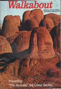
... History House 11 Mackenzie Street Bendigo goldfields BOOK Magazine Travel Walkabout magazine special annual issue December 1966. Price 50 cents. On the cover a view ...Walkabout magazine special annual issue December 1966. Price 50 cents. On the cover a view of the Olgas and at bottom presenting: "this Australia" big colour section. The magazine has 84 pages. Contents: Mail bag - Publisher's column - 1966 and all that - The small world of Jamesy rice - modern miners dig foundations of new Australia - Christmas Day - This Australia - Holiday, Australian style - Pages turned by children - Charlie delta tango - On the move - book reviews.book, magazine, travel -
 Bendigo Historical Society Inc.
Document - H. A. & S. R. WILKINSOM COLLECTION: CONTRACT OF SALE
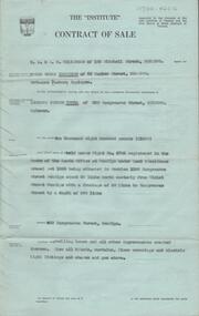
... View Street, Bendigo. Solicitor for purchaser: H. E. Every, Dispensatory Walk, Bendigo. Property: 529 Hargreaves Street, Bendigo being land held under right No. 4703 registered in the books of the lands office at Bendigo under land 9residence areas) act 1955 being situated in section 139C Hargreaves Street, Bendigo about 69 links north easterly from Violet Street Bendigo with a frontage of 50 links to Hargreaves Street by a depth of 200 links, together with dwelling house and all improvements, also all blinds, curtains, floor coverings and electric light fittings and shades and gas stove. ...View Street, Bendigo. Solicitor for purchaser: H. E. Every, Dispensatory Walk, Bendigo. Property: 529 Hargreaves Street, Bendigo being land held under right No. 4703 registered in the books of the lands office at Bendigo under land 9residence areas) act 1955 being situated in section 139C Hargreaves Street, Bendigo about 69 links north easterly from Violet Street Bendigo with a frontage of 50 links to Hargreaves Street by a depth of 200 links, together with dwelling house and all improvements, also all blinds, curtains, floor coverings and electric light fittings and shades and gas stove. ...Contract of sale dated 28th November between Mr. E. S. Harrison (vendor) and Mr. L. J. Tuena. Solicitor for vendor: E. S. Cahill & son View Street, Bendigo. Solicitor for purchaser: H. E. Every, Dispensatory Walk, Bendigo. Property: 529 Hargreaves Street, Bendigo being land held under right No. 4703 registered in the books of the lands office at Bendigo under land 9residence areas) act 1955 being situated in section 139C Hargreaves Street, Bendigo about 69 links north easterly from Violet Street Bendigo with a frontage of 50 links to Hargreaves Street by a depth of 200 links, together with dwelling house and all improvements, also all blinds, curtains, floor coverings and electric light fittings and shades and gas stove. Price: 1,600 pounds. Attached: statement pursuant to section 34 and engagement or appointment in writing pursuant to section 33 of the estate agents act, 1956.organization, business, h.a. & s.r wilkinson real estate -
 Bendigo Historical Society Inc.
Photograph - POST OFFICE: SANDHURST, approx. 1905 - 1910 ?
... History House 11 Mackenzie Street Bendigo goldfields COTTAGE Miners previous reg. no. (reverse) Rohal Historical Society of Victoria, Bendigo Branch, 1959 50 sepia photo: view of Post Office, Sandhurst from Rosalind Park, fence and trees in foreground. ...sepia photo: view of Post Office, Sandhurst from Rosalind Park, fence and trees in foreground. Fence formed from strips of wood forming diamond shaped lattice.previous reg. no. (reverse) Rohal Historical Society of Victoria, Bendigo Branch, 1959 50cottage, miners -
 Bendigo Historical Society Inc.
Postcard - ACC LOCK COLLECTION: BAILLEUL AFTER GERMAN OFFENSIVE FACING MONT KEMMELL FROM THE SQUARE, POSTCARD, 1914-1918
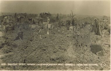
... History House 11 Mackenzie Street Bendigo goldfields POSTCARD Postcard WW1 Bailleul Mont Kemmel France ruins Postcard, WW1, B&W image of the ruins of Bailleul after a German offensive. View of Mont Kemmell from the Square. Copy Z 50 ...Postcard, WW1, B&W image of the ruins of Bailleul after a German offensive. View of Mont Kemmell from the Square. Copy Z 50postcard, postcard, ww1, bailleul, mont kemmel, france, ruins -
 Mission to Seafarers Victoria
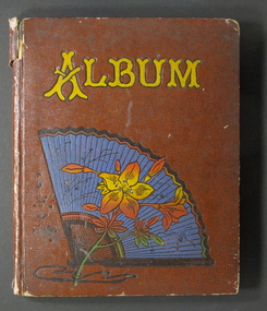
Album (item) - Photographic Album, 1928
... Street Docklands melbourne This album containing 50 photographs depicts a year at the Mission in 1928: Wedding of the Dora Walker with Harry Simpson on 14 February. Picnic at Riversdale Hawthorn, 1 January 1928 Ships in Port Melbourne in November: HMAS Australia, HMAS Brisbane, and destroyers Anzac, Success, Swordsman Wharfs, Victoria Dock, Stevedores Picnic in Finhaven, Kew, the Buchan's Property for Cup Day (6 November) Views of Port Melbourne from 1888 building Monday 29 October: return of Archbishop of Melbourne (Dr. ...This album containing 50 photographs depicts a year at the Mission in 1928: Wedding of the Dora Walker with Harry Simpson on 14 February. Picnic at Riversdale Hawthorn, 1 January 1928 Ships in Port Melbourne in November: HMAS Australia, HMAS Brisbane, and destroyers Anzac, Success, Swordsman Wharfs, Victoria Dock, Stevedores Picnic in Finhaven, Kew, the Buchan's Property for Cup Day (6 November) Views of Port Melbourne from 1888 building Monday 29 October: return of Archbishop of Melbourne (Dr. Harrington Lees), who had spent a 10-month holiday in England with his wife. Arrival on the RMS Maloja Two photographs are missing.Pre Great Depression, 1928 was a difficult year in Melbourne and also for the Mission. Ships were rare on the wharfs meaning seamen were also rare in the missions. However they started the fundraising for the extension of the 1888 Port Melbourne building which was becoming too small. At the end of the year, Reverend Weller announced he was appointed assistant in London. He and his wife Alexina left in January 1929 after five years. They sailed on the Osterley on the 22 January 1929.Embossed yellow font on cover reads: ALBUMfan, strikes, police, reverend john reginald weller (1880-1969), alexina weller (nee caley), freda oxley, hmas australia, hmas brisbane, great depression, unemployment, port melbourne, station pier, sugar cane, queensland, dora simpson nee walker, weddings, cup day, finhaven, kew, the ducketts, mrs john buchan, flinders street extension, gasworks, wharfs, victoria dock, motorboat, southern cross, success, destroyers, football, sports, rms maloja, lhlg, fan album, anzac, swordsman, freda kathleen oxley 1882-1969, annie alexandrina caley (known as alexina) 1885-1934 -
 Eltham District Historical Society Inc
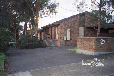
Photograph, Margaret Ball, 27 Pryor Street, Eltham, June 1999, 1999
... 50: Pauline and Ernie Harris. In late 1990s the house was demolished and units built. The Margaret Ball (Pre 1960s Houses) Collection was a personal project initiated to mark the year 2000 and arose as a result of the disappearance of many pre-1960s parts of Eltham due to development. Approximately 200 pre-1960s style houses that were left in Eltham between Main Road and east to Bible Street, between Cecil Street to the north and south to Dalton Street were photographed in late 1999. Not all of the houses could be photographed; some because the garden or trees blocked the view ...Owner 1940-50: Pauline and Ernie Harris. In late 1990s the house was demolished and units built.The Margaret Ball (Pre 1960s Houses) Collection was a personal project initiated to mark the year 2000 and arose as a result of the disappearance of many pre-1960s parts of Eltham due to development. Approximately 200 pre-1960s style houses that were left in Eltham between Main Road and east to Bible Street, between Cecil Street to the north and south to Dalton Street were photographed in late 1999. Not all of the houses could be photographed; some because the garden or trees blocked the view of the house, others because of rubbish or cars were in the way, some because people were working on the house or in the gardens at the time.Roll of 35mm colour negative film, 10 stripsFuji 200eltham, houses, streets, margaret ball (pre 1960s houses) collection, pryor street -
 Bendigo Historical Society Inc.
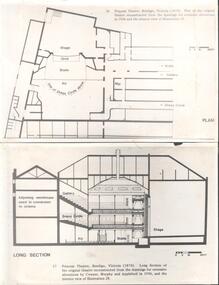
Photograph - National Trust Collection: Princess Theatre, View Street, Bendigo
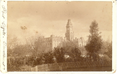
... View Street and McKenzie Street, with the frontage facing View Street. The auditorium was on three levels and seated 650 in the pit (rear stalls), 200 in the stalls, 250 in the dress circle and 850 in the gallery. A further 50...View Street and McKenzie Street, with the frontage facing View Street. The auditorium was on three levels and seated 650 in the pit (rear stalls), 200 in the stalls, 250 in the dress circle and 850 in the gallery. A further 50 ...historic buildingNational Trust Collection: Princess Theatre, cnr View & McKenzie Streets, Bendigo Plan and section of the layout of the Princess Theatre. A negative showing three levels of patrons in attendance of a performance; undated. The Royal Princess Theatre was opened on 31st August 1874. The cost of the building was £12,000 with a capacity of 2,000 people. The building was designed by William Charles Vahland. The site was at the corner of View Street and McKenzie Street, with the frontage facing View Street. The auditorium was on three levels and seated 650 in the pit (rear stalls), 200 in the stalls, 250 in the dress circle and 850 in the gallery. A further 50 were seated in the six stage boxes. The frontage of the theatre was 80ft wide x 60ft, which inside the auditorium the proscenium was 30ft wide by 18ft high. The stage was 56ft deep. Stage lighting at the time was by gas until the Electric Supply Co, of Victoria Ltd. had DC power available in 1898. The theatre was described as comparable to anything Drury Lane in London had to offer. The original proprietors of the theatre John Croley died on 26th March 1899 aged 72 years, while William Billy Heffernan died 23rd March 1891 aged 81 years -
Bendigo Historical Society Inc.
Document - The Royal Princess Theatre Story, 2001
... View Street and McKenzie Street, with the frontage facing View Street. The auditorium was on three levels and seated 650 in the pit (rear stalls), 200 in the stalls, 250 in the dress circle and 850 in the gallery. A further 50...View Street and McKenzie Street, with the frontage facing View Street. The auditorium was on three levels and seated 650 in the pit (rear stalls), 200 in the stalls, 250 in the dress circle and 850 in the gallery. A further 50 ...The Royal Princess Theatre was opened on 31st August 1874. The cost of the building was £12,000 with a capacity of 2,000 people. The building was designed by William Charles Vahland. The site was at the corner of View Street and McKenzie Street, with the frontage facing View Street. The auditorium was on three levels and seated 650 in the pit (rear stalls), 200 in the stalls, 250 in the dress circle and 850 in the gallery. A further 50 were seated in the six stage boxes. The frontage of the theatre was 80ft wide x 60ft, which inside the auditorium the proscenium was 30ft wide by 18ft high. The stage was 56ft deep. Stage lighting at the time was by gas until the Electric Supply Co, of Victoria Ltd. had DC power available in 1898. The theatre was described as comparable to anything Drury Lane in London had to offer. The original proprietor’s of the theatre John Croley died on 26th March 1899 aged 72 years, while William Billy Heffernan died 23rd March 1891 aged 81 years.The Royal Princess Theatre Bendigo History Notes, provided by Fred Page for the Bendigo Historical Society. Three pages of notes and photographs photocopied from an unknown book pp 24 - 26.history, bendigo, royal princess theatre -
 Bendigo Historical Society Inc.
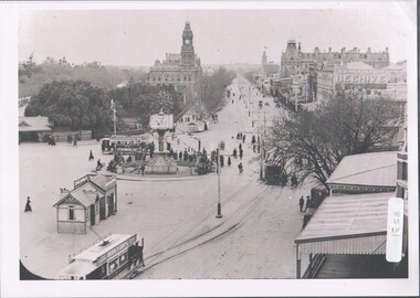
Photograph - Charing Cross and Pall Mall
... Street Bendigo goldfields View of Charing Cross and Pall Mall Bendigo, featuring the Alexandra fountain still under construction. The fountain was jointly funded by the Bendigo Juvenile Industrial Exhibition in 1879, a 500 pound donation by George Lansell and a 700 pound grant from the Sandhurst City Council. The fountain was designed by William Vahland and was opened 5/7/1881. The fountain is 28 feet tall and sits in a 2 feet deep pond that is 50 ...View of Charing Cross and Pall Mall Bendigo, featuring the Alexandra fountain still under construction. The fountain was jointly funded by the Bendigo Juvenile Industrial Exhibition in 1879, a 500 pound donation by George Lansell and a 700 pound grant from the Sandhurst City Council. The fountain was designed by William Vahland and was opened 5/7/1881. The fountain is 28 feet tall and sits in a 2 feet deep pond that is 50 feet in diameter. It was built with 22 tons of Harcourt granite, cast iron and painted stone.8531 A4 B&W photograph of Charing Cross and Pall Mall, Bendigo, in the late 1800s (prior to automobiles); taken from the City Family Hotel. Photograph shows work underway on the Alexandra Fountain at Charing Cross. Photo shows three trams, pedestrians and some horse drawn vehicles. Pall mall shows Post Office, Shamrock hotel and TAFE towers.charing cross, post office -
 Bendigo Historical Society Inc.
Legal record - Frederick Douglas Jones Collection: Solicitor's cash book ledger
... He formed a partnership with Frank Macaboy in 1878 and initially they were located in Gould's buildings in Bull Street but by 1882 they were practising from the Albion Chambers in View Street. When he died, Frederick had been practising for 50 years and was living at Myrtle Street....He formed a partnership with Frank Macaboy in 1878 and initially they were located in Gould's buildings in Bull Street but by 1882 they were practising from the Albion Chambers in View Street. When he died, Frederick had been practising for 50 years and was living at Myrtle Street. 1900 - 1908 entries F D Jones Cash book Handwritten ledger entries F D Jones solicitor cash book No 2 ledger cover - 12 March 1900 to 30 June 1908 - 135 page sets (LH received and RH money paid) Legal record Frederick Douglas Jones Collection: Solicitor's cash book ledger ...Frederick Douglas Jones ( - 14/7/1927) Born in Ireland and came to Australia as an infant, Frederick was admitted as an attorney 8/7/1878. He formed a partnership with Frank Macaboy in 1878 and initially they were located in Gould's buildings in Bull Street but by 1882 they were practising from the Albion Chambers in View Street. When he died, Frederick had been practising for 50 years and was living at Myrtle Street.F D Jones solicitor cash book No 2 ledger cover - 12 March 1900 to 30 June 1908 - 135 page sets (LH received and RH money paid)Handwritten ledger entries1900 - 1908 entries, f d jones, cash book -
 Bendigo Historical Society Inc.
Newspaper - JENNY FOLEY COLLECTION: ICY
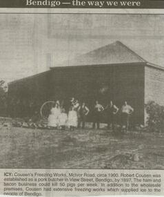
... Robert Cousen was established as a pork butcher in View Street, Bendigo, by 1897. The ham and bacon business could kill 50 pigs per week. ...Robert Cousen was established as a pork butcher in View Street, Bendigo, by 1897. The ham and bacon business could kill 50 pigs per week. ...Bendigo Advertiser ''The way we were'' from 2000. Icy: Cousen's Freezing Works, McIvor road, circa 1900. Robert Cousen was established as a pork butcher in View Street, Bendigo, by 1897. The ham and bacon business could kill 50 pigs per week. In addition to the wholesale premises, Cousen had extensive freezing works which supplied ice to the people of Bendigo. The clip is in a folder.newspaper, bendigo advertiser, the way we were -
Port Melbourne Historical & Preservation Society
Photograph - Various photos related to John James GILCHRIST, John Gilcrist, 1940s - 1950s
... 13 photos from John GILCHRIST showing his father, John James GILCHRIST, at Station Pier and Princes Pier, a view from the Shrine of Remembrance, Centenary Bridge, and his father and mother, Eileen Mary GILCHRIST at their home at 16 McCormack Street Port Melbourne .01 - Princes Pier, Taroona, Port Hobart .02 - View from Shrine overlooking Albert Park Lake .03 - Between piers .04 - Princes Pier at night .05 - From Station Pier West finger pier .06 - House at 16 McCormack Street. (No. 12 McCormack Street also shown) .07 - Centenary Bridge1949-50...Port Melbourne Historical & Preservation Society Port Melbourne Town Hall 333 Bay Street Port Melbourne melbourne From John Gilcrist via Janet Bolitho Piers and wharves - Station Pier Piers and Wharves - Princes pier Built Environment Transport - roads McCormack Street John GILCHRIST John James GILCHRIST Mary Eileen GILCHRIST 13 photos from John GILCHRIST showing his father, John James GILCHRIST, at Station Pier and Princes Pier, a view from the Shrine of Remembrance, Centenary Bridge, and his father and mother, Eileen Mary GILCHRIST at their home at 16 McCormack Street Port Melbourne .01 - Princes Pier, Taroona, Port Hobart .02 - View from Shrine overlooking Albert Park Lake .03 - Between piers .04 - Princes Pier at night .05 - From Station Pier West finger pier .06 - House at 16 McCormack Street. (No. 12 McCormack Street also shown) .07 - Centenary Bridge1949-50 ...From John Gilcrist via Janet Bolitho13 photos from John GILCHRIST showing his father, John James GILCHRIST, at Station Pier and Princes Pier, a view from the Shrine of Remembrance, Centenary Bridge, and his father and mother, Eileen Mary GILCHRIST at their home at 16 McCormack Street Port Melbourne .01 - Princes Pier, Taroona, Port Hobart .02 - View from Shrine overlooking Albert Park Lake .03 - Between piers .04 - Princes Pier at night .05 - From Station Pier West finger pier .06 - House at 16 McCormack Street. (No. 12 McCormack Street also shown) .07 - Centenary Bridge1949-50 .08 - Outside 16 McCormack Street, showing Singer car. (Nos. 22, 24 & 26 McCormack Street also shown) .09 - John and Eileen Gilcrist in backyard .10 - South side of house at 16 McCormack Street .11 - South side of house at 16 McCormack Street .12 - Photo of Edwards Park .13 - East side of house at 16 McCormack Street Refer also to hand drawn plan of house and outbuildings at catalogue no. 2763piers and wharves - station pier, piers and wharves - princes pier, built environment, transport - roads, mccormack street, john gilchrist, john james gilchrist, mary eileen gilchrist -
 Bendigo Historical Society Inc.
Document - MASONIC SOCIETY EVENTS (VARIOUS): JUBILEE SOUVENIR ZENITH LODGE 1866 - 1916
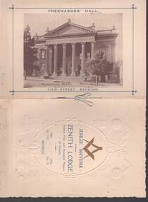
... 50 years. On the back cover is a sepia photo of the Freemasons' Hall View Street, Bendigo....50 years. On the back cover is a sepia photo of the Freemasons' Hall View Street, Bendigo. ...Cream booklet titled Jubilee Souvenir Zenith Lodge Ancient Free and Accepted Masons of Victoria. 1866 - 1916. No 1133 - No 52. Title is inside an embossed oval rope tied at each side. Various embossed symbols surround the oval rope. A blue cord is sewn to hold the pages together with a staple. A Roll of Honour is printed inside the front cover under two flags, a Union Jack and another one like the Australian flag but the blue behind the Southern Cross is red. Jubilee of the Zenith Lodge, No 52, Officers of the Lodge at Consecration, May 1866 is listed, a sepia photo of the Officers 1915 - 16. they are: Wor Bro Dunstan, Wor Bro T L Sargeant, Bro J Langdon, Wor Bro H J Martins, Bro J Leaney,R W W J Parry, R W G W Lansell,Bro G W Bruhn Bro T Cambridge, Wor Bro W Trevena, Wor Bro C E Welch,Bro W G Bowden, Bro T J Banner, Bro A Glen, Bro A G Hamilton, Bro F T Bishop and Bro J Stephens. Golden Lodge, Corinthian Lodge, Masonic Hall. Also listed are Members 1916 and Principal Officers of the Zenith Lodge for the Past 50 years. On the back cover is a sepia photo of the Freemasons' Hall View Street, Bendigo.Cambridge Press Art Printers, Bendigo.clubs, social, jubilee souvenir, masonic society events (various) - jubilee souvenir zenith lodge 1866 - 1916, bro attwood h, bro blair sgt t a, bro crookston rev j, bro dimsey lieut l s, bro harrison sgt h j, bro midgley f s, bro rodger, r h, bro stutt w j, bro wagstaff capt p w, bro ward f h, bro edward garsed, bro samuel peach hogg, bro richard harry andrews, bro wiliam webb, bro john davies, bro g w chaassand, bro thos h o'neill, bro j c duncan, bro john hamlet taylor, cambridge press -
 Bendigo Historical Society Inc.
Document - KELLY AND ALLSOP COLLECTION: FORM FOR APPLICATION FOR LOAN ON MORTGAGE
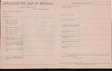
... History House 11 Mackenzie Street Bendigo goldfields BUSINESS Stockbroker kelly & allsop KELLY & ALLSOP COLLECTION Mortgage Loan Blank form Document. KELLY & ALLSOP COLLECTION. Blank form for Application for Loan on Mortgage. To Messrs. Allsop & Co., View Point, Sandhurst. 5 copies of about 50 ...Document. KELLY & ALLSOP COLLECTION. Blank form for Application for Loan on Mortgage. To Messrs. Allsop & Co., View Point, Sandhurst. 5 copies of about 50 retained. Foolscap printed on both sides. Dated 1880sbusiness, stockbroker, kelly & allsop, kelly & allsop collection, mortgage loan, blank form -
 Bendigo Historical Society Inc.
Document - BADHAM COLLECTION: EXHIBITION LABELS X 15 - CARDBOARDS
... Street Bendigo goldfields DOCUMENT Memo railway Exhibition labels x 15 - cardboards Railway Post Office stamps, 1865, and book 1951 - Courtesy Edna Westhead. Copy of 1887 Map of Railway Post Offices - Courtesy Edna Westhead Taken in 1921, Bendigo railway men celebrating 50 years since first train arrived in Bendigo in 1862 - Courtesy Bendigo Historical Society Book of Signals, 1949 - Courtesy Bernie Kingdon Book of Instruction Rolling Stock 1921, 1943 - Courtesy Bernie Kingdon Lost Property Book, 1886 - Courtesy Ross Rowley View of Bendigo Railway Station taken from St. ...Exhibition labels x 15 - cardboards Railway Post Office stamps, 1865, and book 1951 - Courtesy Edna Westhead. Copy of 1887 Map of Railway Post Offices - Courtesy Edna Westhead Taken in 1921, Bendigo railway men celebrating 50 years since first train arrived in Bendigo in 1862 - Courtesy Bendigo Historical Society Book of Signals, 1949 - Courtesy Bernie Kingdon Book of Instruction Rolling Stock 1921, 1943 - Courtesy Bernie Kingdon Lost Property Book, 1886 - Courtesy Ross Rowley View of Bendigo Railway Station taken from St. Paul's tower, 1875 - Courtesy Bendigo Historical Society...document, memo, railway -
 Bendigo Historical Society Inc.
Photograph - PHOTO BENDIGO MALL
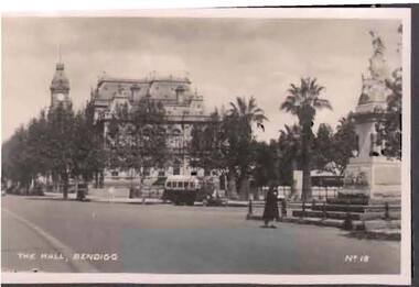
... Bendigo Mall looking forward south mid 1940's - 50's . Street bus in view. Gold statue on right. Photo code No 18...History House 11 Mackenzie Street Bendigo goldfields BENDIGO Streetscape Folder 26 Bendigo Mall looking forward south mid 1940's - 50's . Street bus in view. Gold statue on right. Photo code No 18 Photograph PHOTO BENDIGO MALL ...Bendigo Mall looking forward south mid 1940's - 50's . Street bus in view. Gold statue on right. Photo code No 18bendigo, streetscape, folder 26 -
 Ringwood and District Historical Society
Document - Research Notes, Richard Carter, Land Subdivisions in Ringwood 1890-1950
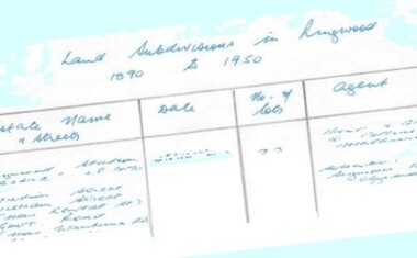
... Street £500 Pg37 Lots 60&70 LP2216 (year?) £460 Pg37 MOUNTAIN VIEW ESTATE LP10902 (1936) Lots 1&2, 19-22 Wantirna Road, Daisy Street £50 Pg38 RAILWAY STATION ESTATE RINGWOOD EAST LP7522 (1925) Lots 16 to 19 £250 Pg38 RINGWOOD PARK ESTATE (LP?) ...Street £500 Pg37 Lots 60&70 LP2216 (year?) £460 Pg37 MOUNTAIN VIEW ESTATE LP10902 (1936) Lots 1&2, 19-22 Wantirna Road, Daisy Street £50 Pg38 RAILWAY STATION ESTATE RINGWOOD EAST LP7522 (1925) Lots 16 to 19 £250 Pg38 RINGWOOD PARK ESTATE (LP?) ...Handwritten table listing main local pre-1950s subdivisions in the Ringwood area, with estate names, streets, number of allotments for sale, and where known, vendor agent, LP (Lodged Plan) title registration number, and auction/sale date, some with sale price.Pg1 RINGWOOD STATION ESTATE LP3070 (Year?) Station Street, William Street (now Kendall Street), Wantirna Road, Station Street Pg1 RINGWOOD TOWNSHIP ESTATE LP5577 (1913) Station Road (now Warrandyte Road), Pratt Street (part now Aird Street), Whitehorse Road Pg2 RINGWOOD ORCHARD ESTATE LP4315 (1914) Brysons Road, Hillcrest Road, Anzac Avenue, Sulva Road Pg3 RINGWOOD RAILWAY ESTATE LP7522 (1918) Whitehorse Road (now Mount Dandenong Road), Dublin Road, Freeman Street, Patterson Street, Bona Street Pg4 THE RINGWOOD ESTATE LP7578 (1919) Warrandyte Road, Hobart Street, Paxton Street, Arnold Street Pg5 GARDEN FARMS ESTATE (LP?) (1919) Canterbury Road, Armstrong Road, Bungalook Road, Orchard Road, Bayswater Road (now Mountain Highway) Pg6 THE RINGWOOD ESTATE (SECOND SUB-DIVISION) LP7604 (1919) Warrandyte Road, Tamar Street, Derwent Street, Mersey Street Pg7 RINGWOOD STATION ESTATE LP7703 (1919) Bedford Road, Williams Grove (now Lena Grove) Pg8 RINGWOOD TOWNSHIP ESTATE LP8198 (1919) Wantirna Road, Ellison Street, Haig Street, Greenwood Avenue Pg9 EASTFIELD ESTATE (LP?) (1920) Eastfield Road, Longview Road, Pleasant Rise, The Mount Pg10 ELECTRIC RAILWAY ESTATE RINGWOOD LP9473 (1922) Campbell Street, Myrtle Avenue, George Street (now Tudor Court), Henry Street (now Myrtle Avenue), Williams Grove (now Lena Grove) Pg11 RINGWOOD PARK ESTATE LP7884 (1922 - two stages) Wonga Road (now Loughnan Road), William Street, Andrew Street, Harrison Street Pg12 HEATHMONT STATION ESTATE LP11009 (Date? - after 1922) Lisgoold Street, Viviani Crescent, Balrour Avenue, Station Street (now part Heathmont Road and part Wainui Street) Pg13 RINGWOOD RAILWAY ESTATE LP10507 (1923) Whitehorse Road, Sherbrooke Avenue, Burwood Avenue, Bonview Avenue, Heatherbrae Avenue, Grant Crescent Pg14 GARDEN HOMES ESTATE (LP?) (1923) Mullum Road, The Centreway, Wattle Crescent (now Wattle Avenue) Reserve Crescent (now Reserve Road) Pg15 DUBLIN ROAD ESTATE LP11993 (1923) Alexandra Road, Vonadawn Avenue, Green Street, Wood Street, Howard Avenue, Bedford Road, Dublin Road Pg16 CARLINGA ESTATE RINGWOOD LP9620 (1923) Bourke Street, Bond Street, Ringwood Street Pg17 PRATT'S JUNCTION ESTATE (LP?) (1923) Junction Street, Georges Road, Oliver Street, Whitehorse Road Pg18 EAST RINGWOOD ESTATE LP10492 (1923) Bona Street, Patterson Street, Miller Grove, Fairview Avenue, Eastfield Road, Whitehorse Road (now Mount Dandenong Road) Pg19 COLEMAN'S HEATHMONT ESTATE LP9974 (1923) Canterbury Road, Bedford Road, Alvena Crescent, Coleman Street, Leonard Street (now Royal Avenue) Pg20 RINGWOOD HEIGHTS ESTATE LP10506 (1924) Whitehorse Road, Bonview Avenue, Grant Crescent, Hillcrest Avenue, Heatherbrae Avenue, Margaret Street, Mary Street Pg21 EAST RINGWOOD STATION ESTATE LP10551 (1924) Knaith Road, Wenwood Street, Lois Street, Victoria Street, Station Street (now Railway Avenue) Pg22 GRAND VIEW ESTATE LP11019 (1924) Whitehorse Road, Rupert Street, Herbert Street, Leonard Street Pg23 RINGWOOD RAILWAY ESTATE & RINGWOOD HEIGHTS ESTATE - FINAL SECTIONS LP10506 & LP10507 (1924) Whitehorse Road, Sherbrooke Avenue, Burwood Avenue, Bonview Avenue, Heatherbrae Avenue, Margaret Street, Mary Street, Grant Crescent Pg24 RINGWOOD EAST ELECTRIC STATION ESTATE (LP?) (1924) Railway Parade (now Patterrson Street), Federal Road, Howship Avenue (part now French Street), Dublin Road, Rosedale Crescent Pg25 BEDFORD PARK (now Ringwood Secondary College) (LP?) (1924) Bedford Road, Adams Street, Anderson Street, Joyce Street, Graham Road Pg26 CROWN JEWEL ESTATE LP11645 (Private sales after 1924) Mount Dandenong Road, Mirabel Avenue, Valda Avenue, Evon Avenue, Velma Grove Pg27 GRAND CENTRAL ESTATE LP10917 (1925) Heathmont Road, Great Ryrie Street, Douglas Street, Garden Street, Bellevue Avenue Pg28 RINGWOOD (unnamed estate - 1926) Nelson Street, Seymour Street, Whitehorse Road Pg29 EAST RINGWOOD RAILWAY STATION ESTATE (YEAR? - 25 shops 60 villas) Railway Avenue, Dublin Road, Lawrence Grove, Stanley Avenue, Knaith Road Pg30 CHARM VIEW ESTATE (LP?) (year? - after 1926) Canterbury Road, Heathmont Road, Dickasons Road, Bennjett Avenue, Orchid Street Pg31 SUNBEAM ESTATE LP12150 (Circa 1925) Govt Road (now Old Lilydale Road), Sunbeam Avenue, Holland Road, Everard Street (now Everard Road) Pg32 FAIRVIEW ESTATE EAST RINGWOOD LP10853 (Circa 1924) Eastfield Road, Patterson Street, Margaret Street (now Short Street) Pg33 EAST RINGWOOD TOWNSHIP ESTATE LP3025 (Circa 1924 - 35 allotments) Mount Dandenong Road, Grey Street, Eastfield Road Pg34 EAST RINGWOOD TOWNSHIP ESTATE LP3025 (Circa 1924 - 49 allotments) and STATE SCHOOL ESTATE (26 allotments) and EAST RINGWOOD STATION ESTATE (14 shop sites) Mount Dandenong Road, Grety Street, Dunn Street, Eastfield Road, King Street, Holland Road, Dublin Road, Patterson Street, Bona Street Pg35 EAST RINGWOOD CENTRAL ESTATE LP17004 (1948) Knaith Road, Shasta Avenue, Talofa Avenue, Russet Road, Dublin Road Pg36 WARE ESTATE LP43360 (1958) Ware Crescent, Davey Drive, Grey Road (now Grey Street), Mount Dandenong Road Pg37 Lot 57 Kendall Street LP3070 (1939) £75.0.0 Pg37 Lot 14 LP7346 (year?) £225 Pg37 Lot 8 WHITE HORSE ESTATE LP14010 (year?) Maroondah Hwy, Seymour Street £98.9.0 Pg37 Lots 4-14 incl. LP10902 (year?) £300 Pg37 Lots 69&70 LP2216 (1939) Bedford Road, Pitt Street £500 Pg37 Lots 60&70 LP2216 (year?) £460 Pg37 MOUNTAIN VIEW ESTATE LP10902 (1936) Lots 1&2, 19-22 Wantirna Road, Daisy Street £50 Pg38 RAILWAY STATION ESTATE RINGWOOD EAST LP7522 (1925) Lots 16 to 19 £250 Pg38 RINGWOOD PARK ESTATE (LP?) (1924) Lot 112 Munro Street £230 Pg38 RINGWOOD TOWNSHIP ESTATE (LP?) (1925) Lot 57 Wantirna Road £850 Pg38 ELECTRIC RAILWAY ESTATE LP9473 (1925) Lot 98 & 99 £180 (30/- foot) Pg38 ELECTRIC RAILWAY ESTATE LP9473 (year?) Lot 100 £233.12.6 incl improvements (£2.12.6 foot) Pg38 Lot 22&23 Bedford Road Heathmont (LP & year?) £675 incl improvements Pg39 Lot 9 Mullum Mullum Road LP8221 (1923) £150 Pg39 Lot 27 Haig Street LP8198 (1925) £825 Pg39 Lot 56 Haig Street cnr Wantirna Road LP8198 (1923) £171 Pg39 Lots 3 & 4 Loughnan Road LP9626 (192?) £147 Pg39 Lots 98 & 99 Myrtle Avenue LP9473 (1925) £180 Pg39 Lots 80 & 81 Myrtle Avenue LP9473 (1929) £150 Pg39 Lot 30 Sherbrooke Avenue LP10507 (1926) £700 incl improvements Pg40 Lot 10 (year?) LP7703 £750 Pg40 Lot 36 (year?) LP7522 £25 Pg40 Lot 38 Pitt Street LP2216 (year?) £350 Pg40 Lot 7 Dublin Road cnr Green Street LP11993 (year?) £300 -
Glenelg Shire Council Cultural Collection
Photograph - Photograph - aerial view of Portland, c. 1954
... Glenelg Shire Council Cultural Collection History House Cliff Street Portland great-ocean-road aerial photography central Portland Portland Harbour south west coastline Front: '820 -49' - handwritten, white, lower border 'RUN 6' 'PORTLAND', printed, white, lower border Black and white aerial photograph of coastline around Portland. Black border, scale all sides, 5 rows of 3 't' at regular intervals. Fifty percent ocean, 50 percent land. See 'Other Information' Photograph Photograph - aerial view ...Black and white aerial photograph of coastline around Portland. Black border, scale all sides, 5 rows of 3 't' at regular intervals. Fifty percent ocean, 50 percent land. See 'Other Information'Front: '820 -49' - handwritten, white, lower border 'RUN 6' 'PORTLAND', printed, white, lower borderaerial photography, central portland, portland harbour, south west coastline -
Glenelg Shire Council Cultural Collection
Photograph - Photograph - aerial view of Portland, c. 1954
... Glenelg Shire Council Cultural Collection History House Cliff Street Portland great-ocean-road aerial photography central Portland Portland Harbour south west coastline Front: '607 - 50 ' - handwritten, white, border 'RUN 8' 'PORTLAND', printed, white, border Black and white aerial photograph of coastline around Portland. Black border, scale all sides, 5 rows of 3 't' at regular intervals. Mostly ocean, small area of land, top centre Photograph Photograph - aerial view ...Black and white aerial photograph of coastline around Portland. Black border, scale all sides, 5 rows of 3 't' at regular intervals. Mostly ocean, small area of land, top centreFront: '607 - 50 ' - handwritten, white, border 'RUN 8' 'PORTLAND', printed, white, borderaerial photography, central portland, portland harbour, south west coastline -
Glenelg Shire Council Cultural Collection
Photograph - Photograph - aerial view of Portland, c. 1954
... Glenelg Shire Council Cultural Collection History House Cliff Street Portland great-ocean-road aerial photography central Portland Portland Harbour south west coastline Front: '784 - 151'- handwritten, white, border 'RUN A PORTLAND', printed, white, border Black and white aerial photograph of coastline around Portland. Black border, scale all sides, 5 rows of 3 't' at regular intervals. Right hand end of headland no longer visible. 50/50 ocean to land. Photograph Photograph - aerial view ...Black and white aerial photograph of coastline around Portland. Black border, scale all sides, 5 rows of 3 't' at regular intervals. Right hand end of headland no longer visible. 50/50 ocean to land.Front: '784 - 151'- handwritten, white, border 'RUN A PORTLAND', printed, white, borderaerial photography, central portland, portland harbour, south west coastline -
 Glenelg Shire Council Cultural Collection
Print, Steampacket Inn, 1983-1984
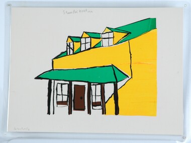
... Street Portland great-ocean-road CEMA Art Collection. Part of "A Community View" 150 years in Portland Screenprint Exhibition. Part of Angela Gee Residency 1983 and 1984. Front: Darren Pumpa (lower left) Steam Packet Inn (upper centre) (pencil) Back: 50 ...CEMA Art Collection. Part of "A Community View" 150 years in Portland Screenprint Exhibition. Part of Angela Gee Residency 1983 and 1984.Laminated screenprint of a drawing of a building. The details of the building are done in thick black lines with patches of green, yellow and brown. The background has been left as the plain paper.Front: Darren Pumpa (lower left) Steam Packet Inn (upper centre) (pencil) Back: 50 -
 Glenelg Shire Council Cultural Collection
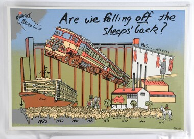
Print, Are we falling off the sheep's back?, 1983-1984
... Street Portland great-ocean-road CEMA Art Collection. Part of "A Community View" 150 years in Portland Screenprint Exhibition. Part of Angela Gee Residency 1983 and 1984. Front: RBR 28 (lower right image, printed) 30/50 ...CEMA Art Collection. Part of "A Community View" 150 years in Portland Screenprint Exhibition. Part of Angela Gee Residency 1983 and 1984.Laminated screenprint of: a sheep transport boat; sheep truck; abattoir; sheep and protestors. The background is blue, green and silver, and features large silos. The text "Are we falling off the sheep's back?" is at the top of the work, as well as a simple map of the "Persian Gulf" with "Kuwait" marked.Front: RBR 28 (lower right image, printed) 30/50 (lower right) (pencil) Back: 35 -
Glenelg Shire Council Cultural Collection
Photograph - Photograph - aerial view of Portland, c. 1954
... Glenelg Shire Council Cultural Collection History House Cliff Street Portland great-ocean-road aerial photography central Portland Portland Harbour south west coastline Front: '820 - 50' - handwritten, white, border 'RUN 6' 'PORTLAND', printed, white, border Black and white aerial photograph of coastline around Portland. Black border, scale all sides, 5 rows of 3 't' at regular intervals. 25% ocean, 75% land. See 'Other Information' Photograph Photograph - aerial view ...Black and white aerial photograph of coastline around Portland. Black border, scale all sides, 5 rows of 3 't' at regular intervals. 25% ocean, 75% land. See 'Other Information'Front: '820 - 50' - handwritten, white, border 'RUN 6' 'PORTLAND', printed, white, borderaerial photography, central portland, portland harbour, south west coastline -
Glenelg Shire Council Cultural Collection
Photograph - Photograph - aerial view of Portland, c. 1954
... Glenelg Shire Council Cultural Collection History House Cliff Street Portland great-ocean-road aerial photography central Portland Portland Harbour south west coastline Front: '607 - 51 ' - handwritten, white, border 'RUN 7' 'PORTLAND', printed, white, border Black and white aerial photograph of coastline around Portland. Black border, scale all sides, 5 rows of 3 't' at regular intervals. 50/50 land and ocean Photograph Photograph - aerial view ...Black and white aerial photograph of coastline around Portland. Black border, scale all sides, 5 rows of 3 't' at regular intervals. 50/50 land and oceanFront: '607 - 51 ' - handwritten, white, border 'RUN 7' 'PORTLAND', printed, white, borderaerial photography, central portland, portland harbour, south west coastline -
 Federation University Historical Collection
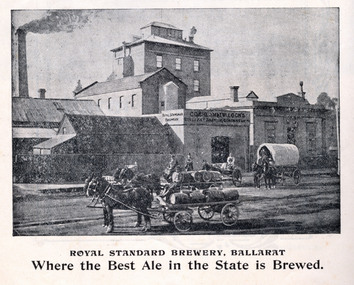
Book, Powell & Co, Guide to Ballarat the Beautiful, 1906, 1906
... 50 pages. The book includes many illustrations and advertisements. Themes of the book include: Ballarat and district, Lake Wendouree, Ballarat Botanical Gardens, Statues, gold and mining, Ballarat gold nuggets, Eureka Stockade, Ballarat School of Mines, Hepburn Lagoon, Emu River, race courses, Art gallery of Ballarat Advertisements include: Dr Lem Chinese Practictioner, Eureka Aerated Waters & Brewing Co., Sunshine Harvester, Gordon Bros., Long's biscuits, South Street, Grand National Eisteddfod of Australia, Lake View Hotel, Carlyon's Hotel, Clarendon Ladies' College, J.E. ...street m1604 chinese chinese medicine d. lem j.e. sang brewery tanners Green, black and red soft covered book of 50 pages. The book includes many illustrations and advertisements. Themes of the book include: Ballarat and district, Lake Wendouree, Ballarat Botanical Gardens, Statues, gold and mining, Ballarat gold nuggets, Eureka Stockade, Ballarat School of Mines, Hepburn Lagoon, Emu River, race courses, Art gallery of Ballarat Advertisements include: Dr Lem Chinese Practictioner, Eureka Aerated Waters & Brewing Co., Sunshine Harvester, Gordon Bros., Long's biscuits, South Street, Grand National Eisteddfod of Australia, Lake View Hotel, Carlyon's Hotel, Clarendon Ladies' College, J.E. ...A book highlighting Ballarat and surrounds for visiting tourists. Green, black and red soft covered book of 50 pages. The book includes many illustrations and advertisements. Themes of the book include: Ballarat and district, Lake Wendouree, Ballarat Botanical Gardens, Statues, gold and mining, Ballarat gold nuggets, Eureka Stockade, Ballarat School of Mines, Hepburn Lagoon, Emu River, race courses, Art gallery of Ballarat Advertisements include: Dr Lem Chinese Practictioner, Eureka Aerated Waters & Brewing Co., Sunshine Harvester, Gordon Bros., Long's biscuits, South Street, Grand National Eisteddfod of Australia, Lake View Hotel, Carlyon's Hotel, Clarendon Ladies' College, J.E. Sang Chinese Doctor and Herbalist, Reid's Ballarat Coffee Palace, Robert Sim & Co Timber Merchants, Cobb & C0 livery and stables Ballarat, Eagle Foundry, Fred A. Reed Tobacconist, Heinz bros butchers, J.J. Goller & Co. Illustrations include: Craig's Royal Hotel, McBride's Boots, John Lavis Cordial Manufacturer, R. Graham & Sons tanners, Lester's hotel, Sun Foundry, Central business College, Edwards Pyrites & Ore Reduction Co., George Farmer, Sturt Street (colour), Lake Wendouree, Ballarat East Town Hall, Lake Burrumbeet, Queen Victoria Statue, Fairy Land, Ballarat Botanical Gardens, Lal Lal Falls, Moorabool Falls, Kirks Dam, Lake Wendouree and paddle boat, Lydiard Street, Bopeep Creek, Star of the East Mine, Peter Lalor Statue, great Equatorial Telescopu at Oddie Observatory (Ballarat Observatory), Boer War monument, Entrance to Art Gallery of Ballarat, interior of Art Gallery of Ballarat, Old Curiosity Shop, Angus Rialto cafe, Ballarat Brewing Co, Royal Standard brwery, Phoenix Brewery Warrenheip, John MacLeod and Companyballarat, ballarat school of mines, buninyong, burrumbeet, cobb and co, eureka brewery, ballarat brewing co, sturt street, m1604, chinese, chinese medicine, d. lem, j.e. sang, brewery, tanners