Showing 352 items matching " conservation council of victoria"
-
 Clunes Museum
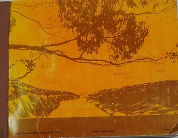
Document - REPORT, LAND CONSERVATION COUNCIL OF VICTORIA, FINAL RECOMMENDATIONS - NORTH CENTRAL AREA, FEBRUARY 1981
... BOUND BOOKLET - ORANGE SOFT COVER WITH NAVY BLUE BINDING LAND CONSERVATION COUNCIL, VICTORIA MELBOURNE - FEBRUARY 1981 - INCLUDING MAPS...LAND CONSERVATION COUNCIL OF VICTORIA...BOUND BOOKLET - ORANGE SOFT COVER WITH NAVY BLUE BINDING LAND CONSERVATION COUNCIL, VICTORIA MELBOURNE - FEBRUARY 1981 - INCLUDING MAPS FINAL RECOMMENDATIONS - NORTH CENTRAL AREA Document REPORT LAND CONSERVATION COUNCIL OF VICTORIA ...THE LAND CONSERVATION COUNCIL WAS ESTABLISHED BY THE LAND CONSERVATION ACT 1970. AS ONE OF ITS THREE FUNCTIONS, IT MAKES RECOMMENDATIONS TO THE MINISTER FOR CONSERVATION WITH RESPECT TO THE USE OF PUBLIC LAND, IN ORDER TO PROVIDE FOR THE BALANCED USE OF LAND IN VICTORIA...BOUND BOOKLET - ORANGE SOFT COVER WITH NAVY BLUE BINDING LAND CONSERVATION COUNCIL, VICTORIA MELBOURNE - FEBRUARY 1981 - INCLUDING MAPSnon-fictionTHE LAND CONSERVATION COUNCIL WAS ESTABLISHED BY THE LAND CONSERVATION ACT 1970. AS ONE OF ITS THREE FUNCTIONS, IT MAKES RECOMMENDATIONS TO THE MINISTER FOR CONSERVATION WITH RESPECT TO THE USE OF PUBLIC LAND, IN ORDER TO PROVIDE FOR THE BALANCED USE OF LAND IN VICTORIA...local history, document, recommendations, land conservation -
 Bendigo Historical Society Inc.
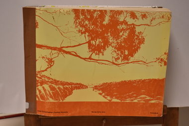
Book - REPORT ON THE NORTH CENTRAL STUDY AREA OF VICTORIA
... 252 page Report on the North Central Study Area by the Land Conservation Council of Victoria - July 1978 Illustrated with B&W photos Back section contains several removeable maps. ...Land Conservation Council, Victoria...History House 11 Mackenzie Street Bendigo goldfields Land Conservation North Central Region Land Conservation Council, Victoria 252 page Report on the North Central Study Area by the Land Conservation Council of Victoria - July 1978 Illustrated with B&W photos Back section contains several removeable maps. ...252 page Report on the North Central Study Area by the Land Conservation Council of Victoria - July 1978 Illustrated with B&W photos Back section contains several removeable maps. Printed by F D Atkinson, Government Printer, MelbourneLand Conservation Council, Victorialand conservation, north central region -
 Bendigo Historical Society Inc.
Document - PETER ELLIS COLLECTION: LETTER FROM BENDIGO FIELD NATURALISTS CLUB
... ... Conservation Council of Victoria...Photocopy of an unsigned letter from The Bendigo Field Naturalists Club with copies sent to the Ministry for Conservation, Premier of Victoria, National Estate Dept, Forests Commission of Victoria, Conservation Council of Victoria, Loddon Campaspe Regional Authority, The Hon D McClure MLA, the Hon F S Grimwade MLC, F J Granter MLC, N B Reid MLC and J Bourchier MP. ...History House 11 Mackenzie Street Bendigo goldfields COMMUNICATION Postal letters Peter Ellis Collection The Bendigo Field Naturalists Club National Estate Funds Forests Commission of Vict Wallaby Caves Mr Ruedin Conservation Council of Victoria National Estate Dept Whipstick Interim Development Order Loddon Campaspe Regional Authority The Hon D McClure MLA The Hon F S Grimwade MLC F J Granter MLC N B Reid MLC J Bourchier MP Photocopy of an unsigned letter from The Bendigo Field Naturalists Club with copies sent to the Ministry for Conservation, Premier of Victoria, National Estate Dept, Forests Commission of Victoria, Conservation Council of Victoria, Loddon Campaspe Regional Authority, The Hon D McClure MLA, the Hon F S Grimwade MLC, F J Granter MLC, N B Reid MLC and J Bourchier MP. ...Photocopy of an unsigned letter from The Bendigo Field Naturalists Club with copies sent to the Ministry for Conservation, Premier of Victoria, National Estate Dept, Forests Commission of Victoria, Conservation Council of Victoria, Loddon Campaspe Regional Authority, The Hon D McClure MLA, the Hon F S Grimwade MLC, F J Granter MLC, N B Reid MLC and J Bourchier MP. Letter refers to the Purchase of land of high conservation value within the Bendigo Whipstick area for consideration in the National Estate Program.communication, postal, letters, peter ellis collection, the bendigo field naturalists club, national estate funds, forests commission of vict, wallaby caves, mr ruedin, conservation council of victoria, national estate dept, whipstick interim development order, loddon campaspe regional authority, the hon d mcclure mla, the hon f s grimwade mlc, f j granter mlc, n b reid mlc, j bourchier mp -
 Stawell Historical Society Inc
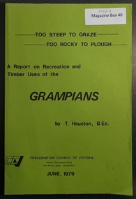
Book - Report, Grampians: A Report on recreation and Timber Uses of. Too Steep to Graze - Too Rocky to Plough, 1979
... Conservation council of Victoria and Logo...1) Conservation & Economics 2) Grampians Study Area 3) Land Use 4) Management 5) Criticisms of the Management Plan Appendix Graphs & Maps Conservation council of Victoria and Logo Green Paper cover: Black tape on Spine Grampians: A Report on recreation and Timber Uses of. ...1) Conservation & Economics 2) Grampians Study Area 3) Land Use 4) Management 5) Criticisms of the Management Plan Appendix Graphs & MapsGreen Paper cover: Black tape on SpineConservation council of Victoria and Logo -
 Stawell Historical Society Inc
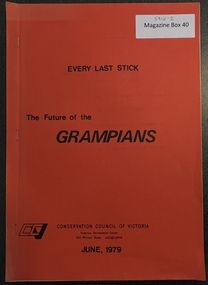
Book - Report, The Future of the Grampians - Every Last Stick, 1979
... Logo CCV - Conservation Council of Victoria...Prior to Grampians National Parks - Draft Plans Logo CCV - Conservation Council of Victoria Paper with Red Paper Cover Stapled The Future of the Grampians - Every Last Stick Book Report ...Prior to Grampians National Parks - Draft PlansPaper with Red Paper Cover StapledLogo CCV - Conservation Council of Victoria -
Whitehorse Historical Society Inc.
Article, Bypass Plan Disastrous, 4/12/1991 12:00:00 AM
... ...Conservation Council of Victoria...Whitehorse Historical Society Inc. 2-10 Deep Creek Road Mitcham melbourne Freeways Koonung Mullum Forestway Association Public Transport Users Association of Victoria Conservation Council of Victoria Hartwell Ross Spyker Peter Public meeting held to demand that the State Government implement package of alternatives and proposed extension to preserve Koonung and Mullum Mullum Valleys. ...Public meeting held to demand that the State Government implement package of alternatives and proposed extension to preserve Koonung and Mullum Mullum Valleys.Public meeting held to demand that the State Government implement package of alternatives and proposed extension to preserve Koonung and Mullum Mullum Valleys.Public meeting held to demand that the State Government implement package of alternatives and proposed extension to preserve Koonung and Mullum Mullum Valleys.freeways, koonung mullum forestway association, public transport users association of victoria, conservation council of victoria, hartwell, ross, spyker, peter -
Lakes Entrance Historical Society
Document - Report, Land Conservation Council, The History of the Aboriginal People of East Gippsland, January 1985
... A Report Prepared for Land Conservation Council, Victoria by Kym Thompson...Lakes Entrance Historical Society 4 Marine Parade Lakes Entrance gippsland Aboriginal history History, traditions and culture of Aboriginals, sites of significance, archeology A Report Prepared for Land Conservation Council, Victoria by Kym Thompson 142 page document with black binding The History of the Aboriginal People of East Gippsland Document Report Land Conservation Council ...History, traditions and culture of Aboriginals, sites of significance, archeology142 page document with black bindingnon-fictionHistory, traditions and culture of Aboriginals, sites of significance, archeologyaboriginal history -
 Tatura Irrigation & Wartime Camps Museum
Book - Land Conservation Council Victoria ( Murray Valley Area ), Land Conservation Council Victoria ( Murray Valley Area )
... Land Conservation Council Victoria ( Murray Valley Area )...Land Conservation Council Victoria ( Murray Valley Area )...Land Conservation Council Victoria. Murray Valley area Price $8.00...Heavy white envelope inside back cover that contains maps Land Conservation Council Victoria ( Murray Valley Area ) Book Land Conservation Council Victoria ( Murray Valley Area ) ...Report on public land use in the Murray Valley area in 1983Mediun size, Yellow and Orange Front Cover. Brown fabric Spine. White back. Heavy white envelope inside back cover that contains mapsnon-fictionReport on public land use in the Murray Valley area in 1983soils and land use -
 Orbost & District Historical Society
book, A History of the Aboriginal people of East Gippsland by Kym Thompson, January, 1985
... It is a report for the Land Conservation Council, Victoria, 1985. Contains archaeological research, history of white invasion and matters related to the preservation of sites of significance in the area. 284pp....Conservation-Council Thompson-Kym A manuscript book with a pink cover. A History of the Aboriginal People of East Gippsland by Kym Thompson. It is a report for the Land Conservation Council, Victoria ...A manuscript book with a pink cover. A History of the Aboriginal People of East Gippsland by Kym Thompson. It is a report for the Land Conservation Council, Victoria, 1985. Contains archaeological research, history of white invasion and matters related to the preservation of sites of significance in the area. 284pp.book australian-aborigines land-conservation-council thompson-kym -
 Sunshine and District Historical Society Incorporated
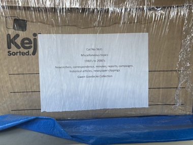
Archive - Gwen Goedecke Collection - Miscellaneous Topics
... | Docklands Task Force - correspondence, information Bulletins on Docklands, Explore Docklands including history and map (all 1991) |Referendum on a Republic (flyer) - information regarding the referendum in 1999 by the Constitution Centenary Foundation |A Whole Year of Celebration (flyer) re Victoria turning 150 years old (1984) From Citzen to Councillor - A Guide for Prospective Councillors (3rd edition (1999) by the Municipal Association of Victoria | PUBLIC FIRST Campaign - a Coalition opposed to privatisation of public utilities - newsletter containing operating principles, organisational roles etc |Environment Victoria - Newspaper 52/53 Forestry in Victoria Western Suburbs Action - by the Conservation Council of Victoria (1984) |Police and Community Youth Clubs - report (1999) Managing Cultural Equity: The Philosophy, Politics and Institutional Behaviours |The Age souvenir pages Melbourne 150' (1992) |PUBLICATIONS|The Australin Municipal journal #64 (June 1985) by the Municipal Association of Victoria| Make Melbourne Marvellous - by the Socialist Alternative Melbourne Collective (The Sam Collective) 1985|Self Help Resource Directory - 2nd edition by a Collective of Self Help Groups (Victoria 1982)|Industrial Waste Project Information Kit (MMBW 1986)|Western Region Environment Commission Minutes July 1985 together with a copy of the Draft Industrial Waste Strategy for Victoria (1985) by the EPA|Interim Directory of Government Departments and Authorities VIC from the Department of the Premier (1979)|National strategies for Managing Hazardous Waste - Conference papers (1985) by the Commonwealth Department of Arts, Heritage and Environment, EPA and the MMBW|The Mt. ...| Docklands Task Force - correspondence, information Bulletins on Docklands, Explore Docklands including history and map (all 1991) |Referendum on a Republic (flyer) - information regarding the referendum in 1999 by the Constitution Centenary Foundation |A Whole Year of Celebration (flyer) re Victoria turning 150 years old (1984) From Citzen to Councillor - A Guide for Prospective Councillors (3rd edition (1999) by the Municipal Association of Victoria | PUBLIC FIRST Campaign - a Coalition opposed to privatisation of public utilities - newsletter containing operating principles, organisational roles etc |Environment Victoria - Newspaper 52/53 Forestry in Victoria Western Suburbs Action - by the Conservation Council of Victoria (1984) |Police and Community Youth Clubs - report (1999) Managing Cultural Equity: The Philosophy, Politics and Institutional Behaviours |The Age souvenir pages Melbourne 150' (1992) |PUBLICATIONS|The Australin Municipal journal #64 (June 1985) by the Municipal Association of Victoria| Make Melbourne Marvellous - by the Socialist Alternative Melbourne Collective (The Sam Collective) 1985|Self Help Resource Directory - 2nd edition by a Collective of Self Help Groups (Victoria 1982)|Industrial Waste Project Information Kit (MMBW 1986)|Western Region Environment Commission Minutes July 1985 together with a copy of the Draft Industrial Waste Strategy for Victoria (1985) by the EPA|Interim Directory of Government Departments and Authorities VIC from the Department of the Premier (1979)|National strategies for Managing Hazardous Waste - Conference papers (1985) by the Commonwealth Department of Arts, Heritage and Environment, EPA and the MMBW|The Mt. ...Letter to Community Activists re Transport needs of Melbourne from the People for Environmentally Sustainable Transport (dated?)| Docklands Task Force - correspondence, information Bulletins on Docklands, Explore Docklands including history and map (all 1991) |Referendum on a Republic (flyer) - information regarding the referendum in 1999 by the Constitution Centenary Foundation |A Whole Year of Celebration (flyer) re Victoria turning 150 years old (1984) From Citzen to Councillor - A Guide for Prospective Councillors (3rd edition (1999) by the Municipal Association of Victoria | PUBLIC FIRST Campaign - a Coalition opposed to privatisation of public utilities - newsletter containing operating principles, organisational roles etc |Environment Victoria - Newspaper 52/53 Forestry in Victoria Western Suburbs Action - by the Conservation Council of Victoria (1984) |Police and Community Youth Clubs - report (1999) Managing Cultural Equity: The Philosophy, Politics and Institutional Behaviours |The Age souvenir pages Melbourne 150' (1992) |PUBLICATIONS|The Australin Municipal journal #64 (June 1985) by the Municipal Association of Victoria| Make Melbourne Marvellous - by the Socialist Alternative Melbourne Collective (The Sam Collective) 1985|Self Help Resource Directory - 2nd edition by a Collective of Self Help Groups (Victoria 1982)|Industrial Waste Project Information Kit (MMBW 1986)|Western Region Environment Commission Minutes July 1985 together with a copy of the Draft Industrial Waste Strategy for Victoria (1985) by the EPA|Interim Directory of Government Departments and Authorities VIC from the Department of the Premier (1979)|National strategies for Managing Hazardous Waste - Conference papers (1985) by the Commonwealth Department of Arts, Heritage and Environment, EPA and the MMBW|The Mt. Cottrell Project - project of the Western Region Commission - a final year thesis (1973)|Gwen's notes and photocopies of articles from a publication Melbourne's Development & Planning |Queen Victoria Hospital / Women's Centre - - newspaper clippings (1980's to 2000's) -correspondence, campaigns -a report by the Ministerial Advisory Committee (2000) |The Crow Collection Association - Ecosa Exchange Newsletters (80's and 90's) - Copies of extracts from Eureka Street, a Jesuit publication, with notations/comments from Ruth Crow (1993) -news articles, correspondence, phamplets, price lists, broad details of subject areas in the Crow Collection (1991) -report to the Committee of Management (1991) by Sheila Byard -article from the Australian Society (1985) on Ruth and Maurice Crow - Plan for Melbourne - parts 2&3 by Ruth and Maurice Crow (1972)john "jack" augustine tighe, gwenyth "gwen" goedecke, mayor -
 Warrnambool and District Historical Society Inc.
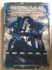
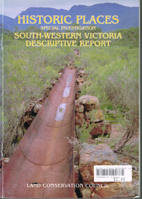
Book, Historic Places of South West Victoria
... Front Cover – Historic Places - Special Investigation - South-Western Victoria - Final Recommendations – Land Conservation Council Spine – Historic Places – South-Western Victoria – Final Recommendations – Land Conservation Council Back Cover – Historic Places, Final Rec., code used for retail sales ... - Final Recommendations – Land Conservation Council Spine – Historic Places – South-Western Victoria – Final Recommendations – Land Conservation Council Back Cover – Historic Places, Final Rec., code used for retail sales This is a soft-cover book with a multi-coloured cover featuring a photograph of the Pioneers Memorial, Deep Lead. ...This is the third in a series of booklets produced by the Land Conservation Council in 1997 (176 pages). Booklets One and Two (1996) contained A Descriptive Report and Proposed Recommendations. The Final Recommendations include information on processes for protection of historic places, lists of significant places in the south-western region and aboriginal historic places. Attached inside the back cover are two maps showing the location of the significant places.This is a useful book as it lists the declared historic sites in the region and researchers will find the information helpful. This is a soft-cover book with a multi-coloured cover featuring a photograph of the Pioneers Memorial, Deep Lead. It has a red-coloured spine and back cover.Front Cover – Historic Places - Special Investigation - South-Western Victoria - Final Recommendations – Land Conservation Council Spine – Historic Places – South-Western Victoria – Final Recommendations – Land Conservation Council Back Cover – Historic Places, Final Rec., code used for retail sales warrnambool, south west historic places, aboriginal historic places -
 Kiewa Valley Historical Society
Report - Alpine Study Area Volume 2 Maps, Land Conservation Council, 1970s
... The Victorian Environmental Assessment Council and the former Environment Conservation Council (ECC) and Land Conservation Council (LCC) have completed 36 land use investigations over more than 35 years, including 27 regional reviews. They provide a framework for use of Public Land in Victoria...Kiewa Valley Historical Society Mount Beauty Information Centre 31 Bogong High Plains Rd Mt Beauty high-country The Victorian Environmental Assessment Council and the former Environment Conservation Council (ECC) and Land Conservation Council (LCC) have completed 36 land use investigations over more than 35 years, including 27 regional reviews. They provide a framework for use of Public Land in Victoria ...The Victorian Environmental Assessment Council and the former Environment Conservation Council (ECC) and Land Conservation Council (LCC) have completed 36 land use investigations over more than 35 years, including 27 regional reviews. They provide a framework for use of Public Land in Victoria. The Land Conservation Council was established by the Land Conservation Act 1970.These maps provide an assessment of the Alpine area at the time the maps were created. Some of the topics eg. Rainfall and water resources may change over the years thus providing a comparative analysis. Others may provide information for future development such as mineral exploration, building of a dam / tunnel etc.Blue box shaped folder containing 9 of 10 Maps of the Alpine Study Area produced by the Land Conservation Council. Maps include 1. Public land and descriptive blocks. 2. Physiography. 3. Topography. 4. Geology (missing). 5. Rainfall and water resources. 6. Vegetation 7. Land systems. 8. Recreation. 9. Primary production. 10. Minerals Ex library item. Stamped in red "Discarded From Stock / Swan Hill Regional Libraryalpine area, maps of alpine area, land conservation council -
 Kiewa Valley Historical Society
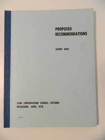
Report - Alpine Area Proposed Recommendations, Land Conservation Council, Victoria Melbourne, April 1978, April 1978
... Land Conservation Council, Victoria Melbourne, April 1978...Of interest for research on the changing ideas regarding the use of public land and the environment. alpine area land conservation council alpine study area report Blue book bound by dark blue cloth tape. It has 92 pages with maps at the end and an empty folder inside the back cover. Land Conservation Council, Victoria ...The Land Conservation Council was established by the Land Conservation Act 1970. It makes recommendations to the Minister for Conservation with respect to the use of public land. Notices showing the boundary of the study area ... published in the Victorian Government Gazette Sept. 1973. A descriptive report was published in July 1977. Submissions (1538) on the future use of public land were received & included those representing a wide cross-section of the community. These were considered in the final report.Of interest for research on the changing ideas regarding the use of public land and the environment.Blue book bound by dark blue cloth tape. It has 92 pages with maps at the end and an empty folder inside the back cover.alpine area, land conservation council, alpine study area report -
 Kiewa Valley Historical Society
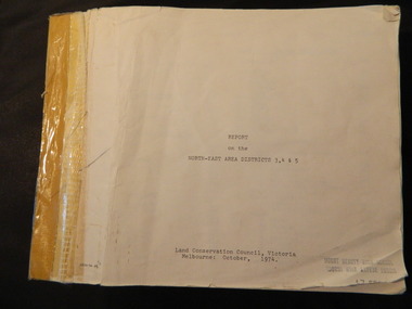
Report - Land Conservation Council x2, Land Conservation Council, Victoria Melbourne, April 1978, October 1974
... Land Conservation Council, Victoria Melbourne, April 1978...Land Conservation Act 1970 established the Land Conservation Council to investigate and recommend to the Minister use of public land in Victoria. ...Land Conservation Council, Victoria Melbourne, April 1978 Report - Land Conservation Council x2 ...Land Conservation Act 1970 established the Land Conservation Council to investigate and recommend to the Minister use of public land in Victoria. It describes and assesses the natural resources:-Physiography, Geology, Topography, Land Systems, Outdoor Recreation, Public land and blocks. Primary Production. Vegetation.North East Victoria includes the Kiewa Valley. This report gives an understanding of the development of the area.Thick heavy book with 312 pages with black and white photos. Back half has a folder with heavy cardboard attached to thick cardboard back cover. Inside folder are 9 maps with color each with a different title.Stamped on Front Cover: "Mount Beauty High School" Has a library borrowing slip at the back of the last page.land conservation council, environment, public land, kiewa valley, planning -
 Orbost & District Historical Society
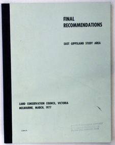
document, FINAL RECOMMENDATIONS E. GIPPSLAND STUDY AREA - LAND CONSERVATION COUNCIL, VICTORIA March 1977, March 1977
... GIPPSLAND STUDY AREA - LAND CONSERVATION COUNCIL, VICTORIA March 1977...Conservation Council operated under the Land Conservation Council Act 1970. In July 1997, the Environment Conservation Council Act 1997 came into operation. This Act revoked the Land Conservation Council Act 1970 and abolished the Land Conservation Council. An Environment Conservation Council was established in its place. (ref. TROVE) This document is a useful reference tool. land-conservation-East-Gippsland A document of 75 pp with a pale green cover and black print, titled Final Recommendations East Gippsland Study area. Land Conservation Council, Melbourne, March, 1977. FINAL RECOMMENDATIONS E. GIPPSLAND STUDY AREA - LAND CONSERVATION COUNCIL, VICTORIA ...Established in 1971, the Land Conservation Council operated under the Land Conservation Council Act 1970. In July 1997, the Environment Conservation Council Act 1997 came into operation. This Act revoked the Land Conservation Council Act 1970 and abolished the Land Conservation Council. An Environment Conservation Council was established in its place. (ref. TROVE) This document is a useful reference tool.A document of 75 pp with a pale green cover and black print, titled Final Recommendations East Gippsland Study area. Land Conservation Council, Melbourne, March, 1977.land-conservation-east-gippsland -
 Glen Eira Historical Society
Article - ELSTERNWICK CLASSIC CINEMA
... Photographers unknown. 3/National Trust of Australia (Victoria) Classification Report on Elsternwick Theatre with attached cover letter addressed to the Manager of the Planning Section, City of Glen Eira Council, from Ian Pausacker from the National Trust dated 04/10/2000. The report includes a statement of significance, history, description, context and floor plans of the theatre. 4/1 newspaper article written by Alex Njoo from the Caulfield/Port Philip Leader, 31/01/2012, congratulating the Tamir family on their conservation of the Elsternwick Classic Cinema. ...Photographers unknown. 3/National Trust of Australia (Victoria) Classification Report on Elsternwick Theatre with attached cover letter addressed to the Manager of the Planning Section, City of Glen Eira Council, from Ian Pausacker from the National Trust dated 04/10/2000. The report includes a statement of significance, history, description, context and floor plans of the theatre. 4/1 newspaper article written by Alex Njoo from the Caulfield/Port Philip Leader, 31/01/2012, congratulating the Tamir family on their conservation of the Elsternwick Classic Cinema. ...This file contains 4 items relating to the Elsternwick Classic Cinema: 1/1 original black and white photograph of the Elsternwick Classic Cinema, 9 Gordon Street Elsternwick. Date and photographer unknown. 2/ 2 photocopied photos of the Elsternwick Classic Theatre in its various stages of operation. One photo is of it as the Dorchester Dance Hall between 1938 and 1946 and the other is of the Classic Cinema in 1994. Photographers unknown. 3/National Trust of Australia (Victoria) Classification Report on Elsternwick Theatre with attached cover letter addressed to the Manager of the Planning Section, City of Glen Eira Council, from Ian Pausacker from the National Trust dated 04/10/2000. The report includes a statement of significance, history, description, context and floor plans of the theatre. 4/1 newspaper article written by Alex Njoo from the Caulfield/Port Philip Leader, 31/01/2012, congratulating the Tamir family on their conservation of the Elsternwick Classic Cinema. Includes a colour photo of the Tamirs, photographer unknown.elsternwick classic cinema, gordon street, elsternwick, dorchester dance hall, national trust of australia, national trust register, elsternwick theatre, pausacker ian, classic cinema, entertainment, cinemas, theatres, victorian style, elsternwick public hall, skating rink company limited, selwyn street, victorian permanent building society, community centres, films, shows and exhibitions, film projectors, amalgamate picture company ltd., richardson frank g., architecture, stairs, associated theatres limited, ballantyne and hared, balconies, architectural features, entrances, depression 1929-1939, astor, dancehalls, esquire theatre, prentice george, plottel joseph, architects, cowper murphy and associates, sharon cinema, tamir eddie, readings, free classical style, plans, business people, njoo alex, tamir family -
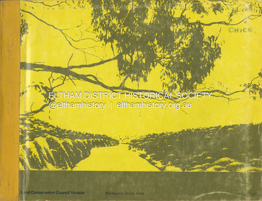 Eltham District Historical Society Inc
Book, Land Conservation Council, Report on the Melbourne Study Area, December 1973
... "The Land Conservation Act 1970 established the Land Conservation Council whose functions is to "carry out investigations and make recommendations to the Minister with respect to the use of public land in order to provide for the balanced use of land in Victoria. ...This report sets out to describe and assess the natural resources of the public lands in the Melbourne area and provides a factual basis on which members of the community may base submissions to the [Land Conservation] Council of Victoria. 444 pages Report on the Melbourne Study Area Book Land Conservation Council ...This report is one of a series describings the physical nature of the land and its environment, examines the likely forms of land use, and assesses the hazards associated with these uses. It is divided into four main sections: Introduction, Characteristics of environment, main forms of land use and description of 24 specific blocks in the study area which include Torquay, Brisbane Ranges, Werribee, Wombat, Loddon, Romsey, Puckapunyal, Strathbogie, Eildon, Disappointment, Break O'Day, Black Range, Cerberean, Upper Goulburn, Kinglake, Donna Buang, Upper Yarra, Thomson, Dandenongs, Bunyip-Latrobe, Shady Creek, Tyers, Westernport and Strzelecki. The Land Conservation Act 1970 established the Land Conservation Council whose functions is to "carry out investigations and make recommendations to the Minister with respect to the use of public land in order to provide for the balanced use of land in Victoria. This report sets out to describe and assess the natural resources of the public lands in the Melbourne area and provides a factual basis on which members of the community may base submissions to the [Land Conservation] Council of Victoria.444 pagesnon-fictionThis report is one of a series describings the physical nature of the land and its environment, examines the likely forms of land use, and assesses the hazards associated with these uses. It is divided into four main sections: Introduction, Characteristics of environment, main forms of land use and description of 24 specific blocks in the study area which include Torquay, Brisbane Ranges, Werribee, Wombat, Loddon, Romsey, Puckapunyal, Strathbogie, Eildon, Disappointment, Break O'Day, Black Range, Cerberean, Upper Goulburn, Kinglake, Donna Buang, Upper Yarra, Thomson, Dandenongs, Bunyip-Latrobe, Shady Creek, Tyers, Westernport and Strzelecki. The Land Conservation Act 1970 established the Land Conservation Council whose functions is to "carry out investigations and make recommendations to the Minister with respect to the use of public land in order to provide for the balanced use of land in Victoria. This report sets out to describe and assess the natural resources of the public lands in the Melbourne area and provides a factual basis on which members of the community may base submissions to the [Land Conservation] Council of Victoria.land use, kinglake, thomson valley, conservation, public lands -
![Book - Map, Land Conservation Council, Melbourne Study Area Report, [December 1973]](/media/collectors/4f729f7b97f83e03086018a5/items/6469bc241d76dd4b008a829f/item-media/646b0013d841f8920fa4323c/item-fit-380x285.jpg?cb=6) Eltham District Historical Society Inc
Eltham District Historical Society IncBook - Map, Land Conservation Council, Melbourne Study Area Report, [December 1973]
... This report sets out to describe and assess the natural resources of the public lands in the Melbourne area and provides a factual basis on which members of the community may base submissions to the [Land Conservation] Council of Victoria. A collection of eight large fold out coloured maps published in a bound book form Melbourne Study Area Report Book Map Land Conservation Council ...The Melbourne Study Report is a series of volumes describing the physical nature of the land and its environment, examines the likely forms of land use, and assesses the hazards associated with these uses. This is Volume 2 (coloured maps). The first page featues a black and white map described as "Shire of Diamond Valley" with public land marked in yellow. Followed by eight large fold out maps. Melbourne Study Area Public land and descriptive blocks, Population description, Geology, Physiography, topography and rainfall, vegetation and water supply. The Land Conservation Act 1970 established the Land Conservation Council whose functions is to "carry out investigations and make recommendations to the Minister with respect to the use of public land in order to provide for the balanced use of land in Victoria. This report sets out to describe and assess the natural resources of the public lands in the Melbourne area and provides a factual basis on which members of the community may base submissions to the [Land Conservation] Council of Victoria.A collection of eight large fold out coloured maps published in a bound book formnon-fictionThe Melbourne Study Report is a series of volumes describing the physical nature of the land and its environment, examines the likely forms of land use, and assesses the hazards associated with these uses. This is Volume 2 (coloured maps). The first page featues a black and white map described as "Shire of Diamond Valley" with public land marked in yellow. Followed by eight large fold out maps. Melbourne Study Area Public land and descriptive blocks, Population description, Geology, Physiography, topography and rainfall, vegetation and water supply. The Land Conservation Act 1970 established the Land Conservation Council whose functions is to "carry out investigations and make recommendations to the Minister with respect to the use of public land in order to provide for the balanced use of land in Victoria. This report sets out to describe and assess the natural resources of the public lands in the Melbourne area and provides a factual basis on which members of the community may base submissions to the [Land Conservation] Council of Victoria. maps, shire of diamond valley, population, geology, topography, rainfall, vegetation, water supply, land use, public lands -
 Eltham District Historical Society Inc
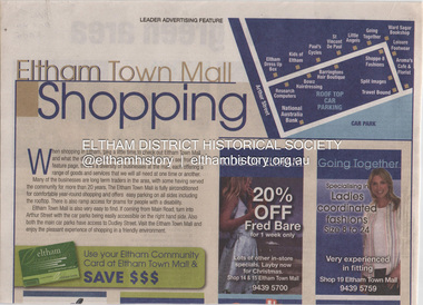
Document - Property Binder, Eltham Mall, 10-18 Arthur Street, Eltham
... Victoria, Melbourne's Threatened Habitats Under Threat: Development Pressures and Conservation Solutions which places the 'Nillumbik Foothills' number seven on list of most endangered by urban sprawl] 2. Advertisement: Huge Bikle Sale, Paul's Cycles, Diamond Valley Leader, February 7, 2007 Eltham Businesses Eltham Town Mall Paul's Cycles shops Brushtailed phascogale Click here to add keywords Cr Greg Johnson Eltham Copper Butterfly Environment Victoria Environmental Significance Overlay Green Wedges Coalition Nillumbik Shire Council Powerful Owl Significant Landscape Overlay Victorian National Parks Association Aroma's Cafe and Florist Arthur Street Barringtons Hair Boutique Bowz Hairdressing Eltham Dress Up Box Going Together Kids of Eltham Leisure Footwear Little Angels National Australia Bank Research Computers Shoppe 8 Fashions Split Images St Vincent de Paul Travel Bound Ward Sagar Bookshop Miscellaneous clippings, notes, photocopies, etc held on the subject property. ...1. Eltham Town Mall Shopping, Diamond Valley Leader, October 26, 2005 [ On reverse - "Red alert for green area by Natalie Birch and Shane Woodrow about a report compiled by Environment Victoria, Melbourne's Threatened Habitats Under Threat: Development Pressures and Conservation Solutions which places the 'Nillumbik Foothills' number seven on list of most endangered by urban sprawl] 2. Advertisement: Huge Bikle Sale, Paul's Cycles, Diamond Valley Leader, February 7, 2007eltham, businesses, eltham town mall, paul's cycles, shops, brushtailed phascogale, click here to add keywords, cr greg johnson, eltham copper butterfly, environment victoria, environmental significance overlay, green wedges coalition, nillumbik shire council, powerful owl, significant landscape overlay, victorian national parks association, aroma's cafe and florist, arthur street, barringtons hair boutique, bowz hairdressing, eltham dress up box, going together, kids of eltham, leisure footwear, little angels, national australia bank, research computers, shoppe 8 fashions, split images, st vincent de paul, travel bound, ward sagar bookshop -
Glen Eira Historical Society
Letter - Trinity Congregational Church, Glen Huntly
... Victoria, advising the Caulfield Historical Society, that the H. B. Council has chosen not to recommend the building for addition to the Historic Buildings Register Dated 08/10/1982. Extracted From Caulfield Conservation...Victoria, advising the Caulfield Historical Society, that the H. B. Council has chosen not to recommend the building for addition to the Historic Buildings Register Dated 08/10/1982. Extracted From Caulfield Conservation ...Roneod letter from the National Trust, Victoria, to the Congregational Union of Victoria. The correspondence gives notification that the church has been placed in the classified List and should be preserved. Dated 20/03/1973. Correspondence from Department of Planning Victoria, advising the Caulfield Historical Society, that the H. B. Council has chosen not to recommend the building for addition to the Historic Buildings Register Dated 08/10/1982. Extracted From Caulfield Conservation Study By Andrew Ward Dated January 1995 Describing Trinity Congregational Church. Includes Brief History Of The Church And Description Of Architectural Features.trinity congregational church., moran b., preston joane, grange road, caulfield., historic buildings council, glen huntly, hart trevor, grey karen, timber houses, filbert street, old calendar greek, primitive methodists, caulfield south, orthodox church, el nido grove, lyons street, porches, market gardens., gothic style, congregationalists, ward andrew, architectural features, architectural styles -
 Greensborough Historical Society
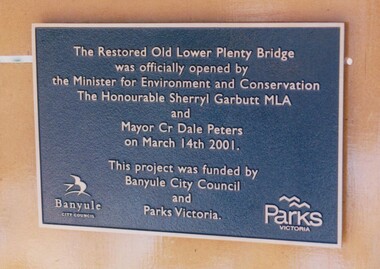
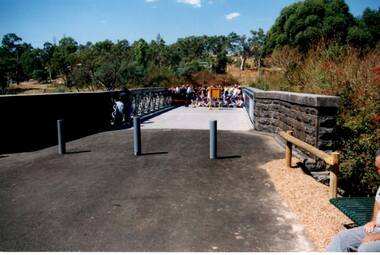
Photograph - Digital Image, Anne Paul, Plaque: Opening of restored Old Lower Plenty Bridge 2001, 14/03/2001
... This plaque commemorates the opening of the restored Old Lower Plenty Bridge, opened on 14/03/2001 by the Minister for Environment and Conservation Sherryl Garbutt MLA and Mayor of Banyule Cr Dale Peters. The project was jointly funded by Banyule Council and Parks Victoria....Greensborough Historical Society 34A Glenauburn Road Lower Plenty Lower Plenty melbourne This plaque commemorates the opening of the restored Old Lower Plenty Bridge, opened on 14/03/2001 by the Minister for Environment and Conservation Sherryl Garbutt MLA and Mayor of Banyule Cr Dale Peters. The project was jointly funded by Banyule Council and Parks Victoria. lower plenty lower plenty bridge sherryl garbutt dale peters banyule council parks victoria Digital copy of colour photograph of memorial plaque Plaque: Opening of restored Old Lower Plenty Bridge 2001 Photograph - Digital Image Anne Paul ...This plaque commemorates the opening of the restored Old Lower Plenty Bridge, opened on 14/03/2001 by the Minister for Environment and Conservation Sherryl Garbutt MLA and Mayor of Banyule Cr Dale Peters. The project was jointly funded by Banyule Council and Parks Victoria.Digital copy of colour photograph of memorial plaquelower plenty, lower plenty bridge, sherryl garbutt, dale peters, banyule council, parks victoria -
 Greensborough Historical Society
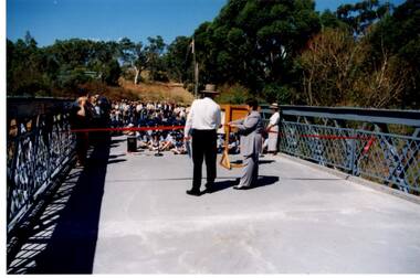
Photograph - Digital Image, Anne Paul, Opening of restored Old Lower Plenty Bridge 2001, 14/03/2001
... The opening of the restored Old Lower Plenty Bridge, opened on 14/03/2001 by the Minister for Environment and Conservation Sherryl Garbutt MLA and Mayor of Banyule Cr Dale Peters. The project was jointly funded by Banyule Council and Parks Victoria. ...Greensborough Historical Society 34A Glenauburn Road Lower Plenty Lower Plenty melbourne The opening of the restored Old Lower Plenty Bridge, opened on 14/03/2001 by the Minister for Environment and Conservation Sherryl Garbutt MLA and Mayor of Banyule Cr Dale Peters. The project was jointly funded by Banyule Council and Parks Victoria. ...The opening of the restored Old Lower Plenty Bridge, opened on 14/03/2001 by the Minister for Environment and Conservation Sherryl Garbutt MLA and Mayor of Banyule Cr Dale Peters. The project was jointly funded by Banyule Council and Parks Victoria. The restored bridge is the oldest remaining bridge in the former Shire of Eltham and forms part of the Plenty River Trail.Digital copy of colour photographlower plenty, lower plenty bridge, sherryl garbutt, dale peters, banyule council, parks victoria -
 Greensborough Historical Society
Photograph - Digital Image, Anne Paul, Opening of restored Old Lower Plenty Bridge 2001 - area adjacent, 14/03/2001
... The opening of the restored Old Lower Plenty Bridge, opened on 14/03/2001 by the Minister for Environment and Conservation Sherryl Garbutt MLA and Mayor of Banyule Cr Dale Peters. The project was jointly funded by Banyule Council and Parks Victoria. ...Greensborough Historical Society 34A Glenauburn Road Lower Plenty Lower Plenty melbourne The opening of the restored Old Lower Plenty Bridge, opened on 14/03/2001 by the Minister for Environment and Conservation Sherryl Garbutt MLA and Mayor of Banyule Cr Dale Peters. The project was jointly funded by Banyule Council and Parks Victoria. ...The opening of the restored Old Lower Plenty Bridge, opened on 14/03/2001 by the Minister for Environment and Conservation Sherryl Garbutt MLA and Mayor of Banyule Cr Dale Peters. The project was jointly funded by Banyule Council and Parks Victoria. The restored bridge is the oldest remaining bridge in Nillumbik and forms part of the Plenty River Trail. this photograph shows the area adjacent to the bridge on the day of the opening.Digital copy of colour photographlower plenty, lower plenty bridge, sherryl garbutt, dale peters, banyule council, parks victoria -
 Greensborough Historical Society
Photograph - Digital Image, Anne Paul, Opening of restored Old Lower Plenty Bridge 2001 - bridge and community, 14/03/2001
... The opening of the restored Old Lower Plenty Bridge, opened on 14/03/2001 by the Minister for Environment and Conservation Sherryl Garbutt MLA and Mayor of Banyule Cr Dale Peters. The project was jointly funded by Banyule Council and Parks Victoria. ...Greensborough Historical Society 34A Glenauburn Road Lower Plenty Lower Plenty melbourne The opening of the restored Old Lower Plenty Bridge, opened on 14/03/2001 by the Minister for Environment and Conservation Sherryl Garbutt MLA and Mayor of Banyule Cr Dale Peters. The project was jointly funded by Banyule Council and Parks Victoria. ...The opening of the restored Old Lower Plenty Bridge, opened on 14/03/2001 by the Minister for Environment and Conservation Sherryl Garbutt MLA and Mayor of Banyule Cr Dale Peters. The project was jointly funded by Banyule Council and Parks Victoria. The restored bridge is the oldest remaining bridge in the former Shire of Eltham and forms part of the Plenty River Trail. This photograph shows the bridge area ready for the opening ceremony and the assembled community members attending the function.Digital copy of colour photographlower plenty, lower plenty bridge, sherryl garbutt, dale peters, banyule council, parks victoria -
 Greensborough Historical Society
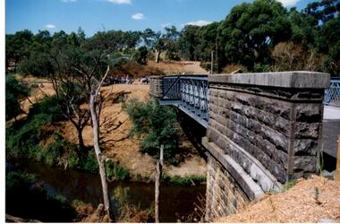
Photograph - Digital Image, Anne Paul, Opening of restored Old Lower Plenty Bridge 2001 - side view of bridge, 14/03/2001
... The opening of the restored Old Lower Plenty Bridge, opened on 14/03/2001 by the Minister for Environment and Conservation Sherryl Garbutt MLA and Mayor of Banyule Cr Dale Peters. The project was jointly funded by Banyule Council and Parks Victoria. ...Greensborough Historical Society 34A Glenauburn Road Lower Plenty Lower Plenty melbourne The opening of the restored Old Lower Plenty Bridge, opened on 14/03/2001 by the Minister for Environment and Conservation Sherryl Garbutt MLA and Mayor of Banyule Cr Dale Peters. The project was jointly funded by Banyule Council and Parks Victoria. ...The opening of the restored Old Lower Plenty Bridge, opened on 14/03/2001 by the Minister for Environment and Conservation Sherryl Garbutt MLA and Mayor of Banyule Cr Dale Peters. The project was jointly funded by Banyule Council and Parks Victoria. The restored bridge is the oldest remaining bridge in the former Shire of Eltham and forms part of the Plenty River Trail. This photograph shows the bridge from the side elevation, showing the bluestone and iron construction.Digital copy of colour photographlower plenty, lower plenty bridge, sherryl garbutt, dale peters, banyule council, parks victoria -
![Book, CUTTRISS, Linda et al, Five hundred [500] million years on Phillip Island, 1995](/media/collectors/4f729f5b97f83e0308601629/items/59addb1990751a2a14cd6a5a/item-media/65fa31f1da165d21f3449f68/item-fit-380x285.jpg?cb=6) Phillip Island and District Historical Society Inc.
Phillip Island and District Historical Society Inc.Book, CUTTRISS, Linda et al, Five hundred [500] million years on Phillip Island, 1995
... Phillip Island and District Historical Society Inc. phillip-island-and-the-bass-coast Natural history victoria phillip island geology nature effect of human beings conservation natural resources Signed copy; Donated by C. McFee. Five hundred [500] million years on Phillip Island Book Book CUTTRISS, Linda Eric BIRD Norval WATSON Bass Coast Shire Council ...Signed copy; Donated by C. McFee.natural history, victoria, phillip island, geology, nature, effect of human beings, conservation, natural resources -
 Eltham District Historical Society Inc
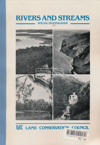
Book, Land Conservation Council, Rivers and Streams: Special Investigation, September 1989
... Council published its final recommendations in June 1991. While welcomed by many, the study cut across the interests of other groups and was perceived to be particularly threatening to water authorities. The investigation resulted in a legislated system of 17 heritage rivers (with significant natural, recreational, scenic and heritage values) and natural catchment areas across Victoria. Soft bound, linen spine, 316 A4 pages, also two loose inserts for making submissions Rivers and Streams: Special Investigation Book Book Land Conservation ...In June 1987, the government directed the LCC to carry out a special investigation of the social, recreational, cultural and ecological values of rivers and streams in Victoria, and to make recommendations on the use of these rivers and how their identified values can best be protected. Notices announcing the commencement of the investigation were published in the Victoria Government Gazette and in Victorian newspapers in November 1987. A descriptive report was published in September 1989. The Council received 75 submissions following the publication of this report. After considering these submissions, the Council formulated its proposed recommendations, which were published in November 1990. The Council received 177 submissions commenting on the proposed recommendations. The Council published its final recommendations in June 1991. While welcomed by many, the study cut across the interests of other groups and was perceived to be particularly threatening to water authorities. The investigation resulted in a legislated system of 17 heritage rivers (with significant natural, recreational, scenic and heritage values) and natural catchment areas across Victoria. -
 Eltham District Historical Society Inc
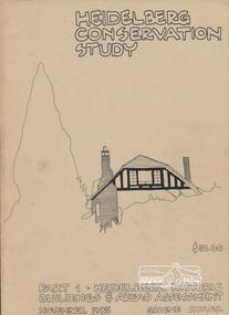
Book, Graem Butler, Heidelberg Conservation Study, Part 1 Heidelberg Historic Buildings and Areas Assessment by Graeme Butler, November 1985
... Council. Pioneering identification of a broad range of heritage assets varying from buildings, gravestones, farm structures, landscape areas, mileposts, divided street construction, in a time when buildings only were assessed in municipal studies. significant buildings heidelberg victoria history development of heidelberg victoria man-made landscape heidelberg victoria significant precincts heidelberg victoria conservation study graeme butler 2 v. : ill., maps ; 29 cm. ...Historic Buildings and Areas Assessment by Graeme Butler. Part 1 of award winning study carried out in 1982 in collaboration with a community advisory committee to Heidelberg City Council. Pioneering identification of a broad range of heritage assets varying from buildings, gravestones, farm structures, landscape areas, mileposts, divided street construction, in a time when buildings only were assessed in municipal studies.2 v. : ill., maps ; 29 cm.significant buildings heidelberg victoria, history development of heidelberg victoria, man-made landscape heidelberg victoria, significant precincts heidelberg victoria, conservation study, graeme butler -
 Otway Districts Historical Society
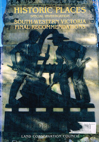
Book, Land Conservation Council, Historic places: special investigation: South-Western Victoria: Final recommendations, January 1997
... Land Conservation Council; Conservation; Historic places; Public land; Aborigines; South West Victoria;...The Land Conservation Council has carried out an investigation of historic places in public land in South-western Victoria. ...Historic places: Special investigation: South-Western Victoria: Final recommendations. Land Conservation Council. Land Conservation Council; Melbourne (Vic); January 1997. viii, 176 p.; illus.; maps. ...Historic places: Special investigation: South-Western Victoria: Final recommendations. Land Conservation Council. Land Conservation Council; Melbourne (Vic); January 1997. viii, 176 p.; illus.; maps. ...The Land Conservation Council has carried out an investigation of historic places in public land in South-western Victoria. The report contains the Council's recommendations for the protection, management and future use of more than 700 historic places, out of 2200 places identified during the investigation. The places have been assigned to three categories, A, B and C, representing State, regional and local levels of significance. The report also contains recommendations relating to general historic places management, the processes available in Victoria for the protection of historic places on public land, and Aboriginal historic places.Historic places: Special investigation: South-Western Victoria: Final recommendations. Land Conservation Council. Land Conservation Council; Melbourne (Vic); January 1997. viii, 176 p.; illus.; maps. Soft cover. ISBN 0 7241 9290 5Maps in plastic sleeve.land conservation council; conservation; historic places; public land; aborigines; south west victoria; -
 Otway Districts Historical Society
Book, Land Conservation Council, Historic places: Special investigation: South-Western Victoria: Descriptive report, January 1996
... Land Conservation Council; conservation; South-western Victoria; historic places;...Historic places: Special investigation: South-Western Victoria: Descriptive report. Land Conservation Council. Land Conservation Council; Melbourne (Vic); January 1966. viii, 180 p.; illus.; maps. ...Victoria, possessing a rich heritage of the signs of past human activity, is fertile ground for an investigation of historic places on public land. This report includes an initial inventory of almost 2000 places. The report outlines the history and the related heritage of the area, describes in some detail its biophysical attributes and introduces the natural resources and present land use. This information provides a context for understanding the origins of the historical features that are observes today. Land Conservation Council ...The south-west of Victoria, possessing a rich heritage of the signs of past human activity, is fertile ground for an investigation of historic places on public land. This report includes an initial inventory of almost 2000 places. The report outlines the history and the related heritage of the area, describes in some detail its biophysical attributes and introduces the natural resources and present land use. This information provides a context for understanding the origins of the historical features that are observes today.Historic places: Special investigation: South-Western Victoria: Descriptive report. Land Conservation Council. Land Conservation Council; Melbourne (Vic); January 1966. viii, 180 p.; illus.; maps. Soft cover. ISBN 0 7241 9288 3Maps in plastic sleeve.land conservation council; conservation; south-western victoria; historic places;