Showing 73 items matching " land conservation council"
-
 Kiewa Valley Historical Society
Report - Land Conservation Council x2, Land Conservation Council, Victoria Melbourne, April 1978, October 1974
... Report - Land Conservation Council x2...Land Conservation Council, Victoria Melbourne, April 1978...land conservation council...Land Conservation Act 1970 established the Land Conservation Council to investigate and recommend to the Minister use of public land in Victoria. ...Inside folder are 9 maps with color each with a different title. Land Conservation Council, Victoria Melbourne, April 1978 Report - Land Conservation Council x2 ...Land Conservation Act 1970 established the Land Conservation Council to investigate and recommend to the Minister use of public land in Victoria. It describes and assesses the natural resources:-Physiography, Geology, Topography, Land Systems, Outdoor Recreation, Public land and blocks. Primary Production. Vegetation.North East Victoria includes the Kiewa Valley. This report gives an understanding of the development of the area.Thick heavy book with 312 pages with black and white photos. Back half has a folder with heavy cardboard attached to thick cardboard back cover. Inside folder are 9 maps with color each with a different title.Stamped on Front Cover: "Mount Beauty High School" Has a library borrowing slip at the back of the last page.land conservation council, environment, public land, kiewa valley, planning -
 Orbost & District Historical Society
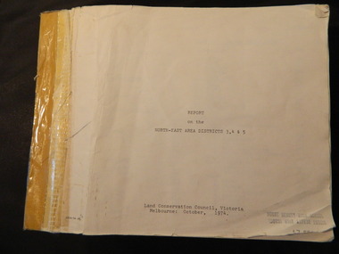
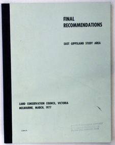
document, FINAL RECOMMENDATIONS E. GIPPSLAND STUDY AREA - LAND CONSERVATION COUNCIL, VICTORIA March 1977, March 1977
... GIPPSLAND STUDY AREA - LAND CONSERVATION COUNCIL, VICTORIA March 1977...Established in 1971, the Land Conservation Council operated under the Land Conservation Council Act 1970. ...A document of 75 pp with a pale green cover and black print, titled Final Recommendations East Gippsland Study area. Land Conservation Council, Melbourne, March, 1977....Land Conservation Council...Orbost & District Historical Society Ruskin Street Orbost gippsland Established in 1971, the Land Conservation Council operated under the Land Conservation Council Act 1970. ...Established in 1971, the Land Conservation Council operated under the Land Conservation Council Act 1970. In July 1997, the Environment Conservation Council Act 1997 came into operation. This Act revoked the Land Conservation Council Act 1970 and abolished the Land Conservation Council. An Environment Conservation Council was established in its place. (ref. TROVE) This document is a useful reference tool.A document of 75 pp with a pale green cover and black print, titled Final Recommendations East Gippsland Study area. Land Conservation Council, Melbourne, March, 1977.land-conservation-east-gippsland -
 Tatura Irrigation & Wartime Camps Museum
Book - Land Conservation Council Victoria ( Murray Valley Area ), Land Conservation Council Victoria ( Murray Valley Area )
... Land Conservation Council Victoria ( Murray Valley Area )...Land Conservation Council Victoria ( Murray Valley Area )...Land Conservation Council Victoria. Murray Valley area Price $8.00...Heavy white envelope inside back cover that contains maps Land Conservation Council Victoria ( Murray Valley Area ) Book Land Conservation Council Victoria ( Murray Valley Area ) ...Report on public land use in the Murray Valley area in 1983Mediun size, Yellow and Orange Front Cover. Brown fabric Spine. White back. Heavy white envelope inside back cover that contains mapsnon-fictionReport on public land use in the Murray Valley area in 1983soils and land use -
 Otway Districts Historical Society
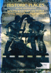
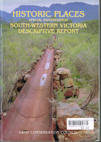
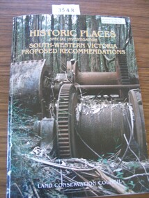
Book, Land Conservation Council, Historic places: special investigation: South-Western Victoria: Final recommendations, January 1997
... Land Conservation Council; Conservation; Historic places; Public land; Aborigines; South West Victoria;...The Land Conservation Council has carried out an investigation of historic places in public land in South-western Victoria. ...Historic places: Special investigation: South-Western Victoria: Final recommendations. Land Conservation Council. Land Conservation Council; Melbourne (Vic); January 1997. viii, 176 p.; illus.; maps. ...Land Conservation Council...Historic places: Special investigation: South-Western Victoria: Final recommendations. Land Conservation Council. Land Conservation Council; Melbourne (Vic); January 1997. viii, 176 p.; illus.; maps. ...The Land Conservation Council has carried out an investigation of historic places in public land in South-western Victoria. The report contains the Council's recommendations for the protection, management and future use of more than 700 historic places, out of 2200 places identified during the investigation. The places have been assigned to three categories, A, B and C, representing State, regional and local levels of significance. The report also contains recommendations relating to general historic places management, the processes available in Victoria for the protection of historic places on public land, and Aboriginal historic places.Historic places: Special investigation: South-Western Victoria: Final recommendations. Land Conservation Council. Land Conservation Council; Melbourne (Vic); January 1997. viii, 176 p.; illus.; maps. Soft cover. ISBN 0 7241 9290 5Maps in plastic sleeve.land conservation council; conservation; historic places; public land; aborigines; south west victoria; -
 Kiewa Valley Historical Society
Report - Alpine Study Area Volume 2 Maps, Land Conservation Council, 1970s
... Land Conservation Council......land conservation council...They provide a framework for use of Public Land in Victoria. The Land Conservation Council was established by the Land Conservation Act 1970....Blue box shaped folder containing 9 of 10 Maps of the Alpine Study Area produced by the Land Conservation Council. Maps include 1. Public land and descriptive blocks. 2. ...Minerals Land Conservation Council Report - Alpine Study Area Volume 2 Maps ...The Victorian Environmental Assessment Council and the former Environment Conservation Council (ECC) and Land Conservation Council (LCC) have completed 36 land use investigations over more than 35 years, including 27 regional reviews. They provide a framework for use of Public Land in Victoria. The Land Conservation Council was established by the Land Conservation Act 1970.These maps provide an assessment of the Alpine area at the time the maps were created. Some of the topics eg. Rainfall and water resources may change over the years thus providing a comparative analysis. Others may provide information for future development such as mineral exploration, building of a dam / tunnel etc.Blue box shaped folder containing 9 of 10 Maps of the Alpine Study Area produced by the Land Conservation Council. Maps include 1. Public land and descriptive blocks. 2. Physiography. 3. Topography. 4. Geology (missing). 5. Rainfall and water resources. 6. Vegetation 7. Land systems. 8. Recreation. 9. Primary production. 10. Minerals Ex library item. Stamped in red "Discarded From Stock / Swan Hill Regional Libraryalpine area, maps of alpine area, land conservation council -
 Otway Districts Historical Society
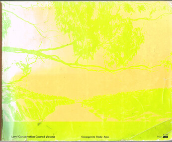
Book, Land Conservation Council, Report on the Corangamite Study Area, May 1976
... Land Conservation Council; Corangamite; geology; physiography; climate; water resources; soils; vegetation; fauna;...Report on the Corangamite study area. Land Conservation Council. Melbourne; Land Conservation Council; May 1976. x, 310 p.; illus, maps (separate). ...Land Conservation Council...Report on the Corangamite Study Area. Book Land Conservation Council ...The Report describes and assesses the natural resources of public land in the Corangamite study area, and provides a factual basis on which members of the community may base their submissions to the Council.Report on the Corangamite study area. Land Conservation Council. Melbourne; Land Conservation Council; May 1976. x, 310 p.; illus, maps (separate). Soft cover.land conservation council; corangamite; geology; physiography; climate; water resources; soils; vegetation; fauna; -
 Otway Districts Historical Society
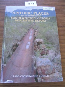
Book, Land Conservation Council, Historic places: Special investigation: South-Western Victoria: Descriptive report, January 1996
... Land Conservation Council; conservation; South-western Victoria; historic places;...Historic places: Special investigation: South-Western Victoria: Descriptive report. Land Conservation Council. Land Conservation Council; Melbourne (Vic); January 1966. viii, 180 p.; illus.; maps. ...Land Conservation Council...Historic places: Special investigation: South-Western Victoria: Descriptive report. Land Conservation Council. Land Conservation Council; Melbourne (Vic); January 1966. viii, 180 p.; illus.; maps. ...The south-west of Victoria, possessing a rich heritage of the signs of past human activity, is fertile ground for an investigation of historic places on public land. This report includes an initial inventory of almost 2000 places. The report outlines the history and the related heritage of the area, describes in some detail its biophysical attributes and introduces the natural resources and present land use. This information provides a context for understanding the origins of the historical features that are observes today.Historic places: Special investigation: South-Western Victoria: Descriptive report. Land Conservation Council. Land Conservation Council; Melbourne (Vic); January 1966. viii, 180 p.; illus.; maps. Soft cover. ISBN 0 7241 9288 3Maps in plastic sleeve.land conservation council; conservation; south-western victoria; historic places; -
 Lakes Entrance Historical Society
Book, Land Conservation Council Victoria, Land Conservation Council East Gippsland Area Review, 1985
... Land Conservation Council East Gippsland Area Review...Land Conservation Council Victoria...Six maps Land Conservation Council East Gippsland Area Review Book Land Conservation Council Victoria ...Report describing the physical and biological aspects of the public land in the eastern corner of Victoria, predominantly the Orbost Shire. Many issues are covered in the report, including timber industry, national parks, waterways and tourism. Six mapsparks, waterways, tourism, gippsland -
 Kiewa Valley Historical Society
Report - Alpine Area Proposed Recommendations, Land Conservation Council, Victoria Melbourne, April 1978, April 1978
... Land Conservation Council, Victoria Melbourne, April 1978......land conservation council...The Land Conservation Council was established by the Land Conservation Act 1970. ...Kiewa Valley Historical Society Mount Beauty Information Centre 31 Bogong High Plains Rd Mt Beauty high-country The Land Conservation Council was established by the Land Conservation Act 1970. ...The Land Conservation Council was established by the Land Conservation Act 1970. It makes recommendations to the Minister for Conservation with respect to the use of public land. Notices showing the boundary of the study area ... published in the Victorian Government Gazette Sept. 1973. A descriptive report was published in July 1977. Submissions (1538) on the future use of public land were received & included those representing a wide cross-section of the community. These were considered in the final report.Of interest for research on the changing ideas regarding the use of public land and the environment.Blue book bound by dark blue cloth tape. It has 92 pages with maps at the end and an empty folder inside the back cover.alpine area, land conservation council, alpine study area report -
Lakes Entrance Historical Society
Document - Report, Land Conservation Council, The History of the Aboriginal People of East Gippsland, January 1985
... A Report Prepared for Land Conservation Council, Victoria by Kym Thompson...Land Conservation Council...Lakes Entrance Historical Society 4 Marine Parade Lakes Entrance gippsland Aboriginal history History, traditions and culture of Aboriginals, sites of significance, archeology A Report Prepared for Land Conservation Council, Victoria by Kym Thompson 142 page document with black binding The History of the Aboriginal People of East Gippsland Document Report Land Conservation Council ...History, traditions and culture of Aboriginals, sites of significance, archeology142 page document with black bindingnon-fictionHistory, traditions and culture of Aboriginals, sites of significance, archeologyaboriginal history -
Ringwood and District Historical Society
Envelope, Packet: Ringwood Area Environment - Land Conservation Council, 150 years of Victoria's Rivers 1989. Heritage Inventory
... Packet: Ringwood Area Environment - Land Conservation Council, 150 years of Victoria's Rivers 1989. ...Historic places, Land Conservation Council relating to past 150 years of Victoria's rivers, streams and water systems; Heritage inventory...Ringwood and District Historical Society 125A Warrandyte Road Ringwood North melbourne Historic places, Land Conservation Council relating to past 150 years of Victoria's rivers, streams and water systems; Heritage inventory Packet: Ringwood Area Environment - Land Conservation Council, 150 years of Victoria's Rivers 1989. ...Historic places, Land Conservation Council relating to past 150 years of Victoria's rivers, streams and water systems; Heritage inventory -
 Stawell Historical Society Inc
Book, Land Conservation Council, Historic Places Special Investigation South Western Victoria Proposed Recommendations, 1996
... Historic places Special Investigation South-Western Victoria Descriptive report Land Conservation Council...Land Conservation Council...Stawell Historical Society Inc 46 Longfield St Stawell grampians Historic Places Special Investigation South Western Victoria descriptive report Jan 1996 stawell heritage Historic places Special Investigation South-Western Victoria Descriptive report Land Conservation Council Card cover with photo of a water metal water race with moutains in the background Historic Places Special Investigation South Western Victoria Proposed Recommendations Book Land Conservation Council ...Historic Places Special Investigation South Western Victoria descriptive report Jan 1996Card cover with photo of a water metal water race with moutains in the background Historic places Special Investigation South-Western Victoria Descriptive report Land Conservation Councilstawell heritage -
 Stawell Historical Society Inc
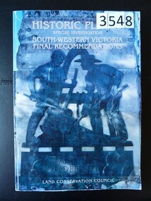
Book, Land Conservation Council, Historic Places Special Investigation South Western Victoria Final Recommendations, 1997
... Historic Places Special Investigation South-Western Victoria Proposed Recommendations Land Conservation Council...Land Conservation Council...Stawell Historical Society Inc 46 Longfield St Stawell grampians stawell heritage Historic Places Special Investigation South-Western Victoria Proposed Recommendations Land Conservation Council Card Cover with color Photo of Double drum winch at a sawmill mill site Green Spine Historic Places Special Investigation South Western Victoria Final Recommendations Book Land Conservation Council ...Card Cover with color Photo of Double drum winch at a sawmill mill site Green SpineHistoric Places Special Investigation South-Western Victoria Proposed Recommendations Land Conservation Councilstawell heritage -
 Stawell Historical Society Inc
Book, Land Conservation Council, Historic Places Special Investigation South Western Victoria Descriptive Report, 1996
... Historic Places Special Investigation South Western Victoria Final Recommendations Land Conservation Council...Land Conservation Council...Red Spine Historic Places Special Investigation South Western Victoria Descriptive Report Book Land Conservation Council ...Card cover with a colour photo of part of the Pioneers memorial at deep lead featuring two miners sluicing for gold. Red SpineHistoric Places Special Investigation South Western Victoria Final Recommendations Land Conservation Councilstawell heritage -
Clunes Museum
Document - REPORT, LAND CONSERVATION COUNCIL OF VICTORIA, FINAL RECOMMENDATIONS - NORTH CENTRAL AREA, FEBRUARY 1981
... BOUND BOOKLET - ORANGE SOFT COVER WITH NAVY BLUE BINDING LAND CONSERVATION COUNCIL, VICTORIA MELBOURNE - FEBRUARY 1981 - INCLUDING MAPS...LAND CONSERVATION COUNCIL OF VICTORIA...Clunes Museum 36 Fraser Street enter building through Collins Place Clunes goldfields local history document recommendations land conservation THE LAND CONSERVATION COUNCIL WAS ESTABLISHED BY THE LAND CONSERVATION ACT 1970. ...THE LAND CONSERVATION COUNCIL WAS ESTABLISHED BY THE LAND CONSERVATION ACT 1970. AS ONE OF ITS THREE FUNCTIONS, IT MAKES RECOMMENDATIONS TO THE MINISTER FOR CONSERVATION WITH RESPECT TO THE USE OF PUBLIC LAND, IN ORDER TO PROVIDE FOR THE BALANCED USE OF LAND IN VICTORIA...BOUND BOOKLET - ORANGE SOFT COVER WITH NAVY BLUE BINDING LAND CONSERVATION COUNCIL, VICTORIA MELBOURNE - FEBRUARY 1981 - INCLUDING MAPSnon-fictionTHE LAND CONSERVATION COUNCIL WAS ESTABLISHED BY THE LAND CONSERVATION ACT 1970. AS ONE OF ITS THREE FUNCTIONS, IT MAKES RECOMMENDATIONS TO THE MINISTER FOR CONSERVATION WITH RESPECT TO THE USE OF PUBLIC LAND, IN ORDER TO PROVIDE FOR THE BALANCED USE OF LAND IN VICTORIA...local history, document, recommendations, land conservation -
Lakes Entrance Historical Society
Book, Land Conservation Council Victoria, Final Recommendations Gippsland Lakes hinterland Area, 1983
... 1980 report and recommendations of the Victorian Land Conservation Council, for the balanced use of public land in teh gippsland Lakes Hinterland includes reserves schools forests rivers foreshores and other public sites. ...Land Conservation Council Victoria...Final Recommendations Gippsland Lakes hinterland Area Book Land Conservation Council Victoria ...1980 report and recommendations of the Victorian Land Conservation Council, for the balanced use of public land in teh gippsland Lakes Hinterland includes reserves schools forests rivers foreshores and other public sites. Map and diagrams added.topography, parks, waterways -
 Eltham District Historical Society Inc
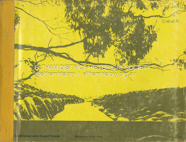
Book, Land Conservation Council, Report on the Melbourne Study Area, December 1973
... "The Land Conservation Act 1970 established the Land Conservation Council whose functions is to "carry out investigations and make recommendations to the Minister with respect to the use of public land in order to provide for the balanced use of land in Victoria. ...Land Conservation Council...This report sets out to describe and assess the natural resources of the public lands in the Melbourne area and provides a factual basis on which members of the community may base submissions to the [Land Conservation] Council of Victoria. 444 pages Report on the Melbourne Study Area Book Land Conservation Council ...This report is one of a series describings the physical nature of the land and its environment, examines the likely forms of land use, and assesses the hazards associated with these uses. It is divided into four main sections: Introduction, Characteristics of environment, main forms of land use and description of 24 specific blocks in the study area which include Torquay, Brisbane Ranges, Werribee, Wombat, Loddon, Romsey, Puckapunyal, Strathbogie, Eildon, Disappointment, Break O'Day, Black Range, Cerberean, Upper Goulburn, Kinglake, Donna Buang, Upper Yarra, Thomson, Dandenongs, Bunyip-Latrobe, Shady Creek, Tyers, Westernport and Strzelecki. The Land Conservation Act 1970 established the Land Conservation Council whose functions is to "carry out investigations and make recommendations to the Minister with respect to the use of public land in order to provide for the balanced use of land in Victoria. This report sets out to describe and assess the natural resources of the public lands in the Melbourne area and provides a factual basis on which members of the community may base submissions to the [Land Conservation] Council of Victoria.444 pagesnon-fictionThis report is one of a series describings the physical nature of the land and its environment, examines the likely forms of land use, and assesses the hazards associated with these uses. It is divided into four main sections: Introduction, Characteristics of environment, main forms of land use and description of 24 specific blocks in the study area which include Torquay, Brisbane Ranges, Werribee, Wombat, Loddon, Romsey, Puckapunyal, Strathbogie, Eildon, Disappointment, Break O'Day, Black Range, Cerberean, Upper Goulburn, Kinglake, Donna Buang, Upper Yarra, Thomson, Dandenongs, Bunyip-Latrobe, Shady Creek, Tyers, Westernport and Strzelecki. The Land Conservation Act 1970 established the Land Conservation Council whose functions is to "carry out investigations and make recommendations to the Minister with respect to the use of public land in order to provide for the balanced use of land in Victoria. This report sets out to describe and assess the natural resources of the public lands in the Melbourne area and provides a factual basis on which members of the community may base submissions to the [Land Conservation] Council of Victoria.land use, kinglake, thomson valley, conservation, public lands -
Lakes Entrance Historical Society
Map - Land Conservation Council Victoria East Gippsland Study Area
... Land Conservation Council Victoria East Gippsland Study Area...Lakes Entrance Historical Society 4 Marine Parade Lakes Entrance gippsland Topography Waterways Land conservation Two maps A shows the geology of East Gippsland. B shows the hinterland of East Gippsland Map Land Conservation Council Victoria East Gippsland Study Area ...Two maps A shows the geology of East Gippsland. B shows the hinterland of East Gippslandtopography, waterways, land conservation -
 Bendigo Historical Society Inc.
Book - REPORT ON THE NORTH CENTRAL STUDY AREA OF VICTORIA
... 252 page Report on the North Central Study Area by the Land Conservation Council of Victoria - July 1978 Illustrated with B&W photos Back section contains several removeable maps. ...Land Conservation Council, Victoria...History House 11 Mackenzie Street Bendigo goldfields Land Conservation North Central Region Land Conservation Council, Victoria 252 page Report on the North Central Study Area by the Land Conservation Council of Victoria - July 1978 Illustrated with B&W photos Back section contains several removeable maps. ...252 page Report on the North Central Study Area by the Land Conservation Council of Victoria - July 1978 Illustrated with B&W photos Back section contains several removeable maps. Printed by F D Atkinson, Government Printer, MelbourneLand Conservation Council, Victorialand conservation, north central region -
 Federation University Historical Collection
Book, Final recommendations Ballarat Study Area Land Conservation Council, Victoria, 1982, 1982
... Final recommendations Ballarat Study Area Land Conservation Council, Victoria, 1982...The contents of the report include: Parks, reference areas, wildlife reserves, water production, hardwood production, softwood production, flora Reserves and Flora and Fauna reserves, bushland reserves, historic area and reserves, rivers and streams, Roadside conservation and Highway parks, Education areas and School Plantations, Lake Reserves, geological reserves, recreation, scenic reserves, agriculture, mineral and stone production, utilities and survey, township land, Uncommitted Land, military training, other reserves and public land. Maps include: The Study area 1: 250 000 Supplementary Maps Final recommendations Ballarat Study Area Land Conservation Council ...Yellow soft covered report of 95 pages . The contents of the report include: Parks, reference areas, wildlife reserves, water production, hardwood production, softwood production, flora Reserves and Flora and Fauna reserves, bushland reserves, historic area and reserves, rivers and streams, Roadside conservation and Highway parks, Education areas and School Plantations, Lake Reserves, geological reserves, recreation, scenic reserves, agriculture, mineral and stone production, utilities and survey, township land, Uncommitted Land, military training, other reserves and public land. Maps include: The Study area 1: 250 000 Supplementary Mapsland conservation authority, ballarat, endowment plantations, pine plantations, langi ghiran state park, mount buangor state park, enfield state park, ballarat-creswick regional park, rossbridge, black lake, flax mill swamp, dereel lagoon, lake bolac, lake wongan, langi ghiran reservoir, gong gong reservoir, pincotts reservoir, beales reservoir, wilsons reservoir, moorabool reservoir, korweinguboora, korweinguborra reservoir, learmonth bores, sago hill, illabarook reservoir, ballarat water commission, dunneworthy, mount cole, mont lonarch, ben major, waterloo, trawalla, linton, ross creek, canadian, shepherds flat, lal lal, mount doran, raglan, chute, carngham, buninyong, watsons hill, enfield, cape clear, illabrook, rokewood junction, mount warrenheip, nerrina, jubilee, golden stream, australasian deep lead mine, happy valley school, piggoreet, berringa, bulldog, ballarat common, wildlife, water, timber, flora, rivers, geology, agriculture, warrenheip, biodiversity -
Save the Dandenongs League Inc.
Archive (item), Save the Dandenongs League Incorporated, Final Recommendations - Melbourne Study Area - Land Conservation Council, Victoria - Melbourne, January, 1977
... Final Recommendations - Melbourne Study Area - Land Conservation Council, Victoria - Melbourne, January, 1977...Final Recommendations - Melbourne Study Area - Land Conservation Council, Victoria - Melbourne, January, 1977 Archive Save the Dandenongs League Incorporated ... -
Save the Dandenongs League Inc.
Archive (item), Save the Dandenongs League Incorporated, Melbourne Area District 2 Review Descriptive Report - Land Conservation Council
... Melbourne Area District 2 Review Descriptive Report - Land Conservation Council...Melbourne Area District 2 Review Descriptive Report - Land Conservation Council Archive Save the Dandenongs League Incorporated ... -
Lakes Entrance Historical Society
Book, Land Conservation Council Victoria East Gippsland Study Area, 1974
... Land Conservation Council Victoria East Gippsland Study Area...History, vegetation, flora, fauna, Land Conservation Council Victoria East Gippsland Study Area Book ...Report describing the nature of environmental features, together with the character and distribution of various natural resources of the East Gippsland, Victoria, study area, comprising land in the old Shire of Orbost. History, vegetation, flora, fauna,vegetation, natural history, vegetation -
Lakes Entrance Historical Society
Book, Land Conservation Council Victoria Gippsland Lakes Hinterland Area, 1982
... Land Conservation Council Victoria Gippsland Lakes Hinterland Area...History, climate, geomorphology, land use, flora and fauna are presented. 1 map in pocket. Land Conservation Council Victoria Gippsland Lakes Hinterland Area Book ...Report describing the physical nature of the land in the Gippsland Lakes (Victoria) Hinterland Study area. History, climate, geomorphology, land use, flora and fauna are presented. 1 map in pocket.waterways, gippsland, natural history, vegetation -
Lakes Entrance Historical Society
Book, Land Conservation Council Victoria Alpine Area, 1977
... Land Conservation Council Victoria Alpine Area...History, climate, landform, vegetation, land use, are some of the aspects presented. Land Conservation Council Victoria Alpine Area Book ...Report containing information from various sources relevant to the future use of public land in the alpine area of Victoria. History, climate, landform, vegetation, land use, are some of the aspects presented.Ruth Clarktopography, vegetation -
Lakes Entrance Historical Society
Book, Land Conservation Council Victoria South Gippsland Area District 2, 1980
... Land Conservation Council Victoria South Gippsland Area District 2....Lakes Entrance Historical Society 4 Marine Parade Lakes Entrance gippsland Gippsland Topography Natural History Vegetation Ruth Clark Report describing and assessing the natural resources of the public land in the South Gippsland (Victoria) Study Area 2, comprising the Latrobe Valley, Strzelecki Range, South Gippsland coastal plains and all of Wilson's Promontory. Land Conservation Council Victoria South Gippsland Area District 2. ...Report describing and assessing the natural resources of the public land in the South Gippsland (Victoria) Study Area 2, comprising the Latrobe Valley, Strzelecki Range, South Gippsland coastal plains and all of Wilson's Promontory. Ruth Clarkgippsland, topography, natural history, vegetation -
 Orbost & District Historical Society
Document - File Folder, A History of Aboriginal People of East Gippsland, January 1985
... Land Conservation Council...A History of Aboriginal People of East Gippsland Document File Folder Land Conservation Council ...This item is a useful reference tool on the history of Indigenous People in East Gippsland and the Orbost district. A manilla folder with typed pages. On the cover is a label, "History of Aboriginal People of East Gippsland". On the inside cover is a letter addressed to the librarian at the Shire of Orbost Library. The letter is clipped to the inside of the folder.on front cover - a stamp -"Orbost Historical Society"aboriginal australians, gippsland aboriginal history, kurnai, brabawooloong peoples, tatungooloong peoples, krowathunkooloong peoples -
![Book - Map, Land Conservation Council, Melbourne Study Area Report, [December 1973]](/media/collectors/4f729f7b97f83e03086018a5/items/6469bc241d76dd4b008a829f/item-media/646b0013d841f8920fa4323c/item-fit-380x285.jpg?cb=6) Eltham District Historical Society Inc
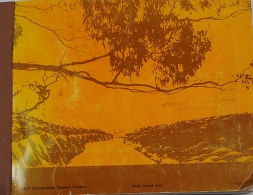
Eltham District Historical Society IncBook - Map, Land Conservation Council, Melbourne Study Area Report, [December 1973]
... Land Conservation Council...This report sets out to describe and assess the natural resources of the public lands in the Melbourne area and provides a factual basis on which members of the community may base submissions to the [Land Conservation] Council of Victoria. A collection of eight large fold out coloured maps published in a bound book form Melbourne Study Area Report Book Map Land Conservation Council ...The Melbourne Study Report is a series of volumes describing the physical nature of the land and its environment, examines the likely forms of land use, and assesses the hazards associated with these uses. This is Volume 2 (coloured maps). The first page featues a black and white map described as "Shire of Diamond Valley" with public land marked in yellow. Followed by eight large fold out maps. Melbourne Study Area Public land and descriptive blocks, Population description, Geology, Physiography, topography and rainfall, vegetation and water supply. The Land Conservation Act 1970 established the Land Conservation Council whose functions is to "carry out investigations and make recommendations to the Minister with respect to the use of public land in order to provide for the balanced use of land in Victoria. This report sets out to describe and assess the natural resources of the public lands in the Melbourne area and provides a factual basis on which members of the community may base submissions to the [Land Conservation] Council of Victoria.A collection of eight large fold out coloured maps published in a bound book formnon-fictionThe Melbourne Study Report is a series of volumes describing the physical nature of the land and its environment, examines the likely forms of land use, and assesses the hazards associated with these uses. This is Volume 2 (coloured maps). The first page featues a black and white map described as "Shire of Diamond Valley" with public land marked in yellow. Followed by eight large fold out maps. Melbourne Study Area Public land and descriptive blocks, Population description, Geology, Physiography, topography and rainfall, vegetation and water supply. The Land Conservation Act 1970 established the Land Conservation Council whose functions is to "carry out investigations and make recommendations to the Minister with respect to the use of public land in order to provide for the balanced use of land in Victoria. This report sets out to describe and assess the natural resources of the public lands in the Melbourne area and provides a factual basis on which members of the community may base submissions to the [Land Conservation] Council of Victoria. maps, shire of diamond valley, population, geology, topography, rainfall, vegetation, water supply, land use, public lands -
 Eltham District Historical Society Inc
Book, Land Conservation Council, Rivers and Streams: Special Investigation, September 1989
... Land Conservation Council...Soft bound, linen spine, 316 A4 pages, also two loose inserts for making submissions Rivers and Streams: Special Investigation Book Book Land Conservation Council ...In June 1987, the government directed the LCC to carry out a special investigation of the social, recreational, cultural and ecological values of rivers and streams in Victoria, and to make recommendations on the use of these rivers and how their identified values can best be protected. Notices announcing the commencement of the investigation were published in the Victoria Government Gazette and in Victorian newspapers in November 1987. A descriptive report was published in September 1989. The Council received 75 submissions following the publication of this report. After considering these submissions, the Council formulated its proposed recommendations, which were published in November 1990. The Council received 177 submissions commenting on the proposed recommendations. The Council published its final recommendations in June 1991. While welcomed by many, the study cut across the interests of other groups and was perceived to be particularly threatening to water authorities. The investigation resulted in a legislated system of 17 heritage rivers (with significant natural, recreational, scenic and heritage values) and natural catchment areas across Victoria. -
 Eltham District Historical Society Inc
Book, Land Conservation Council, Melbourne Area, District 2 Review: Final Recommendations, 1994
... Land Conservation Council...Also inserted loose in book brochure for invitation of submissions till 25 Nov 1991 and AO size colour map (folded) Proposed Recommendations Melbourne Area, District 2 Review: Final Recommendations Book Book Land Conservation Council ...Notices showing the boundary of the area of the review and advising that an investigation was to be carried out were published in the Victoria Government Gazette and in local and other Victorian newspapers in May 1987. A descriptive resources report was published in August 1991. Council received 1,425 submissions and letters following publication of the descriptive report. The Council considered these submissions and published proposed recommendations in April 1993. A further 1,993 submissions were received in response to the proposed recommendations. The Council published its final recommendations in July 1994. A change to legislation in 1989 enabled the LCC to make recommendations for public land within a ‘town’, though cities and rural cities remained excluded from the definition of public land. Timber resources and water quality and yield from timbered catchment areas remained significant issues in Melbourne’s catchments. Recommendations for the Yarra Ranges National Park were based around the closed Melbourne water catchments and adjoining state forest. A recommended Phillip Island State Park based around the penguin reserve was ultimately implemented as the Phillip Island Nature Park.Shire of Nillumbik DPE/Enviro