Showing 404 items matching " mapping"
-
 Bendigo Military Museum
Administrative record - Geodetic Survey and Topographical Mapping in Australia - Report by BP Lambert 1968, 1968
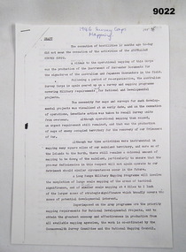
... Geodetic Survey and Topographical Mapping in Australia - Report by BP Lambert 1968...National coordination of their respective geodetic survey and topographic mapping activities is effected on the advice of a National Mapping Council. ...Geodetic Survey and Topographic Mapping a Report by BP Lambert Director of National Mapping, Department of National Development, Canberra, Australia, 1968....BP Lambert, Director of National Mapping, Canberra...National coordination of their respective geodetic survey and topographic mapping activities is effected on the advice of a National Mapping Council. ...Australia is governed by a Federal Government and by six State Governments. National coordination of their respective geodetic survey and topographic mapping activities is effected on the advice of a National Mapping Council. Twenty years ago, at least 95% of Australia was poorly mapped and what maps existed were in need of revision. only a small area of the continent was covered by horizontal geodetic control and there was no scheme for a national levelling survey. Over the intervening period there has been an urgent and increasing demand for topographic maps varying from large scale contoured maps in support of specific engineering projects to rapid reconnaissance maps required for mineral prospecting in remote areas. Superimposed on this has been a defence requirement, specifically for military training areas, and generally for maps of the whole country. During the period much progress has been made. This paper reports on the progress from early colonial days through to the present time and finally hazards a prediction of future trends.Photocopy of 18-page typed report including diagrams, stapled top left-hand corner. Geodetic Survey and Topographic Mapping a Report by BP Lambert Director of National Mapping, Department of National Development, Canberra, Australia, 1968.royal australian survey corps, rasvy, fortuna, army survey regiment, army svy regt, asr, national mapping -
 Bendigo Military Museum
Administrative record - Report on Photogrammetry in Australia 1960 - Division of National Mapping, Division of National Mapping, Department of National Development, September 1960
... Report on Photogrammetry in Australia 1960 - Division of National Mapping...Chapters deal with Mapping activities by various Australian Organisations including the Royal Australian Survey Corps. ...Division of National Mapping, Department of National Development...Report on Photogrammetry in Australia 1960 - Division of National Mapping Administrative record Report on Photogrammetry in Australia 1960 - Division of National Mapping Division of National Mapping, Department of National Development ...This National Report on Photogrammetry in Australia was prepared and submitted to the Ninth International Congress of Photogrammetry held in London during September 1960. Chapters deal with Mapping activities by various Australian Organisations including the Royal Australian Survey Corps. This comprehensive report details the status of mapping and aerial photography in Australia in 1960 including 14 Annexes. An A4 sized buff coloured card covered paper report of 68 pages and stapled. There is a property Card inside the front cover titled "Historical Property Record". Stamped "SCHOOL OF MILITARY SURVEY" on the front cover and first page. Sticker has hand written "526 982 DIV"royal australian survey corps, rasvy, fortuna, army survey regiment, army svy regt, asr, division of national mapping -
 Bendigo Military Museum
Administrative record - Division of National Mapping - Specification for Vertical Aerial Photography, Division of National Mapping, 1963
... Division of National Mapping - Specification for Vertical Aerial Photography...Commonwealth of Australia, Department of Defence of National Development, Division of National Mapping Specification. This is a Specification for Aerial Photography acquisition and is written for civilian contract work....Division of National Mapping...Royal Australian Survey Corps RASvy Fortuna Army Survey Regiment Army Svy Regt ASR 8 x A4 poor photocopies of typed pages Division of National Mapping - Specification for Vertical Aerial Photography Administrative record Division of National Mapping - Specification for Vertical Aerial Photography Division of National Mapping ...Commonwealth of Australia, Department of Defence of National Development, Division of National Mapping Specification. This is a Specification for Aerial Photography acquisition and is written for civilian contract work.8 x A4 poor photocopies of typed pagesroyal australian survey corps, rasvy, fortuna, army survey regiment, army svy regt, asr -
 Bendigo Military Museum
Manual - Defense Mapping Agency (US) - Digitizing the Future Third Edition, c1990
... Defense Mapping Agency (US) - Digitizing the Future Third Edition...Digitizing the Future Third Edition, An information booklet describing the types of new digital geographic products produced by the US Defense Mapping Agency. The Australian Army Survey Regiment went on to also produce many of these digital products...US Defense Mapping Agency...Bendigo Military Museum 37 - 39 Pall Mall Bendigo goldfields Digitizing the Future Third Edition, An information booklet describing the types of new digital geographic products produced by the US Defense Mapping Agency. The Australian Army Survey Regiment went on to also produce many of these digital products Royal Australian Survey Corps RASvy Fortuna Army Survey Regiment Army Svy Regt ASR Front Cover, "DO NOT REMOVE FROM CARTO SQN" Soft Cover Book, Paper Pages, 3 parts with Numerous Sections in each Part, Text, Diagrams and Photographs, Data Information Sheets, DMA Stock No: DDIPDIGITALPAC Defense Mapping Agency (US) - Digitizing the Future Third Edition Manual Defense Mapping Agency (US) - Digitizing the Future Third Edition US Defense Mapping Agency ...Digitizing the Future Third Edition, An information booklet describing the types of new digital geographic products produced by the US Defense Mapping Agency. The Australian Army Survey Regiment went on to also produce many of these digital productsSoft Cover Book, Paper Pages, 3 parts with Numerous Sections in each Part, Text, Diagrams and Photographs, Data Information Sheets, DMA Stock No: DDIPDIGITALPACFront Cover, "DO NOT REMOVE FROM CARTO SQN"royal australian survey corps, rasvy, fortuna, army survey regiment, army svy regt, asr -
 Clunes Museum
Document, VICTORIAN GOVERNMENT DEPT. OF PLANNING, THE RURAL LAND MAPPING PROJECT 1981 - DRAFT, JULY 1981
... THE RURAL LAND MAPPING PROJECT 1981 - DRAFT...SOFT COVER, TAN COLOURED DRAFT OF THE RURAL MAPPING PROJECT 1981 - SHIRE OF TALBOT AND CLUNES....THE RURAL LAND MAPPING PROJECT 1981 SHIRE OF TALBOT AND CLUNES DEPARTMENT OF PLANNING...THE RURAL LAND MAPPING PROJECT 1981 - DRAFT Document DOCUMENT VICTORIAN GOVERNMENT DEPT. ...A REPORT TO THE SHIRE OF TALBOT AND CLUES TO ACCOMPANY AND EXPLAIN THE SET OF PHYSICAL CONSTRAINTS MAPS PRODUCED FOR THE SHIRE AS PART OF THE RURAL LAND MAPPING PROJECT...SOFT COVER, TAN COLOURED DRAFT OF THE RURAL MAPPING PROJECT 1981 - SHIRE OF TALBOT AND CLUNES.non-fictionA REPORT TO THE SHIRE OF TALBOT AND CLUES TO ACCOMPANY AND EXPLAIN THE SET OF PHYSICAL CONSTRAINTS MAPS PRODUCED FOR THE SHIRE AS PART OF THE RURAL LAND MAPPING PROJECT...local history, government, state government, essential services -
 Bendigo Military Museum
Article - Survey Corps Mapping - 1946, 23.08.1946
... Survey Corps Mapping - 1946...Following cessation of hostilities following WWII the Survey Corps was actively redeployed to commence mapping of Mainland Australia to ensure that Australia's limited mapping coverage situation was not repeated should any similar conflict occur. ..."1946 Survey Corps Mapping" ...Survey Corps Mapping - 1946 Article Survey Corps Mapping - 1946 ...Following cessation of hostilities following WWII the Survey Corps was actively redeployed to commence mapping of Mainland Australia to ensure that Australia's limited mapping coverage situation was not repeated should any similar conflict occur. There was still an urgent requirement to map enemy occupied territory for the recovery of our prisoners of war. This paper discusses that 1946 mapping program and is complimented by a Herald Sun Newspaper Article of the time titled "Big Areas to be Mapped from the Air.".Six x A4 photocopied pages of typed text that is a transcription of A Herald Sun article published in 1946. pages are stapled top left-hand corner."1946 Survey Corps Mapping" royal australian survey corps, rasvy, fortuna, army survey regiment, army svy regt, asr -
 Bendigo Military Museum
Administrative record - Advisory Committee on Commonwealth Mapping Meeting Notes - (National Mapping Council Meetings), Circa 1972
... Advisory Committee on Commonwealth Mapping Meeting Notes - (National Mapping Council Meetings)...Submission 8 National Mapping Survey and Mapping Co-ordination. .4 Air photography and Mapping Programme 1956/57. ...Advisory Committee on Commonwealth Mapping (ACOCM) Meeting Notes. 15 Items of typed pages and diagrams. .1 Letter 22 July 1954 .2 Letter 17 Feb 1955 .3 Letter 22 July 1955 .4 letter 26 Jan 1956 .5 Letter Hon WS Kent Hughes Minister for the Interior ACT .6 National Mapping Programme 1956/57 .7 Clarifies Army participation in Cabinet Decision No2 (VP) .8 History of National Mapping 24 Apr 1958 .9 Report on Army Committee on National Mapping 2 July 1958 .10 RASvy Brief Review of Activities Jan - Dec 1964 .11 Advisory Committee Meeting Notes 12 Feb 1965 - Agenda item 8 .12 Advisory Committee Meeting Notes 12 Feb 1965 - Agenda item 8 para 5.1.3 - 11.2 .13 ACOCM Meeting Agenda 1968 .14 ACOCM Meeting Minutes 1970 .15 Letter to Mr B White CBE Secretary from LF Bott...Submission 8 National Mapping Survey and Mapping Co-ordination. .4 Air photography and Mapping Programme 1956/57. ...Advisory Committee on Commonwealth Mapping (ACOCM) Meeting Notes. 15 Items of typed pages and diagrams. .1 Letter to the Hon WS Kent Hughes MVO, OBE, Mc, ED, MP, Minister for the Interior, ACT Signed Jos Francis. Cabinet Decision taken on 22 July 1954, effects on current military mapping agreements between AUS, UK and USA. Australian responsibility "Noted was the fact that RASvy was in preparation for War." .2 Letter by H Wells Lieutenant General, Chief of the General Staff, 17 Feb 1955. Refers to the invitation of Major General RL Brown UK Defence to visit Australia to help align the mapping programme. .3 Draft Cabinet Submission on National Mapping Survey and Mapping Co-ordination of the 22 July 1955. Attachment 1 Cabinet Minute, Vice-President's letter Canberra22 July 1954. Decision No2 (VP). Submission 8 National Mapping Survey and Mapping Co-ordination. .4 Air photography and Mapping Programme 1956/57. Signed by LF Fitzgerald OBE Director of Military Survey 26 Jan 56. .5 Letter Hon WS Kent Hughes MVO, OBE, MC, ED, MP. Minister for the Interior ACT. Confirming the Cabinet Decision No2 (VP) Signed by Joe Francis .6 National Mapping Programme 1956/57. States a view to Army's contribution to this programme .7 Clarifies Army participation in Cabinet Decision No2 (VP) .8 History of National Mapping Asst Secretary (General) 24 Apr 1958 .9 Report on Army Committee on National Mapping. 2 July 1958 .10 RASvy Brief Review of Activities Jan - Dec 1964 .11 Advisory Committee on Commonwealth Mapping Meeting Notes 12 Feb 1965 - Agenda item 8. This endorsed the principle of grouping Commonwealth Mapping Agencies in a Survey Mapping Group in Canberra which included AHQ Survey Regiment. This did not come to fruition. .12 Advisory Committee on Commonwealth Mapping Meeting Notes 12 Feb 1965 - Agenda item 8 para 5.1.3 - 11.2 .13 ACOCM Meeting Agenda 1968 .14 ACOCM Meeting Minutes 1970 .15 Letter to Mr B White CBE Secretary from LF BottAdvisory Committee on Commonwealth Mapping (ACOCM) Meeting Notes. 15 Items of typed pages and diagrams. .1 Letter 22 July 1954 .2 Letter 17 Feb 1955 .3 Letter 22 July 1955 .4 letter 26 Jan 1956 .5 Letter Hon WS Kent Hughes Minister for the Interior ACT .6 National Mapping Programme 1956/57 .7 Clarifies Army participation in Cabinet Decision No2 (VP) .8 History of National Mapping 24 Apr 1958 .9 Report on Army Committee on National Mapping 2 July 1958 .10 RASvy Brief Review of Activities Jan - Dec 1964 .11 Advisory Committee Meeting Notes 12 Feb 1965 - Agenda item 8 .12 Advisory Committee Meeting Notes 12 Feb 1965 - Agenda item 8 para 5.1.3 - 11.2 .13 ACOCM Meeting Agenda 1968 .14 ACOCM Meeting Minutes 1970 .15 Letter to Mr B White CBE Secretary from LF Bottroyal australian survey corps, rasvy, fortuna, army survey regiment, army svy regt, asr, national mapping -
 Federation University Historical Collection
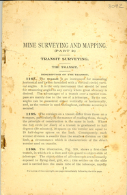
Book - Booklet, Mine Surveying and Mapping part 2
... Mine Surveying and Mapping part 2......mapping...It included a number of diagrams related to surveying and mapping....It included a number of diagrams related to surveying and mapping. Mine Surveying and Mapping part 2 Book Booklet ...This booklet was most probably used by Ballarat School of Mines students. 78 page stapled book with no cover. It included a number of diagrams related to surveying and mapping.ballarat school of mines, survey, surveying, mining, mapping -
 Bendigo Military Museum
Letter - Mapping correspondence about Papua New Guinea 1970-77, Dept of Natural Resources, Army Survey Regiment, Director of Survey - Army, 1 May 1970 - 8 Aug 1977
... Mapping correspondence about Papua New Guinea 1970-77...20 x Letters, Signals and Documents pertaining to Papua New Guinea (PNG) Mapping during the period 1970-77. These documents were important authoritative documents affecting the production of PNG mapping being produced at the Army Survey Regiment at that time....Foolscap size folder containing 20 x letters/signals pertaining to Papua New Guinea mapping. Several documents both have been numbered #15....Bendigo Military Museum 37 - 39 Pall Mall Bendigo goldfields 20 x Letters, Signals and Documents pertaining to Papua New Guinea (PNG) Mapping during the period 1970-77. These documents were important authoritative documents affecting the production of PNG mapping being produced at the Army Survey Regiment at that time. ...20 x Letters, Signals and Documents pertaining to Papua New Guinea (PNG) Mapping during the period 1970-77. These documents were important authoritative documents affecting the production of PNG mapping being produced at the Army Survey Regiment at that time.Foolscap size folder containing 20 x letters/signals pertaining to Papua New Guinea mapping. Several documents both have been numbered #15.Each letter/Signal is numbered 1-20. Document 1- has "recieved" stamp, Document 2- has a note and signature MM Knight WO2, Document 3 - has 788-2-18 ad "Recieved" , Document 5 - has "Sergeant RN Sargeant" annotated, Document -11 has two file numbers and "received" stamp, Document -12 (telephone record) has recipients stamp, date and initials and file ' R750-5-1, Document -13 "received" stamp and initials, Document -15 has "received" stamp and a note "apply after TALASEA", Document -16 includes a diagram, Document -17 "Distribution List" hand written, Document -18 "received" stamp, Document 19 has note and initials, Document -20 "recipients" stamp, note and initials and "Army Survey Regiment" document stamp. royal australian survey corps, rasvy, fortuna, army survey regiment, army svy regt, asr -
 Marysville & District Historical Society
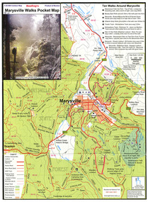
Map (Item) - Pocket map, Rooftop Mapping Services, Rooftop's Marysville Walks Pocket Map, 01-2009
... This map was published by Rooftop Mapping Services in January 2009....This map was published by Rooftop Mapping Services in January 2009....Rooftop Mapping Services...This map was published by Rooftop Mapping Services in January 2009. Rooftop's Marysville Walks Pocket Map Map Pocket map Rooftop Mapping Services ...A pocket map of ten walking tracks in an around Marysville. This map was published by Rooftop Mapping Services in January 2009.A pocket map of ten walking tracks in an around Marysville.marysville, victoria, australia, rooftop mapping services, steavenson falls, steavenson falls car park walk, beauty spot walk, marysville to el kanah guest house walk, gilberts gully walk, michaeldene track, man 'o' war walk, tree fern gully walk, marysville to woods lookout to mount gordon walk, keppels lookout walk -
 Bendigo Military Museum
Administrative record - Royal Australian Survey Corps - Mapping methods 1938, Australian Survey Corps, 1938
... Royal Australian Survey Corps - Mapping methods 1938...The paper describes in detail the mapping methods currently used by the Australian Survey Corps in about 1938. ...Title handwritten on first page "Mapping Methods - Pre WWII Topographers" and on page 11 "Laplace Azimuth" is added near a full description of the subject....The paper describes in detail the mapping methods currently used by the Australian Survey Corps in about 1938. ...This is the record of a presentation by Major TA Vance who was Officer Commanding the Australian Survey Corps 1936 to 1940 to the Victorian Institute of Surveyors. The paper describes in detail the mapping methods currently used by the Australian Survey Corps in about 1938. Topics describes include: 1. Geodetic or 1st Order triangulation. 2. Second and third order triangulation. 3. Traversing, levelling and fixing horizontal and vertical control for aerial photographs. 4. Plotting and contouring from aerial photographs. 5. Draughting. and 6. Reproduction. 17 x A4 photocopied pages of typed textTitle handwritten on first page "Mapping Methods - Pre WWII Topographers" and on page 11 "Laplace Azimuth" is added near a full description of the subject.royal australian survey corps, rasvy, fortuna, army survey regiment, army svy regt, asr -
 Orbost & District Historical Society
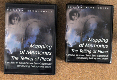
discs and tapes, Mapping of Memories The Telling of Place, 1991-1993
... Mapping of Memories The Telling of Place...These stories are from the Orbost district, Snowy River flats, Conran, Bete Bolong, Marlo, Bonang, Goongerah, Combienbar, Club Terrace,Cann Valley, Cabanandra, Bendoc, Deddickand McKillop's Bridge' Mapping of Memories was first broadcast as four programs on A.B.C. ...Two copies of a D.V.D. titled, "Mapping of Memories The Telling of Place". ...It is a useful reference tool. memories-Orbost-district Mapping-of-Memories Two copies of a D.V.D. titled, "Mapping of Memories The Telling of Place". ...These stories are from the Orbost district, Snowy River flats, Conran, Bete Bolong, Marlo, Bonang, Goongerah, Combienbar, Club Terrace,Cann Valley, Cabanandra, Bendoc, Deddickand McKillop's Bridge' Mapping of Memories was first broadcast as four programs on A.B.C. Radio National in 1993.This item is a record of the lives and history associated with East Gippsland. It is a useful reference tool.Two copies of a D.V.D. titled, "Mapping of Memories The Telling of Place". There are also two tapes - 4 sides. The D.V.D.'s are in black plastic cases with 2 discs in each. The front cover has a colored photo of a child next to a giant pumpkin.memories-orbost-district mapping-of-memories -
 Mission to Seafarers Victoria
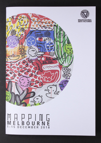
Programme, Multicutural Arts Victoria, Mapping Melbourne 2018, 2018
... Mapping Melbourne 2018 ...The Seafarers Welcome is presented as part of Mapping Melbourne 2018."...top right corner: Multicultural Arts Victoria lower left corner: MAPPING MELBOURNE/1-15 DECEMBER 2018...The Seafarers Welcome is presented as part of Mapping Melbourne 2018." The Mission has always welcomed artistic events arts events multicultural arts victoria the seafarer welcome echoes project 2018 cultural events community top right corner: Multicultural Arts Victoria lower left corner: MAPPING MELBOURNE/1-15 DECEMBER 2018 Colour programme of events with illustrations Mapping Melbourne 2018 Programme Programme Multicutural Arts Victoria ...On 6 December 2018, a recurring event was organised at the Mission. From the Multicultural website: "Meeting at the Seafarer’s bridge on the Yarra, you will be welcomed into a little-known site nearby, a sanctuary for seafarers for the last 100 years and a symbol of old-world generosity amidst the rapidly shifting landscape of the Docklands. A journey through the quirky spaces at Mission to Seafarer’s site through a compelling contemporary ritual performance. The Echoes Projects artists evoke fragments of stories embedded in this site through mesmerising live soundscapes, movement and imagery. Ria Soemardjo, Janette Hoe and Pongjit (Jon) Saphakhun collaborate to create an ongoing exploration of contemporary rituals in response to urban sites in Australia. Based in Melbourne, their contemporary performance work draws deeply from their personal connections to Thai, Chinese and Indonesian ceremonial traditions. Featuring Intricate rhythmic compositions inspired by the rich heritage of Indonesian and Middle Eastern musical traditions, performed by Ron Reeves and Matt Stonehouse – two of Australia’s foremost world music percussionists. Note: 7 PM and 8 PM sessions include delicious vegetarian Indonesian food. 9 PM session includes Indonesian and Thai cakes and sweets. You are invited to stay and eat after the performance, drinks available for purchase at the venue. Performers: Janette Hoe – dance artist Pongjit (Jon) Sekhukhune – actor Ria Soemardjo – musician Ron Reeves – musician Matt Stonehouse – musician /instrument maker Supported by the City of Melbourne Arts Grants Program Details: 6 Dec 2018 (Thursday) Sessions: 7 PM, 8 PM & 9 PM The Mission to Seafarers Audience Meeting point – next to the entrance of the Seafarer’s Bridge, Siddeley St, Docklands. Wheelchair accessible venue. Bookings essential. Tickets: $10 – $15 via Eventbrite. Ticket price is purely to pay for the food element. Companion Card ticketing available. Please contact Multicultural Arts Victoria for ticketing options. Companion ticket will allow admission only. The Seafarers Welcome is presented as part of Mapping Melbourne 2018."The Mission has always welcomed artistic events Colour programme of events with illustrationstop right corner: Multicultural Arts Victoria lower left corner: MAPPING MELBOURNE/1-15 DECEMBER 2018arts, events, multicultural arts victoria, the seafarer welcome, echoes project, 2018, cultural events, community -
Whitehorse Historical Society Inc.
Document, Division of Survey and Mapping, 1984
... Division of Survey and Mapping...Information guide to Parish and Township Plans - Division of Survey and Mapping - Victorian Government.....Division of Survey and Mapping Document Document ...Information guide to Parish and Township Plans - Division of Survey and Mapping - Victorian Government..Information guide to Parish and Township Plans - Division of Survey and Mapping - Victorian Government..Information guide to Parish and Township Plans - Division of Survey and Mapping - Victorian Government..crown lands, victorian government, land surveys -
 Bendigo Military Museum
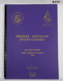
Administrative record - RASvy - Defense Mapping Agency Exchange Officer Mid Tour Report MAJ J Charland 1983, MAJ JJ Charland US Army Corps of Engineers, 15.08.83
... RASvy - Defense Mapping Agency Exchange Officer Mid Tour Report MAJ J Charland 1983...A4 document, Purple Cover, Gold Badge Image US Defense Mapping Agency and RASvy, 13 Pages...This is the Mid Term Tour Report produced by John J Charland, Major, Corps of Engineers, US Army Exchange Officer, Australia in 1983 Royal Australian Survey Corps RASvy Fortuna Army Survey Regiment Army Svy Regt ASR Compiled by John J Charland, Major, Corps of Engineers, United States Army A4 document, Purple Cover, Gold Badge Image US Defense Mapping Agency and RASvy, 13 Pages RASvy - Defense Mapping Agency Exchange Officer Mid Tour Report MAJ J Charland 1983 Administrative record RASvy - Defense Mapping Agency Exchange Officer Mid Tour Report MAJ J Charland 1983 MAJ JJ Charland US Army Corps of Engineers ...A 2 x year personnel exchange program existed between RASvy and the US Army Corps of Engineers. This is the Mid Term Tour Report produced by John J Charland, Major, Corps of Engineers, US Army Exchange Officer, Australia in 1983A4 document, Purple Cover, Gold Badge Image US Defense Mapping Agency and RASvy, 13 PagesCompiled by John J Charland, Major, Corps of Engineers, United States Armyroyal australian survey corps, rasvy, fortuna, army survey regiment, army svy regt, asr -
 Bendigo Military Museum
Journal - Cartographic Mapping Precis - WO2 R C Andrews Mapping Precis Folder, Circa 1960
... Cartographic Mapping Precis - WO2 R C Andrews Mapping Precis Folder...This is a compilation of Precis about cartographic mapping procedures to produce a map, compiled by WOII RC Andrews, Technical Warrant Officer Cartographic Squadron, retired 1975....ANDREWS PRECIS FOLDER" Book with 2 x "chicago" screws, cardboard cover- brown, green cloth tape along binding edge Cartographic Mapping Precis - WO2 R C Andrews Mapping Precis Folder Journal Cartographic Mapping Precis - WO2 R C Andrews Mapping Precis Folder ...This is a compilation of Precis about cartographic mapping procedures to produce a map, compiled by WOII RC Andrews, Technical Warrant Officer Cartographic Squadron, retired 1975.Book with 2 x "chicago" screws, cardboard cover- brown, green cloth tape along binding edge"WO II R. C. ANDREWS PRECIS FOLDER"royal australian survey corps, rasvy, fortuna, army survey regiment, army svy regt, asr -
 Bendigo Military Museum
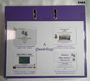
Document - Quadrilology on aspects of Royal Australian Survey Corps mapping by Dr Bob Williams, Dr Bob Williams, 2024
... Quadrilology on aspects of Royal Australian Survey Corps mapping by Dr Bob Williams...A Political Imperative - An amazing surveying and mapping operation. Impossible to Map! Papua New Guinea. ...Supplementing Article Embracing Change - Digital Mapping 1975-1985. Article 3. A Political Imperative - An amazing surveying and mapping operation. ...Supplementing Article Embracing Change - Digital Mapping 1975-1985. Article 3. A Political Imperative - An amazing surveying and mapping operation. ...A4 purple two ring folder that contains four illustrated articles about the Royal Australian Survey Corps written by Dr Bob Williams. Article 1. A brief history from a memorable event in 1915 - Gallipoli. A tribute to Australia's Military Mapmakers Videre Parare Est, 1910-2000. Article 2. Fortuna's role in the story, Reflections of a military mapmaker. Military Mapmakers of "Fortuna" The house of the Army Survey Regiment - Royal Australian Survey Corps. Article 3. A Political Imperative - An amazing surveying and mapping operation. Impossible to Map! Papua New Guinea. Article 4. Military Mapmakers. The farther backward you can look; the farther forward you can see. Dr Bob Williams served in the Royal Australian Survey Corps from 1965 as a Sapper in the Royal Australian Survey Corps and retired from the Army in 1991 as a Major to join DSTO continuing his career in the spatial sciences. A4 purple two ring folder that contains four illustrated articles about the Royal Australian Survey Corps written by Dr Bob Williams. Article 1. A brief history from a memorable event in 1915 - Gallipoli. A tribute to Australia's Military Mapmakers Videre Parare Est, 1910-2000. Article 2. Fortuna's role in the story, Reflections of a military mapmaker. Military Mapmakers of "Fortuna" The house of the Army Survey Regiment - Royal Australian Survey Corps. Supplementing Article Embracing Change - Digital Mapping 1975-1985. Article 3. A Political Imperative - An amazing surveying and mapping operation. Impossible to Map! Papua New Guinea. Article 4. Military Mapmakers. The farther backward you can look; the farther forward you can see.royal australian survey corps, rasvy, fortuna, army survey regiment, army svy regt, asr -
 Bendigo Military Museum
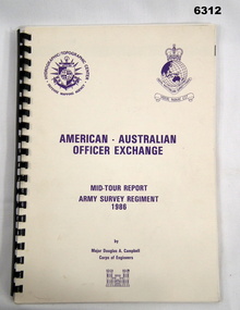
Administrative record - RASvy - Defense Mapping Agency Exchange Officer Mid Tour Report MAJ D A Campbell 1986, Major Douglas A Campbell US Army Corps of Engineers, 1986
... RASvy - Defense Mapping Agency Exchange Officer Mid Tour Report MAJ D A Campbell 1986...A4 Booklet, cream coloured card cover, Defense Mapping Agency and Royal Australian Survey Corps badges in purple on front cover, plastic binder...This is the Mid Term Tour Report produced by Douglas A Campbell, Major, Corps of Engineers, US Army Exchange Officer, Australia in 1986 Royal Australian Survey Corps RASvy Fortuna Army Survey Regiment Army Svy Regt ASR A4 Booklet, cream coloured card cover, Defense Mapping Agency and Royal Australian Survey Corps badges in purple on front cover, plastic binder RASvy - Defense Mapping Agency Exchange Officer Mid Tour Report MAJ D A Campbell 1986 Administrative record RASvy - Defense Mapping Agency Exchange Officer Mid Tour Report MAJ D A Campbell 1986 Major Douglas A Campbell US Army Corps of Engineers ...A 2 x year personnel exchange program existed between RASvy and the US Army Corps of Engineers. This is the Mid Term Tour Report produced by Douglas A Campbell, Major, Corps of Engineers, US Army Exchange Officer, Australia in 1986A4 Booklet, cream coloured card cover, Defense Mapping Agency and Royal Australian Survey Corps badges in purple on front cover, plastic binderroyal australian survey corps, rasvy, fortuna, army survey regiment, army svy regt, asr -
 Bendigo Military Museum
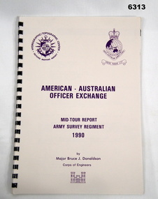
Administrative record - RASvy - Defense Mapping Agency Exchange Officer Mid Tour Report MAJ Bruce J Donaldson 1990, Major Bruce J Donaldson US Army Corps of Engineers, 1990
... RASvy - Defense Mapping Agency Exchange Officer Mid Tour Report MAJ Bruce J Donaldson 1990...A4 booklet, cream colored light cardboard cover, Defense Mapping Agency and Royal Australian Survey Corps Badges in purple on front cover, Plastic ring binding...Donaldson, Major, Corps of Engineers, US Army Exchange Officer, Australia in 1990 Royal Australian Survey Corps RASvy Fortuna Army Survey Regiment Army Svy Regt ASR A4 booklet, cream colored light cardboard cover, Defense Mapping Agency and Royal Australian Survey Corps Badges in purple on front cover, Plastic ring binding RASvy - Defense Mapping Agency Exchange Officer Mid Tour Report MAJ Bruce J Donaldson 1990 Administrative record RASvy - Defense Mapping Agency Exchange Officer Mid Tour Report MAJ Bruce J Donaldson 1990 Major Bruce J Donaldson US Army Corps of Engineers ...A 2 x year personnel exchange program existed between RASvy and the US Army Corps of Engineers. This is the Mid Term Tour Report produced by Bruce J. Donaldson, Major, Corps of Engineers, US Army Exchange Officer, Australia in 1990A4 booklet, cream colored light cardboard cover, Defense Mapping Agency and Royal Australian Survey Corps Badges in purple on front cover, Plastic ring bindingroyal australian survey corps, rasvy, fortuna, army survey regiment, army svy regt, asr -
 Bendigo Military Museum
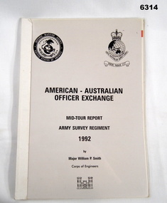
Administrative record - RASvy - Defense Mapping Agency Exchange Officer Mid Tour Report MAJ William P Smith 1992, Major William P Smith US Army Corps of Engineers, 1992
... RASvy - Defense Mapping Agency Exchange Officer Mid Tour Report MAJ William P Smith 1992...A4 Booklet, plastic cover over light cardboard, paper report. Defense Mapping Agency and Royal Australian Survey Corps badges on cover, plastic bound edge...This is the Mid Term Tour Report produced by William P Smith, Major, Corps of Engineers, US Army Exchange Officer, Australia in 1992 Royal Australian Survey Corps RASvy Fortuna Army Survey Regiment Army Svy Regt ASR A4 Booklet, plastic cover over light cardboard, paper report. Defense Mapping Agency and Royal Australian Survey Corps badges on cover, plastic bound edge RASvy - Defense Mapping Agency Exchange Officer Mid Tour Report MAJ William P Smith 1992 Administrative record RASvy - Defense Mapping Agency Exchange Officer Mid Tour Report MAJ William P Smith 1992 Major William P Smith US Army Corps of Engineers ...A 2 x year personnel exchange program existed between RASvy and the US Army Corps of Engineers. This is the Mid Term Tour Report produced by William P Smith, Major, Corps of Engineers, US Army Exchange Officer, Australia in 1992A4 Booklet, plastic cover over light cardboard, paper report. Defense Mapping Agency and Royal Australian Survey Corps badges on cover, plastic bound edgeroyal australian survey corps, rasvy, fortuna, army survey regiment, army svy regt, asr -
 Bendigo Military Museum
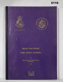
Administrative record - RASvy - Defense Mapping Agency Exchange Officer End of Tour Report MAJ D Bowen 1982, MAJ DH Bowen US Army Corps of Engineers, 3. 5. 1982
... RASvy - Defense Mapping Agency Exchange Officer End of Tour Report MAJ D Bowen 1982...A4 Document, Plastic cover, Purple and gold, RASvy Badge emblem and Defense Mapping Agency Badge emblems in gold, 17 pages, 13 enclosures, black and white print, colour photos and maps...This is the End of Tour Report produced by David H Bowen, Major, Corps of Engineers, US Army Exchange Officer, Australia in 1982 Royal Australian Survey Corps RASvy Fortuna Army Survey Regiment Army Svy Regt ASR Report compiled by David H Bowen, Major, Corps of Engineers, US Army Exchange Officer, Australia A4 Document, Plastic cover, Purple and gold, RASvy Badge emblem and Defense Mapping Agency Badge emblems in gold, 17 pages, 13 enclosures, black and white print, colour photos and maps RASvy - Defense Mapping Agency Exchange Officer End of Tour Report MAJ D Bowen 1982 Administrative record RASvy - Defense Mapping Agency Exchange Officer End of Tour Report MAJ D Bowen 1982 MAJ DH Bowen US Army Corps of Engineers ...A 2 x year personnel exchange program existed between RASvy and the US Army Corps of Engineers. This is the End of Tour Report produced by David H Bowen, Major, Corps of Engineers, US Army Exchange Officer, Australia in 1982A4 Document, Plastic cover, Purple and gold, RASvy Badge emblem and Defense Mapping Agency Badge emblems in gold, 17 pages, 13 enclosures, black and white print, colour photos and mapsReport compiled by David H Bowen, Major, Corps of Engineers, US Army Exchange Officer, Australiaroyal australian survey corps, rasvy, fortuna, army survey regiment, army svy regt, asr -
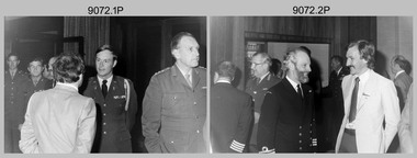
 Bendigo Military Museum
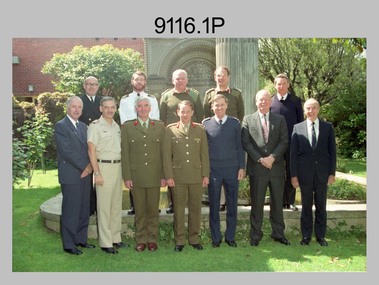
Photograph - Five Nation Mapping, Charting & Geodesy Conference - Army Survey Regiment, Fortuna, Bendigo, Five Nation Mapping, Charting & Geodesy Conference - Army Survey Regiment, Fortuna, Bendigo, c1990
... Five Nation Mapping, Charting & Geodesy Conference - Army Survey Regiment, Fortuna, Bendigo....This collection of four photographs was taken at the Five Nation Mapping, Charting & Geodesy (MC&G) Conference, held at the Army Survey Regiment, Fortuna, Bendigo in 1991. ...This set of four photographs was taken during the Five Nation Mapping, Charting & Geodesy (MC&G) Conference, held at the Army Survey Regiment, Fortuna, Bendigo in October 1990. ...Bendigo Military Museum 37 - 39 Pall Mall Bendigo goldfields This collection of four photographs was taken at the Five Nation Mapping, Charting & Geodesy (MC&G) Conference, held at the Army Survey Regiment, Fortuna, Bendigo in 1991. ...This collection of four photographs was taken at the Five Nation Mapping, Charting & Geodesy (MC&G) Conference, held at the Army Survey Regiment, Fortuna, Bendigo in 1991. Directors (or their representatives) from Australia, Canada, New Zealand, United Kingdom and the United States of America military mapping agencies attended Five Nations MC&G Conference. The Director of Australia’s Joint Intelligence Organisation - MAJ GEN John Baker AC DSM FTSE attended the conference. Photos .1P to .3P were taken in the front of Fortuna’s Pompeii Fountain and photo .4P was taken probably at the same time in Lithographic Squadron’s main print room. More information on this conference is provided in page 145 of Valerie Lovejoy’s book 'Mapmakers of Fortuna – A history of the Army Survey Regiment’ ISBN: 0-646-42120-4. Note – Photo .1P was also published on page 144 of the book. It was incorrectly dated 1988.This set of four photographs was taken during the Five Nation Mapping, Charting & Geodesy (MC&G) Conference, held at the Army Survey Regiment, Fortuna, Bendigo in October 1990. The photographs are on 35mm negative film and scanned at 1200 dpi. They are part of the Army Survey Regiment’s Collection. .1)- Photo, colour, 1991, back row L to R: unidentified (x2), D-SVY COL Don Swiney MBE, unidentified (x2), front row L to R: unidentified (x3), MAJ GEN John Baker AC DSM FTSE, unidentified (x3). .2) - Photo, colour, 1991, back row L to R: unidentified (x2), D-SVY COL Don Swiney MBE, unidentified (x2), front row L to R: all unidentified. .3} - Photo, colour, 1991, back row L to R: unidentified (x2), D-SVY COL Don Swiney MBE, unidentified (x3), front row L to R: all unidentified. .4} - Photo, colour, 1991, L to R: LTCOL Simon Lemon, CO LTCOL Rene van den Tol, MAJ GEN John Baker AC DSM FTSE, MAJ Bob Coote. No personnel or civilians are identified. ‘5 Nations Conference ‘91’ is annotated on plastic negative sleeve. Note – the 1991 date is most likely incorrect as there is conflicting dates. Refer to Historical information.royal australian survey corps, rasvy, army survey regiment, army svy regt, fortuna -
 Wonga Park Community Cottage History Group
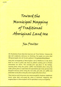
Booklet - 10-page booklet by Jim Poulter, “Toward the Municipal Mapping of Traditional Land Use”
... “Toward the Municipal Mapping of Traditional Land Use”...10-page booklet by Jim Poulter “Toward the Municipal Mapping of Traditional Land Use”...Wonga Park Community Cottage History Group Unit 1, 9 – 13 Old Yarra Road Wonga Park melbourne 10-page booklet by Jim Poulter “Toward the Municipal Mapping of Traditional Land Use” “Toward the Municipal Mapping of Traditional Land Use” Booklet 10-page booklet by Jim Poulter ...10-page booklet by Jim Poulter “Toward the Municipal Mapping of Traditional Land Use” -
 Kew Historical Society Inc
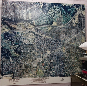
Photograph - Aerial Photograph, Division of Survey and Mapping, Department of Property and Services, City of Kew, Scale 1 : 3,000, 1989, 1989
... Photomosaic compiled by Division of Survey and Mapping, Department of Property and Services. © Crown (State of Victoria) Copyright 1990....Division of Survey and Mapping, Department of Property and Services...Photomosaic compiled by Division of Survey and Mapping, Department of Property and Services. © Crown (State of Victoria) Copyright 1990. ...The City of Kew was a local government area about 4 kilometres east of Melbourne, the state capital of Victoria, Australia, on the southeast bank of the Yarra River. The city covered an area of 14.56 square kilometres, and existed from 1860 until 1994.Very large aerial photograph of “City of Kew” Scale 1 : 3,000. 1989. “City of Kew” Scale 1 : 3,000. 1989. Photomosaic compiled by Division of Survey and Mapping, Department of Property and Services. © Crown (State of Victoria) Copyright 1990.city of kew, kew (vic.), aerial photography -
 Bendigo Military Museum
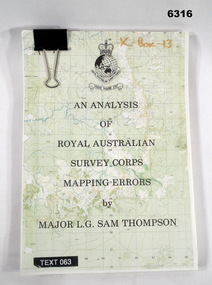
Administrative record - An analysis of Royal Australian Survey Corps mapping errors by Major LG Sam Thompson, Major LG Sam Thompson US Army Corps of Engineers at Army Survey Regiment, circa 1978
... An analysis of Royal Australian Survey Corps mapping errors by Major LG Sam Thompson...The purpose of the report is to analyze and study the map making procedures at the Army Survey Regiment to quantify the accuracy of the mapping to see if they meet acceptable accuracy standards. ...An analysis of Royal Australian Survey Corps mapping errors by Major LG Sam Thompson Administrative record An analysis of Royal Australian Survey Corps mapping errors by Major LG Sam Thompson Major LG Sam Thompson US Army Corps of Engineers at Army Survey Regiment ...The purpose of the report is to analyze and study the map making procedures at the Army Survey Regiment to quantify the accuracy of the mapping to see if they meet acceptable accuracy standards. This was achieved through the study of possible errors.A4 loose leaf booklet held together with a "bulldog" paper clip. Cover part of an a RASvy 1:50,000 map. 1x Cover, 7x Introductory pages, 103x report pages.Marked on front cover "X - Box - 13", "TEXT 063"royal australian survey corps, rasvy, fortuna, army survey regiment, army svy regt, asr -
 Bendigo Military Museum
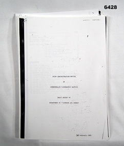
Administrative record - Department of Resources Draft Report of Commonwealth Topographic Mapping February 1985, 21 Feb 85
... Department of Resources Draft Report of Commonwealth Topographic Mapping February 1985...By its decision 3998 of 30 July 1984, The Australian Cabinet directed that there be a complete joint administration review of Commonwealth Topographic Mapping Resources and needs and the way in which those needs could be met. ...Some A3 folded Annexes Department of Resources Draft Report of Commonwealth Topographic Mapping February 1985 Administrative record Department of Resources Draft Report of Commonwealth Topographic Mapping February 1985 Department of Resources and Energy ...By its decision 3998 of 30 July 1984, The Australian Cabinet directed that there be a complete joint administration review of Commonwealth Topographic Mapping Resources and needs and the way in which those needs could be met. This is a Draft Report of that review.A photocopy of a 14 page, A4 Report, stapled top Left-hand corner. Some A3 folded Annexesroyal australian survey corps, rasvy, fortuna, army survey regiment, army svy regt, asr -
 Bendigo Military Museum
Photograph - Five Nation Mapping, Charting & Geodesy Conference - Army Survey Regiment, Fortuna, Bendigo, 1980
... Five Nation Mapping, Charting & Geodesy Conference - Army Survey Regiment, Fortuna, Bendigo. ...This collection of 19 black and white photographs was taken at the Five Nation Mapping, Charting & Geodesy (MC&G) Conference, held at the Army Survey Regiment, Fortuna, Bendigo from the 9th to 11th of September 1980. ...This set of 19 black and white photographs was taken during the Five Nation Mapping, Charting & Geodesy (MC&G) Conference, held at the Army Survey Regiment, Fortuna, Bendigo from the 9th to 11th of September 1980. ...Photograph Five Nation Mapping, Charting & Geodesy Conference - Army Survey Regiment, Fortuna, Bendigo. ...This collection of 19 black and white photographs was taken at the Five Nation Mapping, Charting & Geodesy (MC&G) Conference, held at the Army Survey Regiment, Fortuna, Bendigo from the 9th to 11th of September 1980. Directors (or their representatives) from Australia, Canada, New Zealand, United Kingdom and the United States of America military mapping agencies attended Five Nations MC&G Conference. Identifiable attendees were MAJ GEN William L. Nicholson III - D-DMA (USA), MAJ GEN Eric W Barton CB - Director of Military Survey (UK) and COL NRJ Hillier - D-SVY (AUS). It is apparent from the background of the photos that they were taken in the Army Survey Regiment’s Officers/SGTs Mess Dining Room. Directors (or their representatives) from the five nations signed Page 156 of the Army Survey Regiment’s Visitors Book. See Item 6047. This set of 19 black and white photographs was taken during the Five Nation Mapping, Charting & Geodesy (MC&G) Conference, held at the Army Survey Regiment, Fortuna, Bendigo from the 9th to 11th of September 1980. Photos .1P to .18P are on 35mm negative film and scanned at 96 dpi. Photo .19P is printed on photographic paper and scanned at 200 dpi. They are part of the Army Survey Regiment’s Collection. .1) - Photo, black & white, 1980. In background L to R: MAJ John Blackburn, CAPT Paddy Strunks, MAJ David Bowen USA Exchange, in foreground L to R: unidentified, unidentified USA Army Aide de Camp, D-SVY COL NRJ Hillier. .2) - Photo, black & white, 1980. In background L to R: unidentified, unidentified RAN Hydrographer, MAJ GEN Eric W Barton CB - UK Director of Military Survey, MAJGEN William L. Nicholson III – USA D-DMA, unidentified, in foreground L to R: unidentified NZ Hydrographer, Cr Peter Mansell – City of Bendigo councillor. .3) - Photo, black & white, 1980. In background L to R: unidentified, D-SVY COL NRJ Hillier, unidentified NZ Hydrographer, in foreground L to R: unidentified RAN Hydrographer, unidentified. .4) - Photo, black & white, 1980. L to R: MAJ Don Swiney MBE, MAJGEN William L. Nicholson III - D-DMA. .5) - Photo, black & white, 1980. L to R: CAPT Paddy Strunks, MAJ David Bowen USA Exchange, unidentified (x3). .6) - Photo, black & white, 1980. L to R: unidentified (x2), MAJ GEN Eric W Barton CB - UK Director of Military Survey. .7) - Photo, black & white, 1980. L to R: D-SVY COL NRJ Hillier, unidentified. .8) - Photo, black & white, 1980. L to R: MAJ David Bowen USA Exchange, unidentified NZ Hydrographer. .9) - Photo, black & white, 1980. In background L to R: unidentified, CAPT Peter Searle - UK Exchange, in foreground L to R: unidentified, CO LTCOL Bob Skitch. .10) - Photo, black & white, 1980. L to R: CO LTCOL Bob Skitch, unidentified (x2), MAJ GEN Eric W Barton CB - UK Director of Military Survey. .11) - Photo, black & white, 1980. L to R: Cr Peter Mansell – City of Bendigo councillor, CAPT John Harrison. .12) - Photo, black & white, 1980. L to R: CAPT Peter Searle - UK Exchange, unidentified (x2). .13) - Photo, black & white, 1980. L to R: unidentified Royal Canadian Air Force officer, unidentified. .14) & .15) - Photo, black & white, 1980. L to R: unidentified, D-SVY COL NRJ Hillier. .16) - Photo, black & white, 1980. L to R: CAPT Paddy Strunks, unidentified USA Army Aide de Camp. .17) - Photo, black & white, 1980. L to R: CAPT Bob Cooper, MAJ David Bowen USA Exchange, Cr Peter Mansell – City of Bendigo councillor, CAPT John Harrison. .18) - Photo, black & white, 1980. In background L to R: D-SVY COL NRJ Hillier, CAPT Paddy Strunks, in foreground L to R: MAJ John Blackburn, COL Stirling (NZ). .19) - Photo, black & white, 1980. L to R: MAJGEN William L. Nicholson III - D-DMA, Cr Peter Mansell – City of Bendigo councillor, unidentified Royal Canadian Air Force officer, MAJ GEN Eric W Barton CB - UK Director of Military Survey, unidentified, Cr Robert Campbell – City of Bendigo Mayor, D-SVY COL NRJ Hillier, unidentified, COL Stirling (NZ), unidentified NZ Hydrographer, unidentified RAN Hydrographer.No personnel or civilians are identifiedroyal australian survey corps, rasvy, army survey regiment, army svy regt, fortuna -
 Bendigo Military Museum
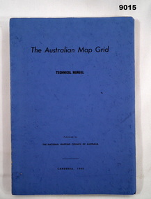
Manual - Australian Map Grid Technical Manual, National mapping Council of Australia, Canberra, 1968
... The Australian Map Grid Technical Manual published by The National Mapping Council of Australia, Canberra, 1968. ...National mapping Council of Australia, Canberra...The Australian Map Grid Technical Manual published by The National Mapping Council of Australia, Canberra, 1968. ...In 1966, all geodetic surveys in Australia and New Guinea were recomputed and adjusted on the new Australian Geodetic Datum (AGD). There was now a homogenous system of coordinates (other than heights) for geodetic survey stations all over Australia, free from discontinuities caused by changes in origin.A A4 blue card covered manual containing 84 Pages of text and diagrams and Graphic Annexes A-J. The Australian Map Grid Technical Manual published by The National Mapping Council of Australia, Canberra, 1968. Bound by 2 x Celco Clips.royal australian survey corps, rasvy, fortuna, army survey regiment, army svy regt, asr, national mapping council of australia -
University of Melbourne, Burnley Campus Archives
Map, Photo Mapping Services Pty. Ltd, Burnley College Burnley Gardens, 1995
... Map compiled by Photo Mapping Services Pty. Ltd., using aerial photography, dated 9th July, 1995. (1) Coloured proof. ...Photo Mapping Services Pty. Ltd....Burnley College Burnley Gardens Map Photo Mapping Services Pty. Ltd. ...HistoricalMap compiled by Photo Mapping Services Pty. Ltd., using aerial photography, dated 9th July, 1995. (1) Coloured proof. Scale 1:500. Aerial views, with and without trees marked, of Burnley Gardens: (2) Map with trees (3) Map without trees, sections numbered but no legend.burnley college, gardens, trees -
 Bendigo Military Museum
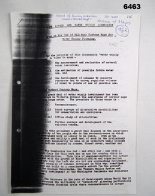
Administrative record - Use of Military maps for water supply planning, 1962
... This demonstrates the value of Military Mapping containing accurate relief information that can then be used for water supply planning....State Rivers and water supply Commision, Division of National Mapping...This demonstrates the value of Military Mapping containing accurate relief information that can then be used for water supply planning. ...These are typed notes on the use of Military maps for water supply planning. This demonstrates the value of Military Mapping containing accurate relief information that can then be used for water supply planning.5 x A4 pages of typed notes, poorly photocopiedroyal australian survey corps, rasvy, fortuna, army survey regiment, army svy regt, asr, state rivers and water supply commission