Showing 30 items matching " mining surveyors report"
-
 Bendigo Historical Society Inc.
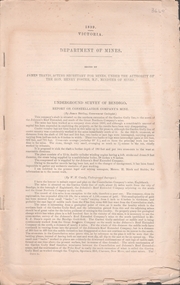
Book - REPORT OF THE MINING REGISTRARS AND SURVEYORS REPORT - SEPT. 1878, 1878
... REPORT OF THE MINING REGISTRARS AND SURVEYORS REPORT - SEPT. 1878...REPORT OF THE MINING REGISTRARS AND SURVEYORS REPORT - SEPT. 1878...History House 11 Mackenzie Street Bendigo goldfields GOLD MINING Miners' Safety Cage mining registrar and surveyors repo gold gold mining mining registrar surveyors REPORT OF THE MINING REGISTRARS AND SURVEYORS REPORT - SEPT. 1878 Book REPORT OF THE MINING REGISTRARS AND SURVEYORS REPORT - SEPT. 1878 ...REPORT OF THE MINING REGISTRARS AND SURVEYORS REPORT - SEPT. 1878gold mining, miners' safety cage, mining registrar and surveyors repo, gold, gold mining, mining registrar, surveyors -
 Bendigo Historical Society Inc.
Book - MINING SURVEYORS AND REGISTRARS REPORT - 30TH. JUNE 1880, 1880
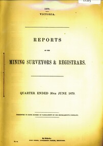
... MINING SURVEYORS AND REGISTRARS REPORT - 30TH. JUNE 1880...Reports of the mining surveyors and registrats quarter ended 30th. ...History House 11 Mackenzie Street Bendigo goldfields GOLD MINING Miners' Safety Cage surveyors and registrars report Bendigo goldfields gold mining mining surveyors registrars Vic. ...Reports of the mining surveyors and registrats quarter ended 30th. June 1880. 35 pagesVic. Govt.gold mining, miners' safety cage, surveyors and registrars report, bendigo, goldfields, gold mining, mining surveyors, registrars -
 Bendigo Historical Society Inc.
Book - REPORT OF THE MINING SURVEYORS AND REGISTRARS, 30TH. JUNE 1881, 1881
... ... mining surveyors report...REPORT OF THE MINING SURVEYORS AND REGISTRARS, 30TH. JUNE 1881. 40 pages...History House 11 Mackenzie Street Bendigo goldfields GOLD MINING Miners' Safety Cage mining surveyors and registrars rep Bendigo gold mining goldfields registrars mining surveyors report Vic. ...REPORT OF THE MINING SURVEYORS AND REGISTRARS, 30TH. JUNE 1881. 40 pagesVic. Govt.gold mining, miners' safety cage, mining surveyors and registrars rep, bendigo, gold mining, goldfields, registrars, mining surveyors report -
 Bendigo Historical Society Inc.
Book - REPORT OF THE MINING SURVEYORS AND REGISTRARS DEC. 1877, 1877-8
... mining... registrars report... surveyors...REPORT OF THE MINING SURVEYORS AND REGISTRARS DEC. 1877...History House 11 Mackenzie Street Bendigo goldfields GOLD MINING Miners' Safety Cage registrars and surveyors report gold gold mining registrars report surveyors report REPORT OF THE MINING SURVEYORS AND REGISTRARS DEC. 1877 Book REPORT OF THE MINING SURVEYORS AND REGISTRARS DEC. 1877 ...REPORT OF THE MINING SURVEYORS AND REGISTRARS DEC. 1877gold mining, miners' safety cage, registrars and surveyors report, gold, gold mining, registrars report, surveyors report -
 Bendigo Historical Society Inc.
Book - REPORT OF THE MINING SURVEYORS AND REGISTRARS JUNE 1876, 1876
... mining... registrars... surveyors report...REPORT OF THE MINING SURVEYORS AND REGISTRARS JUNE 1876...History House 11 Mackenzie Street Bendigo goldfields GOLD MINING Miners' Safety Cage registrars and surveyors report gold gold mining registrars surveyors report REPORT OF THE MINING SURVEYORS AND REGISTRARS JUNE 1876 Book REPORT OF THE MINING SURVEYORS AND REGISTRARS JUNE 1876 ...REPORT OF THE MINING SURVEYORS AND REGISTRARS JUNE 1876gold mining, miners' safety cage, registrars and surveyors report, gold, gold mining, registrars, surveyors report -
 Bendigo Historical Society Inc.
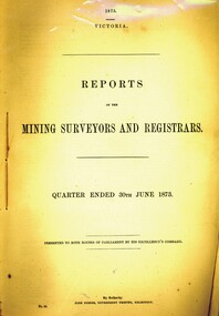
Book - REPORTS OF THE MINING SURVEYORS AND REGISTRARS, 1872
... mining... surveyors... registrars report....REPORTS OF THE MINING SURVEYORS AND REGISTRARS. Quarter ending 30th June 1872....History House 11 Mackenzie Street Bendigo goldfields GOLD MINING Miners' Safety Cage registrars report gold gold mining surveyors registrars report. ...REPORTS OF THE MINING SURVEYORS AND REGISTRARS. Quarter ending 30th June 1872.gold mining, miners' safety cage, registrars report, gold, gold mining, surveyors, registrars report. -
 Bendigo Historical Society Inc.
Book - REPORT OF THE MINING SURVEYORS AND REGISTRARS SEPT. 1878, 1878
... mining... registrars and surveyors report...REPORT OF THE MINING SURVEYORS AND REGISTRARS SEPT. 1878...History House 11 Mackenzie Street Bendigo goldfields GOLD MINING Miners' Safety Cage registrars and surveyors report gold gold mining registrars and surveyors report REPORT OF THE MINING SURVEYORS AND REGISTRARS SEPT. 1878 Book REPORT OF THE MINING SURVEYORS AND REGISTRARS SEPT. 1878 ...REPORT OF THE MINING SURVEYORS AND REGISTRARS SEPT. 1878gold mining, miners' safety cage, registrars and surveyors report, gold, gold mining, registrars and surveyors report -
 Bendigo Historical Society Inc.
Book - REPORT OF THE MINING SURVEYORS AND REGISTRAR - JUNE 1878, 1878
... mining... registrars and surveyors report...REPORT OF THE MINING SURVEYORS AND REGISTRAR - JUNE 1878...History House 11 Mackenzie Street Bendigo goldfields GOLD MINING Miners' Safety Cage registrars and surveyors report gold gold mining registrars and surveyors report REPORT OF THE MINING SURVEYORS AND REGISTRAR - JUNE 1878 Book REPORT OF THE MINING SURVEYORS AND REGISTRAR - JUNE 1878 ...REPORT OF THE MINING SURVEYORS AND REGISTRAR - JUNE 1878gold mining, miners' safety cage, registrars and surveyors report, gold, gold mining, registrars and surveyors report -
 Bendigo Historical Society Inc.
Book - REPORT OF THE MINING SURVEYORS AND REGISTRARS SEPT. 1876, 1876
... mining... registrars and surveyors report....REPORT OF THE MINING SURVEYORS AND REGISTRARS - Sept. 1876...History House 11 Mackenzie Street Bendigo goldfields GOLD MINING Miners' Safety Cage registrars and surveyors report gold gold mining registrars and surveyors report. ...REPORT OF THE MINING SURVEYORS AND REGISTRARS - Sept. 1876gold mining, miners' safety cage, registrars and surveyors report, gold, gold mining, registrars and surveyors report. -
 Federation University Historical Collection
Document, Zelda Martin, Central Victorian Goldmining towns - Boom Towns or Ghost Towns?, c1996
... Steiglitz: Brief History Victorian Post Office Directory 1869 *Map of Steiglitz *List of maps relevant to Steiglitz history *Information 6 tables of data from "Reports of Mining Surveyors Talbot (Back Creek) Brief History Taradale: Post office Directory 1869 - Name/Occupation/Street. ...Steiglitz: Brief History Victorian Post Office Directory 1869 *Map of Steiglitz *List of maps relevant to Steiglitz history *Information 6 tables of data from "Reports of Mining Surveyors Talbot (Back Creek) Brief History Taradale: Post office Directory 1869 - Name/Occupation/Street. ...Zelda Martin was a PhD candidate at the University of Melbourne.[.1] 4th item in light blue display book titled Research Approach/Overview of Chapters/Confirmation of Canditure/Chapters1,2,3&4 of proposed thesis. *Twenty-seven page article on Victorian goldfields towns titled: Central Victorian Goldmining Towns - Boom Towns or Ghost Towns. The article was written during the author's PhD study. It outlines the context methodology, and resources and the chapters of the proposed thesis: (1) Central Victorian Goldmining Towns - The Context (2) Contemporary Views of the Factors Necessary for Town Growth (3) Outward Manifestations of Town Growth (4) The Trappings of Government (5-9) The Main Towns and Their Hinterland. [.2] 5th item in Light Blue display book as above item. *Chapter 1 of proposed thesis titled 'Pick, Shovel and Tin Dish Mining.' Covers in Section A: Central Victoria - Pre 1851: Aborigines in Central Victoria, Squatters, and Government. Section B: The years 1851-1854: The Early Gold Rushes, Government Reaction, Township Surveys, Legislation, Town Development, Local Government and Early Settlement. [.3] 6th item in Light Blue display book as above item. *2A of proposed thesis titled 'Contemporary Views of the Factors Necessary for Town Growth'. Similar information to Chapter 1 plus extra re towns and maps. Sections: Introduction, Context of Place - Geographical Towns Listed, The Context of Time - Pre1851 Aborigines, Governance of Port Phillip, The Squatters, The Villages of Central Victorian Highlands, Conclusion, Condensed Version of Chapter2B. [.4] 7th item in Light Blue display book as above item. *Chapter2B of proposed thesis. Sections: Area of Research, Schools, Banks, Newspapers, Progress Association, Town Development - Sandhurst (Bendigo), Ballarat, Castlemaine,, Maryborough, Ararat and Stawell. [.5] 8th item in Light Blue display book as above item. *Chapter 3 of proposed thesis titled 'Outward Manifestations of Town Growth'. Sections: Introduction, Contemporary Writing, Educationalists, The Bankers, The Townsfolk, Current Theory, General Theories of Urban Development, and Conclusion. [.6] 9th item in Light Blue display book as above item. *Chapter 4 of proposed thesis titled 'Trappings of Government' Sections: Introduction, Early Government Attitudes to Mining and Town Development, Law and Order, Township Surveys, Legislation, Local Government, Transport and Communication, The People and Lobbyists. [.7] 10th item in Light Blue display book as above item. *'The Rise and Fall of Central Victorian Goldmining Towns'. Includes a map showing main Goldfields, a table showing towns and villages at two points in time - 1857 and 1871; a Bibliography of Primary and Secondary Sources. [.8] Resource No1. Black display book titled Local Towns 1 : Alma: *Brief history *Directory *Maps Amphitheatre / Mountain Hut: *Brief History Post Office Directory Ararat: *Brief History *Post Office Directory 1869 - Alphabetical Listing by Occupation *Ararat - Prominent Citizens of 1858 *Langi-Morgala Museum Avoca: *Brief History *Excerpts from 'Avoca The Early Years', Margery and Betty Beavis; pg1 - Beginnings; pg11 - The Midas Touch; pg25 - Local Gold Escorts; pg27 - A Town is Born; pg51- The Administration of Justice; pg53 - The Ways of the Law; pg61 - News of the Day; pg65 - A Time to Play; pg72 - Land Ownership *Post Office Directory (Bailliere's) 1869 *Tourism Map and Information of area *Historic Avoca - A 5.5km Tour *Avoca & the Pyrenees Region - information pamphlet Ballarat: *Early History of Ballarat - Ballarat Historical Society, Publication No.1: origin of the name; Ballaarat - the Beginning; Fabulous Yields from the Ballaarat Goldfield; *Streetscape Lydiard Street. *Hand drawn map showing Leigh River, Old Portland Bay Road, plaque on road to Colac; etc. *Newspaper article re 'The Theatre Royal' ( which stood in the vicinity of the current Owen Williams store) - 'The News'15/04/1998 *Article - 'Ballarat's Mechanics' Institute Lives On' Ballarat Courier, 14/09/1985 *Article - Standing the Test of Time' The News 17/11/1993 re The Mechanics Institute & picture of the Reading Room *'Ballarat a Study of a City, Phyllis Reichl, pub. Nelson, 1968; no.3 place, time and people field studies series *Investigator Vol.33 No.2, 1998 Geelong Historical Society. Article on pg75 describes Ballarat in 1861 *Folded poster - 'Ballarat 100' a history of telegraph communication, pub. Telecom. Beaufort (Fiery Creek): *Brief history *Post Office Directory [.9] Resource No.2 Black Folder Titled Towns cont.No2 Bendigo (Sandhurst): *'Family & Local History at the Bendigo Library - 1851-2001 150 years of gold'. *Bendigo Government Camp in 1853 illustration; key to sketch and names of Government officers stationed there *Excerpts from 'Bendigo and Vicinity' Adolph Haman *The Bendigo Goldfield Registry - pgs 1-7 Introduction *Excerpt: 'Breaking the Grip' *Excerpt: The Most Go-Ahead Place *Excerpts from 'History of Bendigo' - anti license agitation; laying out of town; proposed railway; gold calls and dividends; the Sandhurst Municipality; journalism *Bibliography Blackwood: *Excerpts from 'Aspects of Early Blackwood - The Goldfield, the Landmarks, the Pioneers' Alan J Buckingham and Margaret F Hitchcock, JG Publishing,1980 Buninyong: *A Brief History *Investigator Vol1 No.2 Feb 1966 Geelong Historical Society. Pg3 - Article re gold escort route - Mt Alexander to Adelaide - (see a simple monument on the Western Highway a few miles out of Horsham. Pg 15 - Ballarat Excursion - re the finding of gold. *Three articles published by Buninyong and District Historical Society Inc: (Magpie Exploration; Finding Gold In The Green Hills; Magpie Exploration; Burnt Bridge to Cargarie to Mt Mercer) *Copies of newspaper articles/items *Buninyong Street Directory Carisbrook: *In the Beginning There Was Carisbrook *The History of the Carisbrook Racecourse Carngham / Snake Valley: *Brief History *Directory Castlemaine: *Directory 1865-1866 - Alphabetical and Street *Poster - Castlemaine A Contemporary Guide "The Great Centre" 1866 - A Contemporary Guide to the Fascinating Past *Pamphlet - Castlemaine District Community Hospital *Map - Castlemaine, Maldon & Surrounding Districts *Map and Information - The Dry Diggings Track - a 55kl walk among historic goldfields relics ( Castlemaine Fryerstown Vaughan Mt Franklin Hepburn Daylesford) *Postcard - Former Court House *Directory 1867 - Alphabetical, Trade [.10] Resource No.3 Grey folder Titled Towns 3 Creswick to Maryborough Creswick: *Brief History *Booklet - "Creswick Cemetery Walk" *Booklet - The Buried Rivers of Gold Heritage Trail Creswick *Creswick Historical Museum Information Sheet *Chronological History of Creswick *Alphabetical Directory of the Borough of Creswick *Creswick's Creek Directory 1856 *Historic Creswick Walking Tour *A Brief Account of the Schools of Creswick - Past and Present *100 Years of Railway Travel in Creswick *The Berry Deep Leads *The Spence Home at Jackass Gully in the Creswick State Forest ( William Guthrie Spence - Pioneer) *The New Australian Mine and the 1882 Disaster *Creswick District News, Issue 7, July August 1999 *The Creswick Miners Walk - Information and Map *Maps Chewton: *Brief History *Directory Clunes: *Brief History *Clunes Street Directory Daylesford: *Brief History *Notable Bushfires in Daylesford District Over More Than a Century - "Black Thursday" 1851; 1862; 1899; the Disastrous Hepburn Fire of 1906; 1939; 1944; 1969. *Post Office Directory -Daylesford and Hepburn Dunolly / Inkerman: *Brief History *Directory *Pamphlet - Goldfields Historical Museum *Pamphlet - Historic Dunolly - Victoria's Best Kept Secret *Map of Gold Workings at Dunolly Area - showing where the main gold rushes occurred *Brief History - Inglewood *Directory - Inglewood - Name Occupation, Dwelling Kingower: *Brief History *Directory - Name / Ocupation / Dwelling Linton / Happy Valley / Piggoreet: *Brief History *Directory - Lintons McIvor: *"A History of the Shire and the Township of Heathcote" by J.O. Randell Majorca: *Brief History *Official Post Office Directory 1869 - Name / Occupation/ Address Maldon (Tarrangower): *Brief History Part 1 *Brief History Part 2 *Post Office Directory *List - Alphabetical Order by Names plus Business and Trade (Tarrangower Times Oct/1858) *List - Alphabetical Order by Trade plus Name and Business *Directory - Name / Occupation / Dwelling Maryborough: *Worsley Cottage - built by Arthur Worsley, a contractor in stonework in 1894 [.11] Resource No. 4 Blue Display Book titled Towns 4 Moliagul to Stawell Moliagul: *Brief History *Moligul Legislative Assembly (Voting?) List - Names and Occupations *Moliagul Victorian Post Office Directory 1868 - Name / Ocupation / Address / Comments *"The Welcome Stranger" gold nugget *The Sunday School *The Welcome Stranger Discovery Walk - information and map Moonambel (Mountain Creek) Redbank *Brief History *List of names extracted from advertisments of the Pioneer and Mountain Creek Advertiser 16/02/1861. *Bailliere's Directory 1869 - Alphabetical List of Name / Occupation / Place St Arnaud: *Brief History Sebastapol: *Brief History *Directory 1869 - Alphabetical by Name; plus occupation and address. Browns and Scarsdale: *Brief History *Browns Street Directory - Name and Occupation Smythesdale: *Brief Description *Smythesdale Street Directory -Name and Occupation Stawell (Pleasant Creek) *Brief History *Victorian Official Post Office Directory - Name /Occupation / Dwelling *Chronology - 1841-1920 *Production of gold statistics - 1879 - 1900 *Big Hill *Extracts from "The Golden Years of Stawell". Chapt 1 - Stawell's Coming Out. Capt. 2 - The Gold Rush. Caapt.3 - Cradle of Democracy. Chapt.4 - The Reefs Becomes Stawell. Chapt. 5 - Rushing In. Chapt.6 - The Pioneers. Chapt 7 - The Decade of Optimism. [.12] Resource No. 5: Blue Display Book titled 'Towns Steiglitz to the The Golden Triangle. Steiglitz: Brief History Victorian Post Office Directory 1869 *Map of Steiglitz *List of maps relevant to Steiglitz history *Information 6 tables of data from "Reports of Mining Surveyors Talbot (Back Creek) Brief History Taradale: Post office Directory 1869 - Name/Occupation/Street. Also list in alphabetical order by Occupation Taradale *Chronological Reference to Taradale Mines *Water - The Coliban System of Waterworks *Joseph Brady *The Syphon Tarnagulla (Sandy Creek) *Brief History *Tarnagulla Businessmen Cameos to give depth to advertisments in 'The Tarnagulla Courier' various issues 1864-1871 *Directory - Name/Occupation /Address *List - Name/Business/Trade Wedderburn (Koorong) *Brief History *List - Name/Occupation The Golden Triangle: *The Early Rushes - Wedderburn / Moliagul / Sandy Creek - Tarnagulla / Jones Creek - Waanyarra / Kingower / Dunolly - Goldsborough / Inglweood *Census of 1857 - Population / Occupations *1858-1871 - A Time of Consolidation- Wedderburn / Moliagul / Sandy Creek- Tarnagulla / Arnold *Census 1871 - Population *Information gleaned from the census data - Demographics / Population / Occupations / marital / Birthplace / Religion / Literacy/ Occupation and Housing Cameos *Graphs - Birthplace of settlers /Male-Female Ratio / Married males / Children under 15 as Percentage of Population / Religion *Census 1857 - Statistical data *Maps *Bibliography [.13] Resource No. 6 - Black Display Book Information and Research in Central Victoria including: *Banking - Research from ANZ Bank Archives *Institutions - also includes articles listed from the Ballarat Times Newspaper *Australian mining History Association - A.M.H.A. Bibliography *Australia's Mining History * Bibliography - Land Surveys Victoria - *1853 Administration (Statistics and Other) includes: schools / ministers of religion / police / military / local administration / licences for sale of spirits / distances between various Victorian gold fields. * Victoria Government Gazette (Copy) - N0. 116, 12/12/1854 includes: Gold Felds Commission of Enquiry & No. 85, 15/09/1854 - Addresses presented to the Lieutenant Governor (Sir Charles Hotham) during his tour through the Gold Fields of Victoria,1854. Addresses on behalf of : the people of Bendigo; Members of the Church of England, Bendigo; Members of the Wesleyan Church on the Bendigo Gold Fields; Bendigo Gold District General Hospital; the Bendigo Prospecting Association; Committee of the Bendigo Local Exhibition; Bendigo District Medical Association; Coloured Americans Resident at Bendigo; German Inhabitants of Bendigo; Landowners, Inhabitants, and Miners of Castlemaine; Inhabitants of Forest Creek; Inhabitants of Heathcote and Gold Miners of McIvor; Residents and landholders of the District of Bacchus Marsh; Inhabitants of Kilmore and Vicinity. *Gold Fields Correspondence 1853: letter from Lieutenant Colonel Valiant, (Officer commanding the Troops in Victoria) to the Lieutenant Governor re threatened disturbance at Sandhurst (Bendigo) regarding the Gold License Fee. * Extracts from a book "Victoria" re Gold Fields Commission of Enquiry involving mainly Ballarat and Castlemaine and a chapter titled 'A Tour to the Victorian Gold-Fields' *Lists of central Victorian newspapers - listed by date published 1851to 1874; by first date available to State Library. *A list of cities and towns showing County, population in 1861 &1871, and municipal status. [.14] Resource no.7. Black display book. *Reference: Papers presented to Parliament Victoria - 1859-1860 4 volumes - relevant sections copied. Contains information on Branches of Government. General / Finance / Gold / Gazette / Commission and Warrant / Statistic. *Gold Fields Act. In accordance with the Act the gold fields are divided into six districts - Ballaarat, Castlemaine , Sandhurst, Avoca, Ararat, and Beechworth.. Official staff in each gold district consists of a Resident Warden, Wardens, Wardens' Clerks, Bailiffs, Chinese Protectors, Chinese Interpreters, and Mining Surveyors. *Gold Receiver *Gaols *Police magistrates and Clerks of Petty Sessions, etc. *Field Branch *Immigration and Emigration Overland - Chinese - 1859 *Population on the Goldfields *The Geological Survey - The Government Geologist is assisited by staff from four branches - the office Branch; the Publishing Branch; the Field Branch and the Museum Branch. *Commission to Enquire Into Sludge dated 10/02/1859 (Some sections copied) - Report to the Honorable Chief Commissioner of Public Works, Melbourne re the mode of carrying the sludge from the puddling mills in Sandhurst without interfering with the drainage of the town and the roads in the neighbourhood. [.15] Resource No.8: Camel display book titled Resource No. 8. Aborigines *Lists of book titles - +"Readings in Victorian prehistory" +"The Aborigines of Port Phillip" +Aboriginal languages and clans" +"A History of the Port Phillip District" +"Langi Ghiran 1: Aboriginal Rock...." +"Koorie History: sources for aboriginal studies in the State Library of Victoria", ed. Tom Griffiths, Melb. Friends of the State Library, 1989 +"The Public Lands of Australia Felix"; settlement and land appraisal in Victoria1834-91 with special reference to the Western Plains", J.M.Powell, Melb. Oxford University Press 1970 +*Bibliography of the Victorian Aborigines' from the earliest manuscripts to 31st December 1970, Massoa, Aldo, Melb. Hawthorn Press, 1971 +"Aborigines in Colonial Victoria, 1836-1886", M.F. Christie, Sydney University Press, 1979 +"Urban and Industrial Australia: readings in Human Geography" ed J.M. Powell, Melb. Sorrett Pub. 1974 *Extracts: -Processes of Pioneer Settlement - The Squatting Occupation of Victoria, 1834-60. J.M. Powell -Areal Variations in the Class Structure of the Central-Place Hierarchy. P. Scott - Volume1 and Volume 2: Notes Relating to the Habits of the Natives of Other Parts of Australia and Tasmania. Compiled from various sources for the Government of Victoria by R Brough Smyth. John Curry, O'Neil, Melb. 1st pub. Melb. 1876. p31-45 - Numbers and Distribution of the Aborigines in Victoria -Victorian Aborigines 1835-1901 - A Resource Guide to the Holdings of the Public Record Office, Victoria; published by the Government Information Centre 1984. *History of the Aboriginal Artefacts Displayed in the Daylesford Museum. F. G. Powell (4 page pamphlet) *Letter to Zelda Martin from Peter Lovett, Cultural Officer, Ballarat & District Aboriginal Co- Operative, 05/02/1997 *Map: Ian Clarke Victorian Tribunal Boundary Map - Clans of Central Victoria. *Victorian Rock Art and Mythology - Article about Mount Langhi Ghiran and myths of the Tjapwarong people. *Two Aboriginal myths relating to the Grampians - 'The Monster Emu' / 'The Aquisition of Fire', by the Aborigines in the Grampians Areas *Article titled (chapter 8) Ballarat - information re camping sites in the region. Lake Wendouree / Lake Burrumbeet (includes a myth) / Mt Bunninyong / Lal Lal / Pitfield / Mount Elephant / Mount Egerton / Meredith / Lake Goldsmith / Lake Learmonth / Ercildoune *Notes on the Aborigines of the Wider Ballarat Region plus European names=Aboriginal names. John Morris 26/07/1995 *Role of Aborigines in Town Development in Central Victoria. Mentions Native Police Force est. in Port Phillip 1842 and Central Board for Aborigines est. 1860 *The Grave of King Billy. (Frank Wilson) Pamphlet. *Camping Places in Central and Northern Victoria. Article re Lake Burrumbeet site. *Programme for the Unveiling of Memorial Cairn for Edward Stone Parker 1802-1865. Note portrait not accurate. Accurate portrait is available in the book "A Successful Failure A Trilogy The Aborigines and Early Settlers", Edgar Morrison, Graffiti Publications, 2002. * Large envelope addressed to Mr G Netherway containing newspaper cuttings regarding the life of Edward Stone Parker, the unveiling of the Memorial Cairn as mentioned above, articles titled 'Episodes from Our Early Days' (Edgar Morrison, Yandoit)- The Black's School, A School At Last and The Final years. Also a typed page titled 'Historical Background to E.S.Parker's Career. Includes an interesting tale titled 'When the cat lay doggo' re laying power leads for the unveiling ceremony at the memorial site. [.16] green display folder titled 'Research Aids' *List of references to Commissioners' & W'ardens' Reports (formerly held at La Trobe Library Archives, now at Public Records Office [PRO]). Indicates town referred to / date of report / name of camp if different to town. * Archive information re Anglican Records *Movement around the Goldfields - Miners and Storekeepers - usefulness of newspapers in providing information - areas covered - Castlemaine, Maldon, Ararat, Stawell, Tarnagulla, Dunolly. *Port Phillip /Victoria Directories 1839/1867 - Chronological list of Directories included in this series. *"Notes on the History of Local Government in Victoria" A.W. Greig Melb. University Press 1925 - Photo-copied extract p5-p40. (Source - Deakin University Library) - Introduction by W.Harrison Moore. Section 1 - Development in New South Wales Before Separation. Section 2 - Development in Victoria After Its Separation from New South Wales. Hand written notations: 'roads, markets, and local government 1855 on' ;'opportunity of squatters in parliament' and 'opportunities of matters in parliament p33' * Notes on the Establishment of Surveyor General's Department 1851and Commissioner of Crown Lands and Survey. * Newspaper articles from The Argus, 1849, re the discovery of gold in the Pyrenees region. * Excerpt - a report on schools - A.B.Orlebar, Inspector; re the need for permanent school buildings rather than tents. *Excerpt from - 'Approaches to Urban History', Sean Glynn: The Case for Caution * Except from - 'The Urban Sprinkle', Weston Bate: Country Towns and Australian Regional History *Reference- 'The History of Land Tenure in the Colony of Victoria', John Quick. References the Haines Land Bill, land tenure and Land Leagues. [.17] Light blue envelope folder titled 'Birtchnell's Ballarat, etc. Directory 1862 *Contains various directories for Smythesdale, Buninyong, Clunes, Brown's and Creswick. [.18] Red envelope folder no.2 titled Victorian Gazetteer *Selected pages from 1869 Victorian Gazetteer on A4 paper (with a handwritten note questioning if some pages are from 1868 Victorian Gazetteer as appears to be different sizes - A3 pages.) Information includes locations and descriptions of towns, hotels, banks, communications and populations. (Does not include names, residences and occupations) [.19] Red Envelope folder titled Bailliere's Official Post Office Directory 1868 (or1869 or a mixture of both?) *Preface *Contains a selection of pages of towns highlighted in yellow in the the index *Work on this directory was commenced in 1867. *Information includes: Municipalities - mayors and councilors; lists of towns naming male inhabitants and their occupations. [.20]Yellow manila folder titled Post Grad Seminar Presentation 1996 *Gives some background to Zelda Martin's proposed thesis and why she chose the topic Gold Mining Towns Boom or Bust [.21] A3 display book - No. 1A * A list of 'Relevant Newspapers collected: The Tarrangower Times and Maldon Advertiser (first published 1858) Includes dates 1858-1867. The Mount Alexander Mail. Includes dates 1854-1866 The Tarnagulla Courier. Includes dates from1864-1871 Dunolly and Burnt Creek Express. Includes dates from 1862-1871 * Selection of newspaper pages from The Mount Alexander Mail 1854 to 1856, mostly showing advertisements for businesses and services provided to that community. [.22] A3 display book - No. 1B * Selection of newspaper pages from The Mount Alexander Mail 1857 to 1866, mostly showing advertisements for businesses and services provided to that community. [.23] A3 display book -No. 2 * Selection of newspaper pages from The Tarnagulla Courier 1864 to 1871, mostly showing advertisements for businesses and services provided to that community. [.24] A3 display book - No. 3 *Selection of newspaper pages from The Tarrangower Times (and Maldon and Newstead) Advertiser 1858 to1867, mostly showing advertisements for businesses and services provided to that community. [.25] A3 display book - No.4 * Selection of newspaper pages from The Dunolly and Burnt Creek Express; and The Dunolly and Betbetshire Express 1862 to 1871, mostly showing advertisements for businesses and services provided for that community. [.26] A3 display book - No.5 Includes: * Bryce Ross's Diggings Directory. Includes instructions for using this directory. This directory was used by "all persons having connexion or desiring to communicate with 'working parties, private friends, or Stores at the Diggings." As a directory for each area wwas completed it was published in each month's issue of Bonwick's "Digger's Magazine." Years c1852/1853. This Directory commences first at the head of Forest Creek. Includes a directory for Bendigo and Ballarat. Of interest at the end of the Bendigo and Ballarat directory is a list of the number of storekeepers, butchers, doctors, smiths, eating houses, lemonade sellers and chapels. * The Castlemaine Directory and Book of General Information Comprehending Glass's Model Calendar for the Two Years 1862 and1863. "zelda martin, victorian goldfield towns, bendigo, castlemaine, ballarat, maldon, stawell, ararat, maryborough, creswick, avoca, heathcote, banks, bank of australasia, union bank of australia, government camp, sandhurst, water supply, tarnagulla, talbot, back creek, mountain creek, police court, carisbrook, dunolly, thompson's foundry, charles clacy, anthony trollope, robert cecil, mount alexander, urbanisation, national schools, education, govenrment, industry, railway, transport, settlement, land settlement in central victoria, steiglitz, joseph brady, the new australian mine, berry deep leads, william guthrie spence, creswick state forest, arthur worsley, worsley cottage, the welcome stranger, moliagul, moonambel, redbank, st arnaud, sebastapol, brown's, scarsdale, clunes, chewton, daylesford, bushfires, inkerman, inglewood, kingower, lintons, happy valley, piggoreet, mcivor, majorca, tarrangower, taradale, the coliban system, the syphon, sandy creek, wedderburn, koorong, arnold, jones creek, waanyarra, the golden triangle, census 1857, blackwood, buninyong, durham lead, magpie, carngham, snake valley, alma, amherst, daisy hill, amphitheatre, mountain hut, beaufort, fiery creek, counties, population, gold fields commission of enquiry1854, william westgarth, gold license fee, lieutenant colonel valiant, administration of the victorian gold fields, commission to enquire into sludge 1859, e.s. parker, edward stone parker, edgar morrison, mount franklin protectorate, dja dja wurrung, memorial cairn, franklinford, mt franklin memorial cairn, jajowurrong, dja dja wurung, tjaowarong, wothowurong, assistant protectors, daylesford museum, buluk, rock art - grampians, aboriginal mythology - grampians, aborigines, first nations people, mount franklin, aboriginal artifacts, lake burrumbeet, native police force, central board of aborigines, yandoit, commissioners' reports, wardens' reports, port phillip/victoria directories 1839-1867, local government - victoria 1853/1854, surveyor general's department - 1850's, victorian schools 1850's, a.b.orlebar, haines land bill, william charles haines, wilson gray, land tenure, land leagues, victorian gazetteer, the tarrangower times and maldon advertiser - 1858-1867, the mount alexander mail 1854-1866, the tarnagulla courier 1864, dunolly and burnt creek express 1862-1871, bryce rose's diggings directory, the castlemaine directory 1862-1863 -
 Bendigo Historical Society Inc.
Book - REPORTS OF THE MINING SURVEYORS AND REGISTRARS 1885 - 1896, 1997
... Reports of the Mining Surveyors and Registrars. Sandhurst (Bendigo) District. 13 various Reports from 1885 to December 1887 Greytown Report of 1896 and the Yankee Creek Goldfields Report. ...Book REPORTS OF THE MINING SURVEYORS AND REGISTRARS 1885 - 1896 ...Reports of the Mining Surveyors and Registrars. Sandhurst (Bendigo) District. 13 various Reports from 1885 to December 1887 Greytown Report of 1896 and the Yankee Creek Goldfields Report. Facsimile of Original Reports 1997.goldfields, mining reports -
 Bendigo Historical Society Inc.
Book - REPORTS OF THE MINING SURVEYORS AND REGISTRARS 1859 - 1884, 1997
... Reports of the Mining Surveyors and Registrars, 1859 - 1884. ...History House 11 Mackenzie Street Bendigo goldfields GOLDFIELDS mining reports Reports of the Mining Surveyors and Registrars, 1859 - 1884. ...Reports of the Mining Surveyors and Registrars, 1859 - 1884. Covering Sandhurst (Bendigo) district, including Kilmore, Kangaroo Flat, Eaglehawk, Heathcote, and Waranga. 63 various reports from 1859 to December 1884. Facsimile of original reports 1997.goldfields, mining reports -
 Bendigo Historical Society Inc.
Book - REPORT OF THE MINING SURVEYORS AND REGISTRARS, 31ST. DECEMBER 1881, 1881
... REPORT OF THE MINING SURVEYORS AND REGISTRARS, 31st. December 1881. 44 pages...History House 11 Mackenzie Street Bendigo goldfields GOLD MINING Miners' Safety Cage mining surveyors and registrars rep gold mining Bendigo goldfields mining surveyor mining registrar's reports Vic. ...REPORT OF THE MINING SURVEYORS AND REGISTRARS, 31st. December 1881. 44 pagesVic. Govt.gold mining, miners' safety cage, mining surveyors and registrars rep, gold mining, bendigo, goldfields, mining surveyor, mining registrar's reports -
 Bendigo Historical Society Inc.
Book - REPORT OF THE MINING REGISTRAR AND SURVEYORS JUNE 1879, 1879
... REPORT OF THE MINING REGISTRAR AND SURVEYORS JUNE 1879...History House 11 Mackenzie Street Bendigo goldfields GOLD MINING Miners' Safety Cage mining surveyors and registrars gold gold mining mining registrars mining surveyors REPORT OF THE MINING REGISTRAR AND SURVEYORS JUNE 1879 Book REPORT OF THE MINING REGISTRAR AND SURVEYORS JUNE 1879 ...REPORT OF THE MINING REGISTRAR AND SURVEYORS JUNE 1879gold mining, miners' safety cage, mining surveyors and registrars, gold, gold mining, mining registrars, mining surveyors -
 Bendigo Historical Society Inc.
Book - REPORT OF THE MINING SURVEYORS AND REGISTRARS 30TH. JUNE 1877, 1877
... Report of the mining surveyors and registrars, quarter ended 30th June 1877....History House 11 Mackenzie Street Bendigo goldfields GOLD MINING Miners' Safety Cage registrars and surveyors report gold gold mining registrars surveyors Report of the mining surveyors and registrars, quarter ended 30th June 1877. ...Report of the mining surveyors and registrars, quarter ended 30th June 1877.gold mining, miners' safety cage, registrars and surveyors report, gold, gold mining, registrars, surveyors -
 Bendigo Historical Society Inc.
Book - REPORTS OF THE MINING SURVEYORS AND REGISTRAR, 1873
... REPORTS OF THE MINING SURVEYORS AND REGISTRAR - June 1873...History House 11 Mackenzie Street Bendigo goldfields GOLD MINING Miners' Safety Cage mining surveyors and registrars rep gold gold mining suvveyors and registrars REPORTS OF THE MINING SURVEYORS AND REGISTRAR - June 1873 Book REPORTS OF THE MINING SURVEYORS AND REGISTRAR ...REPORTS OF THE MINING SURVEYORS AND REGISTRAR - June 1873gold mining, miners' safety cage, mining surveyors and registrars rep, gold, gold mining, suvveyors and registrars -
 Bendigo Historical Society Inc.
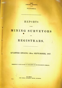
Book - REPORTS OF THE MINING SURVEYORS AND REGISTRARS 30TH. SEPT. 1867, 1867
... mining registrars report... mining surveyor...REPORTS OF THE MINING SURVEYORS AND REGISTRARS 30TH. SEPT. 1867...History House 11 Mackenzie Street Bendigo goldfields GOLD MINING Miners' Safety Cage surveyors reports gold gold mining mining registrars report mining surveyor REPORTS OF THE MINING SURVEYORS AND REGISTRARS 30TH. ...REPORTS OF THE MINING SURVEYORS AND REGISTRARS 30TH. SEPT. 1867gold mining, miners' safety cage, surveyors reports, gold, gold mining, mining registrars report, mining surveyor -
 The Beechworth Burke Museum
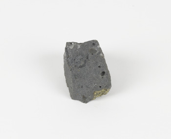
Geological specimen - Basalt (igneous-volcanic) containing Olivine, unknown
... mining had ceased in the area. Soon after gold was discovered in 1851, Victoria’s Governor La Trobe wrote to the Colonial Office in London, urging ‘the propriety of selecting and appointing as Mineral Surveyor for this Colony a gentleman possessed of the requisite qualifications and acquaintance with geological science and phenomena’. Alfred Selwyn was appointed geological surveyor in Australia in 1852 which began the Geological Survey of Victoria. In 1853-69 the Geological Survey issued under Selwyn's direction sixty-one geological maps and numerous reports...mining had ceased in the area. Soon after gold was discovered in 1851, Victoria’s Governor La Trobe wrote to the Colonial Office in London, urging ‘the propriety of selecting and appointing as Mineral Surveyor for this Colony a gentleman possessed of the requisite qualifications and acquaintance with geological science and phenomena’. Alfred Selwyn was appointed geological surveyor in Australia in 1852 which began the Geological Survey of Victoria. In 1853-69 the Geological Survey issued under Selwyn's direction sixty-one geological maps and numerous reports ...This particular geological specimen was found in Mount Franklin or Lalgambook in Djadjawurrung, located between Daylesford and Newstead, approximately ninety minutes drive from Melbourne. The mountain is an example of a breached scoria cone (a steep conical hill of loose pyroclastic fragments) which was created by a volcanic eruption about 470,000 years ago, a date which may indicate the age of this geological specimen. The volcanic eruptions of Mount Franklin were most likely witnessed by members of the Dja Dja Wurrung Aboriginal tribe, who referred to this country as the 'smoking grounds'. Mount Franklin and the surrounding area appears to have been a place of considerable religious significance to Aboriginal people, there is evidence which indicates that frequent large ceremonial gatherings took place in the area. Basalt is the most common rock on Earth’s surface, more than 90% of all volcanic rock on Earth is basalt. Basalt is an aphanitic extrusive igneous rock formed from the rapid cooling of low-viscosity lava exposed at or very near the surface of a rocky planet or moon. Specimens are black in colour and weather to dark green or brown. Basalt is rich in iron and magnesium and is mainly composed of olivine, pyroxene, and plagioclase. Olivine is the name of a group of rock-forming silicate minerals with compositions ranging between Mg2SiO4 and Fe2SiO4. Unlike other minerals, Olivine has a very high crystallisation temperature which makes it the first of the minerals to crystallise from magma. As magma cools, the crystals begin to form and settle on the bottom of the lava and form basalts that are abnormally enriched in olivine in the lower part of lava flows. According to H. M. King (on geology.com) "Olivine is thought to be an important mineral in Earth's mantle. Its presence as a mantle mineral has been inferred by a change in the behaviour of seismic waves as they cross the boundary between Earth's crust and mantle". Lava from Mount Franklin and other volcanoes in the area filled valleys and buried the gold bearing streams that became the renowned ‘deep leads’ of the gold mining era. In 1852, as part of the Victorian gold rush, gold was discovered in the immediate area, this gold was created by lava flows during the Newer Volcanic period, which were mined intensively during the nineteenth century. Around 1865 the presence of a deep lead in Mount Franklin was established. Deep lead mining was initially unsuccessful, and it was not until the late 1870s that the Franklinford Gold Mining Company mined at Mount Franklin on a significant scale. A few years later the Mount Franklin Estate Gold Mining Company also struck gold, followed by the Shakespeare and Great Western companies in the mid-1880s. By the late 1880s, however, deep lead mining had ceased in the area. Soon after gold was discovered in 1851, Victoria’s Governor La Trobe wrote to the Colonial Office in London, urging ‘the propriety of selecting and appointing as Mineral Surveyor for this Colony a gentleman possessed of the requisite qualifications and acquaintance with geological science and phenomena’. Alfred Selwyn was appointed geological surveyor in Australia in 1852 which began the Geological Survey of Victoria. In 1853-69 the Geological Survey issued under Selwyn's direction sixty-one geological maps and numerous reports; they were of such high standard that a writer in the Quarterly Journal of the Geological Society of London bracketed the survey with that of the United States of America as the best in the world. During his years spent in Australia, Selwyn collected numerous significant geological specimens, examples of which are held in collections such as the Burke Museum.This geological specimen is an example of basalt and olivine which shows the volcanic lava activity and geographical specific nature of Mt Franklin as a significant volcanic site. According to Agriculture Victoria 'The crater is one of the deepest in the Central Highlands area. It is a major megacryst site with some of the largest known Victorian examples of megacrysts of augite and an orthoclase. The small parasitic mound of Lady Franklin on the western flanks adds to the geological interest of the site'. This specimen also highlights the locality as a significant place for both indigenous activity and Victorian gold rush era mining practices. This specimen is part of a larger collection of geological and mineral specimens collected from around Australia (and some parts of the world) and donated to the Burke Museum between 1868-1880. A large percentage of these specimens were collected in Victoria as part of the Geological Survey of Victoria that begun in 1852 (in response to the Gold Rush) to study and map the geology of Victoria. Collecting geological specimens was an important part of mapping and understanding the scientific makeup of the earth. Many of these specimens were sent to research and collecting organisations across Australia, including the Burke Museum, to educate and encourage further study.An angular, solid hand-sized piece of grey volcanic Basalt with green/brown Olivine phenocrysts along one flat edge.Olivine in basalt / - label is probably / correct. / C. Willman / 15/4/21burke museum, beechworth, indigo shire, beechworth museum, geological, geological specimen, mineralogy, basalt, igneous rock, igneous-volcanic, volcanic geology, volcanic, olivine, olivine specimen, basaltoid -
 Bendigo Historical Society Inc.
Document - UNDERGROUND SURVEY OF BENDIGO MINES
... History House 11 Mackenzie Street Bendigo goldfields BENDIGO Mining garden gully line of reef mines Jems Stirling, geologist and W.H Cundy Underground Surveyor, Department of Mines Two page document, 'Underground survey of Bendigo, report on Constellation Company's Mine on northern extension of the Garden Gully line of reef. ...Two page document, 'Underground survey of Bendigo, report on Constellation Company's Mine on northern extension of the Garden Gully line of reef. Report on the New Chum Railway Reserve Company and the Shenandoah Company, the New Chum Railway Co being immediately south and the Shenandoah Co immediately north of the railway line. Two maps Constellation Co. Mine shaft and New Chum Railway and Shenandoah auriferous reef below 2700 feet.Jems Stirling, geologist and W.H Cundy Underground Surveyor, Department of Minesbendigo, mining, garden gully line of reef mines -
 Bendigo Historical Society Inc.
Slide - DIGGERS & MINING: DIGGERS & MINING
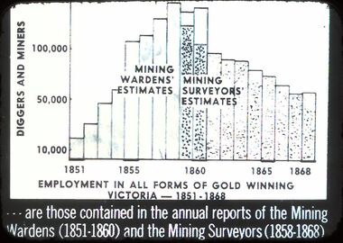
... Mining. Graph depicts employment in all forms of gold winning Victoria (1851-1868) - - - - are these contained in the annual reports of the Mining Wardens (1851-1860 and the Mining Surveyors (1858-1868) Markings: 44/ 994:LIF 1. ...Mining. Graph depicts employment in all forms of gold winning Victoria (1851-1868) - - - - are these contained in the annual reports of the Mining Wardens (1851-1860 and the Mining Surveyors (1858-1868) Markings: 44/ 994:LIF 1. ...Diggers & Mining: Diggers & Mining. Graph depicts employment in all forms of gold winning Victoria (1851-1868) - - - - are these contained in the annual reports of the Mining Wardens (1851-1860 and the Mining Surveyors (1858-1868) Markings: 44/ 994:LIF 1. Used as a teaching aid.hanimounteducation, tertiary, diggers & miners -
 Bendigo Historical Society Inc.
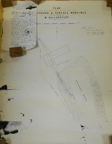
Document - MARKS COLLECTION: PLAN RELATING TO UNDERGROUND AND SURFACE WORKINGS VICTORIA HILL
... Ballerstedt Victoria Hill' Signed by Thomas Forbes, Mining Surveyor, 22nd. April 1868' Attached to plan is a letter report accompanying plans on the underground workings in (illegible) Ballerstedt & Sons, Victoria Hill (ink blot covering writing RH side) Text of letter begins : the underground level southwards from the shaft is 4ft 6' x 6 ft wide as shown on the plan; and is at a depth of (illegible) from the surface; along the (illegible) of which the timbering both upright and cap-pieces; are now in as good condition as when the work was being proceed with; with the exception of the uprights and one cap-piece which are slightly crushed from the general settlement of the mullock. ...Ballerstedt Victoria Hill' Signed by Thomas Forbes, Mining Surveyor, 22nd. April 1868' Attached to plan is a letter report accompanying plans on the underground workings in (illegible) Ballerstedt & Sons, Victoria Hill (ink blot covering writing RH side) Text of letter begins : the underground level southwards from the shaft is 4ft 6' x 6 ft wide as shown on the plan; and is at a depth of (illegible) from the surface; along the (illegible) of which the timbering both upright and cap-pieces; are now in as good condition as when the work was being proceed with; with the exception of the uprights and one cap-piece which are slightly crushed from the general settlement of the mullock. ...Plan on paper: on top of plan 'plan showing the position of the underground & surface workings in the claim of Mr. Ballerstedt Victoria Hill' Signed by Thomas Forbes, Mining Surveyor, 22nd. April 1868' Attached to plan is a letter report accompanying plans on the underground workings in (illegible) Ballerstedt & Sons, Victoria Hill (ink blot covering writing RH side) Text of letter begins : the underground level southwards from the shaft is 4ft 6' x 6 ft wide as shown on the plan; and is at a depth of (illegible) from the surface; along the (illegible) of which the timbering both upright and cap-pieces; are now in as good condition as when the work was being proceed with; with the exception of the uprights and one cap-piece which are slightly crushed from the general settlement of the mullock. The timbering of the drives is still standing in the same position though upwards of 12 months has elapsed after the slip in the open cutting had taken place, showing very clearly in my mind that the slip could not be attributable to the insufficient timbering of the underground workings; but rather to the action of the weather in this particular part of the cutting. The probably quantity of mullock that was detached or slipped from the west side of the cutting; would be (from careful enquiry and observation ) about 1500 loads at least; enough to crush the whole of the timber in the levels, if it had not been of the most substantial character and I think yours to prove that the fall was not caused by any defective timbering but from the cause already stated. I may state that I have inspected the underground workings generally in the mine, and the timbering is of the most substantial characterbendigo, mining, victoria hill -
Ringwood and District Historical Society
Administrative record - Mining Reports, Government Printer, Melbourne, Colony of Victoria quarterly and annual mining reports - 1860s 1870s & 1880s, 1865 - 1883
... Quarterly Colony of Victoria reports of the Mining Surveyors & Registrars, Victoria, 1865-1881 - Summary of gold mining statistics for the quarter - Tables showing the yield of gold from certain parcels of quartz raised during the quarter in some of the deepest mines in Victoria with depth of the deepest shafts, levels, cross-cuts, etc. - Estimated yield of gold and quantity of gold exported during the quarter - Gold received and issued from the Royal Mint during the quarter - Summary of yield of gold from quartz, tailings, etc., crushed during the quarter - Summary of yield of gold from washdirt and cement washed and crushed during quarter - Number and distribution of miners on the goldfields of the colony. 2. 1879-82 Hard bound volume - Chief Inspector of Mines Reports to the Honorable Minister of Mines, Victoria. ...mining reports show any Ringwood mine references under Castlemaine District, St. Andrews Subdivision. Noteworthy for Ringwood: - Death of Pierce Boardman, mining manager at New Ringwood Mining Co., accidentally killed when he lost his footing and fell to a depth of 40 feet on 1st January 1879. - William White injured in truck accident at New Ringwood Antimony Tribute Company, 31st March 1882. antimony boardman william white Boxed collection of soft and hard bound reports including: 1. Quarterly Colony of Victoria reports of the Mining Surveyors ...Colony of Victoria mining reports show any Ringwood mine references under Castlemaine District, St. Andrews Subdivision. Noteworthy for Ringwood: - Death of Pierce Boardman, mining manager at New Ringwood Mining Co., accidentally killed when he lost his footing and fell to a depth of 40 feet on 1st January 1879. - William White injured in truck accident at New Ringwood Antimony Tribute Company, 31st March 1882.Boxed collection of soft and hard bound reports including: 1. Quarterly Colony of Victoria reports of the Mining Surveyors & Registrars, Victoria, 1865-1881 - Summary of gold mining statistics for the quarter - Tables showing the yield of gold from certain parcels of quartz raised during the quarter in some of the deepest mines in Victoria with depth of the deepest shafts, levels, cross-cuts, etc. - Estimated yield of gold and quantity of gold exported during the quarter - Gold received and issued from the Royal Mint during the quarter - Summary of yield of gold from quartz, tailings, etc., crushed during the quarter - Summary of yield of gold from washdirt and cement washed and crushed during quarter - Number and distribution of miners on the goldfields of the colony. 2. 1879-82 Hard bound volume - Chief Inspector of Mines Reports to the Honorable Minister of Mines, Victoria. (Includes fatal and non-fatal accident reports, mining operations, and employment statistcs.) Noteworthy for Ringwood: - Death of Pierce Boardman, mining manager at New Ringwood Mining Co., accidentally killed when he lost his footing and fell to a depth of 40 feet on 1st January 1879. - William White injured in truck accident at New Ringwood Antimony Tribute Company, 31st March 1882. 3. Mineral Statistics for Victoria - annual reports for years 1867, 1871, 1874, 1876, 1877, 1878, & 1879. 4. Handwritten study notes.antimony, boardman, william white -
 Ringwood and District Historical Society
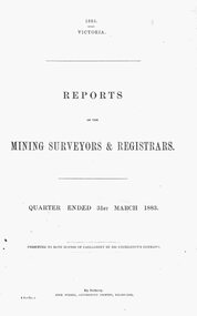
Document, Extract from the Victoria Mining Surveyors & Registrars, Quarter ended 31st March, 1883, including activities of The Ringwood Antimony Tribute Company and The Ringwood Consols Company
... The first document is a copy of the front cover of: "Reports of the Mining Surveyors & Registrars. Quarter ended 31st March 1883." ...Ringwood and District Historical Society 125A Warrandyte Road Ringwood North melbourne The first document is a copy of the front cover of: "Reports of the Mining Surveyors & Registrars. Quarter ended 31st March 1883." ...Printed documents (2)The first document is a copy of the front cover of: "Reports of the Mining Surveyors & Registrars. Quarter ended 31st March 1883." The other document is an extract from the Reports relating to 'The Ringwood Antimony Tribute Company' and other associated mining activities at Ringwood. -
 Federation University Historical Collection
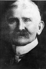
Photograph - Photograph (black & white), Ferdinand Moritz Krause
... mining at the University of Melbourne from June 1895 to January 1897. Whilst at Ballarat in 1887-90 he had completed geological maps and reports on the parishes of Haddon, Carngham, Scarsdale, Lillerie, Smythesdale and Comeralghip; these were published in 1898. The Institute of Surveyors...mining at the University of Melbourne from June 1895 to January 1897. Whilst at Ballarat in 1887-90 he had completed geological maps and reports on the parishes of Haddon, Carngham, Scarsdale, Lillerie, Smythesdale and Comeralghip; these were published in 1898. The Institute of Surveyors ...Civil engineer and geologist Ferdinand Moritz Krause lecturered at the Ballarat School of Mines from 1880 to 1895. He was born at Kassel, Germany on 24 February 1841, the youngest son of Frederich Wilhelm Krause. Ferdinand Krause married Amy Augusta Dimock. He died in South Africa 16 June 1918. In June 1880 Krausé was appointed to the Ballarat School of Mines as lecturer in 'geology, palaeontology, mineralogy, electricity, magnetism, scientific mining, geological and topographical surveying' and as museum curator. In 1881 he was appointed Professor of Geology and in 1892 was elected president of the Staff Association. He was held in high repute by his students and also known as a keen musician. He resigned from the School of Mines to be lecturer in mining at the University of Melbourne from June 1895 to January 1897. Whilst at Ballarat in 1887-90 he had completed geological maps and reports on the parishes of Haddon, Carngham, Scarsdale, Lillerie, Smythesdale and Comeralghip; these were published in 1898. The Institute of Surveyors elected him a member in 1891. His Introduction to the study of Mineralogy for Australian readers was published in Melbourne in 1896. In January 1897 he became manager of the General Gordon mine near Kalgoorlie. In 1900 he contributed an article to the Ballarat School of Mines Students' Magazine on the mining geology of Kalgoorlie. Invited by a former student, George Denny, Krausé left for South Africa in 1901. His last work was a geological map of the Barberton area, Transvaal, published in March 1918. He died on 16 June, survived by his wife, three sons and a daughter. (http://adb.anu.edu.au/biography/krause-ferdinand-moritz-3971, accessed 20 November 2018) Black and White photograph of the head and shoulders of Professor Ferdinand Krause of the Ballarat School of Mines.ballarat school of mines, ferdinand krause, geology, fm krause, krause, ballarat school of mines museum -
Clunes Museum
Document - REPORTS
... Clunes Museum 36 Fraser Street enter building through Collins Place Clunes goldfields E J Dunn described the geology of the mining in an around Clunes and a recommendation for re-commencing mining operations in Clunes 1909 local history document mining NIL .1 PHOTOCOPY OF A PAGE SHOWING RETURNS MADE BY MINING SURVEYORS AND REGISTERS TAKEN FOR THE QUARTER ENDED 31ST MARCH 1875 .2 & .3 PHOTOCOPY OF TWO PAGES OF A GEOLOGICAL SURVEY COMPLETED FOR THE GOVERNMENT (SENT IN 17/5/1909) Document REPORTS E J DUNN ...E J Dunn described the geology of the mining in an around Clunes and a recommendation for re-commencing mining operations in Clunes 1909.1 PHOTOCOPY OF A PAGE SHOWING RETURNS MADE BY MINING SURVEYORS AND REGISTERS TAKEN FOR THE QUARTER ENDED 31ST MARCH 1875 .2 & .3 PHOTOCOPY OF TWO PAGES OF A GEOLOGICAL SURVEY COMPLETED FOR THE GOVERNMENT (SENT IN 17/5/1909)NILlocal history, document, mining -
Stawell Historical Society Inc
Archive, Mining Surveyor’s and Registrar’s Reports - 1872-1878 not complete, 1872 - 1878
... Stawell Historical Society Inc 46 Longfield St Stawell grampians Stawell Mining Mining Surveyor’s and Registrar’s Reports - 1872-1878 not complete Archive ...stawell, mining -
Stawell Historical Society Inc
Archive, Mining Surveyor’s and Registrar’s Reports 1859-1871, 1859 - 1871
... Stawell Historical Society Inc 46 Longfield St Stawell grampians Stawell Mining None for year 1867 Mining Surveyor’s and Registrar’s Reports 1859-1871 Archive ...None for year 1867stawell, mining -
 Tarnagulla History Archive
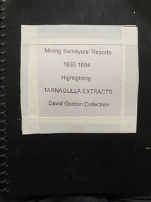
Folio of Extracts of Mining Surveyor's Reports - 1859-1864
... Tarnagulla History Archive Tarnagulla Public Hall 69-71 Commercial Rd Tarnagulla goldfields Folio of Extracts of Mining Surveyor's Reports - 1859-1864. ... -
 Bendigo Historical Society Inc.
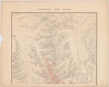
Map - Sandhurst Goldfield 1873, 1873
... mining engineer, and his wife Elizabeth, née Brough. On 14 November 1852 Smyth arrived in Melbourne and went to the gold diggings, where he worked as a carter on the construction of roads at Sawpit Gully. Back in Melbourne, on 7 November 1853 he became a draftsman under the surveyor-general, Andrew Clarke, and soon was acting chief draftsman. Smyth compiled numerous reports...mining engineer, and his wife Elizabeth, née Brough. On 14 November 1852 Smyth arrived in Melbourne and went to the gold diggings, where he worked as a carter on the construction of roads at Sawpit Gully. Back in Melbourne, on 7 November 1853 he became a draftsman under the surveyor-general, Andrew Clarke, and soon was acting chief draftsman. Smyth compiled numerous reports ...Robert Brough Smyth (1830-1889), civil servant and mining engineer, was born on 18 February 1830 near Wallsend, Northumberland, England, son of Edward Smith, mining engineer, and his wife Elizabeth, née Brough. On 14 November 1852 Smyth arrived in Melbourne and went to the gold diggings, where he worked as a carter on the construction of roads at Sawpit Gully. Back in Melbourne, on 7 November 1853 he became a draftsman under the surveyor-general, Andrew Clarke, and soon was acting chief draftsman. Smyth compiled numerous reports and wrote catalogues for exhibitions of minerals and fossils. In November 1869 he superintended the establishment of a museum of economic geology, mineralogy and mining and published in Melbourne The Gold Fields and Mineral Districts of Victoria … Covertly involved in the controversy that led to the disbanding of the Geological Survey in 1869, he became its director on its reinstatement in 1871; he increased its part in the search for and proving of economic mineral and coal deposits. In 1875 he became chief inspector of mines and published the geological reports on John Forrest's Western Australian exploration. On 19 June 1860 Smyth had become honorary secretary to the Board for the Protection of Aborigines and in 1863 became a voting member. Zealous and determined, he assumed the role of chairman, which belonged ex officio to the chief secretary, and wielded great power, including the dubious dismissal of John Green, general inspector of Aborigines in 1861-75 with whom he had earlier collaborated. Smyth's compilation, The Aborigines of Victoria … (1878), arose from his efforts to gather information and artefacts of Victorian Aboriginal cultures at a time when their vestiges were fast disappearing. The work, still valuable though long since superseded, relied heavily upon others such as L. Fison, G. B. Halford, A. Howitt and J. Milligan. Press reports and a petition from officers in the Mining Department accused Smyth of 'tyrannical and overbearing conduct', and in February 1876 a board of inquiry was constituted and heard evidence until April. McCoy defended 'one of the best heads of department he had ever known' but the board found the charges of 'excessive severity … in the main substantiated', and reported that Smyth had been irritable, lacking self-control and over-fastidious, but acknowledged his 'unremitting energy and zealous labours in the public service'. On 4 May Smyth resigned all public offices except his membership of the Aborigines' board. Source: Australian Dictionary of Biography. https://adb.anu.edu.au/biography/smyth-robert-brough-4621Original map printed on paper on canvas; copy of map with original. Title: Sandhurst gold field [cartographic material] / surveyed and compiled under the direction of R. Brough Smyth and Thos. Couchman, Angus Mackay ; additions made to the survey under the same direction by Regd. A.F. Murray, April 1873. "Lithd. by R. Shepherd" Topographic map of Sandhurst gold field, with relief shown by hachures. Shows roads, railways and public buildings. "Note - blocks held under leasing regulations are outlined and numbered in red" Map is also available on State Library Victoria: https://find.slv.vic.gov.au/discovery/fulldisplay?vid=61SLV_INST:SLV&search_scope=slv_local&tab=searchProfile&context=L&docid=alma994975393607636 sandhurst, goldfield, lease holdings, gullies, brough smyth, state library of victoria -
Federation University Historical Collection
Book - Report, Reports of the Mining Surveyors and Registrars, 1867, 30/06/1969 - 31/12/1881
... gold statistics mining survey .1) 39 page report dated 30 September 1867 .2) 40 page report dated 31 December 1871 .3) 46 page report dated 30 June 1872 .4) 42 page report dated 31 December 1873 .5) 45 page report dated 30 September 1872 .6) 44 page report dated 31 December 1881 Reports of the Mining Surveyors and Registrars, 1867 Book Report ....1) 39 page report dated 30 September 1867 .2) 40 page report dated 31 December 1871 .3) 46 page report dated 30 June 1872 .4) 42 page report dated 31 December 1873 .5) 45 page report dated 30 September 1872 .6) 44 page report dated 31 December 1881gold statistics, mining survey