Showing 253 items matching " victoria quartz mine"
-
 Bendigo Historical Society Inc.
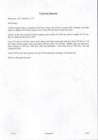
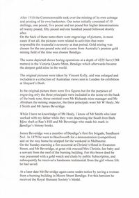
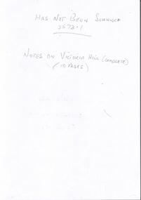
Document - VICTORIA QUARTZ - BRIEF NOTES ON THE VICTORIA QUARTZ MINE
... VICTORIA QUARTZ - BRIEF NOTES ON THE VICTORIA QUARTZ MINE...victoria quartz...Victoria Quartz... Brief Notes on the Victoria Quartz Mine...Handwritten notes on the Victoria Quartz Mine. Notes mention locality, depth, geological information, Dividends, Calls and the Victoria Reef Tribute. ...History House 11 Mackenzie Street Bendigo goldfields DOCUMENT Gold victoria quartz Victoria Quartz Brief Notes on the Victoria Quartz Mine Victoria Reef Quartz Shaft No 127 Vict Reef Q M Coy Mines Dept Bendigo Advertiser Victoria Reef Tribute Handwritten notes on the Victoria Quartz Mine. ...Handwritten notes on the Victoria Quartz Mine. Notes mention locality, depth, geological information, Dividends, Calls and the Victoria Reef Tribute. Document from Albert Richardson Collection of mining history.document, gold, victoria quartz, victoria quartz, brief notes on the victoria quartz mine, victoria reef quartz shaft no 127, vict reef q m coy, mines dept, bendigo advertiser, victoria reef tribute -
 Bendigo Historical Society Inc.
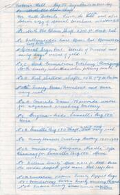
Document - VICTORIA QUARTZ - NOTES ON THE VICTORIA QUARTZ MINE
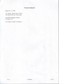
... VICTORIA QUARTZ - NOTES ON THE VICTORIA QUARTZ MINE...victoria quartz...Victoria Quartz... Notes on the Victoria Quartz Mine...Three typed and one handwritten copies of notes on the Victoria Quartz Mine. Notes include Size of Lease, Depth of Shaft, Locality, P;lant, Early History, Leading & Prominent, Best Gold and Gold Yield....Document VICTORIA QUARTZ - NOTES ON THE VICTORIA QUARTZ MINE ...Three typed and one handwritten copies of notes on the Victoria Quartz Mine. Notes include Size of Lease, Depth of Shaft, Locality, P;lant, Early History, Leading & Prominent, Best Gold and Gold Yield.document, gold, victoria quartz, victoria quartz, notes on the victoria quartz mine, goldmines hotel, mr william rae, lansell's 180, mr e j dunn, geological branch of the mines department, new chum railway mine, new chum drainage association, mines dept special edition australian mining standard 1/6/1899, mines dept booklet 'bendigo goldfield' 1936, mines dept annual and quarterly reports, annals of bendigo, a richardson -
 Bendigo Historical Society Inc.
Document - VICTORIA QUARTZ - VICTORIA QUARTZ MINE MISHAP
... VICTORIA QUARTZ - VICTORIA QUARTZ MINE MISHAP...Victoria Quartz... Victoria Quartz Mine Mishap...The article referred to an overwinding incident at the Victoria Quartz Mine. It was a new winding plant. ...Document VICTORIA QUARTZ - VICTORIA QUARTZ MINE MISHAP ...One handwritten and one typed copy of an article in the Bendigo Advertiser dated Wednesday February 3, 1897. The article referred to an overwinding incident at the Victoria Quartz Mine. It was a new winding plant. A lever would not move and with the motion of the engine, which he could not check, the cage was rapidly taken to the popper heads. It was held there by the safety catches and the cable detached. And damaged portion of the rails at the top of the legs and some iron and timber on both the old and new engine houses. It appeared the valve refused to work because the lubrication was found to be empty.document, gold, victoria quartz, victoria quartz mine mishap, bendigo advertiser 3/2/1897, big 180, little 180, roberts & son, mr john ennor, mr masters, mr albert richardson -
 Bendigo Historical Society Inc.
Document - VICTORIA QUARTZ - NOTES ON THE VICTORIA QUARTZ MINE
... VICTORIA QUARTZ - NOTES ON THE VICTORIA QUARTZ MINE...victoria quartz...Victoria Quartz... Notes on the Victoria Quartz Mine...Handwritten notes on the Victoria Quartz Mine. Notes mention length of claim along the reef, amalgamation of claims, depths the gold was found, value of gold, dividends paid and calls, where the gold was found on the reef and the type of stone encountered. ...History House 11 Mackenzie Street Bendigo goldfields DOCUMENT Gold victoria quartz Victoria Quartz Notes on the Victoria Quartz Mine Mr William Rae Mr Lansell 180 Mine Victoria Reef Great Central Victoria New Chum United J H Craig A M S Special Edition Handwritten notes on the Victoria Quartz Mine. ...Handwritten notes on the Victoria Quartz Mine. Notes mention length of claim along the reef, amalgamation of claims, depths the gold was found, value of gold, dividends paid and calls, where the gold was found on the reef and the type of stone encountered. Also mentions the returns of the reef for the years 1896 to 1898, not including pyrites And amount of gold from loads.document, gold, victoria quartz, victoria quartz, notes on the victoria quartz mine, mr william rae, mr lansell, 180 mine, victoria reef, great central victoria, new chum united, j h craig, a m s special edition -
 Bendigo Historical Society Inc.
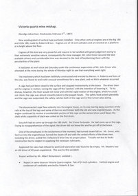
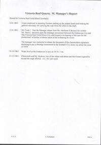
Document - VICTORIA QUARTZ - VICTORIA REEF QUARTZ MINE MANAGER'S REPORT
... VICTORIA QUARTZ - VICTORIA REEF QUARTZ MINE MANAGER'S REPORT...victoria quartz...Victoria Quartz... Victoria Reef Quartz Mine...Two copies of the Victoria Reef Quartz Mine Managers report. The report mentions putting up the poppet heads, drainage assessment, water level and two men offered 50/- per week. ...Document VICTORIA QUARTZ - VICTORIA REEF QUARTZ MINE MANAGER'S REPORT ...Two copies of the Victoria Reef Quartz Mine Managers report. The report mentions putting up the poppet heads, drainage assessment, water level and two men offered 50/- per week. Dates 14/6/1861, 22/6/1861, 18/10/1861 and 13/12/1861.document, gold, victoria quartz, victoria quartz, victoria reef quartz mine manager's report, victoria reef gold mines, gerraws, mr cook, mr sterry, mr mollison, endeavour coy, the victoria reef gold mines coy, ironbark co, endeavour, chenoweth, mr hoskins -
 Bendigo Historical Society Inc.
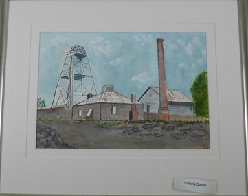
Painting - JOHN HALL COLLECTION: WATER COLOUR VICTORIA QUARTZ MINE
... JOHN HALL COLLECTION: WATER COLOUR VICTORIA QUARTZ MINE...Water colour painting of the Victoria Quartz mine Victoria Hill, framed under glass. ...Painting JOHN HALL COLLECTION: WATER COLOUR VICTORIA QUARTZ MINE ...Water colour painting of the Victoria Quartz mine Victoria Hill, framed under glass. Painted by Mr John Hall.John Hallartwork, water colour, gold mines, john hall -
 Bendigo Historical Society Inc.
Document - VICTORIA QUARTZ - MINE MANAGER'S REPORTS 1886-87 YIELDS
... VICTORIA QUARTZ - MINE MANAGER'S REPORTS 1886-87 YIELDS...victoria quartz...Victoria Quartz... Victoria Quartz Mine...Document VICTORIA QUARTZ - MINE MANAGER'S REPORTS 1886-87 YIELDS ...Typed copy and a handwritten copy of the Victoria Quartz Manager's Reports, 1886-87 Yields. Items mentioned are: depth from the surface, type of stone, crushings and depth of Plat Nos 1 to 13 from the surface.document, gold, victoria quartz, victoria quartz, victoria quartz mine manager's reports 1886-87 yields, samuel renfrey, 180 boundary -
 Bendigo Historical Society Inc.
Document - VICTORIA QUARTZ - FROM THE VICTORIA QUARTZ MINE MANAGER'S REPORT
... VICTORIA QUARTZ - FROM THE VICTORIA QUARTZ MINE MANAGER'S REPORT...victoria quartz...Victoria Quartz... From the Victoria Quartz Mine...Victoria Quartz. Winze below 2,606 ft. 104 tons for 850 ozs 3 dwt. Gold. From Mine Manager's Report. ...Victoria Quartz. 'Leader' at Museum. Document VICTORIA QUARTZ - FROM THE VICTORIA QUARTZ MINE MANAGER'S REPORT ...Handwritten ona piece of paper, from the Bendigo Advertiser 1/1/1900. 'Victoria Quartz. Winze below 2,606 ft. 104 tons for 850 ozs 3 dwt. Gold. From Mine Manager's Report. Per Bgo. Adv. On the back is written: fortitude Club. Any money rec'd. Victoria Quartz. 'Leader' at Museum.document, gold, victoria quartz, victoria quartz, from the victoria quartz mine manager's report, bendigo advertiser 1/1/1900, fortutude club -
 Bendigo Historical Society Inc.
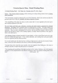
Document - VICTORIA QUARTZ - MODEL WINDING PLANT AT THE VICTORIA QUARTZ MINE
... VICTORIA QUARTZ - MODEL WINDING PLANT AT THE VICTORIA QUARTZ MINE...victoria quartz...Victoria Quartz... Model Winding Plant at the Victoria Quartz Mine...Document VICTORIA QUARTZ - MODEL WINDING PLANT AT THE VICTORIA QUARTZ MINE ...Handwritten copy of an article titled 'A Model Winding Plant' which appeared in the Bendigo Advertiser Thursday June 30, 1910 on Page 5. Article describes the winding plant and mentions the remodelling of the plant supervised by Mr W Abraham. The designing and remodelling of the plant was done by Mr Andrew Harkness.document, gold, victoria quartz, victoria quartz, model winding plant at the victoria quartz mine, bendigo advertiser june 30 1910, the victoria quartz company, mr w abraham, mr andrew harkness -
 Bendigo Historical Society Inc.
Plan - Victoria Quartz Gold Mine
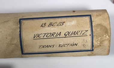
... Victoria Quartz Gold Mine...Victoria Hill Quartz Gold Mine...The Victoria Quartz Gold Mine was situated on Victoria Hill, Ironbark, (1877 - 1913). ...Hand drawn plan of the bottom section of the Victoria Quartz Gold Mine. Mine shaft shown from 2706 feet to 5200 (potential) feet shown, with annotation regarding geological features and gold obtained from different level crushings. ...History House 11 Mackenzie Street Bendigo goldfields The Victoria Quartz Gold Mine was situated on Victoria Hill, Ironbark, (1877 - 1913). ...The Victoria Quartz Gold Mine was situated on Victoria Hill, Ironbark, (1877 - 1913). At the turn of the century, this was the site of one of the premier mines on the Bendigo goldfield. In 1908, it boasted the world's deepest shaft - 4,478 feet (1,365 metres). The shaft reached a depth of 4,613 feet (1,406 metres) in 1910. In 1857 eight small claims in this area had been merged to form the Victoria Reef Quartz Mining Co. Another merger in 1877 led to the formation of the Victoria Quartz Co. For the next three decades, the mine produced consistent profits. In 1910, water burst into the claim, flooding the shaft and halting operations. The company baled water for six months then handed the mine over to the tributers who worked the upper levels for the share of the profits. The mine closed in 1913, having produced over 48,000 ounces of gold and paid dividends of £99,600. (Source, Goldfield Guide https://www.goldfieldsguide.com.au/explore-location/400/victoria-hill-mining-reserve/) Victorian Heritage Register information on mine: Statement of Significance Last updated on - July 14, 2005 The story of quartz mining on Victoria Hill lies at the heart of Bendigo's historical status as the world's richest and deepest reefing field. Gold was discovered on Victoria Hill in 1854, and by early 1855 claims had been taken up over its entire extent. Shafts were first worked by windlass, whip or whim, and primitive crushing batteries were in operation. By 1861, Victoria Hill had yielded at least 1,200,000oz in gold. One of the early claims on Victoria Hill was owned by Prussian immigrants, Christopher Ballerstedt and his son Theodore. In 1854, they bought a claim on the hill for £80, to which they subsequently added other claims, and from the quartz veins (called spurs), worked both by shafts and a large open cut, obtained gold worth nearly £200,000. Christopher Ballerstedt was dubbed 'Father of the Hill' and has been credited as the first to debunk the theory at that time prevalent on the Bendigo field, that the gold content of reefs would diminish at depth. As his shafts plunged below the 200-foot level, the quartz remained rich in gold. His success inspired others, and so led the way to Bendigo's later status as the world's deepest and richest goldfield. The Ballerstedt's built Bendigo's grandest mansion, Fortuna. Theodore continued to work Victoria Hill after his father's death, but in 1871, convinced that his claim was exhausted, he sold both mine and mansion to George Lansell for £60,000. Lansell's mine on Victoria Hill was called the 180, and operated under his ownership until his death in 1906. The mine supplied the initial wealth that made Lansell Bendigo's 'Quartz King'. George Lansell was such a force in Bendigo's mining history that his death was cited as one of the reasons for the decline of Bendigo as a quartz mining centre, The Victoria Hill Quartz Gold Mines are of historical, archaeological and scientific importance to the State of Victoria. The Victoria Hill Quartz Gold Mines are historically significant as the symbolic heart of Bendigo's famous goldfield. The mines are linked to nineteenth-century individuals (Christopher Ballerstedt and George Lansell) who played prominent roles in the evolution of Bendigo. Both men's fortunes and their influence on Bendigo, originated from mining operations carried out on the hill. The Victoria Hill Quartz Gold Mines are historically and scientifically important as characteristic examples of an important form of gold mining. Gold mining sites are of crucial importance for the pivotal role they have played since 1851 in the development of Victoria. As well as being a significant producer of Victoria's nineteenth century wealth, quartz mining, with its intensive reliance on machinery, played an important role in the development of Victorian manufacturing industry. The Victoria Hill Quartz Gold Mines are important as a manifestation of this aspect of gold mining. The Victoria Hill Quartz Gold Mines are scientifically important, as they contain relics span nearly sixty years of mining (1854 to 1913), documenting the richest and most significant years of Bendigo's world-famous quartz mining industry. Enhancing the significance of the place are relics from the Victoria Quartz Company operations, ncluding, at 4,870 feet, the world's deepest nineteenth-century gold mining shaft. As a postscript to the chronology of gold mining is the surviving crushing machinery (formerly part of the Bendigo Crushing Works) which was erected near the foundations of Lansell's 180 mine in 1932, to crush quartz for nearby mines. The place has a potential to yield artefacts and evidence which will be able to provide significant information about the technological history of gold mining. [Source: Victorian Heritage Register] Hermes Number 8506 https://vhd.heritagecouncil.vic.gov.au/index.php/places/8506/download-report Hand drawn plan of the bottom section of the Victoria Quartz Gold Mine. Mine shaft shown from 2706 feet to 5200 (potential) feet shown, with annotation regarding geological features and gold obtained from different level crushings. Blue border sticker on outside of plan: '13 BC 23 Victoria Quartz Trans-Section'. Plan is not dated. The Victoria Quartz plan is part of the Margaret Roberts Collection.victoria hill quartz gold mine, victoria hill -
 Bendigo Historical Society Inc.
Plan - Victoria Quartz Gold Mine, Unknown
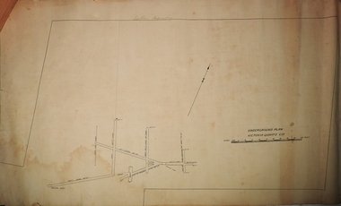
... Victoria Quartz Gold Mine......Victoria Quartz Gold Mine... Victoria Quartz Gold Mine was situated on Victoria Hill, Bendigo. ...Victoria Quartz Gold Mine was situated on Victoria Hill, Bendigo. ...Victoria Quartz Gold Mine was situated on Victoria Hill, Bendigo. Victoria Hill is situated on the Marong Road, opposite the Gold Mines Hotel. Victoria Hill was one of the richest areas on the Bendigo Goldfield. It had many successful mines, including Lansell's '180' and the Victoria Quartz, once the deepest gold mine in the world. At the turn of the century, this was the site of one of the premier mines on the Bendigo goldfield. In 1908, it boasted the world's deepest shaft - 4,478 feet (1,365 metres). The shaft reached a depth of 4,613 feet (1,406 metres) in 1910. In 1857 eight small claims in this area had been merged to form the Victoria Reef Quartz Mining Co. Another merger in 1877 led to the formation of the Victoria Quartz Co. For the next three decades, the mine produced consistent profits. In 1910, water burst into the claim, flooding the shaft and halting operations. The company baled water for six months then handed the mine over to the tributers who worked the upper levels for the share of the profits. The mine closed in 1913, having produced over 48,000 ounces of gold and paid dividends of £99,600.Printed in black text on light tan paper: 'Underground workings, Victoria Quartz Co''. Written on accompanying label: "Victoria Reef, underground plan'. Plan shows shaft, drives and geological features. Plan forms part of the Margaret Roberts Collection.gold mining, gold, bendigo, victoria quartz gold mine, victoria reef -
 Bendigo Historical Society Inc.
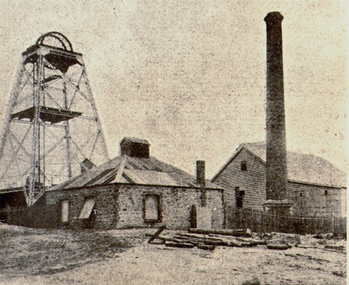
Photograph - VICTORIA QUARTZ MINE, c.1900
... VICTORIA QUARTZ MINE...Inscriptions: 'Victoria Quartz', on front. Photograph VICTORIA QUARTZ MINE ...Black and white photograph. Stone or brick building in foreground. Poppet head to the left. Chimney in front of timber building on right fence. Inscriptions: 'Victoria Quartz', on front.topic, mining -
 Bendigo Historical Society Inc.
Document - VICTORIA HILL - NOTES ON SIGNS FOR VICTORIA HILL
... ... Victoria Quartz Mine...Victoria Hill. Sign posts listed are for: Ballerstedt's First open Cut, Quartz Veins (Spurs), Prospecting Shafts 1929, Engine beds for Lansell's big 180 Mine, 20 Head Crushing Battery Stampers, concrete dam, Victoria Quartz Mine, Foundations of steel poppet legs of the Victoria Quartz Mine, Victoria Quartz Dams, Rae's Open Cut, Site where the quartz was roasted, Anticlinal Arch , coloured rock formations, primitive tunnels, Adit, Engine bed for Great Central Victoria, Prospecting Tunnels, Great Central Victoria (Midway). ...History House 11 Mackenzie Street Bendigo goldfields DOCUMENT Victoria Hill Notes on Signs for Victoria Hill Gold Mines Hotel Ballerstedt's First open Cut Quartz Veins (Spurs) Prospecting Shafts 1929 Engine beds for Lansell's big 180 Mine 20 Head Crushing Battery Stampers concrete dam Victoria Quartz Mine Foundations of steel poppet legs of the Victoria Quartz Mine Victoria Quartz Dams Rae's Open Cut Site where the quartz was roasted Anticlinal Arch coloured rock formations primitive tunnels Adit Engine bed for Great Central Victoria Prospecting Tunnels Great Central Victoria (Midway) A Richardson Three page typed copy of notes for signs on Victoria Hill. ...Three page typed copy of notes for signs on Victoria Hill. Mentions items to be seen at Victoria Hill. Sign posts listed are for: Ballerstedt's First open Cut, Quartz Veins (Spurs), Prospecting Shafts 1929, Engine beds for Lansell's big 180 Mine, 20 Head Crushing Battery Stampers, concrete dam, Victoria Quartz Mine, Foundations of steel poppet legs of the Victoria Quartz Mine, Victoria Quartz Dams, Rae's Open Cut, Site where the quartz was roasted, Anticlinal Arch , coloured rock formations, primitive tunnels, Adit, Engine bed for Great Central Victoria, Prospecting Tunnels, Great Central Victoria (Midway). Notes prepared by Albert Richardson.document, victoria hill, notes on signs for victoria hill, gold mines hotel, ballerstedt's first open cut, quartz veins (spurs), prospecting shafts 1929, engine beds for lansell's big 180 mine, 20 head crushing battery stampers, concrete dam, victoria quartz mine, foundations of steel poppet legs of the victoria quartz mine, victoria quartz dams, rae's open cut, site where the quartz was roasted, anticlinal arch , coloured rock formations, primitive tunnels, adit, engine bed for great central victoria, prospecting tunnels, great central victoria (midway), a richardson -
 Bendigo Historical Society Inc.
Document - LONG GULLY HISTORY GROUP COLLECTION: BANKNOTES AND JAMES BEVERAGE
... ... Victoria Quartz Mine...Victoria Quartz Gold Mine was on Victoria Hill, Ironbark, Bendigo. ...The scene chosen shows boring operations in the Victoria Quartz Mine. The picture was taken by Vincent Kelly of the five figures but for engraving only three were shown. ...History House 11 Mackenzie Street Bendigo goldfields Victoria Quartz Gold Mine was on Victoria Hill, Ironbark, Bendigo. ...Victoria Quartz Gold Mine was on Victoria Hill, Ironbark, Bendigo. The Victoria Hill Quartz Gold Mines are scientifically important, as they contain relics span nearly sixty years of mining (1854 to 1913), documenting the richest and most significant years of Bendigo's world-famous quartz mining industry. Enhancing the significance of the place are relics from the Victoria Quartz Company operations, including, at 4,870 feet, the world's deepest nineteenth-century gold mining shaft. (Heritage Victoria) Geology of Victoria Hill: https://aigjournal.aig.org.au/wp-content/uploads/2019/12/AIG-Victoria-Hill-Mining-Reserve_FinalWeb.pdfTyped copy of what appears to be a speech. Mentioned is that after 1910 the Commonwealth took over the minting it's own money. Gold mining was chosen for the one pound note and a Bendigo scene was chosen. The scene chosen shows boring operations in the Victoria Quartz Mine. The picture was taken by Vincent Kelly of the five figures but for engraving only three were shown. They were Mr W Healy, Mr J Smith and Mr James Beverage. James Beverage was a member of Bendigo's first fire brigade. He went to Beechworth for a demonstration and on the way home stopped at Christie's Hotel in Swanston Street. There was a fire at the hotel and Mr Beverage rescued Mrs Christie, her baby and a servant. At a later date Mr Beverage saved a woman from a burning building in Moore Street in Bendigo. He received the Royal Humane Society's Medal which is now housed at the Bendigo Fire Station in Hargreaves Street. In the City's formative years the area that deposited its rain water into the Long Gully Creek was considered to be in Long Gully and for many years the Victoria Quartz Mine deposited many thousands of gallons of water into the Long Gully Creek. Mr Steve Gibbons unveiled the plaque.bendigo, history, long gully history group, the long gully history group - banknotes and james beverage, victoria quartz mine, vincent kelly, shepard's bush, mr rickards, mr abraham, mr w healy, mr j smith, mr james beverage, south iron bark mine, rae's hill, sandhurst no 1 fire brigade, christie's hotel, mrs christie, royal humane society's medal, bendigo fire station, long gully history group, mr steve gibbons, department of environment water heritage, arts commnmoration of historic events and famous persons -
 Bendigo Historical Society Inc.
Document - ENQUIRY: FREDERICK JOSEPH SMITH, 16th May, 2010
... ...Victoria Quartz Mine...Enquiry (May 2010) re Frederick Joseph Smith, Manager of The Victoria Quartz Mine. Reference to him being on back of the Australian One Pound note 1913-1918. ...History House 11 Mackenzie Street Bendigo goldfields PERSON Individual Fredrick Joseph Smith Victoria Quartz Mine Australian One Pound Note Noel Rieusset Enquiry (May 2010) re Frederick Joseph Smith, Manager of The Victoria Quartz Mine. ...Enquiry (May 2010) re Frederick Joseph Smith, Manager of The Victoria Quartz Mine. Reference to him being on back of the Australian One Pound note 1913-1918. No further correspondence to BHS.Noel Rieussetperson, individual, fredrick joseph smith, victoria quartz mine, australian one pound note -
 Bendigo Historical Society Inc.
Document - CENTRAL NELL GWYNNE MINE - NOTES ON CENTRAL NELL GWYNNE AREA
... Mine... Victoria Hill... Victoria Quartz...Typed notes on the description of the Central Nell Gwynne Mine Area and the Victoria Hill Area. Also mentioned are the Victoria Quartz Mine, Lansell's 'big' 180, Ballerstadt, George Lansell, Adventure and the Cinderalla. ...History House 11 Mackenzie Street Bendigo goldfields MINE Gold central nell gwynne mine Central Nell Gwynne Mine Victoria Hill Victoria Quartz Mine New Chum Line Lansell's 'big' 180 Ballerstadt George Lansell Fortuna A. ...Typed notes on the description of the Central Nell Gwynne Mine Area and the Victoria Hill Area. Also mentioned are the Victoria Quartz Mine, Lansell's 'big' 180, Ballerstadt, George Lansell, Adventure and the Cinderalla. Also recommendations for tourist purposes. (2 pages)mine, gold, central nell gwynne mine, central nell gwynne mine, victoria hill, victoria quartz mine, new chum line, lansell's 'big' 180, ballerstadt, george lansell, fortuna, a. h.q. survey regiment, adventure, rae, wittscheibe & co., luffsman & sons, lazarus mine, latham & watson's mine, great extended hustlers -
 Bendigo Historical Society Inc.
Document - VICTORIA HILL - ABRIDGED SIGNS FOR VICTORIA HILL
... ... Victoria Quartz Mine...Signs mentioned are: Ballerstedt's First Open Cut,20 Head Crushing Battery, Victoria Quartz Mine, Victoria Quartz Foundations of Steel Poppet Legs, Coloured rock formations, Primitive tunnels, Adit, Engine Beds Lansell's Big 180 Mine, Anticlinal Arch, Coloured rock formations marking and patterns. ...Signs mentioned are: Ballerstedt's First Open Cut,20 Head Crushing Battery, Victoria Quartz Mine, Victoria Quartz Foundations of Steel Poppet Legs, Coloured rock formations, Primitive tunnels, Adit, Engine Beds Lansell's Big 180 Mine, Anticlinal Arch, Coloured rock formations marking and patterns. ...Handwritten carbon copy of notes with typed copy of same, for signs on Victoria Hill. Signs mentioned are: Ballerstedt's First Open Cut,20 Head Crushing Battery, Victoria Quartz Mine, Victoria Quartz Foundations of Steel Poppet Legs, Coloured rock formations, Primitive tunnels, Adit, Engine Beds Lansell's Big 180 Mine, Anticlinal Arch, Coloured rock formations marking and patterns. Notes prepared by Albert Richardson.document, gold, victoria hill, victoria hill, abridged signs for victoria hill, ballerstedt's first open cut, 20 head crushing battery, victoria quartz mine, victoria quartz foundations of steel poppet legs, coloured rock formations, primitive tunnels, adit, engine beds lansell's big 180 mine, anticlinal arch, coloured rock formations marking and patterns -
 Bendigo Historical Society Inc.
Photograph - VICTORIA HILL - LOOKING NORTH FROM OLD CHUM HILL TO THE VICTORIA HILL
... Victoria Hill... A Richardson... North Old Chum Mine... Lansell's Rich '180' Mine... Victoria Quartz...In the background is The North Old Chum Mine, behind it is Lansell's Rich '180' Mine and in the distance is Ballerstedt's Rich Open Cut and the Victoria Quartz Mine. Notes prepared by Albert Richardson....History House 11 Mackenzie Street Bendigo goldfields PHOTO Victoria Hill Looking North from Old Chum Hill to the Victoria Hill A Richardson North Old Chum Mine Lansell's Rich '180' Mine Victoria Quartz Mine Gold Mines Hotel Two copies of photocopied photo of an open cut mine which is straddled by Marong Road. ...Two copies of photocopied photo of an open cut mine which is straddled by Marong Road. In the background is The North Old Chum Mine, behind it is Lansell's Rich '180' Mine and in the distance is Ballerstedt's Rich Open Cut and the Victoria Quartz Mine. Notes prepared by Albert Richardson.photo, victoria hill, looking north from old chum hill to the victoria hill, a richardson, north old chum mine, lansell's rich '180' mine, victoria quartz mine, gold mines hotel -
 Bendigo Historical Society Inc.
Document - RAE'S CRUSHING BATTERY - THE RICH VICTORIA HILL
... ... Victoria Quartz Mine...Eleven pages including four pages of photocopied photos, They are:- Wm Rae's Crushing Works, The Victoria Quartz Mine, Looking North from Old Chum Hill to the Victoria Hill early 1870's, Victoria Hill from Rae's Open Cut. ...History House 11 Mackenzie Street Bendigo goldfields DOCUMENT Gold rae's crushing battery Rae's Crushing Battery Wm Rae's Crushing Works Victoria Quartz Mine View from Old Chum Hill to the Victoria Hill Victoria Hill from Rae's Open Cut Ballerstedt Lansell's Bit 180 Dickers Mining Record 23/11/1861 J N Macartney Bendigo Goldfields Registry 1871 New Chum Syncline Cleopatra Needle type chimney Victoria Quartz Coy Annals of Bendigo Australian Mining Standard Special Edition 1/6/1899 Bendigo Advertiser Bendigo & Vicinity 1895 H Harkness & Sons New Chum Drainage Scheme Eureka Extd New Chum Railway Pearl Inrush of water at Victoria Quartz Mine Floyd's small 5 head Crushing Battery Great Central Victoria (Midway) Midway Midway No 2 Midway North Ballerstedt's Small 24 Yard Claim The Humboldt Wittscheibe The Adventure Bendigo Mines Ltd Luffsman & Sterry's Claim Round Shaft Chinese Joss House Fortuna Eleven pages including four pages of photocopied photos, They are:- Wm Rae's Crushing Works, The Victoria Quartz Mine, Looking North from Old Chum Hill to the Victoria Hill early 1870's, Victoria Hill from Rae's Open Cut. ...Eleven pages including four pages of photocopied photos, They are:- Wm Rae's Crushing Works, The Victoria Quartz Mine, Looking North from Old Chum Hill to the Victoria Hill early 1870's, Victoria Hill from Rae's Open Cut. Notes begin at page 4, there are two page 6 and no page 7, otherwise same notes as 3573.1. Small note with 'Notes on Victoria Hill - incomplete. Notes prepared by Albert Richardson.document, gold, rae's crushing battery, rae's crushing battery, wm rae's crushing works, victoria quartz mine, view from old chum hill to the victoria hill, victoria hill from rae's open cut, ballerstedt, lansell's bit 180, dickers mining record 23/11/1861, j n macartney bendigo goldfields registry 1871, new chum syncline, cleopatra needle type chimney, victoria quartz coy, annals of bendigo, australian mining standard special edition 1/6/1899, bendigo advertiser, bendigo & vicinity 1895, h harkness & sons, new chum drainage scheme, eureka extd, new chum railway, pearl, inrush of water at victoria quartz mine, floyd's small 5 head crushing battery, great central victoria (midway), midway, midway no 2, midway north, ballerstedt's small 24 yard claim, the humboldt, wittscheibe, the adventure, bendigo mines ltd, luffsman & sterry's claim, round shaft, chinese joss house, fortuna -
 Bendigo Historical Society Inc.
Document - VICTORIA HILL - NOTES ON VICTORIA HILL (SIGNS)
... ... Victoria Quartz Mine...Signs indicate the feature and a description including Prospecting Shafts, dams, engine beds, Lansell's Big 180 Shaft, stampers, Victoria Quartz Mine, Victoria Quartz Dams, Rae's Open Cut, Anticlinal Arch, small primitive tunnels, Engine-bed for Great Central Victoria known as 'Midway' mine, prospecting tunnels, floyd's small 5 Head Crushing Battery, Ballerstedt's Small 24 Yard Claim, The Humboldt 1856 to 1861, Luffsman and Sterry's Claim, and A Round Shaft....History House 11 Mackenzie Street Bendigo goldfields DOCUMENT Memo victoria hill Victoria Hill Notes on Victoria Hill (Signs) Lansell's Big 180 Ballerstedt Senior George Lansell Victoria Quartz Mine Victoria Reef Quartz Coy Wm Rae A Roberts & Sons Mr E J Dunn New Chum Drainage Scheme Eureka Extended New Chum Railway Pearl Bendigo Advertiser Inrush of Water at the Victoria Quartz Victoria Consols Shamrock Shenandoah Victoria Quartz Dams Rae's Open Cut. ...Twelve handwritten copied pages (a & b) of notes with typed copy of same, regarding the signs for Victoria Hill. Signs indicate the feature and a description including Prospecting Shafts, dams, engine beds, Lansell's Big 180 Shaft, stampers, Victoria Quartz Mine, Victoria Quartz Dams, Rae's Open Cut, Anticlinal Arch, small primitive tunnels, Engine-bed for Great Central Victoria known as 'Midway' mine, prospecting tunnels, floyd's small 5 Head Crushing Battery, Ballerstedt's Small 24 Yard Claim, The Humboldt 1856 to 1861, Luffsman and Sterry's Claim, and A Round Shaft.document, memo, victoria hill, victoria hill, notes on victoria hill (signs), lansell's big 180, ballerstedt senior, george lansell, victoria quartz mine, victoria reef quartz coy, wm rae, a roberts & sons, mr e j dunn, new chum drainage scheme, eureka extended, new chum railway, pearl, bendigo advertiser, inrush of water at the victoria quartz, victoria consols, shamrock, shenandoah, victoria quartz dams, rae's open cut. prospecting tunnel, floyd's small 5 head crushing battery, great central victoria (midway), midway no 2, midway north, ballerstedt's small 24 yard claim, the humboldt, wittscheibe, the adventure, advance, george lansell, luffsman & sterry's claim, david sterry, gold mines hotel, city of sandhurst, lansell's fortuna, a richardson -
 Bendigo Historical Society Inc.
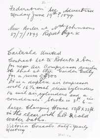
Document - CARLISLE UNITED MINE
... ... Victoria Quartz Mine...1899, New Boiler at Nth Johnsons 27/7/1899, report page 4 and referring to Bendigonian Dec 28th 1899, report on dividends from Victoria Quartz Mine....1899 Boiler Nth Johnsons Victoria Quartz Mine Bendigonian Dec 28th 1899 Hand written notes about contract let to Roberts & Son for a new air compressor, dividends, Changing House and Half-Yearly meeting. ...Hand written notes about contract let to Roberts & Son for a new air compressor, dividends, Changing House and Half-Yearly meeting. Also notes referring to Federation, see Advertiser Monday June 19th? 1899, New Boiler at Nth Johnsons 27/7/1899, report page 4 and referring to Bendigonian Dec 28th 1899, report on dividends from Victoria Quartz Mine.place, mining site, carlisle united mine, carlisle united, roberts & son, air compressor, changing house, federation, advertiser monday june 19th? 1899, boiler, nth johnsons, victoria quartz mine, bendigonian dec 28th 1899 -
 Bendigo Historical Society Inc.
Document - VICTORIA HILL - THE RICH VICTORIA HILL AND ITS HISTORICAL ASSOCIATIONS
... ... Victoria Quartz Mine...Copies of photos include: Victoria Hill from Rae's Open Cut, Looking North from Old Chum Hill to the Victoria Hill, the Victoria Quartz Mine and Wm. Rae's Crushing Works....Copies of photos include: Victoria Hill from Rae's Open Cut, Looking North from Old Chum Hill to the Victoria Hill, the Victoria Quartz Mine and Wm. Rae's Crushing Works. ...Copy and a photocopy of notes titled 'The rich Victoria Hill and its Historical Associations. The photocopy does not have copies of the photos. Notes include Introduction, directions for getting to Victoria Hill, North Old Chum Mine 2310 ft deep, Ballerstedt's First Open Cut, Geographical Features, Lansell's Big 180, Crushing Battery, Lansell's Cleopatra Needle type chimney, Victoria Quartz Mine 4613 ft deep, Victoria Reef Quartz Company, Victoria Quartz Company, Victoria Quartz Dams, Rae's Open Cut, Quartz Roasting, Floyd's small 5 Head Crushing Battery, Great Central Victoria (Midway) Shaft, Ballerstedt's Small 24 yard Claim, The Humboldt, The Adventure, The Advance and Luffsman and Sterry's Claim. Copies of photos include: Victoria Hill from Rae's Open Cut, Looking North from Old Chum Hill to the Victoria Hill, the Victoria Quartz Mine and Wm. Rae's Crushing Works.document, gold, victoria hill, the rich victoria hill and its historical associations, j n macartney, quartz miners' arms hotel, ironbark methodist church, john brown knitwear factory, little 180, george lansell, conrad heinz, british and american hotel, victoria reef gold mining company, manchester arms hotel, housing commission homes, the ironbark, hercules and energetic, midway, wittscheibe, great central victoria, wm rae, mr & mrs conroy, moorhead's shop, central nell gwynne, gold mines hotel, david chaplin sterry, new chum & victoria, old chum, burrowes & sterry, rotary club of bendigo south, big 180, north old chum mine, ballerstedt's first open-cut, lansell's bit 180 shaft, victoria quartz mine, victoria reef quartz company, a roberts & sons, mr e j dunn, h harkness & sons, new chum drainage scheme, eureka extended, new chum railway, the pearl, inrush of water, shamrock, shenandoah, victoria quartz dams, rae's open cut, floyd's small 5 head crushing battery, great central victoria (midway) shaft, midway no 2, midway north, the humboldt, the adventure, the advance, luffsman & sterry's claim, chinese joss house, fortuna, p m g repeater station, bendigo and vicinity 1895, j n macartney 1st edition 1871, mr rae anderson, 'gill family, annals of bendigo obituary notices 1904, mining records and australian mining standard special edition 1/6/1899, bendigo advertiser 22/6/1871, b m l records mines department, patterson's goldfields of victoria, dickers mining record 23/11/1861, annals of bendigo, bendigo advertiser 24/7/1933, 27/8/1908, 30/6/1910, 16/6/1910, 17/6/1910, mining reports for 1910, australian mining standard special edition 1/6/1899 p40, bendigo mines ltd, mines department records, the bendigo goldfield 1851 to 1954, the victoria hill 1854 to 1949, wm rae's crushing works -
 Bendigo Historical Society Inc.
Document - VICTORIA HILL - THE RICH VICTORIA HILL AND IT'S HISTORICAL ASSOCIATION
... ... Victoria Quartz Mine...Victoria Hill and Its Historical Association' Signed by A Richardson and dated 30 - 8 - 1971. and a typed copy of same. Notes include: Introduction, Hotels, Mines, Mining History and descriptions of features where the signposts are. Mines mentioned in the text are: North Old Chum. Ballerstedt's first open cut, Lansell's Big 180. 20 head stamper, Lansell's Cleopatra Needle, Victoria Quartz...Ballerstedt's first open cut, Lansell's Big 180. 20 head stamper, Lansell's Cleopatra Needle, Victoria Quartz Mine. Cleopatra's Needle was a square sectioned brick chimney with this four sided pyramidal chimney top with four vents to allow the smoke to escape whatever the direction of the wind. ...Two copies of document : nineteen handwritten pages of notes on 'The Rich Victoria Hill and Its Historical Association' Signed by A Richardson and dated 30 - 8 - 1971. and a typed copy of same. Notes include: Introduction, Hotels, Mines, Mining History and descriptions of features where the signposts are. Mines mentioned in the text are: North Old Chum. Ballerstedt's first open cut, Lansell's Big 180. 20 head stamper, Lansell's Cleopatra Needle, Victoria Quartz Mine. Cleopatra's Needle was a square sectioned brick chimney with this four sided pyramidal chimney top with four vents to allow the smoke to escape whatever the direction of the wind. It was demolished in the 1950's as it had a bend in it and it was considered unsafe. Lansell had two other mines with similar chimneys, the '222' in Chum Street and his 'Sandhurst' or 'Needle' mine near the Bendigo, Eaglehawk boundary. Notes prepared by Albert Richardson.mine, gold, victoria hill, victoria hill, the rich victoria hill and it's historical association, j. n. macartney, quartz miner's arms hotel, ironbark methodist church, greek orthodox church, john brown knitwear factory, little 180 mine, geo lansell, conrad heinz, british & american hotel, victoria reef gold mining coy, manchester arms hotel, housing commission homes, ironbark (victoria reef gold mines, hercules and energetic, midway, wittscheibe, gt central victoria, wm rae, mr & mrs conroy, wm rae jr, central nell gwynne, moorhead's shop, gill family, gold mines hotel, david chaplin sterry, pioneer, new chum and victoria, burrowes and sterry, new chum and victoria tribute, rotary club of bendigo south, big 180, victoria quartz mines, jeweller's shop, bendigo and district tourist association, north old chum mine, john wybrandt, ballerstedt's first open-cut, j c t christopher ballerstedt, ballerstedt's mine, bendigo cemetry, lansell's 'cleopatra nedle' type chimney, 222 mine, sandhurst or 'needle' mine, victoria quartz mine, victoria reef quartz company, mr e j dunn, eureka ext'd, new chum railway, pearl, bendigo advertiser 16 june 1910, victoria consols, shamrock, shenandoah, victoria quartz dams, rae's open cut, prospecting tunnels, floyd's small 5 head crushing battery, gt central victoria (midway) shaft, midway no 2, midway north, ballerstedt's small 24 yard claim, the humboldt, the tribute coy, advance, luffsman and sterry's claim, a round shaft, chinese joss house, lansell's fortuna, p m g repeater station, a richardson -
 Bendigo Historical Society Inc.
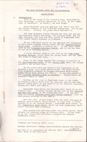
Document - DRAINAGE PROBLEMS - NEW CHUM MINES THE DRAINAGE QUESTION
... ... Victoria Quartz Mine...Owing to the breaking of the steel wire rope at the victoria Quartz mine, the trouble was intensified. ...Owing to the breaking of the steel wire rope at the victoria Quartz mine, the trouble was intensified. ...Handwritten extract from the Bendigo Advertiser Jan 2nd 1911. ''In absence of Mr McBride, Minister for Mines in the country, officers of the Mines Department were inclined to-day to say much about unwatering the deep Bendigo mines, which is again a pressing problem. Owing to the breaking of the steel wire rope at the victoria Quartz mine, the trouble was intensified. An arrangement had been made by which the companies affected along the line should contribute, but two of the companies, it is stated, suspended operations. A scheme has been placed by Mr Stanfield before the parties interested, and the officers of the Mines Department expressed the hope that for the sake of the future of deep mining, some arrangement should be come to. Unless the companies show a disposition to help themselves substantially, the officers do not think it likely that the Government will co-operate. There are, it was added certain provisions of the Mines Act, and covenants in leases can be enforced, but there is no desire to compel the companies which have carried on in the face of great difficulties, to do anything reasonable.'' Albert Richardson Mining History Collectiongold, drainage problems, drainage problems, new chum mines the drainage question, bendigo advertiser 2/1/1911, mr mcbride, mines department, victoria quartz mine, mr stanfield, mines act, albert richardson. -
 Bendigo Historical Society Inc.
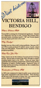
Pamphlet - Victoria Hill, Bendigo Touris Brochure, Early 2000s
... ...victoria quartz mine...It is situated on a fabulously rich line of reef, Victoria Hill boasted many successful mines, including Lansell's '180' and 'Victoria Quartz' once the deepest mine in the world....It is situated on a fabulously rich line of reef, Victoria Hill boasted many successful mines, including Lansell's '180' and 'Victoria Quartz' once the deepest mine in the world. bendigo fortuna victoria hill lansell's 180 victoria quartz mine Victoria Hill, Bendigo Touris Brochure This item contains the following document: 11217.58a Brochure, describes "What is Victoria Hill, "Why Bendigo, What you can see" and the "Conservation of the hill". ...Victoria Hill is a mining site of international significance. It is situated on a fabulously rich line of reef, Victoria Hill boasted many successful mines, including Lansell's '180' and 'Victoria Quartz' once the deepest mine in the world.Victoria Hill, Bendigo Touris Brochure This item contains the following document: 11217.58a Brochure, describes "What is Victoria Hill, "Why Bendigo, What you can see" and the "Conservation of the hill". On the rear is a map and opening hours. Produced by the City of Greater Bendigo and the Department of Natural Resources and Environment 11217.58b Rear of brochure with mapnon-fictionbendigo, fortuna, victoria hill, lansell's 180, victoria quartz mine -
 Bendigo Historical Society Inc.
Document - RAE'S CRUSHING BATTERY - THE RICH VICTORIA HILL & ITS HISTORICAL ASSOCIATIONS
... ... Victoria Quartz Mine...Mentioned are:- North Old Chum Mine, Ballerstedt's First Open-cut, Quartz Veins (Spurs), rock formations pitching North, Prospecting shafts 1929, Concrete dam, Engine beds of Lansells Big 180 Mine, Lansells Big 180 Shaft, twenty stampers crushing battery, Lansell's Cleopatra Needle type chimney, Victoria Quartz Mine, Victoria Quartz dams, Rae's Open-cut, Quartz once roasted here to an intense heat, Anticlinal Arch New Chum Line, small primitive tunnels, Prospecting tunnels, Floyd's small 5 head crushing battery, Great Central Victoria (Midway) Shaft, Great Central Victoria engine-bed, Ballerstedt's small 24 yard claim, The Humboldt, Adventure ground, The Advance, Luffsman & Sterry's Claim, A round shaft. ...History House 11 Mackenzie Street Bendigo goldfields DOCUMENT Gold rae's crushing battery Rae's Crushing Battery Rae's Crushing Works Victoria Quartz Mine from Old Chum Hill Victoria Hill from Rae's Open Cut Ironbark Hercules & Energetic Midway Wittscheibe Great Central Victoria Mr & Mrs Conroy Central Nell Gwynne Gold Mines Hotel John Brown Knitwear Factory New Chum & Victoria Rotary Club of Bendigo South North Old Chum Ballerstedt's First Open-Cut Lansell's Big 180 Shaft Cleopatra Needle type chimney A Roberts & Sons Mr E J Dunn H Harkness & Sons Eureka Extd New Chum Railway Pearl Inrush of water at Victoria Quartz Floyd's small 5 head crushing battery Great Central Victoria (Midway) Ballertedt's Small 24 Yard Claim Humboldt Humboldt Great Central Victoria Victoria Hill Bendigo & Vicinity 1895 p51 J N Macartney 1st Edition 1871 Bendigo Goldfield Registry 1871 Plan of New Chum Line Mr Rae Anderson Annals of Bendigo Obituary 1904 Bendigo Advertiser B M L Records Mines Dept Patterson's Goldfields of Victoria Dickers Mining Record 23/11/1861 Australian Mining Standard Special Edition 1/6/1899 p40 Bendigo Mines Ltd Chinese Joss House Fortuna The Victoria Goldfield 1851 to 1954 The Victoria Hill 1854 to 1949 The first five pages are photocopies of photos:- 2 of Rae's Crushing Works; Victoria Quartz on Victoria Hill, Ironbark; Looking North from Old Chum Hill to the Victoria Hill; Victoria Hill - from Rae's Open Cut. ...The first five pages are photocopies of photos:- 2 of Rae's Crushing Works; Victoria Quartz on Victoria Hill, Ironbark; Looking North from Old Chum Hill to the Victoria Hill; Victoria Hill - from Rae's Open Cut. Introduction covers location of buildings and mines. Mentioned are:- North Old Chum Mine, Ballerstedt's First Open-cut, Quartz Veins (Spurs), rock formations pitching North, Prospecting shafts 1929, Concrete dam, Engine beds of Lansells Big 180 Mine, Lansells Big 180 Shaft, twenty stampers crushing battery, Lansell's Cleopatra Needle type chimney, Victoria Quartz Mine, Victoria Quartz dams, Rae's Open-cut, Quartz once roasted here to an intense heat, Anticlinal Arch New Chum Line, small primitive tunnels, Prospecting tunnels, Floyd's small 5 head crushing battery, Great Central Victoria (Midway) Shaft, Great Central Victoria engine-bed, Ballerstedt's small 24 yard claim, The Humboldt, Adventure ground, The Advance, Luffsman & Sterry's Claim, A round shaft. Small piece of paper with 'Notes on Victoria Hill complete. Notes prepared by Albert Richardson.document, gold, rae's crushing battery, rae's crushing battery, rae's crushing works, victoria quartz mine, from old chum hill, victoria hill from rae's open cut, ironbark, hercules & energetic, midway, wittscheibe, great central victoria, mr & mrs conroy, central nell gwynne, gold mines hotel, john brown knitwear factory, new chum & victoria, rotary club of bendigo south, north old chum, ballerstedt's first open-cut, lansell's big 180 shaft, cleopatra needle type chimney, a roberts & sons, mr e j dunn, h harkness & sons, eureka extd, new chum railway, pearl, inrush of water at victoria quartz, floyd's small 5 head crushing battery, great central victoria (midway), ballertedt's small 24 yard claim, humboldt, humboldt, great central victoria, victoria hill, bendigo & vicinity 1895 p51, j n macartney 1st edition 1871, bendigo goldfield registry 1871, plan of new chum line, mr rae anderson, annals of bendigo obituary 1904, bendigo advertiser, b m l records mines dept, patterson's goldfields of victoria, dickers mining record 23/11/1861, australian mining standard special edition 1/6/1899 p40, bendigo mines ltd, chinese joss house, fortuna, the victoria goldfield 1851 to 1954, the victoria hill 1854 to 1949 -
 Bendigo Historical Society Inc.
Document - VICTORIA HILL - KEY TO SIGN POSTS ON AREA MAP
... MINE...Gold...victoria hill...Victoria Hill... Victoria Hill Key to Sign Posts on Area Map... North Old Chum Shaft... Ballerstedt's First Open Cut... Lansell's Big 180 Shaft... 'Cleopatra Needle' type Chimney... Victoria Quartz...Victoria Hill. No 1 North Old Chum Shaft, No 2 Ballerstedt's First Open - Cut. Special Sign Post, No 2 C Rock Formations Pitching North, No 2 B Rich shallow shafts, No 2 A Quartz veins, No 4 A Concrete Dams, No 3 Engine Beds - Lansell's 'Big 180' Mine, No 3 B Lansell's 'Big 180' Shaft, No 4 Twenty Stampers Crushing Battery, No 3 C Foundations - 'Cleopatra Needle' type Chimney for Lansell's 'big 180' Mine, No 5 Victoria Quartz Mine, No 5 A Fou;ndations Victoria Quartz Poppet Legs, No 5 C Foundations Victoria Quartz Winding Plant, No 5 B Victoria Quartz Dams, No 6 Rae's Open - Cut, No 9 Quartz Once Roasted Here, No 12 Anticlinal Arch, No 15 primitive Tunnels, No 14 Beautifully Coloured Rock Formations, No 16 Adit, Graded Bedding, Oblique Fault, Spurry Quartz Veins, No 17 Prospecting Tunnels, No 18 Floyd's Small Crushing Battery, No 19 Gt Central Victoria (Midway) Shaft, No 20 Great Central Victoria (Midway) Engine Bed, No 21 ballerstedt's Small 24 Yard Claim, No 22 Humboldt Shaft, No 23 Wittscheibe's 'Jeweller's Shop', No 24 The 'Adventure' ground, Large Open - Cut, No 26 Luffsman and Sterry's Ground, NO 27 A Round Shaft, Notes prepared by Albert Richardson....History House 11 Mackenzie Street Bendigo goldfields MINE Gold victoria hill Victoria Hill Victoria Hill Key to Sign Posts on Area Map North Old Chum Shaft Ballerstedt's First Open Cut Lansell's Big 180 Shaft 'Cleopatra Needle' type Chimney Victoria Quartz Mine Rae's Open Cut Prospecting Tunnels Floyd's Small Crushing Battery Gt Central Victoria (Midway) Shaft Ballerstedt's Small 245 Yard Claim Humboldt Shaft Wittscheibe's 'Jeweller's Shop' Adventure Luffsman and Sterry's Ground David Sterry Sterry's 'Gold Mines' Hotel Round Shaft Three page hand written carbon copy of Sign numbers at Victoria Hill. ...Three page hand written carbon copy of Sign numbers at Victoria Hill. No 1 North Old Chum Shaft, No 2 Ballerstedt's First Open - Cut. Special Sign Post, No 2 C Rock Formations Pitching North, No 2 B Rich shallow shafts, No 2 A Quartz veins, No 4 A Concrete Dams, No 3 Engine Beds - Lansell's 'Big 180' Mine, No 3 B Lansell's 'Big 180' Shaft, No 4 Twenty Stampers Crushing Battery, No 3 C Foundations - 'Cleopatra Needle' type Chimney for Lansell's 'big 180' Mine, No 5 Victoria Quartz Mine, No 5 A Fou;ndations Victoria Quartz Poppet Legs, No 5 C Foundations Victoria Quartz Winding Plant, No 5 B Victoria Quartz Dams, No 6 Rae's Open - Cut, No 9 Quartz Once Roasted Here, No 12 Anticlinal Arch, No 15 primitive Tunnels, No 14 Beautifully Coloured Rock Formations, No 16 Adit, Graded Bedding, Oblique Fault, Spurry Quartz Veins, No 17 Prospecting Tunnels, No 18 Floyd's Small Crushing Battery, No 19 Gt Central Victoria (Midway) Shaft, No 20 Great Central Victoria (Midway) Engine Bed, No 21 ballerstedt's Small 24 Yard Claim, No 22 Humboldt Shaft, No 23 Wittscheibe's 'Jeweller's Shop', No 24 The 'Adventure' ground, Large Open - Cut, No 26 Luffsman and Sterry's Ground, NO 27 A Round Shaft, Notes prepared by Albert Richardson.mine, gold, victoria hill, victoria hill, victoria hill key to sign posts on area map, north old chum shaft, ballerstedt's first open cut, lansell's big 180 shaft, 'cleopatra needle' type chimney, victoria quartz mine, rae's open cut, prospecting tunnels, floyd's small crushing battery, gt central victoria (midway) shaft, ballerstedt's small 245 yard claim, humboldt shaft, wittscheibe's 'jeweller's shop', adventure, luffsman and sterry's ground, david sterry, sterry's 'gold mines' hotel, round shaft -
 Bendigo Historical Society Inc.
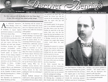
Newspaper - LONG GULLY HISTORY GROUP COLLECTION: THE MINE FLOODING CRISIS - BENDIGO'S DEPUTATION TO THE MINES MINISTER MCBRIDE
... ... Victoria Quartz Mine...Mines Minister McBride by James Lerk. The participants in the deputation were S H McGowan, J H Craig, G A Petrie, J G Stanfield, George Lansell Junior, H E Rowe, A Capper Moore, I E Dyason, S L Stirling, Senator McColl, J Sternberg, T Hicks and T Glass. It was hoped the Government would provide a pound for pound subsidy for the unwatering of the Victoria Quartz...It was hoped the Government would provide a pound for pound subsidy for the unwatering of the Victoria Quartz. Of the 11 mines, 5 were willing to contribute. ...Copy of an article from the Bendigo Weekly 25/6/2000 titled The Mine Flooding Crisis - Bendigo's Deputation to Mines Minister McBride by James Lerk. The participants in the deputation were S H McGowan, J H Craig, G A Petrie, J G Stanfield, George Lansell Junior, H E Rowe, A Capper Moore, I E Dyason, S L Stirling, Senator McColl, J Sternberg, T Hicks and T Glass. It was hoped the Government would provide a pound for pound subsidy for the unwatering of the Victoria Quartz. Of the 11 mines, 5 were willing to contribute. The Minister thought dams would be ineffective. There is an accompanying photo of Minister Peter McBride.bendigo, history, long gully history group, the long gully history group - the mine flooding crisis - bendigo's deputation to mines minister mcbride, bendigo weekly 25/6/2000, james lerk, hon p mcbride, victoria quartz mine, s h mcgowan, bendigo mine owners association, j h craig, g a petrie, j g stanfield, george lansell junior, h e rowe, chamber of mines, a capper moore, i e dyason, d l stirling, senator mccoll, j sternberg, t hicks, t glass, new chum, lazarus, 180 mine, new chum consolidated, new chum railway mine, mr merrin, peter mcbride -
 Bendigo Historical Society Inc.
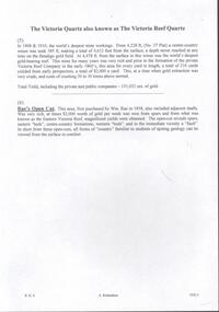
Document - VICTORIA QUARTZ - NOTES ON THE VICTORIA QUARTZ & RAE'S OPEN CUT
... Handwritten page and carbon copy of notes on the Victoria Quartz Mine and Rae's Open Cut....History House 11 Mackenzie Street Bendigo goldfields DOCUMENT Gold victoria quartz Victoria Quartz Notes on the Victoria Quartz & Rae's Open Cut Victoria Reef Company Wm Rae Eastern Victoria Reef Handwritten page and carbon copy of notes on the Victoria Quartz Mine and Rae's Open Cut. ...Handwritten page and carbon copy of notes on the Victoria Quartz Mine and Rae's Open Cut.document, gold, victoria quartz, victoria quartz, notes on the victoria quartz & rae's open cut, victoria reef company, wm rae, eastern victoria reef -
 Bendigo Historical Society Inc.
Document - BENDIGO ADVERTISER - NOTES ON VICTORIA QUARTZ
... victoria quartz...Victoria Quartz... Notes on Victoria Quartz... Victoria Quartz Mine...History House 11 Mackenzie Street Bendigo goldfields DOCUMENT Gold victoria quartz Victoria Quartz Notes on Victoria Quartz Victoria Quartz Mine Explosion Bendigo Advertiser 11/7/1905 Lansell's 180 Tribute Bendigo Advertiser Mining Intelligence 3/8/1908 Crushings - Bendigo Advertiser17/8/1908 Ventilation at the Victoria Quartz - Bendigo Advertiser 17/9/1908 Victoria Quartz - A Reef at 4504 feet - Bendigo Advertiser Mining Intelligence 29/8/1908 One typed and one handwritten copy of articles from the Bendigo Advertiser. ...One typed and one handwritten copy of articles from the Bendigo Advertiser. Items mentioned are a man killed in an explosion at the mine, yields of gold at various depths, ventilation at the mine and a new discovery.document, gold, victoria quartz, victoria quartz, notes on victoria quartz, victoria quartz mine explosion, bendigo advertiser 11/7/1905, lansell's 180 tribute, bendigo advertiser mining intelligence 3/8/1908, crushings - bendigo advertiser17/8/1908, ventilation at the victoria quartz - bendigo advertiser 17/9/1908, victoria quartz - a reef at 4504 feet - bendigo advertiser mining intelligence 29/8/1908