Showing 78 items matching "admiralty charts"
-
 Flagstaff Hill Maritime Museum and Village
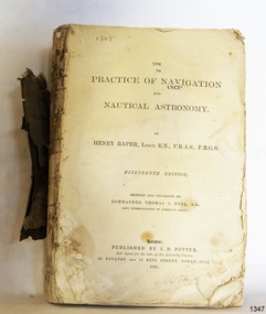
Book - Technical Reference, Henry Raper, Lieut. R.N, The Practice of Navigation and Nautical Astronomy, 1891
... ...Admiralty Charts...The publisher, J D Potter of London, was at that time the sole agent for the Admiralty Charts produced by the Royal Navy. Printer Spottswoode and Co.,. was established by William Strachan in 1738. ...Hull, R.N., Late Superintendant of Admiralty Charts Dedication: To Rear-Admiral Sir Francis Beaufort K.C.B. ...Hull, R.N., Late Superintendant of Admiralty Charts Dedication: To Rear-Admiral Sir Francis Beaufort K.C.B. ...This technical textbook is the nineteenth edition of the book by Henry Raper, Lieutenant in the Royal Navy with awards that include F.R.A.S. (Fellow of the Royal Astronomical Society) and F.R.G.S. (Friend of the Royal Geographical Society). The book is dedicated in honour of Rear-Admiral Sir Francis Beaufort K.C.B., Hydrographer to the Admiralty. He was awarded the title K.C.B. (King's Commander) as a Member of the Order of Bath, an order of British Chivalry, The book was first published in 1840 and soon became a resource for navigation students. It includes topics on nautical navigation, astronomy, navigation charts, calculations and mathematical tables, time, tides, ships, longitude, and position at sea. Thomas A. Hull, who revised and expanded this edition, was a Commander in the Royal Navy and had previously been Superintendent of Admiralty Charts used for navigation worldwide by seamen from many walks of life. The publisher, J D Potter of London, was at that time the sole agent for the Admiralty Charts produced by the Royal Navy. Printer Spottswoode and Co.,. was established by William Strachan in 1738. In 1819 his nephews A and R Spottswoode took over the business and bought premises in New-Street Square and Shoe Lane. In 1850 over 200 workers were employed by the firm. and five years later the business became Spottswoode & Co. Andrew Spottswoode invented the Spottswoode Press.This technical book was very popular as a textbook for students of maritime navigation, written and updated by members of the British Royal Navy and relied upon for accurate advice and information. The first edition was published in 1840, this edition was updated, expanded and published in 1891 when ports around the world were filling with travellers, merchants and business people. Title: The Practice of Navigation and Nautical Astronomy Author: Henry Raper, Lieut, R.N., F.R.A.S., F.R.G.S. Nineteenth Edition, revised and enlarged by Commander Thomas A. Hull, R.N., Late Superintendant of Admiralty Charts Dedication: To Rear-Admiral Sir Francis Beaufort K.C.B. Publisher: J D Potter, London, sole agent for the sale of Admiralty Charts Printer: Spottswoode and Co. New-Street Square, London Date: 1891 Small leather hardcover book with gold embossed text and lines on the spine. The Dedication in the book is as follows: - "To Rear-Admiral Sir Francis Beaufort K.C.B. Hydrographer to the Admiralty. Sir, The eminent station which you occupy in the naval scientific world renders it highly gratifying to me to dedicate the following Work to you as a testimony of my regard and esteem; while the general accordance of my views on the subject with those of your more experienced judgement, gives me the greater confidence in laying my labours before the Public. I have the honour to be, Sir, Your obedient servant, HENRY RAPER"flagstaff hill maritime museum, maritime museum, shipwreck coast, flagstaff hill, warrnambool, flagstaff hill maritime village, book, navigation, nautical astronomy, hydrography, nautical charts, nautical navigation, astronomical navigation, admiralty charts, henry raper, thomas a. hull, royal navy, j d potter, royal astronomical society, royal geographical society, calculations, mathematical tables, longitude, latitude, nautical time, location at sea, position at sea, maritime, practical navigation, spottswoode and co., sir francis beaufort, k.c.b., rear-admiral sir francis beaufort, hydrographer to the admiralty, scientific book, naval science -
 Queenscliffe Maritime Museum
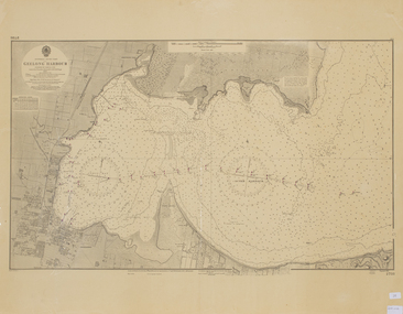
Map - Chart of Geelong Harbour, Geelong Harbour
... ...Admiralty Charts...An Admiralty Chart of Geelong Harbour revised in 1954...Geelong Corio Admiralty Charts Geelong Harbour Map Ref: 2731 An Admiralty Chart of Geelong Harbour revised in 1954 Geelong Harbour Map Chart of Geelong Harbour ...When Hamilton Hume and William Hovell arrived at the bay in 1824 they met with the local Wautharong people who referred to the bay as "Jillong" and the surround land "Corayo", but by the time the area was surveyed in the late 1830s the Aboriginal names had been swapped. The names "Corayo" and "Jillong" had since been Anglicised to "Corio" and "Geelong".Corio Bay is an important harbour and leisure location in the West and continues to attract development such as the new Tasmania Ferry Terminal.An Admiralty Chart of Geelong Harbour revised in 1954Geelong Harbour Map Ref: 2731geelong, corio, admiralty charts -
 Flagstaff Hill Maritime Museum and Village
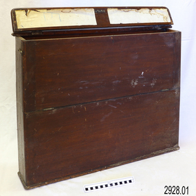
Container - Chart Case, Late 19th to early 20th centuries
... chart box...british admiralty charts...Chart case (or map case), wooden, has hinged opening at top. Front of case folds down and has a hook closure. It contained 65 British Admiralty navigational charts, which are listed and stored separately. ...Chart case (or map case), wooden, has hinged opening at top. Front of case folds down and has a hook closure. It contained 65 British Admiralty navigational charts, which are listed and stored separately. ...This case was donated along with the contents of over 60 navigational charts for locations all over the world. The narrow box is built to keep the charts in order and easily accessible on board a vessel. The chart case is a rare example of a container used on board a vessel for the storage and protection of navigational charts. It represents the type of equipment used by the navigator of a seafaring vessel. The charts within the case represent the places to which the vessel travelled.Chart case (or map case), wooden, has hinged opening at top. Front of case folds down and has a hook closure. It contained 65 British Admiralty navigational charts, which are listed and stored separately. (See separate items 2928.2 to 2928.66)There is a hand written name on the back of the case.flagstaff hill, warrnambool, shipwrecked coast, flagstaff hill maritime museum, maritime museum, shipwreck coast, flagstaff hill maritime village, great ocean road, map case, chart case, map box, chart box, british admiralty charts, navigational charts, hydrographer charts, navigation, ship equipment -
 Flagstaff Hill Maritime Museum and Village
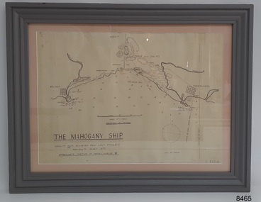
Document - Location Chart, The Mahogany Ship, 2007
... ...Admiralty Chart 1872...The chart is a copy and is based on the Admiralty Chart by Lieut. Stanley, dated 1872. ...Lower left: "THE MAHOGANY SHIP" "LOCALITY PLAN, ENLARGED FROM LIEUT. STANLEY'S ADMIRALTY CHART 1872" "APPROXIMATE POSITION OF WRECK MARKED [symbol of a Portuguese cross]" Other labels on chart: "BELFAST" "PORT FIARY" "GRIFFITHS I" "RIVER MOYNE" "RIVER MERRI" "ARMSTRONG BAY" " GORMANS LANE" "TOWER HILL" "KOROIT" "HELEN ROCK" "WARRNAMBOOL" "LADY BAY" "MIDDLE I" "LIGHT HO." ...The chart is a copy and is based on the Admiralty Chart by Lieut. Stanley, dated 1872. The Mahogany Ship Document Location Chart ...This chart shows a possible site for the fabled wreck called the 'Mahogany Ship'. Flagstaff Hill’s collection includes other objects that some say could be relics from this Ancient Wreck, (also called the Gold Ship, or the Ancient Vessel). The chart shows the coordinates for the Summits of Griffith Island and of Middle Island. It also has the depths of the sea at various intervals and shows the shore and sand dunes, lighthouses and other reference points. The mystery of the Mahogany Ship began in 1836 when two shipwrecked sealers discovered the remains of an “ancient vessel” in the sand dunes about four miles west of Warrnambool. Since the last recorded sightings in the 1880’s the true origin of the Mahogany Ship has remained one of Australia’s most famous historical mysteries or fables. One of the more recent theories is that the vessel was one of the Portuguese ships exploring the Australian coast in 1522. For over one hundred years searchers have attempted to locate and identify the wreck. The search continues for the tangible evidence which will once and for all establish the Mahogany Ship’s place in Australia’s History.The chart represents the worldwide interest in locating the wreck of the Mahogany Ship. Locating the actual wreck or proving the existence of a Portuguese ship's wreck could change the history of the discovery of Australia. A Mahogany Ship committee was formed to gather and research information about the discovery of the wrecked ship. A large amount of money was offered as a prize for finding the wreck or parts of it. People have written books, painted images, made videos and told tales of the ship but it continues to remain a mystery or even a fable. The chart is significant for its possible link to one of Victoria’s and Australia’s maritime mysteries, the Mahogany Ship (also known as the Ancient Wreck). It is one of very few known relics that could give evidence of the existence and history of the vessel. It is listed on the Victorian Heritage Register S438 as it is one of Victoria’s oldest recorded shipwrecks. The identity of the vessel has the potential to change Australia’s history.A chart in a wooden frame, behind glass. The chart shows the approximate position of the mystery Ancient Wreck, later called the "Mahogany Ship". The chart is a copy and is based on the Admiralty Chart by Lieut. Stanley, dated 1872. Lower left: "THE MAHOGANY SHIP" "LOCALITY PLAN, ENLARGED FROM LIEUT. STANLEY'S ADMIRALTY CHART 1872" "APPROXIMATE POSITION OF WRECK MARKED [symbol of a Portuguese cross]" Other labels on chart: "BELFAST" "PORT FIARY" "GRIFFITHS I" "RIVER MOYNE" "RIVER MERRI" "ARMSTRONG BAY" " GORMANS LANE" "TOWER HILL" "KOROIT" "HELEN ROCK" "WARRNAMBOOL" "LADY BAY" "MIDDLE I" "LIGHT HO." Lower right: "G 410 B" Label on the back; "This chart presented to the Mahogany Ship Committee and Flagstaff Hill by Avis Quarrell, April 2007"warrnambool, shipwrecked coast, flagstaff hill maritime museum, shipwreck coast, mahogany ship, ancient vessel, ancient wreck, portuguese ship, coastal reserve, fabled wreck, gold ship, griffiths island, belfast (now port fairy), koroit, location plan, leuit. stanley, admiralty chart 1872, tower hill, merri river, moyne river, middle island, helen rock, armstrong bay, griffiths land -
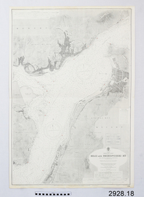
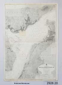
 Flagstaff Hill Maritime Museum and Village
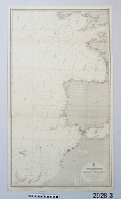
Document - Navigation Chart, Portsmouth to Canary Islands, Ca. 1928
... ...Admiralty chart...This is an Official British Admiralty Navigation Chart, one of a set of 65 charts donated together with a wooden chart case. ...British Admiralty Navigation Chart - Portsmouth to Canary Islands - printed on rectangular white paper. ...Published in London by the British Admiralty in 1928. Portsmouth to Canary Islands Document Navigation Chart Admiralty Office ...This is an Official British Admiralty Navigation Chart, one of a set of 65 charts donated together with a wooden chart case. It was published and printed in London in 1928 by the British Admiralty. Navigation charts are drawn by professional hydrographers and describe the geography of land and water, enabling a water based navigator on board vessels such as ships to safely negotiate between ports locally and around the world. They are drawn to a particular standard with common symbols noting landmarks. The charts are used in conjunction with other navigational instruments and tools to calculate the vessel’s exact location and a safe route to its destination.The set of charts and their chart are of significance as examples of equipment and documents used to navigate the oceans of the world, particularly to Australia. Migration to Australia is an important part of this country's history.British Admiralty Navigation Chart - Portsmouth to Canary Islands - printed on rectangular white paper. Published in London by the British Admiralty in 1928.warrnambool, shipwreck coast, flagstaff hill, flagstaff hill maritime museum, flagstaff hill maritime village, chart, map, navigate, navigation, location, vessel, 1928, british admiralty, hydrographer, geography, admiralty chart, portsmouth, canary islands -
 Flagstaff Hill Maritime Museum and Village
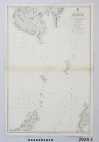
Document - Navigation Chart, Eastern Part of the Celebes Sea, Ca. 1928
... ...Admiralty chart...This is an Official British Admiralty Navigation Chart, one of a set of 65 charts donated together with a wooden chart case. ...British Admiralty Navigation Chart - Eastern Part of the Celebes Sea - printed on rectangular white paper. ...Published in London by the British Admiralty in 1928. Eastern Part of the Celebes Sea Document Navigation Chart Admiralty Office ...This is an Official British Admiralty Navigation Chart, one of a set of 65 charts donated together with a wooden chart case. It was published and printed in London in 1928 by the British Admiralty. Navigation charts are drawn by professional hydrographers and describe the geography of land and water, enabling a water based navigator on board vessels such as ships to safely negotiate between ports locally and around the world. They are drawn to a particular standard with common symbols noting landmarks. The charts are used in conjunction with other navigational instruments and tools to calculate the vessel’s exact location and a safe route to its destination.The set of charts and their chart are of significance as examples of equipment and documents used to navigate the oceans of the world, particularly to Australia. Migration to Australia is an important part of this country's history.British Admiralty Navigation Chart - Eastern Part of the Celebes Sea - printed on rectangular white paper. Published in London by the British Admiralty in 1928.warrnambool, shipwreck coast, flagstaff hill, flagstaff hill maritime museum, flagstaff hill maritime village, chart, map, navigate, navigation, location, vessel, 1928, british admiralty, hydrographer, geography, admiralty chart, celebes sea -
 Flagstaff Hill Maritime Museum and Village
Document - Chart, Admiralty Office, Port Phillip, 1899
... Chart...Australia...South Coast...Port Phillip...Admiralty...Accurate charts were imperative for sea farers to sail their vessels safely from one side of the world to another. The British Admiralty...Admiralty Chart of Port Phillip, Victoria, South Coast of Australia. ...Sold by W D Potter Agent for Admiralty Charts 145 minorities. Port Phillip Document Chart Admiralty Office ...Accurate charts were imperative for sea farers to sail their vessels safely from one side of the world to another. The British Admiralty published many charts and updated them frequently. Specialists were employed to gather information such as depth soundings to give the navigator as many helps as possible. At regular intervals the charts had to be updated with the amount of adjustment needed to a compass to allow for magnetic variation.This chart is significant for its association with incoming and outgoin ships for trade and passengers in the late 19th century.Admiralty Chart of Port Phillip, Victoria, South Coast of Australia. It shows navigation buoys, lighthouses, tides and money other details. It was surveyed by Commander Henry L. Cox R.N. in 1864. Published by Admiralty August 19th 1865. Corrections were made by Staff Commander E.J. Stanley R.N. in 1874. The West Channel was surveyed b J.B. Mason , Engineer, in 1899. Published and cartographed in Admiralty, London, England in 1897, supervised by Capt G H Richards R N Hydrographer. Chart was updated in 1899. Sold by W D Potter Agent for Admiralty Charts 145 minorities.Printed: "Port Phillip" "Australia - South Coast, Victoria"flagstaff hill, warrnambool, maritime-museum, flagstaff hill maritime museum & village, shipwreck coast, chart, australia, south coast, port phillip, admiralty, 1899, navigation, cartography, cartographer -
 Flagstaff Hill Maritime Museum and Village
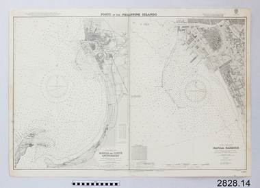
Document - Navigation Chart, Manila Harbour
... Chart...British Admiralty Navigation Chart...British Admiralty Navigation Chart - Manila Harbour...Flagstaff Hill Maritime Museum and Village 89 Merri Street Warrnambool great-ocean-road Warrnambool Shipwrecked-coast Flagstaff-Hill Flagstaff-Hill-Maritime-Museum Maritime-Museum Shipwreck-coast Flagstaff-Hill-Maritime-Village Shipwrecked-artefact Navigation Chart British Admiralty Navigation Chart Manila Harbour British Admiralty Navigation Chart - Manila Harbour Manila Harbour Document Navigation Chart ...British Admiralty Navigation Chart - Manila Harbourwarrnambool, shipwrecked-coast, flagstaff-hill, flagstaff-hill-maritime-museum, maritime-museum, shipwreck-coast, flagstaff-hill-maritime-village, shipwrecked-artefact, navigation chart, british admiralty navigation chart, manila harbour -
 Flagstaff Hill Maritime Museum and Village
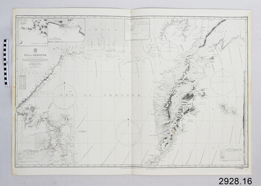
Document - Navigation Chart, Sea of Okhotsk
... Chart...British Admiralty Navigation Chart...British Admiralty Navigation Chart - Sea of Okhotsk...Flagstaff Hill Maritime Museum and Village 89 Merri Street Warrnambool great-ocean-road Warrnambool Shipwrecked-coast Flagstaff-Hill Flagstaff-Hill-Maritime-Museum Maritime-Museum Shipwreck-coast Flagstaff-Hill-Maritime-Village Shipwrecked-artefact Navigation Chart British Admiralty Navigation Chart British Admiralty Navigation Chart - Sea of Okhotsk Sea of Okhotsk Document Navigation Chart ...British Admiralty Navigation Chart - Sea of Okhotskwarrnambool, shipwrecked-coast, flagstaff-hill, flagstaff-hill-maritime-museum, maritime-museum, shipwreck-coast, flagstaff-hill-maritime-village, shipwrecked-artefact, navigation chart, british admiralty navigation chart -
 Flagstaff Hill Maritime Museum and Village
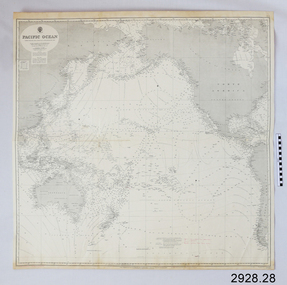
Document - Navigation Chart, Pacific Ocean
... Chart...British Admiralty Navigation Chart...British Admiralty Navigation Chart - Pacific Ocean...Flagstaff Hill Maritime Museum and Village 89 Merri Street Warrnambool great-ocean-road Warrnambool Shipwrecked-coast Flagstaff-Hill Flagstaff-Hill-Maritime-Museum Shipwreck-coast Maritime-Museum Flagstaff-Hill-Maritime-Village Shipwrecked-artefact Navigation Chart British Admiralty Navigation Chart British Admiralty Pacific Ocean British Admiralty Navigation Chart - Pacific Ocean Pacific Ocean Document Navigation Chart ...British Admiralty Navigation Chart - Pacific Oceanwarrnambool, shipwrecked-coast, flagstaff-hill, flagstaff-hill-maritime-museum, shipwreck-coast, maritime-museum, flagstaff-hill-maritime-village, shipwrecked-artefact, navigation chart, british admiralty navigation chart, british admiralty, pacific ocean -
 Flagstaff Hill Maritime Museum and Village
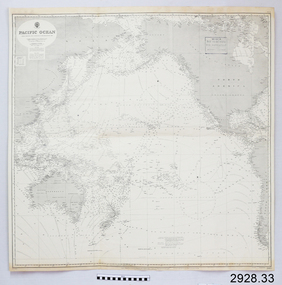
Document - Navigation Chart, Pacific Ocean
... chart...british admiralty navigation chart...British Admiralty Navigation Chart - Pacific Ocean...Flagstaff Hill Maritime Museum and Village 89 Merri Street Warrnambool great-ocean-road warrnambool shipwrecked-coast flagstaff-hill flagstaff-hill-maritime-museum maritime-museum shipwreck-coast flagstaff-hill-maritime-village shipwrecked-artefact navigation chart british admiralty navigation chart british admiralty pacific ocean British Admiralty Navigation Chart - Pacific Ocean Pacific Ocean Document Navigation Chart ...British Admiralty Navigation Chart - Pacific Oceanwarrnambool, shipwrecked-coast, flagstaff-hill, flagstaff-hill-maritime-museum, maritime-museum, shipwreck-coast, flagstaff-hill-maritime-village, shipwrecked-artefact, navigation chart, british admiralty navigation chart, british admiralty, pacific ocean -
 Flagstaff Hill Maritime Museum and Village
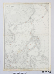
Document - Navigation Chart, China Sea
... Chart...British Admiralty Navigation Chart...British Admiralty Navigation Chart - China Sea...Flagstaff Hill Maritime Museum and Village 89 Merri Street Warrnambool great-ocean-road Warrnambool Shipwrecked-coast Flagstaff-Hill Flagstaff-Hill-Maritime-Museum Maritime-Museum Shipwreck-coast Flagstaff-Hill-Maritime-Village Shipwrecked-artefact Navigation Chart British Admiralty Navigation Chart British Admiralty China Sea British Admiralty Navigation Chart - China Sea China Sea Document Navigation Chart ...British Admiralty Navigation Chart - China Seawarrnambool, shipwrecked-coast, flagstaff-hill, flagstaff-hill-maritime-museum, maritime-museum, shipwreck-coast, flagstaff-hill-maritime-village, shipwrecked-artefact, navigation chart, british admiralty navigation chart, british admiralty, china sea -
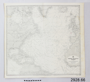 Flagstaff Hill Maritime Museum and Village
Document - Navigation Chart, North Atlantic Ocean
... Chart...British Admiralty Navigation Chart...British Admiralty Navigation Chart - North Atlantic Ocean...Flagstaff Hill Maritime Museum and Village 89 Merri Street Warrnambool great-ocean-road Warrnambool Shipwrecked-coast Flagstaff-Hill Flagstaff-Hill-Maritime-Museum Maritime-Museum Shipwreck-coast Flagstaff-Hill-Maritime-Village Shipwrecked-artefact Navigation Chart British Admiralty Navigation Chart British Admiralty North Atlantic Ocean British Admiralty Navigation Chart - North Atlantic Ocean North Atlantic Ocean Document Navigation Chart ...British Admiralty Navigation Chart - North Atlantic Oceanwarrnambool, shipwrecked-coast, flagstaff-hill, flagstaff-hill-maritime-museum, maritime-museum, shipwreck-coast, flagstaff-hill-maritime-village, shipwrecked-artefact, navigation chart, british admiralty navigation chart, british admiralty, north atlantic ocean -
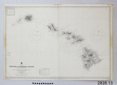 Flagstaff Hill Maritime Museum and Village
Document - Navigation Chart, Hawaiian or Sandwich Islands
... British Admiralty Navigation Chart...British Admiralty Navigation Chart - Hawaiian or Sandwich Islands...Flagstaff Hill Maritime Museum and Village 89 Merri Street Warrnambool great-ocean-road Warrnambool Shipwrecked-coast Flagstaff-Hill Flagstaff-Hill-Maritime-Museum Maritime-Museum Shipwreck-coast Flagstaff-Hill-Maritime-Village Shipwrecked-artefact British Admiralty Navigation Chart Navigation Chart Hawaiian or Sandwich Islands British Admiralty Navigation Chart - Hawaiian or Sandwich Islands Hawaiian or Sandwich Islands Document Navigation Chart ...British Admiralty Navigation Chart - Hawaiian or Sandwich Islandswarrnambool, shipwrecked-coast, flagstaff-hill, flagstaff-hill-maritime-museum, maritime-museum, shipwreck-coast, flagstaff-hill-maritime-village, shipwrecked-artefact, british admiralty navigation chart, navigation chart, hawaiian or sandwich islands -
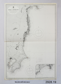 Flagstaff Hill Maritime Museum and Village
Document - Navigation Chart, Tokyo to Sendai Bay
... British Admiralty Navigation Chart...British Admiralty Navigation Chart - Tokyo to Sendai Bay...Flagstaff Hill Maritime Museum and Village 89 Merri Street Warrnambool great-ocean-road Warrnambool Shipwrecked-coast Flagstaff-Hill Flagstaff-Hill-Maritime-Museum Maritime-Museum Shipwreck-coast Flagstaff-Hill-Maritime-Village Shipwrecked-artefact British Admiralty Navigation Chart Navigation Chart Tokyo to Sendai Bay British Admiralty Navigation Chart - Tokyo to Sendai Bay Tokyo to Sendai Bay Document Navigation Chart ...British Admiralty Navigation Chart - Tokyo to Sendai Baywarrnambool, shipwrecked-coast, flagstaff-hill, flagstaff-hill-maritime-museum, maritime-museum, shipwreck-coast, flagstaff-hill-maritime-village, shipwrecked-artefact, british admiralty navigation chart, navigation chart, tokyo to sendai bay -
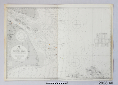 Flagstaff Hill Maritime Museum and Village
Document - Navigation Chart, Approaches to Yangtze Kiang
... Chart...British Admiralty Navigation Chart...British Admiralty Navigation Chart - Approaches to Yangtze Kiang...Flagstaff Hill Maritime Museum and Village 89 Merri Street Warrnambool great-ocean-road Warrnambool Shipwrecked-coast Flagstaff-Hill Flagstaff-Hill-Maritime-Museum Maritime-Museum Shipwreck-coast Flagstaff-Hill-Maritime-Village Shipwrecked-artefact Navigation Chart British Admiralty Navigation Chart British Admiralty Yangtze Kiang British Admiralty Navigation Chart - Approaches to Yangtze Kiang Approaches to Yangtze Kiang Document Navigation Chart ...British Admiralty Navigation Chart - Approaches to Yangtze Kiangwarrnambool, shipwrecked-coast, flagstaff-hill, flagstaff-hill-maritime-museum, maritime-museum, shipwreck-coast, flagstaff-hill-maritime-village, shipwrecked-artefact, navigation chart, british admiralty navigation chart, british admiralty, yangtze kiang -
 Flagstaff Hill Maritime Museum and Village
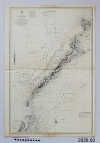
Document - Navigation Chart, Palawan Island
... Chart...British Admiralty Navigation Chart...British Admiralty Navigation Chart - China Sea- Palawan Island...Flagstaff Hill Maritime Museum and Village 89 Merri Street Warrnambool great-ocean-road Warrnambool Shipwrecked-coast Flagstaff-Hill Flagstaff-Hill-Maritime-Museum Maritime-Museum Shipwreck-coast Flagstaff-Hill-Maritime-Village Shipwrecked-artefact Navigation Chart British Admiralty Navigation Chart British Admiralty Palawan Island British Admiralty Navigation Chart - China Sea- Palawan Island Palawan Island Document Navigation Chart ...British Admiralty Navigation Chart - China Sea- Palawan Islandwarrnambool, shipwrecked-coast, flagstaff-hill, flagstaff-hill-maritime-museum, maritime-museum, shipwreck-coast, flagstaff-hill-maritime-village, shipwrecked-artefact, navigation chart, british admiralty navigation chart, british admiralty, palawan island -
 Flagstaff Hill Maritime Museum and Village
Document - Navigation Chart, Red Sea - Sheet 4
... Chart...British Admiralty Navigation Chart...British Admiralty Navigation Chart - Red Sea - Sheet 4...Flagstaff Hill Maritime Museum and Village 89 Merri Street Warrnambool great-ocean-road Warrnambool Shipwrecked-coast Flagstaff-Hill Flagstaff-Hill-Maritime-Museum Maritime-Museum Shipwreck-coast Flagstaff-Hill-Maritime-Village Shipwrecked-artefact Navigation Chart British Admiralty Navigation Chart British Admiralty Red Sea - Sheet 4 Red Sea British Admiralty Navigation Chart - Red Sea - Sheet 4 Red Sea - Sheet 4 Document Navigation Chart ...British Admiralty Navigation Chart - Red Sea - Sheet 4warrnambool, shipwrecked-coast, flagstaff-hill, flagstaff-hill-maritime-museum, maritime-museum, shipwreck-coast, flagstaff-hill-maritime-village, shipwrecked-artefact, navigation chart, british admiralty navigation chart, british admiralty, red sea - sheet 4, red sea -
 Flagstaff Hill Maritime Museum and Village
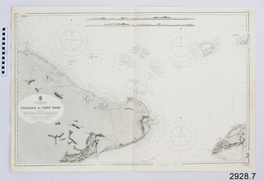
Document - Navigation Chart, Borneo - Taganak to Tawi Tawi
... chart...british admiralty...British Admiralty Navigation Chart - Borneo - Taganak to Tawi Tawi...Flagstaff Hill Maritime Museum and Village 89 Merri Street Warrnambool great-ocean-road warrnambool shipwrecked-coast flagstaff-hill flagstaff-hill-maritime-museum maritime-museum shipwreck-coast flagstaff-hill-maritime-village shipwrecked-artefact navigation chart british admiralty - British Admiralty Navigation Chart - Borneo - Taganak to Tawi Tawi Borneo - Taganak to Tawi Tawi Document Navigation Chart ...British Admiralty Navigation Chart - Borneo - Taganak to Tawi Tawi-warrnambool, shipwrecked-coast, flagstaff-hill, flagstaff-hill-maritime-museum, maritime-museum, shipwreck-coast, flagstaff-hill-maritime-village, shipwrecked-artefact, navigation chart, british admiralty -
 Flagstaff Hill Maritime Museum and Village
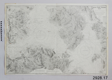
Document - Navigation Chart, Hong Kong - Waters East
... Chart...British Admiralty Navigation Chart...British Admiralty Navigation Chart - Hong Kong - Waters East...Flagstaff Hill Maritime Museum and Village 89 Merri Street Warrnambool great-ocean-road Warrnambool Shipwrecked-coast Flagstaff-Hill Flagstaff-Hill-Maritime-Museum Maritime-Museum Shipwreck-coast Flagstaff-Hill-Maritime-Village Shipwrecked-artefact Navigation Chart British Admiralty Navigation Chart Hong Kong - Waters East Hong Kong British Admiralty Navigation Chart - Hong Kong - Waters East Hong Kong - Waters East Document Navigation Chart ...British Admiralty Navigation Chart - Hong Kong - Waters Eastwarrnambool, shipwrecked-coast, flagstaff-hill, flagstaff-hill-maritime-museum, maritime-museum, shipwreck-coast, flagstaff-hill-maritime-village, shipwrecked-artefact, navigation chart, british admiralty navigation chart, hong kong - waters east, hong kong -
 Flagstaff Hill Maritime Museum and Village
Document - Navigation Chart, Moji and Shimonoseki Kò
... british admiralty navigation chart...British Admiralty Navigation Chart - Japan - Moji and Shimonoseki Kò...Flagstaff Hill Maritime Museum and Village 89 Merri Street Warrnambool great-ocean-road warrnambool shipwrecked-coast flagstaff-hill flagstaff-hill-maritime-museum maritime-museum shipwreck-coast flagstaff-hill-maritime-village shipwrecked-artefact british admiralty navigation chart navigation chart Moji and Shimonoseki Kò British Admiralty Navigation Chart - Japan - Moji and Shimonoseki Kò Moji and Shimonoseki Kò Document Navigation Chart ...British Admiralty Navigation Chart - Japan - Moji and Shimonoseki Kòwarrnambool, shipwrecked-coast, flagstaff-hill, flagstaff-hill-maritime-museum, maritime-museum, shipwreck-coast, flagstaff-hill-maritime-village, shipwrecked-artefact, british admiralty navigation chart, navigation chart, moji and shimonoseki kò -
 Flagstaff Hill Maritime Museum and Village
Document - Navigation Chart, Moji and ShimonosekiKò
... chart...british admiralty navigation chart...British Admiralty Navigation Chart - Japan - Moji and Shimonoseki Kò...Flagstaff Hill Maritime Museum and Village 89 Merri Street Warrnambool great-ocean-road warrnambool shipwrecked-coast flagstaff-hill flagstaff-hill-maritime-museum maritime-museum shipwreck-coast flagstaff-hill-maritime-village shipwrecked-artefact navigation chart british admiralty navigation chart Moji and Shimonoseki Kò British Admiralty Navigation Chart - Japan - Moji and Shimonoseki Kò Moji and ShimonosekiKò Document Navigation Chart ...British Admiralty Navigation Chart - Japan - Moji and Shimonoseki Kòwarrnambool, shipwrecked-coast, flagstaff-hill, flagstaff-hill-maritime-museum, maritime-museum, shipwreck-coast, flagstaff-hill-maritime-village, shipwrecked-artefact, navigation chart, british admiralty navigation chart, moji and shimonoseki kò -
 Flagstaff Hill Maritime Museum and Village
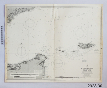
Document - Navigation Chart, Gulf of Aden - Sokòtra Island
... Chart...British Admiralty Navigation Chart...British Admiralty Navigation Chart - Gulf of Aden - Sokòtra Island...Flagstaff Hill Maritime Museum and Village 89 Merri Street Warrnambool great-ocean-road Warrnambool Shipwrecked-coast Flagstaff-Hill Flagstaff-Hill-Maritime-Museum Maritime-Museum Shipwreck-coast Flagstaff-Hill-Maritime-Village Shipwrecked-artefact Navigation Chart British Admiralty Navigation Chart Gulf of Aden Sokòtra Island British Admiralty Navigation Chart - Gulf of Aden - Sokòtra Island Gulf of Aden - Sokòtra Island Document Navigation Chart ...British Admiralty Navigation Chart - Gulf of Aden - Sokòtra Islandwarrnambool, shipwrecked-coast, flagstaff-hill, flagstaff-hill-maritime-museum, maritime-museum, shipwreck-coast, flagstaff-hill-maritime-village, shipwrecked-artefact, navigation chart, british admiralty navigation chart, gulf of aden, sokòtra island -
 Flagstaff Hill Maritime Museum and Village
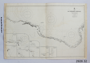
Document - Navigation Chart, Ras Makhabez to Benghazi
... chart...british admiralty navigation chart...British Admiralty Navigation Chart - Libia, Ras Makhebez to Benghazi...Flagstaff Hill Maritime Museum and Village 89 Merri Street Warrnambool great-ocean-road warrnambool shipwrecked-coast flagstaff-hill flagstaff-hill-maritime-museum maritime-museum shipwreck-coast flagstaff-hill-maritime-village shipwrecked-artefact navigation chart british admiralty navigation chart british admiralty libia Ras Makhabez to Benghazi British Admiralty Navigation Chart - Libia, Ras Makhebez to Benghazi Ras Makhabez to Benghazi Document Navigation Chart ...British Admiralty Navigation Chart - Libia, Ras Makhebez to Benghaziwarrnambool, shipwrecked-coast, flagstaff-hill, flagstaff-hill-maritime-museum, maritime-museum, shipwreck-coast, flagstaff-hill-maritime-village, shipwrecked-artefact, navigation chart, british admiralty navigation chart, british admiralty, libia, ras makhabez to benghazi -
 Flagstaff Hill Maritime Museum and Village
Document - Navigation Chart, Hong Kong, Water East
... Chart...British Admiralty Navigation Chart...British Admiralty Navigation Chart - Hong Kong, Water East...Flagstaff Hill Maritime Museum and Village 89 Merri Street Warrnambool great-ocean-road Warrnambool Shipwrecked-coast Flagstaff-Hill Flagstaff-Hill-Maritime-Museum Maritime-Museum Shipwreck-coast Flagstaff-Hill-Maritime-Village Shipwrecked-artefact Navigation Chart British Admiralty Navigation Chart British Admiralty Hong Kong British Admiralty Navigation Chart - Hong Kong, Water East Hong Kong, Water East Document Navigation Chart ...British Admiralty Navigation Chart - Hong Kong, Water Eastwarrnambool, shipwrecked-coast, flagstaff-hill, flagstaff-hill-maritime-museum, maritime-museum, shipwreck-coast, flagstaff-hill-maritime-village, shipwrecked-artefact, navigation chart, british admiralty navigation chart, british admiralty, hong kong -
 Flagstaff Hill Maritime Museum and Village
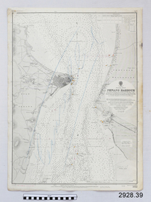
Document - Navigation Chart, Penang Harbour
... Chart...British Admiralty Navigation Chart...British Admiralty Navigation Chart - Penang Harbour and Malacca Straits...Flagstaff Hill Maritime Museum and Village 89 Merri Street Warrnambool great-ocean-road Warrnambool Shipwrecked-coast Flagstaff-Hill Flagstaff-Hill-Maritime-Museum Maritime-Museum Shipwreck-coast Flagstaff-Hill-Maritime-Village Shipwrecked-artefact Navigation Chart British Admiralty Navigation Chart British Admiralty Penang Harbour British Admiralty Navigation Chart - Penang Harbour and Malacca Straits Penang Harbour Document Navigation Chart ...British Admiralty Navigation Chart - Penang Harbour and Malacca Straitswarrnambool, shipwrecked-coast, flagstaff-hill, flagstaff-hill-maritime-museum, maritime-museum, shipwreck-coast, flagstaff-hill-maritime-village, shipwrecked-artefact, navigation chart, british admiralty navigation chart, british admiralty, penang harbour -
 Lakes Entrance Historical Society
Book, Howse, Derek and Sanderson, Michael, The Sea Chart, 1973
... A sample collection of maps and charts showing the development of the sea chart from 1420 to a metric Admiralty chart of 1971. The sixty reproductions are of sea charts preserved in the National Maritime Museum, Greenwich....Lakes Entrance Historical Society 4 Marine Parade Lakes Entrance gippsland Maritime History A sample collection of maps and charts showing the development of the sea chart from 1420 to a metric Admiralty chart of 1971. The sixty reproductions are of sea charts preserved in the National Maritime Museum, Greenwich. ...A sample collection of maps and charts showing the development of the sea chart from 1420 to a metric Admiralty chart of 1971. The sixty reproductions are of sea charts preserved in the National Maritime Museum, Greenwich.maritime history -
 Flagstaff Hill Maritime Museum and Village
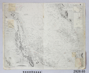
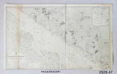
Document - Navigation Chart, Cape Rachado to Singapore
... Chart...British Admiralty Navigation Chart...British Admiralty Navigation Chart - Cape Rachado to Singapore - Malacca Straits...Flagstaff Hill Maritime Museum and Village 89 Merri Street Warrnambool great-ocean-road Warrnambool Shipwrecked-coast Flagstaff-Hill Flagstaff-Hill-Maritime-Museum Maritime-Museum Shipwreck-coast Flagstaff-Hill-Maritime-Village Shipwrecked-artefact Navigation Chart British Admiralty Navigation Chart British Admiralty British Admiralty Navigation Chart - Cape Rachado to Singapore - Malacca Straits Cape Rachado to Singapore Document Navigation Chart ...British Admiralty Navigation Chart - Cape Rachado to Singapore - Malacca Straitswarrnambool, shipwrecked-coast, flagstaff-hill, flagstaff-hill-maritime-museum, maritime-museum, shipwreck-coast, flagstaff-hill-maritime-village, shipwrecked-artefact, navigation chart, british admiralty navigation chart, british admiralty -
 Flagstaff Hill Maritime Museum and Village
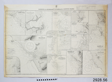
Document - Navigation Chart, Harbours and Anchorage in The Hawaiian or Sandwich Islands
... chart...british admiralty navigation chart...British Admiralty Navigation Chart - Harbours and Anchorage in The Hawaiian or Sandwich Islands...Flagstaff Hill Maritime Museum and Village 89 Merri Street Warrnambool great-ocean-road warrnambool shipwrecked-coast flagstaff-hill flagstaff-hill-maritime-museum maritime-museum shipwreck-coast flagstaff-hill-maritime-village shipwrecked-artefact navigation chart british admiralty navigation chart british admiralty sandwich islands hawaiian islands British Admiralty Navigation Chart - Harbours and Anchorage in The Hawaiian or Sandwich Islands Harbours and Anchorage in The Hawaiian or Sandwich Islands Document Navigation Chart ...British Admiralty Navigation Chart - Harbours and Anchorage in The Hawaiian or Sandwich Islandswarrnambool, shipwrecked-coast, flagstaff-hill, flagstaff-hill-maritime-museum, maritime-museum, shipwreck-coast, flagstaff-hill-maritime-village, shipwrecked-artefact, navigation chart, british admiralty navigation chart, british admiralty, sandwich islands, hawaiian islands -
 Flagstaff Hill Maritime Museum and Village
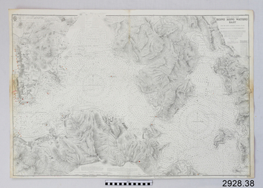
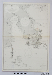
Map - Navigation Chart, Celebes - Tomori Gulf to Salaya Strait
... admiralty...navigation chart...British Admiralty Navigation Chart - Celebes - Tomori Gulf to Salaya strait...Flagstaff Hill Maritime Museum and Village 89 Merri Street Warrnambool great-ocean-road warrnambool shipwrecked-coast flagstaff-hill flagstaff-hill-maritime-museum maritime-museum shipwreck-coast flagstaff-hill-maritime-village british admiralty navigation chart celebes Tomori Gulf to Salaya Strait British Admiralty Navigation Chart - Celebes - Tomori Gulf to Salaya strait Celebes - Tomori Gulf to Salaya Strait Map Navigation Chart T.S. ...British Admiralty Navigation Chart - Celebes - Tomori Gulf to Salaya straitwarrnambool, shipwrecked-coast, flagstaff-hill, flagstaff-hill-maritime-museum, maritime-museum, shipwreck-coast, flagstaff-hill-maritime-village, british admiralty, navigation chart, celebes, tomori gulf to salaya strait