Showing 288 items matching "atlas"
-
 Marysville & District Historical Society
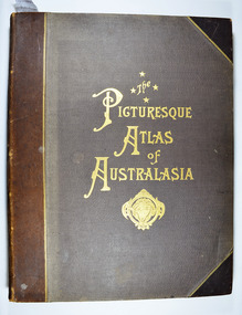
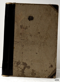
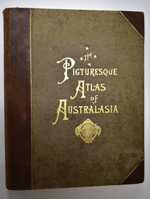
Book - Hardcover book, Picturesque Atlas Publishing Company Limited, The Picturesque Atlas of Australasia-Volume 1, 1886
... The Picturesque Atlas of Australasia-Volume 1...atlas...An atlas of Australasia that was first published in 1886....Picturesque Atlas Publishing Company Limited...An atlas of Australasia that was first published in 1886. atlas australasia history The Picturesque Atlas of Australasia-Volume 1 Stamp of the Marysville & District/ Historical Society Inc/ P.O. ...The Picturesque Atlas of Australasia-Volume 1Hardcover. Cover is brown with the title in gold lettering. Underneath the title is a symbol of a solid wreath surrounding the head of a ram.non-fictionThe Picturesque Atlas of Australasia-Volume 1atlas, australasia, history -
 Marysville & District Historical Society
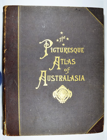
Book - Hardcover book, Picturesque Atlas Publishing Company Limited, The Picturesque Atlas of Australasia-Volume 2, 1886
... The Picturesque Atlas of Australasia-Volume 2...atlas...An atlas of Australasia that was first published in 1886....Picturesque Atlas Publishing Company Limited...An atlas of Australasia that was first published in 1886. atlas australasia history The Picturesque Atlas of Australasia-Volume 2 Stamp of the Marysville & District/ Historical Society Inc/ P.O. ...The Picturesque Atlas of Australasia-Volume 2Hardcover. Cover is brown with the title in gold lettering. Underneath the title is a symbol of a solid wreath surrounding the head of a ram. Three fold-out maps are included; Railway Postal and Telegraph Map of South Australia, 1888; Railway Postal & Telegraph Map of Queensland, 1888; Railway, Postal, Telegraph and Rainfall Map of Tasmania 1889. non-fictionThe Picturesque Atlas of Australasia-Volume 2atlas, australasia, history -
 Marysville & District Historical Society
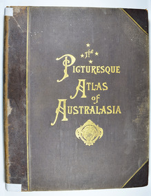
Book - Hardcover book, Picturesque Atlas Publishing Company Limited, The Picturesque Atlas of Australasia-Volume 3, 1886
... The Picturesque Atlas of Australasia-Volume 3...atlas...An atlas of Australasia that was first published in 1886....Picturesque Atlas Publishing Company Limited...An atlas of Australasia that was first published in 1886. atlas australasia history The Picturesque Atlas of Australasia-Volume 3 Stamp of the Marysville & District/ Historical Society Inc/ P.O. ...The Picturesque Atlas of Australasia-Volume 3Hardcover. Cover is brown with the title in gold lettering. Underneath the title is a symbol of a solid wreath surrounding the head of a ram. A fold-out map is included; Railway Postal and Telegraph Map of the North Island of New Zealand, 1889. non-fictionThe Picturesque Atlas of Australasia-Volume 3atlas, australasia, history -
 Flagstaff Hill Maritime Museum and Village
Book - Atlas, F.E. Hiscocks and Co, New Victorian Counties Atlas, 1874
... Atlas...New Victorian Counties Atlas......Atlas...The New Victorian Counties Atlas is highly prized by historians and map collectors today because it represents the pinnacle of colonial commercial printing. ...Hard cover book, New Victorian Counties Atlas Author: F.E. Hiscocks and Co, Publisher: George Robertson, Melbourne Vic. ...New Victorian Counties Atlas Book Atlas F.E. Hiscocks and Co George Robertson & Co. ...Published in Melbourne in 1874 by the prominent bookseller and publisher George Robertson, F.E. Hiscocks & Co.’s New Victorian Counties Atlas is a monumental 19th-century cartographic and statistical record of the colony of Victoria. While George Robertson was the publisher responsible for production, marketing, and distribution, the detailed compiling and surveying were executed by F.E. Hiscocks & Co., with the striking colour lithography handled by the renowned Melbourne firm Hamel & Ferguson.Hard cover book, New Victorian Counties Atlas Author: F.E. Hiscocks and Co, Publisher: George Robertson, Melbourne Vic. Date: 1874 Morocco Olive hardcover with a damaged black spine, reinforced corners to hardcover gold edging to where spine meets hardcover. Title in a lozenge on front cover edged with a decorative panel. non-fictionPublished in Melbourne in 1874 by the prominent bookseller and publisher George Robertson, F.E. Hiscocks & Co.’s New Victorian Counties Atlas is a monumental 19th-century cartographic and statistical record of the colony of Victoria. While George Robertson was the publisher responsible for production, marketing, and distribution, the detailed compiling and surveying were executed by F.E. Hiscocks & Co., with the striking colour lithography handled by the renowned Melbourne firm Hamel & Ferguson.flagstaff hill, warrnambool, maritime village, maritime museum, shipwreck coast, great ocean road, new victorian counties atlas, hiscocks and co, atlas, maps -
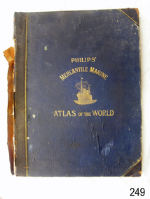 Flagstaff Hill Maritime Museum and Village
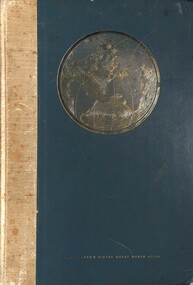
Book - Atlas, George Philip & Son Ltd, The London Geographical Institute, Philips' Mercantile Marine Atlas, 1904
... Atlas...Philips' Mercantile Marine Atlas......Atlas...Philips' Mercantile Marine Atlas of the World contains a series of 30 plates containing over 100 charts and plans, with tables of over 8,600 distances between ports, national and house flags, lists of British & United States Consulates and a complete index of 20,000 ports. ..."Philips' Mercantile Marine Atlas of the World". Dark blue hardcover, gold embossing and trim. ...Philips' Mercantile Marine Atlas Book Atlas George Philip & Son Ltd, The London Geographical Institute ...Philips' Mercantile Marine Atlas of the World contains a series of 30 plates containing over 100 charts and plans, with tables of over 8,600 distances between ports, national and house flags, lists of British & United States Consulates and a complete index of 20,000 ports. Specially designed for merchant shippers, exporters and ocean travellers, and for general use. The atlas is significant as a record of the status of world statistics in 1904, of interest to travelers, merchants, and world traders. "Philips' Mercantile Marine Atlas of the World". Dark blue hardcover, gold embossing and trim. Edited by George Philip, F.R.G.S. Second edition. Published in London by George Philip & Son, London, Date: 1904 Inscription on a purple stamp on the fly page."Please - - - / HARDY GILLARD / - - / - - LONDON"flagstaff hill, warrnambool, flagstaff hill maritime museum and village, shipwreck coast, great ocean road, atlas, marine atlas, philip's mercantile marine atlas, ports, flags, consulates, ocean travellers, shipppers, merchants, 1904 -
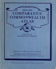 Sunshine and District Historical Society Incorporated
Book - Philip's Comparative Commonwealth Atlas for use in Australian Schools, George Philip and Son Limited, 1957
... Philip's Comparative Commonwealth Atlas for use in Australian Schools...Atlas...Typical atlas used in Australian schools in the late 1950's and early 1960's...Philip's Compatative Commonwealth Atlas for use in Australian Schools...Typical atlas used in Australian schools in the late 1950's and early 1960's Atlas Philip's Compatative Commonwealth Atlas for use in Australian Schools Blue soft covered book Philip's Comparative Commonwealth Atlas for use in Australian Schools Book Philip's Comparative Commonwealth Atlas for use in Australian Schools George Philip and Son Limited ...Blue soft covered bookatlas -
 Queenscliffe Maritime Museum
Book - Royal Atlas 1861, Keith Johnston, The Royal Atlas of Modern Geography, 1861
... The Royal Atlas of Modern Geography...In 1861 Johnston published the first edition of the Royal Atlas of Modern Geography with 48 maps. By 1914 the atlas had gone through 12 editions and morphed into the Johnston's Handy Royal Atlas of Modern Geography with 61 colour lithographed maps and an index of 84 pages. ...105 page leather bound atlas containing some coloured illustrations of maps of the countries of the world up to 1861. ...Keith Johnstone Royal Atlas...Queenscliffe Maritime Museum 2 Wharf St Queenscliff geelong-and-the-bellarine-peninsula In 1861 Johnston published the first edition of the Royal Atlas of Modern Geography with 48 maps. By 1914 the atlas had gone through 12 editions and morphed into the Johnston's Handy Royal Atlas of Modern Geography with 61 colour lithographed maps and an index of 84 pages. ...Atlas of the word in 1861105 page leather bound atlas containing some coloured illustrations of maps of the countries of the world up to 1861. Published by William Blackwood & Sons, 1861. Folio [51x34cm] size with 9 pages of introductory text followed by 48 double-page spread and part coloured maps.non-fictionAtlas of the word in 1861geography, world atlas, keith johnstone -
 Sunshine and District Historical Society Incorporated
Book - Keith Johnston's School Physical Atlas, Alex Keith Johnston, Keith Johnston's School Physical Atlas Illustrating in a Series of Original Designs, 1871
... Keith Johnston's School Physical Atlas Illustrating in a Series of Original Designs...Atlas...Typical atlas used in Australian schools...Front Cover - Keith Johnston's School Physical Atlas W. Blackwood & Sons Edinburgh and London First & Third Page - Handwritten Benjamin ? ...Typical atlas used in Australian schools Atlas Front Cover - Keith Johnston's School Physical Atlas W. ...Hard covered booknon-fictionatlas -
 Bendigo Historical Society Inc.
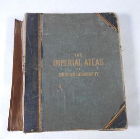
Book - Atlas, The Imperial Atlas of Modern Geography, 1860
... Atlas...The Imperial Atlas of Modern Geography...The Imperial Atlas of Modern Geography published in London by Blackie and Son, Warwick Square, E.C.; Glasgow and Edinburgh in 1860 MDCCCLX. ...The Imperial Atlas of Modern Geography Book Atlas ...Publisher Walter Graham Blackie (1816-1906) began as a letterpress operator, printer and publisher. He married Marion Brodie 16/4/1846. In 185, his successful business in Glasgow, employed 60 men and 40 boys.The Imperial Atlas of Modern Geography published in London by Blackie and Son, Warwick Square, E.C.; Glasgow and Edinburgh in 1860 MDCCCLX. The atlas includes an extensive series of maps embracing the most recent discoveries and the latest political divisions of territory in all parts of the world compiled and engraved from the most authentic sources. world maps, index -
 Numurkah & District Historical Society
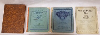
Book - School Atlases, Macmillan's New Australian Atlas / Phillip's New Comparitive Commonwealth Atlas (2) / The New Pictorial Atlas of the World
... Macmillan's New Australian Atlas / Phillip's New Comparitive Commonwealth Atlas (2) / The New Pictorial Atlas of the World......atlas...4 x World Atlas book. Cardboard covers & paper pages...Cardboard covers & paper pages Macmillan's New Australian Atlas / Phillip's New Comparitive Commonwealth Atlas (2) / The New Pictorial Atlas of the World Book School Atlases ...4 x World Atlas book. Cardboard covers & paper pagessee photoeducation, school, atlas, geography -
 Whitehorse Historical Society Inc.
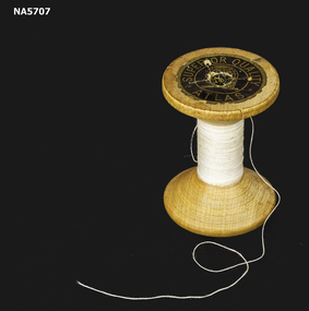
Domestic object - Cotton reel, Coats, Atlas, C 1900
... - Wooden cotton reel - White sewing thread - label one end - Atlas Superior Quality...Superior Quality Atlas...Coats, Atlas...Whitehorse Historical Society Inc. 2-10 Deep Creek Road Mitcham melbourne Example of wooden cotton reel Sewing Thread Superior Quality Atlas - Wooden cotton reel - White sewing thread - label one end - Atlas Superior Quality Domestic object Cotton reel Coats, Atlas ...Example of wooden cotton reel- Wooden cotton reel - White sewing thread - label one end - Atlas Superior QualitySuperior Quality Atlassewing, thread -
 Sunshine and District Historical Society Incorporated
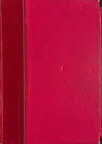
Book - Newnes Pictorial Knowledge Atlas, George Newes (Aust) Pty Ltd, 1950's
... Newnes Pictorial Knowledge Atlas...Atlas...Newnes Pictorial Knowledge Atlas...Typical geography book used in schools in the late 1950's Atlas Newnes Pictorial Knowledge Atlas Hard cover red book Newnes Pictorial Knowledge Atlas Book Newnes Pictorial Knowledge Atlas George Newes (Aust) Pty Ltd ...Hard cover red bookatlas -
 Greensborough Historical Society
Book - Atlas, Victoria. Department of Sustainability and Environment, Melbourne atlas, 2006_
... Atlas...Melbourne atlas...The purpose of the Melbourne Atlas is to give a spatial view of physical , environmental, social, economic and cultural aspects of Melbourne which can be used in planning. ...Wire binding. Melbourne atlas Book Atlas Victoria. Department of Sustainability and Environment ...The purpose of the Melbourne Atlas is to give a spatial view of physical , environmental, social, economic and cultural aspects of Melbourne which can be used in planning. It contains maps and graphs depicting many aspects of life in Melbourne. A snapshot of life in Melbourne in 2006.Various paging, text, illus., colour maps. Wire binding.melbourne, maps, town planning, social conditions -
 Anglesea and District Historical Society
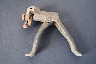
Saw Setting Tool - Atlas Brand, Atlas, Antique Vintage Pistol Grip Saw Setting Tool, Estimated 1920
... Two screw adjustments allow settings of angle and depth. "Atlas" brand stamped in top....Atlas...Atlas...Two screw adjustments allow settings of angle and depth. "Atlas" brand stamped in top. Antique Vintage Pistol Grip Saw Setting Tool Saw Setting Tool - Atlas Brand Atlas ...Two handles give pistol grip. Centre cylinder pushes against plate to set angle of saw tooth. Two screw adjustments allow settings of angle and depth. "Atlas" brand stamped in top.Atlassaw setting tool -
 Flagstaff Hill Maritime Museum and Village
Book - Reference Book/Atlas, G. Woolworth Colton, Coltons General Atlas, 1866
... Coltons General Atlas ......Atlas...The original first edition of “Colton’s General Atlas” started in 1857 will usually have a title page or imprint matching that year, while the map plates may retain earlier copyright dates because atlases often reused plates across multiple years. ...Hard cover book, Coltons General Atlas. Author: G. Woolworth Colton Publisher: G.W. & C.B. ...The original first edition of “Colton’s General Atlas” started in 1857 will usually have a title page or imprint matching that year, while the map plates may retain earlier copyright dates because atlases often reused plates across multiple years. ...Colton’s General Atlas is a 19th century commercial world atlas by G. Woolworth Colton, with descriptive text by Richard Swainson Fisher, and it was issued in multiple editions through the late 1800s. The atlas began as Colton’s earlier Atlas of the World in 1855–1856, then was reduced to a single volume work under the title “Colton’s General Atlas” starting in 1857. The subject work is an 1866 copy, and is a later edition in a long running atlas series. The 1866 edition is bibliographically useful because it sits in the transitional period after Colton’s firm had already changed hands and reorganised, and references note that the 1866 issue differs from 1865, particularly in western mapping.Hard cover book, Coltons General Atlas. Author: G. Woolworth Colton Publisher: G.W. & C.B. Colton, New York USA. Date: 1866 Light brown cloth hardcover and spine, spine has black repair tape, front cover has reinforced corners in black.non-fictionColton’s General Atlas is a 19th century commercial world atlas by G. Woolworth Colton, with descriptive text by Richard Swainson Fisher, and it was issued in multiple editions through the late 1800s. The atlas began as Colton’s earlier Atlas of the World in 1855–1856, then was reduced to a single volume work under the title “Colton’s General Atlas” starting in 1857. The subject work is an 1866 copy, and is a later edition in a long running atlas series. The 1866 edition is bibliographically useful because it sits in the transitional period after Colton’s firm had already changed hands and reorganised, and references note that the 1866 issue differs from 1865, particularly in western mapping. flagstaff hill, warrnambool, maritime village, maritime museum, shipwreck coast, great ocean road, coltons general atlas, weights and measures, atlas -
 Sunshine and District Historical Society Incorporated
Book, Reader's Digest, The Reader's Digest Great World Atlas
... The Reader's Digest Great World Atlas...Atlas...The Reader's Digest Great World Atlas|Reece Carland 3 Leith Ave Sunshine inscribed inside the front cover...Brimbank Library, 301 Hampshire Road, Sunshine 3020. melbourne Atlas The Reader's Digest Great World Atlas|Reece Carland 3 Leith Ave Sunshine inscribed inside the front cover Large green hard covered book with a map of the world & text printed in gold The Reader's Digest Great World Atlas Book Reader's Digest ...Large green hard covered book with a map of the world & text printed in goldatlas -
 City of Moorabbin Historical Society (Operating the Box Cottage Museum)
Tool - Tools 'Atlas' spray gun
... A mid 20th Century Atlas PTY Ltd Spray Painting kit ...Tools atlas spray painting gun ...Atlas Pty Ltd ...City of Moorabbin Historical Society (Operating the Box Cottage Museum) Joyce Park Jasper Road Ormond melbourne A mid 20th Century Atlas PTY Ltd Spray Painting kit This tool is typical of the type used by early settlers in Moorabbin mid 20th century early settlers market gardeners blacksmiths tools building equipment hammers moorabbin shire bentleigh mckinnon highett cheltenham mcewan james pty ltd melbourne bunnings pty ltd Atlas Pty Ltd Tools atlas spray painting gun Tool Tools 'Atlas' spray gun ...A mid 20th Century Atlas PTY Ltd Spray Painting kit This tool is typical of the type used by early settlers in Moorabbin mid 20th century Tools atlas spray painting gun Atlas Pty Ltd early settlers, market gardeners, blacksmiths, tools, building equipment, hammers, moorabbin shire, bentleigh, mckinnon, highett, cheltenham, mcewan james pty ltd, melbourne, bunnings pty ltd -
 Kiewa Valley Historical Society
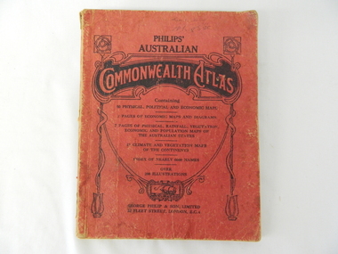
Atlas Australian Commonwealth, Philips' Australian Commonwealth Atlas, 1944
... Philips' Australian Commonwealth Atlas...This atlas, printed in 1944, details not only the geographic and political boundaries of the world as it was at that time but also the snap shot of life of the time. ...This atlas has a thick (350 g/m) red cardboard cover with bold black lettering and shading. ...On front cover "Philips' Australian COMMONWEALTH ATLAS" and underneath "Containing" underneath "60 PHYSICAL, POLITICAL AND ECONOMIC MAPS". ...Philips' Australian Commonwealth Atlas Atlas Australian Commonwealth George Philip & Son, Ltd ...This atlas, printed in 1944, details not only the geographic and political boundaries of the world as it was at that time but also the snap shot of life of the time. This snap shot in time covers the major Australian cities, the major farming, grazing, industrial and sporting/recreational activities. Also there are snap shots of similar activities from other global areas. The period also covered World War II, detailed by a photo of "shell making", munitions, required by Australian soldiers. The great political and territorial changes made as a result of World War II can be clearly identified for example , Israel (the Jewish homeland). The various prewar colonies of major European nations.This atlas was used by children of a Kiewa Valley family and shows the value and the general educational exposure that these children had at this time. The rural setting and within the backdrop of a world war did not severely alter the life style of children in this region. The "news reels" shown in cinemas of cities and larger towns were the only visual realisations of major events of global significance available to these children. The information provided by this atlas allowed students to glimpse at what the "outside world" was. The majority of these students would possibly never see these regions for themselves. The great communication facilities of the late 1900s and beyond, was still only science fiction.This atlas has a thick (350 g/m) red cardboard cover with bold black lettering and shading. The cover is set out within a shield like frame. The shield is held up by two square markings, each with a four part circular pattern and a cord entwining two pendulum structures ending with a bowl figure at the bottom. There is a semi circular form enclosing a printed book contents list. The inside cover has the atlas title and contents and the publisher details. The atlas contain 56 pages of world and Australian maps, vegetation and rainfall maps. Within this atlas there are 27 double sided pages of black and white photographs depicting life styles, buildings, landscapes and prominent and significant to Australia males from 1652 to 1944. The pages are of approximately 200 g/m and have the yellow aged appearance.On front cover "Philips' Australian COMMONWEALTH ATLAS" and underneath "Containing" underneath "60 PHYSICAL, POLITICAL AND ECONOMIC MAPS". Publisher George Philip & Son, Limited 32 Fleet Street, London E.C. 4. Inside cover are: written, in freehand and in ink the following names and dates; "J.Muller Form V 1945", "L L Muller Form IV 1946", "N.J. Muller Form I + II + III 1948 +49 + 50" and "D Muller Form I 1949". also handwritten and in pencil is "Peter Leslie". On the last page is a small freehand sketch of Australia in biro.1940s school curriculum, rural education, 1940s atlas, australian atlas -
 Eltham District Historical Society Inc
Book, George Robertson and Company, Atlas
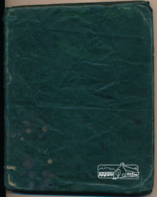
... Atlas......atlas...School atlas (title and year of publication unknown) owned by Ada Shillinglaw. ...Eltham District Historical Society Inc 728 Main Rd Eltham melbourne School atlas (title and year of publication unknown) owned by Ada Shillinglaw. ...School atlas (title and year of publication unknown) owned by Ada Shillinglaw. Ada was the youngest child of the Shillinglaw family. One of five items relating to the Shillinglaw Family collectionThe book was owned by Ada Shillinglaw. This family were pioneer settlers in the Eltham area.Hardcover covered in green vinyl wrapInscription on flyleaf: Ada Shillinglaw shillinglaw family collection, atlas -
 Warrnambool and District Historical Society Inc.
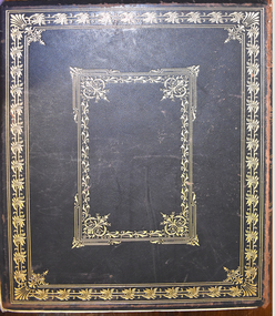
Book - Antiquarian book, Hon. Andrew Garran, Picturesque Atlas of Australasia Volume One, 1886
... Picturesque Atlas of Australasia Volume One ......The Picturesque Atlas Publishing Company...Andrew Garran The Picturesque Atlas Publishing Company ...Contemporary and geographical record of Australasia in the 19th centuryThis is a leather covered book. The cover is decorated with gold panels of fruit and gold lettering on the spine and has a plastic cover to protect it. There is gilt edging on the 388 pages. It contains text, sketches, lithographs and some coloured maps and engravings on wood..non-fictionContemporary and geographical record of Australasia in the 19th centurywarrnambool history, western district history, australian history, australasian history, picturesque atlas of australasia, picturesque atlas of australasia volume 1 -
 Warrnambool and District Historical Society Inc.
Book - Antiquarian Book, Hon Andrew Garran, Picturesque Atlas of Australasia Volume Two, 1886
... Picturesque Atlas of Australasia Volume Two......Pituresque Atlas Publishing Company...It contains text, sketches, lithographs, maps and five loose maps. Picturesque Atlas of Australasia Volume Two Book Antiquarian Book Hon Andrew Garran Pituresque Atlas Publishing Company ...A contemporary and geographical record of Australasia in the 19th centuryThis is a leather covered book of 801 pages. The cover is decorated with gold panels of fruit and has gold lettering on the spine. The pages have gilt edges. It contains text, sketches, lithographs, maps and five loose maps. non-fictionA contemporary and geographical record of Australasia in the 19th centuryaustralasian history, antiquarian books, picturesque atlas of australasia, warrnambool, picturesque atlas of australasia volume 2 -
Phillip Island and District Historical Society Inc.
Book, GARRAN, Andrew, Picturesque atlas of Australasia, 1886
... Picturesque atlas of Australasia......Picturesque Atlas Pub. Co....Phillip Island and District Historical Society Inc. phillip-island-and-the-bass-coast Labelled 'Cowes Free Public Library', 'Phillip Island Historical Society, Cleeland Bequest'. Picturesque atlas of Australasia Book GARRAN, Andrew Picturesque Atlas Pub. ...Labelled 'Cowes Free Public Library', 'Phillip Island Historical Society, Cleeland Bequest'. -
Stawell Historical Society Inc
Print, The Picturesque Atlas of Australia, Coloured Wood Engraving of Stawell c 1866 Published in "The Picturesque Atlas of Australasia", 1886
... Coloured Wood Engraving of Stawell c 1866 Published in "The Picturesque Atlas of Australasia"...The Picturesque Atlas of Australia...View from Big Hill by Hy Fulwood Circa 1866 Coloured Wood Engraving of Stawell c 1866 Published in "The Picturesque Atlas of Australasia" Print The Picturesque Atlas of Australia ...Prepared to celebrate the centenary of Australian settlement since the arrival of the First FleetColoured print of Stawell. View from Big Hill by Hy Fulwood Circa 1866panorama, mining -
 Sunshine and District Historical Society Incorporated
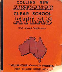
Book - Collins New Australia Atlas Clear School Atlas, William Collins, Sons & Co. Ltd, April 1964
... Collins New Australia Atlas Clear School Atlas...Front Cover - Collins New Australia Atlas Clear School Atlas with Special Supplements William Collins (Overseas) Ltd Publishers Sydney Melbourne Brisbane Adelaide...Front Cover - Collins New Australia Atlas Clear School Atlas with Special Supplements William Collins (Overseas) Ltd Publishers Sydney Melbourne Brisbane Adelaide Redish soft covered book with black text and map of Australia Collins New Australia Atlas Clear School Atlas Book Collins New Australia Atlas Clear School Atlas William Collins, Sons & Co. ...This book has 60 pages of Physical, Political, Economic, Air Age and Historical Maps with Comprehensive Index, entirely revised and redrawn.Redish soft covered book with black text and map of Australianon-fictionThis book has 60 pages of Physical, Political, Economic, Air Age and Historical Maps with Comprehensive Index, entirely revised and redrawn.sunshine technical school, derby road, sunshine, linda moushall -
 Bendigo Military Museum
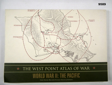
Book - ATLAS, PACIFIC, WW2, Brigadier General Vincent J. Esposito, THE WEST POINT ATLAS OF WAR/ WORLD WAR II: THE PACIFIC, Original 1959
... THE WEST POINT ATLAS OF WAR/ WORLD WAR II: THE PACIFIC.......Atlas..."Originally published in 1959 as part of a two volume set. The West Point Atlas of War: World War II/ The Pacific provides a unique way of studying military history."...Illustrated black, red and dark green maps and black and white photographs. THE WEST POINT ATLAS OF WAR/ WORLD WAR II: THE PACIFIC. Book ATLAS, PACIFIC, WW2 Brigadier General Vincent J. ..."Originally published in 1959 as part of a two volume set. The West Point Atlas of War: World War II/ The Pacific provides a unique way of studying military history."Soft cover book. Cover - cardboard, beige and gold colour print on front, spine and back. Illustrated - front and back - red and black colour print of maps. 128 pages - cut, plain, off white colour, heavy gauge paper. Illustrated black, red and dark green maps and black and white photographs.publication, book, atlas, pacific, ww2 -
 Seaworks Maritime Museum
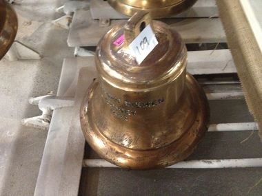
Bell, Atlas van Dieman
... Atlas van Dieman...Bell from the "Atlas van Dieman"...Seaworks Maritime Museum 82 Nelson Place Williamstown melbourne Bell from the "Atlas van Dieman" Atlas van Dieman Bell ...Bell from the "Atlas van Dieman" -
Moorabbin Air Museum
Book - Armstrong Whitworth Atlas, The Armstrong Whitworth Atlas Army Co-Operation Aeroplane with an Appendix on the Atlas Dual Control Aeroplane
... The Armstrong Whitworth Atlas Army Co-Operation Aeroplane with an Appendix on the Atlas Dual Control Aeroplane...Armstrong Whitworth Atlas...Moorabbin Air Museum Moorabbin Airport 12 First Street Moorabbin melbourne Armstrong Whitworth Atlas Technical overview of Atlas Army co-operation aircraft, circa 1929 The Armstrong Whitworth Atlas Army Co-Operation Aeroplane with an Appendix on the Atlas Dual Control Aeroplane Book Armstrong Whitworth Atlas ...Technical overview of Atlas Army co-operation aircraft, circa 1929non-fictionTechnical overview of Atlas Army co-operation aircraft, circa 1929 -
Ringwood and District Historical Society
Legal record - Fire Insurance document (C.E.Carter), Fire Insurance - Atlas Assurance Co Ltd for J. E. M. Williams, 1934
... Fire Insurance - Atlas Assurance Co Ltd for J. E. M. Williams, 1934...Standard form of Fire Insurance Policy issued by Atlas Assurance Company Limited, England....Standard form of Fire Insurance Policy issued by Atlas Assurance Company Limited, England. Fire Insurance - Atlas Assurance Co Ltd for J. ...Standard form of Fire Insurance Policy issued by Atlas Assurance Company Limited, England.Policy issued to J. E. M. Williams for property in Main Street Ringwood, dated September 1934. -
 Flagstaff Hill Maritime Museum and Village
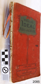
Book, Walkers Ideal Atlas of the World
... Walkers Ideal Atlas of the World...Walkers Ideal Atlas of the World Publisher: John Walker & Co Ltd Date: 1910 ...Flagstaff Hill Maritime Museum and Village 89 Merri Street Warrnambool great-ocean-road flagstaff hill warrnambool shipwrecked-coast flagstaff-hill flagstaff-hill-maritime-museum maritime-museum shipwreck-coast flagstaff-hill-maritime-village walkers ideal atlas of the world book john walker & co ltd Walkers Ideal Atlas of the World Publisher: John Walker & Co Ltd Date: 1910 Walkers Ideal Atlas of the World Book ...Walkers Ideal Atlas of the World Publisher: John Walker & Co Ltd Date: 1910 flagstaff hill, warrnambool, shipwrecked-coast, flagstaff-hill, flagstaff-hill-maritime-museum, maritime-museum, shipwreck-coast, flagstaff-hill-maritime-village, walkers ideal atlas of the world, book, john walker & co ltd -
 Montsalvat
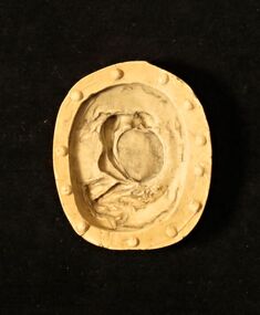
Rubber Mould, Untitled (Atlas)
... Untitled (Atlas)...Oval mould of an oval design depicting a male nude carrying a large orb; possibly Atlas carrying the world. ...Montsalvat 7 Hillcrest Avenue Eltham melbourne matcham skipper mould jewellery nude None Oval mould of an oval design depicting a male nude carrying a large orb; possibly Atlas carrying the world. Untitled (Atlas) Rubber Mould Matcham Skipper (1921-2011) ...Oval mould of an oval design depicting a male nude carrying a large orb; possibly Atlas carrying the world. Nonematcham skipper, mould, jewellery, nude