
Showing 31 items matching "baw baws"
-
 Dandenong & District Historical Society
Document - 1st Dandenong Baw Baw Hut Documentation, Articles Concerning 1st Dandenong Baw Baw Hut Documentation
... 1st Dandenong Baw Baw Hut Documentation...Articles Concerning 1st Dandenong Baw Baw Hut Documentation...1st Dandenong Baw Baw Hut Documentation, Newspaper Article, History...Articles concerning 1st Dandenong Baw Baw Hut Documentation...1st Dandenong Baw Baw Hut Documentation, Newspaper Article, History Articles concerning 1st Dandenong Baw Baw Hut Documentation Articles Concerning 1st Dandenong Baw Baw Hut Documentation Document 1st Dandenong Baw Baw Hut Documentation ...1st Dandenong Baw Baw Hut Documentation, Newspaper Article, History -
 Marysville & District Historical Society
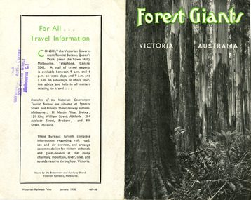
Ephemera (Item) - Information brochure, Victorian Government Tourist Bureau, Forest Giants Victoria Australia, 01-1938
... ...baw baws...An information brochure on where to see tall trees, Forest Giants, in Victoria, including Marysville, that was published in January, 1938. victoria australia victorian government tourist bureau betterment and publicity board victorian railways white mountain ash red mountain ash messmate blue gum mountain ash cumberland valley marysville mount monda healesville acheron way alpine highway omeo baw baws strzelecki ranges otway ranges warburton yarra junction noojee bulga and tarra valley park yarram turton's pass otway forest beech forest apollo bay information brochure brochure Victorian Railways Print January, 1938 469-38 Stamp of Victorian/ Government Tourist Bureau/ 272 Collins Street/ Melbourne C.1 An information brochure on where to see tall trees, Forest Giants, in Victoria, including Marysville, that was published in January, 1938. ...An information brochure on where to see tall trees, Forest Giants, in Victoria, including Marysville, that was published in January, 1938.An information brochure on where to see tall trees, Forest Giants, in Victoria, including Marysville, that was published in January, 1938.Victorian Railways Print January, 1938 469-38 Stamp of Victorian/ Government Tourist Bureau/ 272 Collins Street/ Melbourne C.1victoria, australia, victorian government tourist bureau, betterment and publicity board, victorian railways, white mountain ash, red mountain ash, messmate, blue gum, mountain ash, cumberland valley, marysville, mount monda, healesville, acheron way, alpine highway, omeo, baw baws, strzelecki ranges, otway ranges, warburton, yarra junction, noojee, bulga and tarra valley park, yarram, turton's pass, otway forest, beech forest, apollo bay, information brochure, brochure -
 Marysville & District Historical Society
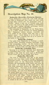
Ephemera (Item) - Book page, Unknown
... ...baw baws...A page from a unknown book regarding Marysville and the surrounding district including Narbethong, Healesville and Warburton. marysville victoria narbethong healesville warburton toolangi launching place box hill ringwood lilydale watts river yea river sylvia falls don road wood's point baw baws maroondah reservoir graceburn weir mt juliet fernshaw A page from a unknown book regarding Marysville and the surrounding district including Narbethong, Healesville and Warburton. ...A page from a unknown book regarding Marysville and the surrounding district including Narbethong, Healesville and Warburton.A page from a unknown book regarding Marysville and the surrounding district including Narbethong, Healesville and Warburton.marysville, victoria, narbethong, healesville, warburton, toolangi, launching place, box hill, ringwood, lilydale, watts river, yea river, sylvia falls, don road, wood's point, baw baws, maroondah reservoir, graceburn weir, mt juliet, fernshaw -
 Marysville & District Historical Society
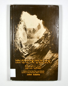
Book - Hardback book, Mountain Gold-A History of the Baw Baw and Walhalla country of the Narracan Shire, Victoria, 1980
... Mountain Gold-A History of the Baw Baw and Walhalla country of the Narracan Shire, Victoria......baw baw...A history of the Baw Baw and Walhalla country of the Narracan Shire, Victoria...A history of the Baw Baw and Walhalla country of the Narracan Shire, Victoria gold gold field gold miner gold mining gold town walhalla baw baw gippsland victoria australia history G&V THOMAS Stamp of the Marysville & District Historical Society Inc / P.O. ...A history of the Baw Baw and Walhalla country of the Narracan Shire, VictoriaHardback. Brown dust cover. Photograph on front cover looks out from the entry of a mine onto the front of a building which has a hill to the side of it. The back cover has a photograph of the side of a hill with some trees on it.G&V THOMAS Stamp of the Marysville & District Historical Society Inc / P.O. Box 22 / Marysville 3779gold, gold field, gold miner, gold mining, gold town, walhalla, baw baw, gippsland, victoria, australia, history -
 Sunshine and District Historical Society Incorporated
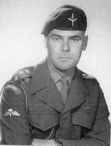
Photograph - Ian Teague Photographs, Various
... Various photos of Mr Ian Teagues activities before his retirement in 1964 as Lt Col 1 1st Sunshine Scouts Mount Baw Baw hike 1950 2 1st Sunshine Scouts Mount Baw Baw hike 1950 3 Albion State School Grade 6 1946 4 Darling Flour Mill Albion 1951 5 Presbyterian Church Sunshine 1951...Ian Teague Various photos of Mr Ian Teagues activities before his retirement in 1964 as Lt Col 1 1st Sunshine Scouts Mount Baw Baw hike 1950 2 1st Sunshine Scouts Mount Baw Baw hike 1950 3 Albion State School Grade 6 1946 4 Darling Flour Mill Albion 1951 5 Presbyterian Church Sunshine 1951 Photograph Ian Teague Photographs ...ian teague -
Eltham District Historical Society Inc
Document - Folder, Murphy, James and descendants
... Contents Note from Ray Blake, 26 April 2000: Ms Murphy said her people had traditionally owned all of inner Melbourne, north to the Great Divide, West to Werribee River, East to Mt Baw Baw, South to Mordialloc Creek....Contents Note from Ray Blake, 26 April 2000: Ms Murphy said her people had traditionally owned all of inner Melbourne, north to the Great Divide, West to Werribee River, East to Mt Baw Baw, South to Mordialloc Creek. James Murphy Newspaper clippings, A4 photocopies, etc Murphy, James and descendants Document Folder ...James Murphy was a mining surveyor involved with the Caledonia diggings. Contents Note from Ray Blake, 26 April 2000: Ms Murphy said her people had traditionally owned all of inner Melbourne, north to the Great Divide, West to Werribee River, East to Mt Baw Baw, South to Mordialloc Creek.Newspaper clippings, A4 photocopies, etcjames murphy -
 Dandenong & District Historical Society
Journal, Dandenong & District Historical Society, Gipps-Land Gate Vol41 No2, 2014
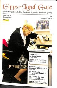
... Letter To The Editor Marg Stork: Her Passion To Write 1923-2014 Recollections Of Dandenong Swimming Club The Keys Family Of Keysborough and Keys Road The Londsdale Ski Club At Mount Baw Baw Order Of Australia Medals Society News A Dirty Story Harking Back 73 Years ...Letter To The Editor Marg Stork: Her Passion To Write 1923-2014 Recollections Of Dandenong Swimming Club The Keys Family Of Keysborough and Keys Road The Londsdale Ski Club At Mount Baw Baw Order Of Australia Medals Society News A Dirty Story Harking Back 73 Years Gipps-Land Gate Vol41 No2 Journal Dandenong & District Historical Society ...An interesting group of Early Dandenong Personalities, Places and EventsA5 size publication of the Gipps-Land Gate, October, 2014 featuring an old picture of Dandenong on the cover. Letter To The Editor Marg Stork: Her Passion To Write 1923-2014 Recollections Of Dandenong Swimming Club The Keys Family Of Keysborough and Keys Road The Londsdale Ski Club At Mount Baw Baw Order Of Australia Medals Society News A Dirty Story Harking Back 73 Years An interesting group of Early Dandenong Personalities, Places and Eventshotel history, early education in dandenong, interesting milestones, family histories -
 Vision Australia
Administrative record - Text, Royal Victorian Institute for the Blind annual report 1982-1983, 1982-1983
... Activities in annual report include: retirement of Ralph Lightfoot, appointment of Frances Warren, opening of Wangaratta regional office, family group home in second year providing home environment for three children, establishment of self contained flat within residential services at Burwood, bushfires threatened but did not destroy Wahpeton at Romsey and ski lodge at Mt Baw Baw, and support from hotels through 80 Lucky Envelope machines....Activities in annual report include: retirement of Ralph Lightfoot, appointment of Frances Warren, opening of Wangaratta regional office, family group home in second year providing home environment for three children, establishment of self contained flat within residential services at Burwood, bushfires threatened but did not destroy Wahpeton at Romsey and ski lodge at Mt Baw Baw, and support from hotels through 80 Lucky Envelope machines. ...Activities in annual report include: retirement of Ralph Lightfoot, appointment of Frances Warren, opening of Wangaratta regional office, family group home in second year providing home environment for three children, establishment of self contained flat within residential services at Burwood, bushfires threatened but did not destroy Wahpeton at Romsey and ski lodge at Mt Baw Baw, and support from hotels through 80 Lucky Envelope machines.1 volume of printed material with imagesannual report, royal victorian institute for the blind -
 Kew Historical Society Inc
Container - Erica Lines Thermos Flask, 1900-1950
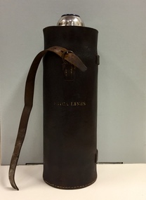
... Erica is a town in Victoria, in the Shire of Baw Baw. In the early 1900s, the township of Erica began to grow after construction of the railway line from Moe to Walhalla. ...Erica is a town in Victoria, in the Shire of Baw Baw. In the early 1900s, the township of Erica began to grow after construction of the railway line from Moe to Walhalla. ...Erica is a town in Victoria, in the Shire of Baw Baw. In the early 1900s, the township of Erica began to grow after construction of the railway line from Moe to Walhalla. When the station opened in 1910 it was named Harris, but was renamed Erica in 1914. Erica was to become the largest town on the Moe-Walhalla railway. The railway line from Moe to Erica closed in 1954. When the item was donated by Raif Brunette in 2007 it was described as a 'Stagecoach thermos flask with leather protective cover'.Metal thermos flask encased in a leather cover embossed with the name 'Erica Lines'."ERICA LINES"erica lines, thermos flasks -
 Falls Creek Historical Society
Journal - Schuss Vol. 19. No. 7 September- October 1953
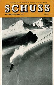
... Erica Division's Hut on Mt. Baw Baw Lower Right: The Skyline Lodge...Erica Division's Hut on Mt. Baw Baw Lower Right: The Skyline Lodge Schuss Vol. 19. ...Schuss was advertised as Victoria’s Official Ski Journal It was issued monthly from 1935 to 1961 except during the war when summer issues covered two months. This continued after the war, but it averaged 10 issues annually over its 25 year life. Schuss was published by the Ski Club of Victoria which had a membership of 38 Ski Clubs and demanded to be recognised as the prime authority on skiing in the state. The other 30 ski clubs with 85% of the members disagreed and the politics of skiing became heated. These clubs formed the Federation of Victorian Ski Clubs with their own journal, Ski Horizon. With the establishment of the Victorian Ski Association, Ski-Horizon published its last issue in Nov - Dec. 1955 and the role of the official journal was fully taken over by “Schuss”. This item is significant because it contains stories, images and information documenting the development of the ski industry in Victoria.The journal features stories and events chronicling developments in Victoria and internationally. Items related to the Falls Creek Area in this issue include:- Cover - Features a photo of a skier descending a steep slope. Page 240 includes four images of heavy snow conditions at Victorian resorts. The images are: Top Left: Hotham Heights Chalet Top Right: SEC Stores Hut near Skyline Lodge Lower Left: Mt. Erica Division's Hut on Mt. Baw Baw Lower Right: The Skyline Lodgeschuss journal, skyline lodge, falls creek -
 Vision Australia
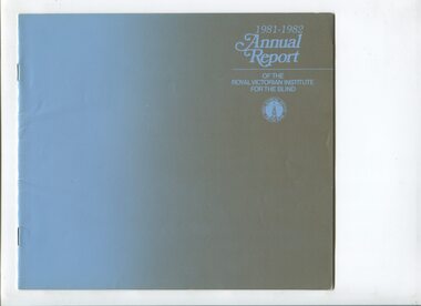
Administrative record - Text, Royal Victorian Institute for the Blind annual report 1981-1982, 1981-1982
... Articles in annual report include: the official opening of the educational camp at Romsey, introduction of a Hartley 3909 Mini Computer, increasing move away from residential services with 74% of school children supported in learn at their local school, hydrotherapy unit (spa) and Versa Brailler purchased for school, 2 week ski camp offered at RVIB ski lodge at Mt Baw Baw, employment continuing in packaging and assembly, plant nursery, maintenance of St Kilda Road and Raleigh Street sites, kiosks at RMIT, Melbourne University and the Institute, trial scheme launched with Alfred for work experience in various roles, introduction of 4 track tapes in library and reduction of Clarke & Smith tapettes, and development of 16mm film 'The Mediators' for use by Public Relations department....Articles in annual report include: the official opening of the educational camp at Romsey, introduction of a Hartley 3909 Mini Computer, increasing move away from residential services with 74% of school children supported in learn at their local school, hydrotherapy unit (spa) and Versa Brailler purchased for school, 2 week ski camp offered at RVIB ski lodge at Mt Baw Baw, employment continuing in packaging and assembly, plant nursery, maintenance of St Kilda Road and Raleigh Street sites, kiosks at RMIT, Melbourne University and the Institute, trial scheme launched with Alfred for work experience in various roles, introduction of 4 track tapes in library and reduction of Clarke & Smith tapettes, and development of 16mm film 'The Mediators' for use by Public Relations department. royal victorian institute for the blind Corporation records 1 volume of printed material Royal Victorian Institute for the Blind annual report 1981-1982 Administrative record Text ...Articles in annual report include: the official opening of the educational camp at Romsey, introduction of a Hartley 3909 Mini Computer, increasing move away from residential services with 74% of school children supported in learn at their local school, hydrotherapy unit (spa) and Versa Brailler purchased for school, 2 week ski camp offered at RVIB ski lodge at Mt Baw Baw, employment continuing in packaging and assembly, plant nursery, maintenance of St Kilda Road and Raleigh Street sites, kiosks at RMIT, Melbourne University and the Institute, trial scheme launched with Alfred for work experience in various roles, introduction of 4 track tapes in library and reduction of Clarke & Smith tapettes, and development of 16mm film 'The Mediators' for use by Public Relations department.1 volume of printed materialroyal victorian institute for the blind, corporation records -
 Falls Creek Historical Society
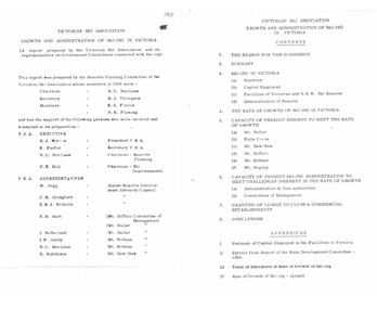
Document - Victorian Ski Association Report - Growth & Administration Of Skiing In Victoria
... Different pages in the report include:- Introduction and contents; reasons for completing this Submission and Summary: Analysis of capital employed on Victoria's snowfields; Facilities of NSW and Vic Ski Resorts; Administration of resorts: the growth of skiing in Victoria; an analysis of resorts at Mt Buller, Falls Creek, Mt. Baw Baw, Mt. Buffalo, Mt. Hotham and Mt. Bogong; Capacity of the present administration to meet challenges related to growth ; the granting of leases to Clubs and Commercial Establishments and an estimate of Capital employed in Ski Facilities in Victoria. ...Different pages in the report include:- Introduction and contents; reasons for completing this Submission and Summary: Analysis of capital employed on Victoria's snowfields; Facilities of NSW and Vic Ski Resorts; Administration of resorts: the growth of skiing in Victoria; an analysis of resorts at Mt Buller, Falls Creek, Mt. Baw Baw, Mt. Buffalo, Mt. Hotham and Mt. Bogong; Capacity of the present administration to meet challenges related to growth ; the granting of leases to Clubs and Commercial Establishments and an estimate of Capital employed in Ski Facilities in Victoria. ...Bob (Herman) Hymans (a former member of the Royal Netherlands Navy) was born in Bloemendaal, Holland on 30th September 1922. During World War II he fought against the Japanese in the Dutch East Indies (now Indonesia) and was imprisoned in Changi and on the Burma Railway. After gaining qualifications as a Ski Instructor, Bob arrived in Falls Creek in July 1950. Working as an Instructor and Supervisor at Bogong Lodge, Bob decided his future was in accommodation. He was successful in negotiating an indenture for land from the State Electricity Commission (SEC). It took Bob two years to build his Grand Coeur Chalet but, tragically, it was burned down in August 1961. Bob also built the first Chairlift in Australia. This was a single chairlift and the structure was built from wooden electricity poles. He was constantly full of new ideas and proposals for the village. Bob Hymans died on 7th July 2007. This Collection of documents and letters tells the story of Bob's endeavours to develop Falls Creek into the ski village it is today.This item is significant because it documents the growth of the Skiing Industry in Victoria up until 1966.A detailed report into the "Growth and Administration of Skiing in Victoria" produced by the Victorian Ski Association. Different pages in the report include:- Introduction and contents; reasons for completing this Submission and Summary: Analysis of capital employed on Victoria's snowfields; Facilities of NSW and Vic Ski Resorts; Administration of resorts: the growth of skiing in Victoria; an analysis of resorts at Mt Buller, Falls Creek, Mt. Baw Baw, Mt. Buffalo, Mt. Hotham and Mt. Bogong; Capacity of the present administration to meet challenges related to growth ; the granting of leases to Clubs and Commercial Establishments and an estimate of Capital employed in Ski Facilities in Victoria. It also includes a table and a graph representing the growth rate of skiing in Victoria.falls creek tourist area management committee, falls creek administration, sewerage system falls creek -
 Kew Historical Society Inc
Album - Photograph Album No.1, Henry Beater Christian, 1924-26
... ...baw baw (vic.)...Readable named locations include: Kew, the Grampians, Marysville, Baw Baw, Daylesford, Hepburn Springs, Bruthen, Swan Reach, Yea, Flowerdale, Port Fairy, Cockatoo, etc....baw baw (vic.) christian-washfold collection Digital copy of a 47-page photograph album containing 255 gelatinous silver images, loaned by Diane Washfold with permission given to digitise and hold a copy in our collection. The album contains a groups of photographic positives taken by Henry B Christian (a resident of Pakington Street), of places in Kew and throughout regional Victoria during the 1920s. The mainly sepia photographs, while small, are of a high quality. Photographs are typically lightly glued onto pages. Locations are frequently identified by white or black ink, which in a number of cases is illegible due to wear. Readable named locations include: Kew, the Grampians, Marysville, Baw ...Henry Christian (c.1809-91), the grandfather of the photographer, was one of the first settlers in Kew. He arrived in Victoria with his wife Agnes and son Orlando in 1855 on the Gypsy Queen. He established a rope-making business in Bulleen Road by 1858 but was declared insolvent two years later. In his final years, he was celebrated as one of the oldest living settlers of the district. His son, Orlando Henry Beater Christian (c.1853-1930) became a member of the Hawthorn Band and a foundation member of the Willsmere Swimming Club. Orlando and his wife Elizabeth had four children of which Henry Beater Christian (1886-1962) was the oldest.An album of photographs, compiled by Henry Beater Christian (1886-1962) of Pakington Street, Kew, depicting individuals, natural and settled environments and the interactions between these worlds. Henry Christian, was a keen explorer, not just of his immediate environment but also of the Victorian wilderness. His major opus is contained in two albums in which he records, sometimes in majestic detail and on other occasions the intimate features of the natural world. His photographic travels during the 1920s, often in solitary ramblings but on other occasions with companions, recall the heroic landscape photography of an earlier era, pioneered by Nicholas Caire. In addition to their aesthetic value, the albums are historically significant records within the State of Victoria, of what is now a distant point in time, and of places that have become radically altered through human intervention.Digital copy of a 47-page photograph album containing 255 gelatinous silver images, loaned by Diane Washfold with permission given to digitise and hold a copy in our collection. The album contains a groups of photographic positives taken by Henry B Christian (a resident of Pakington Street), of places in Kew and throughout regional Victoria during the 1920s. The mainly sepia photographs, while small, are of a high quality. Photographs are typically lightly glued onto pages. Locations are frequently identified by white or black ink, which in a number of cases is illegible due to wear. Readable named locations include: Kew, the Grampians, Marysville, Baw Baw, Daylesford, Hepburn Springs, Bruthen, Swan Reach, Yea, Flowerdale, Port Fairy, Cockatoo, etc.henry beater christian (1886-1962), landscape photography, photograph albums, kew (vic.) — yarra river, kew (vic.) — zig-zag bridge, kew (vic.) — macauley’s boathouse, studley park (vic.) — yarra river, wonderland — grampians (vic.), black spur (vic.), marysville (vic.), maroondah dam (vic.) — construction, warburton (vic.), cockatoo (vic.), bruthen (vic.), swan reach road (vic.), glen hills (vic.), lightning creek (vic.), omeo (vic.), glen wills (vic.), mt wills (vic.), sunnyside (vic), granite flat (vic.), toolangi (vic.), yea (vic, )., flowerdale (vic.), mt white law (vic.), baw baw (vic.), christian-washfold collection -
![The Township of Walhalla / [by] Nicholas Caire, circa 1876](/media/collectors/550653872162f11fb04854aa/items/57825a89d0cdd1176ce3295a/item-media/57825aefd0cdd1176ce34515/item-fit-380x285.jpg?cb=6) Kew Historical Society Inc
Kew Historical Society IncPhotograph, Anglo-Australasian Photographic Company, The Township of Walhalla, c. 1876
... On Reverse: ‘This romantic Township is situated near Stringer’s Creek in Gipps Land, not far from the celebrated Baw-Baw Mountains. The Long Tunnel Gold Claim has proved a great source of wealth to this small out-of-the-way place, yielding sometimes between 2,000 and 3,000 ounces of gold per month. ...His vision of the Australian bush and pioneer life had a counterpart in the works of Henry Lawson and other nationalist poets, authors and painters. nicholas caire (1837-1918) walhalla landscape photography On Reverse: ‘This romantic Township is situated near Stringer’s Creek in Gipps Land, not far from the celebrated Baw-Baw Mountains. The Long Tunnel Gold Claim has proved a great source of wealth to this small out-of-the-way place, yielding sometimes between 2,000 and 3,000 ounces of gold per month. ...Nicholas Caire was born on Guernsey in the Channel Islands in 1837. He arrived in Adelaide with his parents in about 1860. In 1867, following photographic journeys in Gippsland, he opened a studio in Adelaide. From 1870 to 1876 he lived and worked in Talbot in Central Victoria. In 1876 he purchased T. F. Chuck's studios in the Royal Arcade Melbourne. In 1885, following the introduction of dry plate photography, he began a series of landscape series, which were commercially successful. As a photographer, he travelled extensively through Victoria, photographing places few of his contemporaries had previously seen. He died in 1918. Reference: Jack Cato, 'Caire, Nicholas John (1837–1918)', Australian Dictionary of Biography.An original, rare photograph from the series 'Views of Victoria: General Series' by the photographer, Nicholas Caire (1837-1918). The series of 60 photographs that comprise the series was issued c. 1876 and reinforced a neo-Romantic view of the Australian landscape to which a growing nationalist movement would respond. Nicholas Caire was active as a photographer in Australia from 1858 until his death in 1918. His vision of the Australian bush and pioneer life had a counterpart in the works of Henry Lawson and other nationalist poets, authors and painters.‘The Township of Walhalla’ : Views of Victoria (General Series) No.37 : Albumen silver photograph | Photo on card with Title and Description on reverse | Mounted 24 x 30 cm; Photo 12 x 17 cm.On Reverse: ‘This romantic Township is situated near Stringer’s Creek in Gipps Land, not far from the celebrated Baw-Baw Mountains. The Long Tunnel Gold Claim has proved a great source of wealth to this small out-of-the-way place, yielding sometimes between 2,000 and 3,000 ounces of gold per month. The population, which is mostly a mining one, reaches nearly 2,000 inhabitants, and are scattered about among the creeks and gullies of the neighbourhood. Until recently, the road traffic was limited to pack-horses, in consequence of the precipitous hills which surround the Town.‘nicholas caire (1837-1918), walhalla, landscape photography -
 Kiewa Valley Historical Society
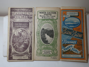
Maps - Tourist
... Tourist Map of Warburton, Mt Baw Baw, and Walhalla. Blue and Orange cover. dated 23-5-33 Govt. printer. 3 different maps of each area showin roads, tracks and timber tramways.Also in red and blue. 3. ...Tourist Map of Warburton, Mt Baw Baw, and Walhalla. Blue and Orange cover. dated 23-5-33 Govt. printer. 3 different maps of each area showin roads, tracks and timber tramways.Also in red and blue. 3. ...These maps were all dated 1933 which was before the construction of the Kiewa Hydro Electric Scheme and when Tawonga was spelt Towonga. North East Victoria in 1933 was before the construction of the Kiewa Hydro Electric Scheme so the townships of Mt Beauty and Bogong are not shown. The description of the Snow Lines was important as skiers, bushwalkers and campers relied on them. The details on the map include "ADB. Numbered from A.1-377 round plates. CD Numbered from C 1-235 square plates. Poles about 3 chains apart 27 to the mile." 3 Tourist location maps (folded) and printed on parchment. 1. Tourist map of the Dandenong Ranges. Brown cover. dated 6-4-33. Govt. printer showing roads, tracks in red and heights of the land. 2. Tourist Map of Warburton, Mt Baw Baw, and Walhalla. Blue and Orange cover. dated 23-5-33 Govt. printer. 3 different maps of each area showin roads, tracks and timber tramways.Also in red and blue. 3. Tourist Map of North Eastern Victoria including Bogong High Plains Mt Buffalo Etc. Green cover. dated June 1933 Govt. printer. Main map and insert titled Bogong High Plains. Showing roads , tracks and tram ways. On insert showing snow poles. Also Red and Blue and mountains.By Authority of H.J. Green - 6 pence. Dept of Lands and Survey, Melbourne1933 maps, tourism maps, bogong high plains map 1933, snow poles -
 Bendigo Historical Society Inc.
Photograph - FAMILY LIVING IN LARGE TREE TRUNK
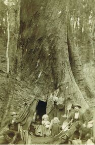
... Fumina is in timber country at the foot of the Baw Baw Mountains and the area was frequently affected by major bushfires. ...Fumina is in timber country at the foot of the Baw Baw Mountains and the area was frequently affected by major bushfires. ...Sepia image (copy) picture shows family gathered at base of large tree trunk with door opening. Two small children in doorway, woman holding younger child inside tree, two men either side of image. Both men are wearing suit coats, vests and wearing hats. Straw broom and pots fixed to tree trunk. Man on RH side has an axe to his right. PLEASE NOTE: Letter with photo inquiring about the people in photo, states that the image is that of Peter Tyson, younger brother of James, his wife Margaret Sheil, and their twin daughters, Alice and Harriet. Diary is of accounts with limited text of a written diary on RH wide of sheets. Bookkeeper was Robert Primrose, whose name appears frequently in the book. Further research by Murray Poustie discovered that the photograph may actually be of Nicholas Penny, his wife Eva and their children Charlie, May, George and Nicholas. Also in the photograph on the left is their neighbour, Mr. John Green. The Photograph was taken by Max Lowenhardt when the Penny family was living in the tree at Fumina in 1906-07 following devastating bushfires. Fumina is in timber country at the foot of the Baw Baw Mountains and the area was frequently affected by major bushfires. The photograph was featured on the cover of the Gippsland Heritage Journal No.19, 1996 and is also extensively noted as ''The Penny family's tree home at Fumina'' in other publications including Vision & Realisation.person, receipts -
 Sunshine and District Historical Society Incorporated
Booklet - The life and times of Ian C Teague, Ian C Teague, 1935 onwards
... Typed Manuscript The Life and Times of Ian C Teague 1935 which included the Mixed Photograph sheets Mixed Photograph copies including school army Mixed Photograph copies including Albion State School C 1926 Grade 6 Albion School 1946 Aerial photograph of War Service Homes 43 Sydney Street 1957 Mixed Photograph copies including Presbyterian Church Dad and Ian 1949 Mixed Photograph copies including Newspaper article dated 24 July 1941 The Sun News Pictorial How the Lights went out over Melbourne Mixed Photograph copies including Cricket articles for Don Bradman and photograph copies of Derrimut Hotel Cinema Sunshine Post Office and Kororoit Creek Swimming Pool Mixed Photograph copies including Scout hike over the Baw Baw Mountains Dec to Jan 1951|Mixed Photograph copies including John Darling Mills and John Flynn Mixed Photograph copies including The Victory Medal given to all School children by the Federal Government in Late 1945 Newspaper Article 15 August 1945 The Herald Peace World hails Jap Surrender Mixed Photograph copies including Looking North West from Sunshine Station 1924 Mixed Photograph copies including Map of Woodend and Ian and Joan at 3 and 4 years...Teague History Typed Manuscript The Life and Times of Ian C Teague 1935 which included the Mixed Photograph sheets Mixed Photograph copies including school army Mixed Photograph copies including Albion State School C 1926 Grade 6 Albion School 1946 Aerial photograph of War Service Homes 43 Sydney Street 1957 Mixed Photograph copies including Presbyterian Church Dad and Ian 1949 Mixed Photograph copies including Newspaper article dated 24 July 1941 The Sun News Pictorial How the Lights went out over Melbourne Mixed Photograph copies including Cricket articles for Don Bradman and photograph copies of Derrimut Hotel Cinema Sunshine Post Office and Kororoit Creek Swimming Pool Mixed Photograph copies including Scout hike over the Baw Baw Mountains Dec to Jan 1951|Mixed Photograph copies including John Darling Mills and John Flynn Mixed Photograph copies including The Victory Medal given to all School children by the Federal Government in Late 1945 Newspaper Article 15 August 1945 The Herald Peace World hails Jap Surrender Mixed Photograph copies including Looking North West from Sunshine Station 1924 Mixed Photograph copies including Map of Woodend and Ian and Joan at 3 and 4 years Stories typed from a life time ago in Sunshine area by Ian Teague Booklet The life and times of Ian C Teague Ian C Teague ...Typed Manuscript The Life and Times of Ian C Teague 1935 which included the Mixed Photograph sheets Mixed Photograph copies including school army Mixed Photograph copies including Albion State School C 1926 Grade 6 Albion School 1946 Aerial photograph of War Service Homes 43 Sydney Street 1957 Mixed Photograph copies including Presbyterian Church Dad and Ian 1949 Mixed Photograph copies including Newspaper article dated 24 July 1941 The Sun News Pictorial How the Lights went out over Melbourne Mixed Photograph copies including Cricket articles for Don Bradman and photograph copies of Derrimut Hotel Cinema Sunshine Post Office and Kororoit Creek Swimming Pool Mixed Photograph copies including Scout hike over the Baw Baw Mountains Dec to Jan 1951|Mixed Photograph copies including John Darling Mills and John Flynn Mixed Photograph copies including The Victory Medal given to all School children by the Federal Government in Late 1945 Newspaper Article 15 August 1945 The Herald Peace World hails Jap Surrender Mixed Photograph copies including Looking North West from Sunshine Station 1924 Mixed Photograph copies including Map of Woodend and Ian and Joan at 3 and 4 yearsteague, history -
 Eltham District Historical Society Inc
Photograph, Fay Bridge, Moor-rul Viewing Platform, Garden Hill, Kangaroo Ground, n.d
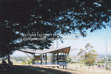
... From the platform you. can see the Dandenongs, the city of Melbourne, the You Yangs, Mount Macedon, the Kinglake Ranges and the Mt Baw-Baw Ranges where the Yarra River starts. ...From the platform you. can see the Dandenongs, the city of Melbourne, the You Yangs, Mount Macedon, the Kinglake Ranges and the Mt Baw-Baw Ranges where the Yarra River starts. ...OPENING OF THE VIEWING PLATFORM AT KANGAROO GROUND Nillumbik Council has advised that the viewing platform at Kangaroo Ground 27km NE of Melbourne is to be opened to the public on Wednesday, March 26th 2008 (Melway 271 , G10). The function of the platform is to provide shelter adjacent to the War Memorial Tower whilst allowing all people to enjoy the stunning panoramic views. From the platform you. can see the Dandenongs, the city of Melbourne, the You Yangs, Mount Macedon, the Kinglake Ranges and the Mt Baw-Baw Ranges where the Yarra River starts. This landscape covers all the ancestral lands of the Wurundjeri and some of the wider Kulin nation land. The platform has been given the name Moor-rut, a name which described the fertile soils of the Kangaroo Ground area in contrast to the poorer (Silurian) country of its surrounds, which the Wurundjeri knew as 'Nillumbik' or less rich country. The full 360 degree view can be seen from the adjacent Tower of Remembrance which has 53 stairs. The viewing platform however can be accessed by wheelchair. Inside the viewing platform there are eight double sided interpretive panels giving the history and information regarding this special area. The viewing platform's interpretive panels set out the Aboriginal and European history of the area and also the geology and the local flora and fauna, so that the casual visitor comes away understanding more about this significant part of Victoria. The concept of the viewing platform is part of the refurbishment project for the Kangaroo Ground War Memorial Park which has taken place since 1997 with the active approval and financial assistance of the Nillumbik Shire Council. This project has been guided by an Advisory Committee with volunteer community representatives from the local Historical Societies, the Country Fire Authority, the Returned Services League and the Wurundjeri people. Other allied groups such as the Nillumbik Reconciliation Group have been called upon for their expertise. The initial idea for the viewing platform came from Dean Stewart when he was the caretaker while living at the park. He discussed this idea with local author Mick Woiwod and Harry Gilham of Eltham District Historical Society when they were planning the refurbishment of the War Memorial Park in 1996. When the committee was formalised by the Nillumbik Council in 1997, Nicholas Pelling, representing the CFA and RSL, joined the group. Dennis Ward, local architect, then volunteered to develop the concept plan for the refurbishment of the park and later drew up the plans for the viewing platform. The Kangaroo Ground War Memorial Park and its Tower of Remembrance is located on one of the highest locations in the Yarra Valley. The Tower of Remembrance is a unique war memorial constructed from local stone standing 14 metres high. It was built in the style of a Scottish watchtower reflecting the strong Scottish influence of the first European settlers of the district from the 1840s onward. The park was opened in 1921 and the Tower of Remembrance was dedicated in 1926 recognising the local people who served in the First World War. Those who served in the Second World War were recognised by plaques dedicated in 1951 and more recently those who served in Korea, Borneo, Malaya and Vietnam by plaques unveiled in 2001. Harry Gilham, Advisory Committee Convenor - Eltham District Historical Society Newsletter N0 179 March 2008fay bridge collection, garden hill, kangaroo ground, memorial park, moor-rul viewing platform -
 Eltham District Historical Society Inc
Photograph - Black and White Print, Moor-rul Viewing Platform, March 2007
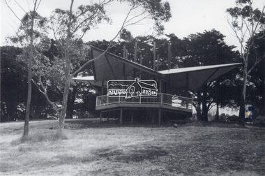
... From the platform you. can see the Dandenongs, the city of Melbourne, the You Yangs, Mount Macedon, the Kinglake Ranges and the Mt Baw-Baw Ranges where the Yarra River starts. ...From the platform you. can see the Dandenongs, the city of Melbourne, the You Yangs, Mount Macedon, the Kinglake Ranges and the Mt Baw-Baw Ranges where the Yarra River starts. ...Early stages - no display panels installed. OPENING OF THE VIEWING PLATFORM AT KANGAROO GROUND Nillumbik Council has advised that the viewing platform at Kangaroo Ground 27km NE of Melbourne is to be opened to the public on Wednesday, March 26th 2008 (Melway 271 , G10). The function of the platform is to provide shelter adjacent to the War Memorial Tower whilst allowing all people to enjoy the stunning panoramic views. From the platform you. can see the Dandenongs, the city of Melbourne, the You Yangs, Mount Macedon, the Kinglake Ranges and the Mt Baw-Baw Ranges where the Yarra River starts. This landscape covers all the ancestral lands of the Wurundjeri and some of the wider Kulin nation land. The platform has been given the name Moor-rut, a name which described the fertile soils of the Kangaroo Ground area in contrast to the poorer (Silurian) country of its surrounds, which the Wurundjeri knew as 'Nillumbik' or less rich country. The full 360 degree view can be seen from the adjacent Tower of Remembrance which has 53 stairs. The viewing platform however can be accessed by wheelchair. Inside the viewing platform there are eight double sided interpretive panels giving the history and information regarding this special area. The viewing platform's interpretive panels set out the Aboriginal and European history of the area and also the geology and the local flora and fauna, so that the casual visitor comes away understanding more about this significant part of Victoria. The concept of the viewing platform is part of the refurbishment project for the Kangaroo Ground War Memorial Park which has taken place since 1997 with the active approval and financial assistance of the Nillumbik Shire Council. This project has been guided by an Advisory Committee with volunteer community representatives from the local Historical Societies, the Country Fire Authority, the Returned Services League and the Wurundjeri people. Other allied groups such as the Nillumbik Reconciliation Group have been called upon for their expertise. The initial idea for the viewing platform came from Dean Stewart when he was the caretaker while living at the park. He discussed this idea with local author Mick Woiwod and Harry Gilham of Eltham District Historical Society when they were planning the refurbishment of the War Memorial Park in 1996. When the committee was formalised by the Nillumbik Council in 1997, Nicholas Pelling, representing the CFA and RSL, joined the group. Dennis Ward, local architect, then volunteered to develop the concept plan for the refurbishment of the park and later drew up the plans for the viewing platform. The Kangaroo Ground War Memorial Park and its Tower of Remembrance is located on one of the highest locations in the Yarra Valley. The Tower of Remembrance is a unique war memorial constructed from local stone standing 14 metres high. It was built in the style of a Scottish watchtower reflecting the strong Scottish influence of the first European settlers of the district from the 1840s onward. The park was opened in 1921 and the Tower of Remembrance was dedicated in 1926 recognising the local people who served in the First World War. Those who served in the Second World War were recognised by plaques dedicated in 1951 and more recently those who served in Korea, Borneo, Malaya and Vietnam by plaques unveiled in 2001. Harry Gilham, Advisory Committee Convenor - Eltham District Historical Society Newsletter N0 179 March 2008 Black and white inkjet print on paper 14 x 21 cmmoor-rul viewing platform, garden hill, kangaroo ground, memorial park -
 Narre Warren and District Family History Group
Book, Narre Warren & District Family History Group Inc, Casey Cardinia Collection - Selected articles from the West Gippsland Trader - Volume 1, 2010
... ...Baw Baw Track...Baw Baw Track 10 Jul 2008 Land of the moon? 07 Aug 2008 I loved eeling in the Tarago River 14 Aug 2008 Don’t let the red steer loose 28 Aug 2008 Yes, there is a place called Jumbuk 04 Sep 2008 The land of the big trees 23 Oct 2008 Still looking for Gippsland’s first town 13 Nov 2008 Journey to the bowels of the earth 30 Oct 2008 For King and Country – J.M. Laidlaw 06 Nov 2008 Jesse Huggett lived an adventurous life 22 Nov 2008 Churchill Island, yet again 04 Dec 2008 Bowman’s Track – if we can find it 11 Dec 2008 Draining of the great Koo Wee Rup Swamp 18 Dec 2008 The swampies had a go 02 Apr 2009 Looking for natural gas not offshore oil 21 Aug 2008 The Dreaded Summer Wildfire 17 Jul 2008 The Tangel (or Tanjil) hills District 7 Feb 2012 The Tanjil Area Goldrush 29 Aug 2013 Saddled and Spurred 9 Feb 2012 Many Racecourses Have Disappeared 16 Feb 2012 Fraser’s Hotel in Glenmaggie 23 Feb 2012 “Nothing Today, Jack!” on the Berwick Hill 1 Mar 2012 The Schnapper Point Line 8 Mar 2012 The Imaginary Town of Tambo 22 Mar 2012 The Tanjil Story Part One 15 Mar 2012 Inverloch Served Mosquito Fleet of Mis-Matched Boats 21 Jun 2012 The Last Bits of the Line 29 Mar 2012 “Gold Rush” to the Tanjil Area led to Reef Mining Companies 16 Aug 2012 New Life for Old Port Welshpool? 30 Aug 2012 The Capital of South Gippsland 28 Jun 2012 The Last Bits of the Line 5 Jul 2012 Ferdinand Von Mueller - a Man of Knowledge 12 Jul 2012 Stones in the Creek 19 Jul 2012 Gembrook - an Attractive Little Town 7 Jun 2012 Getting Rid of the Wood 21 Mar 2013 Getting Into Orbost 13 Dec ? Metung - A BEnd in the River 20 Sep 2012 The Royal Victorian Navy 6 Dec 2012 Tree Ferns to Blackberries 22 Nov 2012 Nowa Nowa Arm and Boggy Creek 18 Oct 2012 Home of the Baw...Metung - A BEnd in the River 20 Sep 2012 The Royal Victorian Navy 6 Dec 2012 Tree Ferns to Blackberries 22 Nov 2012 Nowa Nowa Arm and Boggy Creek 18 Oct 2012 Home of the Baw Baw Frog 1 Nov 2012 Clearing the Hills 11 Oct 2012 The Loss of the Monumental City 4 Oct 2012 The Waterloo Township 13 Sep 2012 Birth of the Shire of Morwell 27 Sep 2012 George Black and Tarwin Meadows 9 Aug 2012 The Forgotten Corner of Gippsland 27 Mar 2008 Thomas William Harrison’s Family 3 Jul ? ...Folder containing a table of contents and a selection of articles on Gippsland History by John Wells in the West Gippsland Trader Volume 1. The date the articles were published, and title of articles are listed below. 30 Oct 1997 Noojee Railway Line is an Engineering Classic 06 Nov 1997 Railways were a kiss of life for small settlements 13 Nov 1997 Erica was a timber and railway town 20 Nov 1997 People fought for railway line through to Stratford 27 Nov 1997 Tiny towns on the Wonthaggi line Vol 16 No 50 Cobungra station has some wild and beautiful country Vol 16 No 51 The explorers we have forgotten Vol 17 No 30 Hallam store became a place for men to gather 14 Feb 2002 Charlie Styles and his dull grey bedford bus Vol 26 No 10 Southern Community names 03 Aug 2006 A bit more Cloverlea 28 Sep 2006 Many airlines were keen to link wide brown land 26 Oct 2006 The ‘run’ at Top Plain 02 Nov 2006 Briagolong and the Garden of Eden 09 Nov 2006 I found a treasure in a milk bar 16 Nov 2006 Got five bob in your pocket, or should I say fifty cents? 23 Nov 2006 Trains were important in developing Gippsland 30 Nov 2006 The main line into Gippsland 07 Dec 2006 Alfred Howitt was a great man who deserves recognition Dec 2006? Christmas again? Already? 15 Feb 2007 The Great Southern Railway 08 Mar 2007 Expectations about water quality have changed since the old days 29 Mar 2007 Navigating by tree tops 12 Apr 2007 The Gippsland railway branch lines were very important in many ways 26 Apr 2007 Some community names from our northern hills 10 May 2007 Community names at the eastern end 24 May 2007 A shorter railway with big tonnages 31 May 2007 Cerberus was the guard dog 07 Jun 2007 Suburban stations in Gippsland 14 Jun 2007 How many Longwarry schools were there? 21 Jun 2007 Traralgon run was Hobson’s choice 28 Jun 2007 Maiden and Mormon and Happy Go Lucky 05 Jul 2007 Consider the humble rabbit trap 12 Jul 2007 Five acre blocks are everywhere 26 Jul 2007 Fencing, but not the Olympic variety 02 Aug 2007 Hanging the barbed wire fences 09 Aug 2007 Collecting and keeping the tucker we gathered 23 Aug 2007 The Longwarry Primary School itself 30 Aug 2007 Surveyors did it hard down Poowong way 06 Sep 2007 Back to the Poowong story 13 Sep 2007 A “think piece” or an indulgence? 20 Sep 2007 Longwarry “extra late final” 04 Oct 2007 Platina’s gone but not forgotten 11 Oct 2007 Robert Nield – Murray is back at it 18 Oct 2007 Spetts’ cottage at Walhalla 25 Oct 2007 Across the Alps to Omeo 08 Nov 2007 Where the gold lies deep in settlements that died 15 Nov 2007 Mines aplenty in the Walhalla area 22 Nov 2007 The other Violet Town – Jolly’s 29 Nov 2007 Mallacoota archaeology 06 Dec 2007 The Cassilis township or call it a settlement 13 Dec 2007 George Bass missed French Island 08 Feb 2008 David Mickle relates many stories of railway accidents 11Sep 2008 Lord Howe has a long history 18 Sep 2008 Quarry Hills important link for Berwick 25 Sep 2008 Tall ships, short ships, schooners and sloops 26 Jun 2008 We find Yanakie Jack again 03 Jul 2008 The well known Baw Baw Track 10 Jul 2008 Land of the moon? 07 Aug 2008 I loved eeling in the Tarago River 14 Aug 2008 Don’t let the red steer loose 28 Aug 2008 Yes, there is a place called Jumbuk 04 Sep 2008 The land of the big trees 23 Oct 2008 Still looking for Gippsland’s first town 13 Nov 2008 Journey to the bowels of the earth 30 Oct 2008 For King and Country – J.M. Laidlaw 06 Nov 2008 Jesse Huggett lived an adventurous life 22 Nov 2008 Churchill Island, yet again 04 Dec 2008 Bowman’s Track – if we can find it 11 Dec 2008 Draining of the great Koo Wee Rup Swamp 18 Dec 2008 The swampies had a go 02 Apr 2009 Looking for natural gas not offshore oil 21 Aug 2008 The Dreaded Summer Wildfire 17 Jul 2008 The Tangel (or Tanjil) hills District 7 Feb 2012 The Tanjil Area Goldrush 29 Aug 2013 Saddled and Spurred 9 Feb 2012 Many Racecourses Have Disappeared 16 Feb 2012 Fraser’s Hotel in Glenmaggie 23 Feb 2012 “Nothing Today, Jack!” on the Berwick Hill 1 Mar 2012 The Schnapper Point Line 8 Mar 2012 The Imaginary Town of Tambo 22 Mar 2012 The Tanjil Story Part One 15 Mar 2012 Inverloch Served Mosquito Fleet of Mis-Matched Boats 21 Jun 2012 The Last Bits of the Line 29 Mar 2012 “Gold Rush” to the Tanjil Area led to Reef Mining Companies 16 Aug 2012 New Life for Old Port Welshpool? 30 Aug 2012 The Capital of South Gippsland 28 Jun 2012 The Last Bits of the Line 5 Jul 2012 Ferdinand Von Mueller - a Man of Knowledge 12 Jul 2012 Stones in the Creek 19 Jul 2012 Gembrook - an Attractive Little Town 7 Jun 2012 Getting Rid of the Wood 21 Mar 2013 Getting Into Orbost 13 Dec ? Metung - A BEnd in the River 20 Sep 2012 The Royal Victorian Navy 6 Dec 2012 Tree Ferns to Blackberries 22 Nov 2012 Nowa Nowa Arm and Boggy Creek 18 Oct 2012 Home of the Baw Baw Frog 1 Nov 2012 Clearing the Hills 11 Oct 2012 The Loss of the Monumental City 4 Oct 2012 The Waterloo Township 13 Sep 2012 Birth of the Shire of Morwell 27 Sep 2012 George Black and Tarwin Meadows 9 Aug 2012 The Forgotten Corner of Gippsland 27 Mar 2008 Thomas William Harrison’s Family 3 Jul ? Railway was Enormous Value to Swamp Country 19 Jun 2008 The Narre Warren Reserve Gates 12 Jun 2008 Heavy Harry is a Pretty Crook Giant 2 May ? Small Settlements on a Long Gippsland Track 5 Jun 2008 Land of Bullumwaal ot “Two Spears” 29 May 2008 Bigger Stops on a Long Road 15 May 2008 Crossing the Beautiful Snowy River 17 Apr 2008 I Remember Uncle Jack aqs an Old Man with Something Wrong 25 Jun 2009 The Murder of Cornelius Green 2 Jul 2009 Captain James Cook was too Late 5 Sep 2013 Oil and the Gippsland Lakes 18 Jun 2009 The Suburbs Around Sale 13 May 2010 The Boag Generations go on and on in Gippsland 27 May 2010 Underwater Coal at Yallourn Open Cut 4 Nov 2010 Narracan - the Aboriginal Name for Crow 23 Apr 2009 Driving Along the Omeo Track 2 Dec 2010 Remembering Those Old Wives’ Tales that we all Grew up with 16 Apr 2009 Myrtlebank, the Lost Suburb 16 Dec 2010 The Tragedy of the Loch Ard 9 Dec 2010 The Latrobe River Wharf on the East Bank 2 Jun 2011 Stony Creek Township’s Quiet Past 17 Mar 2011 William Barak Saw the Whites Take Over 5 May 2011 The Squatters’ Names Still Here 12 May 2011 The Diary of C.A.Ramsden (part one) 26 May 2011 South Coast Towns, 1891 19 May 2011 The Second Part of C.A.Ramsden’s Diary 28 Apr 2011 Squatter Names Still Remain on our Maps 13 Oct 2011 The Resting Place of 1131 Australians 29 Sep 2011 The Mitchell Valley Hopfields Oct 6 Lest We Forget - Lijssenthoek 10 Nov 2011 The Kurnai Men UNKNOWN The Returning of Captain Joe McLaughlin 6 Jun 2013 The Marlo Plains 16 May 2013 Bain’s Border Hotel 23 May ? The Mystery Map 30 May 2013 Finding a Road to the Jordan 4 Apr 2013 Rick Solves Mystery of American Captain 2 May ? The Haunted Hills - Tall Story or Truth? 18 Apr ? Interesting Times 15 Aug 2013 Remembering the Good Times 11 Dec 2014 The Old Sale Road - an Important Link 26 Mar 2015 Difficult to Know the Real Story 27 Nov 2014 The State’s Real Birthday 12 Sep 2013 The Herald 1925 2 Oct 2014 Beacons of Hope 9 Oct 2014 The Joys of Parenthood 6 Nov 2014 Aboriginal Life in Gippsland 30 Oct 2014 Growing up in Gippsland - Harriett Quigley 26 Sep 2013 The McHaffie Diary 19 Sep 2013 Outtrim - Once a Boom Town 10 Oct 2013 Happy Hundredth Birthday 4 Sep 2014 Many Towns Simply Disappeared 17 Jul 2014 Long Distance Farmer 25 Sep 2014 Sam Anderson - Gippsland’s First Farmer 28 Aug 2014 Local Oil 90 Years Ago 6 Mar 2014 A Fiery Summer - 1898 20 Feb 2014 The Corduroy Roads 8 May 2014 The Darkness Within 13 Mar ? Draining the Moe Swamp 1 May 2014 Any Ideas on Old Cannon? 3 Jul 2014 The Magnificent Snowy 14 Aug 2014 Two Gems in the Hills 19 Jun 2014 The Towns Down the Line 27 Feb 2014 State School 2502, Longwarry 18 Sep 2014 Lakes a Natural Fishing Ground 15 May 2014 Police Down the Ages 22May 2014 Iron Horse Came at a Walk 29 May 2014 Prom’s Early Attraction 12 Jun 2014 A Brief History of Meeniyan 5 Jun 2014 Ride on the Old Great Southern 26 Jun 2014 When Victoria Police Went on Strike 23 Apr 2015 Grandma’s Family Lost Heavily 11 Jun 2015 A Rail Journey Almost to Orbost 28 May 2015 Second Battle of Hastings 4 Jun 2015 Dandenong to Trafalgar by Train 18 Jun 2015 The Travelling Picture Man 19 Feb 2015 Water was a Problem 5 Feb 2015 Sandy Point Return Invokes Memories 24 Oct 2013 Lyrebirds Nesting in Trees? 12 Mar 2015 Supplying Melbourne’s Water 9 Aug 2015 They Shall Not Grow Old as we That Are Left 9 Jul 2015 National Parks a Valuable Resource 11 Sep 2014 Living Through the Best and the Worst 12 Feb 2015 Fishing is Part of Port’s History 26 Feb 2015 Chance Lost to Eliminate Rabbits 5 Mar 2015 Bloomfield - End of the Line, in a Way 11 Jul ? Emerald Primary School 22 Aug 2013 The Heartbreak Hills 17 Oct 2013 Port Albert, Land of Elephants 14 Nov 2013 Bullumwaal Land of Two Spears 28 Nov 2013 Coalville - the Forgotten Mine 5 Dec 2013 Early Travel with the Bishop 12 Dec 2013 Bishop Perry in Gippsland 19 Dec 2013 The Great Sale Goldfields Hoax 20 Mar 2014 A Chance to Dazzle the Kids 27 Mar 2014 More of Those Creeks and Rivers 3 Apr 2014 The Arctocephalus is With us Still 10 Apr 2014 Upper Yarra Dam had an Early Start UNKNOWN Harkaway’s Colorful History Contains Some Doubtful Tales UNKNOWN Berwick and the Peninsula in 1886non-fictionwonthaggi railway line towns, great southern railway, baw baw track -
 Narre Warren and District Family History Group
Book, Narre Warren & District Family History Group Inc, Casey Cardinia Collection - Selected articles from the West Gippsland Trader - Volume 2, 2021
... Metung - A BEnd in the River 20 Sep 2012 The Royal Victorian Navy 6 Dec 2012 Tree Ferns to Blackberries 22 Nov 2012 Nowa Nowa Arm and Boggy Creek 18 Oct 2012 Home of the Baw Baw Frog 1 Nov 2012 Clearing the Hills 11 Oct 2012 The Loss of the Monumental City 4 Oct 2012 The Waterloo Township 13 Sep 2012 Birth of the Shire of Morwell 27 Sep 2012 George Black and Tarwin Meadows 9 Aug 2012 The Forgotten Corner of Gippsland 27 Mar 2008 Thomas William Harrison’s Family 3 Jul ? ...Metung - A BEnd in the River 20 Sep 2012 The Royal Victorian Navy 6 Dec 2012 Tree Ferns to Blackberries 22 Nov 2012 Nowa Nowa Arm and Boggy Creek 18 Oct 2012 Home of the Baw Baw Frog 1 Nov 2012 Clearing the Hills 11 Oct 2012 The Loss of the Monumental City 4 Oct 2012 The Waterloo Township 13 Sep 2012 Birth of the Shire of Morwell 27 Sep 2012 George Black and Tarwin Meadows 9 Aug 2012 The Forgotten Corner of Gippsland 27 Mar 2008 Thomas William Harrison’s Family 3 Jul ? ...Folder containing a table of contents and a selection of articles on Gippsland History by John Wells in the West Gippsland Trader Volume 2. The date the articles were published, and title of articles are listed below. 19 Jul 2012 Gembrook - an Attractive Little Town 7 Jun 2012 Getting Rid of the Wood 21 Mar 2013 Getting Into Orbost 13 Dec ? Metung - A BEnd in the River 20 Sep 2012 The Royal Victorian Navy 6 Dec 2012 Tree Ferns to Blackberries 22 Nov 2012 Nowa Nowa Arm and Boggy Creek 18 Oct 2012 Home of the Baw Baw Frog 1 Nov 2012 Clearing the Hills 11 Oct 2012 The Loss of the Monumental City 4 Oct 2012 The Waterloo Township 13 Sep 2012 Birth of the Shire of Morwell 27 Sep 2012 George Black and Tarwin Meadows 9 Aug 2012 The Forgotten Corner of Gippsland 27 Mar 2008 Thomas William Harrison’s Family 3 Jul ? Railway was Enormous Value to Swamp Country 19 Jun 2008 The Narre Warren Reserve Gates 12 Jun 2008 Heavy Harry is a Pretty Crook Giant 2 May ? Small Settlements on a Long Gippsland Track 5 Jun 2008 Land of Bullumwaal ot “Two Spears” 29 May 2008 Bigger Stops on a Long Road 15 May 2008 Crossing the Beautiful Snowy River 17 Apr 2008 I Remember Uncle Jack aqs an Old Man with Something Wrong 25 Jun 2009 The Murder of Cornelius Green 2 Jul 2009 Captain James Cook was too Late 5 Sep 2013 Oil and the Gippsland Lakes 18 Jun 2009 The Suburbs Around Sale 13 May 2010 The Boag Generations go on and on in Gippsland 27 May 2010 Underwater Coal at Yallourn Open Cut 4 Nov 2010 Narracan - the Aboriginal Name for Crow 23 Apr 2009 Driving Along the Omeo Track 2 Dec 2010 Remembering Those Old Wives’ Tales that we all Grew up with 16 Apr 2009 Myrtlebank, the Lost Suburb 16 Dec 2010 The Tragedy of the Loch Ard 9 Dec 2010 The Latrobe River Wharf on the East Bank 2 Jun 2011 Stony Creek Township’s Quiet Past 17 Mar 2011 William Barak Saw the Whites Take Over 5 May 2011 The Squatters’ Names Still Here 12 May 2011 The Diary of C.A.Ramsden (part one) 26 May 2011 South Coast Towns, 1891 19 May 2011 The Second Part of C.A.Ramsden’s Diary 28 Apr 2011 Squatter Names Still Remain on our Maps 13 Oct 2011 The Resting Place of 1131 Australians 29 Sep 2011 The Mitchell Valley Hopfields Oct 6 Lest We Forget - Lijssenthoek 10 Nov 2011 The Kurnai Men UNKNOWN The Returning of Captain Joe McLaughlin 6 Jun 2013 The Marlo Plains 16 May 2013 Bain’s Border Hotel 23 May ? The Mystery Map 30 May 2013 Finding a Road to the Jordan 4 Apr 2013 Rick Solves Mystery of American Captain 2 May ? The Haunted Hills - Tall Story or Truth? 18 Apr ? Interesting Times 15 Aug 2013 Remembering the Good Times 11 Dec 2014 The Old Sale Road - an Important Link 26 Mar 2015 Difficult to Know the Real Story 27 Nov 2014 The State’s Real Birthday 12 Sep 2013 The Herald 1925 2 Oct 2014 Beacons of Hope 9 Oct 2014 The Joys of Parenthood 6 Nov 2014 Aboriginal Life in Gippsland 30 Oct 2014 Growing up in Gippsland - Harriett Quigley 26 Sep 2013 The McHaffie Diary 19 Sep 2013 Outtrim - Once a Boom Town 10 Oct 2013 Happy Hundredth Birthday 4 Sep 2014 Many Towns Simply Disappeared 17 Jul 2014 Long Distance Farmer 25 Sep 2014 Sam Anderson - Gippsland’s First Farmer 28 Aug 2014 Local Oil 90 Years Ago 6 Mar 2014 A Fiery Summer - 1898 20 Feb 2014 The Corduroy Roads 8 May 2014 The Darkness Within 13 Mar ? Draining the Moe Swamp 1 May 2014 Any Ideas on Old Cannon? 3 Jul 2014 The Magnificent Snowy 14 Aug 2014 Two Gems in the Hills 19 Jun 2014 The Towns Down the Line 27 Feb 2014 State School 2502, Longwarry 18 Sep 2014 Lakes a Natural Fishing Ground 15 May 2014 Police Down the Ages 22May 2014 Iron Horse Came at a Walk 29 May 2014 Prom’s Early Attraction 12 Jun 2014 A Brief History of Meeniyan 5 Jun 2014 Ride on the Old Great Southern 26 Jun 2014 When Victoria Police Went on Strike 23 Apr 2015 Grandma’s Family Lost Heavily 11 Jun 2015 A Rail Journey Almost to Orbost 28 May 2015 Second Battle of Hastings 4 Jun 2015 Dandenong to Trafalgar by Train 18 Jun 2015 The Travelling Picture Man 19 Feb 2015 Water was a Problem 5 Feb 2015 Sandy Point Return Invokes Memories 24 Oct 2013 Lyrebirds Nesting in Trees? 12 Mar 2015 Supplying Melbourne’s Water 9 Aug 2015 They Shall Not Grow Old as we That Are Left 9 Jul 2015 National Parks a Valuable Resource 11 Sep 2014 Living Through the Best and the Worst 12 Feb 2015 Fishing is Part of Port’s History 26 Feb 2015 Chance Lost to Eliminate Rabbits 5 Mar 2015 Bloomfield - End of the Line, in a Way 11 Jul ? Emerald Primary School 22 Aug 2013 The Heartbreak Hills 17 Oct 2013 Port Albert, Land of Elephants 14 Nov 2013 Bullumwaal Land of Two Spears 28 Nov 2013 Coalville - the Forgotten Mine 5 Dec 2013 Early Travel with the Bishop 12 Dec 2013 Bishop Perry in Gippsland 19 Dec 2013 The Great Sale Goldfields Hoax 20 Mar 2014 A Chance to Dazzle the Kids 27 Mar 2014 More of Those Creeks and Rivers 3 Apr 2014 The Arctocephalus is With us Still 10 Apr 2014 Upper Yarra Dam had an Early Start UNKNOWN Harkaway’s Colorful History Contains Some Doubtful Tales UNKNOWN Berwick and the Peninsula in 1886non-fictiongippsland lakes, emerald primary school, meeniyan, upper yarra dam -
 Kiewa Valley Historical Society
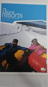
Book - Alpine Resorts - 2020 draft strategy, Alpine Resorts 2020 draft strategy
... Falls Creek, Lake Mountain, Mount Baw Baw, Mount Buller, Mount Hotham and Mount Stirling, after the catastrophic bush fires of 2002- 2003. ...This is a commissioned report auspiced by the State Government of Victoria - Department of Sustainability and Environment 2003.This report was prepared to guide the sustainable long-term planning and management of Victoria's six Alpine Resorts. Falls Creek, Lake Mountain, Mount Baw Baw, Mount Buller, Mount Hotham and Mount Stirling, after the catastrophic bush fires of 2002- 2003.Colorured cardboard front cover with two people on air mattresses in foreground. Title white on bue top left corner. 40 glossy thick paper/card pages. A4Logo "Victoria / The Place to betourism in alpine resorts, sustainability and environment, victorian government, 2002-2003 bushfires -
 Old Gippstown
Building - School
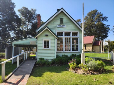
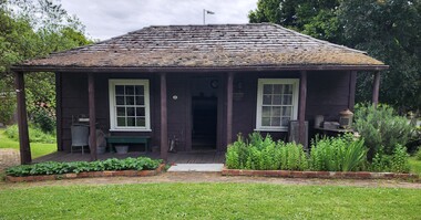
... ...Baw Baw Shire...(Dr Linda Young, Deakin University, significance assessment July 2009) School Sunny Creek Old Gippstown West Gippsland Gippsland Gippsland Heritage Park Goldfields Coal Mines Victorian era Moe Historical Village Education Sunny Creek Road Baw Baw Shire Yarragon East Latrobe Valley Old Gippsland Heritage Park Latrobe City Council Board of Education Has a name board above the front window that reads " SUNNY CREEK SCHOOL SS2903". ...2903 SUNNY CREEK formerly YARRAGON EAST. Sunny Creek State School, first called Yarragon East, was situated on Sunny Creek Road between Yarragon and Trafalgar and was opened in 1888. It was generally served by two teachers or a Head Teacher assisted by a Sewing Mistress. Edwin Mann taught there for 35 years, with his wife, Mrs Mann, as the Sewing Mistress for some years. [Extracted from Vision and Realisation: A Centenary History of State Education in Victoria, Vol. 3, 1973. This does not contain any details of the actual construction of the school, which is a typical Education Department building, and may date from later than 1888]High local historic significance, with some social significance: reunions of old students still held. (Dr Linda Young, Deakin University, significance assessment July 2009)Single-classroom State School. It is a rectangular-shaped timber building with weatherboard walls, timber frame and corrugated iron roof. An outside verandah is situated along the side of the building. Inside there is a small entry porch, a blackboard the length of the room (with fireplace) and a small store-room/cloak room. Built in 1888Has a name board above the front window that reads " SUNNY CREEK SCHOOL SS2903".school, sunny creek, old gippstown, west gippsland, gippsland, gippsland heritage park, goldfields, coal mines, victorian era, moe, historical village, education, sunny creek road, baw baw shire, yarragon east, latrobe valley, old gippsland heritage park, latrobe city council, board of education -
 Old Gippstown
Building - Slab Kitchen
... ...Baw Baw Shire...Medium local historic significance. out kitchen Old Gippstown West Gippsland Gippsland Gippsland Heritage Park Goldfields Coal Mine Victorian era Moe Historical Village timber slab cottage Ripplebrook Labertouche Mason-Brook Pastoral Co. Baw Baw Shire Latrobe Valley Old Gippsland Heritage Park Gunaikurnai Latrobe City Council A small building of horizontal timber slabs. ...A slab construction cottage built in Ripplebrook in 1880 as a home for a single female landowner by the name of Ada Donaldson, and later relocated to Labertouche. It was donated to Old Gippstown by the Mason-Brook Pastoral Co. of Labertouche. A small building of horizontal timber slabs. It has a verandah over the front entrance and the front porch, a main living area with a cast iron stove in the fireplace and a separate room (probably a bedroom). There is a stone chimney on the back wall and the roof is shingled. Originally a cottage in its own right, the slab kitchen is now a part of the Bushy Park display.Medium local historic significance.A small building of horizontal timber slabs. It has a verandah over the front entrance and the front porch. There is a stone chimney on the back wall and the roof is shingled. This building was built in 1880sout kitchen, old gippstown, west gippsland, gippsland, gippsland heritage park, goldfields, coal mine, victorian era, moe, historical village, timber slab cottage, ripplebrook, labertouche, mason-brook pastoral co., baw baw shire, latrobe valley, old gippsland heritage park, gunaikurnai, latrobe city council -
 Old Gippstown
Building - Miner's Hut
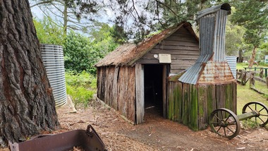
... ...Baw Baw Shire...Tanjil Gold Mining Old Gippstown West Gippsland Gippsland Gippsland Heritage Park Goldfields Moe Historical Village Tanjil Valley Blue Rock Dam Baw Baw Shire Blue Rock Lake Old Gippstown Heritage Park Latrobe Valley Latrobe City Council A small, rectangular bark hut with a bark roof. ...This hut came from the Tanjil goldfields, and was in use around 1900, and was the home of two miners on the Tanjil River gold field. The township of Tanjil came into being above what is now the Blue Rock Dam, in about 1867.A small, rectangular bark hut with a bark roof. The fireplace and chimney are made of corrugated iron with stone base. It has a timber framework.tanjil, gold, mining, old gippstown, west gippsland, gippsland, gippsland heritage park, goldfields, moe, historical village, tanjil valley, blue rock dam, baw baw shire, blue rock lake, old gippstown heritage park, latrobe valley, latrobe city council -
 Old Gippstown
Building - Coach House
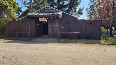
... ...Baw Baw Shire...Used as a shed. agriculture Old Gippstown West Gippsland Gippsland Gippsland Heritage Park Goldfields Coal Mine Victorian era Moe Historical Village Baw Baw Shire Willow Grove Latrobe Valley Old Gippstown Heritage Park Horse drawn vehicles butchers cart baker's cart Tanjil Valley Latrobe City Council A large square-shaped shed with walls of split timber. ...Built in the 1920s on Tom Fowler's farm at Willow Grove. Used as a shed.A large square-shaped shed with walls of split timber. It has a gabled roof of corrugated iron, while the floor is made up of wooden cobbles. The roofs of the side extensions are made of wood. The floor is Red Gum blocksagriculture, old gippstown, west gippsland, gippsland, gippsland heritage park, goldfields, coal mine, victorian era, moe, historical village, baw baw shire, willow grove, latrobe valley, old gippstown heritage park, horse drawn vehicles, butchers cart, baker's cart, tanjil valley, latrobe city council -
 Old Gippstown
Building - Livery Stable
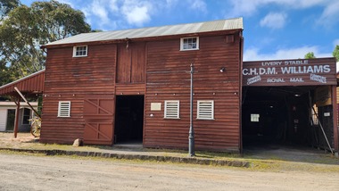
... ...Baw Baw Shire...Used by general carriers in Warragul from the late 1880s Warragul General Carriers Stables Old Gippstown West Gippsland Gippsland Gippsland Heritage Park Goldfields Coal Mine Victorian era Moe Historical Village Baw Baw Shire transport Latrobe Valley Old Gippstown Heritage Park Latrobe City Council A large, two-storey stables of timber with a corrugated iron roof. ...Used by general carriers in Warragul from the late 1880sA large, two-storey stables of timber with a corrugated iron roof. Internally there are four horse stalls on the ground floor and a loft above. The loft is accessed via steep internal stairs and a trapdoor, with an outside door and hoist point. Build in the 1880s warragul, general carriers, stables, old gippstown, west gippsland, gippsland, gippsland heritage park, goldfields, coal mine, victorian era, moe, historical village, baw baw shire, transport, latrobe valley, old gippstown heritage park, latrobe city council -
 Old Gippstown
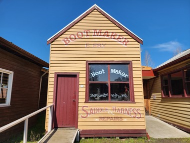
Building - Bootmaker and Saddler, 1906
... ...Baw Baw Shire...Many of the tools belonged to Harry Coombs, who was Moe's first bootmaker from 1910 - 1966 bootmakers Neerim South Samuel Fry Harry Coombs Old Gippstown West Gippsland Gippsland Gippsland Heritage Park Goldfields Coal Mine Victorian era Moe Historical Village Baw Baw Shire Saddlery leather work Old Gippstown Heritage Park Latrobe Valley Latrobe City Council Sign writing on shop front A small rectangular timber shop. ...Built in 1906 in main street of Neerim South by Samuel Fry who established his business at that time. Exhibits include early boots and shoes, Heavy leather working machines and saddlery. Many of the tools belonged to Harry Coombs, who was Moe's first bootmaker from 1910 - 1966A small rectangular timber shop. The front has a gabled corrugated iron roof, while the workshop at the rear of the shop is not as high as the front and has a flat corrugated iron roof.Sign writing on shop frontbootmakers, neerim south, samuel fry, harry coombs, old gippstown, west gippsland, gippsland, gippsland heritage park, goldfields, coal mine, victorian era, moe, historical village, baw baw shire, saddlery, leather work, old gippstown heritage park, latrobe valley, latrobe city council -
 Victorian Aboriginal Corporation for Languages
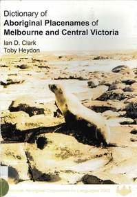
Book, Ian D Clark et al, Dictionary of Aboriginal placenames of Melbourne and Central Victoria, 2002
... ...Baw Baw...Daung Wurrung Woiwurrung Dja Dja Wurrung Wathawurrung Wadawurrung Boon Wurrung Jardwadjali Melbourne Yarra Baw Baw Central Goldfields Bass Coast Greater Geelong South Gippsland Surf Coast Yarra Ranges Golden Plains Mornington Peninsula Yarra Ranges Ballarat Frankston Greater Dandenong Queenscliffe Moorabool Boroondara maps, b&w photographs Dictionary including Indigenous and European place names. ...Dictionary including Indigenous and European place names. Origins are given.maps, b&w photographsdaung wurrung, woiwurrung, dja dja wurrung, wathawurrung, wadawurrung, boon wurrung, jardwadjali, melbourne, yarra, baw baw, central goldfields, bass coast, greater geelong, south gippsland, surf coast, yarra ranges, golden plains, mornington peninsula, yarra ranges, ballarat, frankston, greater dandenong, queenscliffe, moorabool, boroondara -
 Victorian Aboriginal Corporation for Languages
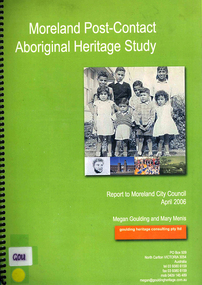
Book, Megan Goulding et al, Moreland post-contact Aboriginal heritage study, 2006
... ...Mount Baw Baw...Woiworung Woi wurrung Wurundjeri Waa Bunjil Werribee River Port Phillip Mount Baw Baw Great Dividing Range Yarra River Eastern Kulin Gunung willam balluk William Barak John Batman William Thomas Moreland history moieties local history colonisation maps, colour photographs, b&w photographs, tables This study aims to identify Aboriginal heritage sites and landscape associations in the Moreland municipality that date from the pre-contact period through to the early contact period when Europeans settled in and around the area, to the present day. ...This study aims to identify Aboriginal heritage sites and landscape associations in the Moreland municipality that date from the pre-contact period through to the early contact period when Europeans settled in and around the area, to the present day.maps, colour photographs, b&w photographs, tableswoiworung, woi wurrung, wurundjeri, waa, bunjil, werribee river, port phillip, mount baw baw, great dividing range, yarra river, eastern kulin, gunung willam balluk, william barak, john batman, william thomas, moreland history, moieties, local history, colonisation
