
Showing 278 items matching "bourke road"
-
 Camberwell Historical Society
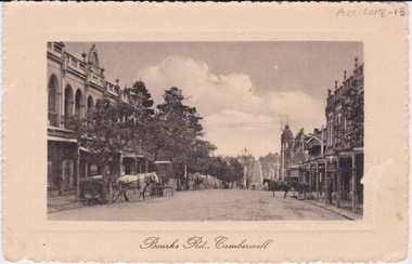
Postcard - Photo postcard, Postcard of Bourke Road, Camberwell, Unknown date but postcard probably dated circa 1900 - definitely pre 1913 because in that year gas lamps were removed from main roads, intersections, also street trees in Burke Road. Also no cars are visible on the street, only horses and carriages. In March 1894 the first streets in the central city of Melbourne were lit with electricity
... Postcard of Bourke Road, Camberwell ......bourke road...Undated photograph on postcard depicting horses and carts with gas lamp in the distance on Bourke Road, Camberwell. ...Front of postcard: 'Bourke Road, Camberwell' Back of postcard: 'Post Card' 'This side for correspondence' 'This side for address' 'Stamp here' 'Printed in Germany.' ...camberwell bourke road Front of postcard: 'Bourke Road, Camberwell' Back of postcard: 'Post Card' 'This side for correspondence' 'This side for address' 'Stamp here' 'Printed in Germany.' ...Undated photograph on postcard depicting horses and carts with gas lamp in the distance on Bourke Road, Camberwell. Front of postcard: 'Bourke Road, Camberwell' Back of postcard: 'Post Card' 'This side for correspondence' 'This side for address' 'Stamp here' 'Printed in Germany.' Handwritten notes '22649 $20'camberwell, bourke road -
 Ambulance Victoria Museum
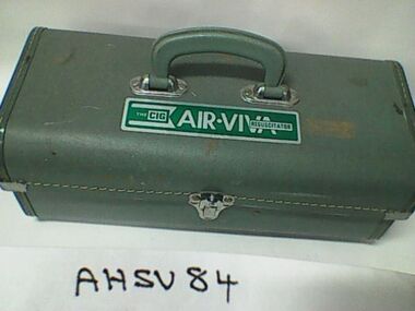
Resuscitator, Air Viva, The Commonwealth Industrial Gases Limited, Circa 1960
... 138 Bourke Road, Alexandria , New South Wales, Australia ...Issued to Ambulance stations during the 1990s and also used at public venues kike swimming polls as the item was easily used by personnel with limited training. Item was used taken in ambulances. Source Chas Martin (AHSV curator 29 Feb 2016).pale green fibre board box with carry handle. Opens out and contains a resuscitation kit. Contains instruction leaflets.THE CIG AIR VIVA RESUSCITATORresuscitation, air viva, cig -
 Ambulance Victoria Museum
RM Resuscitator
... 138 Bourke Road, Alexandria, N.S.W, Australia ...Metal box on stand containing C.I.G. oxy viva resuscitatorC.I.G -
Whitehorse Historical Society Inc.
Map, Survey for road from Doncaster to Ringwood, 01/03/1867
... Survey in County of Bourke, Road Plan no. 390, showing early routes of Doncaster, Whitehorse and Mitcham Roads. ...Survey in County of Bourke, Road Plan no. 390, showing early routes of Doncaster, Whitehorse and Mitcham Roads. ...Survey in County of Bourke, Road Plan no. 390, showing early routes of Doncaster, Whitehorse and Mitcham Roads.Survey in County of Bourke, Road Plan no. 390, showing early routes of Doncaster, Whitehorse and Mitcham Roads. Measurement in chains. Surveyor: Thomas E. Rawlinson.Survey in County of Bourke, Road Plan no. 390, showing early routes of Doncaster, Whitehorse and Mitcham Roads. parish of nunawading, parish of bulleen, whitehorse road mitcham, doncaster road, doncaster east, mitcham road mitcham -
Glen Eira Historical Society
Plan - Clarinda Street, 27, Caulfield South
... Bourke... Sycamore Road...Scott W V Gillespie Grace Ellen Clarinda Street Solicitors S P Simmonds and Co Estate Agents Property values Land values Plans Architectural features Land titles Certificates Caulfield South Prahran East Elsternwick County of Bourke Sycamore Road South Caulfield Glenhuntly Road Plan Clarinda Street, 27, Caulfield South ...A one page typed letter from Plante and Henty Solicitors on behalf of the Executor of the will of the late Grace Ellen Gillespie, to W V Scott of S P Simmonds and Co, dated 04/03/1957, requesting valuation of 27 Clarinda Street, Caulfield South for Probate purposes. The letter is accompanied by the Certificate of Title for the property which includes a map (87mm x 67mm) of the property. It is also accompanied by a floor plan (300mm x 205mm) of the house. The file also includes a two page copy of correspondence from W V Scott to Plante and Henty, dated 22/03/1957, providing the valuation of 27 Clarinda Street. The file also includes three pages of handwritten working notes for the purposes of the valuation which provide dimensions and estimated value of the property.scott w v, gillespie grace ellen, clarinda street, solicitors, s p simmonds and co estate agents, property values, land values, plans, architectural features, land titles, certificates, caulfield south, prahran east, elsternwick county of bourke, sycamore road, south caulfield, glenhuntly road -
 Melbourne Tram Museum
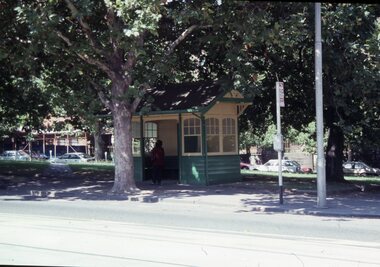
Slide - Set of 15 - Railway MMTB Tram shelters, Robert Green, 2/1990
... Road...Bourke St...Set of 15 colour slides of Tramway Board and MMTB tramway shelters, by Robert Green Feb1990. 1 - Macarthur St and St Andrews Place (Tramway Board) 2 - Macarthur St and St Andrews Place (Tramway Board) 2A - Macarthur St and St Andrews Place (Tramway Board) - logon on the shelter 3 - SW Corner of St Kilda Road & High St 4 - Cnr St Kilda Road and Dorcas St 5 - Batman Ave and St Kilda Road - removed with Batman Ave closed, now at the TMSV Bylands 6 - ditto 7 - ditto - shows the Bundy clock on the office wall. 8 - Victoria and Brunswick Streets 9 - ditto 10 - Cnr St Kilda Road and Bromby St 11 - Victoria and Brunswick Streets 12 - Cnr Dandenong Road and Wattletree Road 13 - Victoria and Brunswick Streets 14 - Bourke and Spencer Streets - note the Bundy clock. ...Yields information about Melbourne tramway shelters. tramways shelters Tramway Board MMTB Macarthur St St Kilda Road Brunwick St Batman Ave Victoria Parade Wattletree Road Bourke St All slides have their location marked on them in black ink. ...Set of 15 colour slides of Tramway Board and MMTB tramway shelters, by Robert Green Feb1990. 1 - Macarthur St and St Andrews Place (Tramway Board) 2 - Macarthur St and St Andrews Place (Tramway Board) 2A - Macarthur St and St Andrews Place (Tramway Board) - logon on the shelter 3 - SW Corner of St Kilda Road & High St 4 - Cnr St Kilda Road and Dorcas St 5 - Batman Ave and St Kilda Road - removed with Batman Ave closed, now at the TMSV Bylands 6 - ditto 7 - ditto - shows the Bundy clock on the office wall. 8 - Victoria and Brunswick Streets 9 - ditto 10 - Cnr St Kilda Road and Bromby St 11 - Victoria and Brunswick Streets 12 - Cnr Dandenong Road and Wattletree Road 13 - Victoria and Brunswick Streets 14 - Bourke and Spencer Streets - note the Bundy clock. Behind is the MTOCo Offices and Carlyons Hotel.Yields information about Melbourne tramway shelters.Set of 14 Kodak colour slides in plastic mounts and one unmounted phtographAll slides have their location marked on them in black ink.tramways, shelters, tramway board, mmtb, macarthur st, st kilda road, brunwick st, batman ave, victoria parade, wattletree road, bourke st -
 Melbourne Tram Museum
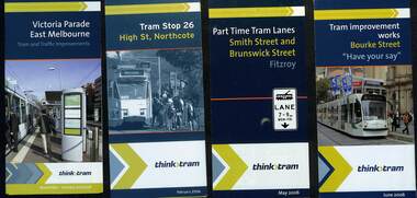
Pamphlet - Set of 8 Think Tram projects, VicRoads, 2005 to 2009
... Road...Bourke St...All include a small map of the works. 1 - Victoria Parade East Melbourne - 5 fold - 2005/2006 2 - Tram stope 26, High St Northcote - 3 fold - Feb. 2006 3 - Part time tram lanes Smith St and Brunswick St Fitzroy - 3 fold - May 2006 4 - Bourke St - have your say - 4 fold - June 2006 5 - Toorak Road tram terminus - 3 fold - Nov. 2006 6 - Bourke St tram stop construction - 4 fold - Sept 2007 7 - Elizabeth St at Queen Victoria Market platform stop - 2 fold - Nov. 2007 8 - Nicholson St - have your say - 4 fold - June 2009...Trams tramways vicroads think tram projects roadworks tram stops Toorak Road Bourke St High St Elizabeth St Nicholson St Victoria Parade Set of 8 pamphlets - folded to DL printed on gloss paper. ...Set of 8 pamphlets detailing the proposed works and dates undertaken by VicRoads, Yarra Trams and the State Government. All include a small map of the works. 1 - Victoria Parade East Melbourne - 5 fold - 2005/2006 2 - Tram stope 26, High St Northcote - 3 fold - Feb. 2006 3 - Part time tram lanes Smith St and Brunswick St Fitzroy - 3 fold - May 2006 4 - Bourke St - have your say - 4 fold - June 2006 5 - Toorak Road tram terminus - 3 fold - Nov. 2006 6 - Bourke St tram stop construction - 4 fold - Sept 2007 7 - Elizabeth St at Queen Victoria Market platform stop - 2 fold - Nov. 2007 8 - Nicholson St - have your say - 4 fold - June 2009Demonstrates an information documents produced by Vicroads as part of the Think Tram projects.Set of 8 pamphlets - folded to DL printed on gloss paper.trams, tramways, vicroads, think tram, projects, roadworks, tram stops, toorak road, bourke st, high st, elizabeth st, nicholson st, victoria parade -
 Melbourne Legacy
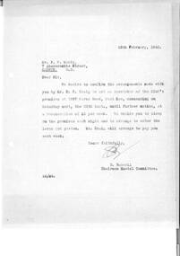
Letter - Document, letter
... Makin to confirm his appointment as caretaker of the Club's premises at 1267 Bourke Road at a remuneration rate of £2 per week. ...Makin to confirm his appointment as caretaker of the Club's premises at 1267 Bourke Road at a remuneration rate of £2 per week. ...Letter dated 18 February 1943 from E. Russell of the Hostel Committee to Mr F.P. Makin to confirm his appointment as caretaker of the Club's premises at 1267 Bourke Road at a remuneration rate of £2 per week. The hostel manager Mr Craig would be responsible for paying the remuneration to Mr Makin.A record of employment process and business correspondence in 1943.Blue quarto copy paper, black type, two hole punched.Initialled in blue ink by E. Russell.residences, holmbush, staff -
 Melbourne Tram Museum
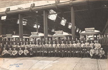
Photograph - Malvern Depot - traffic staff, 1916
... The trams have the destinations of Windsor, Esplanade, Mont Albert and Bourke Road. Note the structure supporting the overhead for roller door connection and the roller door enclosure....The trams have the destinations of Windsor, Esplanade, Mont Albert and Bourke Road. Note the structure supporting the overhead for roller door connection and the roller door enclosure. ...Photo shows the Malvern depot staff, in uniform standing in front of one single trucker and three bogie cars in front of the original Malvern Depot building. There are some 64 men in dark jackets and 32 in khaki or light jackets. The trams have the destinations of Windsor, Esplanade, Mont Albert and Bourke Road. Note the structure supporting the overhead for roller door connection and the roller door enclosure.Yields information about the Malvern depot traffic staff in 1916 and their uniforms.Black and white photo with notes on the front and rear, mounted onto heavy brown card.tramways, tramcars, traffic congestion, collins st, tram 649, tram 268, tram 276 -
 Eltham District Historical Society Inc
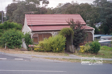
Photograph, Margaret Ball, 68 Bible Street, Eltham, Nov-Dec 1999, 1999
... Owned in 1930s by L. Bourke, Shire Council Road Foreman. Had a tin roof....Owned in 1930s by L. Bourke, Shire Council Road Foreman. Had a tin roof. The Margaret Ball (Pre 1960s Houses) Collection was a personal project initiated to mark the year 2000 and arose as a result of the disappearance of many pre-1960s parts of Eltham due to development. ...Owned in 1930s by L. Bourke, Shire Council Road Foreman. Had a tin roof.The Margaret Ball (Pre 1960s Houses) Collection was a personal project initiated to mark the year 2000 and arose as a result of the disappearance of many pre-1960s parts of Eltham due to development. Approximately 200 pre-1960s style houses that were left in Eltham between Main Road and east to Bible Street, between Cecil Street to the north and south to Dalton Street were photographed in late 1999. Not all of the houses could be photographed; some because the garden or trees blocked the view of the house, others because of rubbish or cars were in the way, some because people were working on the house or in the gardens at the time.Roll of 35mm colour negative film, 7 stripsKodak GC 400-6eltham, houses, streets, margaret ball (pre 1960s houses) collection, bible street -
 Melbourne Tram Museum
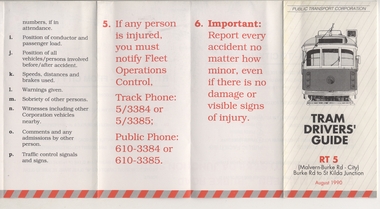
Pamphlet, Public Transport Corporation (PTC), "Tram Drivers' Guide RT 5", Aug. 1990
... Pamphlet for tramcars, sheet of paper folded into pocket size, 12 folds, printed on gloss paper with black and red colours titled "Tram Drivers' Guide RT 5", providing g a map for the Route 5 Malvern Bourke Road from Burke Road to St Kilda Road, showing notes for both directions, compulsory stops, facilities and features. ...Trams tramways PTC Malvern Burke Rd Accidents Tram Drivers Map Pamphlet for tramcars, sheet of paper folded into pocket size, 12 folds, printed on gloss paper with black and red colours titled "Tram Drivers' Guide RT 5", providing g a map for the Route 5 Malvern Bourke Road from Burke Road to St Kilda Road, showing notes for both directions, compulsory stops, facilities and features. ...Pamphlet for tramcars, sheet of paper folded into pocket size, 12 folds, printed on gloss paper with black and red colours titled "Tram Drivers' Guide RT 5", providing g a map for the Route 5 Malvern Bourke Road from Burke Road to St Kilda Road, showing notes for both directions, compulsory stops, facilities and features. On the reverse side, has notes regarding classes of tram, information about accidents and telephone numbers. Dated August 1990. 2nd copy added 11-12-17 from Donation of Ron Scholten.trams, tramways, ptc, malvern burke rd, accidents, tram drivers, map -
 Port Fairy Historical Society Museum and Archives
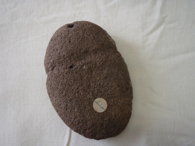
Tool - axe head
... aboriginal stone axe head found on Jack Bourke's property (Albert Road) January 1972...aboriginal stone axe head found on Jack Bourke's property (Albert Road) January 1972 local history ethnographic material hunting fishing gathering stone aboriginal Stone axe head. ...aboriginal stone axe head found on Jack Bourke's property (Albert Road) January 1972Stone axe head. Hole at one end and groove made for twinelocal history, ethnographic material, hunting, fishing, gathering, stone, aboriginal -
 Melbourne Tram Museum
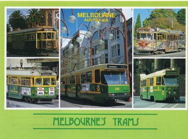
Postcard, Australian Souvenirs and Marketing Pty Ltd of Moorabbin, "Melbourne Trams", late 1980's
... Colour postcard green border, divided back - 5 panel, titled "Melbourne Trams", 1 - W1 431 2 - SW6 872, Moreland, Route 15 3 - A288, Bourke St, route 111 to Exhibition 4 - W5 682, Merrin Eirth, Transporting Art Tram, Malvern Bourke Road, route 5. Tram was painted during 1987. 5 - Z2 113, route 95, route 95, Parliament House. ...Trams tramways W1 class SW6 class A class Route 111 Route 15 Route 5 Z class Route 95 tram 431 tram 872 tram 288 tram 113 Colour postcard green border, divided back - 5 panel, titled "Melbourne Trams", 1 - W1 431 2 - SW6 872, Moreland, Route 15 3 - A288, Bourke St, route 111 to Exhibition 4 - W5 682, Merrin Eirth, Transporting Art Tram, Malvern Bourke Road, route 5. Tram was painted during 1987. 5 - Z2 113, route 95, route 95, Parliament House. ...Colour postcard green border, divided back - 5 panel, titled "Melbourne Trams", 1 - W1 431 2 - SW6 872, Moreland, Route 15 3 - A288, Bourke St, route 111 to Exhibition 4 - W5 682, Merrin Eirth, Transporting Art Tram, Malvern Bourke Road, route 5. Tram was painted during 1987. 5 - Z2 113, route 95, route 95, Parliament House. Back has space for name and address, stamp and a message and details of the postcard, giving a brief history of trams in Melbourne, gives a date of 1983 for track distance. Photographs by Geoff Inkstertrams, tramways, w1 class, sw6 class, a class, route 111, route 15, route 5, z class, route 95, tram 431, tram 872, tram 288, tram 113 -
Melbourne Tram Museum
Film - DVD - Film - Reel 39, Lindsay Walker, "Tram Collection", 1985 to 1988
... Set of two DVD's with digitized film: Each Reel has its own listing of sequences; Reel 39 - Flinders St, Kew, Domain Road, Bourke St, Kew depot, South Melbourne depot, tours, maintenance strike, Malvern Depot, Victoria Parade, Thornbury, South Melbourne, Ballarat, Moomba 1988....Set of two DVD's with digitized film: Each Reel has its own listing of sequences; Reel 39 - Flinders St, Kew, Domain Road, Bourke St, Kew depot, South Melbourne depot, tours, maintenance strike, Malvern Depot, Victoria Parade, Thornbury, South Melbourne, Ballarat, Moomba 1988. ...Set of two DVD's with digitized film: Each Reel has its own listing of sequences; Reel 39 - Flinders St, Kew, Domain Road, Bourke St, Kew depot, South Melbourne depot, tours, maintenance strike, Malvern Depot, Victoria Parade, Thornbury, South Melbourne, Ballarat, Moomba 1988.Yields information about the operation of Melbourne trams in film and has a close association with the donor.Set of two DVD's in plastic cases, marked.In marker pen: 12/2 - "Lindsay Walker, Tram Collection, Movie Reels 28, 29, 39 and super 8melbourne, tramways, films, tours, victoria parade, kew, domain road, depots, thornbury, ballarat, moomba -
 Melbourne Tram Museum
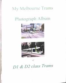
Album, Gus Weir, My Melbourne Trams - D1 & D2 class trams, 2002 to 2012
... Many photos taken at Domain Interchange, Swanston Walk, Bourke St, St Kilda Road, Port Junction, Elizbeth St, docklands, Swanston Walk, St Vincents Plaza, Toorak, and La Trobe St. ...Many photos taken at Domain Interchange, Swanston Walk, Bourke St, St Kilda Road, Port Junction, Elizbeth St, docklands, Swanston Walk, St Vincents Plaza, Toorak, and La Trobe St. ...Compiled by Gus Weir of the Wellington Tramway Museum, former Wellington tram driver. Comprises some 43 double-sided album sheets for photographs of Melbourne D1 & D2 class trams. Scanned into 4 parts as pdf files. Many photos taken at Domain Interchange, Swanston Walk, Bourke St, St Kilda Road, Port Junction, Elizbeth St, docklands, Swanston Walk, St Vincents Plaza, Toorak, and La Trobe St. Photos by Gus himself during Melbourne visits. Part 1 - Introduction - D1 3501, 3502, 3503, 3504, 3505, 3506, 3508, 3510, 3511, 3512, 3513 Part 2 - D1 3513, 3514, 3515, 3516, 3517, 3519, 3521, 3522, 3523, 3524, 3525, 2526, 3529, 3530 Part 3 - D1 3531, 3534, 3536, 3537, 3538, D2 5001, 5002, 5003, 5103, 5004, 5005, 5006, 5007, 5008, 5016, 5010 Part 4 - D2 5010, 5011, 5013, 5014, 5015, 5016, 5017, 5018, 5019, 5020, 5021Yields detailed information about Melbourne trams from 2002 to 2012Set of 43 album sheets generally with four photos within a bound album, heavy brown card covers, plastic cover with a Negative pocket, and some blanks to allow for further photos. Each photo has a label on the rear, with details of the photograph's location, photographer, and date. An insert label on each page gives the tram number, location, and date.tramways, tramcars, albums, melbourne, yarra trams, m>tram, domain junction, swanston st, bourke st, elizabeth st, d1 class, d2 class -
 Melbourne Tram Museum
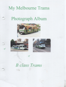
Album, Gus Weir, My Melbourne Trams - B class trams, 1990 to 2011
... Many photos taken at Domain Interchange, Swanston Walk, Bourke St, St Kilda Road, Elizbeth St, docklands, St Vincents Plaza, and La Trobe St. ...Many photos taken at Domain Interchange, Swanston Walk, Bourke St, St Kilda Road, Elizbeth St, docklands, St Vincents Plaza, and La Trobe St. ...Compiled by Gus Weir of the Wellington Tramway Museum, former Wellington tram driver. Comprises some 44 double-sided album sheets for photographs of Melbourne B class trams. Scanned into 4 parts as pdf files. Many photos taken at Domain Interchange, Swanston Walk, Bourke St, St Kilda Road, Elizbeth St, docklands, St Vincents Plaza, and La Trobe St. Photos by Gus himself during Melbourne visits. Part 1 - Introduction - B1 - 2001, 2002, B2 2003, 2005, 2009, 2010, 2027, 2010, 2012, 2014, 2106, 2026, 2027, 2032 & 2034. Part 2 - B2 2036, 2037, 2040, 2041, 2042, 2045, 2047, 2048, 2049, 2051, 2052, 2055, 2060, 2063, 2067, 2119, 2068, 2069, 2077 & 2078 Part 3 - B2 2078, 2085, 2087, 2093, 2094, 2047, 2049, 2100, 2101, 2103, 2089, 2114, 2104, 2105, 2106, 2108, 2109 & 2111. Part 4 - B2 2112, 2115, 2117, 2120, 2123, 2125. 2126, 2131 & 2132.Yields detailed information about Melbourne trams from 1990 to 2011Set of 44 album sheets most with four photos within a PerforMore spring clip album, heavy card covers, plastic cover with a Negative pocket, and some blanks to allow for further photos. Each photo has a label on the rear, with details of the photograph's location, photographer, and date. An insert label on each page gives the tram number, location, and date.tramways, tramcars, albums, melbourne, mmtb, the met, ptc, yarra trams, swanston trams, m>tram, domain junction, swanston st, bourke st, elizabeth st, b class, b1 class -
 Melbourne Tram Museum
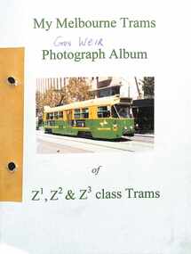
Album, Gus Weir, My Melbourne Trams - Z1, Z2 & Z3 class trams, 1980 to 2011
... Many photos taken at Domain Interchange, Swanston Walk, Bourke St, St Kilda Road, Elizbeth St and La Trobe St. ...Many photos taken at Domain Interchange, Swanston Walk, Bourke St, St Kilda Road, Elizbeth St and La Trobe St. ...Compiled by Gus Weir of the Wellington Tramway Museum, former Wellington tram driver. Comprises some 70 double-sided album sheets for photographs of Melbourne Z1, Z2 and Z3 class trams. Scanned into 6 parts as pdf files. Many photos taken at Domain Interchange, Swanston Walk, Bourke St, St Kilda Road, Elizbeth St and La Trobe St. Photos by Gus himself during Melbourne visits with some by B R Symons, D W Jones, and Michael P Hawkins Part 1 - Introduction - Z1, 1, 2, 3, 4, 5, 7, 9, 10, 14, 19 & 22. Part 2 - Z1, 28, 31, 34, 37, 39, 49, 43, 45, 47, 49, 50, 52, 54, 56, 58, 59, 61, 63, 65, 71, 70, 73, 80, 81, 84, 85, 86, 87, 89, 93 & 95. Part 3 - Z1 & Z2 & Z3 - 96, 100, 101, 108, 112, 113, 114, 115, 116, 117, 120, 122, 123, 125, 126, 128, 199, 136, 137 & 138 Part 4 - Z3 138, 139, 148, 150, 151, 154, 157, 155, 158 (Royal Tram), 160, 163, 164, 166, 167, 168, 169, 170 & 173 Part 5 - Z3 175, 176. 178, 179, 181, 182, 185, 186, 187, 193, 194, 196, 197, 199, 201, 203, & 204 Part 6 - Z3 204, 205, 208, 209, 211, 217, 219, 220, 222, 223, 224, 225, 226, 228, 229 & 230, Yields detailed information about Melbourne trams from 1980 to 2011Set of 70 album sheets most with four photos - some blanks to allow for further photos. Each photo has a label on the rear, with details of the photograph location, photographer and date. An insert label on each page gives tram number, location and date. See last image file - Gus Weir Obituary - Wellington Tramway Museum 2019.tramways, tramcars, albums, z1 class, z2 class, z3 class, melbourne, mmtb, the met, ptc, yarra trams, swanston trams, m>tram, domain junction, swanston st, bourke st -
 Melbourne Tram Museum
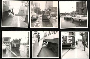
Document - Report, Melbourne & Metropolitan Tramways Board (MMTB), "Interim Report - Nicholson Street Safety Bars", 1978c, 1973
... .4 - tram and traffic at the Bourke St terminus. .5 - not used. .6 - tram 1000 at ditto on a wet day .7 - as for .2 .8 - ditto .9 - ditto .10 - side on view of W2 447 with a concrete prow fitted with a set of flashing lights. .11 - to .15 - series of large prints of enlarged 35mm negatives of night testing of safety zone sign taken at South Melbourne Depot and in St Kilda Road. .16 Bourke St - looking west at Russell St? ....4 - tram and traffic at the Bourke St terminus. .5 - not used. .6 - tram 1000 at ditto on a wet day .7 - as for .2 .8 - ditto .9 - ditto .10 - side on view of W2 447 with a concrete prow fitted with a set of flashing lights. .11 - to .15 - series of large prints of enlarged 35mm negatives of night testing of safety zone sign taken at South Melbourne Depot and in St Kilda Road. .16 Bourke St - looking west at Russell St? ...Report and photographs of various mechanisms to identify and check clearances for Safety Zones on tramways. .1 - Report - 4 pages stapled in top left hand corner - titled "Interim Report - Nicholson Street Safety Bars", dated 20/6/1978 signed by R. G. Vanselow. Describes the work involved in providing a type of "jiggle bars" leading up to the safety zone. Many photographs of the various types of safety zone marks were included within the folder. The photos of 912 are related to the clearance testing carried out during 1973 for the Z class. See also Reg Item 480? .2 - tram 912 fitted with a wooden device to measure clearances - with a concrete safety zone being checked. .3 - tram 1040 in Bourke St with a Safety Zone sign on the left - King St? .4 - tram and traffic at the Bourke St terminus. .5 - not used. .6 - tram 1000 at ditto on a wet day .7 - as for .2 .8 - ditto .9 - ditto .10 - side on view of W2 447 with a concrete prow fitted with a set of flashing lights. .11 - to .15 - series of large prints of enlarged 35mm negatives of night testing of safety zone sign taken at South Melbourne Depot and in St Kilda Road. .16 Bourke St - looking west at Russell St? with caption "prow replacing type 2 (Hairpin sign) with both original (white) and new MCC (Yellow) line marking on approach". .17 - Bourke St - looking west at Kings St and caption "Prow replacing type 2 (Hairpin sign) with original line marking on approach. .16 and .17 taken on Polaroid Instamatic cameras.Some of the photos have captions written on the rear.trams, tramways, tram stops, bourke st, safety zone, testing, z class, safety, tram 912, tram 1040, tram 1000, tram 447 -
Surrey Hills Historical Society Collection
Work on paper - Vertical File, Independent Order of Rechabites Surrey Hills
... William Sneddon, Thomas Hogg, Joseph Stephenson being the registered proprietors of Lot one and two on Bourke Road being the trustees for the time being of Surrey Hills Tent No. 309. ...William Sneddon, Thomas Hogg, Joseph Stephenson being the registered proprietors of Lot one and two on Bourke Road being the trustees for the time being of Surrey Hills Tent No. 309. ...Independence Order of Rechabites 1. History of Rechabites in Surrey Hills. (3 pages single sided) 2. Excerpt from The Rechabite Journal 1 March 1889 p. 66. “News from the tents” (1 page) 3. Surrey Hills Tent No. 309 Victoria District, Independent Order of Rechabites. (15 pages single sided) 4. The Rechabite Register of Tents 15 December 1909 (6 pages single sided) 5. Independent Order of Rechabites (Victoria) Inc. document with notes on history and emblem of Rechabites. (5 pages single sided) (2 copies). 6. Rechabite Acrostic, Motto, Order list of regulations. (5 pages single sided) 7. Rechabite Hall Property Account Balance Sheet for year ending 31 May 1953 (one page single sided) 8. Independent Order of Rechabites Surrey Hills Annual Meeting Business Paper, 12th – 13th March 1946 (4 pages A3 single sided) 9. Syllabus “Something for Everyone” list of events during 1940. Membership fees, A “Safe” Friendly Society, Hawthorn Tent No. 50 I.O.R. (2 pages single sided) 10. “An Invitation from the Officers and Members of the Surrey Hills Tent, No. 309 Syllabus for 1940” (2 pages single sided) 11. Surrey Hills Tent No. 309 Jubilee Banquet, Saturday, 11 February 1939 (6 pages single sided) 12. 42nd Anniversary Celebration “Back to Surrey Hills” in the Rechabite Hall, Saturday, 14th February 1931 (three pages A5 single sided) 13. 42nd Anniversary Celebration “Back to Surrey Hills” in the Rechabite Hall, Canterbury Road, Saturday, 14th February 1931 (one page A6) 14. General Report of the purchase of land and building of the Rechabite Hall, Canterbury Rd, Surrey Hills, 30 November 1930. (three pages single sided) 15. 41st Anniversary of Surrey Hills Tent No. 309 I.O.R. 4th March 1930 (one page single sided) 16. The Melbourne Concert Party presents the Fest of Music, Mirth, Melody and Merriment. Rechabite Hall, Canterbury Rd, Surrey Hills, Tuesday, 4th September 1928 Menu of songs. (one page A5) 17. Program of the 40th Anniversary Celebration Surrey Hills Tent 309 I.O.R. 16th February 1928. (one page A6) 18. William Sneddon, Thomas Hogg, Joseph Stephenson being the registered proprietors of Lot one and two on Bourke Road being the trustees for the time being of Surrey Hills Tent No. 309. (Two pages A3 single sided) 19. Programme of songs (no date). (One page and notes below hand written of the following district officers who were present. 20. Surrey Hills Tent 309 Syllabus 1926. (one page A6) 21. Surrey Hills Tent I.O.R. United Tent Minutes of previous meeting 28th May 1918 22. ‘Agenda’ Tuesday, 2 June 1914 23. “Pleasant Sunday Afternoon” in the Surrey Hall, Surrey Hills on Sunday, 31st May also a Grand Musical Entertainment on Monday, 1st June, Re-Union past and present members on Tuesday, 2 June and conclude with Grand Picture Show on Monday evening, 8th June. (no year stated. A5.) 24. Letter to Dear Bro from GB Wyatt dated 17 June 1913. (one page) 25. Pleasant Afternoon Service, Sunday, 26th June and Grand Concert at Bioscope Entertainment on Monday, 27th June with Programme of songs and recitation by Mr Will Elder. (no year listed) (one page) 26. Twentieth Anniversary of Surrey Hills Tent No. 309 on Monday, 12 July Programme. (one page) 27. 6 x A6 pages of Opening Meetings in New Rechabite Hall and Syllabus for half year ending May, 1926. 28. Anniversary Concert 9th February 1926 Programme. 29. Meeting programme Syllabus 1921. (A6 one page) 30. A grand Picture Night of “The Two Glasses” on Monday, 8th June. Semi-Jubilee Celebrations. (no year listed). (one page A5) 31. A grand Picture Night of “The Two Glasses” on Monday, 8th June. Semi-Jubilee Celebrations. (no year listed). (one page A5) 32. Semi-Jubilee Celebrations Sunday, 14th May 1914 Programme. (two pages A5) 33. Letter to Bro Stephenson from W Wilson dated 16th June 1913. (one page A5) 34. Letter to “Dear Sir & Bro” from Stephenson dated 11 June 1913 (one page A6) 35. Letter to W Wilson from Dr R L Forsyth dated 15 June 1912 (one page A5) 36. Letter to Dr Forsyth from Secretary to No. 309 I.O.R. dated 12th June 1912 37. Letter to W Wilson from Dr R L Forsyth dated June 1912 (date undecipherable) (one page A5) 38. Letter from Robl B Batten, Secretary Hawthorn Tent No. 50 to Secretary Tent 309, dated 2nd December 1911. (one page A5) 39. Letter to W Wilson from (undecipherable name) dated 7 August 1911. Did have telephone number of 169 Canterbury. (one page) 40. Grand Concert and Bioscope Entertainment Programme, 10th July 1911 (one page) 41. Jubilee Group Demonstration Public Meeting held at Box Hill Recreation Hall, Monday, 26th September 1910. 42. Appeal re: Early Closing of Liquor Bars. (one page) 43. Bioscope Entertainment “How a Great Newspaper is Produced” Lecture, Monday, 1st August 1910. (one page) 44. A Edments brochure of Melbourne Supply Stores. (two pages A4) 45. Town of Camberwell Public Notice that Alcoholic Stimulants is most potent and deadly. 1st May 1908. (one page A4) 46. Joint Installation programme dated Tuesday, 17th December 1907. (One page) 47. Letter to Dear Friend from C M Rotherham dated 5 June 1913 (one page single sided) 48. Twenty-First Anniversary Sunday and Monday, 26 & 27 June (no year stated) Programme. (one page) 49. A Grand Concert & Bioscope Entertainment to celebrate the seventieth anniversary on Tuesday evening, 15th May 1906 programme. (one page single sided) 50. Grand Comedy Evening, Monday 15 June 1903 “Arabian Nights” programme. (one page single sided). 51. Keith Wilson’s talk “Building a community – growth and outreach of Surrey Hills Independent Order of Rechabites Tent 309. 1903 – 1920” dated Tuesday, 17th June 1914. (5 pages single sided) 52. 1912 Members list from Secretary William Wilson ‘Longview’ Surrey Hills. (one page A4) 53. The Rechabite newsletter Vol. 74 No. 6. November 1983. 54. The Rechabite newsletter Vol 75 No. 1. October – December 1985. 55. Note to Sue on Holiday Inn note paper size A6 from Val dated 25 May 2015. 56. “Salford Park” Wantirna Retirement at its Best. The Rechabite Community Villages Announce a Unique Opportunity poster. (one page single sided) rechabites, independent order of rechabites, surrey hills independent order of rechabites, tent 309 -
 Eltham District Historical Society Inc
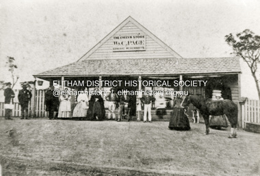
Photograph - Copy of photograph, The Evelyn Store, W. & C. Page, General Merchants, Little Eltham, located on northeast corner of Main Road and John Street, c.1865
... They pointed out that Eltham had two hotels, a local population of about a thousand persons, a great number of them strangers employed on the public roads. The Bourke District police inspector investigated and recommended that the application be approved; and he advised the Chief Commissioner of the availability of a cottage (not very good) and a two-stalled stable with a fenced paddock of four acres, for the sum of ten shillings a week. ...They pointed out that Eltham had two hotels, a local population of about a thousand persons, a great number of them strangers employed on the public roads. The Bourke District police inspector investigated and recommended that the application be approved; and he advised the Chief Commissioner of the availability of a cottage (not very good) and a two-stalled stable with a fenced paddock of four acres, for the sum of ten shillings a week. ...W. and C. Page’s Evelyn Store was in the centre of the Eltham township in the 1860s. It was situated on the eastern side of Maria Street (Main Road) on what was Lot 355 of Josiah Holloway’s Plan of Subdivision of Little Eltham The property is described as having a frontage of one hundred and fifty one feet six inches to Maria-street by a depth of one hundred and thirty two feet with John Street on the south side. That property is now known as 816 Main Road and is occupied by Goodstart Early Learning Eltham. William Austin Page and Charlotte Moyses were married in the last quarter of 1840 in Wisbech, Cambridgeshire, England. Records of their arrival in Australia have not been found. The first record of W.A and C. Page, General Merchants is an advertisement placed in The Argus newspaper in February 1854 for The White Flag Store in Wellington Street, Collingwood. William Austin Page is next recorded in the 1856 Electoral Roll for Evelyn as a storekeeper of Little Eltham. The nature of his qualification being a dwelling house in Little Eltham. There is no C. Page recorded so it is likely that this is William’s wife. It is not known when the store was built, possibly at the direction of W. and C. Page but most likely circa 1855-1856. The Page’s previous business in 1854 being The White Flag Store in Wellington Street, Collingwood. On 21 April 1857, W.A. Page along with John Pearson, Richard Warren (owner of the Eltham Hotel), James Kiddle and Thomas Marland petitioned the Licensing Magistrates of the District of Heidelberg, seeking for better police protection for the district. They pointed out that Eltham had two hotels, a local population of about a thousand persons, a great number of them strangers employed on the public roads. The Bourke District police inspector investigated and recommended that the application be approved; and he advised the Chief Commissioner of the availability of a cottage (not very good) and a two-stalled stable with a fenced paddock of four acres, for the sum of ten shillings a week. This was William Jarrold' s cottage, on the west side of Main Road which became Eltham's first police station - with Constable George Reid in charge. In 1858 the newly established Eltham Road District Board implemented a rate charge. For the year ending October 14, 1858, William A. Page of Little Eltham was listed as the owner and occupier of a shop in Little Eltham, assessed 10 shillings based on building rate of 6d per £, the store valued at £20. The same was assessed for 1859 through 1861. The business was advertised for sale with four years remaining on the then present lease in October 1860. Apparently, there was a lack of interest as they attempted to sell the business again in September 1861 with three years remaining on the lease. Again, to no avail. No record of W.A. Page or the store appears in the 1862 rates assessment however in 1863 the store was valued at £25, owned by T. Hunniford and occupied by W.A. Page. Presumably Thomas Hunniford, purchased the property in 1862 and it may have been unoccupied for a period of time or the owner/occupier entries could have been transposed incorrectly in the rates book. In April 1863, William Austin Page, storekeeper of Little Eltham advertised his intention to have Lot 345 (sic) of Josiah Holloway’s Plan of Subdivision brought under the provisions of the Real Property Act. The property is described as having a frontage of one hundred and fifty one feet six inches to Maria-street by a depth of one hundred and thirty two feet with John Street on the south side. The actual lot described is Lot 355 and this is most likely the location of Page’s Evelyn Store. This action suggests the Pages remained owners of the property and this move was to facilitate a future sale. By September 1867 the Pages had been appointed official agents for The Leader newspaper. In January 1868 the business was once again put up for sale, the owners having been in business 12 years and desirous to return to England. Once more it did not sell and was offered again for sale in March and October of that year. Presumably businesses must have been difficult to sell in those times. No further evidence has been located so far of the Pages having sold their business, but an advertisement was placed in December 1870 offering the store and dwelling house for sale, presently occupied by the Pages. The property was finally sold January 28, 1871, by auction for £150. Whether the Pages ever did return to England, at least for a visit also has not been established but death records show William Austin Page died 12 April 1884 and his wife Charlotte died 4 August 1896. Both are buried in St Kilda Cemetery. - Research by Peter Pidgeon, EDHS, June 2026Black and white copy of photographeltham, evelyn store, general merchants, general store, shops, w. & c. page, william austin page, charlotte page (nee moyses), little eltham -
 Flagstaff Hill Maritime Museum and Village
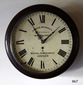
Instrument - Clock
... Road...Bank of Australasia...BoA...Union Bank...Australia & New Zealand Bank...ANZ Bank...James Murray...clock...wall clock...Great Bourke...Flagstaff Hill Warrnambool Shipwrecked coast Flagstaff Hill Maritime Museum Maritime Museum Shipwreck coast Flagstaff Hill Maritime Village Great Ocean Road Bank of Australasia BoA Union Bank Australia & New Zealand Bank ANZ Bank James Murray clock wall clock Great Bourke Street Melbourne Royal Exchange London William Kerr turret clock Old Model School National Model & Training School access door winding key Face: "JAMES MURRAY / - GT. ...This wall clock originated from the Bank of Australasia. The label on the base matches other items from the same donor. It was spring powered by winding the key mechanism with the clock's key through the hole in the clock face. The hinged door on the base of the clock's case allows access to the clock's working mechanism. James Murray (son of James Murray 1780-1847) was a maker of clocks and chronometers. He worked at No. 1, Royal Exchange, London and from 1861 at 107 Great Bourke Street, Melbourne. In 1854 William Kerr ordered a clock from James Murray and erected it on the Albert Street frontage of the National Model & Training School in Spring Street Melbourne. It was Melbourne's first turret clock and remained there for 80 years before it was transferred to the Public Library in Melbourne in 1934 (now Museum Victoria). The Bank of Australasia was incorporated by Royal Charter of England in March 1834. It had its Australian beginning on 14th December 1835, opening in Sydney. The Acting Superintendent of the bank at that time was David Charters McArthur. He was Superintendent from 1867-to 1876. The Melbourne branch opened on 28th August 1838 in a two-roomed brick cottage on the north side of Little Collins Street, where two huge mastiff dogs were used at night to guard the bank. The government also provided an armed military sentinel. Due to the bank's rapid growth, a new building for the Melbourne branch was opened in 1840 at 75 Collins Street West. By 1879 the bank had been upgraded to a magnificent two-storey building on the corners of Collins and Queens Streets, with the entry on Collins Street. In 1951 the Bank of Australasia amalgamated with the Union Bank to form the Australia and New Zealand Bank, now known as the ANZ. Then in 1970, the ANZ merged with both the ES&A and the London Bank of Australia to form the ANZ Banking Group Limited. The ANZ Banking Group Ltd kindly donated a variety of historic items from the Bank of Australasia. BANK of AUSTRALASIA, WARRNAMBOOL – In 1854 Warrnambool had two banks, the Union Bank and the Bank of Australasia. Later, completely different bank businesses opened; in 1867 the National Bank of Australasia, then in 1875 the Colonial Bank of Australasia. The original Warrnambool branch of the Bank of Australasia was established in July 1854, and operated from a leased cottage on Merri Street, close to Liebig Street. The bank next bought a stone building previously erected by drapers Cramond & Dickson on the corner of Timor and Gibson Streets. Samuel Hannaford was a teller and then Manager at the Warrnambool branch from 1855 to 1856 and the Warrnambool Council chose that bank for its dealings during 1856-57. In 1859 Roberts & Co. was awarded the contract to build the new Bank of Australasia branch for the sum of £3,000. The land was on a sand hill on the northeast corner of Timor and Kepler Streets and had been bought in 1855 from investor James Cust. The new building opened on May 21, 1860. The bank continued to operate there until 1951 when it merged with the Union Bank to form the ANZ Bank, which continued operating from its Liebig Street building. Warrnambool City Council purchased the former Bank of Australasia building in 1971 and renovated it, then on 3rd December 1973 it was officially opened as the Art Gallery by Cr. Harold Stephenson and Gallery Director John Welsh. The Gallery transferred to the purpose-built building in Liebig Street in 1986 and the old bank building is now the Gallery club. Staff at the Bank of Australasia in Warrnambool included the following men but others were also involved: Samuel Hannaford, Teller then Manager from 1855-1856; W H Palmer, Manager from January 1857 until November 1869 when the Teller Basil Spence was promoted to Manager; H B Chomley, Manager from April 1873 and still there in 1886; A Butt, Manager in 1895-1904; J R McCleary Accountant and Acting Manager for 12 months, until 1900; A Kirk, Manager 1904; J Moore, staff until his transfer to Bendigo in December 1908; J S Bath was Manager until 1915; C C Cox, Manager until April 1923; Richard C Stanley, Manager 1923 to April 1928. The clock has significance through its association with the Bank of Australasia. The early Australian bank was established in 1834 by Royal Charter and opened in Sydney, Australia, in Sydney in 1835. The bank had many Australian offices in November 1877, particularly on the east and south coasts. Victoria had 45 percent of all Offices. The clock is significant for its connection with the quality clockmaker James Murray, originally from Royal Exchange London with a branch that opened in Melbourne in 1861. James Murray is renown for making the first turret clock to be installed in Melbourne. The clock is locally significant for its association with the Warrnambool Bank of Australasia, which was established in 1854. It was Warrnambool Council’s first bank. The bank continued to operate until the organisation's merger in 1951 when it became the ANZ Bank Group today. The Bank was an integral part of the growth of local commerce and the community.Wall clock with a round face behind glass in a wooden case. The painted brass face has Roman numerals, two decorative hands, divisions for minutes and a keyhole. The curved base of the case has a hinged access door with a keyhole and adhesive label. The back of the clock's case has metal mounting brackets. Inscriptions on the rectangular white label. Made by James Murray, Melbourne.Face: "JAMES MURRAY / - GT. BOURKE ST. / MELBOURNE / & / ROYAL EXCHANGE / LONEON" Label: "A M / 40"flagstaff hill, warrnambool, shipwrecked coast, flagstaff hill maritime museum, maritime museum, shipwreck coast, flagstaff hill maritime village, great ocean road, bank of australasia, boa, union bank, australia & new zealand bank, anz bank, james murray, clock, wall clock, great bourke street melbourne, royal exchange london, william kerr, turret clock, old model school, national model & training school, access door, winding key -
 Federation University Historical Collection
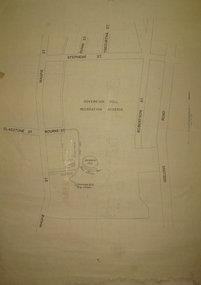
Plan, Sovereign Hill Recreation Reserve and Surrounds
... The plan also depicts the Ballarat East streets surrounding Sovereign hill, including Geelong Road, Magpie Street, Stephens Street, Tregurtha Street, Dunn Street, Bourke Street, Gladstone Street and Robertson Street. ...The plan also depicts the Ballarat East streets surrounding Sovereign hill, including Geelong Road, Magpie Street, Stephens Street, Tregurtha Street, Dunn Street, Bourke Street, Gladstone Street and Robertson Street. ...This map was probably produced around the time that the Sovereign Hill Museums Association was established. A simple plan with black marking on paper. It shows the Sovereign Hill Recreation Rerserve, including the swimming pool located near the Sovereign Hill Trig Point, showers, toilets, kiosk, bandstand and pine trees. The plan also depicts the Ballarat East streets surrounding Sovereign hill, including Geelong Road, Magpie Street, Stephens Street, Tregurtha Street, Dunn Street, Bourke Street, Gladstone Street and Robertson Street. The scale is 2 chains to 1 inch.sovereign hill, swimming pool -
 Greensborough Historical Society
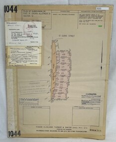
Poster - Planning Document, Shire of Diamond Valley et al, Subdivision Plan # 1044 - Parish of Nillumbik, County Bourke, Crown Allotment B Section 12, Eltham North, 1981-1987
... Subdivision Plan # 1044 - Parish of Nillumbik, County Bourke, Crown Allotment B Section 12, Eltham North. This subdivision plan includes Weidlich Road and St Clems Street. ...Subdivision Plan # 1044 - Parish of Nillumbik, County Bourke, Crown Allotment B Section 12, Eltham North. This subdivision plan includes Weidlich Road and St Clems Street. ...Subdivision Plan # 1044 - Parish of Nillumbik, County Bourke, Crown Allotment B Section 12, Eltham North. This subdivision plan includes Weidlich Road and St Clems Street. The developer for this subdivision is Taunton Developments and the Surveyors are Fisher Cleeland Turner & Dwyer Vic, Surveyors and Engineers.An example of hard copy subdivision plans from the Greensborough area. Mainly from the Shire of Diamond Valley era (1964-1994).Plan (single sided) mounted on heavy card. Stamped and handwritten Council permissions, dates and other details. subdivision plans, shire of diamond valley, taunton developments -
 Greensborough Historical Society
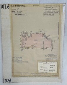
Poster - Planning Document, Shire of Diamond Valley et al, Subdivision Plan # 1026 - Parish of Nillumbik, County Bourke, Crown Allotment B Section 12, Eltham North, 1981-1984
... Subdivision Plan # 1026 - Parish of Nillumbik, County Bourke, Crown Allotment B Section 12, Eltham North. This subdivision plan includes Ryans Road (also known as Government Road) and St Clems Street. ...Subdivision Plan # 1026 - Parish of Nillumbik, County Bourke, Crown Allotment B Section 12, Eltham North. This subdivision plan includes Ryans Road (also known as Government Road) and St Clems Street. ...Subdivision Plan # 1026 - Parish of Nillumbik, County Bourke, Crown Allotment B Section 12, Eltham North. This subdivision plan includes Ryans Road (also known as Government Road) and St Clems Street. The developer for this subdivision is Taunton Developments and the Surveyors are Fisher Cleeland Turner & Dwyer Vic, Surveyors and Engineers.An example of hard copy subdivision plans from the Greensborough area. Mainly from the Shire of Diamond Valley era (1964-1994).Plan (single sided) mounted on heavy card. Stamped and handwritten Council permissions, dates and other details. subdivision plans, shire of diamond valley, taunton developments -
 Greensborough Historical Society
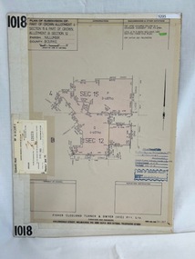
Poster - Planning Document, Shire of Diamond Valley et al, Subdivision Plan # 1018 - Parish of Nillumbik, County Bourke, Crown Allotment 4 Section 15, and Crown Allotment B Section 12, Eltham North, 1981-1982
... Subdivision Plan # 1018 - Parish of Nillumbik, County Bourke, Crown Allotment 4 Section 15, and Crown Allotment B Section 12, Eltham North. This subdivision plan includes Ryans Road (also known as Government Road) and St Clems Street. ...Subdivision Plan # 1018 - Parish of Nillumbik, County Bourke, Crown Allotment 4 Section 15, and Crown Allotment B Section 12, Eltham North. This subdivision plan includes Ryans Road (also known as Government Road) and St Clems Street. ...Subdivision Plan # 1018 - Parish of Nillumbik, County Bourke, Crown Allotment 4 Section 15, and Crown Allotment B Section 12, Eltham North. This subdivision plan includes Ryans Road (also known as Government Road) and St Clems Street. The developer for this subdivision is Taunton Developments and the Surveyors are Fisher Cleeland Turner & Dwyer Vic, Surveyors and Engineers.An example of hard copy subdivision plans from the Greensborough area. Mainly from the Shire of Diamond Valley era (1964-1994).Plan (single sided) mounted on heavy card. Stamped and handwritten Council permissions, dates and other details. subdivision plans, shire of diamond valley, taunton developments -
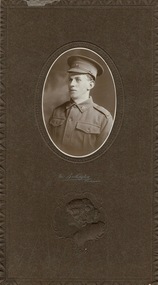 Lara RSL Sub Branch
Photograph, Burlington Studios, J.L.McIntyre
... Bourke Street Mall). The photo would have been taken circa 1915. WW1 picture of (Jack McIntyre) J.L. McIntyre; REG. No. 3591; 58th. BATT. 1st A.I.F Foundation Member Lara R.S.L. 1890 - 1990 well documented history and service record. On front side, half way down are the words The Burlington Melbourne and below this is an embossed picture of a female upper torso. On the rear in pen are the words J.L. J.McIntyre (Jack) 45 Walkers Road ...The Burlington Studios were in the Wertheim Buildings, 294 Bourke Street, Melbourne (now the Bourke Street Mall). The photo would have been taken circa 1915. WW1 picture of (Jack McIntyre) J.L. McIntyre; REG. No. 3591; 58th. BATT. 1st A.I.F Foundation Member Lara R.S.L. 1890 - 1990 well documented history and service record.Carboard with wax paper over framed pictureOn front side, half way down are the words The Burlington Melbourne and below this is an embossed picture of a female upper torso. On the rear in pen are the words J.L. J.McIntyre (Jack) 45 Walkers Road Lara. -
 Flagstaff Hill Maritime Museum and Village
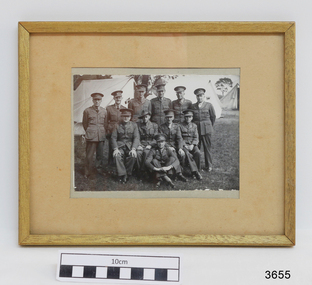
Photograph - Military group, C. Fitch & Son, c. 1941
... Dr Angus assisted Dr Tom Ryan, a pioneer in the use of X-rays and in ocular surgery. flagstaff hill warrnambool shipwrecked coast flagstaff hill maritime museum maritime museum shipwreck coast flagstaff hill maritime village great ocean road dr w r angus australian army officers of 46th battalion, 3rd division army surgeon camp 20 army surgeon ww2 c. fitch and son Stamped details of the "Official Photographer C. Fitch & Son, 4 Racing Club Lane, off Little Bourke ...This photograph was taken during World War 2 when Dr. W.R. Angus served as an army surgeon. The details on the back of the photograph include the date of 1941. The photograph was donated to Flagstaff Hill Maritime Village by the family of Doctor William Roy Angus, Surgeon and Oculist. It is part of the “W.R. Angus Collection” that includes historical medical equipment, surgical instruments and material once belonging to Dr Edward Ryan and Dr Thomas Francis Ryan, (both of Nhill, Victoria) as well as Dr Angus’ own belongings. The Collection’s history spans the medical practices of the two Doctors Ryan, from 1885-1926 plus that of Dr Angus, up until 1969. ABOUT THE “W.R.ANGUS COLLECTION” Doctor William Roy Angus M.B., B.S., Adel., 1923, F.R.C.S. Edin.,1928 (also known as Dr Roy Angus) was born in Murrumbeena, Victoria in 1901 and lived until 1970. He qualified as a doctor in 1923 at University of Adelaide, was Resident Medical Officer at the Royal Adelaide Hospital in 1924 and for a period was house surgeon to Sir (then Mr.) Henry Simpson Newland. Dr Angus was briefly an Assistant to Dr Riddell of Kapunda, then commenced private practice at Curramulka, Yorke Peninsula, SA, where he was physician, surgeon and chemist. In 1926, he was appointed as new Medical Assistant to Dr Thomas Francis Ryan (T.F. Ryan, or Tom), in Nhill, Victoria, where his experiences included radiology and pharmacy. In 1927 he was Acting House Surgeon in Dr Tom Ryan’s absence. Dr Angus had become engaged to Gladys Forsyth and they decided he would take time to further his studies overseas in the UK in 1927. He studied at London University College Hospital and at Edinburgh Royal Infirmary and in 1928, was awarded FRCS (Fellow from the Royal College of Surgeons), Edinburgh. He worked his passage back to Australia as a Ship’s Surgeon on the on the Australian Commonwealth Line’s T.S.S. Largs Bay. Dr Angus married Gladys in 1929, in Ballarat. (They went on to have one son (Graham 1932, born in SA) and two daughters (Helen (died 12/07/1996) and Berenice (Berry), both born at Mira, Nhill ) Dr Angus was a ‘flying doctor’ for the A.I.M. (Australian Inland Ministry) Aerial Medical Service in 1928 . The organisation began in South Australia through the Presbyterian Church in that year, with its first station being in the remote town of Oodnadatta, where Dr Angus was stationed. He was locum tenens there on North-South Railway at 21 Mile Camp. He took up this ‘flying doctor’ position in response to a call from Dr John Flynn; the organisation was later known as the Flying Doctor Service, then the Royal Flying Doctor Service. A lot of his work during this time involved dental surgery also. Between 1928-1932 he was surgeon at the Curramulka Hospital, Yorke Peninsula, South Australia. In 1933 Dr Angus returned to Nhill where he’d previously worked as Medical Assistant and purchased a share of the Nelson Street practice and Mira hospital from Dr Les Middleton one of the Middleton Brothers, the current owners of what was once Dr Tom Ryan’s practice. Dr L Middleton was House Surgeon to the Nhill Hospital 1926-1933, when he resigned. [Dr Tom Ryan’s practice had originally belonged to his older brother Dr Edward Ryan, who came to Nhill in 1885. Dr Edward saw patients at his rooms, firstly in Victoria Street and in 1886 in Nelson Street, until 1901. The Nelson Street practice also had a 2 bed ward, called Mira Private Hospital ). Dr Edward Ryan was House Surgeon at the Nhill Hospital 1884-1902 . He also had occasions where he successfully performed veterinary surgery for the local farmers too. Dr Tom Ryan then purchased the practice from his brother in 1901. Both Dr Edward and Dr Tom Ryan work as surgeons included eye surgery. Dr Tom Ryan performed many of his operations in the Mira private hospital on his premises. He too was House Surgeon at the Nhill Hospital 1902-1926. Dr Tom Ryan had one of the only two pieces of radiology equipment in Victoria during his practicing years – The Royal Melbourne Hospital had the other one. Over the years Dr Tom Ryan gradually set up what was effectively a training school for country general-practitioner-surgeons. Each patient was carefully examined, including using the X-ray machine, and any surgery was discussed and planned with Dr Ryan’s assistants several days in advance. Dr Angus gained experience in using the X-ray machine there during his time as assistant to Dr Ryan. Dr Tom Ryan moved from Nhill in 1926. He became a Fellow of the Royal Australasian College of Surgeons in 1927, soon after its formation, a rare accolade for a doctor outside any of the major cities. He remained a bachelor and died suddenly on 7th Dec 1955, aged 91, at his home in Ararat. Scholarships and prizes are still awarded to medical students in the honour of Dr T.F. Ryan and his father, Dr Michael Ryan, and brother, John Patrick Ryan. ] When Dr Angus bought into the Nelson Street premises in Nhill he was also appointed as the Nhill Hospital’s Honorary House Surgeon 1933-1938. His practitioner’s plate from his Nhill surgery states “HOURS Daily, except Tuesdays, Fridays and Saturday afternoons, 9-10am, 2-4pm, 7-8pm. Sundays by appointment”. This plate is now mounted on the doorway to the Port Medical Office at Flagstaff Hill Maritime Village, Warrnambool. Dr Edward Ryan and Dr Tom Ryan had an extensive collection of historical medical equipment and materials spanning 1884-1926 and when Dr Angus took up practice in their old premises he obtained this collection, a large part of which is now on display at the Port Medical Office at Flagstaff Hill Maritime Village in Warrnambool. During his time in Nhill Dr Angus was involved in the merging of the Mira Hospital and Nhill Public Hospital into one public hospital and the property titles passed on to Nhill Hospital in 1939. In 1939 Dr Angus and his family moved to Warrnambool where he purchased “Birchwood,” the 1852 home and medical practice of Dr John Hunter Henderson, at 214 Koroit Street. (This property was sold in1965 to the State Government and is now the site of the Warrnambool Police Station. ). The Angus family was able to afford gardeners, cooks and maids; their home was a popular place for visiting dignitaries to stay whilst visiting Warrnambool. Dr Angus had his own silk worm farm at home in a Mulberry tree. His young daughter used his centrifuge for spinning the silk. Dr Angus was appointed on a part-time basis as Port Medical Officer (Health Officer) in Warrnambool and held this position until the 1940’s when the government no longer required the service of a Port Medical Officer in Warrnambool; he was thus Warrnambool’s last serving Port Medical Officer. (The duties of a Port Medical Officer were outlined by the Colonial Secretary on 21st June, 1839 under the terms of the Quarantine Act. Masters of immigrant ships arriving in port reported incidents of diseases, illness and death and the Port Medical Officer made a decision on whether the ship required Quarantine and for how long, in this way preventing contagious illness from spreading from new immigrants to the residents already in the colony.) Dr Angus was a member of the Australian Medical Association, for 35 years and surgeon at the Warrnambool Base Hospital 1939-1942, He served as a Surgeon Captain during WWII 1941-45, in Ballarat, Victoria, and in Bonegilla, N.S.W., completing his service just before the end of the war due to suffering from a heart attack. During his convalescence he carved an intricate and ‘most artistic’ chess set from the material that dentures were made from. He then studied ophthalmology at the Royal Melbourne Eye and Ear Hospital and created cosmetically superior artificial eyes by pioneering using the intrascleral cartilage. Angus received accolades from the Ophthalmological Society of Australasia for this work. He returned to Warrnambool to commence practice as an ophthalmologist, pioneering in artificial eye improvements. He was Honorary Consultant Ophthalmologist to Warrnambool Base Hospital for 31 years. He made monthly visits to Portland as a visiting surgeon, to perform eye surgery. He represented the Victorian South-West subdivision of the Australian Medical Association as its secretary between 1949 and 1956 and as chairman from 1956 to 1958. In 1968 Dr Angus was elected member of Spain’s Barraquer Institute of Barcelona after his research work in Intrasclearal cartilage grafting, becoming one of the few Australian ophthalmologists to receive this honour, and in the following year presented his final paper on Living Intrasclearal Cartilage Implants at the Inaugural Meeting of the Australian College of Ophthalmologists in Melbourne In his personal life Dr Angus was a Presbyterian and treated Sunday as a Sabbath, a day of rest. He would visit 3 or 4 country patients on a Sunday, taking his children along ‘for the ride’ and to visit with him. Sunday evenings he would play the pianola and sing Scottish songs to his family. One of Dr Angus’ patients was Margaret MacKenzie, author of a book on local shipwrecks that she’d seen as an eye witness from the late 1880’s in Peterborough, Victoria. In the early 1950’s Dr Angus, painted a picture of a shipwreck for the cover jacket of Margaret’s book, Shipwrecks and More Shipwrecks. She was blind in later life and her daughter wrote the actual book for her. Dr Angus and his wife Gladys were very involved in Warrnambool’s society with a strong interest in civic affairs. Their interests included organisations such as Red Cross, Rostrum, Warrnambool and District Historical Society (founding members), Wine and Food Society, Steering Committee for Tertiary Education in Warrnambool, Local National Trust, Good Neighbour Council, Housing Commission Advisory Board, United Services Institute, Legion of Ex-Servicemen, Olympic Pool Committee, Food for Britain Organisation, Warrnambool Hospital, Anti-Cancer Council, Boys’ Club, Charitable Council, National Fitness Council and Air Raid Precautions Group. He was also a member of the Steam Preservation Society and derived much pleasure from a steam traction engine on his farm. He had an interest in people and the community He and his wife Gladys were both involved in the creation of Flagstaff Hill, including the layout of the gardens. After his death (28th March 1970) his family requested his practitioner’s plate, medical instruments and some personal belongings be displayed in the Port Medical Office surgery at Flagstaff Hill Maritime Village, and be called the “W. R. Angus Collection”. The W.R. Angus Collection is significant for still being located at the site it is connected with, Doctor Angus being the last Port Medical Officer in Warrnambool. The collection of medical instruments and other equipment is culturally significant, being an historical example of medicine from late 19th to mid-20th century. Dr Angus assisted Dr Tom Ryan, a pioneer in the use of X-rays and in ocular surgery. Framed, glass covered photograph, black and white, of Australian Army Officers of 46th Battalion, 3rd Division at Camp Site 20, September 1941. Amongst the officers is Dr.W.R. Angus (front row, 1st on left). Frame is wood. Names of the officers are hand written in ink on the paper on the back of the photograph, as are the stamped details of the "Official Photographer C. Fitch & Son, 4 Racing Club Lane, off Little Bourke St, Melbourne. "Stamped details of the "Official Photographer C. Fitch & Son, 4 Racing Club Lane, off Little Bourke St, Melbourne. "flagstaff hill, warrnambool, shipwrecked coast, flagstaff hill maritime museum, maritime museum, shipwreck coast, flagstaff hill maritime village, great ocean road, dr w r angus, australian army officers, of 46th battalion, 3rd division, army surgeon camp 20, army surgeon ww2, c. fitch and son -
 Flagstaff Hill Maritime Museum and Village
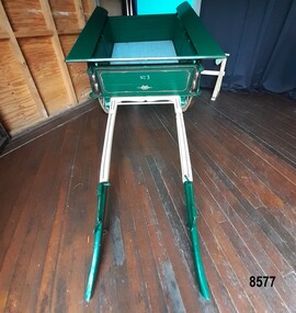
Vehicle - Tip Dray, Prior to 1930s
... Bourke's sons (Andy) found the dray in a shed and restored it. The sign writing on the back and side panels were added during the restoration. This Tipping Dray is a significant example of a horse drawn vehicle that was used by workers from the early days of white settlement through to the 1940's and even into the early 1960's. It was used in a range of "working class" occupations - road ...A Dray is a type of dead axle wagon that was used to transport heavy loads or objects. They had a flat level floor and while some had no sides, others had box bodies and sides. Tip Drays (also known as Tip Carts, Muck Cart, Scotch Cart, Tumbrel or Putt in different parts of England) were smaller than other drays as their loads were heavy and usually only pulled by one horse. Their basic design included two wheels, a tipping body and shafts. The Tip Dray has a unique mechanism that allows the top to tip backwards to tip the load out of the back of the dray. The tipper was activated by a handle at the front allowing the driver to operate it while still having control over the horse. A Tip Dray was an indispensable piece of equipment in the days before tractors and mechanical trucks. They were used by farmers and carters to transport hay, rocks, bricks, gravel and rubbish etc. and because they were useful for dumping loads, they were favoured for use in road and railway construction. A photo in the collection of the Lorne Historical Society shows a tipping dray being used during the construction of the Great Ocean Road. They were part of the daily street traffic in towns and cities around Australia from the early days of settlement. In Australia in the early 1900's, carters began to join unions to protect their jobs and pay. N.S.W. had a "Trolley, Draymen and Carters Union", Queensland had a "Tip Dray Men's Association" and in W. A. the "Top Dray Driver's Union" had a "cessation of work" in 1911 when they were fighting for an increase in their day's wages. In 1910 a meeting of Tip Carters was held in Geelong at the Trades Hall to discuss the formation of a union (The Geelong Tip Dray Carters) which was a success and a schedule of rates for all carting, whether by contract or day labor, was fixed. By 1912 they had "labelled" more than 50 drays and had representatives on the "Trades Hall and Eight Hours Committee". By the mid 1930's and early 1940's, tip drays were being superseded by mechanical trucks and utes. However tip drays continued to be used in some circumstances. They were a practical solution to the problem of petrol rationing during W. W. 2. It was noted in a letter to the editor in the "Sunshine Advocate" in 1938 that a positive argument for continued use of Tip Drays for rubbish collection related to the idea that a horse drawn vehicle involved with lots of stops and starts at different houses (very like a milkman's delivery route) often involved the horse "driving itself" while the driver picked up the rubbish - something a motor truck was unable to do! Another article written in August 1935 and published in the Age in a parliamentary report into the rubber industry noted "tip drays had almost disappeared and in their place, metal was carted in 5 ton motor trucks" but the report went on to say that as a part of the Government relief work (during the Great Depression) the Government had "to some extent reintroduced the tip drays so that a greater number of men would be employed". This particular tip dray was owned by Mr. Oswald (Jack) Bourke. He used it to deliver dry goods from Sunbury to the Queen Victoria Market in Melbourne several times a week in the 1930's and then (between 1945 and 1962) Mr. Bourke used it on the garbage round in Springvale Victoria for the Springvale Council. The Council owned three drays and the "No. 3" painted on this dray is in recognition of its original number. After the death of Mr. Bourke in 1990, one of Mr. Bourke's sons (Andy) found the dray in a shed and restored it. The sign writing on the back and side panels were added during the restoration. This Tipping Dray is a significant example of a horse drawn vehicle that was used by workers from the early days of white settlement through to the 1940's and even into the early 1960's. It was used in a range of "working class" occupations - road construction, railway construction, carting goods, rubbish collection etc. and would have been found in cities, country towns and on farms.A wooden and metal tipping dray with a box body and four sides. It has two iron and wooden wheels (with 14 spokes), two wooden shafts and a metal tipping mechanism. The back panel folds down to allow loads to be dumped out. It is painted in green and cream with sign writing on one of the sides and on the front and back panels. It features decorative painted lines and designs in burgundy, cream and light blue on most of the wooden parts. The tipping mechanism is on the front of the dray's left side and consists of a metal pin secured with a metal ring, and a lever.Front of dray - "No. 3" Side of dray - "A. & M. BOURKE / Contractors / LONGWARRY" Back of dray - "G.T. ANDREWS / QUEEN VICTORIA MARKET - Stand C23 / Phone DANDENONG 225"flagstaff hill maritime museum and village, warrnambool, shipwreck coast, tipping dray, dray, tip dray, tip cart, vehicles, horse drawn vehicle, springvale council, jack bourke, muck cart, scotch cart, tumbrel, putt, box body, oswald bourke, sunbury, queen victoria market, melbourne, no. 3 -
 Flagstaff Hill Maritime Museum and Village
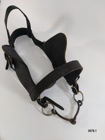
Equipment - Horse Harness, Glenn's Leather Goods, Early to mid-20th century
... Road...Sunbury...Springvale...dray...delivery dray...harness...horse harness...horse drawn vehicles...working horse...Oswald (Jack) Bourke...Bourke with his horse and dray to firstly deliver drygoods from Sunbury to Melbourne in the 1930's and later (through the 1940's and 1950's up to 1961) when he worked on the garbage round for the Springvale City Council. This horse harness is a significant example of the equipment that was needed wherever horses were being used - particularly in the early years of Victoria's settlement by white settlers. Harnesses such as this example were used with drays, farming equipment, delivery carts and personal transportation. Flagstaff Hill Maritime Museum and Village Warrnambool Great Ocean Road ...The early settlers of Victoria depended on horse drawn vehicles to farm, make roads and railways, deliver produce and transport people. Horse harnesses were an important requisite for all drivers and could be found wherever there were working horses. Horse Harnesses have played an essential role in different cultures throughout history. Simple, utilitarian horse harnesses made of leather straps and iron rings were being used in early China before AD 500 as well as ancient Greece and Rome allowing horses to pull chariots and ploughs. The Greeks and Romans were the first to use a "horse collar" which distributed the weight of the harness evenly across the horse's chest rather than relying on a "throat harness" that could damage a horse's throat or choke them. During the medieval period, European horse harnesses became more elaborate and decorative. Variations of different horse harnesses were also found in Native American and Middle Eastern cultures. Horse Harnesses usually have four basic components which include - 1. Communication - the bridle, bit and reins allows the driver to communicate instructions and commands to the horse, guiding its movement and direction. 2. Draft - the collar, hame straps, hames, traces and chains enables the horse to draw and pull the load efficiently by distributing the weight and transferring the pulling force to the vehicle. 3. Stopping - the breeching band, pole straps and breast strap helps to control or stabilise the horse and vehicle when moving downhill or stopping. 4. Support - the back pad, backband, belly band and back saddle keep the harness in the correct position and proper alignment. This dray harness is a plain, basic harness and reflects its working class origins. It was used by Mr. Oswald (Jack) Bourke with his horse and dray to firstly deliver drygoods from Sunbury to Melbourne in the 1930's and later (through the 1940's and 1950's up to 1961) when he worked on the garbage round for the Springvale City Council. This horse harness is a significant example of the equipment that was needed wherever horses were being used - particularly in the early years of Victoria's settlement by white settlers. Harnesses such as this example were used with drays, farming equipment, delivery carts and personal transportation.A leather and metal horse harness used with a horse and dray circa 1930's to the early 1960's. It is made up of a number of components. 1. A leather bridle with metal buckles and rings, blinkers and a metal single jointed, snaffle bit that has the initials M B stamped onto the leather. 2. A leather bridle with metal buckles and rings and a metal "straight bar" Eggbut snaffle bit. It has an elongated X design (with 4 dots) stamped onto the leather strap holders near each buckle. 3. A blue and white vinyl halter with one leather patched strap. The nose band and a chin strap are covered with woollen padding. 4. A pair of leather shaft protectors. They have lacing holes along each edge and a repeating design of small shapes (flowers, wings, crosses and arrowheads) which run along the front of each protector. 5. A leather strap with a stainless steel chain and catch and a maker's mark for "Glenn's Leather Goods, Pearcedale Victoria" stamped onto the end. 6. A wide leather strap covered with a webbing sleeve. It has two large metal rings and each end and one ring has a rope attached. 7. A leather strap comprised of three separate sections (two shorter and one longer) joined with two metal rings. The longer section has notches along its length and the shorter section at the other end has a buckle. It also had a maker's mark stamped on it but the mark is very worn and the writing is difficult to read. 8. An adjustable leather horse collar with two buckles and straps at the top opening and two "B's" stamped into the leather. The top of the collar is made from treated leather pieces stitched together and the underneath of the collar is untreated leather. It has a padded indentation running all the way around the collar for the hames to sit in. 9. Two pairs of long leather traces - each having a buckle and notched section at one end and each one is made with three lengths of leather spliced together. 10. A leather strap (with one spliced join) belonging to a horse harness with two shorter straps (each ending with a metal clip) attached to a steel D ring at one end. 11. Three assorted short leather straps - the top one has clips at each end and a buckle (for adjusting the length) in the centre, the middle strap has notches and a buckle and the bottom strap is white with notches and a buckle.Bridle with blinkers - "M B" Bridle - design showing an elongated X with a dot in each section stamped onto strap holder Shaft Protectors - stamped design of flowers, wings, crosses and arrowheads Strap with chain - "Glenn's leather goods / Pearcedale / Victoria" Leather Strap (with two metal rings) - Maker's stamp - "name indecipherable / SADDLER / ...OURNE" Collar - "B / B" Leather strap - flagstaff hill maritime museum and village, warrnambool, great ocean road, sunbury, springvale, dray, delivery dray, harness, horse harness, horse drawn vehicles, working horse, oswald (jack) bourke, bridle, horse collar, hames, shaft protectors -
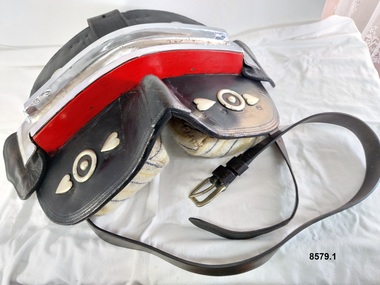 Flagstaff Hill Maritime Museum and Village
Equipment - Show Harness, R. Mitchell, Saddler, Early to mid-20th century
... Road...Shipwreck Coast...harness...horse harness...show harness...Clydesdale horses...Andy Bourke...Flagstaff Hill Maritime Museum and Village Warrnambool Great Ocean Road Shipwreck Coast harness horse harness show harness Clydesdale horses Andy Bourke horse drawn cart housen bridle hames breeching straps dropper bit Liverpool bit backband harness ornamentation bellyband back saddle fly terret Saddle - "R.MITCHELL / SADDLER" Hames - "MADE IN ENGLAND / WARRANTED / STEEL" "MADE IN ENGLAND / WARRANTED / unclear" Breeching Straps - "R. ...The early settlers of Victoria depended on horse drawn vehicles to farm, make roads and railways, deliver produce and transport people. Horse harnesses were an important requisite for all drivers and could be found wherever there were working horses. Horse Harnesses have played an essential role in different cultures throughout history. Simple, utilitarian horse harnesses made of leather straps and iron rings were being used in early China before AD 500 as well as ancient Greece and Rome, allowing horses to pull chariots and ploughs. The Greeks and Romans were the first to use a "horse collar" which distributed the weight of the harness evenly across the horse's chest rather than relying on a "throat harness" that could damage a horse's throat or choke them. During the medieval period, European horse harnesses became more elaborate and decorative. Variations of different horse harnesses were also found in Native American and Middle Eastern cultures. Horse Harnesses usually have four basic components which include - 1. Communication - the bridle, bit and reins allows the driver to communicate instructions and commands to the horse, guiding its movement and direction. 2. Draft - the collar, hame straps, hames, traces and chains enables the horse to draw and pull the load efficiently by distributing the weight and transferring the pulling force to the vehicle. 3. Stopping - the breeching band, pole straps and breast strap helps to control or stabilise the horse and vehicle when moving downhill or stopping. 4. Support - the back pad, backband, belly band and back saddle keep the harness in the correct position and proper alignment. This show harness was used by Mr. Andy Bourke when showing his Clydesdales at shows or demonstrations. Although a more modern example with decorative embellishments, it still has many essential components traditionally found in an everyday working horse harness. The original purpose of the "housen" for example, was to run rain or drizzle off the horse's neck when they had to work in wet conditions - it was laid flat for this purpose on the top of the collar. Nowadays it is purely for show and is often used to advertise a business or stud. Horse brasses and fly terrets were fastened to various parts of a horse's harness. In the early days they probably began as amulets to ward off evil and to bring good luck and continued to be used as a festive decoration. The heyday of horse brasses was between the years 1851 and 1900. Horse brasses are fastened to various parts of the harness with many of their designs being symbolic. The ornamentation on this harness (although not authentic horse brasses) are based on the horse brasses that were popular in the 19th century. This horse harness is a significant example of the equipment that was needed wherever heavy horses were being used - particularly in the early years of Victoria's settlement by white settlers. Harnesses such as this example were used with stage coaches, drays, farming equipment, delivery carts and personal transportation.A leather and metal horse harness used when showing a Clydesdale (or other breed of heavy horse). It is made up of a number of components. 1. Decorative leather cart saddle with two large cloth pads underneath (which have a scalloped leather and stud border), a raised leather pommel and a silver and red coloured metal back strap holder across the top. It has two symmetrical sets of ornamentation (silver hearts and circles) in the front and a wide strap or girth (with a maker's stamp reading "R. Mitchell Saddler") and buckle which attaches the saddle to the horse. 2. Pair of steel hames which are gently curved (to fit on a horse collar) and are topped with steel knobs. They have several steel rings and lugs (to hold straps and chains) and a "Made in England Warranted Steel" stamp. 3. Breeching harness which consists of a number of leather straps, chains and metal rings including a wide padded leather strap with a scalloped edge that sits on the back of the horse and a thick leather strap that goes around the hind quarters of a horse which is joined to the back strap with four shorter vertical straps and buckles. These straps feature silver and red patent leather trim and silver heart shaped ornamentation. The strap also features the maker's stamp of "R. Mitchell". 4. Decorative leather bridle with blinkers featuring the same silver and red patent leather trim on the cheek piece, brow band and throatlatch. It has a stainless steel "Liverpool Driving Bit" with a curb chain, a variety of decorative silver ornaments (rosettes, diamonds plus a heart and two circles) on each end of the forehead band, dropper and strap as well as a silver metal bell (sometimes known as a "fly terret" or "swinger") that sits on the headpiece of the bridle. 5. Leather "violin shaped" dropper (or hanger) with two silver rosette shaped ornaments and a stainless steel clip on the top 6. Stainless steel "Liverpool Driving Bit" with a straight mouthpiece which is ribbed on one side. It has three rein spots (spaces) and a curb chain. 7. Leather arch shaped "Housen" covered in black and red patent leather and decorated with silver studs (some spelling out F H) and bordered with a red fringe. It has a leather strap at the back and two leather loops on the front. 8. Leather padded backband (Australian style "Stallion Draught Roller") decorated with two groups of nine metal "horse brasses" or harness ornaments displaying horseshoe, starburst and horse head designs on blue, red and white striped webbing. The backband has three notched straps at each end, a buckle near the centre and the initial B stamped in two places underneath. 9. Bellyband made of leather and red, white and blue striped webbing. It has a set of three buckles at each end (which correspond with the notched straps of the backband). 10. Wide, thick leather strap which has a buckle and notches at each end. It also has the maker's stamp of "R. Mitchell Saddler". 11.One pair of long leather traces - each with a buckle and notched loop at one end, decorated with a small silver diamond shaped harness ornament. 12. Length of stainless steel heavy duty chain with two swivel connectors.Saddle - "R.MITCHELL / SADDLER" Hames - "MADE IN ENGLAND / WARRANTED / STEEL" "MADE IN ENGLAND / WARRANTED / unclear" Breeching Straps - "R. MITCHELL / MAKER / R. MITCHELL MAKER" Housen - "F H" Backband "B / B' Wide leather strap - "R. MITCHELL / SADDLER"flagstaff hill maritime museum and village, warrnambool, great ocean road, shipwreck coast, harness, horse harness, show harness, clydesdale horses, andy bourke, horse drawn cart, housen, bridle, hames, breeching straps, dropper, bit, liverpool bit, backband, harness ornamentation, bellyband, back saddle, fly terret
