Showing 556 items matching "bushlands"
-
 Whitehorse Historical Society Inc.
Pamphlet, Our bushlands, 2007
... Our bushlands......Bushland...A guide to bushland parks in the City of Whitehorse....A guide to bushland parks in the City of Whitehorse. Our bushlands Pamphlet Pamphlet ...A guide to bushland parks in the City of Whitehorse.A guide to bushland parks in the City of Whitehorse.A guide to bushland parks in the City of Whitehorse.city of whitehorse, bushland, parks and reserves -
 Eltham District Historical Society Inc
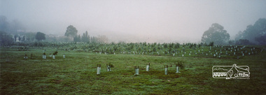
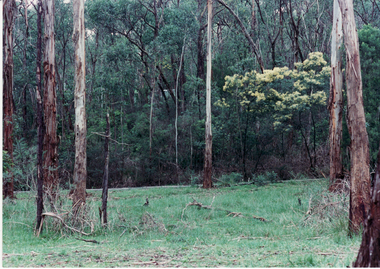
Photograph, Barak Bushlands Reserve, Eltham, March 2003, 2003
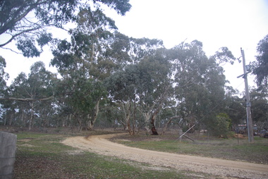
... Barak Bushlands Reserve, Eltham, March 2003...On 15 August 2004, the Shire of Nillumbik officially named the area "Barak Bushlands" as part of its commitment to Aboriginal reconciliation. ...Source: Aboriginal reconcilation events in Nillumbik, Ken Eckersall, 2006. barak bushlands reserve eltham walking trail Digital scan from borrowed photo Barak Bushlands Reserve, Eltham, March 2003 Photograph Photograph Jim Connor ...This area is urban and wetlands west of the Eltham gateway approach near the bridge over Diamond Creek and forms part of a walking trail. On 15 August 2004, the Shire of Nillumbik officially named the area "Barak Bushlands" as part of its commitment to Aboriginal reconciliation. The naming day memorialised the one hundred and first anniversary of the death of the last full-blood Yarra Aboriginal leader, William Barak. Source: Aboriginal reconcilation events in Nillumbik, Ken Eckersall, 2006.Digital scan from borrowed photobarak bushlands reserve, eltham, walking trail -
 Eltham District Historical Society Inc
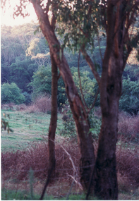
Photograph - Digital Photograph, Alan King, Diamond Creek, Barak Bushlands, Eltham, 2008
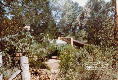
... Diamond Creek, Barak Bushlands, Eltham...Aided by the Friends and other community members, the Council created the Barak Bushlands consisting of a forest, a wetland, a bridge, a path and open space. ...Nillumbik Now and Then (Marshall-King) Collection Barak Bushlands Diamond Creek (Creek) Eltham Born digital image file Diamond Creek, Barak Bushlands, Eltham Photograph Digital Photograph Alan King Alan King Marguerite Marshall ...A habitat corridor and it strengthens the community. Published: Nillumbik Now and Then / Marguerite Marshall 2008; photographs Alan King with Marguerite Marshall.; p185 Barak Bushlands lie west of the Diamond Creek on the corner of Falkiner Street and busy, noisy Main Road. They form part of an important habitat corridor linking the Yarra River to the Kinglake National Park.1 Manna Gums, tawny frogmouths and platypuses are some of the indigenous plants and animals that have made their home there. The bushlands are the result of more than nine years of hard work by the local community with the Nillumbik Council, to transform a degraded flood plain into this refuge of natural beauty. In 1997, shortly after moving into the new Riverside Estate on Falkiner Street, Eltham, several residents noticed the sorry state of the Diamond Creek and surrounding area. Part of it was used as a cow paddock and although small patches of vegetation survived, the area was infested with weeds, rabbits, rubbish and drainage from the housing estate. At various times the 4.4 hectares had been used as a market garden and for shire stock piles. The residents began to restore the area by revegetating land along the Diamond Creek. In 1998 they established the Friends of the Diamond Creek Falkiner Street Reserve2 and 35 families joined from the 90-house Estate. Carolyn Mellor, as the Friends’ Land Manager, undertook a four-year horticulture course to guide this massive project for a volunteer organisation. Since 1999, she has been the Friends’ President. In 1999 the Friends urged the Nillumbik Council to undertake a feasibility study into establishing a wetland system and urban forest. Work began in 2002 with Nillumbik Council funding the project, supplemented by government grants. The Friends also received grants from Melbourne Water and Parks Victoria. Aided by the Friends and other community members, the Council created the Barak Bushlands consisting of a forest, a wetland, a bridge, a path and open space. The beautiful wetland treats most of the estate’s stormwater runoff. Storm water is filtered through plants in the wetland ponds then is released slowly into the billabong, before flowing into the Diamond Creek. The wetland also helps to minimise flooding and the improved water quality provides a flora and fauna habitat. The Friends and other volunteers planted more than 27,000 plants, more than one third of which they grew from seeds they collected at Lower Eltham and Wingrove Parks. Eltham High School students planted thousands of these through a Year Eight program introduced for this purpose. Other groups who assisted were: Green Corps, local Scouts and Guides – 2nd Montmorency, 1st Diamond Creek and 1st Eltham Cub Packs, Eltham College students, Eltham East Primary School, Landcare members, Eltham Lions Club and the Eltham Baptist Church. To maintain enthusiasm for the mammoth task, the Friends and other volunteers ‘adopted’ trees to water and wrote their names on the stakes. In 2004, to recognise the area’s original occupiers, the reserve was named Barak Bushlands. William Barak, who lived from 1824 to 1903, was the last chief of the Yarra Yarra tribe of the Wurundjeri-willam people. Traces of these original inhabitants remain in scar trees (bark sections removed to make a shield or canoe). That same year the Friends’ group was a finalist in the prestigious Federal Government, Banksia Environmental Awards. The Friends have also participated in Clean Up Australia, removing tonnes of rubbish and regularly testing the billabong, wetland and creek, for pollutants. For years the Friends, together with the Australian Platypus Conservancy, have tagged, measured and checked the health of platypuses from the Diamond and Mullum Mullum Creeks. With Latrobe University the Friends have conducted night walks to view owls, possums, bats and sugar gliders. Challenges for the council and the Friends continue with a large rabbit population, some vandalism, weed eradication and maintenance. However, thanks to this community effort, locals can now escape confined urban living on small blocks of land and enjoy the beauty of indigenous plants and animals. Working together has also strengthened the local community,This collection of almost 130 photos about places and people within the Shire of Nillumbik, an urban and rural municipality in Melbourne's north, contributes to an understanding of the history of the Shire. Published in 2008 immediately prior to the Black Saturday bushfires of February 7, 2009, it documents sites that were impacted, and in some cases destroyed by the fires. It includes photographs taken especially for the publication, creating a unique time capsule representing the Shire in the early 21st century. It remains the most recent comprehenesive publication devoted to the Shire's history connecting local residents to the past. nillumbik now and then (marshall-king) collection, barak bushlands, diamond creek (creek), eltham -
 Croydon Conservation Society Inc.
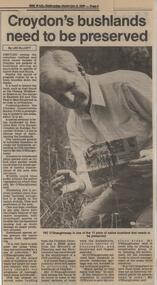
Newspaper, Article on 'Croydon's bushlands need to be preserved' Cheong Wildflower Sanctuary 7 November 1990
... Article on 'Croydon's bushlands need to be preserved' Cheong Wildflower Sanctuary 7 November 1990...Croydon melbourne Newspaper extract Article on 'Croydon's bushlands need to be preserved' Cheong Wildflower Sanctuary 7 November 1990 Newspaper ...Newspaper extract -
Whitehorse Historical Society Inc.
Pamphlet, Bushland Community Handbook, 2015
... Bushland Community Handbook... Involved in the management of Bushland and the means of doing it....Description of Community groups in Whitehorse involved in the management of Bushland and the means of doing it....Description of Community groups in Whitehorse involved in the management of Bushland and the means of doing it. Bushland Community Handbook Pamphlet Pamphlet ...Description of Community groups in Whitehorse.Description of Community groups in Whitehorse involved in the management of Bushland and the means of doing it.Description of Community groups in Whitehorse. city of whitehorse, community groups, wildlife, native plants -
 Clunes Museum
Photograph
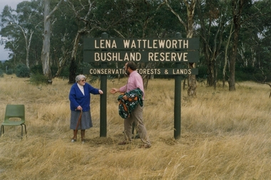
... A CORNER BLOCK OF BUSHLAND NAMED LENA WATTLEWORTH BUSHLAND RESERVE....COLOUR PHOTOGRAPH OF LENA WATTLEWORTH BUSHLAND RESERVE CONSERVATION FORESTS AND LAND. ...COLOUR PHOTOGRAPH OF LENA WATTLEWORTH BUSHLAND RESERVE CONSERVATION FORESTS AND LAND. ...A CORNER BLOCK OF BUSHLAND NAMED LENA WATTLEWORTH BUSHLAND RESERVE.COLOUR PHOTOGRAPH OF LENA WATTLEWORTH BUSHLAND RESERVE CONSERVATION FORESTS AND LAND. PHOTO TAKEN TALBOT ROAD. MRS WATTLEWORTH DURING THE PRESENTATION. PHOTOGRAPH MOUNTED ON WHITE CARDBOARD.local history, photography, photographs, weickhardt, wattleworth -
 Stawell Historical Society Inc
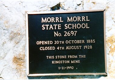
Photograph, Morrl Morrl School Plaque
... 7095 Dedication Plaque 7095-1 Group of People outside in bushland...2 Colour photographs: 1 A plaque for Morrl Morrl School. 2nd a group of people outside in a bushland wetting....Stawell Historical Society Inc 46 Longfield St Stawell grampians 7095 Dedication Plaque 7095-1 Group of People outside in bushland Education Morrl Morrl Morrl MOrrl State School No. 2697 Opened 20th October 1885 - Closed 4th August 1928 This Stone from the Kingston Mine 1-11-1992 2 Colour photographs: 1 A plaque for Morrl Morrl School. 2nd a group of people outside in a bushland wetting. ...7095 Dedication Plaque 7095-1 Group of People outside in bushland2 Colour photographs: 1 A plaque for Morrl Morrl School. 2nd a group of people outside in a bushland wetting.Morrl MOrrl State School No. 2697 Opened 20th October 1885 - Closed 4th August 1928 This Stone from the Kingston Mine 1-11-1992education, morrl morrl -
 Stawell Historical Society Inc
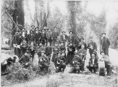
Photograph, Salvation Army Bandsmen and Women at Mt. William 1900
... Salvation Army Bandsmen and Women at Mt. William bushland setting. 1900 was a period of gold rush. ...The background is a bushland setting....The background is a bushland setting. Salvation Army Bandsmen and Women at Mt. ...Salvation Army Bandsmen and Women at Mt. William bushland setting. 1900 was a period of gold rush. Photo taken at the time of the gold rush Mafeking in the Grampians. Black and white photograph of a scene depicting a group of people, some bandsmen & women. The background is a bushland setting.W. Hale Mount William. (handwritten 1900). on the back John Clark. The Stawell S.A. band at Mount William. Sept 1900 R.M. Perry.stawell religion -
 Sunbury Family History and Heritage Society Inc.
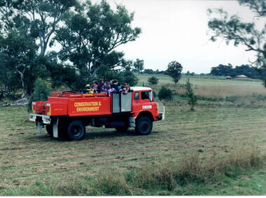
Photograph, Gellibrand Hill, 1987
... The rangers were responsible for maintaining the bushland in the park and the students were at the park doing some tree planting....A non-digital photograph of a group of children in the back of a red conservation and environment truck in a bushland park....The rangers were responsible for maintaining the bushland in the park and the students were at the park doing some tree planting. ...The children from Bulla Primary School were taken for a ride around Gellibrand Hill on the back of a truck used by the park rangers at Gellibrand Hill near Bulla. The rangers were responsible for maintaining the bushland in the park and the students were at the park doing some tree planting.The excursion was included in then children's science and environmental studies.A non-digital photograph of a group of children in the back of a red conservation and environment truck in a bushland park.tree planting, gellibrand hill, bulla primary school, conservation -
Whitehorse Historical Society Inc.
Article, Friends of the lake education unit, 1/03/1996 12:00:00 AM
... Who started the Friends of the Lake Education Unit in 1985 to give knowledge to children on how to care for the bushland area....Article from Whitehorse Gazette on Dorothy Meagher who started the Friends of the Lake Education Unit in 1985 to give knowledge to children on how to care for the bushland area....Article from Whitehorse Gazette on Dorothy Meagher who started the Friends of the Lake Education Unit in 1985 to give knowledge to children on how to care for the bushland area. Friends of the lake education unit Article Article ...Article from Whitehorse Gazette on Dorothy Meagher.Article from Whitehorse Gazette on Dorothy Meagher who started the Friends of the Lake Education Unit in 1985 to give knowledge to children on how to care for the bushland area.Article from Whitehorse Gazette on Dorothy Meagher. meagher, dorothy, blackburn lake sanctuary -
Ringwood and District Historical Society
Documents, 1997 Bushland Management Plans for BJ Hubbard Reserve, Wombolano Park, Loughie's Bushland, and weed control monitoring sheet
... 1997 Bushland Management Plans for BJ Hubbard Reserve, Wombolano Park, Loughie's Bushland, and weed control monitoring sheet....Five Bushland Management Documents 1. Bushland Reserve Management Plan 2. ...BJ Hubbard Reserve - Bushland Management Plan 1997 4. Wombolano Park - Bushland Management Plan 1997 5. ...Five Bushland Management Documents 1. Bushland Reserve Management Plan 2. Weed Control Monitoring Sheet 3. BJ Hubbard Reserve - Bushland Management Plan 1997 4. Wombolano Park - Bushland Management Plan 1997 5. Loughie's Bushland Management Plan 1997 -
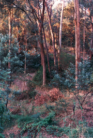
 Whitehorse Historical Society Inc.
Photograph, Bush Scenes in Mitcham
... bushlands...Whitehorse Historical Society Inc. 2-10 Deep Creek Road Mitcham melbourne bushlands mitcham Black and white photo of bush scenes in Mitcham Bush Scenes in Mitcham Photograph Photograph ...Black and white photo of bush scenes in Mitchambushlands, mitcham -
Stawell Historical Society Inc
Photograph, Water Race Black Range -- 18 Photos
... 18 colour photographs in bushland setting ...Stawell Historical Society Inc 46 Longfield St Stawell grampians Water Race (18 Colour Photos) Black Range Stawell 18 colour photographs in bushland setting Water Race Black Range -- 18 Photos Photograph ...Water Race (18 Colour Photos) Black Range18 colour photographs in bushland setting stawell -
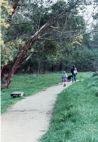
 Whitehorse Historical Society Inc.
Photograph, Yarran Dheran
... ...bushland...Coloured photo of Bushland at Yarran Dheran....Whitehorse Historical Society Inc. 2-10 Deep Creek Road Mitcham melbourne yarran dheran bushland Coloured photo of Bushland at Yarran Dheran. ...Coloured photo of Bushland at Yarran Dheran.yarran dheran, bushland -
 Whitehorse Historical Society Inc.
Photograph, Yarran Dheran
... Coloured photo of Bushland at Yarran Dheran....Whitehorse Historical Society Inc. 2-10 Deep Creek Road Mitcham melbourne yarran dheran Coloured photo of Bushland at Yarran Dheran. Yarran Dheran Photograph Photograph ...Coloured photo of Bushland at Yarran Dheran.yarran dheran -
 Halls Gap & Grampians Historical Society
Photograph - B/W
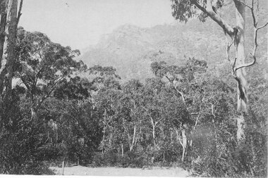
... A photo of bushland with rocky mountain rising behind...Halls Gap & Grampians Historical Society Centennial Hall 117-119 Grampians Road Halls Gap grampians This is a photo of Chatauqua Peak, which is named after the Chautauquans, who held summer camps in Halls Gap in the 1890s SCENERY Grampians Ranges A photo of bushland with rocky mountain rising behind Photograph B/W ...This is a photo of Chatauqua Peak, which is named after the Chautauquans, who held summer camps in Halls Gap in the 1890sA photo of bushland with rocky mountain rising behindscenery, grampians ranges -
 Halls Gap & Grampians Historical Society
Photograph - B/W, C 1960s
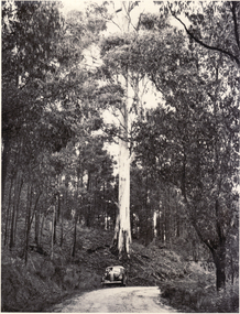
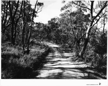
... The photo shows a sandy track through bushland....The photo shows a sandy track through bushland. Photograph B/W ...Location unknown.The photo shows a sandy track through bushland.'Forests Commission, Victoria' inscribed on bottom, right of border. 'Publicity & Public relations Branch, When reproducing please Acknowledge Forests Commission, Victoria, Negative No. 322-14' stamped on back.access routes, roads, scenery, grampians ranges -
 Stawell Historical Society Inc
Photograph, Stawell Historical Society members on excursion
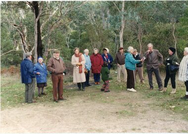
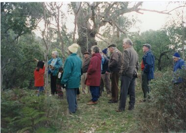
... 2 Colour Photographs of 13 people in bushland...Stawell Historical Society Inc 46 Longfield St Stawell grampians Stawell Historical Society Halls Gap L/R: Bill Attrill, Jill Attrill, Clive Cawthorn, Betty Jackson, Maire Van Leeuwen, Wnedy Melbourne, Carmel Loats, Don Rickard, Ida Stanton Allan Kingston, Bill Cook, Thea Tucker, Pat Cook 2 Colour Photographs of 13 people in bushland Stawell Historical Society members on excursion. ...2 Colour Photographs of 13 people in bushlandL/R: Bill Attrill, Jill Attrill, Clive Cawthorn, Betty Jackson, Maire Van Leeuwen, Wnedy Melbourne, Carmel Loats, Don Rickard, Ida Stanton Allan Kingston, Bill Cook, Thea Tucker, Pat Cookstawell historical society, halls gap -
 Stawell Historical Society Inc
Photograph, Stawell Historical Society members on excursion
... 2 Colour Photographs of 13 people in bushland...Stawell Historical Society Inc 46 Longfield St Stawell grampians Stawell Historical Society Halls Gap L/R: Bill Attrill, Jill Attrill, Clive Cawthorn, Betty Jackson, Maire Van Leeuwen, Wnedy Melbourne, Carmel Loats, Don Rickard, Ida Stanton Allan Kingston, Bill Cook, Thea Tucker, Pat Cook 2 Colour Photographs of 13 people in bushland Stawell Historical Society members on excursion. ...2 Colour Photographs of 13 people in bushlandL/R: Bill Attrill, Jill Attrill, Clive Cawthorn, Betty Jackson, Maire Van Leeuwen, Wnedy Melbourne, Carmel Loats, Don Rickard, Ida Stanton Allan Kingston, Bill Cook, Thea Tucker, Pat Cookstawell historical society, halls gap -
 National Wool Museum
Photograph - Mt Kenya, J W Allen, 1928-1929
... Black and white photograph depicting a landscape with bushland. ...Kenya / behind / [printed] Velox Black and white photograph depicting a landscape with bushland. Photograph Mt Kenya J W Allen ...This photograph was found loose in the first of three albums compiled and owned by J W Allen, Secretary of New South Wales Grazier's, and is associated with the New South Wales Graziers Association world tour of sheep 1928-1929. The album contains photographs of travel, sheep, farms, stations, people and landscapes from around the world. Locations include Naples, Port Said, Suez, Birregurra (Vic), Alexandra (Vic), Ballangeich (Vic), Keith (SA), Mt Gambier (SA), Buckland Park (SA), Tasmania, Winton (QLD), Sydney Harbour, Canberra (ACT), Toowoomba (QLD), Rockhampton (QLD), Tocal (NSW), Deepwater (NSW), Glen Innes (NSW), Longreach (QLD), Moree (NSW), Barraba (NSW) and Mudgee (NSW). Properties depicted include Mooleric, Turkeith, Woolongoon, Minadale, Crower Station, Merrindie, Koomooloo Station, Cappeedee, Koonoona, Rathmore, Ellenthorpe, Camden Park Station, Glenlegh, Strathmore Station, Ilparran Station, Binneguy, Midkin, Terlings, Ashley, Bereen, Plumthorpe, Mayvale and Havilah. The album was found in a clean out at the Great Southern Agricultural Research Institute and donated to the National Wool Museum, along with other related material such as photographs, glass lantern slides and ephemera.Black and white photograph depicting a landscape with bushland. back: [handwritten] Mt. Kenya / from Narrmore – Nanyuki / Road / Naromore – Nanyuki Road / Piece of bush belt with [?] Mt. Kenya / behind / [printed] Veloxagriculture, sheep, farming, stations, research, breeding, photography, travel -
Whitehorse Historical Society Inc.
Pamphlet, Bushland community handbook, 2004?
... Bushland community handbook......Bushland...Handbook of bushland management and design for community groups...Whitehorse Historical Society Inc. 2-10 Deep Creek Road Mitcham melbourne Parks and reserves Bushland Handbook of bushland management and design for community groups Handbook of bushland management and design for community groups Bushland community handbook Pamphlet Pamphlet ...Handbook of bushland management and design for community groupsHandbook of bushland management and design for community groupsHandbook of bushland management and design for community groupsparks and reserves, bushland -
 Whitehorse Historical Society Inc.
Photograph, Yarraan Dheran
... Coloured photo of Bushland Path in Yarran Dheran....Whitehorse Historical Society Inc. 2-10 Deep Creek Road Mitcham melbourne yarran dheran Coloured photo of Bushland Path in Yarran Dheran. Yarraan Dheran Photograph Photograph ...Coloured photo of Bushland Path in Yarran Dheran.yarran dheran -
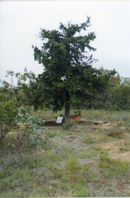 Stawell Historical Society Inc
Photograph, Grave of John McClure
... Colour Photograph of a grave under cypress trees in bushland...Grave of John McClure at Deep Lead Cemetery Colour Photograph of a grave under cypress trees in bushland Grave of John McClure Photograph ...The Deep Lead Cemetery. The grave under the Cypress trees is that of John McClure B.A. who died in 1859 at the age of 46 years. He was the first clerk of petty sessions at Pleasant Creek and was one of the first buried at the deep lead cemetery which at the time was reserved but not fenced.Colour Photograph of a grave under cypress trees in bushlandGrave of John McClure at Deep Lead Cemetery -
Whitehorse Historical Society Inc.
Pamphlet, Go bush in Nunawading, 1986
... A leaflet with names, locations and map of bushland parks in Nunawading....Parks and Reserves A leaflet with names, locations and map of bushland parks in Nunawading. A leaflet with names, locations and map of bushland parks in Nunawading. ...A leaflet with names, locations and map of bushland parks in Nunawading.A leaflet with names, locations and map of bushland parks in Nunawading.A leaflet with names, locations and map of bushland parks in Nunawading.city of nunawading. parks and recreation department., parks and reserves -
 Whitehorse Historical Society Inc.
Photograph, Bushland Yarran Dheran
... Bushland Yarran Dheran...Coloured photo of Bushland along Walk in Yarran Dheran....Whitehorse Historical Society Inc. 2-10 Deep Creek Road Mitcham melbourne yarran dheran Coloured photo of Bushland along Walk in Yarran Dheran. Bushland Yarran Dheran Photograph Photograph ...Coloured photo of Bushland along Walk in Yarran Dheran.yarran dheran -
 Ballarat Heritage Services
Photograph - Photograph - Colour, Clare Gervasoni, Treed road behind St Laurence O'Toole Catholic Church, Sandon, 2017, 16/07/2017
... Colour photograph of bushland behind a church at Sandon, Victoria....Work was completed mid 2003 and in November 2003 St Laurence’s was re-dedicated with the celebration of Mass and a picnic tea. sandon sandon cemetery st laurence o'toole catholic church, sandon landscape road Colour photograph of bushland behind a church at Sandon, Victoria. ...St Laurence O'Toole church and cemetery is located in a rural setting at 801/821 Creswick-Newstead Rd, Sandon. Originally a small wooden school (22’x14’) was erected in Sandon by Father Patrick Smyth (who was involved in the Eureka Stockade movement) in 1859. It was also used for Mass and became known as a chapel. In June 1882 tenders were called for the construction of a brick Church by the Castlemaine architect, T.F. Kibble, and it was built at a cost of 1000 pounds. The church was blessed by Archbishop Goold on 06 May 1883 and dedicated to St Laurence O'Toole. The brick building demonstrates original design qualities of a Victorian Rudimentary Gothic style, including the steeply pitched, parapet gable roof form, together with a central steeply pitched, gabled porch that projects slightly from the main gable end. Other intact qualities include the exposed brick wall construction, lapped galvanised corrugated iron roof cladding, minor gabled porch at the rear, small ventilation dormers nearby the roof ridgeline, series of stone steps that lead to the central porch with its double pointed door opening and vertical boarded doors, simple rose window in the main gable end, pointed windows, brick buttresses with double lower copings, and the light masonry detailing (the banding marking the floor level within, buttress copings, window and door surrounds and quoins, and the drip moulds).(Shire of Mount Alexander: Heritage Study of the former Shire of Newstead, 2000) The visually connected cemetery demonstrates important visual qualities formed by the regular rows of graves and cemetery architecture, and the grassed and treed rural landscape. It is a rare and substantially intact example of a Victorian Catholic Church with a cemetery in its churchyard. Many headstones and cemetery architecture, date from the 19th century and represent some fine examples of masonry craftsmanship. Some refurbisments occurred during the 1940s and in 2002 a major restoration project was undertaken from roof to footings, by a dedicated band of volunteers and trades people. Work was completed mid 2003 and in November 2003 St Laurence’s was re-dedicated with the celebration of Mass and a picnic tea. Colour photograph of bushland behind a church at Sandon, Victoria.sandon, sandon cemetery, st laurence o'toole catholic church, sandon, landscape, road -
 Eltham District Historical Society Inc
Photograph, John Street, Eltham, c.1983, 1983c
... Colour photograph of houses screened by bushland, John Street, Eltham...Eltham District Historical Society Inc 728 Main Rd Eltham melbourne john street eltham houses Colour photograph of houses screened by bushland, John Street, Eltham John Street, Eltham, c.1983 Photograph ...Colour photograph of houses screened by bushland, John Street, Elthamjohn street, eltham, houses -
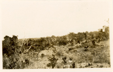
 Ringwood and District Historical Society
Photograph, Coombe's property next to 'Quambee', North Ringwood, 1912
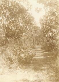
... Sepia photograph showing track through bushland on Coombe's property....Ringwood and District Historical Society 125A Warrandyte Road Ringwood North melbourne Sepia photograph showing track through bushland on Coombe's property. Coombe's property next to 'Quambee', North Ringwood, 1912. ...Sepia photograph showing track through bushland on Coombe's property.