
Showing 111 items matching "canning street bridge"
-
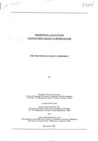 Sunshine and District Historical Society Incorporated
Document - Maribyrnong Valley Study Canning Street Bridge to Brimbank Park December 1990, Henshall Hansen Associates
... Maribyrnong Valley Study Canning Street Bridge to Brimbank Park December 1990...... Canning Street... Bridge...Maribyrnong Valley Study Canning Street Bridge to Brimbank Park December 1990...Typed Report Maribyrnong Valley Study Canning Street Bridge to Brimbank Park December 1990 for the Western Region Commission...Maribyrnong Valley Maribyrnong River Canning Street Bridge Typed Report Maribyrnong Valley Study Canning Street Bridge to Brimbank Park December 1990 for the Western Region Commission Maribyrnong Valley Study Canning Street Bridge to Brimbank Park December 1990 Document Maribyrnong Valley Study Canning Street Bridge to Brimbank Park December 1990 Henshall Hansen Associates ...Typed Report Maribyrnong Valley Study Canning Street Bridge to Brimbank Park December 1990 for the Western Region Commissionmaribyrnong valley, maribyrnong river, canning street, bridge -
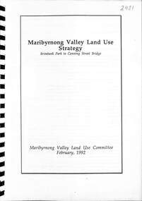 Sunshine and District Historical Society Incorporated
Document - Maribyrnong Valley Land Use Strategy. Brimbank Park to Canning Street Bridge 1992, Maribyrnong Valley Land Use Committee February 1992, 1992
... Brimbank Park to Canning Street Bridge 1992...... Canning Street... Bridge...Brimbank Park to Canning Street Bridge. Maribyrnong Valley Land use Committee February 1992....Maribyrnong Valley Maribyrnong River Canning Street Bridge Maribyrnong Valley Land Use. ...Maribyrnong Valley Land Use. Brimbank Park to Canning Street Bridge. Maribyrnong Valley Land use Committee February 1992.maribyrnong valley, maribyrnong river, canning street, bridge -
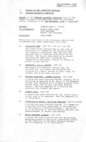 Sunshine and District Historical Society Incorporated
Administrative record - City of Sunshine - Commissioner Mr Alexander Alex George Gillon Collection 1976 - 1982 - Report of forward planning committee meeting 2nd December 1980, City of Sunshine, 9th December 1980
... ...Canning Street Bridge...Oval Railway Walkover Ardeer Railway Station Street Signs Station Place Sunshine Condition of House 5 Hillside Crescent Maribyrnong Ernie Shepherd Gardens Keeping Chickens and Birds Parking Ballarat Road and Glencairn Avenue ICI Practice Wickets Canning Street Bridge Sunshine Football Club Vandalism at Skinner Reserve...Oval Ballarat Road Deer Park Ardeer Railway Station Ardeer Hillside Crescent Maribyrnong Ernie Shepherd Gardens Yardley Street Maidstone Glencairn Avenue Canning Street Bridge Canning Street Avondale Heights Sunshine Football Club Skinner Reserve Braybrook Report of Forward Planning Committee Meeting 2nd December 1980 Salvation Army Request for Financial Assistance Purchase I.C.I. ...Report of Forward Planning Committee Meeting 2nd December 1980 Salvation Army Request for Financial Assistance Purchase I.C.I. Oval Railway Walkover Ardeer Railway Station Street Signs Station Place Sunshine Condition of House 5 Hillside Crescent Maribyrnong Ernie Shepherd Gardens Keeping Chickens and Birds Parking Ballarat Road and Glencairn Avenue ICI Practice Wickets Canning Street Bridge Sunshine Football Club Vandalism at Skinner Reservei.c.i. oval, ballarat road, deer park, ardeer railway station, ardeer, hillside crescent, maribyrnong, ernie shepherd gardens, yardley street, maidstone, glencairn avenue, canning street bridge, canning street, avondale heights, sunshine football club, skinner reserve, braybrook -
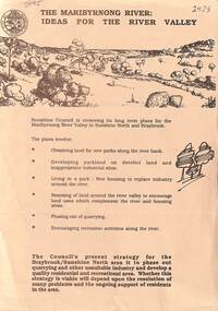 Sunshine and District Historical Society Incorporated
Document - The Maribyrnong River Ideas for the River Valley, City of Sunshine
... ... Canning Street... Bridge...Maribyrnong Valley Maribyrnong River Canning Street Bridge Flyer The Maribyrnong River Ideas for the River Valley The Maribyrnong River Ideas for the River Valley Document The Maribyrnong River Ideas for the River Valley City of Sunshine ...Flyer The Maribyrnong River Ideas for the River Valleymaribyrnong valley, maribyrnong river, canning street, bridge -
 Federation University Historical Collection
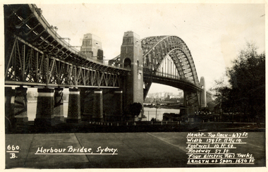
Postcard, Kodak, Sydney Harbour Bridge, c1949, 13/10/1949
... The Frank Wright Medal at the Royal South Street competition is awarded to an individual recognized as making an outstanding contribution to brass music in Australia. frank wright cornet conductor sydney harbour bridge Written in white on front - 660.B, Harbour Bridge, Sydney., Height-Top arch - 437 ft.,Width 159 ft. 11 3/4 in., Footways 10 ft. ea., Roadway 57 ft., Four Electric Rail Tracks., Length of span 1650 ft. Handwritten on back - Message to W. Snelling in London from Frank Wright Black and white photograph of the Sydney Harbour Bridge. A small section of the city and water can ...Postcard written by Frank Wright to a friend, W. Snelling in London. Frank Wright was a renown resident of Smeaton, where he was born. He lived at Laura Villa, and attended Smeaton State School. His father William was a gold miner and his mother's name was Sarah. Their family won many singing and instrumental awards. Frank was tutored by Percy Code and was awarded a gold medal for the highest marks in the ALCM examinations in the British Colonies at the age of seventeen years. He became the Australian Open Cornet Champion by the age of eighteen. A year later, Frank conducted the City of Ballarat Band, and later the Ballarat Soldiers’ Memorial Band. He formed the Frank Wright Frisco Band and Frank Wright and his Coliseum Orchestra. These bands won many South Street awards, and Frank as conductor won many awards in the Australian Band Championship contest. In 1933 Frank Wright sailed to England to conduct the famous St Hilda’s Band and was later appointed Musical Director of the London County Council, where he organized many amazing concerts in parks, in and around the London district. He was made Professor of Brass and Military Band Scoring and conducted at the Guildhall of Music and Drama. Frank was often invited to adjudicate Brass Band Championships around Europe, in Australia, including South Street and in New Zealand. The Frank Wright Medal at the Royal South Street competition is awarded to an individual recognized as making an outstanding contribution to brass music in Australia.Black and white photograph of the Sydney Harbour Bridge. A small section of the city and water can be seen beneath the arched span of the bridge.Written in white on front - 660.B, Harbour Bridge, Sydney., Height-Top arch - 437 ft.,Width 159 ft. 11 3/4 in., Footways 10 ft. ea., Roadway 57 ft., Four Electric Rail Tracks., Length of span 1650 ft. Handwritten on back - Message to W. Snelling in London from Frank Wrightfrank wright, cornet, conductor, sydney harbour bridge -
 Federation University Historical Collection
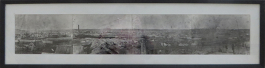
Photograph - Photograph - Black and White, Ballarat, c1858, c1858
... Bridge Street on the left is well established. The crude pans and cradles of the early “diggers’ were already giving way to steam power and the deep shafts of the “miners”. Money and machinery were needed to get to the deeper leads, and the smoke stacks of the great company mines can be seen across the photo. ...Bridge Street on the left is well established. The crude pans and cradles of the early “diggers’ were already giving way to steam power and the deep shafts of the “miners”. Money and machinery were needed to get to the deeper leads, and the smoke stacks of the great company mines can be seen across the photo. ...Four photographs framed together to produce a panorama. The four photographs were taken from the slope of the Ballarat School of Mines where the Wesley Church now stands. When joined they gave a panoramic view of one of the world’s richest alluvial goldfields. The town you see had over 50,000 people. Bridge Street on the left is well established. The crude pans and cradles of the early “diggers’ were already giving way to steam power and the deep shafts of the “miners”. Money and machinery were needed to get to the deeper leads, and the smoke stacks of the great company mines can be seen across the photo. The waterloo mines was one of the first deep shafts and was sunk at the foot of the Dana Street hill. Its tailings are seen in the second photo from left. ballarat, ballarat gas works, mount warrenheip, shingle roof, mullock heap, mining -
 The Beechworth Burke Museum
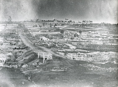
Photograph, c.1863
... bridge, while in the background, right-hand-side, Benevolent Hospital can be seen. In the centre of the photograph can be seen a horse and cart travelling along the road. This photograph shows historical and research value in its depiction of Beechworth in the late 1800s. It features a key historical site, the Benevolent Hospital, as well providing a historical look at a street ...Taken in Beechworth, this photograph depicts Albert road bisecting the Spring Creek Diggings. The foreground of the photograph features a small bridge, while in the background, right-hand-side, Benevolent Hospital can be seen. In the centre of the photograph can be seen a horse and cart travelling along the road. This photograph shows historical and research value in its depiction of Beechworth in the late 1800s. It features a key historical site, the Benevolent Hospital, as well providing a historical look at a street that operates in Beechworth in the present day.Black and white, rectangular photograph printed on matt photographic paper, unmountedReverse: PH 238 / 1997.2462 / Albert Road . 1863 . 1800s beechworth, 1860s beechworth, beechworth, spring creek, benevolent asylum, albert road -
 Marysville & District Historical Society
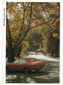
Postcard (item) - Colour postcard, K. & H. Ellis, Pack Road, Marysville, Pre 2009
... View is down Murchison Street towards Barton Bridge. In the background can be seen the rectory from the Church of England. ...A colour photograph of Murchison Street in Marysville in Victoria.A colour photograph of Pack Road in Marysville in Victoria. Labeling is incorrect. View is down Murchison Street towards Barton Bridge. In the background can be seen the rectory from the Church of England. The rectory survived the 2009 Black Saturday bushfires whilst the church was destroyed. This postcard was produced by Colorscans Publishing as a souvenir of Marysville.Colorscans c PUBLISHED & PRINTED BY COLORSCANS (PUBLISHING) PTY LTD 118-120 BRIGHTON STREET, RICHMOND 3121/ Supa-vu/ cards MARYSVILLE - VICTORIA/ Pack Road, Marysville Photographed and Distributed by:/ K & H. Ellis - 35 Old Warburton Road,/ Warburton 3799marysville, victoria, pack road, murchison street, postcard, souvenir, colorscans publishing, k & h ellis, 2009 black saturday bushfires, church of england -
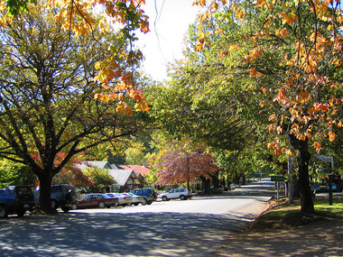 Marysville & District Historical Society
Photograph (Item) - Colour photograph, Travel Victoria, 2006
... Shows the view looking down the street towards the F.J. Barton Bridge. All the buildings that can be seen in the photograph were destroyed in the 2009 Black Saturday bushfires. murchison street marysville victoria photograph 2009 black saturday bushfires f.j. barton bridge A colour photograph of Murchison Street in Marysville in Victoria. ...A colour photograph of Murchison Street in Marysville in Victoria.A colour photograph of Murchison Street in Marysville in Victoria. Shows the view looking down the street towards the F.J. Barton Bridge. All the buildings that can be seen in the photograph were destroyed in the 2009 Black Saturday bushfires.murchison street, marysville, victoria, photograph, 2009 black saturday bushfires, f.j. barton bridge -
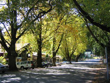 Marysville & District Historical Society
Photograph (Item) - Colour photograph, Travel Victoria, 2006
... A colour photograph of Murchison Street in Marysville in Victoria. F.J. Barton Bridge and Christ Church can be seen in the distance....The buildings along Murchison Street, including the Christ Church, were destroyed in the 2009 Black Saturday bushfires. murchison street marysville victoria christ church photograph 2009 black saturday bushfires A colour photograph of Murchison Street in Marysville in Victoria. F.J. Barton Bridge and Christ Church can be seen in the distance. ...A colour photograph of Murchison Street in Marysville in Victoria.A colour photograph looking down Murchison Street in Marysville in Victoria. The buildings along Murchison Street, including the Christ Church, were destroyed in the 2009 Black Saturday bushfires.murchison street, marysville, victoria, christ church, photograph, 2009 black saturday bushfires -
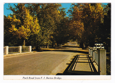 Marysville & District Historical Society
Postcard (item) - Colour postcard, Nucolorvue Productions Pty. Ltd, Pack Road from F.J. Barton Bridge, Pre 2009
... Street from the F.J. Barton Bridge. The F.J. Barton Bridge was named after Frederick John Barton. The Barton Family were amongst Marysville's first pioneering families. This postcard was published by Nucolorvue Productions as a souvenir of Marysville. marysville f.j. barton bridge murchison street victoria postcard souvenir nucolorvue productions fj barton NU-COLOR-VUE/ OF / AUSTRALIA MARYSVILLE, VICTORIA. Pack Road from F.J. BARTON/ BRIDGE. PLACE/ STAMP/ HERE POST CARD NCV.172 - NUCOLORVUE PRODUCTIONS PTY. LTD./ COPYRIGHT Printed in Australia (Note our new/ bridge) Hullo Dot,/ Very pleased to/ have the chance to meet someone who/ can ...A colour photograph of Murchison Street from the F.J. Barton Bridge in Marysville in Victoria.A colour photograph of Pack Road from the F.J. Barton Bridge in Marysville in Victoria. Labeling is incorrect. The view is looking down Murchison Street from the F.J. Barton Bridge. The F.J. Barton Bridge was named after Frederick John Barton. The Barton Family were amongst Marysville's first pioneering families. This postcard was published by Nucolorvue Productions as a souvenir of Marysville.NU-COLOR-VUE/ OF / AUSTRALIA MARYSVILLE, VICTORIA. Pack Road from F.J. BARTON/ BRIDGE. PLACE/ STAMP/ HERE POST CARD NCV.172 - NUCOLORVUE PRODUCTIONS PTY. LTD./ COPYRIGHT Printed in Australia (Note our new/ bridge) Hullo Dot,/ Very pleased to/ have the chance to meet someone who/ can tell us your news. All the best from/ all the family here at Marysville/ Terry. Dear Dot,/ Good to hear/ first hand news/ of you. Regards,/ Elsie Walkermarysville, f.j. barton bridge, murchison street, victoria, postcard, souvenir, nucolorvue productions, fj barton -
 Federation University Historical Collection
Booklet, The Ballarat Historian: Journal of the Ballarat Historical Society - The History of Mt Clear High School, June 1983
... The Ballarat Junior Technical School was started in 1913 to bridge the gap between primary schools and senior technical colleges at the old Dana Street National School under the administration of the School of Mines. The Ballarat Girls Technical School which was commenced in 1951 and the Girls High School which can be traced back to 1874, both had several incarnations before joining together. ...The Ballarat Junior Technical School was started in 1913 to bridge the gap between primary schools and senior technical colleges at the old Dana Street National School under the administration of the School of Mines. The Ballarat Girls Technical School which was commenced in 1951 and the Girls High School which can be traced back to 1874, both had several incarnations before joining together. ...The Mt Clear Technical High School was an amalgamation of several schools. The Ballarat Junior Technical School was started in 1913 to bridge the gap between primary schools and senior technical colleges at the old Dana Street National School under the administration of the School of Mines. The Ballarat Girls Technical School which was commenced in 1951 and the Girls High School which can be traced back to 1874, both had several incarnations before joining together. The Mt Clear Technical School separated from the School of Mines in January 1977 and was officially opened on 10th October 1981.Called 'A marriage of convenience', this 7 page, A4 booklet is stapled at the top left hand corner and is a photocopy of the vol.1, no.9 issue of The Ballarat Historian. It contains a history of the the schools in Ballarat which eventually merged and formed on the completion of the buildings in 1981, the Mt Clear Technical High School. It was written by J A Chisholm who was the Jnr. Vice-President of the Ballarat Historical Society. It was listed as Vol.1, No.9 as the Journal of the Ballarat Historical Society.ballarat historical society, journal of the ballarat historical society, the ballarat historian, j a chisholm, mount clear technical high school, mount clear high school, jack chisholm, j.a. chisholm, mt clear -
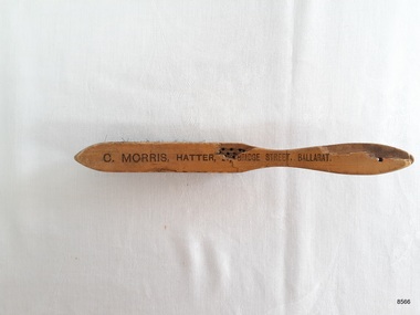 Flagstaff Hill Maritime Museum and Village
Domestic object - Hat Brush, late 19th century
... can be dated to the late 19th century. The address of the business was 24 Bridge St Ballarat and was owned by Mr Charles Morris. Flagstaff Hill Warrnambool Maritime Village Maritime Museum Flagstaff Hill Maritime Museum & Village Shipwreck coast Great Ocean Road hat brush wooden hat brush natural bristles C.Morris Hatter Hatter Ballarat C.Morris Ballarat C. MORRIS, HATTER, (?) BRIDGE STREET ...The hat brush is an example of a domestic object that would have been common to most households in the late 19th and early 20th century.The hat brush is significant in that the inscription connects the brush to a prominent hat maker in the Western district whose business can be dated to the late 19th century. The address of the business was 24 Bridge St Ballarat and was owned by Mr Charles Morris. Curved wooden hat brush constructed from light polished timber. The handle end has a small hole in it and the front end is pointed. The bristles are two tone in a circling pattern and cut to follow the curved shape of the wood. There is a chip out of the wood exposing the bristle holes. The brush is stamped with the suppliers name and address.C. MORRIS, HATTER, (?) BRIDGE STREET, BALLARAT.flagstaff hill, warrnambool, maritime village, maritime museum, flagstaff hill maritime museum & village, shipwreck coast, great ocean road, hat brush, wooden hat brush, natural bristles, c.morris hatter, hatter ballarat, c.morris ballarat -
 Greensborough Historical Society
Photograph - Digital Image, Old pool Plenty River, May 2014, 21/05/2014
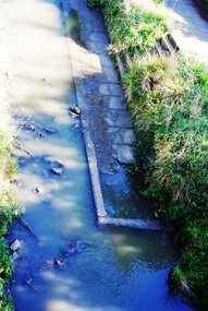
... Opened in 1937, the remnants of this concrete pool can be seen today from the Main Street bridge Greensborough. Photograph by Marilyn Smith 2014....Opened in 1937, the remnants of this concrete pool can be seen today from the Main Street bridge Greensborough. Photograph by Marilyn Smith 2014. plenty river pool greensborough pool swimming pools Digital copy of colour photograph. ...Plenty River pool Greensborough. Opened in 1937, the remnants of this concrete pool can be seen today from the Main Street bridge Greensborough. Photograph by Marilyn Smith 2014.Digital copy of colour photograph.plenty river pool, greensborough pool, swimming pools -
 Greensborough Historical Society
Photograph - Digital Image, Old Pool Plenty River 2014, 21/05/2014
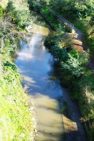
... Opened in 1937, the remnants of this concrete pool can be seen today from the Main Street bridge Greensborough. Photograph by Marilyn Smith 2014....Opened in 1937, the remnants of this concrete pool can be seen today from the Main Street bridge Greensborough. Photograph by Marilyn Smith 2014. plenty river pool swimming pools greensborough pool Digital copy of colour photograph. ...Plenty River pool Greensborough. Opened in 1937, the remnants of this concrete pool can be seen today from the Main Street bridge Greensborough. Photograph by Marilyn Smith 2014.Digital copy of colour photograph.plenty river pool, swimming pools, greensborough pool -
 Greensborough Historical Society
Photograph - Digital Image, Old Pool Plenty River May 2014, 21/05/2014
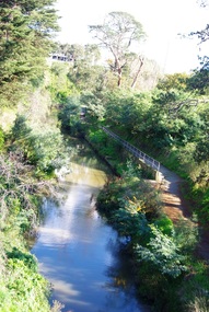
... Opened in 1937, the remnants of this concrete pool can be seen today from the Main Street bridge Greensborough. Photograph by Marilyn Smith 2014....Opened in 1937, the remnants of this concrete pool can be seen today from the Main Street bridge Greensborough. Photograph by Marilyn Smith 2014. greensborough pool swimming pools plenty river pool Digital copy of colour photograph. ...Plenty River pool Greensborough. Opened in 1937, the remnants of this concrete pool can be seen today from the Main Street bridge Greensborough. Photograph by Marilyn Smith 2014.Digital copy of colour photograph.greensborough pool, swimming pools, plenty river pool -
 Greensborough Historical Society
Photograph, Plenty River Bridge Greensborough, 1910c
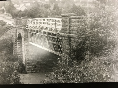
... Street bridge over the Plenty River, taken around 1910. Quirk's Tailor shop is seen in the background and a horse and cart coming down the road. The road appears unsealed. Rampant blackberries can...Street bridge over the Plenty River, taken around 1910. Quirk's Tailor shop is seen in the background and a horse and cart coming down the road. The road appears unsealed. Rampant blackberries can ...Early photograph of Main Street bridge over the Plenty River, taken around 1910. Quirk's Tailor shop is seen in the background and a horse and cart coming down the road. The road appears unsealed. Rampant blackberries can be seen growing around the bridge abutments. Part of a collection of photographic enlargements of Greensborough sites.Black and white enlargement of photographic imagemain street bridge, main street greensborough, plenty river greensborough, quirk's tailor shop, blackberry, mckenzie bridge -
 Mission to Seafarers Victoria
Photograph - Mounted photograph, Black and white, Thelma-Duryed, George Henry Martin, 1915
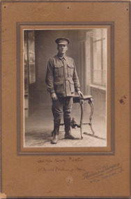
... street, Magill, has been advised that her husband, Gunner G. H. Martin, was killed in action in France on August 7. He sailed from Melbourne for Egypt in June, 1915, and had been at the front in France since April last. He also served ten months in the Naval Bridging Train before joining the artillery. He was born in Edmonton, England, and lived in Magill for about five years. He was in his 28th year." - from the Adelaide Chronicle 30 Sep 1916 (nla.gov.au) As his occupation was seaman, we can ...Born: Edmonton, England, 10 January 1888 Home Town: Magill, Campbelltown, South Australia Occupation: Seaman Service Number: 176 Enlisted: 27 March 1915, Melbourne, Victoria Last Rank: Gunner Last Unit: 1st Royal Australian Naval Bridging Train Died: Killed in action, France, 7 August 1916, aged 28 years Cemetery: Gordon Dump Cemetery, Ovillers-la Boisselle Gordon Dump Cemetery, Ovillers la Boisselle, Picardie, France Memorials: Australian War Memorial Roll of Honour, Magill Honour Board, Magill War Memorial 27 Mar 1915: Enlisted AIF WW1, Private, 1st Royal Australian Naval Bridging Train, Melbourne, Victoria 4 Jun 1915: Embarked AIF WW1, Private, SN 176, 1st Royal Australian Naval Bridging Train, --- :embarkation_roll: roll_number: '24' embarkation_place: Melbourne embarkation_ship: HMAT Port Macquarie embarkation_ship_number: A39 public_note: '' 4 Jun 1915: Embarked AIF WW1, SN 176, 1st Royal Australian Naval Bridging Train, HMAT Port Macquarie, Melbourne 7 Aug 1916: Involvement AIF WW1, Gunner, SN 176, Battle for Pozières The portrait has been used in this article : "THE LATE GUNNER G. H. MARTIN. Mrs. G. H. Martin, of Jackson-street, Magill, has been advised that her husband, Gunner G. H. Martin, was killed in action in France on August 7. He sailed from Melbourne for Egypt in June, 1915, and had been at the front in France since April last. He also served ten months in the Naval Bridging Train before joining the artillery. He was born in Edmonton, England, and lived in Magill for about five years. He was in his 28th year." - from the Adelaide Chronicle 30 Sep 1916 (nla.gov.au)As his occupation was seaman, we can assume George Henry Martin visited the Mission. The Senior Chaplain, Alfred Hurney Goldsmith, RANR, was appointed chaplain of the Naval Bridging Train in 1914. (Jottings 31, Midwinter 1914). We can only imagine the two men knew each other and that the portrait was donated by George himself or by his family to the Mission.Portrait of ANZAC soldier in 1915naval bridging train, france, ww1, thelma-duryed, adelaide, george henry martin 1888-1916 -
 Ringwood and District Historical Society
Photograph, Croydon West High School off Cutts Avenue and Maroondah Hwy, Ringwood - November, 1969
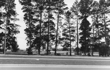
... It was later sub-divided and the two streets named Wilhelmina and Juliana Courts, in honor of Wilhelmina, Queen of the Netherlands, and her daughter, Juliana, later succeeding her as Queen. The Burnt Bridge Shopping Centre can...It was later sub-divided and the two streets named Wilhelmina and Juliana Courts, in honor of Wilhelmina, Queen of the Netherlands, and her daughter, Juliana, later succeeding her as Queen. The Burnt Bridge Shopping Centre can ...Written on backing sheet, "West Croydon School (In Ringwood municipality)". November 1969. The area behind the pine trees was used as a training ground by the Wilhelmina Soccer Club, later called Ringwood City SC and Ringwood FC. It was later sub-divided and the two streets named Wilhelmina and Juliana Courts, in honor of Wilhelmina, Queen of the Netherlands, and her daughter, Juliana, later succeeding her as Queen. The Burnt Bridge Shopping Centre can be seen in the far west on one of the images. -
 Orbost & District Historical Society
black and white photograph, January 1934
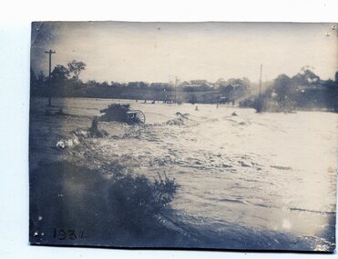
... bridges and roads, dumping silt and debris on the rich river flats and drowning cattle. This is a pictorial record of the 1934 flood, a significant event in the history of Orbost. orbost-flood-1934 flood-orbost on back - "near Hilyer's garage at foot of hill Main Street Caravan Park on right" on front at bottom left - "1934" A black / white photograph of floodwaters. In the middle of the water can ...From The Argus (Melbourne) on January 10 1934 "Damage estimated at £500,000 has been caused by the floods in the Orbost district. No loss of life occurred, largely owing to the heroic efforts of rescue parties. Many families spent Monday night on the roofs of houses or in trees, surrounded by deep, rushing flood waters." This 1934 flood was devastating, destroying a section of the 1922 Orbost bridge - the centre span was washed away -. wrecking fences, bridges and roads, dumping silt and debris on the rich river flats and drowning cattle. This is a pictorial record of the 1934 flood, a significant event in the history of Orbost.A black / white photograph of floodwaters. In the middle of the water can be see debris including a large spoked wheel. In the background are houses and fences.on back - "near Hilyer's garage at foot of hill Main Street Caravan Park on right" on front at bottom left - "1934"orbost-flood-1934 flood-orbost -
 Orbost & District Historical Society
black and white photographs, 1980s? (winter months)
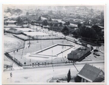
... The swimming pool and bowling club can be seen in the foreground. 3259.2 is aview looking north-west and showing the tennis courts and clubhouse, the Recreation Reserve oval, the Youth Centre, Historical Museum, Municipal Offices, Senior Citizens clubrooms with the fire station in the foreground. 3259.3 is a view looking south with the Shire of Orbost Municipal offices and Ruskin Street in the foreground. Munro Street can be seen running from Ruskin Street to St Joseph's School in the middle distance. Lochiel Park oval, Lochiel House, the Snowy River and highway bridge...The swimming pool and bowling club can be seen in the foreground. 3259.2 is aview looking north-west and showing the tennis courts and clubhouse, the Recreation Reserve oval, the Youth Centre, Historical Museum, Municipal Offices, Senior Citizens clubrooms with the fire station in the foreground. 3259.3 is a view looking south with the Shire of Orbost Municipal offices and Ruskin Street in the foreground. Munro Street can be seen running from Ruskin Street to St Joseph's School in the middle distance. Lochiel Park oval, Lochiel House, the Snowy River and highway bridge ...All photographs seem to have been takenfrom the Telecom tower on the corner of Browning and Wolseley Streets in Orbost 3259.1 is a view of the Orbost township looking north-east. The swimming pool and bowling club can be seen in the foreground. 3259.2 is aview looking north-west and showing the tennis courts and clubhouse, the Recreation Reserve oval, the Youth Centre, Historical Museum, Municipal Offices, Senior Citizens clubrooms with the fire station in the foreground. 3259.3 is a view looking south with the Shire of Orbost Municipal offices and Ruskin Street in the foreground. Munro Street can be seen running from Ruskin Street to St Joseph's School in the middle distance. Lochiel Park oval, Lochiel House, the Snowy River and highway bridge are in the background. 3259.4 is a view looking south showing the Club Hotel, C.B.C. Bank in the middle distance and Hoffman's paddock (Forest Park) and the Snowy River beyond. 3259.5 is a view looking north-east over houses. 3259.6 is aview over the main street, Nicholson Street.showing the main shopping precinct. Shop signs for Permewans, Williams Shoes, F.B. Dicken and Orbost Bakery can be seen. 3259.7 is a view looking south west and shows Forest park and beyond towards Bete Bolong.These photographs are detailed pictorial records of the township of Orbost.Seven black / white photographs taken from above a township. Chimney smoke can be seen in the photographs.orbost-township-1980s aerial-photograph-orbost -
 Eltham District Historical Society Inc
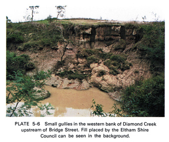
Work on paper (Sub-Item) - Photograph, Small gullies in the western bank of Diamond Creek upstream of Bridge Street, Eltham
... Colour photograph of a muddy creek (probably after a downpour) on the western bank of Diamond Creek upstream of Bridge Street, Eltham. Fill placed by the Eltham Shire Council can be seen in the background...Colour photograph of a muddy creek (probably after a downpour) on the western bank of Diamond Creek upstream of Bridge Street, Eltham. Fill placed by the Eltham Shire Council can be seen in the background eltham diamond creek bridge street gullies fill Image printed on A4 page from 04997 Diamond Creek Basin Study, 1980 Small gullies in the western bank of Diamond Creek upstream of Bridge Street, Eltham Work on paper Photograph ...Colour photograph of a muddy creek (probably after a downpour) on the western bank of Diamond Creek upstream of Bridge Street, Eltham. Fill placed by the Eltham Shire Council can be seen in the backgroundeltham, diamond creek, bridge street, gullies, fill -
 Eltham District Historical Society Inc
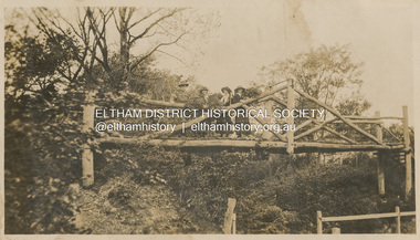
Photograph, "Curry, Byrne, McGeachy & self on rustic bridge, Eltham", 22 Oct 1919
... The old Diamond Street bridge in Eltham had a raised section seen here and a lower section, the railings of which can just be seen. ...The old Diamond Street bridge in Eltham had a raised section seen here and a lower section, the railings of which can just be seen. ...The old Diamond Street bridge in Eltham had a raised section seen here and a lower section, the railings of which can just be seen. The upper pedestrian crossing provided continual access for foot traffic during times of flood. This photo is part of the Alice Broadhurst collection held by Yarra Plenty Regional Library, a series of 12 photo albums compiled by Alice Broadhurst (1896-1981), initially while working as a Voluntary Aid Detachment nurse with the Australian Red Cross at the Mont Park Military Hospital (No. 16 AGH) and subsequently as a nurse at the Royal Melbourne and Royal Women’s hospitals alongside many pioneering doctors of their fields. This photo depicts an outing with fellow VAD nurses McGeachy and Byrne and two patients of Mont Park, Curry and Caffery to Eltham in spring 1919 Digital file"Curry, Byrne, McGeachy & self on rustic bridge, Eltham, Oct 22, 1919"eltham, diamond creek, diamond street bridge, alice elizabeth broadhurst, byrne, caffery, curry, mcgeachy, nursing staff, mont park, 16 agh -
 Eltham District Historical Society Inc
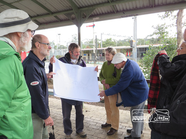
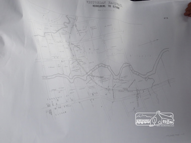
Photograph, Liz Pidgeon, Heritage Excursion; The 1901 Eltham Railway Walk, 3 May 2014, 3 May 2014
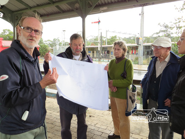
... streets. Along the way we will discuss the details shown on the railway plans as well as more recent railway documents and photographs. At the conclusion and if time permits we can inspect the historical display at the Eltham Station. The walk is about 3 km in length and will take about 2.5 hours. It will start at 2 pm at the Eltham Railway Station car park (east/Main Road side) (Melway Ref. 21 J5). heritage excursion activities eltham district historical society eltham railway station eltham library trestle bridge Born Digital Heritage Excursion; The 1901 Eltham Railway Walk, 3 May 2014 Photograph Liz Pidgeon ...Newsletter No. 216, May 2014 May Excursion – The 1901 Eltham Railway Walk The railway from Heidelberg to Eltham was opened in 1902. Over the previous year railway construction cut a curving swathe through Josiah Holloway’s 1851 Little Eltham subdivision. The survey plans for the railway show the owners and occupiers of land within Little Eltham affected by the railway alignment and for some distance each side. The plans show houses and other buildings but development at that time was rather sparse. Copies of these plans from the State Library of Victoria collection have been provided to the Society by Alan Sheehan. For our walk on 3rd May we intend to follow the railway from the Eltham Station to Ryans Road, which was the boundary of the adjoining Montmorency Farm. The return will be by way of nearby streets. Along the way we will discuss the details shown on the railway plans as well as more recent railway documents and photographs. At the conclusion and if time permits we can inspect the historical display at the Eltham Station. The walk is about 3 km in length and will take about 2.5 hours. It will start at 2 pm at the Eltham Railway Station car park (east/Main Road side) (Melway Ref. 21 J5).Born Digitalheritage excursion, activities, eltham district historical society, eltham railway station, eltham library, trestle bridge -
 Eltham District Historical Society Inc
Photograph, Liz Pidgeon, Heritage Excursion; The 1901 Eltham Railway Walk, 3 May 2014, 3 May 2014
... streets. Along the way we will discuss the details shown on the railway plans as well as more recent railway documents and photographs. At the conclusion and if time permits we can inspect the historical display at the Eltham Station. The walk is about 3 km in length and will take about 2.5 hours. It will start at 2 pm at the Eltham Railway Station car park (east/Main Road side) (Melway Ref. 21 J5). heritage excursion activities eltham district historical society eltham railway station eltham library trestle bridge Born Digital Heritage Excursion; The 1901 Eltham Railway Walk, 3 May 2014 Photograph Liz Pidgeon ...Newsletter No. 216, May 2014 May Excursion – The 1901 Eltham Railway Walk The railway from Heidelberg to Eltham was opened in 1902. Over the previous year railway construction cut a curving swathe through Josiah Holloway’s 1851 Little Eltham subdivision. The survey plans for the railway show the owners and occupiers of land within Little Eltham affected by the railway alignment and for some distance each side. The plans show houses and other buildings but development at that time was rather sparse. Copies of these plans from the State Library of Victoria collection have been provided to the Society by Alan Sheehan. For our walk on 3rd May we intend to follow the railway from the Eltham Station to Ryans Road, which was the boundary of the adjoining Montmorency Farm. The return will be by way of nearby streets. Along the way we will discuss the details shown on the railway plans as well as more recent railway documents and photographs. At the conclusion and if time permits we can inspect the historical display at the Eltham Station. The walk is about 3 km in length and will take about 2.5 hours. It will start at 2 pm at the Eltham Railway Station car park (east/Main Road side) (Melway Ref. 21 J5).Born Digitalheritage excursion, activities, eltham district historical society, eltham railway station, eltham library, trestle bridge -
 Eltham District Historical Society Inc
Photograph, Liz Pidgeon, Heritage Excursion; The 1901 Eltham Railway Walk, 3 May 2014, 3 May 2014
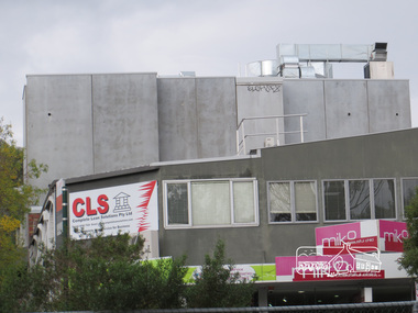
... streets. Along the way we will discuss the details shown on the railway plans as well as more recent railway documents and photographs. At the conclusion and if time permits we can inspect the historical display at the Eltham Station. The walk is about 3 km in length and will take about 2.5 hours. It will start at 2 pm at the Eltham Railway Station car park (east/Main Road side) (Melway Ref. 21 J5). heritage excursion activities eltham district historical society eltham railway station eltham library trestle bridge Born Digital Heritage Excursion; The 1901 Eltham Railway Walk, 3 May 2014 Photograph Liz Pidgeon ...Newsletter No. 216, May 2014 May Excursion – The 1901 Eltham Railway Walk The railway from Heidelberg to Eltham was opened in 1902. Over the previous year railway construction cut a curving swathe through Josiah Holloway’s 1851 Little Eltham subdivision. The survey plans for the railway show the owners and occupiers of land within Little Eltham affected by the railway alignment and for some distance each side. The plans show houses and other buildings but development at that time was rather sparse. Copies of these plans from the State Library of Victoria collection have been provided to the Society by Alan Sheehan. For our walk on 3rd May we intend to follow the railway from the Eltham Station to Ryans Road, which was the boundary of the adjoining Montmorency Farm. The return will be by way of nearby streets. Along the way we will discuss the details shown on the railway plans as well as more recent railway documents and photographs. At the conclusion and if time permits we can inspect the historical display at the Eltham Station. The walk is about 3 km in length and will take about 2.5 hours. It will start at 2 pm at the Eltham Railway Station car park (east/Main Road side) (Melway Ref. 21 J5).Born Digitalheritage excursion, activities, eltham district historical society, eltham railway station, eltham library, trestle bridge -
 Eltham District Historical Society Inc
Photograph, Liz Pidgeon, Heritage Excursion; The 1901 Eltham Railway Walk, 3 May 2014, 3 May 2014
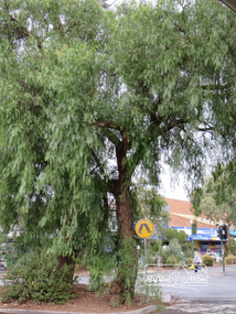
... streets. Along the way we will discuss the details shown on the railway plans as well as more recent railway documents and photographs. At the conclusion and if time permits we can inspect the historical display at the Eltham Station. The walk is about 3 km in length and will take about 2.5 hours. It will start at 2 pm at the Eltham Railway Station car park (east/Main Road side) (Melway Ref. 21 J5). heritage excursion activities eltham district historical society eltham railway station eltham library trestle bridge Born Digital Heritage Excursion; The 1901 Eltham Railway Walk, 3 May 2014 Photograph Liz Pidgeon ...Newsletter No. 216, May 2014 May Excursion – The 1901 Eltham Railway Walk The railway from Heidelberg to Eltham was opened in 1902. Over the previous year railway construction cut a curving swathe through Josiah Holloway’s 1851 Little Eltham subdivision. The survey plans for the railway show the owners and occupiers of land within Little Eltham affected by the railway alignment and for some distance each side. The plans show houses and other buildings but development at that time was rather sparse. Copies of these plans from the State Library of Victoria collection have been provided to the Society by Alan Sheehan. For our walk on 3rd May we intend to follow the railway from the Eltham Station to Ryans Road, which was the boundary of the adjoining Montmorency Farm. The return will be by way of nearby streets. Along the way we will discuss the details shown on the railway plans as well as more recent railway documents and photographs. At the conclusion and if time permits we can inspect the historical display at the Eltham Station. The walk is about 3 km in length and will take about 2.5 hours. It will start at 2 pm at the Eltham Railway Station car park (east/Main Road side) (Melway Ref. 21 J5).Born Digitalheritage excursion, activities, eltham district historical society, eltham railway station, eltham library, trestle bridge -
 Eltham District Historical Society Inc
Photograph, Liz Pidgeon, Heritage Excursion; The 1901 Eltham Railway Walk, 3 May 2014, 3 May 2014
... streets. Along the way we will discuss the details shown on the railway plans as well as more recent railway documents and photographs. At the conclusion and if time permits we can inspect the historical display at the Eltham Station. The walk is about 3 km in length and will take about 2.5 hours. It will start at 2 pm at the Eltham Railway Station car park (east/Main Road side) (Melway Ref. 21 J5). heritage excursion activities eltham district historical society eltham railway station eltham library trestle bridge Born Digital Heritage Excursion; The 1901 Eltham Railway Walk, 3 May 2014 Photograph Liz Pidgeon ...Newsletter No. 216, May 2014 May Excursion – The 1901 Eltham Railway Walk The railway from Heidelberg to Eltham was opened in 1902. Over the previous year railway construction cut a curving swathe through Josiah Holloway’s 1851 Little Eltham subdivision. The survey plans for the railway show the owners and occupiers of land within Little Eltham affected by the railway alignment and for some distance each side. The plans show houses and other buildings but development at that time was rather sparse. Copies of these plans from the State Library of Victoria collection have been provided to the Society by Alan Sheehan. For our walk on 3rd May we intend to follow the railway from the Eltham Station to Ryans Road, which was the boundary of the adjoining Montmorency Farm. The return will be by way of nearby streets. Along the way we will discuss the details shown on the railway plans as well as more recent railway documents and photographs. At the conclusion and if time permits we can inspect the historical display at the Eltham Station. The walk is about 3 km in length and will take about 2.5 hours. It will start at 2 pm at the Eltham Railway Station car park (east/Main Road side) (Melway Ref. 21 J5).Born Digitalheritage excursion, activities, eltham district historical society, eltham railway station, eltham library, trestle bridge -
 Eltham District Historical Society Inc
Photograph, Liz Pidgeon, Heritage Excursion; The 1901 Eltham Railway Walk, 3 May 2014, 3 May 2014
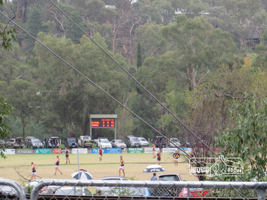
... streets. Along the way we will discuss the details shown on the railway plans as well as more recent railway documents and photographs. At the conclusion and if time permits we can inspect the historical display at the Eltham Station. The walk is about 3 km in length and will take about 2.5 hours. It will start at 2 pm at the Eltham Railway Station car park (east/Main Road side) (Melway Ref. 21 J5). heritage excursion activities eltham district historical society eltham railway station eltham library trestle bridge Eltham Central Park football Born Digital Heritage Excursion; The 1901 Eltham Railway Walk, 3 May 2014 Photograph Photograph Liz Pidgeon ...Football match at Eltham Central Park between Eltham and Heidelberg Newsletter No. 216, May 2014 May Excursion – The 1901 Eltham Railway Walk The railway from Heidelberg to Eltham was opened in 1902. Over the previous year railway construction cut a curving swathe through Josiah Holloway’s 1851 Little Eltham subdivision. The survey plans for the railway show the owners and occupiers of land within Little Eltham affected by the railway alignment and for some distance each side. The plans show houses and other buildings but development at that time was rather sparse. Copies of these plans from the State Library of Victoria collection have been provided to the Society by Alan Sheehan. For our walk on 3rd May we intend to follow the railway from the Eltham Station to Ryans Road, which was the boundary of the adjoining Montmorency Farm. The return will be by way of nearby streets. Along the way we will discuss the details shown on the railway plans as well as more recent railway documents and photographs. At the conclusion and if time permits we can inspect the historical display at the Eltham Station. The walk is about 3 km in length and will take about 2.5 hours. It will start at 2 pm at the Eltham Railway Station car park (east/Main Road side) (Melway Ref. 21 J5).Born Digitalheritage excursion, activities, eltham district historical society, eltham railway station, eltham library, trestle bridge, eltham central park, football -
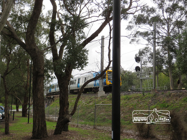 Eltham District Historical Society Inc
Photograph, Liz Pidgeon, Heritage Excursion; The 1901 Eltham Railway Walk, 3 May 2014, 3 May 2014
... streets. Along the way we will discuss the details shown on the railway plans as well as more recent railway documents and photographs. At the conclusion and if time permits we can inspect the historical display at the Eltham Station. The walk is about 3 km in length and will take about 2.5 hours. It will start at 2 pm at the Eltham Railway Station car park (east/Main Road side) (Melway Ref. 21 J5). heritage excursion activities eltham district historical society eltham railway station eltham library trestle bridge Born Digital Heritage Excursion; The 1901 Eltham Railway Walk, 3 May 2014 Photograph Liz Pidgeon ...Newsletter No. 216, May 2014 May Excursion – The 1901 Eltham Railway Walk The railway from Heidelberg to Eltham was opened in 1902. Over the previous year railway construction cut a curving swathe through Josiah Holloway’s 1851 Little Eltham subdivision. The survey plans for the railway show the owners and occupiers of land within Little Eltham affected by the railway alignment and for some distance each side. The plans show houses and other buildings but development at that time was rather sparse. Copies of these plans from the State Library of Victoria collection have been provided to the Society by Alan Sheehan. For our walk on 3rd May we intend to follow the railway from the Eltham Station to Ryans Road, which was the boundary of the adjoining Montmorency Farm. The return will be by way of nearby streets. Along the way we will discuss the details shown on the railway plans as well as more recent railway documents and photographs. At the conclusion and if time permits we can inspect the historical display at the Eltham Station. The walk is about 3 km in length and will take about 2.5 hours. It will start at 2 pm at the Eltham Railway Station car park (east/Main Road side) (Melway Ref. 21 J5).Born Digitalheritage excursion, activities, eltham district historical society, eltham railway station, eltham library, trestle bridge
