Showing 71 items matching "castlemaine area"
-
 Old Castlemaine Schoolboys Association Inc.
List, Pubs in the Castlemaine Area remembered by Mary Ireland
... Pubs in the Castlemaine Area remembered by Mary Ireland...Old Castlemaine Schoolboys Association Inc. 123 Mostyn Street CASTLEMAINE goldfields Pubs in the Castlemaine Area remembered by Mary Ireland List ... -
 Narre Warren and District Family History Group
Book, Joseph Jenkins et al, Diary of a Welsh swagman, 1869-1894, 1977
... ...Castlemaine area...Narre Warren and District Family History Group 110 High Street Berwick melbourne swagmen diaries Castlemaine area Maldon area itinerant labourer Joseph Jenkins was a Welsh itinerant labourer in late 1800s Victoria. ...Joseph Jenkins was a Welsh itinerant labourer in late 1800s Victoria. Exceptional for a labourer at the time, Jenkins had a high level of literacy and kept detailed daily diaries for over 25 years, resulting in one of the most comprehensive accounts of early Victorian working life.non-fictionJoseph Jenkins was a Welsh itinerant labourer in late 1800s Victoria. Exceptional for a labourer at the time, Jenkins had a high level of literacy and kept detailed daily diaries for over 25 years, resulting in one of the most comprehensive accounts of early Victorian working life.swagmen, diaries, castlemaine area, maldon area, itinerant labourer -
 Koorie Heritage Trust
Book, Bradfield, Raymond, Castlemaine : A golden harvest, 1972
... ...Castlemaine area-History....Koorie Heritage Trust Levels 1 & 3, Yarra Building Federation Square, Melbourne melbourne Jajowurrung tribe-Loddon region (Dja Dja wurrung) Castlemaine area-History. vii-xii; 80 p.; plates; index; Castlemaine : A golden harvest Book Bradfield, Raymond Kilmore : Lowden Publishing Co ...vii-xii; 80 p.; plates; index; jajowurrung tribe-loddon region (dja dja wurrung), castlemaine area-history. -
 Bendigo Historical Society Inc.
Map - CAMPBELL COLLECTION: BENDIGO AND DISTRICT MAPS
... Mitiamo, Greater Bendigo Area, Castlemaine F.D....Mitiamo, Greater Bendigo Area, Castlemaine F.D. Map CAMPBELL COLLECTION: BENDIGO AND DISTRICT MAPS. ...Map. Forest Commission Victoria, Bendigo Forest District, Basic information prepared 1982, scale 1:100,000. Fire Prevention Strategy Plan. Mitiamo, Greater Bendigo Area, Castlemaine F.D.map, bendigo, forest district -
 Bendigo Historical Society Inc.
Book - "Goldfields of Victoria. From Macedon to Ballarat, Bendigo and Beyond.", 2017
... areas of Central Victoria. A large section of Central Victoria's architecture, natural resources and attractions are covered in this book. Victoria became one of the largest producers of gold in the world, with Bendigo producing 700 tonnes, Ballarat 400 tonnes, and the Castlemaine-Chewton area, 130 tonnes of gold. ...areas of Central Victoria. A large section of Central Victoria's architecture, natural resources and attractions are covered in this book. Victoria became one of the largest producers of gold in the world, with Bendigo producing 700 tonnes, Ballarat 400 tonnes, and the Castlemaine-Chewton area, 130 tonnes of gold. ...Gold mines, miner's huts, heritage gardens, wineries, wildlife parks, museums, art galleries and markets all show the charm of the goldfields areas of Central Victoria. A large section of Central Victoria's architecture, natural resources and attractions are covered in this book. Victoria became one of the largest producers of gold in the world, with Bendigo producing 700 tonnes, Ballarat 400 tonnes, and the Castlemaine-Chewton area, 130 tonnes of gold. The elaborate, grand buildings of Ballarat and Bendigo are testament to the affluence of the gold boom. This book touches on much of this heritage from the goldmining period and its legacy. "Goldfields of Victoria. From Macedon to Ballarat, Bendigo and Beyond" written by Kornelia Freeman and Ulo Pukk. Contains contents of regional towns with sub-indexes of smaller localities in that area. Published in Australia by Melbourne Books in 2017. Hard cover. Front cover has photograph/image of Australian bush scene, possibly from a hill/mountain at sunrise/sunset - hues of orange, green and ochre. Back cover is image of several men dressed colonial soldiers with historic buildings in the background - likely taken at 'Sovereign Hill', Ballarat. Book title in gold. Book includes color photos - mostly of historic buildings or natural landmarks within the designated local area. Spine in gold. Some maps in book. ISBN 9781925556223. 296 pp. macedon, bendigo, ballarat, goldfields -
 Bendigo Historical Society Inc.
Newspaper - JENNY FOLEY COLLECTION: REUNION
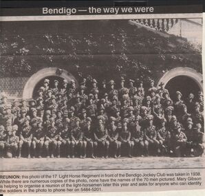
... Members were drawn from Kyneton, Castlemaine and Bendigo areas. In 1936 the regiment, including 100 horses, camped at the Bendigo Racecourse so it is possible this photo was actually 1936.From Dec 1941 this regiment became the 17th Light Horse (Machine Gun) Regiment and was disbanded in April 1943. ...Members were drawn from Kyneton, Castlemaine and Bendigo areas. In 1936 the regiment, including 100 horses, camped at the Bendigo Racecourse so it is possible this photo was actually 1936.From Dec 1941 this regiment became the 17th Light Horse (Machine Gun) Regiment and was disbanded in April 1943. ...The 17th Light Horse was a militia unit between the wars. Members were drawn from Kyneton, Castlemaine and Bendigo areas. In 1936 the regiment, including 100 horses, camped at the Bendigo Racecourse so it is possible this photo was actually 1936.From Dec 1941 this regiment became the 17th Light Horse (Machine Gun) Regiment and was disbanded in April 1943. Members were absorbed into other units.Bendigo Advertiser ''The way we were'' from 2003. Reunion: this photo of the 17 Light horse regiment in front of the Bendigo jockey Club was taken in 1938. While there are numerous copies of the photo, none have the names of the 70 men pictured. The clip is in a folder.newspaper, bendigo advertiser, the way we were -
 Bendigo Historical Society Inc.
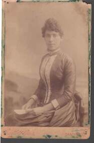
Photograph - CABINET PORTRAIT OF VICTORIAN LADY
... Possibly a member of the Opie/Dower/Martin/Adams family formerly of Castlemaine/Maldon/Mt. Pleasant areas. Originally from Cornwall. ...Possibly a member of the Opie/Dower/Martin/Adams family formerly of Castlemaine/Maldon/Mt. Pleasant areas. Originally from Cornwall. ...Cabinet portrait of Victorian Lady seated with sheet of paper in hands. No inscriptions on reverse. Unframed in album. Possibly a member of the Opie/Dower/Martin/Adams family formerly of Castlemaine/Maldon/Mt. Pleasant areas. Originally from Cornwall. Photograph c.1880's./Bartlett Brothers -Sandhurst photoBartlett Bros., Sandhurstphotograph, portrait, female, cabinet portrait of victorian lady, bartlett bros. sandhurst, opie, dower, martin, adams -
 Bendigo Historical Society Inc.
Slide - DIGGERS & MINING: THE DIGGINGS - THE DIGGERS
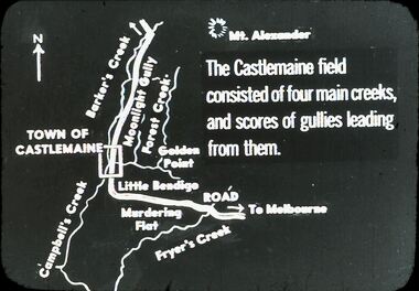
... Slide depicts areas of Castlemaine, Fryer's Creek, Campbell's Creek, Murdering Flat, Golden Point and Mt Alexander. ...Slide depicts areas of Castlemaine, Fryer's Creek, Campbell's Creek, Murdering Flat, Golden Point and Mt Alexander. ...Diggers & Mining: The Digging - The Diggers. Slide depicts areas of Castlemaine, Fryer's Creek, Campbell's Creek, Murdering Flat, Golden Point and Mt Alexander. The Castlemaine field consisted of four main creeks, and scores of gullies leading from them. Markings: 13 994.LIF:6. Used as a teaching aid.hanimounteducation, tertiary, goldfields -
 Bendigo Historical Society Inc.
Administrative record - Correspondence ledger
... Contains the names of different landholders and allotment numbers in areas such as Bendigo, Castlemaine and surrounding areas. ...Contains the names of different landholders and allotment numbers in areas such as Bendigo, Castlemaine and surrounding areas. ...Green and red ledger book. Contains the names of different landholders and allotment numbers in areas such as Bendigo, Castlemaine and surrounding areas. The ledger has the following columns: Date, File No., Name and address, Subject, Received from, Dispatched to, Date, Report. Some of the names in the received and dispatched are: Mr. Jackson, Mr. Yewers, Mr. Lavery, Mr. O'Toole, Mr. MacGibbon. The first entry is from the 22nd of January 1907 and the last one is from the 28th of July 1908.index - correspondence ledger, landholding -
 Bendigo Historical Society Inc.
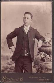
Photograph - CABINET PHOTOGRAPH OF YOUNG MAN
... Possibly a member of the Opie/Dower/Martin/Adams family, formerly of Castlemaine/Maldon/Mt. Pleasant areas. C.1880's./ wearing a suit and waistcoat / watch chain with coin and German cross?...Possibly a member of the Opie/Dower/Martin/Adams family, formerly of Castlemaine/Maldon/Mt. Pleasant areas. C.1880's./ wearing a suit and waistcoat / watch chain with coin and German cross? ...Cabinet photograph of young man standing next to urn & pedestal right arm on hip and left arm leaning against urn. Nothing on reverse. Possibly a member of the Opie/Dower/Martin/Adams family, formerly of Castlemaine/Maldon/Mt. Pleasant areas. C.1880's./ wearing a suit and waistcoat / watch chain with coin and German cross?Yeoman & Co., 169 Bourke St. East, Melbournephotograph, portrait, male, cabinet photograph of young man, yeoman & co melbourne, opie, dower, martin, adams -
 Bendigo Historical Society Inc.
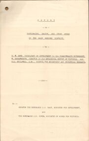
Document - MCCOLL, RANKIN AND STANISTREET COLLECTION: REPORT ON CASTLEMAINE, MALDON & OTHER AREAS
... Copy of a typewritten report on Castlemaine, Maldon, and other areas of the main Bendigo District by H.W. ...Consists of 19 Foolscap Pages Document MCCOLL, RANKIN AND STANISTREET COLLECTION: REPORT ON CASTLEMAINE, MALDON & OTHER AREAS ...Copy of a typewritten report on Castlemaine, Maldon, and other areas of the main Bendigo District by H.W. Gepp Consultant on Development to the Commonwealth Government. W. Baragwanath Director of the Geological Survey of Victoria and F.L. Stillwell D.Sc. Council for Scientific and Industrial Research. Mentions Castlemaine, Fryertown, Maldon, South German Mine, Mt. Tarrengower Tunnel, Raywood, Sebastian, Wedderburn, Inglewood, Whipstick, Lightning Hill, Black Forest Mine, Old Tom Mine. Trentham. Dated 17th September 1931. Consists of 19 Foolscap PagesH.W. Gepp, W. Baragwanath, F.L. Stillwell.gold, mining, report, gold mining, bendigo, castlemaine, maldon -
 Sunshine and District Historical Society Incorporated
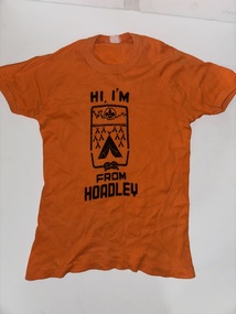
Clothing - Hi, I'm from Hoadley T-Shirt
... . - Teams from Sunshine have: - Competed under creative patrol names - Won awards for initiative and teamwork - Contributed staff and Rover support - The event is often held in bushland areas like Castlemaine, Mataranka, or Tallarook, but Sunshine units travel statewide to participate.... - Teams from Sunshine have: - Competed under creative patrol names - Won awards for initiative and teamwork - Contributed staff and Rover support - The event is often held in bushland areas like Castlemaine, Mataranka, or Tallarook, but Sunshine units travel statewide to participate ...The Hoadley Area in Scouting refers to a regional designation within Scouts Victoria, named in honour of Charles Hoadley, a pioneering Antarctic explorer and influential figure in Australian Scouting. While there isn’t a formal “Hoadley Area” in Sunshine today, the name is most prominently associated with the Hoadley Hide—a major Venturer Scout event. Sunshine, Deer Park, St. Albans and Brimbank Scout Troops are part of the Hoadley Area. 🧭 Charles Hoadley’s Legacy - Charles Hoadley (1887–1947) was a geologist on Douglas Mawson’s Australasian Antarctic Expedition and later became Chief Commissioner of Scouts Victoria. - He championed youth leadership, bushcraft, and adventure-based learning. - The Hoadley Hide was named in his honour and began in the 1950s as a way to challenge Venturers in navigation and initiative. 🏕️ Sunshine & Hoadley Hide - Sunshine-area Venturer Units (including Sunshine, Deer Park, and Brimbank District) have long participated in Hoadley Hide events. - Teams from Sunshine have: - Competed under creative patrol names - Won awards for initiative and teamwork - Contributed staff and Rover support - The event is often held in bushland areas like Castlemaine, Mataranka, or Tallarook, but Sunshine units travel statewide to participate. 🗂️ Historical Area Structures - In earlier decades, Scouts Victoria was divided into Areas (e.g. Hoadley Area, Baden-Powell Area), which grouped districts for administration and events. - Sunshine is part of a Hoadley-named Area, especially during the 1960s–80s, but these structures have since evolved into Regions and Districts. Orange Size 14 t-shirt with black textHi, I'm from Hoadley T-Shirtscouting, scouts, cubs -
 Bendigo Historical Society Inc.
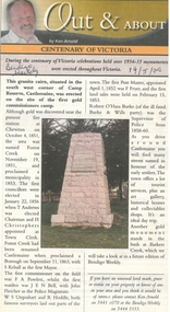
Newspaper - Newspaper articles by Ken Arnold, Out &About, 2000 - 2003
... Castlemaine 22.9.00 16. Cairn. Harcourt area 29.9.00 17. Cairn Marks Gold Route 6.10.00 18. ...Castlemaine 22.9.00 16. Cairn. Harcourt area 29.9.00 17. Cairn Marks Gold Route 6.10.00 18. ...Ken Arnold is a Bendigo author and publisher.A series of one hundred and thirty-five articles written by Ken Arnold and published in the Bendigo Weekly between 2000 and 2003. Each article has a topic or theme and includes historical information and details. Each article includes a photograph. The articles are stored in a red vinyl covered two ring A5 folder. Index below. Number Article Name Date 1. Centenary of Victoria 19.5.00 2. Storm Water Drain 26.5.00 3. Granite Rollers 2.6.00 4. Poverty Mine 9.6.00 5. Golden Monument. St Arnaud 16.6.00 6. Turner Statue 7.7.00 7. Gold Monument. High St Golden Square 30.6.00 8. Gold Monument. Howard Square Bendigo 14.7.00 9. Lansell Statue 21.7.00 10. Shelbourne West School 18.8.00 11. Mologa’s State Schools 25.8.00 12. Salinity Stone. Pyramid Hill 1.9.00 13. Cairn. Carisbrook 8.9.00 14. Commemorative Markers. Taradale 15.9.00 15. Burke Monument. Castlemaine 22.9.00 16. Cairn. Harcourt area 29.9.00 17. Cairn Marks Gold Route 6.10.00 18. Volcanic Rock Cairn. Woodstock 13.10.00 19. Garfield Water Wheel 20.10.00 20. Anticline. Castlemaine 27.10.00 21. Lawson Bridge 10.11.00 22. Plaque. Sutton Grange area 17.11.00 23. Memorial Cairn. Maryborough 1.12.00 24. Lonely Grave 8.12.00 25. Moonlight Flat Church 5.1.01 26. Historic Church. Near Tullaroop reservoir 12.1.01 27. Granite Statue. Castlemaine 19.1.01 28. Marker. Near Tullaroop reservoir 25.1.01 29. Church Site. Mologa 2.2.01 30. Church Site. Mologa 9.2.01 31. Plaque. Mologa 16.2.01 32. Mincha School 23.2.01 33. Historic Marker. Mincha 2.3.01 34. Expedition Marker. Pyramid Hill 9.3.01 35. Irrigation Marker. Tragowel 16.3.01 36. Mologa School Sites 23.3.01 37. Cairn. Pyramid Hill 30.3.01 38. Plaque. Pyramid Hill 6.4.01 39. Bristol Hill Lookout Tower. Maryborough 12.4.01 40. Eppalock Reservoir 20.4.01 41. Colbinabbin Cairn 27.4.01 42. Mount Macedon Cross 4.5.01 43. Memorial Gateway. Macedon 11.5.01 44. Cairn. Daylesford 18.5.01 45. Grave. Carlsruhe 25.5.01 46. Water Tower. Elmore 1.6.01 47. State School Site. Glenalbyn 8.6.01 48. Cairn. Kanya 15.6.01 49. Lonely Grave. Wedderburn 22.6.01 50. Church Cairn. Glenalbyn 29.6.01 51. Kamarooka School 6.7.01 52. Granite Marker. Moyston 13.7.01 53. Memorial Park. Kerang 20.7.01 54. Water Plaque. Bears Lagoon 27.7.01 55. Cemetery. Bears Lagoon 3.8.01 56. Race Monument 10.8.01 57. Cairn. Pyalong 17.8.01 58. Cairn. In memory of Edward Parker 24.8.01 59. Mt Macedon 31.8.01 60. Mt Macedon Cairn 7.9.01 61. Expedition Pass. Chewton 14.9.01 62. Granite Archway. St Arnaud 21.9.01 63. Stuart Mill School Site 28.9.01 64. School Site. Beazley’s Bridge 5.10.01 65. Fosterville 12.10.01 66. Barnadown 19.10.01 67. Salisbury School Site 26.10.01 68. Cricket History at Wattle Flat 2.11.01 69. School Site. Waterloo Plains 9.11.01 70. Carapooee School Site 11.01 71. Turkish Gun. Maldon 11.01 72. Kooreh 30.11.01 73. Marnoo East School 7.12.01 74. Bulgana Site 14.12.01 75. Emu School 21.12.01 76. Kooroocheang 4.1.02 77. Church Site. Gre Gre North 11.1.02 78. Carmens Tunnel. Maldon 18.1.02 79. Monument. Maldon 25.1.02 80. Woodfull Plaques. Maldon 1.2.02 81. Carapooee. St Peters Anglican Church 8.2.02 82. Cairn. Kingower 15.2.02 83. Cob & Co Stopover. Rheola 22.2.02 84. Flynn Monument 1.3.02 85. The Welcome Stranger. Moliagul 8.3.02 86. Campbell’s Creek Reserve 15.3.02 87. Mine. Fryerstown 22.3.02 88. Escott Grave. Near Chewton 28.3.02 89. School No 808. Kurting area 5.4.02 90. Graves. Bendigo Creek 10.5.02 91. School. Fish Point, Benjeroop North 17.5.02 92. Old Township. Diggora 24.5.02 93. Diggora West (1) 31.5.02 94. Diggora West (2) 7.6.02 95. School No 2735. Gower East 14.6.02 96. Pannoomilloo 21.6.02 97. Kamarooka Settlement 28.6.02 98. Mincha West State School No 1931 5.7.02 99. Bridges. Arnold 12.7.02 100. Woodvale 19.7.02 101. A Famous Son of Raywood. Jack Donaldson 26.7.02 102. Tandarra Area Schools 2.8.02 103. Dingee 9.8.02 104. Avonmore 30.8.02 105. Myola East School 6.9.02 106. Colbinabbin West 13.9.02 107. Colbinabbin West School 20.9.02 108. Runnymede area 27.9.02 109. Wanalta 4.10.02 110. School Sites. Between Wanalta and Carop 11.10.02 111. Burramboot 18.10.02 112. Kangaroo Chair. 25.10.02 113. Mincha South 1.11.02 114. Woodlands Church 8.11.02 115. School site. Sylvaterre 15.11.02 116. Terrick Terrick 22.11.02 117. Leitchville 29.11.02 118. Pennyweight Cemetery. Castlemaine 6.12.02 119. Mincha Area 13.12.02 120. Musk School 20.12.02 121. Dowie Park. Carisbrook 3.1.03 122. Neereman School Site 10.1.03 123. Bald Rock 17.1.03 124. Sylvaterre School Site 24.1.02 125. Carlsruhe 31.1.02 126. Athenaeum. Maldon 7.2.03 127. School. Mincha West 14.2.03 128. Yarraberb 21.2.03 129. Settlement Marker. Ravenswood Estate 28.2.03 130. Comini Reserve. Ravenswood 7.3.03 131. Ironbark and Gold Track. Whroo 14.3.03 132. Burke and Wills Obelisk. Castlemaine 21.3.03 133. James Cook Statue. Myers St Bendigo 28.3.03 134. St Marys Church. Axedale 4 .4.03 135. Butter Factory Site. Warragamba 11.4.03 events, monuments, historical sites, landmarks -
 City of Melbourne Libraries
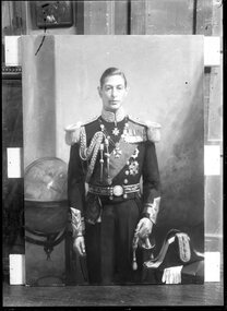
Photograph, Bull, Hugh Jones, 1897-1993, "A Royal Portrait" (Duke of York), 1933
... Many servicemen from the Castlemaine area recuperated there and had fond memories of the kindness of the teenage Lady Elizabeth Bowes-Lyon (1900-2002, later Duchess of York) who spent the war years running errands and aiding in the welfare and morale of the patients. ...Many servicemen from the Castlemaine area recuperated there and had fond memories of the kindness of the teenage Lady Elizabeth Bowes-Lyon (1900-2002, later Duchess of York) who spent the war years running errands and aiding in the welfare and morale of the patients. ...Published: The Age, Sat 14 October 1933 Published title: A Royal Portrait Published caption: "Seen at his studio, Alphington, Mr. W. B. Mclnnes's portrait of the Duke of York, which he painted recently on commission from the trustees of the Castlemaine Gallery, at St. John’s Wood, London, impresses as a vital record of one whose natural habitat is a palace, and whose place in life is one of near relationship to the throne of England. The Duke is painted in the uniform of the admiral of the fleet, a highly ornate vesture entailing much elaboration of gold and numerous medals, in dealing with which the artist has not failed to centre his attention on the head, and has succeeded in producing what is undoubtedly a soundly painted portrait and a good likeness. During the five fittings Mr. Mclnnes, apart from the ordinary social amenities, found his Royal sitter little inclined to talk, though he spoke feelingly of his trip to Australia and the pleasure it had given him: but with the Duchess the tendency to be sociable was much more clearly pronounced. She took, and expressed, a keen interest in the social and political matters of the day with a special concern for the supremacy of England and Australia in all questions relating to sport, such as cricket, tennis and golf. She spoke well of her portrait painted by Quinn, and regretted that she would not see the two hung side by side at the Castlemaine Gallery." Description: An unframed painting of a standing, middle-aged man dressed in the uniform of a Royal Navy admiral of the Fleet with medals, sash, ornate belt, cuffs and epaulettes. His left hand rests on the handle of a sword in its scabbard and his bicorn hat and white gloves are on a table beside him. To his right is a globe of the world showing Australia. Research by project volunteer, Fiona Collyer: In 1933, Castlemaine Art Gallery trustees commissioned artist W.B. McInnes (1889-1939) to paint a portrait of Prince Albert, Duke of York as a companion piece to the portrait of his wife, the Duchess of York, that the gallery had commissioned Australian official war artist James Quinn (1869-1951) to paint in 1930. During the First World War, the Duchess’s childhood home, Glamis Castle in Scotland was used as a makeshift military hospital and convalescence home for wounded soldiers. Many servicemen from the Castlemaine area recuperated there and had fond memories of the kindness of the teenage Lady Elizabeth Bowes-Lyon (1900-2002, later Duchess of York) who spent the war years running errands and aiding in the welfare and morale of the patients. In 1927, the Duke and Duchess of York (later King George VI and Queen Elizabeth) came to Australia to formally open the newly built Parliament House in Canberra and to tour the country. While visiting Victoria in April, they embarked on a whistle-stop train journey to Bendigo, stopping at Kyneton for ten minutes and Castlemaine for 15 minutes. At Kyneton, an excited crowd of 10,000 people welcomed the couple with “three cheers and three cheers for Baby Betty” before the Duchess was presented with a bouquet of locally grown roses and the Duke a bound album of photographs of noted beauty spots of the district. Next the Royal Couple stopped at Castlemaine to the cheers of 15,000 people. There the couple were presented with a basket of prime quality Harcourt apples and a pair of cot blankets, manufactured at Castlemaine Woollen Mills, a birthday gift for baby Princess Betty. The Duchess recognised Colonel W.E. James, of the Seventh Battalion, who had convalesced at Glamis Castle in 1917, and they chatted before the train departed, while the Duke shook hands with returned soldiers. Last stop was the town of Bendigo which was colourfully decorated with bunting and flags, arches and flowers. 3000 pigeons were released on their arrival and the liberated birds circled overhead for several minutes as if to welcome the Royal Couple. A crowd of 50,000 cheering people lined the streets in bright sunshine as the couple drove by. From an arch over Hargreaves Street, pretty girls showered the pair with rose petals. The Duke was presented with a gold nugget and an album, handsomely bound in morocco, of a history of the Bendigo mining industry, while the Duchess received a bouquet of prize winning white chrysanthemums. After 75 minutes in Bendigo they journeyed back to Melbourne for a State reception. While the couple were in Melbourne, the Duke often played lawn tennis at the Government House courts with three times Grand Slam champion Norman Brookes, who declared that while he considered the Duke a second class player whose serve lacked sting, he had a fine backhand and with time and practice he could become a first class player. The federal Parliament had previously been situated in Melbourne, but Canberra was chosen as the location for Australia’s capital as a compromise between fierce rival states, Victoria and NSW. It is written in the Constitution that the federal capital would be in “the State of NSW... distant not less than one hundred miles from Sydney.” The word Canberra is thought to derive from the local Ngunnawal word “Kanbarra” meaning “meeting place”. The Provisional Parliament House was a large, white, three storey building facetiously dubbed “The Wedding Cake”, plonked down in a bare, former sheep paddock. It was decorated for the event with Union Jacks and Australian red ensign flags. On 9 May, the day of the opening, the expectant crowd assembled in front of the building. Only two of the spectators were Aboriginal. One was Jimmy Clements (1847-1927, aka Nangar or Yangar, but popularly known as “King Billy”), accompanied by his three dogs. (The title “King” or “Queen” was often given by white settlers to Aborigines who were seen as allies and could maintain good relations between First Nations groups and the colonists. Some were given inscribed brass breastplates or gorgets to wear.) Jimmy was an excellent horse breaker and expert tracker for the police. He was also the nephew of “Queen” Nellie Hamilton (1842-1897) of the Canberra-Queanbeyan region, home of the Ngambri and Ngunnawal people. Nellie was the oldest surviving full-blooded Aboriginal woman in the district. The other was George John Noble (1840s-1928, aka Ooloogan, also “Marvellous” due to his regular use of the word). Both were initiated Wiradjuri walamira elders: “clever men” believed to have the ability to heal physical and spiritual ailments. They were also travelling showmen, skilled at boomerang and spear throwing and often performed at country agricultural shows and football matches. They had walked barefoot for three days from the Brungle Mission, near Gundagai. 11 May 1927, The Argus reported that “King Billy... claims sovereign rights to the Federal Territory” which the National Archives of Australia describes as “possibly the first recorded instance of Aboriginal protest at Parliament House in Canberra.” 10 May 1927, The Argus reported on Jimmy Clements: “During the wait great interest was taken in the appearance near the east stand of an aborigine, a member of the Gundagai tribe, and a well known character in the district. He was very old and grey and ruggedly picturesque. He was determined to go his own way in spite of the arguments of two inspectors and one sergeant of police. Immediately and instinctively the crowd in the stands rallied to his side. There were choruses of advice and encouragement for him to do as he pleased. A well-known clergyman stood up and called out that the aborigine had a better right than any man present to a place on the steps of the House of Parliament and in the Senate during the ceremony. The old man’s persistence and the sympathy of the crowd won him an excellent position and also a shower of small change that must have amounted to 30/ or 40/ [shillings].” At 10.30 am, Australia’s eighth Prime Minister, Mr Stanley Bruce (1923-1929) welcomed the Royal couple onto the crimson carpeted portico. Unfortunately, Dame Nellie Melba’s rendition of “God Save the King” and the greater part of the Duke’s reply was drowned out by the roar of squadrons of aeroplanes circling overhead. A brief religious service followed, conducted by leaders of the Methodist, Presbyterian and Anglican churches. Interestingly, there was no Roman Catholic representation at the ceremony even though around one quarter of Australians were Catholic at the time. The Duke unlocked the front doors with a golden key, then unveiled a statue of his father King George V by sculptor Sir Bertram Mackennal in the King’s Hall. Then the official party, Senators, members of the House of Representatives and invited guests entered the Senate chamber where the Duke read a message from the King, establishing Canberra as the seat of the Federal Government, watched on by Australia’s elite. The conclusion of the ceremony was announced by a gay fanfare of trumpets from the entrance of Parliament House and a 21 gun salute and answered by cheers from the crowd. The dignitaries then feasted on a luncheon of turtle soup, poached schnapper, fillets of beef, roast chicken and ham, straw potatoes, green peas, Canberra Pudding (a pudding made with dripping, dried fruit and jam), fruit, ices, coffee and cheese. They toasted the King with non-alcoholic fruit punch as the Federal Capital Territory (later ACT) was a “dry” area and no speeches were made. The diary entry that day of Ethel Baird, Lady Stonehaven, the wife of the Governor-General, is brief and to the point: “To P.H. & waited for Yorks. Ceremony went off without a hitch. Ghastly Banquet Lunch.” Later that day, the Duke mounted a coal black mare, police horse Number 303 which had been hastily re-named “Black Bess” for the occasion, to receive the final salute from the assembled troops and returned soldiers dressed in mufti. The RAAF squadron were flying overhead in “V” formations when suddenly, one of the planes, piloted by Flying Officer Francis Charles Ewen, left the formation, nose-diving 900 metres from Parliament House and landing behind the Y.W.C.A. refreshment marquee. Francis, aged only 28, tragically died of his wounds later that day. The Federal Capital Commission contracted Sargent’s Pies of Sydney to supply 5000 meals for the event. They supplied pies, sausage rolls, scones and sandwiches with the agreed price of 3 shillings a head. Only 1200 meals were served and the uneaten remainder dumped, with the Commission bearing the cost of the unsold food. An estimated crowd of 20,000 attended the opening, far fewer than the expected 100,000. Many visitors travelled long distances, bringing their own hampers of food and camping in tents as there was very limited accommodation available. Thousands of people around Australia listened to the ceremony broadcast on the wireless, with receiving sets installed in schools, public halls and workplaces and it was also filmed for posterity. The next morning, the Royal couple, along with Prime Minister Bruce and Mrs Bruce held an informal public reception on the steps of Parliament House where early settlers, residents and visitors to Canberra filed past them. The Press widely reported Jimmy Clements’ encounter with the Duke and Duchess. The Sun-Pictorial reported 11 May 1927: "MET THE DUKE. ABORIGINE KING HE APPROVED Sugarbag: Sports Suit. John Clements, otherwise King Billy, a full blooded aborigine king, aged 86, was among the 2000 who filed past the Duke and the Duchess at the public reception at Canberra to day. “How you likem Duke and Duchess Billy?” he was asked afterwards. “I think they are both very nice.” he replied in good English. King Billy was a very bedraggled figure, with tangled locks and a beard which almost hid his wrinkled and black face. He wore an old sports suit and carried a sugarbag. Passing the Duke and Duchess he turned full towards them. The crowd cheered, and the Duke and Duchess smiled. The Duke was particularly amused.” The Canberra Times reported 13 May 1927: "A REAL AUSTRALIAN. A quaint but pathetic figure stood in broad relief in the queue of ranks at the reception. Where his dusky forbears have gathered in native ceremonial for centuries past, a lone representative of a fast vanishing race saluted visiting Royalty. Despite the grotesque garb and untamed mane the aborigine comported himself not without dignity. With his three faithful dogs, he made an immediate target for a battery of cameras.” "The Argus reported 11 May 1927: "...an ancient aborigine who calls himself King Billy and who claims sovereign rights to the federal Territory walked slowly forward alone and saluted the Duke and Duchess. They cheerily acknowledged his greeting. The old aborigine, with his long, matted beard and nondescript clothing, is a popular identity of Canberra, and must be one of the most extraordinary figures who has received a Royal salute.” The Sun (Sydney) reported 10 May 1927: “Suddenly, in the midst of the forest of green and white colored hats of women, appeared a head with a shaggy leonine mane and a patriarchal beard. Jacky, the aboriginal, an identity of the district, who is also known as the King of Canberra, had arrived to testify to his loyalty. He saluted the Duke with an excellent dash, and shambled past with his faithful sheep dog aide-de-camp at his heels. The Duke and Duchess were highly amused at this quaint figure moving along with a sort of bodyguard of shrieking young boys and girls.” The Sydney Morning Herald 11 May 1927 mistook Jimmy for his friend “Marvellous”: “...the appearance of an aged aboriginal widely known in the district as “Marvellous, the uncrowned king of Queanbeyan." His beaming black countenance was almost hidden beneath a shock of hair and beard. Bare-footed and carrying a sugar bag in one hand and a tiny Australian flag in the other, he at first mistook a policeman at the foot of the steps for the Duke. To his great embarrassment and to the vast amusement of the onlookers, the policeman became the object of a hearty salutation. However, "Marvellous" was quickly shepherded back to a position in the procession and as he passed along brought his hand up to an approved military salute for the benefit of their Royal Highnesses. The Duke returned it with a special wave.” The Labor Daily 11 May 1927 irreverently reported on the scene: "People March Past. Some 400 people, old identities of Canberra marched past. They were mostly aged ladies with memories faithfully preserving the traditions of other days and curtsied reverently. The younger generations, who speedily joined the procession, behaved differently however. Surely it was the most motley collection that ever passed before Royalty. Men without collars jostled others well dressed. Fat women, young women, children of all heights and ages were there. The oldest inhabitants, in the persons of the abo, "Marbly", and his companion were present. The poor old fellows evidently were keen to get closer to the Duke than the procession dared go, but they were overawed by the stern glances of military men.” The Canberra Times reported 13 May 1927: "...and towards the end of the procession, a full-blooded aboriginal, bareheaded and barefooted, and carrying an old swag on his back, made a picturesque figure as he several times saluted the Royal couple, his old eyes beaming inexpressible delight.” The Register reported 11 May 1927: "PUBLIC MARCH PAST. Old “Jacky”, an aboriginal identity of the district, who has been following the proceedings of the various ceremonies with apparently great interest, appeared in the march past. He halted in front of the steps and raised his hand to his shaggy grey locks in an attempt at a salute. Smiling, the Duke returned the salute, and the Duchess bestowed a charming smile on the figure of mingled pathos and comedy.” Tweed Daily reported 12 May 1927: “King Billy” WAS THERE. Appropriately enough, the inevitable “King Billy” with his refreshing impression of possum and gum-leaves, was present at the dedication of the Federal capital at Canberra. Bare-footed, in a dingy old suit and battered felt hat, he wandered on to the empty stand after the illustrious assemblage had passed into Parliament House. A desolate figure in all that he stood for, he proved, an amiable representative of the dispossessed race. He cheerfully waved a Union Jack for the camera man, and grinned into the very eye of a movie man’s camera without flinching.” Footage of Jimmy filmed that day features in the film “The Birth Of White Australia” produced in 1928 and shows him enthusiastically waving a small Union Jack flag in front of Parliament House with his three dogs at his feet. The caption reads " "King Billy" calls for cheers for the son of the great white King across the seas. “Mine tinkit that pfellers father budgeree King liket me” supposedly says Jimmy." Jimmy told the Daily Telegraph, 13 May 1927 “I have opened your Parliament House on my own ground, now you can go and look at it." Jimmy died on 28 August 1927, aged 80. The Herald newspaper on 30 August 1927, published an illustration depicting Jimmy’s dog standing on his grave, his customary chimney pot hat leaning on his headstone. The caption reads: “The Dead King — His Only Mourner. Drawn by Will Dyson (King Billy, last of the Canberra aborigines, lived just long enough to see the Duke of York open Australia’s capital on the site where his tribe once roamed. He died in the Queanbeyan Hospital yesterday morning.)” A letter published in the Sydney Morning Herald, 19 September 1927 reported: "Old King Billy... Sir, ...I would like to mention... the passing away of one, if not the last remaining aboriginal chieftains. He may be called “Old King Billy,” and his death occurred here in Queanbeyan a few weeks ago. The removal of this well-known black has left another big gap in all that remains distinctively Australian in character. He was one of the last remaining tribe of the Monaro district, and one of the most predominant personalities throughout the Commonwealth. ...he had lived through 80 years all told. He was on many occasions sought by artists for his splendid physique and personality as a model, and many a journey he has had to make to Sydney on that account. A more striking and pronounced type could not be found. ...A very fine cast in lifelike form is to be seen in the Australian Museum, Sydney ...his last important appearance in public was at the Commonwealth celebrations at Canberra, to which territory he partly belonged. ...we have no aborigine statue chiselled to the memory of their race, a more fitting and lasting memorial could not be undertaken than to have one modelled from this fine figure and erected to the memory of his race at Canberra... It would be a fitting adornment if planted with the Australian gumtrees for any avenue or garden. [King Billy] ...a very intelligent fellow, responding readily to kindness and common sense. Hoping yet to see a befitting testimonial and a lasting memorial to a race that is rapidly and I may say, unfortunately, disappearing, I am etc., SYDNEY R.OAKLEY, Queanbeyan." The “lifelike form” referred to by the correspondent was a sculpture that Jimmy Clements had posed for: “The Wunderlich Aboriginal Group” for The Australian Museum in Sydney. In 1925, Mr Ernest Wunderlich, director of Wunderlich Limited, manufacturer of building materials and President of the Board of Trustees at The Australian Museum, commissioned renowned sculptor George Rayner Hoff (sculptor of the Anzac Memorial in Hyde Park, Sydney, National War Memorial in Adelaide, and “Lion” the original Holden Motor Company car emblem) to sculpt a life sized Aboriginal family group diorama as a gift to the Museum. There was much concern at this time that the Aboriginal population and especially the “full blooded” were fading into oblivion so fast that they may soon become extinct. Three “full blooded” Aborigines were chosen for models. An article in The Australian Museum magazine, July/September 1926 about The Wunderlich Aboriginal Group explained “...it will not be many years before the aborigine, in New South Wales and Victoria at least, will be an entity of the past. Every year sees a shrinkage in their number, and the coastal tribes that once roamed the Sydney district are, unfortunately, no longer with us. ...the man, who is hurling a boomerang, is Yangar, or “Jimmy Clements,” son of Gayan-Bleuet-Galoom, the late “King of Orange,” western New South Wales. “Jimmy” is an old man, but well preserved. He has a very retentive memory and recollects the various tribal customs and initiation ceremonies, but regarding these he is extremely reticent and will not communicate his “honoured secrets.” The female figure is “Nellie Walker,” a daughter of Geri-Bungel, and a native of Bombala, Monaro district, southern New South Wales. The boy is Harold Marsh, aged nine years, who was born at Kinchela, Macleay River, northern New South Wales. He is now living at the Brewarrina settlement... In the selection of aborigines great care had to be taken to ensure that the individuals were pure bloods, and to the Aborigines’ Protection Board and the Police Department of this State thanks are due for the valuable assistance rendered by them.” Ngarigo woman, Nellie Bungil Walker (1867-1932) had five children, two died as babies and her remaining children were taken from her. She worked as a domestic and was living at La Perouse Aboriginal Community, Sydney at the time of her sculpture’s creation. In the years after the sculpture was made, Nellie and Rayner remained friends. Yaegl boy Harold “Harry” Marsh was from the Kinchela Aboriginal Training Home for boys near Kempsey, (1924-1970), an agricultural training institution under the jurisdiction of the Aboriginal Protection Board to house Aboriginal boys forcibly removed from their families “in the interest of the moral or physical welfare” of the boys. The boys at Kinchela were aged 5-15 years old and referred to as numbers, not names and any connection to Aboriginal culture or language was forbidden. Brutal and cruel physical punishment and sexual assaults were rampant. Survivors recall being flogged and chained naked to a huge Morton Bay fig tree overnight or “sent down the line” where every boy was ordered to punch the “wrong doer” as hard as possible for fear that they would be next. The Kinchela children are acknowledged as part of the Stolen Generation. In 1925, Rayner Hoff created a terracotta bust “Harry Marsh” which is in the collection of the Art Gallery of New South Wales. The figures of the trio were modelled in clay before being cast in plaster and hand-coloured by Museum artist Miss Ethel A. King. The finished figures were completed with wigs and fur pelts and with Jimmy hurling a boomerang and Nellie holding a dilly-bag. They were placed in a glass cabinet in the Australian Ethnology Gallery. The subjects were not named. The Sydney Morning Herald 1 July 1926 critiqued the sculptures. "A GROUP OF STATUARY. MUSEUM’S ACQUISITION. Artistically the group is very fine, for the sculptor has caught his subjects in attitudes that reveal all the stalwart athletic lines of their bodies... The man, who is depicted as about 60 years of age, is bearded, immense, and savagely primitive-is throwing a boomerang, and beside him a boy, aged about 11 years is following beneath a shading hand, the flight of birds at which the hunter aims. Behind them, patient, obedient, stand(s) the woman waiting with her dilly bag to gather the spoils.” In 1996, Nellie’s daughter, Victoria Kempsey née Walker, happened to visit The Australian Museum and saw the sculpture of her mother, displayed semi-naked in a glass cabinet, alongside glass cabinets of taxidermied animals. She had last seen her mother 62 years previously when Nellie was dying from tuberculosis. Greatly distressed, Victoria wrote to the Museum requesting that they remove the sculpture, which they did. In 2023, a documentary was produced called “Her Name Is Nanny Nellie” which follows the journey of Nellie Walker’s great-granddaughter Auntie Irene Ridgeway discovering Nellie’s story, honouring her life and restoring her sculpture. Irene told Refinery29 Australia that “It was about reclaiming her life, reclaiming her history and who she really was as a real person. She was not a naked and unnamed lady standing in a museum. It's giving them back their families, they weren't just there to be looked at as flora and fauna or as 'natives'." The documentary was written and directed by Irene’s son Daniel King and premiered at the 2023 Adelaide Film Festival and broadcast on NITV. The restored sculpture of Nellie, dressed in 1920s style clothing was displayed at The Australian Museum, Sydney in The Bayala Nura Gallery in 2023. Irene wanted Nellie to be depicted in the way she actually was when she posed for the sculpture in 1925. The other two sculptures were not displayed due to ongoing conversations with family members and the fragility of the sculptures. It is anticipated that they may be displayed in the future. Melbourne born William Beckwith (Bill) McInnes (1889-1939) studied drawing at National Gallery School in Melbourne from the age of 14 under the tuition of artist Frederick McCubbin before succeeding his former teacher as Master of Drawing at the School from 1916-1934. He was acting Director of the NGV and Head of the National Gallery School from 1934. In 1927, Bill and official war artist H. Septimus Power were commissioned to paint the opening of the new federal Parliament House in Canberra. Septimus painted the general scene of the arrival of the Royal entourage in front of Parliament House, while Bill depicted the ceremony inside the Senate chamber. Bill was widely acclaimed for his landscapes and lauded as the heir to great Australian landscape artist Arthur Streeton. He won the Archibald Prize seven times (including the inaugural, a portrait of architect Desbrowe Annear) which made him a highly sought after portrait painter and he earned kudos for his commission to paint the Duke of York. During the breaks in painting the portrait, the pair chatted and Bill was surprised by the Duke’s wide knowledge of Australian affairs. The Duke was particularly interested to hear how the rabbit crisis was being handled. Bill’s work is held in major Australian galleries including the NGV, which has 12 of his paintings in their collection. Bill was married to fellow artist Violet McInnes and they lived at “The Poplars” in Alphington with their six children. Violet painted still life of flowers and portraits. In 1941, she entered her portrait of fellow artist Sybil Craig into the Archibald Prize and in 1945 Violet was appointed an official war artist. Defending his traditional style Bill said “...we in Australia have not been bitten by Cubism or Futurism or other of the “isms”...and I am glad of it”. References: THE DUCHESS OF YORK. (1931, December 7). The Argus (Melbourne, Vic. : 1848 - 1957), p. 8. Retrieved April 3, 2025, from http://nla.gov.au/nla.news-article4427568 WAR NURSE (1930, March 11). The Sun (Sydney, NSW : 1910 - 1954), p. 1. Retrieved April 3, 2025, from http://nla.gov.au/nla.news-article223714728 The Royal Visit. (1927, April 29). The Age (Melbourne, Vic. : 1854 - 1954), p. 9. Retrieved April 4, 2025, from http://nla.gov.au/nla.news-article205813465 Canberra. (1927, April 30). Advocate (Burnie, Tas. : 1890 - 1954), p. 5. Retrieved January 10, 2025, from http://nla.gov.au/nla.news-article68233606 Australian Dictionary of Biography, Nangar, https://adb.anu.edu.au/biography/nangar-33736 Australian Dictionary of Biography, Jimmy Clements, https://en.wikipedia.org/wiki/Jimmy_Clements Wikipedia, George John Noble, https://en.wikipedia.org/wiki/George_John_Noble PARLIAMENT AT CANBERRA. (1927, May 14). The Australasian (Melbourne, Vic. : 1864 - 1946), p. 37 (METROPOLITAN EDITION). Retrieved December 25, 2024, from http://nla.gov.au/nla.news-article140733921 CANBERRA CEREMONY (1927, May 10). The Argus (Melbourne, Vic. : 1848 - 1957), p. 19. Retrieved November 3, 2024, from http://nla.gov.au/nla.news-article3853643 CANBERRA. (1927, May 11). The Argus (Melbourne, Vic. : 1848 - 1957), p. 20. Retrieved November 24, 2024, from http://nla.gov.au/nla.news-article3853897 THE FINAL SCENES (1927, May 11). The Labor Daily (Sydney, NSW : 1924 - 1938), p. 5. Retrieved January 10, 2025, from http://nla.gov.au/nla.news-article236614453 TWIN SONS (1927, May 10). The Sun (Sydney, NSW : 1910 - 1954), p. 11. Retrieved April 4, 2025, from http://nla.gov.au/nla.news-article223616143 National Archives of Australia, Aboriginal [Jimmy Clements, a Wiradjuri elder] on steps of Parliament House (King Billy), https://recordsearch.naa.gov.au/SearchNRetrieve/Interface/ViewImage.aspx?B=3050026 Sydney Morning Herald, The chant of Jimmy Clements: I’ll do the honours on my ground, thanks, https://www.smh.com.au/national/the-chant-of-jimmy-clements-i-ll-do-the-honours-on-my-ground-thanks-20241023-p5kkt5.html MET THE DUKE (1927, May 11). The Sun News-Pictorial (Melbourne, Vic. : 1922 - 1954; 1956), p. 14. Retrieved November 3, 2024, from http://nla.gov.au/nla.news-article275177101 PUBLIC MARCH PAST. (1927, May 11). The Register (Adelaide, SA : 1901 - 1929), p. 11. Retrieved April 2, 2025, from http://nla.gov.au/nla.news-article54271512 A REAL AUSTRALIAN (1927, May 13). The Canberra Times (ACT : 1926 - 1995), p. 12. Retrieved December 18, 2024, from http://nla.gov.au/nla.news-article1213124 THE PEOPLE'S DAY (1927, May 13). The Canberra Times (ACT : 1926 - 1995), p. 3. Retrieved April 3, 2025, from http://nla.gov.au/nla.news-article1213105 KING BILLY" WAS THERE. (1927, May 12). Tweed Daily (Murwillumbah, NSW : 1914 - 1949), p. 2. Retrieved November 27, 2024, from http://nla.gov.au/nla.news-article190193273 A BUSY DAY. (1927, May 11). The Sydney Morning Herald (NSW : 1842 - 1954), p. 15. Retrieved November 3, 2024, from http://nla.gov.au/nla.news-article16374845 Nothing Wrong With Canberra Opening, Says "King Billy" (1927, May 13). The Daily Telegraph (Sydney, NSW : 1883 - 1930), p. 2. Retrieved November 3, 2024, from http://nla.gov.au/nla.news-article245750627 THIS IS MARVELLOUS! (1927, May 11). The Sun News-Pictorial (Melbourne, Vic. : 1922 - 1954; 1956), p. 16. Retrieved December 9, 2024, from http://nla.gov.au/nla.news-article275177155 Mildenhall's Canberra, Royal Visit, May 1927. Canberra citizens passing the Royal Party on the front steps of Parliament House at the Civic Reception 1927 [photograph], https://mildenhall.moadoph.gov.au/rephoto/62 Australian Dictionary of Biography, 1927 - Jimmy Clements, John Noble, and the Opening of Parliament House, https://adb.anu.edu.au/the-quest-for-indigenous-recognition/jimmy-clements YouTube, The Birth of White Australia (1928), amateurish racism on the big screen [Jimmy Clements at 11.12 minutes in], https://www.youtube.com/watch?v=OByX4iPsTgo YouTube, We Were Just Little Boys, https://m.youtube.com/watch?v=u4Hw9d91k2E WASTE AT CANBERRA. (1927, May 20). The South Eastern Times (Millicent, SA : 1906 - 1954), p. 1. Retrieved April 4, 2025, from http://nla.gov.au/nla.news-article200058308 YouTube, Museum of Australian Democracy at Old Parliament House, Whispers in the Corridors-An Aboriginal Presence, https://www.youtube.com/watch?v=fwifXP61M5Y History Snoop, Air Fatality in Canberra Scars an Historic Day in Australia, https://www.historysnoop.com/air-fatality-in-canberra/ YouTube, NFSA Films, The Opening Of Canberra, Australia's Capital City, https://www.youtube.com/watch?v=pOA8llA0iE0 Pauline Conolly, Pudding & Pies at Parliament House, https://paulineconolly.com/2022/pudding-and-pies-at-parliament-house/ THE MENU (1927, May 5). The Sun (Sydney, NSW : 1910 - 1954), p. 13 (FINAL EXTRA). Retrieved April 2, 2025, from http://nla.gov.au/nla.news-article223623278 PROMISING (1927, May 7). The Sun (Sydney, NSW : 1910 - 1954), p. 2. Retrieved December 15, 2024, from http://nla.gov.au/nla.news-article223616208 The Dead King -- His Only Mourner (1927, August 30). The Herald (Melbourne, Vic. : 1861 - 1954), p. 6. Retrieved November 3, 2024, from http://nla.gov.au/nla.news-article244196114 The VOICE of the CITY (1927, August 31). The Daily Telegraph (Sydney, NSW : 1883 - 1930), p. 4. Retrieved December 26, 2024, from http://nla.gov.au/nla.news-article246406061 THE LAST OF HIS TRIBE. (1927, September 2). Bairnsdale Advertiser and Tambo and Omeo Chronicle (Vic. : 1882 - 1946), p. 6. Retrieved December 24, 2024, from http://nla.gov.au/nla.news-article269318935 GONE WEST. (1927, September 17). The Irwin Index (Mingenew, WA : 1926 - 1956), p. 1. Retrieved December 23, 2024, from http://nla.gov.au/nla.news-article251554113 King Billy Dead. (1927, September 10). The Port Macquarie News and Hastings River Advocate (NSW : 1882 - 1950), p. 5. Retrieved December 1, 2024, from http://nla.gov.au/nla.news-article112534982 DEATH OF KING BILLY OF CANBERRA. (1927, September 16). Huon Times (Franklin, Tas. : 1910 - 1933), p. 5. Retrieved December 23, 2024, from http://nla.gov.au/nla.news-article136428435 OLD KING BILLY. (1927, September 19). The Sydney Morning Herald (NSW : 1842 - 1954), p. 5. Retrieved November 19, 2024, from http://nla.gov.au/nla.news-article16404722 "Marvellous" is Dead. (1928, March 30). The Gundagai Times and Tumut, Adelong and Murrumbidgee District Advertiser (NSW : 1868 - 1931), p. 2. Retrieved December 8, 2024, from http://nla.gov.au/nla.news-article122748136 LAST OF LACHLAN RIVER TRIBE (1926, May 3). Evening News (Sydney, NSW : 1869 - 1931), p. 7. Retrieved December 18, 2024, from http://nla.gov.au/nla.news-article117289515 Coal Strike Effects (1926, June 11). The Daily Telegraph (Sydney, NSW : 1883 - 1930), p. 14. Retrieved November 30, 2024, from http://nla.gov.au/nla.news-article245759732 SBS On Demand, Her name is Nanny Nellie, https://www.sbs.com.au/ondemand/movie/her-name-is-nanny-nellie/2300137539512 The Australian Museum Magazine, Vol. 2, No. 11, July-Sept 1926, The Wunderlich Aboriginal Group, https://shorturl.at/uViTe ABC News, King Billy and Marvellous were not invited to the 1927 opening of Parliament House — but that didn't stop their fight for sovereignty, https://shorturl.at/HGpjC Museum of Australian Democracy at Old Parliament House, The thieving diva: behind the scenes of the opening ceremony at Parliament House, https://www.moadoph.gov.au/explore/stories/heritage/the-thieving-diva-behind-the-scenes-of-the-opening-ceremony-at-parliament Refinery29, Beyond a museum glass case: one First Nations woman's quest to reclaim her ancestors' story, https://www.refinery29.com/en-au/my-name-is-nelly-documentary-irene-ridgeway-interview Sydney Morning Herald, Why it took 100 years to restore the dignity of Nanny Nellie, https://www.smh.com.au/national/why-it-took-100-years-to-restore-the-dignity-of-nanny-nellie-20230719-p5dpjo.html Australian Museum, Meeting Nanny Nellie, https://australian.museum/publications/explore_summer2024/nanny-nellie/ ABORIGINES. (1926, July 1). The Sydney Morning Herald (NSW : 1842 - 1954), p. 14. Retrieved November 29, 2024, from http://nla.gov.au/nla.news-article16302447 Wikipedia, Kinchela Aboriginal Boys Training Home, https://en.wikipedia.org/wiki/Kinchela_Aboriginal_Boys%27_Training_Home Art Gallery NSW, Harry Marsh by Rayner Hoff, https://www.artgallery.nsw.gov.au/collection/works/59.2000/ Art Gallery of South Australia, Lion (produced for the Holden Motor Company) by Rayner Hoff, https://www.agsa.sa.gov.au/collection-publications/collection/works/lion-produced-for-the-holden-motor-company/27253/ Wikipedia, William Beckwith McInnes, https://en.wikipedia.org/wiki/William_Beckwith_McInnes DUKE OF YORK PORTRAIT UNIVEILED IN CASTLEMAINE GALLERY (1933, December 4). The Sun News-Pictorial (Melbourne, Vic. : 1922 - 1954; 1956), p. 18. Retrieved April 4, 2025, from http://nla.gov.au/nla.news-article276125581 Castlemaine Art Museum, Portrait of His Royal Majesty the Duke of York, https://collection.castlemaineartmuseum.org.au/objects/181/portrait-of-his-royal-majesty-the-duke-of-yorkPhotographer notations on slide: "Portrait of Duke of York by W.B. McInnes 1933 B4".1930-1939, aboriginal culture, royal visits, openings (events), sculpture, land rights, museums, museum displays -
Federation University Historical Collection
Document, Zelda Martin, Central Victorian Goldmining towns - Boom Towns or Ghost Towns?, c1996
... Indicates town referred to / date of report / name of camp if different to town. * Archive information re Anglican Records *Movement around the Goldfields - Miners and Storekeepers - usefulness of newspapers in providing information - areas covered - Castlemaine, Maldon, Ararat, Stawell, Tarnagulla, Dunolly. ...Indicates town referred to / date of report / name of camp if different to town. * Archive information re Anglican Records *Movement around the Goldfields - Miners and Storekeepers - usefulness of newspapers in providing information - areas covered - Castlemaine, Maldon, Ararat, Stawell, Tarnagulla, Dunolly. ...Zelda Martin was a PhD candidate at the University of Melbourne.[.1] 4th item in light blue display book titled Research Approach/Overview of Chapters/Confirmation of Canditure/Chapters1,2,3&4 of proposed thesis. *Twenty-seven page article on Victorian goldfields towns titled: Central Victorian Goldmining Towns - Boom Towns or Ghost Towns. The article was written during the author's PhD study. It outlines the context methodology, and resources and the chapters of the proposed thesis: (1) Central Victorian Goldmining Towns - The Context (2) Contemporary Views of the Factors Necessary for Town Growth (3) Outward Manifestations of Town Growth (4) The Trappings of Government (5-9) The Main Towns and Their Hinterland. [.2] 5th item in Light Blue display book as above item. *Chapter 1 of proposed thesis titled 'Pick, Shovel and Tin Dish Mining.' Covers in Section A: Central Victoria - Pre 1851: Aborigines in Central Victoria, Squatters, and Government. Section B: The years 1851-1854: The Early Gold Rushes, Government Reaction, Township Surveys, Legislation, Town Development, Local Government and Early Settlement. [.3] 6th item in Light Blue display book as above item. *2A of proposed thesis titled 'Contemporary Views of the Factors Necessary for Town Growth'. Similar information to Chapter 1 plus extra re towns and maps. Sections: Introduction, Context of Place - Geographical Towns Listed, The Context of Time - Pre1851 Aborigines, Governance of Port Phillip, The Squatters, The Villages of Central Victorian Highlands, Conclusion, Condensed Version of Chapter2B. [.4] 7th item in Light Blue display book as above item. *Chapter2B of proposed thesis. Sections: Area of Research, Schools, Banks, Newspapers, Progress Association, Town Development - Sandhurst (Bendigo), Ballarat, Castlemaine,, Maryborough, Ararat and Stawell. [.5] 8th item in Light Blue display book as above item. *Chapter 3 of proposed thesis titled 'Outward Manifestations of Town Growth'. Sections: Introduction, Contemporary Writing, Educationalists, The Bankers, The Townsfolk, Current Theory, General Theories of Urban Development, and Conclusion. [.6] 9th item in Light Blue display book as above item. *Chapter 4 of proposed thesis titled 'Trappings of Government' Sections: Introduction, Early Government Attitudes to Mining and Town Development, Law and Order, Township Surveys, Legislation, Local Government, Transport and Communication, The People and Lobbyists. [.7] 10th item in Light Blue display book as above item. *'The Rise and Fall of Central Victorian Goldmining Towns'. Includes a map showing main Goldfields, a table showing towns and villages at two points in time - 1857 and 1871; a Bibliography of Primary and Secondary Sources. [.8] Resource No1. Black display book titled Local Towns 1 : Alma: *Brief history *Directory *Maps Amphitheatre / Mountain Hut: *Brief History Post Office Directory Ararat: *Brief History *Post Office Directory 1869 - Alphabetical Listing by Occupation *Ararat - Prominent Citizens of 1858 *Langi-Morgala Museum Avoca: *Brief History *Excerpts from 'Avoca The Early Years', Margery and Betty Beavis; pg1 - Beginnings; pg11 - The Midas Touch; pg25 - Local Gold Escorts; pg27 - A Town is Born; pg51- The Administration of Justice; pg53 - The Ways of the Law; pg61 - News of the Day; pg65 - A Time to Play; pg72 - Land Ownership *Post Office Directory (Bailliere's) 1869 *Tourism Map and Information of area *Historic Avoca - A 5.5km Tour *Avoca & the Pyrenees Region - information pamphlet Ballarat: *Early History of Ballarat - Ballarat Historical Society, Publication No.1: origin of the name; Ballaarat - the Beginning; Fabulous Yields from the Ballaarat Goldfield; *Streetscape Lydiard Street. *Hand drawn map showing Leigh River, Old Portland Bay Road, plaque on road to Colac; etc. *Newspaper article re 'The Theatre Royal' ( which stood in the vicinity of the current Owen Williams store) - 'The News'15/04/1998 *Article - 'Ballarat's Mechanics' Institute Lives On' Ballarat Courier, 14/09/1985 *Article - Standing the Test of Time' The News 17/11/1993 re The Mechanics Institute & picture of the Reading Room *'Ballarat a Study of a City, Phyllis Reichl, pub. Nelson, 1968; no.3 place, time and people field studies series *Investigator Vol.33 No.2, 1998 Geelong Historical Society. Article on pg75 describes Ballarat in 1861 *Folded poster - 'Ballarat 100' a history of telegraph communication, pub. Telecom. Beaufort (Fiery Creek): *Brief history *Post Office Directory [.9] Resource No.2 Black Folder Titled Towns cont.No2 Bendigo (Sandhurst): *'Family & Local History at the Bendigo Library - 1851-2001 150 years of gold'. *Bendigo Government Camp in 1853 illustration; key to sketch and names of Government officers stationed there *Excerpts from 'Bendigo and Vicinity' Adolph Haman *The Bendigo Goldfield Registry - pgs 1-7 Introduction *Excerpt: 'Breaking the Grip' *Excerpt: The Most Go-Ahead Place *Excerpts from 'History of Bendigo' - anti license agitation; laying out of town; proposed railway; gold calls and dividends; the Sandhurst Municipality; journalism *Bibliography Blackwood: *Excerpts from 'Aspects of Early Blackwood - The Goldfield, the Landmarks, the Pioneers' Alan J Buckingham and Margaret F Hitchcock, JG Publishing,1980 Buninyong: *A Brief History *Investigator Vol1 No.2 Feb 1966 Geelong Historical Society. Pg3 - Article re gold escort route - Mt Alexander to Adelaide - (see a simple monument on the Western Highway a few miles out of Horsham. Pg 15 - Ballarat Excursion - re the finding of gold. *Three articles published by Buninyong and District Historical Society Inc: (Magpie Exploration; Finding Gold In The Green Hills; Magpie Exploration; Burnt Bridge to Cargarie to Mt Mercer) *Copies of newspaper articles/items *Buninyong Street Directory Carisbrook: *In the Beginning There Was Carisbrook *The History of the Carisbrook Racecourse Carngham / Snake Valley: *Brief History *Directory Castlemaine: *Directory 1865-1866 - Alphabetical and Street *Poster - Castlemaine A Contemporary Guide "The Great Centre" 1866 - A Contemporary Guide to the Fascinating Past *Pamphlet - Castlemaine District Community Hospital *Map - Castlemaine, Maldon & Surrounding Districts *Map and Information - The Dry Diggings Track - a 55kl walk among historic goldfields relics ( Castlemaine Fryerstown Vaughan Mt Franklin Hepburn Daylesford) *Postcard - Former Court House *Directory 1867 - Alphabetical, Trade [.10] Resource No.3 Grey folder Titled Towns 3 Creswick to Maryborough Creswick: *Brief History *Booklet - "Creswick Cemetery Walk" *Booklet - The Buried Rivers of Gold Heritage Trail Creswick *Creswick Historical Museum Information Sheet *Chronological History of Creswick *Alphabetical Directory of the Borough of Creswick *Creswick's Creek Directory 1856 *Historic Creswick Walking Tour *A Brief Account of the Schools of Creswick - Past and Present *100 Years of Railway Travel in Creswick *The Berry Deep Leads *The Spence Home at Jackass Gully in the Creswick State Forest ( William Guthrie Spence - Pioneer) *The New Australian Mine and the 1882 Disaster *Creswick District News, Issue 7, July August 1999 *The Creswick Miners Walk - Information and Map *Maps Chewton: *Brief History *Directory Clunes: *Brief History *Clunes Street Directory Daylesford: *Brief History *Notable Bushfires in Daylesford District Over More Than a Century - "Black Thursday" 1851; 1862; 1899; the Disastrous Hepburn Fire of 1906; 1939; 1944; 1969. *Post Office Directory -Daylesford and Hepburn Dunolly / Inkerman: *Brief History *Directory *Pamphlet - Goldfields Historical Museum *Pamphlet - Historic Dunolly - Victoria's Best Kept Secret *Map of Gold Workings at Dunolly Area - showing where the main gold rushes occurred *Brief History - Inglewood *Directory - Inglewood - Name Occupation, Dwelling Kingower: *Brief History *Directory - Name / Ocupation / Dwelling Linton / Happy Valley / Piggoreet: *Brief History *Directory - Lintons McIvor: *"A History of the Shire and the Township of Heathcote" by J.O. Randell Majorca: *Brief History *Official Post Office Directory 1869 - Name / Occupation/ Address Maldon (Tarrangower): *Brief History Part 1 *Brief History Part 2 *Post Office Directory *List - Alphabetical Order by Names plus Business and Trade (Tarrangower Times Oct/1858) *List - Alphabetical Order by Trade plus Name and Business *Directory - Name / Occupation / Dwelling Maryborough: *Worsley Cottage - built by Arthur Worsley, a contractor in stonework in 1894 [.11] Resource No. 4 Blue Display Book titled Towns 4 Moliagul to Stawell Moliagul: *Brief History *Moligul Legislative Assembly (Voting?) List - Names and Occupations *Moliagul Victorian Post Office Directory 1868 - Name / Ocupation / Address / Comments *"The Welcome Stranger" gold nugget *The Sunday School *The Welcome Stranger Discovery Walk - information and map Moonambel (Mountain Creek) Redbank *Brief History *List of names extracted from advertisments of the Pioneer and Mountain Creek Advertiser 16/02/1861. *Bailliere's Directory 1869 - Alphabetical List of Name / Occupation / Place St Arnaud: *Brief History Sebastapol: *Brief History *Directory 1869 - Alphabetical by Name; plus occupation and address. Browns and Scarsdale: *Brief History *Browns Street Directory - Name and Occupation Smythesdale: *Brief Description *Smythesdale Street Directory -Name and Occupation Stawell (Pleasant Creek) *Brief History *Victorian Official Post Office Directory - Name /Occupation / Dwelling *Chronology - 1841-1920 *Production of gold statistics - 1879 - 1900 *Big Hill *Extracts from "The Golden Years of Stawell". Chapt 1 - Stawell's Coming Out. Capt. 2 - The Gold Rush. Caapt.3 - Cradle of Democracy. Chapt.4 - The Reefs Becomes Stawell. Chapt. 5 - Rushing In. Chapt.6 - The Pioneers. Chapt 7 - The Decade of Optimism. [.12] Resource No. 5: Blue Display Book titled 'Towns Steiglitz to the The Golden Triangle. Steiglitz: Brief History Victorian Post Office Directory 1869 *Map of Steiglitz *List of maps relevant to Steiglitz history *Information 6 tables of data from "Reports of Mining Surveyors Talbot (Back Creek) Brief History Taradale: Post office Directory 1869 - Name/Occupation/Street. Also list in alphabetical order by Occupation Taradale *Chronological Reference to Taradale Mines *Water - The Coliban System of Waterworks *Joseph Brady *The Syphon Tarnagulla (Sandy Creek) *Brief History *Tarnagulla Businessmen Cameos to give depth to advertisments in 'The Tarnagulla Courier' various issues 1864-1871 *Directory - Name/Occupation /Address *List - Name/Business/Trade Wedderburn (Koorong) *Brief History *List - Name/Occupation The Golden Triangle: *The Early Rushes - Wedderburn / Moliagul / Sandy Creek - Tarnagulla / Jones Creek - Waanyarra / Kingower / Dunolly - Goldsborough / Inglweood *Census of 1857 - Population / Occupations *1858-1871 - A Time of Consolidation- Wedderburn / Moliagul / Sandy Creek- Tarnagulla / Arnold *Census 1871 - Population *Information gleaned from the census data - Demographics / Population / Occupations / marital / Birthplace / Religion / Literacy/ Occupation and Housing Cameos *Graphs - Birthplace of settlers /Male-Female Ratio / Married males / Children under 15 as Percentage of Population / Religion *Census 1857 - Statistical data *Maps *Bibliography [.13] Resource No. 6 - Black Display Book Information and Research in Central Victoria including: *Banking - Research from ANZ Bank Archives *Institutions - also includes articles listed from the Ballarat Times Newspaper *Australian mining History Association - A.M.H.A. Bibliography *Australia's Mining History * Bibliography - Land Surveys Victoria - *1853 Administration (Statistics and Other) includes: schools / ministers of religion / police / military / local administration / licences for sale of spirits / distances between various Victorian gold fields. * Victoria Government Gazette (Copy) - N0. 116, 12/12/1854 includes: Gold Felds Commission of Enquiry & No. 85, 15/09/1854 - Addresses presented to the Lieutenant Governor (Sir Charles Hotham) during his tour through the Gold Fields of Victoria,1854. Addresses on behalf of : the people of Bendigo; Members of the Church of England, Bendigo; Members of the Wesleyan Church on the Bendigo Gold Fields; Bendigo Gold District General Hospital; the Bendigo Prospecting Association; Committee of the Bendigo Local Exhibition; Bendigo District Medical Association; Coloured Americans Resident at Bendigo; German Inhabitants of Bendigo; Landowners, Inhabitants, and Miners of Castlemaine; Inhabitants of Forest Creek; Inhabitants of Heathcote and Gold Miners of McIvor; Residents and landholders of the District of Bacchus Marsh; Inhabitants of Kilmore and Vicinity. *Gold Fields Correspondence 1853: letter from Lieutenant Colonel Valiant, (Officer commanding the Troops in Victoria) to the Lieutenant Governor re threatened disturbance at Sandhurst (Bendigo) regarding the Gold License Fee. * Extracts from a book "Victoria" re Gold Fields Commission of Enquiry involving mainly Ballarat and Castlemaine and a chapter titled 'A Tour to the Victorian Gold-Fields' *Lists of central Victorian newspapers - listed by date published 1851to 1874; by first date available to State Library. *A list of cities and towns showing County, population in 1861 &1871, and municipal status. [.14] Resource no.7. Black display book. *Reference: Papers presented to Parliament Victoria - 1859-1860 4 volumes - relevant sections copied. Contains information on Branches of Government. General / Finance / Gold / Gazette / Commission and Warrant / Statistic. *Gold Fields Act. In accordance with the Act the gold fields are divided into six districts - Ballaarat, Castlemaine , Sandhurst, Avoca, Ararat, and Beechworth.. Official staff in each gold district consists of a Resident Warden, Wardens, Wardens' Clerks, Bailiffs, Chinese Protectors, Chinese Interpreters, and Mining Surveyors. *Gold Receiver *Gaols *Police magistrates and Clerks of Petty Sessions, etc. *Field Branch *Immigration and Emigration Overland - Chinese - 1859 *Population on the Goldfields *The Geological Survey - The Government Geologist is assisited by staff from four branches - the office Branch; the Publishing Branch; the Field Branch and the Museum Branch. *Commission to Enquire Into Sludge dated 10/02/1859 (Some sections copied) - Report to the Honorable Chief Commissioner of Public Works, Melbourne re the mode of carrying the sludge from the puddling mills in Sandhurst without interfering with the drainage of the town and the roads in the neighbourhood. [.15] Resource No.8: Camel display book titled Resource No. 8. Aborigines *Lists of book titles - +"Readings in Victorian prehistory" +"The Aborigines of Port Phillip" +Aboriginal languages and clans" +"A History of the Port Phillip District" +"Langi Ghiran 1: Aboriginal Rock...." +"Koorie History: sources for aboriginal studies in the State Library of Victoria", ed. Tom Griffiths, Melb. Friends of the State Library, 1989 +"The Public Lands of Australia Felix"; settlement and land appraisal in Victoria1834-91 with special reference to the Western Plains", J.M.Powell, Melb. Oxford University Press 1970 +*Bibliography of the Victorian Aborigines' from the earliest manuscripts to 31st December 1970, Massoa, Aldo, Melb. Hawthorn Press, 1971 +"Aborigines in Colonial Victoria, 1836-1886", M.F. Christie, Sydney University Press, 1979 +"Urban and Industrial Australia: readings in Human Geography" ed J.M. Powell, Melb. Sorrett Pub. 1974 *Extracts: -Processes of Pioneer Settlement - The Squatting Occupation of Victoria, 1834-60. J.M. Powell -Areal Variations in the Class Structure of the Central-Place Hierarchy. P. Scott - Volume1 and Volume 2: Notes Relating to the Habits of the Natives of Other Parts of Australia and Tasmania. Compiled from various sources for the Government of Victoria by R Brough Smyth. John Curry, O'Neil, Melb. 1st pub. Melb. 1876. p31-45 - Numbers and Distribution of the Aborigines in Victoria -Victorian Aborigines 1835-1901 - A Resource Guide to the Holdings of the Public Record Office, Victoria; published by the Government Information Centre 1984. *History of the Aboriginal Artefacts Displayed in the Daylesford Museum. F. G. Powell (4 page pamphlet) *Letter to Zelda Martin from Peter Lovett, Cultural Officer, Ballarat & District Aboriginal Co- Operative, 05/02/1997 *Map: Ian Clarke Victorian Tribunal Boundary Map - Clans of Central Victoria. *Victorian Rock Art and Mythology - Article about Mount Langhi Ghiran and myths of the Tjapwarong people. *Two Aboriginal myths relating to the Grampians - 'The Monster Emu' / 'The Aquisition of Fire', by the Aborigines in the Grampians Areas *Article titled (chapter 8) Ballarat - information re camping sites in the region. Lake Wendouree / Lake Burrumbeet (includes a myth) / Mt Bunninyong / Lal Lal / Pitfield / Mount Elephant / Mount Egerton / Meredith / Lake Goldsmith / Lake Learmonth / Ercildoune *Notes on the Aborigines of the Wider Ballarat Region plus European names=Aboriginal names. John Morris 26/07/1995 *Role of Aborigines in Town Development in Central Victoria. Mentions Native Police Force est. in Port Phillip 1842 and Central Board for Aborigines est. 1860 *The Grave of King Billy. (Frank Wilson) Pamphlet. *Camping Places in Central and Northern Victoria. Article re Lake Burrumbeet site. *Programme for the Unveiling of Memorial Cairn for Edward Stone Parker 1802-1865. Note portrait not accurate. Accurate portrait is available in the book "A Successful Failure A Trilogy The Aborigines and Early Settlers", Edgar Morrison, Graffiti Publications, 2002. * Large envelope addressed to Mr G Netherway containing newspaper cuttings regarding the life of Edward Stone Parker, the unveiling of the Memorial Cairn as mentioned above, articles titled 'Episodes from Our Early Days' (Edgar Morrison, Yandoit)- The Black's School, A School At Last and The Final years. Also a typed page titled 'Historical Background to E.S.Parker's Career. Includes an interesting tale titled 'When the cat lay doggo' re laying power leads for the unveiling ceremony at the memorial site. [.16] green display folder titled 'Research Aids' *List of references to Commissioners' & W'ardens' Reports (formerly held at La Trobe Library Archives, now at Public Records Office [PRO]). Indicates town referred to / date of report / name of camp if different to town. * Archive information re Anglican Records *Movement around the Goldfields - Miners and Storekeepers - usefulness of newspapers in providing information - areas covered - Castlemaine, Maldon, Ararat, Stawell, Tarnagulla, Dunolly. *Port Phillip /Victoria Directories 1839/1867 - Chronological list of Directories included in this series. *"Notes on the History of Local Government in Victoria" A.W. Greig Melb. University Press 1925 - Photo-copied extract p5-p40. (Source - Deakin University Library) - Introduction by W.Harrison Moore. Section 1 - Development in New South Wales Before Separation. Section 2 - Development in Victoria After Its Separation from New South Wales. Hand written notations: 'roads, markets, and local government 1855 on' ;'opportunity of squatters in parliament' and 'opportunities of matters in parliament p33' * Notes on the Establishment of Surveyor General's Department 1851and Commissioner of Crown Lands and Survey. * Newspaper articles from The Argus, 1849, re the discovery of gold in the Pyrenees region. * Excerpt - a report on schools - A.B.Orlebar, Inspector; re the need for permanent school buildings rather than tents. *Excerpt from - 'Approaches to Urban History', Sean Glynn: The Case for Caution * Except from - 'The Urban Sprinkle', Weston Bate: Country Towns and Australian Regional History *Reference- 'The History of Land Tenure in the Colony of Victoria', John Quick. References the Haines Land Bill, land tenure and Land Leagues. [.17] Light blue envelope folder titled 'Birtchnell's Ballarat, etc. Directory 1862 *Contains various directories for Smythesdale, Buninyong, Clunes, Brown's and Creswick. [.18] Red envelope folder no.2 titled Victorian Gazetteer *Selected pages from 1869 Victorian Gazetteer on A4 paper (with a handwritten note questioning if some pages are from 1868 Victorian Gazetteer as appears to be different sizes - A3 pages.) Information includes locations and descriptions of towns, hotels, banks, communications and populations. (Does not include names, residences and occupations) [.19] Red Envelope folder titled Bailliere's Official Post Office Directory 1868 (or1869 or a mixture of both?) *Preface *Contains a selection of pages of towns highlighted in yellow in the the index *Work on this directory was commenced in 1867. *Information includes: Municipalities - mayors and councilors; lists of towns naming male inhabitants and their occupations. [.20]Yellow manila folder titled Post Grad Seminar Presentation 1996 *Gives some background to Zelda Martin's proposed thesis and why she chose the topic Gold Mining Towns Boom or Bust [.21] A3 display book - No. 1A * A list of 'Relevant Newspapers collected: The Tarrangower Times and Maldon Advertiser (first published 1858) Includes dates 1858-1867. The Mount Alexander Mail. Includes dates 1854-1866 The Tarnagulla Courier. Includes dates from1864-1871 Dunolly and Burnt Creek Express. Includes dates from 1862-1871 * Selection of newspaper pages from The Mount Alexander Mail 1854 to 1856, mostly showing advertisements for businesses and services provided to that community. [.22] A3 display book - No. 1B * Selection of newspaper pages from The Mount Alexander Mail 1857 to 1866, mostly showing advertisements for businesses and services provided to that community. [.23] A3 display book -No. 2 * Selection of newspaper pages from The Tarnagulla Courier 1864 to 1871, mostly showing advertisements for businesses and services provided to that community. [.24] A3 display book - No. 3 *Selection of newspaper pages from The Tarrangower Times (and Maldon and Newstead) Advertiser 1858 to1867, mostly showing advertisements for businesses and services provided to that community. [.25] A3 display book - No.4 * Selection of newspaper pages from The Dunolly and Burnt Creek Express; and The Dunolly and Betbetshire Express 1862 to 1871, mostly showing advertisements for businesses and services provided for that community. [.26] A3 display book - No.5 Includes: * Bryce Ross's Diggings Directory. Includes instructions for using this directory. This directory was used by "all persons having connexion or desiring to communicate with 'working parties, private friends, or Stores at the Diggings." As a directory for each area wwas completed it was published in each month's issue of Bonwick's "Digger's Magazine." Years c1852/1853. This Directory commences first at the head of Forest Creek. Includes a directory for Bendigo and Ballarat. Of interest at the end of the Bendigo and Ballarat directory is a list of the number of storekeepers, butchers, doctors, smiths, eating houses, lemonade sellers and chapels. * The Castlemaine Directory and Book of General Information Comprehending Glass's Model Calendar for the Two Years 1862 and1863. "zelda martin, victorian goldfield towns, bendigo, castlemaine, ballarat, maldon, stawell, ararat, maryborough, creswick, avoca, heathcote, banks, bank of australasia, union bank of australia, government camp, sandhurst, water supply, tarnagulla, talbot, back creek, mountain creek, police court, carisbrook, dunolly, thompson's foundry, charles clacy, anthony trollope, robert cecil, mount alexander, urbanisation, national schools, education, govenrment, industry, railway, transport, settlement, land settlement in central victoria, steiglitz, joseph brady, the new australian mine, berry deep leads, william guthrie spence, creswick state forest, arthur worsley, worsley cottage, the welcome stranger, moliagul, moonambel, redbank, st arnaud, sebastapol, brown's, scarsdale, clunes, chewton, daylesford, bushfires, inkerman, inglewood, kingower, lintons, happy valley, piggoreet, mcivor, majorca, tarrangower, taradale, the coliban system, the syphon, sandy creek, wedderburn, koorong, arnold, jones creek, waanyarra, the golden triangle, census 1857, blackwood, buninyong, durham lead, magpie, carngham, snake valley, alma, amherst, daisy hill, amphitheatre, mountain hut, beaufort, fiery creek, counties, population, gold fields commission of enquiry1854, william westgarth, gold license fee, lieutenant colonel valiant, administration of the victorian gold fields, commission to enquire into sludge 1859, e.s. parker, edward stone parker, edgar morrison, mount franklin protectorate, dja dja wurrung, memorial cairn, franklinford, mt franklin memorial cairn, jajowurrong, dja dja wurung, tjaowarong, wothowurong, assistant protectors, daylesford museum, buluk, rock art - grampians, aboriginal mythology - grampians, aborigines, first nations people, mount franklin, aboriginal artifacts, lake burrumbeet, native police force, central board of aborigines, yandoit, commissioners' reports, wardens' reports, port phillip/victoria directories 1839-1867, local government - victoria 1853/1854, surveyor general's department - 1850's, victorian schools 1850's, a.b.orlebar, haines land bill, william charles haines, wilson gray, land tenure, land leagues, victorian gazetteer, the tarrangower times and maldon advertiser - 1858-1867, the mount alexander mail 1854-1866, the tarnagulla courier 1864, dunolly and burnt creek express 1862-1871, bryce rose's diggings directory, the castlemaine directory 1862-1863 -
 Federation University Historical Collection
Calendar, Pictorial Ballarat Calendar, 1983, 1982
... Three artists were involved by producing black and white sketches of areas in Ballarat. Peter Bryan was born in Castlemaine and studied architecture. ...Three artists were involved by producing black and white sketches of areas in Ballarat. Peter Bryan was born in Castlemaine and studied architecture. ...Calendar made for the "McCallum House Appeal. Three artists were involved by producing black and white sketches of areas in Ballarat. Peter Bryan was born in Castlemaine and studied architecture. Exhibited his work and his paintings are included in private collections. William Mansel Bolitho was a full time teacher at Ballarat North Technical School. He was admitted as a member of the Australian Guild of Realist Artists, c1980. Graham Hawley was born in Bendigo and studied at the Bendigo School of Mines and RMIT. He lectured in graphic design at the Ballarat College of Advanced Education.1983 calendar with drawings of Ballarat scenes by Graham Hawley, Peter Bryan and Bill Bolitho.calendar, mccallum house appeal, artists, pictorial ballarat, peter bryan, mansel bolitho, graham hawley, australian guild of realist artists -
 Eltham District Historical Society Inc
Photograph - Digital Photograph, Alan King, Sweet Bursaria, 2008
... The butterfly now survives in seven sites in Eltham and Greensborough, including the main sites at the Pauline Toner Reserve on Eucalyptus Road, the Western and Eastern colonies on Diosma Road, and the Yandell Reserve in Greensborough.The butterfly survives also in Castlemaine and in the Kiata and Salisbury areas. However, it remains endangered....The butterfly now survives in seven sites in Eltham and Greensborough, including the main sites at the Pauline Toner Reserve on Eucalyptus Road, the Western and Eastern colonies on Diosma Road, and the Yandell Reserve in Greensborough.The butterfly survives also in Castlemaine and in the Kiata and Salisbury areas. However, it remains endangered. ...Published: Nillumbik Now and Then / Marguerite Marshall 2008; photographs Alan King with Marguerite Marshall.; p181 The rare Eltham Copper Butterfly, Paralucia pyro-discus, was saved from near extinction by a community campaign in the late 1980s. Thanks to that effort, the butterfly, a form of the Fiery Copper Butterfly, with a wing span of only 2.5cm, can be seen in parts of Eltham and Greensborough from late November to April. As late as 1987 the butterfly was thought to be near extinction. But that year, entomologist, Michael Braby, found several colonies, including two major ones in natural bushland on Diosma Road, Eltham. However these were threatened with destruction, as their habitat was to be destroyed by a development of 71 houses. The colonies were on a 14 hectare subdivision owned by Esanda Finance, an ANZ Bank subsidiary. It would cost around $5 million, to reimburse the bank for the land. The butterfly, which depends on woodland, a stunted form of the Sweet Bursaria bush, and the Notoncus ant, was considered too fragile to relocate. Braby’s discovery led to a sometimes fiery two-year campaign, which even became an election issue. It involved the local community, local and state governments and the developer, before a compromise was reached. The larvae have an intricate relationship with the small black ant, Notoncus. During the day, the larvae shelter in nests made by the ants around the base of the trunk and roots of the Sweet Bursaria (Bursaria spinosa). The ants are thought to protect the larvae from predators and parasites, as they attend them from the nests to feed on the Bursaria leaves at night. In return, the larvae excrete a sugar solution, which the ants love to eat. The butterfly was first recorded in Victoria in 1893, and first collected scientifically from Eltham in 1931. But it was only officially named in 1951, by Victoria’s then top butterfly expert, David Crosby.2 However, from 1970, rapid housing development in Eltham destroyed much of the butterfly’s habitat. The discovery of several major colonies in 1987 met with great excitement, and 250 people attended the first local public meeting. The State Government commissioned Crosby to investigate how to protect the butterfly, and the council froze development for three weeks. Then Esanda agreed to suspend development for several months, until a compromise was reached. Crosby recommended that 62 of the 71 lots be kept to ensure the butterflys’ survival. However this would cost $1 million to $1.5million in compensation to Esanda. Greensborough MP Pauline Toner, launched a $1million fundraising campaign and many artists donated their works to the appeal. Toner offered Clifton Pugh’s painting Eltham Copper Country to millionaire Alan Bond for $1 million, after having heard that he had offered $6 million for the Van Gough painting Sunflowers. However Bond did not accept. The butterfly was considered a ‘hot’ election issue during the by-election, following Pauline Toner’s resignation. Liberal party candidate, Margaret Brown, was accused of falsely saying she had been involved in the butterfly campaign so as to win votes. Sadly, the $1million appeal fell short at $426,000, so a compromise was reached. The State Government donated the Education Department site on Eucalyptus Road, but only nine lots of the Diosma site were bought, and the rest of the development went ahead. On March 3, 1989, Ms Toner died, and the Eucalyptus Road site was named in her honour. Around 2000 the butterfly was further threatened by proposed developments on Pitt Street, facing the Pauline Toner Reserve and between Diosma and Nyora Roads. Fortunately the Friends of the ECB, with the Shire of Nillumbik, ensured that more habitat was made available. The butterfly now survives in seven sites in Eltham and Greensborough, including the main sites at the Pauline Toner Reserve on Eucalyptus Road, the Western and Eastern colonies on Diosma Road, and the Yandell Reserve in Greensborough.The butterfly survives also in Castlemaine and in the Kiata and Salisbury areas. However, it remains endangered.This collection of almost 130 photos about places and people within the Shire of Nillumbik, an urban and rural municipality in Melbourne's north, contributes to an understanding of the history of the Shire. Published in 2008 immediately prior to the Black Saturday bushfires of February 7, 2009, it documents sites that were impacted, and in some cases destroyed by the fires. It includes photographs taken especially for the publication, creating a unique time capsule representing the Shire in the early 21st century. It remains the most recent comprehenesive publication devoted to the Shire's history connecting local residents to the past. nillumbik now and then (marshall-king) collection, eltham copper butterfly, sweet bursaria -
 Eltham District Historical Society Inc
Photograph - Digital Photograph, Alan King, Pauline Toner Butterfly Reserve, 2008
... The butterfly now survives in seven sites in Eltham and Greensborough, including the main sites at the Pauline Toner Reserve on Eucalyptus Road, the Western and Eastern colonies on Diosma Road, and the Yandell Reserve in Greensborough.5 The butterfly survives also in Castlemaine and in the Kiata and Salisbury areas. However, it remains endangered....The butterfly now survives in seven sites in Eltham and Greensborough, including the main sites at the Pauline Toner Reserve on Eucalyptus Road, the Western and Eastern colonies on Diosma Road, and the Yandell Reserve in Greensborough.5 The butterfly survives also in Castlemaine and in the Kiata and Salisbury areas. However, it remains endangered. ...One of seven sites in Eltham and Greensborough where the butterfly survives. Published: Nillumbik Now and Then / Marguerite Marshall 2008; photographs Alan King with Marguerite Marshall.; p181 The rare Eltham Copper Butterfly, Paralucia pyro-discus, was saved from near extinction by a community campaign in the late 1980s. Thanks to that effort, the butterfly, a form of the Fiery Copper Butterfly, with a wing span of only 2.5cm, can be seen in parts of Eltham and Greensborough from late November to April. As late as 1987 the butterfly was thought to be near extinction. But that year, entomologist, Michael Braby, found several colonies, including two major ones in natural bushland on Diosma Road, Eltham. However these were threatened with destruction, as their habitat was to be destroyed by a development of 71 houses. The colonies were on a 14 hectare subdivision owned by Esanda Finance, an ANZ Bank subsidiary. It would cost around $5 million, to reimburse the bank for the land. The butterfly, which depends on woodland, a stunted form of the Sweet Bursaria bush, and the Notoncus ant, was considered too fragile to relocate. Braby’s discovery led to a sometimes fiery two-year campaign, which even became an election issue. It involved the local community, local and state governments and the developer, before a compromise was reached. The larvae have an intricate relationship with the small black ant, Notoncus. During the day, the larvae shelter in nests made by the ants around the base of the trunk and roots of the Sweet Bursaria (Bursaria spinosa). The ants are thought to protect the larvae from predators and parasites, as they attend them from the nests to feed on the Bursaria leaves at night. In return, the larvae excrete a sugar solution, which the ants love to eat. The butterfly was first recorded in Victoria in 1893, and first collected scientifically from Eltham in 1931. But it was only officially named in 1951, by Victoria’s then top butterfly expert, David Crosby.2 However, from 1970, rapid housing development in Eltham destroyed much of the butterfly’s habitat. The discovery of several major colonies in 1987 met with great excitement, and 250 people attended the first local public meeting. The State Government commissioned Crosby to investigate how to protect the butterfly, and the council froze development for three weeks. Then Esanda agreed to suspend development for several months, until a compromise was reached. Crosby recommended that 62 of the 71 lots be kept to ensure the butterflys’ survival. However this would cost $1 million to $1.5million in compensation to Esanda. Greensborough MP Pauline Toner, launched a $1million fundraising campaign and many artists donated their works to the appeal. Toner offered Clifton Pugh’s painting Eltham Copper Country to millionaire Alan Bond for $1 million, after having heard that he had offered $6 million for the Van Gough painting Sunflowers. However Bond did not accept. The butterfly was considered a ‘hot’ election issue during the by-election, following Pauline Toner’s resignation. Liberal party candidate, Margaret Brown, was accused of falsely saying she had been involved in the butterfly campaign so as to win votes. Sadly, the $1million appeal fell short at $426,000, so a compromise was reached. The State Government donated the Education Department site on Eucalyptus Road, but only nine lots of the Diosma site were bought, and the rest of the development went ahead. On March 3, 1989, Ms Toner died. Thee Eucalyptus Road site was named in her honour. Around 2000 the butterfly was further threatened by proposed developments on Pitt Street, facing the Pauline Toner Reserve and between Diosma and Nyora Roads. Fortunately the Friends of the ECB, with the Shire of Nillumbik, ensured that more habitat was made available. The butterfly now survives in seven sites in Eltham and Greensborough, including the main sites at the Pauline Toner Reserve on Eucalyptus Road, the Western and Eastern colonies on Diosma Road, and the Yandell Reserve in Greensborough.5 The butterfly survives also in Castlemaine and in the Kiata and Salisbury areas. However, it remains endangered.This collection of almost 130 photos about places and people within the Shire of Nillumbik, an urban and rural municipality in Melbourne's north, contributes to an understanding of the history of the Shire. Published in 2008 immediately prior to the Black Saturday bushfires of February 7, 2009, it documents sites that were impacted, and in some cases destroyed by the fires. It includes photographs taken especially for the publication, creating a unique time capsule representing the Shire in the early 21st century. It remains the most recent comprehenesive publication devoted to the Shire's history connecting local residents to the past. nillumbik now and then (marshall-king) collection, eltham copper butterfly, pauline toner butterfly reserve -
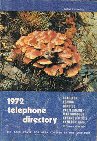 Bendigo Historical Society Inc.
Book - BOOK - 1972 TELEPHONE DIRECTORY
... A copy of the 1972 Telephone Directy for Charlton, Echuca, Bendigo, Castlemaine, Maryborough, Kerang Districts, Kyneton area. The book is blue with a unique pattern and has a picture of the local flora.The back cover features of a map of the Bendigo Area....History House 11 Mackenzie Street Bendigo goldfields BOOK Rural A copy of the 1972 Telephone Directy for Charlton, Echuca, Bendigo, Castlemaine, Maryborough, Kerang Districts, Kyneton area. The book is blue with a unique pattern and has a picture of the local flora.The back cover features of a map of the Bendigo Area. ...A copy of the 1972 Telephone Directy for Charlton, Echuca, Bendigo, Castlemaine, Maryborough, Kerang Districts, Kyneton area. The book is blue with a unique pattern and has a picture of the local flora.The back cover features of a map of the Bendigo Area.book, rural -
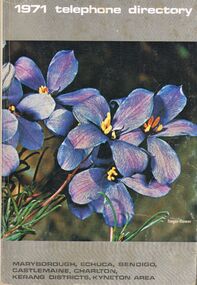 Bendigo Historical Society Inc.
Book - BOOK - 1971 TELEPHONE DIRECTORY
... A copy of the 1971 Telephone Directory for Maryborough, Ehuca, Bendigo, Castlemaine, Charlton, Kerang Districts, Kyneton area. It feature some purple flowers on the front cover and it also has an ad for Peter's icecream at the back cover....History House 11 Mackenzie Street Bendigo goldfields BOOK Rural A copy of the 1971 Telephone Directory for Maryborough, Ehuca, Bendigo, Castlemaine, Charlton, Kerang Districts, Kyneton area. It feature some purple flowers on the front cover and it also has an ad for Peter's icecream at the back cover. ...A copy of the 1971 Telephone Directory for Maryborough, Ehuca, Bendigo, Castlemaine, Charlton, Kerang Districts, Kyneton area. It feature some purple flowers on the front cover and it also has an ad for Peter's icecream at the back cover.book, rural -
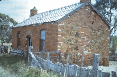 Bendigo Historical Society Inc.
Slide - MALDON & SURROUNDING AREAS, Apr 1968
... Maldon & Surrounding Areas. An old house on the Muckleford to Castlemaine Road....Maldon & Surrounding Areas. An old house on the Muckleford to Castlemaine Road. Slide MALDON & SURROUNDING AREAS. ...Slide. Maldon & Surrounding Areas. An old house on the Muckleford to Castlemaine Road.slide, maldon & surrounding areas., maldon & surrounding areas. -
 The Beechworth Burke Museum
Geological specimen - Ventifact (wind- or ice-shaped) pebble
... The Geological Survey of Victoria was instigated in response to the Victorian Gold Rush which began around 1851 in the Beechworth, Castlemaine, Daylesford, Bendigo and Ballarat areas. The survey was conducted by Alfred Richard Cecil Selwyn from his arrival in December 1852 until his resignation in 1869and during this time he trained many notable geologists, e.g. ...Ventifacts are sand-blasted rocks that are typically faceted and often display parallel grooves carved by wind-blown sand. They are useful indicators of wind direction and strength in environments such as deserts, mountains, and coastal areas because they are usually not hidden by later sediment, soil or vegetation cover. In Antarctica ventifaction is strongly related to the composition or type of rock. Ventifacts are important because they provide evidence for abraders such as sand, dust or snow and ice crystals, and offer a unique understanding of past wind processes that are effective in the reconstruction of past wind flow conditions and can provides clues to weather and climate changes in the past. Interestingly ventifacts have also been found on the surface of Mars. They were a threat to the NASA rover due to the sharp angles of the facets, created by the Martian wind over the course of millions of years. These Martian ventifacts act like weathervanes for past wind and weather patterns on the red planet in a similar manner to those found on earth.The Geological Survey of Victoria was instigated in response to the Victorian Gold Rush which began around 1851 in the Beechworth, Castlemaine, Daylesford, Bendigo and Ballarat areas. The survey was conducted by Alfred Richard Cecil Selwyn from his arrival in December 1852 until his resignation in 1869and during this time he trained many notable geologists, e.g. Aplin, Wilkinson, Daintree, who went on to other State survey senior positions. This specimen was among those donated to the Burke Museum in 1868.A hand-sized solid mineral specimen in shades of dark and light browns with light lines visible in all configurations and a groove on configuration 2.light lines visible in all configurations and a groove on configuration 2burke museum, beechworth, geological, geological specimen, ventifact, antarctic region, antarctic, alfred richard cecil selwyn, alfred selwyn, wind direction, wind strength, abraders, wind flow, climate change, reconstruction of wind flow conditions, weather change, mars -
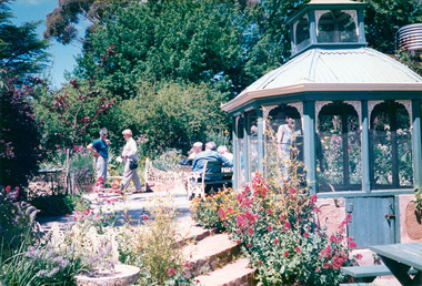 Eltham District Historical Society Inc
Photograph, Buda, Castlemaine, Spring Gardens Excursion, 30 October 1988, 30 Oct 1988
... area has been selected because it offers a wide range of gardens open to the public. From this range we have chosen three gardens which we think will be of great interest to members and their families and friends. These are the gardens: • "Buda", Castlemaine...area has been selected because it offers a wide range of gardens open to the public. From this range we have chosen three gardens which we think will be of great interest to members and their families and friends. These are the gardens: • "Buda", Castlemaine ...Pam and Marion EDHS Newsletter No. 62, September, 1988 SPRING GARDENS TRIP 30 Oct 1988 On this trip we will be visiting gardens which are of historic interest or of old world character. The date has been selected to coincide with the time when the gardens are likely to be at their best. The Central Victorian Goldfields area has been selected because it offers a wide range of gardens open to the public. From this range we have chosen three gardens which we think will be of great interest to members and their families and friends. These are the gardens: • "Buda", Castlemaine One of Victoria's most famous historic gardens. The mansion which was the home of the Leviny family for 118~ years is also open for inspection. • "Badger's Keep", Chewton This is a cottage garden (complete with 100 year old cottage) with a great diversity of plants. • "The Springs", Sedgwick A country garden also with a great array of plants The cost of the bus is $9.00 for adults and $5.00 for children. There is an additional charge for entry to the gardens, $2.00 each for "Badger's Keep" and "The Springs": for "Buda" it is $3.00, $1.50 for pensioners and $1.00 for children Each of the gardens has plants for sale. Bring your own picnic lunch. Please be at the Eltham Shire Offices by 8.15 a.m. so we can leave promptly at 8.30. To book for this trip complete the attached form and return the appropriate fare. EDHS Newsletter No. 63, November, 1988 RECENT ACTIVITIES More recently the Spring Gardens trip attracted a full bus load and a waiting list. Those who went thoroughly enjoyed the historic garden and mansion at "Buda" and two other excellent gardens at "Badger's Keep" and "The Springs". The popularity of this trip warrants a repeat performance. There are a number of other gardens of historic and general interest which are worth a visit in the future.Two colour photographic printsactivities, eltham district historical society, buda, castlemaine -
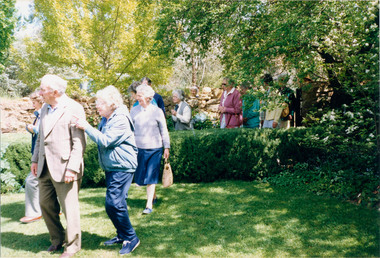 Eltham District Historical Society Inc
Photograph, Buda, Castlemaine, Spring Gardens Excursion, 30 October 1988, 30 Oct 1988
... area has been selected because it offers a wide range of gardens open to the public. From this range we have chosen three gardens which we think will be of great interest to members and their families and friends. These are the gardens: • "Buda", Castlemaine...area has been selected because it offers a wide range of gardens open to the public. From this range we have chosen three gardens which we think will be of great interest to members and their families and friends. These are the gardens: • "Buda", Castlemaine ...Pam and Marion EDHS Newsletter No. 62, September, 1988 SPRING GARDENS TRIP 30 Oct 1988 On this trip we will be visiting gardens which are of historic interest or of old world character. The date has been selected to coincide with the time when the gardens are likely to be at their best. The Central Victorian Goldfields area has been selected because it offers a wide range of gardens open to the public. From this range we have chosen three gardens which we think will be of great interest to members and their families and friends. These are the gardens: • "Buda", Castlemaine One of Victoria's most famous historic gardens. The mansion which was the home of the Leviny family for 118~ years is also open for inspection. • "Badger's Keep", Chewton This is a cottage garden (complete with 100 year old cottage) with a great diversity of plants. • "The Springs", Sedgwick A country garden also with a great array of plants The cost of the bus is $9.00 for adults and $5.00 for children. There is an additional charge for entry to the gardens, $2.00 each for "Badger's Keep" and "The Springs": for "Buda" it is $3.00, $1.50 for pensioners and $1.00 for children Each of the gardens has plants for sale. Bring your own picnic lunch. Please be at the Eltham Shire Offices by 8.15 a.m. so we can leave promptly at 8.30. To book for this trip complete the attached form and return the appropriate fare. EDHS Newsletter No. 63, November, 1988 RECENT ACTIVITIES More recently the Spring Gardens trip attracted a full bus load and a waiting list. Those who went thoroughly enjoyed the historic garden and mansion at "Buda" and two other excellent gardens at "Badger's Keep" and "The Springs". The popularity of this trip warrants a repeat performance. There are a number of other gardens of historic and general interest which are worth a visit in the future.Seven colour photographic printsactivities, eltham district historical society, buda, castlemaine -
 Eltham District Historical Society Inc
Photograph, Woodburn residence, mudbrick adobe (1949), Eltham Heritage Tour, 24 May 1992, 24/05/1992
... area, growing up the hill from the station. It was a typical outer Melbourne suburb with lawns and roses with patches of originality. The shopping precinct still has 1950 characteristics - walls which sloped back, projecting roofs, the original shop fronts are nearly all tiled below the old windows. There's an air of past times about the School, the Dairy, the Butcher's (now a milk bar) and the Castlemaine...area, growing up the hill from the station. It was a typical outer Melbourne suburb with lawns and roses with patches of originality. The shopping precinct still has 1950 characteristics - walls which sloped back, projecting roofs, the original shop fronts are nearly all tiled below the old windows. There's an air of past times about the School, the Dairy, the Butcher's (now a milk bar) and the Castlemaine ...ELTHAM HERITAGE TOUR The Society excursion on 24th May 1992 was arranged by David Bick, leader of the team carrying out the Shire's heritage study. David selected a number of sites or buildings identified in the study, some of them lesser known components of the Shire's heritage. The tour commenced at the Eltham Shire Office at 10.00 am. Travel was by private car and mini-bus with stops at about twelve locations for commentary by David.It included a short walk in Hurstbridge and lunch at Kinglake. Highlights of the tour included: - 10 am Leave from Shire Offices - 3 Important Trees - A Physical Link to Eltham's First Settlers - Toorak Mansion Gates - A Surviving Farm House - An Intact Circa 1900 Main Street - First Settlers - Gold Miners, and Timber-getters - An Early Hotel - A Pioneering Homestead - Changing Eltham Shire - 20th Century - 4 pm Afternoon Tea and Finish Tour Extract from ELTHAM CULTURAL HERITAGE TOUR (Newsletter No. 85, July 1992, by Bettina Woodburn) "In some respects Eltham is a 'back-water' and it has its own distinctive flavour. On the outskirts the homes date from the 1960's, 70's and 80s with a sprinkling of 'earth homes', mud-brick or pise, rammed dirt. Crossing Main Road into Beddoe Street and Thompson Crescent a very pleasant drive past pines and old fence lines, front lawns unfenced, the occasional ·old farm building, we eventually looked down on a huge circular roof of a 1992 adobe home. Other distinctive places included the Pauline Toner Butterfly Reserve, Gordon Ford's splendid garden at Fulling in Pitt Street, cypress hedges and old houses in Bridge Street and in every direction Eltham's special feature - a totally treed horizon. We were now in the part of the Shire closest to Melbourne - Montmorency - not on the way to anywhere, with no through road going across it, developed in the 1950's and 1960's with conventional gardens, now converted to native plants. The rail looped between Greensborough and Eltham and a shopping street (Were Street) served the area, growing up the hill from the station. It was a typical outer Melbourne suburb with lawns and roses with patches of originality. The shopping precinct still has 1950 characteristics - walls which sloped back, projecting roofs, the original shop fronts are nearly all tiled below the old windows. There's an air of past times about the School, the Dairy, the Butcher's (now a milk bar) and the Castlemaine stone face of the Commonwealth Bank. The final stop for the tour was at the mud-brick Woodburn residence, adobe of 1949 with additions. After War Service, Bill Woodburn had commenced an Architecture course at Melbourne University and after second year in the Christmas vacation, with his wife, Betti, built the two bedroom house - with amazing saving of costs. In the three and a half months they made over 3000 bricks (external walls 18" x 12" x 4", internal walls 12" x 9" x 4"), sifted top soil for mortar and laid them, on concrete foundations and slab floor, made all the structural window frames, door frames and roof members to carry 'super six' asbestos sheets, laboured for the electrician and plumber, did all the glazing and, still without electricity, moved in in March 1949. Rooms have been added, at first with glass walls, later using concrete blocks, to accommodate three daughters and a son. The house not only grew from the earth, but also with the family."Record of the Society's history and activities and highlighting various aspects of the Heritage Study undertaken by David Bick used to create the future heritage overlay for the Shire of Eltham and later Nillumbik Shire.Roll of 35mm colour negative film, 4 stripsKodak Gold 100 5095shire of eltham historical society, activities, heritage tour, woodburn house -
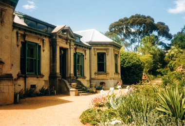 Eltham District Historical Society Inc
Photograph, Buda, Castlemaine, Spring Gardens Excursion, 30 October 1988, 30/10/1988
... area has been selected because it offers a wide range of gardens open to the public. From this range we have chosen three gardens which we think will be of great interest to members and their families and friends. These are the gardens: • "Buda", Castlemaine...area has been selected because it offers a wide range of gardens open to the public. From this range we have chosen three gardens which we think will be of great interest to members and their families and friends. These are the gardens: • "Buda", Castlemaine ...[from EDHS Newsletter No. 62, September 1988:] SPRING GARDENS TRIP 30 Oct 1988 On this trip we will be visiting gardens which are of historic interest or of old world character. The date has been selected to coincide with the time when the gardens are likely to be at their best. The Central Victorian Goldfields area has been selected because it offers a wide range of gardens open to the public. From this range we have chosen three gardens which we think will be of great interest to members and their families and friends. These are the gardens: • "Buda", Castlemaine: One of Victoria's most famous historic gardens. The mansion, which was the home of the Leviny family for 118~ years, is also open for inspection. • "Badger's Keep", Chewton: This is a cottage garden (complete with 100 year old cottage) with a great diversity of plants. • "The Springs", Sedgwick: A country garden also with a great array of plants. The cost of the bus is $9.00 for adults and $5.00 for children. There is an additional charge for entry to the gardens, $2.00 each for "Badger's Keep" and "The Springs"; for "Buda" it is $3.00, $1.50 for pensioners and $1.00 for children. Each of the gardens has plants for sale. Bring your own picnic lunch. Please be at the Eltham Shire Offices by 8.15 a.m. so we can leave promptly at 8.30. To book for this trip complete the attached form and return the appropriate fare. [from EDHS Newsletter No. 63, November 1988:] RECENT ACTIVITIES More recently the Spring Gardens trip attracted a full bus load and a waiting list. Those who went thoroughly enjoyed the historic garden and mansion at "Buda" and two other excellent gardens at "Badger's Keep" and "The Springs". The popularity of this trip warrants a repeat performance. There are a number of other gardens of historic and general interest which are worth a visit in the future.Two colour photographsactivities, buda, castlemaine -
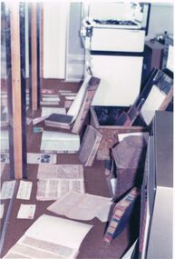 Bendigo Historical Society Inc.
Photograph - CASTLEMAINE GAS COMPANY COLLECTION: STORAGE AREA
... CASTLEMAINE GAS COMPANY COLLECTION: STORAGE AREA...Collection Castlemaine Gas & Fuel. Colour photograph storage area fas stove background right, Box containing two books, number of books and paper sheets on floor, Appliance foreground right, Windows along loft side....Photograph CASTLEMAINE GAS COMPANY COLLECTION: STORAGE AREA ...BHS CollectionCollection Castlemaine Gas & Fuel. Colour photograph storage area fas stove background right, Box containing two books, number of books and paper sheets on floor, Appliance foreground right, Windows along loft side.business, retail, gas and fuel -
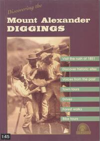 Bendigo Historical Society Inc.
Book - BOOK: DISCOVERING THE MOUNT ALEXANDER DIGGINGS - MOUNT ALEXANDER DIGGINGS COMMITTEE, 1999
... The areas covered include Chewton, Castlemaine, Campbells Creek, Vaughan, Fryerstown Newstead and Maldon. ...History House 11 Mackenzie Street Bendigo goldfields BHS Collection GOLDFIELDS Gold mining Mount Alexander Castlemaine Campbells Creek Maldon Indigenous stories Mount Alexander Diggins Committee Softcover book with purple cover and a detail from a sepia photograph of miners in Forest Creek in 1858. The book is a guide to the Mount Alexander goldfields with historical notes, sites to visit, suggested tours, drives and walks. The areas ...BHS CollectionSoftcover book with purple cover and a detail from a sepia photograph of miners in Forest Creek in 1858. The book is a guide to the Mount Alexander goldfields with historical notes, sites to visit, suggested tours, drives and walks. The areas covered include Chewton, Castlemaine, Campbells Creek, Vaughan, Fryerstown Newstead and Maldon. Indigenous stories are also included.Mount Alexander Diggins Committeegoldfields, gold mining, mount alexander, castlemaine, campbells creek, maldon, indigenous stories -
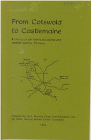 Bendigo Historical Society Inc.
Booklet - From Cotswold to Castlemaine
... area on title page. B&W photos of George C R Collins and Jemima on page 13. B&W photo of family of George and Jemima on page 14. Printed by Advertiser (Jamieson) Printery. Booklet From Cotswold to Castlemaine ...A history of the Family of Charles and Hannah Collins, Pioneers. 24-page booklet. Compiled in 1973 by Iris E. Hocking (Great Granddaughter) and her father, George William Collins (Grandson). Sketch map of Victorian Goldfields area on title page. B&W photos of George C R Collins and Jemima on page 13. B&W photo of family of George and Jemima on page 14. Printed by Advertiser (Jamieson) Printery.Signature of Iris E. Hocking in ink at bottom of page 1.charles and hannah collins, family history, george c r collins, hannah charlotte whitaker-clarke, jemima martin, charles collins, hannah collins -
 Bendigo Historical Society Inc.
Administrative record - Land Sales Register
... Dates from 1906 - 1922. ledger filled with names, addresses, financial details, and glued in posters of land sales associated with clients. Castlemaine is listed as the area for the ledger and also St Anaud, Maryborough, Avoca, Inglewood, Dunolly, Daylesford, Maldon, Heathcote, Woodend. ...Dates from 1906 - 1922. ledger filled with names, addresses, financial details, and glued in posters of land sales associated with clients. Castlemaine is listed as the area for the ledger and also St Anaud, Maryborough, Avoca, Inglewood, Dunolly, Daylesford, Maldon, Heathcote, Woodend. ...Large cloth bound ledger, hard board cover, front and back. Over a hundred pages not all numbered. Handwritten. Dates from 1906 - 1922. ledger filled with names, addresses, financial details, and glued in posters of land sales associated with clients. Castlemaine is listed as the area for the ledger and also St Anaud, Maryborough, Avoca, Inglewood, Dunolly, Daylesford, Maldon, Heathcote, Woodend. Scratched on the front cover is a faded reading of 'Castlemaine.' Written onto the spine is written in blue texta, 'Land Sales, C'Maine,' and also '8.6.1906 to 23.2.1922.' land sales, register, castlemaine