
Showing 1278 items matching "commercial street"
-
 Merbein District Historical Society
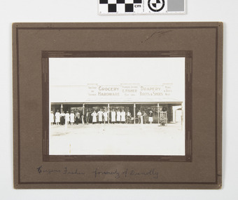
Photograph - Fisher's staff outside Fisher's Store in Commercial Street Merbein, Fisher's Pioneer Store late 1920's
... Fisher's staff outside Fisher's Store in Commercial Street Merbein...shops businesses Fisher's staff Merbein Pioneer Store Commercial Street 1920...shops businesses Fisher's staff Merbein Pioneer Store Commercial Street 1920 names supplied L-R -------- Miss Ahearne Miss Bessie Fisher ------ ------- Mr E. ...sepia photograph mounted on boardnames supplied L-R -------- Miss Ahearne Miss Bessie Fisher ------ ------- Mr E. Clay Mr Eugene Fisher C. Norman Bill Summerfield K. Drury E. Hibberd J. Hatch Bob Spence Bill Tierney (cartman) Harry Fisher Mrs Elizabeth Fisher Miss May(drapery)shops businesses fisher's staff merbein pioneer store commercial street 1920 -
 Stawell Historical Society Inc
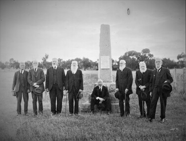
Photograph, "Peace" Memorial on Halls Gap Road built 1919 at site of old Treasury Building Commercial Street Pleasant Creek c1922
... "Peace" Memorial on Halls Gap Road built 1919 at site of old Treasury Building Commercial Street Pleasant Creek c1922...Group of gentlemen beside the Peace Memorial situated on Halls Gap Road built 1919 at site of old Treasury Building Commercial Street Pleasant Creek. c 1922. Photo simliar to 0480, same group of gentlemen but withour their hats on. ..."Peace" Memorial on Halls Gap Road built 1919 at site of old Treasury Building Commercial Street Pleasant Creek c1922 Photograph ...Group of gentlemen beside the Peace Memorial situated on Halls Gap Road built 1919 at site of old Treasury Building Commercial Street Pleasant Creek. c 1922. Photo simliar to 0480, same group of gentlemen but withour their hats on. C. Cray and W. Carter are in 0480 but not 0480.1.Black and white photograph of eight elderly gentlemen dressed in suits.Memorial on Hall's Gap Road third fromLeft John Williams and James Paton seated. M. Chapman Glenorchy (R.M.B. 6108 Stawell) As in Diamond Jubilee Book Photo Chapman Stawellstawell -
 Stawell Historical Society Inc
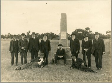
Photograph, "Peace" Memorial on Halls Gap Road built 1919 at site of old Treasury Building Commercial Street Pleasant Creek c1922
... "Peace" Memorial on Halls Gap Road built 1919 at site of old Treasury Building Commercial Street Pleasant Creek c1922...Group of gentlemen beside the Peace Memorial situated on Halls Gap Road at site of old Treasury Building Commercial Street Pleasant Creek. c 1922. The memorial is a few kilometers from Stawell built by a group of working bees in 1919. ..."Peace" Memorial on Halls Gap Road built 1919 at site of old Treasury Building Commercial Street Pleasant Creek c1922 Photograph ...Group of gentlemen beside the Peace Memorial situated on Halls Gap Road at site of old Treasury Building Commercial Street Pleasant Creek. c 1922. The memorial is a few kilometers from Stawell built by a group of working bees in 1919. People in photograph: From L to R: S. Feilding, C. Hunt, J. Williams, D. Morgan, T. Richardson, D. Stweart, W. Thomas, seated on monument Mr J. Paton Reclined on grass, C. Gray, W. Carter.Two black and white photographs, one an original the other a copy of 10 elderly gentlemen dressed in suits all wearing hats - posed near a momorial.stawell -
 Stawell Historical Society Inc
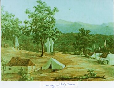
Painting, Mining Scene in Commercial (Rd) Street 1857
... Mining Scene in Commercial (Rd) Street 1857...Commercial (Rd) Street 1857 Mining Scene...Commercial (Rd) Street 1857 Mining Scene Stawell Mining Mining Scene in Commercial (Rd) Street 1857 Painting ...Commercial (Rd) Street 1857 Mining Scenestawell mining -
 Merbein District Historical Society
Photograph, Commercial Street, Merbein, Early 1920's
... Commercial Street, Merbein...Street Commercial Street, Merbein Photograph ...street -
 Merbein District Historical Society
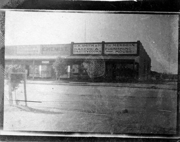
Photograph, Commercial Street, shops, Merbein, unknown
... Commercial Street, shops, Merbein...Bakers and Pastrycooks Chemist Businesses Commercial Street, shops, Merbein Photograph ...merbein furnishing house, r.h. smith & co. bakers and pastrycooks, chemist, businesses -
 Merbein District Historical Society
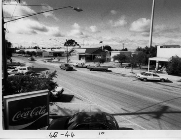
Photograph, Commercial Street Merbein, unknown
... Commercial Street Merbein...Businesses Commercial Street Merbein Photograph ...businesses -
 Merbein District Historical Society
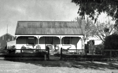
Photograph, Kimpton's House, 140 Commercial Street, Merbein, c.1938
... Kimpton's House, 140 Commercial Street, Merbein...Kimpton's House, 140 Commercial Street, Merbein Photograph ... -
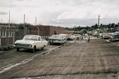
 Eltham District Historical Society Inc
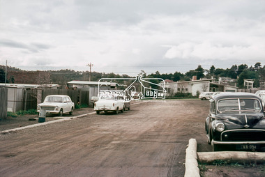
Photograph, Laneway running between Arthur Street and Luck Street (now Commercial Place), Eltham, c.6 May 1968, 1968
... Laneway running between Arthur Street and Luck Street (now Commercial Place), Eltham, c.6 May 1968...Commercial Place, Luck Street, Pryor Street...Commercial Place, Luck Street, Pryor Street 35mm Colour positive transparency Mount - Agfacolor Service (Blue stepped) Laneway running between Arthur Street and Luck Street (now Commercial Place), Eltham, c.6 May 1968 Photograph ...35mm Colour positive transparency Mount - Agfacolor Service (Blue stepped)commercial place, luck street, pryor street -
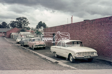
 Eltham District Historical Society Inc
Photograph, Laneway running between Arthur Street and Luck Street (now Commercial Place), Eltham, c. 6 May 1968
... Laneway running between Arthur Street and Luck Street (now Commercial Place), Eltham...Carparks, Commercial Place, Luck Street, Pryor Street...Present-day Commercial Place looking towards Pryor Street and Luck Street beyond. ...Google Streetview https://maps.app.goo.gl/Vuwg7G9LWUVZ5Hn1A Carparks, Commercial Place, Luck Street, Pryor Street 35mm Colour positive transparency Mount - Agfacolor Service (Blue stepped) Laneway running between Arthur Street and Luck Street (now Commercial Place), Eltham Photograph ...Present-day Commercial Place looking towards Pryor Street and Luck Street beyond. Taken from near the Midway Arcade. The building front left is the toilet block that serviced Midway Arcade. Google Streetview https://maps.app.goo.gl/Vuwg7G9LWUVZ5Hn1A35mm Colour positive transparency Mount - Agfacolor Service (Blue stepped)carparks, commercial place, luck street, pryor street -
 Eltham District Historical Society Inc
Photograph, Laneway running between Arthur Street and Luck Street (now Commercial Place), Eltham, c.6 May 1968, 1968
... Laneway running between Arthur Street and Luck Street (now Commercial Place), Eltham, c.6 May 1968...Arthur Street, Commercial Place, Eltham Shire Hall, Pryor Street...Arthur Street, Commercial Place, Eltham Shire Hall, Pryor Street 35mm Colour positive transparency Mount - Agfacolor Service (Blue stepped) Laneway running between Arthur Street and Luck Street (now Commercial Place), Eltham, c.6 May 1968 Photograph ...35mm Colour positive transparency Mount - Agfacolor Service (Blue stepped)arthur street, commercial place, eltham shire hall, pryor street -
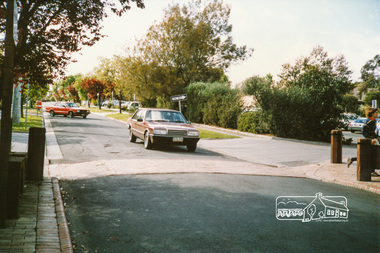 Eltham District Historical Society Inc
Photograph, Pryor Street at Commercial Place, Eltham
... Pryor Street at Commercial Place, Eltham...street...commercial place...Colour photograph of Pryor Street, Eltham at Commercial Place...pryor street commercial place eltham Colour photograph of Pryor Street, Eltham at Commercial Place Pryor Street at Commercial Place, Eltham Photograph ...Colour photograph of Pryor Street, Eltham at Commercial Placepryor street, commercial place, eltham -
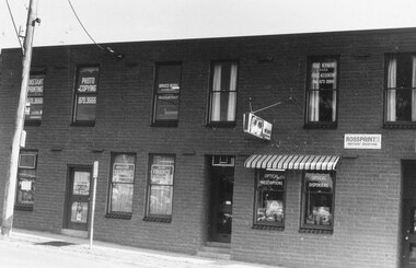 Ringwood and District Historical Society
Photograph, Street Scenes. Commercial premises in Ringwood Street, corner of Bond Street, Ringwood - 18/5/1981
... Street Scenes. Commercial premises in Ringwood Street, corner of Bond Street, Ringwood - 18/5/1981....Ringwood Street, corner of Bond St Street Scenes. Commercial premises in Ringwood Street, corner of Bond Street, Ringwood - 18/5/1981. ...Ringwood Street, corner of Bond StWritten on back of photograph, "18/5/81. Ringwood Street, corner of Bond St." -
 Stawell Historical Society Inc
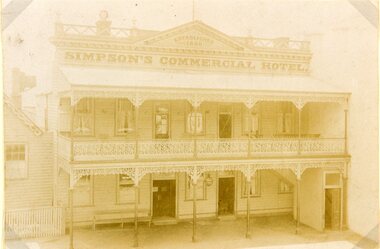
Photograph, Simpsons Commercial Hotel in Main Street Stawell
... Simpsons Commercial Hotel in Main Street Stawell...Simpsons Commercial Hotel Main Street Stawell...Simpsons Commercial Hotel Main Street Stawell Stawell Simpsons Commercial Hotel in Main Street Stawell Photograph ...Simpsons Commercial Hotel Main Street Stawellstawell -
 Ballarat Heritage Services
Photograph - Photograph - Colour, Clare Gervasoni, Koroit Post Office, 2015, 21/12/2015
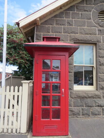
... The administrative and commercial area (focussing on the Boundary-Commercial Road/High Street intersection and the Koroit Hotel) consists of a number of significant public buildings and leads to a street of relatively intact humble shopfronts and kerbline verandahs, visually punctuated by opposing bank facades. ...Commercial Street, Koroit, Victoria, Australia...The administrative and commercial area (focussing on the Boundary-Commercial Road/High Street intersection and the Koroit Hotel) consists of a number of significant public buildings and leads to a street of relatively intact humble shopfronts and kerbline verandahs, visually punctuated by opposing bank facades. ...The town borrows its name from the Koroitch Gundidj people who occupied the area prior to European settlement. (https://en.wikipedia.org/wiki/Koroit, accessed 21 December 2016) Koroit was first surveyed as a township in 1847. Around the 1850 the district had the highest population of Irish immigrants in rural Australia. The Koroit Post Office was designed by architect and engineer John Mason of Port Fairy. (Moyne Shire Heritage Study 2006 Stage 2, Volume 2: Environmental History, Prepared for Moyne Shire Council Helen Doyle in association with Context Pty Ltd, 2006.) Rosebrook Bridge, Rosebrook (1853; replaced) Post Office buildings, Bank Street, Port Fairy (c.1857) The author Henry Handel Richardson lived in the Koroit Post Office as a child after her family moved to Koroit in 1878. Remembering Koroit from her youth, the third volume in her The Fortunes of Richard Mahony trilogy is set in the town. When the author was six, her father Walter died in Koroit on 1 August 1879 and was buried at the Koroit cemetery. (https://en.wikipedia.org/wiki/Koroit, accessed 21 December 2016) In 1878 Mary Richardson was appointed postmistress of the Koroit Post Office at a salary of 72 pounds with free quarters, firewood and kerosene. She lived at the back of the Post Office. (From a Green and Pleasant Land by H. McCorkell and P. Yule.) Photographs showing the bluestone Koroit Post Office, phone box and postbox. It is located at 99 Commercial Road, Koroit. "Historic Area Statement of Significance: The significance of Koroit derives from its role as the urban centre of one of the most concentrated Irish Roman Catholic rural districts in Australia, noted for its mixed livestock and cropping argicultural patterns. This is reflected in two separate and distinctive areas in the town - the administrative/commercial area and the church precinct. The administrative and commercial area (focussing on the Boundary-Commercial Road/High Street intersection and the Koroit Hotel) consists of a number of significant public buildings and leads to a street of relatively intact humble shopfronts and kerbline verandahs, visually punctuated by opposing bank facades. The church precinct is dominated by a group of Catholic buildings larger in scale and more complete in range than those in any comparably sized Victorian town." http://vhd.heritagecouncil.vic.gov.au/places/69338#sthash.ELLuSMvg.dpuf, accessed 21 December 2016."koroit, post office, phone box, payphone, bluestone, henry handel richardson, koroit post office -
 Allan Doney Collection, Bendigo Historical Society Inc.
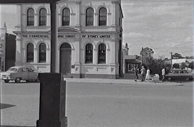
Negative - Rochester - Street - Commercial Bank, Allan Doney, 1950 -1970
... Rochester - Street - Commercial Bank...Negative Rochester - Street - Commercial Bank Allan Doney ...In the years of Allan Doney’s photography, landmark buildings succumbed to fire, neglect and redevelopment. He photographed the grey sand hills from Bendigo’s mining past, the streetscapes, poppet heads, miners’ cottages, gracious homes with ornate verandahs, trams and much more. Above all, his photographs show how much of the city has survived from the 19th century – and how much has not. Through two decades of great change, Allan Doney was there to capture ways people interacted with it. Although he travelled to many other places in Northern Victoria and beyond in search of subjects for his art, he seemed to always return to Bendigo for inspiration. -
 Allan Doney Collection, Bendigo Historical Society Inc.
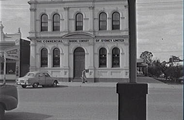
Negative - Rochester - Street - Commercial Bank, Allan Doney, 1950 -1970
... Rochester - Street - Commercial Bank...Negative Rochester - Street - Commercial Bank Allan Doney ...In the years of Allan Doney’s photography, landmark buildings succumbed to fire, neglect and redevelopment. He photographed the grey sand hills from Bendigo’s mining past, the streetscapes, poppet heads, miners’ cottages, gracious homes with ornate verandahs, trams and much more. Above all, his photographs show how much of the city has survived from the 19th century – and how much has not. Through two decades of great change, Allan Doney was there to capture ways people interacted with it. Although he travelled to many other places in Northern Victoria and beyond in search of subjects for his art, he seemed to always return to Bendigo for inspiration. -
 Allan Doney Collection, Bendigo Historical Society Inc.
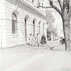
Negative - Commercial Bank - View Street Bendigo, Allan Doney, 1950 -1970
... Commercial Bank - View Street Bendigo...Negative Commercial Bank - View Street Bendigo Allan Doney ...In the years of Allan Doney’s photography, landmark buildings succumbed to fire, neglect and redevelopment. He photographed the grey sand hills from Bendigo’s mining past, the streetscapes, poppet heads, miners’ cottages, gracious homes with ornate verandahs, trams and much more. Above all, his photographs show how much of the city has survived from the 19th century – and how much has not. Through two decades of great change, Allan Doney was there to capture ways people interacted with it. Although he travelled to many other places in Northern Victoria and beyond in search of subjects for his art, he seemed to always return to Bendigo for inspiration. -
 Ringwood and District Historical Society
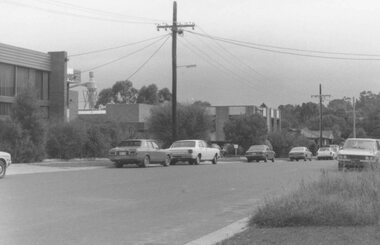
Photograph, Ringwood Street commercial developments opposite Eastland, Ringwood - 1984
... Ringwood Street commercial developments opposite Eastland, Ringwood - 1984...Black and white photograph Ringwood Street commercial developments opposite Eastland, Ringwood - 1984 Photograph ...Black and white photographWritten on back of photograph: "Ringwood Street, new offices, 1984." -
 Darebin Art Collection
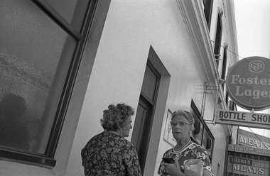
Photograph, David Wadelton, 'The Commercial Hotel, High Street, Northcote', 1977
... 'The Commercial Hotel, High Street, Northcote'...the commercial hotel 'The Commercial Hotel, High Street, Northcote' Photograph David Wadelton ...David Wadelton’s photographs capture the architecture, people and character of Darebin’s suburbs and surrounds since 1975. Wadelton’s photographs preserve the past while also documenting the slow transformation and gentrification of the inner-city suburbs. This record is collected in publications and anthologies as well as more informally on the Facebook page Northcote Hysterical Society, which Wadelton has run since 2019. In 2016, David donated a suite of 20 photographs to the Darebin Art Collection, providing a wonderful archive of Darebin’s local history. Artist Bio David Wadelton was born in 1955 in Terang, Victoria, and now lives and works in Naarm/Melbourne. He studied visual art at Preston and Phillip Institutes in Melbourne, graduating in 1976 and 1982, respectively. Since the early 1980s, he has exhibited extensively throughout Australia with regular solo exhibitions at Tolarno Galleries, Melbourne. A survey exhibition of Wadelton’s paintings and photographs, 'David Wadelton: Icons of Suburbia', was presented by McClelland Sculpture Park + Gallery in 2011. In addition to his career as a visual artist, Wadelton has made significant contributions to the field of experimental music in Australia.the commercial hotel -
 Flagstaff Hill Maritime Museum and Village
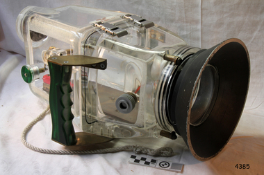
Equipment - Camera Housing, Wills Camera Housings, Late 1960s to the mid-1970s
... 46 Commercial Street, Kaniva, Victoria, Australia ...This is an early underwater camera housing for a video camera. It was sold by Wills Camera Housings from Kaniva, Victoria. It is dated around the late 1960s to the mid1970s. The history of underwater photography began with the first protective camera box for underwater photography was made in 1856. In 1914 the first underwater video footage was taken. Colour underwater photography was first shot in 1926. In 1950 the first commercially available underwater camera housing, the "Tarzan" was designed by Henry Broussard, an underwater photographer, for his own camera. It was produced by the French company Beauchat. In 1957 the revolutionary underwater camera was invented by Jaques-Yves Cousteau and Jean de Wouters. The new amphibious "Calypso" changed the nature of underwater photography.This underwater video camera housing is significant for its purpose of underwater photography. Camera housings such as this were used to record the position and layout of shipwrecks along coast of the Great Ocean Road. Flagstaff Hill Maritime Museum and Village has underwater footage of dives that show the now protected shipwrecks.Underwater camera housing for a video camera. Perspex and metal, made by Wills Camera Housings of Kaniva, Victoria. flagstaff hill, flagstaff hill maritime museum and village, warrnambool, maritime museum, maritime village, great ocean road, shipwreck coast, camera housing, underwater camera housing, video camera housing -
 Flagstaff Hill Maritime Museum and Village
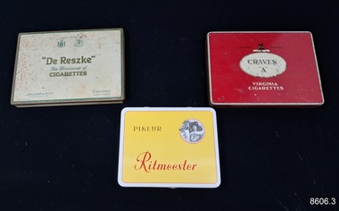
Leisure object - Smoker's Items, 1940s
... ...27 Commercial Street, London, E1 6LP, UK ...These cigarette and cigar tin boxes belonged to Dr.William Roy Angus, Surgeon and Oculist. They were donated to Flagstaff Hill Maritime Village by his daughter, Bernice McDade. They are part of the “W.R. Angus Collection” that includes historical medical equipment, surgical instruments and material once belonging to Dr Edward Ryan and Dr Thomas Francis Ryan, (both of Nhill, Victoria) as well as Dr Angus’ own belongings. The Collection’s history spans the medical practices of the two Doctors Ryan, from 1885-1926 plus that of Dr Angus, up until 1969. ABOUT THE “W.R. ANGUS COLLECTION” Doctor William Roy Angus M.B., B.S., Adel., 1923, F.R.C.S. Edin.,1928 (also known as Dr Roy Angus) was born in Murrumbeena, Victoria in 1901 and lived until 1970. He qualified as a doctor in 1923 at University of Adelaide, was Resident Medical Officer at the Royal Adelaide Hospital in 1924 and for a period was house surgeon to Sir (then Mr.) Henry Simpson Newland. Dr Angus was briefly an Assistant to Dr Riddell of Kapunda, then commenced private practice at Curramulka, Yorke Peninsula, SA, where he was physician, surgeon and chemist. In 1926, he was appointed as new Medical Assistant to Dr Thomas Francis Ryan (T.F. Ryan, or Tom), in Nhill, Victoria, where his experiences included radiology and pharmacy. In 1927 he was Acting House Surgeon in Dr Tom Ryan’s absence. Dr Angus had become engaged to Gladys Forsyth and they decided he would take time to further his studies overseas in the UK in 1927. He studied at London University College Hospital and at Edinburgh Royal Infirmary and in 1928, was awarded FRCS (Fellow from the Royal College of Surgeons), Edinburgh. He worked his passage back to Australia as a Ship’s Surgeon on the on the Australian Commonwealth Line’s T.S.S. Largs Bay. Dr Angus married Gladys in 1929, in Ballarat. (They went on to have one son (Graham 1932, born in SA) and two daughters (Helen (died 12/07/1996) and Berenice (Berry), both born at Mira, Nhill ) Dr Angus was a ‘flying doctor’ for the A.I.M. (Australian Inland Ministry) Aerial Medical Service in 1928 . The organisation began in South Australia through the Presbyterian Church in that year, with its first station being in the remote town of Oodnadatta, where Dr Angus was stationed. He was locum tenens there on North-South Railway at 21 Mile Camp. He took up this ‘flying doctor’ position in response to a call from Dr John Flynn; the organisation was later known as the Flying Doctor Service, then the Royal Flying Doctor Service. A lot of his work during this time involved dental surgery also. Between 1928-1932 he was surgeon at the Curramulka Hospital, Yorke Peninsula, South Australia. In 1933 Dr Angus returned to Nhill where he’d previously worked as Medical Assistant and purchased a share of the Nelson Street practice and Mira hospital from Dr Les Middleton one of the Middleton Brothers, the current owners of what was once Dr Tom Ryan’s practice. Dr L Middleton was House Surgeon to the Nhill Hospital 1926-1933, when he resigned. [Dr Tom Ryan’s practice had originally belonged to his older brother Dr Edward Ryan, who came to Nhill in 1885. Dr Edward saw patients at his rooms, firstly in Victoria Street and in 1886 in Nelson Street, until 1901. The Nelson Street practice also had a 2 bed ward, called Mira Private Hospital ). Dr Edward Ryan was House Surgeon at the Nhill Hospital 1884-1902 . He also had occasions where he successfully performed veterinary surgery for the local farmers too. Dr Tom Ryan then purchased the practice from his brother in 1901. Both Dr Edward and Dr Tom Ryan work as surgeons included eye surgery. Dr Tom Ryan performed many of his operations in the Mira private hospital on his premises. He too was House Surgeon at the Nhill Hospital 1902-1926. Dr Tom Ryan had one of the only two pieces of radiology equipment in Victoria during his practicing years – The Royal Melbourne Hospital had the other one. Over the years Dr Tom Ryan gradually set up what was effectively a training school for country general-practitioner-surgeons. Each patient was carefully examined, including using the X-ray machine, and any surgery was discussed and planned with Dr Ryan’s assistants several days in advance. Dr Angus gained experience in using the X-ray machine there during his time as assistant to Dr Ryan. Dr Tom Ryan moved from Nhill in 1926. He became a Fellow of the Royal Australasian College of Surgeons in 1927, soon after its formation, a rare accolade for a doctor outside any of the major cities. He remained a bachelor and died suddenly on 7th Dec 1955, aged 91, at his home in Ararat. Scholarships and prizes are still awarded to medical students in the honour of Dr T.F. Ryan and his father, Dr Michael Ryan, and brother, John Patrick Ryan. ] When Dr Angus bought into the Nelson Street premises in Nhill he was also appointed as the Nhill Hospital’s Honorary House Surgeon 1933-1938. His practitioner’s plate from his Nhill surgery states “HOURS Daily, except Tuesdays, Fridays and Saturday afternoons, 9-10am, 2-4pm, 7-8pm. Sundays by appointment”. This plate is now mounted on the doorway to the Port Medical Office at Flagstaff Hill Maritime Village, Warrnambool. Dr Edward Ryan and Dr Tom Ryan had an extensive collection of historical medical equipment and materials spanning 1884-1926 and when Dr Angus took up practice in their old premises he obtained this collection, a large part of which is now on display at the Port Medical Office at Flagstaff Hill Maritime Village in Warrnambool. During his time in Nhill Dr Angus was involved in the merging of the Mira Hospital and Nhill Public Hospital into one public hospital and the property titles passed on to Nhill Hospital in 1939. In 1939 Dr Angus and his family moved to Warrnambool where he purchased “Birchwood,” the 1852 home and medical practice of Dr John Hunter Henderson, at 214 Koroit Street. (This property was sold in1965 to the State Government and is now the site of the Warrnambool Police Station. ). The Angus family was able to afford gardeners, cooks and maids; their home was a popular place for visiting dignitaries to stay whilst visiting Warrnambool. Dr Angus had his own silk worm farm at home in a Mulberry tree. His young daughter used his centrifuge for spinning the silk. Dr Angus was appointed on a part-time basis as Port Medical Officer (Health Officer) in Warrnambool and held this position until the 1940’s when the government no longer required the service of a Port Medical Officer in Warrnambool; he was thus Warrnambool’s last serving Port Medical Officer. (The duties of a Port Medical Officer were outlined by the Colonial Secretary on 21st June, 1839 under the terms of the Quarantine Act. Masters of immigrant ships arriving in port reported incidents of diseases, illness and death and the Port Medical Officer made a decision on whether the ship required Quarantine and for how long, in this way preventing contagious illness from spreading from new immigrants to the residents already in the colony.) Dr Angus was a member of the Australian Medical Association, for 35 years and surgeon at the Warrnambool Base Hospital 1939-1942, He served as a Surgeon Captain during WWII1942-45, in Ballarat, Victoria, and in Bonegilla, N.S.W., completing his service just before the end of the war due to suffering from a heart attack. During his convalescence he carved an intricate and ‘most artistic’ chess set from the material that dentures were made from. He then studied ophthalmology at the Royal Melbourne Eye and Ear Hospital and created cosmetically superior artificial eyes by pioneering using the intrascleral cartilage. Angus received accolades from the Ophthalmological Society of Australasia for this work. He returned to Warrnambool to commence practice as an ophthalmologist, pioneering in artificial eye improvements. He was Honorary Consultant Ophthalmologist to Warrnambool Base Hospital for 31 years. He made monthly visits to Portland as a visiting surgeon, to perform eye surgery. He represented the Victorian South-West subdivision of the Australian Medical Association as its secretary between 1949 and 1956 and as chairman from 1956 to 1958. In 1968 Dr Angus was elected member of Spain’s Barraquer Institute of Barcelona after his research work in Intrasclearal cartilage grafting, becoming one of the few Australian ophthalmologists to receive this honour, and in the following year presented his final paper on Living Intrasclearal Cartilage Implants at the Inaugural Meeting of the Australian College of Ophthalmologists in Melbourne In his personal life Dr Angus was a Presbyterian and treated Sunday as a Sabbath, a day of rest. He would visit 3 or 4 country patients on a Sunday, taking his children along ‘for the ride’ and to visit with him. Sunday evenings he would play the pianola and sing Scottish songs to his family. One of Dr Angus’ patients was Margaret MacKenzie, author of a book on local shipwrecks that she’d seen as an eye witness from the late 1880’s in Peterborough, Victoria. In the early 1950’s Dr Angus, painted a picture of a shipwreck for the cover jacket of Margaret’s book, Shipwrecks and More Shipwrecks. She was blind in later life and her daughter wrote the actual book for her. Dr Angus and his wife Gladys were very involved in Warrnambool’s society with a strong interest in civic affairs. Their interests included organisations such as Red Cross, Rostrum, Warrnambool and District Historical Society (founding members), Wine and Food Society, Steering Committee for Tertiary Education in Warrnambool, Local National Trust, Good Neighbour Council, Housing Commission Advisory Board, United Services Institute, Legion of Ex-Servicemen, Olympic Pool Committee, Food for Britain Organisation, Warrnambool Hospital, Anti-Cancer Council, Boys’ Club, Charitable Council, National Fitness Council and Air Raid Precautions Group. He was also a member of the Steam Preservation Society and derived much pleasure from a steam traction engine on his farm. He had an interest in people and the community He and his wife Gladys were both involved in the creation of Flagstaff Hill, including the layout of the gardens. After his death (28th March 1970) his family requested his practitioner’s plate, medical instruments and some personal belongings be displayed in the Port Medical Office surgery at Flagstaff Hill Maritime Village, and be called the “W. R. Angus Collection”.The W.R. Angus Collection is significant for still being located at the site it is connected with, Doctor Angus being the last Port Medical Officer in Warrnambool. The collection of medical instruments and other items and equipment is culturally significant, being a historical example of medicine from the late 19th to mid-20th century. Dr Angus assisted Dr Tom Ryan, a pioneer in the use of X-rays and in ocular surgery.Three metal square boxes with lids, once containing cigarettes or cigars from variuos tobacco companies.Box 1: 'Pikeur Ritmeester. 20 Cigars. Made in Holland.' and Cavalier with Horse logo. Box 2: 'Cork Tipped, Trade Mark, Craven A Virginia Cigarettes. 50 Craven A Cork Tipped. ' and cat logo. Box 3: 'By Special Appointment. De Reske. The Aristocrat of Cigarettes. J Millhoff & Co Ltd Piccadiily W.' Virginias Ivory Tipped. Sole Distibutors Godfrey Phillips Ltd London & Melbourne.' and two logos.flagstaff hill maritime museum and village, great ocean road, shipwreck coast, smoking, cigars, cigarettes, pikeur, ritmeester, craven a, de reszke, millhoff -
 Warrnambool and District Historical Society Inc.
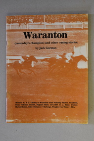
Book, Border Watch Pty Ltd, Waranton, 1986
... 72 Commercial Street East, Mount Gambier, South Australia, Australia ...This book by Jack Gorman contains articles on horse racing in Australia, and in particular, Victoria and the Western District in the 19th and 20th centuries. It includes articles on the 1891 Melbourne Cup, the Casterton Centenary Cup of 1961, the champion horse ‘Waranton’, hunting in the Casterton district, the 1922 Grand Annual Steeplechase at Warrnambool and many people associated with horse racing in the past. This book is retained as it contains articles on various horse races and people associated with horse racing of the past in the Western District of Victoria, including accounts of Warrnambool races. It will be a useful addition to our local history library. This is a soft cover book of 52 pages. The cover has brown and white colouring and has an image of the finish of a horse race and black printing. The pages contain printed material, black and white photographs and sketches. The book has been stapled but the staples have been removed.western district horse racing, grand annual steeplechase, history of warrnambool, casterton centenary cup, jack gorman -
 Ballarat Heritage Services
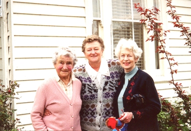
Photograph - Photograph - Colour, Josie Fitzgerald at her Koroit Home
... 13 Commercial Street, Koroit, Victoria, Australia ...Josie married Tom Fitzgerald.Josie Fitzgerald and her nieces Kathleen (Carroll) Gervasoni and Rosemary Carroll.josie fitzgerald, kathleen gervasoni, rosemary carroll, koroit -
 Sunshine and District Historical Society Incorporated
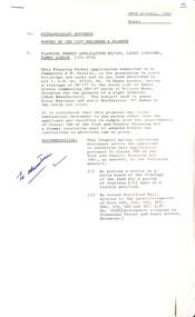
Administrative record - City of Sunshine - Commissioner Mr Alexander Alex George Gillon Collection 1976 - 1982 - Extraordinary business 28th October 1980, City of Sunshine, 28th October 1980
... ...Commercial Street...Extraordinary Business 28th October 1980 Report of the City Engineer & Planner Planning Permit Application Light Industry 14 Eames Avenue Brooklyn Planning Permit Application Extension to Existing School Mother of God Primary School Blanche Street Ardeer Planning Permit Application Light Industry Hot Bread Kitchen and Caretaker's Residence 9 Commercial Street Maidstone Planning Permit Application Transport Depot 552 Geelong Road Brooklyn Planning Permit Application Truck Wash Bay 552 Geelong Road Brooklyn Planning Permit Application Take Away Food Premises and Caretaker's Dwelling 288 Ballarat Road Braybrook Planning Permit Application Timber Yard Lot 9 Ballarat Road Sunshine Omar Street Maidstone Road Closure Report of the Building Surveyor Location of Buildings 9 Delamare Drive St. ...Eames Avenue Brooklyn Mother of God Primary School Blanche Street Ardeer Commercial Street Maidstone Geelong Road Ballarat Road Braybrook Sunshine Delamare Drive Belford Street St. ...Extraordinary Business 28th October 1980 Report of the City Engineer & Planner Planning Permit Application Light Industry 14 Eames Avenue Brooklyn Planning Permit Application Extension to Existing School Mother of God Primary School Blanche Street Ardeer Planning Permit Application Light Industry Hot Bread Kitchen and Caretaker's Residence 9 Commercial Street Maidstone Planning Permit Application Transport Depot 552 Geelong Road Brooklyn Planning Permit Application Truck Wash Bay 552 Geelong Road Brooklyn Planning Permit Application Take Away Food Premises and Caretaker's Dwelling 288 Ballarat Road Braybrook Planning Permit Application Timber Yard Lot 9 Ballarat Road Sunshine Omar Street Maidstone Road Closure Report of the Building Surveyor Location of Buildings 9 Delamare Drive St. Albans Location of Buildings 29 Hampshire Road Sunshine Building Over Easement 42 Belford Street St. Albans Building Over Easement12 - 14 Drummartin Street Albioneames avenue, brooklyn, mother of god primary school, blanche street, ardeer, commercial street, maidstone, geelong road, ballarat road, braybrook, sunshine, delamare drive, belford street, st. albans, hampshire road, drummartin street, albion -
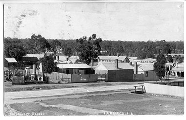 Tarnagulla History Archive
Photograph of Tarnagulla from Poverty Street, behind Bank, Tarnagulla from Poverty Street, behind Bank, Between 1886 and 1899
... street...commercial road...View of part of Commercial Road and Poverty Streets, Tarnagulla, from a position on Poverty Street behind the Bank site. ...Corner of Poverty Street and Commercial Road, Tarnagulla, Victoria, Australia...Commercial Rd and Poverty St, bakery stables and horse. Clouston's, Renshaw's Victoria House, Golden Age Hotel, Renshaw's Commerce House and Post Office. This is an original photographic postcard. tarnagulla commerce shops businesses streetscapes horses stables poverty street commercial road main street golden age hotel renshaw's bakery clouston's Text near bottom edge: 'Johnsn & Co. ...Murray Comrie Collection. Information collated by Murray Comrie: Photo after 1886 and before 1899. Shows bakers shop at corner of Commercial Rd and Poverty St, bakery stables and horse. Clouston's, Renshaw's Victoria House, Golden Age Hotel, Renshaw's Commerce House and Post Office. This is an original photographic postcard. Monochrome photographic postcard. View of part of Commercial Road and Poverty Streets, Tarnagulla, from a position on Poverty Street behind the Bank site. Premises on Commercial Road which are visible include the Golden Age Hotel and Renshaw's Drapers.Text near bottom edge: 'Johnsn & Co. Ararat' and 'Tarnagulla'.tarnagulla, commerce, shops, businesses, streetscapes, horses, stables, poverty street, commercial road, main street, golden age hotel, renshaw's, bakery, clouston's -
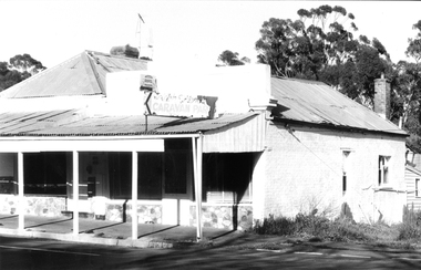 Tarnagulla History Archive
Photograph: Building on corner of Poverty Street and Commercial Road, Tarnagulla
... Photograph: Building on corner of Poverty Street and Commercial Road, Tarnagulla...Photograph: Building on corner of Poverty Street and Commercial Road, Tarnagulla Stokes & Son ...David Gordon Collection. -
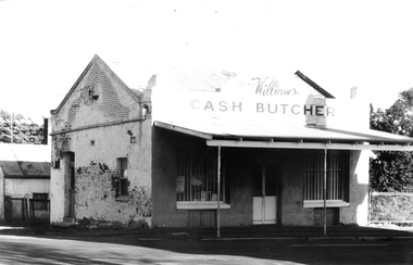 Tarnagulla History Archive
Photograph: Cash Butcher building on corner of Poverty Street and Commercial Road, Tarnagulla
... Photograph: Cash Butcher building on corner of Poverty Street and Commercial Road, Tarnagulla...Photograph: Cash Butcher building on corner of Poverty Street and Commercial Road, Tarnagulla Stokes & Son ...David Gordon Collection. -
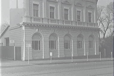 Allan Doney Collection, Bendigo Historical Society Inc.
Negative - View Street Bendigo - Commercial Bank, Allan Doney, 1950 -1970
... View Street Bendigo - Commercial Bank...Negative View Street Bendigo - Commercial Bank Allan Doney ...In the years of Allan Doney’s photography, landmark buildings succumbed to fire, neglect and redevelopment. He photographed the grey sand hills from Bendigo’s mining past, the streetscapes, poppet heads, miners’ cottages, gracious homes with ornate verandahs, trams and much more. Above all, his photographs show how much of the city has survived from the 19th century – and how much has not. Through two decades of great change, Allan Doney was there to capture ways people interacted with it. Although he travelled to many other places in Northern Victoria and beyond in search of subjects for his art, he seemed to always return to Bendigo for inspiration. -
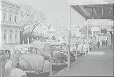 Allan Doney Collection, Bendigo Historical Society Inc.
Negative - View Street Bendigo - Commercial Bank, Allan Doney, 1950 -1970
... View Street Bendigo - Commercial Bank...Negative View Street Bendigo - Commercial Bank Allan Doney ...In the years of Allan Doney’s photography, landmark buildings succumbed to fire, neglect and redevelopment. He photographed the grey sand hills from Bendigo’s mining past, the streetscapes, poppet heads, miners’ cottages, gracious homes with ornate verandahs, trams and much more. Above all, his photographs show how much of the city has survived from the 19th century – and how much has not. Through two decades of great change, Allan Doney was there to capture ways people interacted with it. Although he travelled to many other places in Northern Victoria and beyond in search of subjects for his art, he seemed to always return to Bendigo for inspiration.
