
Showing 37 items matching "control tower"
-
 National Vietnam Veterans Museum (NVVM)
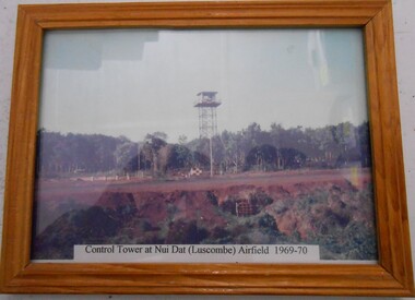
Photograph, Control Tower at Nui Dat Airfield
... Control Tower at Nui Dat Airfield......Control Tower...Framed colour Photograph of the Control Tower at Nui Dat (Luscombe) Airfield 1969-70...Photograph Nui Dat Luscombe Field Control Tower Nui Dat Airfield Framed colour Photograph of the Control Tower at Nui Dat (Luscombe) Airfield 1969-70 Control Tower at Nui Dat Airfield Photograph Photograph ...Framed colour Photograph of the Control Tower at Nui Dat (Luscombe) Airfield 1969-70photograph, nui dat, luscombe field, control tower, nui dat airfield -
 Ballarat Heritage Services
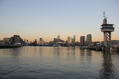
Digital photographs, L.J. Gervasoni, Yarra River Melbourne Docklands Port Control Tower, 2015
... Yarra River Melbourne Docklands Port Control Tower......control tower...yarra river melbourne docklands yarra river dock docklands shipping port channel water container port control tower control tower tower Digital Images Yarra River Melbourne Docklands Port Control Tower Digital photographs L.J. ...Digital Imagesyarra river melbourne docklands, yarra river, dock, docklands, shipping, port, channel, water, container, port control tower, control tower, tower -
 Royal Brighton Yacht Club
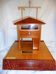
Model, High Flyer Series (Model of the Race Control Tower)
... High Flyer Series (Model of the Race Control Tower)...High Flyer Series (Model of the Race Control Tower) Donor: Graham Noel Tower Fleet Start Series is run in conjunction with the Artemis, Sprint and Stern Chaser Series and held from October to May. ...Merritt 2009/10 high flyer race tower phd tower start High Flyer Series (Model of the Race Control Tower) Model ...High Flyer Series (Model of the Race Control Tower) Donor: Graham Noel Tower Fleet Start Series is run in conjunction with the Artemis, Sprint and Stern Chaser Series and held from October to May. It is awarded to the PHD handicap winner, and extras are allowed. First Winner: Andaluca, W. Merritt 2009/10 high flyer, race tower, phd, tower start -
 Sunbury Family History and Heritage Society Inc.
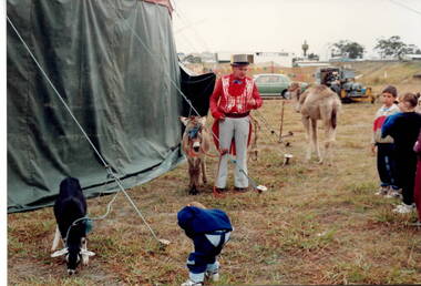
Photograph, Circus visit
... The students from Bulla Primary School were visiting a circus and the ringmaster was showing them a pony, a camel and goat which were some of the animals in the circus.The site chosen for the circus must have been near an airport as an air control tower is visible on the skyline....There are vehicles in the background and an air control tower is visible on the skyline. The circus was on land in the vicinity of Tullamarine Airport....There are vehicles in the background and an air control tower is visible on the skyline. The circus was on land in the vicinity of Tullamarine Airport. ...The students from Bulla Primary School were visiting a circus and the ringmaster was showing them a pony, a camel and goat which were some of the animals in the circus.The site chosen for the circus must have been near an airport as an air control tower is visible on the skyline.A non-digital coloured photograph of a circus ringmaster, who is holding a pony and talking to children about the donkey, the camel and the goat that are some of the circus animals. There are vehicles in the background and an air control tower is visible on the skyline. The circus was on land in the vicinity of Tullamarine Airport.circuses, bulla primary school, circus animals -
 Federation University Art Collection
Bookplate, [Untitled]
... Planes are depicted alongside what appears to be an air traffic control tower...The competition includes a design award for secondary schools students. bookplate printmaking australian bookplate design award keith wingrove memorial trust Name in pencil on back Trent Gregor Planes are depicted alongside what appears to be an air traffic control tower [Untitled] Bookplate ...After a quiet period, interest in bookplates in Australia began to increase in the early 1970s, Entrepreneurial art and book collectors such as Edwin Jewell and others commissioned multiple Bookplate designs from a range of well known fine artists. At a 1997 meeting in Melbourne of the Ephemera Society of Australia Edwin Jewell and others announced the formation of the Australian Bookplate Society. The society was instrumental in promoting the art of the bookplate through establishment of the Australian Bookplate Design competition. The competition includes a design award for secondary schools students.Planes are depicted alongside what appears to be an air traffic control towerName in pencil on back Trent Gregorbookplate, printmaking, australian bookplate design award, keith wingrove memorial trust -
 Federation University Art Collection
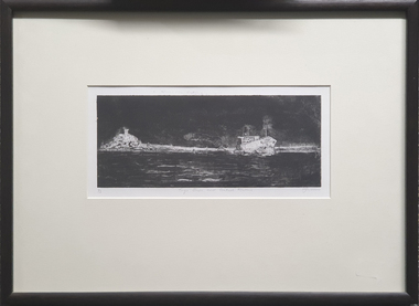
Print, Mary Wagenfield, Tugs, Ships and Control Towers, 2001
... LL 1/3 Centre Tugs Ships and Control Towers LR mgw2000...Tugs, Ships and Control Towers Print Mary Wagenfield ...Mary WAGENFIELDA tug boat pulling away from the land.LL 1/3 Centre Tugs Ships and Control Towers LR mgw2000available, ships, tug boat, port -
Moorabbin Air Museum
Book - AIR TRAFFIC CONTROL, Take Off To Touchdown The Story of Air Traffic Control
... ...Control tower...Air traffic control The coming of radio War years Post war boom Navigation & control aids Area control Control tower Operational control Control of a flight Search & rescue Men of ATC Phonetic alphabet Air traffic control terms Technical & general overview of air traffic control in Australia, circa 1967 Take Off To Touchdown The Story of Air Traffic Control Book AIR TRAFFIC CONTROL ...Technical & general overview of air traffic control in Australia, circa 1967non-fictionTechnical & general overview of air traffic control in Australia, circa 1967the coming of radio, war years, post war boom, navigation & control aids, area control, control tower, operational control, control of a flight, search & rescue, men of atc, phonetic alphabet, air traffic control terms -
Port Melbourne Historical & Preservation Society
Photograph - Ground work for new marina on south side of Yarra, Ron Laing, 1990s
... A set of 26 colour photographs covering the ground work for the new marina on the south side of the river below the new harbour control tower...Donated to the PMH&PS by the photographer. yarra river built environment ron laing A set of 26 colour photographs covering the ground work for the new marina on the south side of the river below the new harbour control tower Photograph Ground work for new marina on south side of Yarra Ron Laing ...Part of Ron Laing's collection of photographs recording Port Melbourne over a thirteen year period. Donated to the PMH&PS by the photographer.A set of 26 colour photographs covering the ground work for the new marina on the south side of the river below the new harbour control toweryarra river, built environment, ron laing -
 City of Kingston
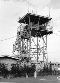
Photograph - Black and white, c. 1970
... Black and white photograph of the control tower at Moorabbin Airport. At the base of the tower is a single storey brick building with a wire fence at the running across the front....Moorabbin Airport Aviation Handwritten in black ink on reverse: 701 Handwritten in red ink on reverse: 100% Black and white photograph of the control tower at Moorabbin Airport. At the base of the tower is a single storey brick building with a wire fence at the running across the front. ...Moorabbin Airport was acquired in 1946 by a group of aviators and the Civil Aviation Department, Moorabbin Airport opened as a fully-functioning aerodrome in December 1949, chosen for its ideal location in the Market Gardens for an aviation base to be situated southeast of Melbourne. Black and white photograph of the control tower at Moorabbin Airport. At the base of the tower is a single storey brick building with a wire fence at the running across the front.Handwritten in black ink on reverse: 701 Handwritten in red ink on reverse: 100%moorabbin, airport, aviation -
 Nhill Aviation Heritage Centre
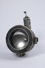
Memorabilia - Signalling lamp
... Type used on the RAAF Base by air crew and control tower operators....Type used on the RAAF Base by air crew and control tower operators. signal lamp lantern communication signals RAAF Ref No SA/760 Lantern portable signalling. ...Type used on the RAAF Base by air crew and control tower operators. Electric signalling lamp in grey metal casing, and hand grip with trigger at rear. Mount on top for sighting attachmentRAAF Ref No SA/760 Lantern portable signalling. Admiralty Pattern No 5110D. Serial No. 3901 Year 1942 Amalgamated Wireless A/SIA LTD signal lamp, lantern, communication, signals -
Tatura Irrigation & Wartime Camps Museum
Photograph, 1918
... Sugarloaf Reservoir construction 22/2/1918 / Round concrete control tower and the spillway under construction / Traction engine and pump under timber cover middle foreground / Mount Sugarloaf in background....Sugarloaf Reservoir construction 22/2/1918 / Round concrete control tower and the spillway under construction / Traction engine and pump under timber cover middle foreground / Mount Sugarloaf in background. ...Taken by photographer for State Rivers and Water Supply Commission.Medium sized black and white photograph. Sugarloaf Reservoir construction 22/2/1918 / Round concrete control tower and the spillway under construction / Traction engine and pump under timber cover middle foreground / Mount Sugarloaf in background.victorian state rivers and supply commission, sugarloaf reservoir -
Port Melbourne Historical & Preservation Society
Photograph - Port Melbourne's changing waterfront, Ron Laing, 1999
... A set of 34 colour photographs of Port Melbourne's changing waterfront, covering the old and new harbor control tower on Fishermens Bend, restoration of the outer beacon, reconstruction of the west wing of Station Pier, demolition of the concrete 'steps' breakwater at Port Melbourne, reconstruction of the foreshore - Sandridge Beach to Beacon Road...Donated to the PMH&PS by the photographer. built environment natural environment demolitions piers and wharves ron laing A set of 34 colour photographs of Port Melbourne's changing waterfront, covering the old and new harbor control tower on Fishermens Bend, restoration of the outer beacon, reconstruction of the west wing of Station Pier, demolition of the concrete 'steps' breakwater at Port Melbourne, reconstruction of the foreshore - Sandridge Beach to Beacon Road Photograph Port Melbourne's changing waterfront Ron Laing ...Part of Ron Laing's collection of photographs recording Port Melbourne over a thirteen year period. Donated to the PMH&PS by the photographer.A set of 34 colour photographs of Port Melbourne's changing waterfront, covering the old and new harbor control tower on Fishermens Bend, restoration of the outer beacon, reconstruction of the west wing of Station Pier, demolition of the concrete 'steps' breakwater at Port Melbourne, reconstruction of the foreshore - Sandridge Beach to Beacon Roadbuilt environment, natural environment, demolitions, piers and wharves, ron laing -
 Waverley RSL Sub Branch
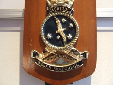
Plaque H.M.A.S. Albatross, H.M.A.S. Albatross
... More aircraft necessitated stricter standards of air traffic control and a new control tower was built in 1958. In 1964 the introduction of Wessex helicopters, with a dunking sonar capability, required a further expansion of services. ...More aircraft necessitated stricter standards of air traffic control and a new control tower was built in 1958. In 1964 the introduction of Wessex helicopters, with a dunking sonar capability, required a further expansion of services. ...In July 1947, the Commonwealth Defence Council approved the formation of a Fleet Air Arm which would be controlled and operated by the RAN. The initial planning included purchase of two aircraft carriers, aircraft and establishment of shore facilities. The carriers were named HMA Ships Sydney and Melbourne, and the shore facilities were at Nowra. HMAS Albatross was commissioned in August 1948 and the 20th Carrier Air Group, comprising Sea Fury and Firefly aircraft, was brought from England to Australia by HMAS Sydney. These aircraft, operated by 805 and 816 Squadrons, disembarked to Nowra in May 1949. In November 1950, they were joined by the Carrier Air Group of 808 and 817 Squadrons, also flying Sea Furies and Fireflies. HMAS Albatross has been expanding ever since. As more capable aircraft have been acquired, so ground support facilities have had to be built. In 1955, Sea Venoms and Gannets arrived, requiring radar workshops and test facilities. More aircraft necessitated stricter standards of air traffic control and a new control tower was built in 1958. In 1964 the introduction of Wessex helicopters, with a dunking sonar capability, required a further expansion of services. In 1965, it was decided to buy American aircraft to replace the ageing British Gannets and Sea Venoms. McDonnell Douglas Skyhawks and Grumman Trackers were chosenand additional avionics facilities were built to service the complex equipment they carried. The helicopters now based at HMAS Albatross have restored to the RAN much of the anti-submarine capability lost when the Tracker squadron was disbanded in 1983. In recent years significant redevelopment has taken place, continuing the operation of HMAS Albatross and recognising its strategic importance as the sole Royal Australian Navy Air Station.Wooden Plaque 15cm x 13cm with insignia of H.M.A.S. Albatross H.M.A.S. Albatross -
 Bendigo Military Museum
Photograph - Field Trip Preparations, AHQ Survey Regiment, 1960
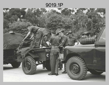
... Base camps were established at Camooweal for the traverse and Georgetown for the map control and annotation. Bilby towers were used on the coastal section of the EDM traverse, east and south of Borroloola. ...Base camps were established at Camooweal for the traverse and Georgetown for the map control and annotation. Bilby towers were used on the coastal section of the EDM traverse, east and south of Borroloola. ...Field Trip Preparations - Tellurometer traverse, Wyndham, Western Australia to Borroloola, Northern Territory 1960. This was a Tellurometer Traverse undertaken to establish 1st order EDM traverse (geodetic survey of Australia) from Mt Isa to Borroloola with airborne barometric altimetry in the Camooweal area. Followed by 1:250,000 map control by 4th order astro, airborne barometric altimetry and air photo annotation from Georgetown. Laplace Astro carried out as a separate activity from Camooweal, working north to Borroloola and east to Richmond. Also ‘Leap-frog’ barometer heighting from Croydon to Esmeralda closing on State BM at Croydon. Base camps were established at Camooweal for the traverse and Georgetown for the map control and annotation. Bilby towers were used on the coastal section of the EDM traverse, east and south of Borroloola. Vehicles used were Austin Champs (with Rolls Royce engines) and Humber one-ton trucks with Landrovers used for first time on a field trip. Other personnel included on the trip, but not exclusively are; Capt Clem Sargent, WO1 Des Moore, WO1 Ron Newman; Sgt Len Davies, Sgt Norm Vaughan, Sgt Joe Farrington (Laplace), Sgt Tony Slattery, Sgt John Van de Graaff (Laplace), Sgt Harry Wright (MT), Sgt Jack Waller (QM) Cpl Lou Sommer, Cpl Bob Skitch (later Sgt), Spr Don Cocker, Spr Ian Bryan, Spr Leo Bub, Spr Bruce Cockburn, Spr Pat Cox, Spr Jim Fitzhenry, Spr Bill Hills, Spr Noel Humphreys, Spr Dennis Woods, Spr Richard Jackson-Hope, Spr Bill Jeffery, Spr Andy Millar, Spr Dave Owen, Spr Blue Rogers, Spr Tom Royle, Spr Bob (Lofty) Thompson, Spr Peter Strandly and Spr Mick Symmons. This set of 6 photographs were taken in 1960 of preparations, prior to departure on a field trip to the Northern Territory by elements of the AHQ (Army) Survey Regiment under the command of Major Jim Stedman. Black and white photographs were scanned at 300 dpi. .1) - Photo, black & white, Unidentified personnel loading vehicles (Land Rovers) in preparation for Field trip. .2) - Photo, black & white, Unidentified personnel loading vehicles (Austin Champ front with Humber 1 ton at rear) in preparation for Field trip. .3) - Photo, black & white, Unidentified personnel loading vehicles (Austin Champ front with Humber 1 ton at rear) in preparation for Field trip. .4) - Photo, black & white, Unidentified personnel in a vehicle (Austin Champ preparing to depart on the Field trip. .5) - Photo, black & white, personnel on parade (MAJ Jim Stedman at left, WO1 Des Moore at right, others unidentified) prior to departing on the Field trip with new Land Rovers at back. .6) - Photo, black & white, Personnel on parade prior to departing on the Field trip. This photo is an enlarged, but clipped version of photo .5P. royal australian survey corps, rasvy, army survey regiment, army svy regt, asr, fortuna, field survey -
 Ballarat Heritage Services
Digital photograph, Dorothy Wickham, Tower of London, 2016
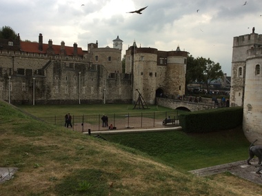
... The Tower of London has played a prominent role in English history. It was besieged several times, and controlling it has been important to controlling the country. ...The Tower of London has played a prominent role in English history. It was besieged several times, and controlling it has been important to controlling the country. ...The Tower of London, officially Her Majesty's Royal Palace and Fortress of the Tower of London, is a historic castle located on the north bank of the River Thames in central London. It lies within the London Borough of Tower Hamlets, separated from the eastern edge of the square mile of the City of London by the open space known as Tower Hill. It was founded towards the end of 1066 as part of the Norman Conquest of England. The White Tower, which gives the entire castle its name, was built by William the Conqueror in 1078, and was a resented symbol of oppression, inflicted upon London by the new ruling elite. The castle was used as a prison from 1100 (Ranulf Flambard) until 1952 (Kray twins),[3] although that was not its primary purpose. A grand palace early in its history, it served as a royal residence. As a whole, the Tower is a complex of several buildings set within two concentric rings of defensive walls and a moat. There were several phases of expansion, mainly under Kings Richard the Lionheart, Henry III, and Edward I in the 12th and 13th centuries. The general layout established by the late 13th century remains despite later activity on the site. The Tower of London has played a prominent role in English history. It was besieged several times, and controlling it has been important to controlling the country. The Tower has served variously as an armoury, a treasury, a menagerie, the home of the Royal Mint, a public record office, and the home of the Crown Jewels of England. From the early 14th century until the reign of Charles II, a procession would be led from the Tower to Westminster Abbey on the coronation of a monarch. In the absence of the monarch, the Constable of the Tower is in charge of the castle. This was a powerful and trusted position in the medieval period. In the late 15th century the castle was the prison of the Princes in the Tower. Under the Tudors, the Tower became used less as a royal residence, and despite attempts to refortify and repair the castle its defences lagged behind developments to deal with artillery. The peak period of the castle's use as a prison was the 16th and 17th centuries, when many figures who had fallen into disgrace, such as Elizabeth I before she became queen, Sir Walter Raleigh, and Elizabeth Throckmorton were held within its walls. This use has led to the phrase "sent to the Tower". Despite its enduring reputation as a place of torture and death, popularised by 16th-century religious propagandists and 19th-century writers, only seven people were executed within the Tower before the World Wars of the 20th century. Executions were more commonly held on the notorious Tower Hill to the north of the castle, with 112 occurring there over a 400-year period. In the latter half of the 19th century, institutions such as the Royal Mint moved out of the castle to other locations, leaving many buildings empty. Anthony Salvin and John Taylor took the opportunity to restore the Tower to what was felt to be its medieval appearance, clearing out many of the vacant post-medieval structures. In the First and Second World Wars, the Tower was again used as a prison, and witnessed the executions of 12 men for espionage. After the Second World War, damage caused during the Blitz was repaired, and the castle reopened to the public. Today the Tower of London is one of the country's most popular tourist attractions. Under the ceremonial charge of the Constable of the Tower, it is cared for by the charity Historic Royal Palaces and is protected as a World Heritage Site.(Wikipedia) A World Heritage Site is a landmark which has been officially recognized by the United Nations, specifically by UNESCO. Sites are selected on the basis of having cultural, historical, scientific or some other form of significance, and they are legally protected by international treaties. UNESCO regards these sites as being important to the collective interests of humanity. More specifically, a World Heritage Site is an already classified landmark on the earth, which by way of being unique in some respect as a geographically and historically identifiable piece is of special cultural or physical significance (such as either due to hosting an ancient ruins or some historical structure, building, city, complex, desert, forest, island, lake, monument, or mountain) and symbolizes a remarkable footprint of extreme human endeavour often coupled with some act of indisputable accomplishment of humanity which then serves as a surviving evidence of its intellectual existence on the planet. And with an ignoble intent of its practical conservation for posterity, but which otherwise could be subject to inherent risk of endangerment from human or animal trespassing, owing to unmonitored/uncontrolled/unrestricted nature of access or threat by natural or accelerated extinction owing to local administrative negligence, hence it would have been listed and demarcated by the United Nations Educational, Scientific and Cultural Organization (UNESCO) to have been identified or recognised and officially christened and internationally elevated through multilateral declaration by UNESCO as a universally protected zone. [1] The list is maintained by the international World Heritage Programme administered by the UNESCO World Heritage Committee, composed of 21 UNESCO member states which are elected by the General Assembly. (Wikipedia)The Tower of London is a UNESCO world heritage site.tower of london -
 Flagstaff Hill Maritime Museum and Village
Document - Plans, Lighthouse Keeper's Quarters Warrnambool, 1858-1909
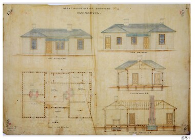
... tower, the Lower Light is square. The Lighthouses were categorised as harbour lights rather than coastal lights, so they remain under the control of the Victorian Government’s Ports and Harbours section. ...tower, the Lower Light is square. The Lighthouses were categorised as harbour lights rather than coastal lights, so they remain under the control of the Victorian Government’s Ports and Harbours section. ...The set of seven 1858 plans shows proposed plans for the original Lighthouse Complex that was built on Middle Island in 1858-1859. The whole complex was then transferred to Flagstaff Hill in 1871. The plan, dated 1909, is for proposed additions and repairs to the Quarters at Flagstaff Hill. The plan 'Alterations and Additions' shows alternate plans for changes to the quarters at the Flagstaff Hill location. This plan has no date. The Complex comprised the Lighthouse, the Lighthouse Keepers’ Quarters, the Store (now called the Chart Room) and a Privy, which was not included in these plans. The Keeper’s bluestone Quarters was a cottage divided into two compartments, one for each keeper and his family. The bluestone Store was divided into three; a store, a workshop an oil store (or office). The Privy comprised of a small building also divided into two separate, back-to-back toilets, one for each Keeper and his family. The Flagstaff Hill Keeper's Quarters have had extensions and additions at various times, and these have also been removed at various other times. THE PLANS - *Dec. 1858 (12/58) ‘Lighthouse Keepers Quarters No.2 Warrnambool’ (2375.01)* Public Works Office Melbourne – Front and Back elevations, sections, and floor plan. The drawing shows timber walls. [The floor plan is the closest plan to the current building, however, the walls are timber in this plan.] *Nov. 1858 – No.3 ‘Lighthouse Keepers Quarters Warrnambool’ (2375.02)* Office of Public Works, Melbourne – Back and End elevations and section through. The drawing shows stone walls. One side; Senior Keeper’s bedroom, living room and kitchen with storeroom. Another side; is the Assistant’s bedroom, living room and storeroom. *Nov. 1858 - No.4 ‘Lighthouse Stores Warrnambool’ (2375.03)* Office of Public Works – Front, Side and end elevations, centre section. The drawing shows stone walls. *Nov. 1858 – No.4, ‘Lighthouse Stores No. 2 Warrnambool’ (2375.04)* Office of Public Works – Front, side and end elevations, centre section. The drawing shows timber walls. *Nov. 1858 – ‘Details Lighthouse Keepers Quarters No. 2 Warrnambool’ (2375.05)* Public Works Office Melbourne. The plan shows the foundations, joists and eaves. The drawing shows timber walls. (Nov. 1858 – ‘No.4 ‘Lighthouse No. 2 – Warrnambool’ (2375.06)* Public Works Melbourne (Part of the paper is missing). This plan shows an octagonal tower, internal stairs, a balcony landing, and a weather vane on top. *November 1858 – No. 1, ‘Lighthouse – Warrnambool’ (2375.07)* Office of Public Works Melbourne. This plan shows a round tower, including the stairs, windows on the tower and the weather vane on the top. *4/3/9 [1909] – ‘Additions and Repairs, Lighthouse Quarters, Warrnambool, General Plan’ (2375.8)* Department of Public Works Melbourne’s official stamp is signed by Croft. It shows the floor plans of the Store, Upper Lighthouse and the Quarters. The Store building has three sections; a Store, Work-Shop and Office, with an internal wall between them and separate entries. The Quarters are divided into two dwellings. The Senior Keeper’s side on the left has fireplaces in two of the three bedrooms and there is a pantry and wash house. The Assistant’s side has no fireplaces in the bedrooms and there’s no pantry or washhouse. These plans include proposed changes to the buildings. The Senior Keeper’s Quarters would have a partition on bedroom 2, a bath with plumbing and drainage, a wall moved and a built-in side porch. The Store would also have a built-in porch. The undated plan 'Additions and Alterations' (2375.9) shows alternative arrangements for water tanks, plumbing and such. WARRNAMBOOL'S LADY BAY LIGHTHOUSES- In the 1800s ships sailing from England to Australia began to use Bass Strait as a faster route to Melbourne. Small navigation errors led to many tragic shipwrecks. From 1848 lighthouses were operating along Victoria’s southern coast as a guide for sailors. Coastal towns such as Warrnambool grew and the exchange of trade and passengers were of great benefit. However, the uncertain weather changes, relatively shallow waters and treacherous, hidden rocky reefs were not suitable for a Harbour and in the 1840s and 1850s there were many shipwrecks in the area, with some even stranded in its Lady Bay harbour. A jetty was built in 1850 and a flagstaff to guide seafarers was placed up high on what became known now as Flagstaff Hill. In November 1857 the Victorian Government recommended that Warrnambool Harbour had beacons and two lighthouses to guide vessels into and out of the Harbour safely. The white light of the Middle Island lighthouse was to be used for the first time on September 1, 1859. The red light of the Beach Lighthouse, a wooden obelisk structure, was first operated on March 25, 1860, but in 1868 this light was ‘discontinued’ due to it being too low. Melbourne’s Department of Public Works decided to relocate the Middle Island Lighthouse Complex - Lighthouse, Keeper’s Quarters, Privy, Store Room and even water tanks - to Flagstaff Hill. The lower obelisk was shortened, and a protruding gallery, railing, and external ladder were added, as well as the light from the Beach Lighthouse. A green guiding light was erected on the end of the jetty. The transfer of the Complex began in March 1871. Each shaped stone of the lighthouse was carefully numbered, removed then reassembled on Flagstaff Hill. In 1872 the well was sunk behind the Lighthouse Keeper’s Cottage. The Keepers and families had left Middle Island in April and moved to Flagstaff Hill in October 1871. Vessels entering Lady Bay align the Upper and Lower Lighthouse towers during the day and the lights at night. The Upper Lighthouse is a round tower, the Lower Light is square. The Lighthouses were categorised as harbour lights rather than coastal lights, so they remain under the control of the Victorian Government’s Ports and Harbours section. The lights were originally powered by oil, then acetylene gas, later by electricity, and then converted to solar power in 1988. In 1993 the solar panel was replaced by a battery charger. A decision was made in 1936 to replace the lighthouses’ lights with unattended lights that no longer required Keepers and Assistants. At least 29 Keepers had attended to the lighthouse from its opening in 1859 to when the last official Lightkeepers left In April 1916. The Warrnambool Harbour Board rented out the Quarters from 1916 to 1936. The Board closed down but the rentals continued with other unknown landlords. In the 1970s the Flagstaff Hill Planning Board was set up under the chairmanship of John Lindsay. The Board was to make recommendations to the Warrnambool City Council regarding the use of the buildings and the rest of the Crown Land on the site. The Flagstaff Hill Maritime Village opened in 1975 and began renovating the Cottage in stages, during which time evidence of a 1920s fire was found in the eastern section of the cottage. Additions of a porch on the west and a washroom on the east were made in the 1980s. The western part of the building is now a Shipwreck Museum and the east has returned to a late 19th-century Lighthouse Keeper’s cottage and includes the screen made by Assistant Lighthouse Keeper Thomas Hope during one of his two periods of service there. THE LIGHTHOUSE KEEPERS Lighthouse Keepers were responsible for keeping their Lighthouse’s lights shining at night. They kept a lookout for passing vessels and changes in weather. They were expected to clean, polish and maintain the equipment and buildings. They kept regular and detailed records of who was on watch, and the time the light was lit, trimmed and extinguished. They kept a journal about other events that occurred. They keep regular, accurate Meteorological Logs. It was expected that they were competent in Morse code signalling. They would be called to help in times of disasters and shipwrecks, and to give official statements about these events. Many Lighthouse Keepers also volunteered as members of the lifeboat crew. The Lady Bay lighthouses were officially classified as small, so the Keepers had the official titles of Senior Assistant Lighthouse Keeper and Assistant Lighthouse Keeper. They were employed by the Public Service and paid rent to live in the Lighthouse Quarters. They were compulsorily retired at the age of 60, with most receiving a superannuation payment. Despite their time-consuming duties, there was time to follow hobbies and crafts such as growing vegetables, playing musical instruments, making models of buildings including lighthouses, and crafting furniture pieces. An example of a keeper’s skills is the carved fire screen made by /assistant Keeper Thomas Hope in the early 20th century and displayed in the Lighthouse Keeper’s cottage at Flagstaff Hill. The last occupants of the Middle Island Complex were Senior Keeper Robert Deverell, his Assistant Keeper, Andrew Farncombe, and their families. They all became the first occupants at the Lady Bay Lighthouse Keepers’ Quarters on Merri Street. The Warrnambool Lighthouse Complex plans are the origin of what is now the Lady Bay Lighthouse Complex. They are a record of the people, process and departments involved in bringing the complex into fruition. The plans are significant to the Complex, which is now listed on the Victorian Heritage Register, H1520, for being of historical, scientific (technological) and architectural significance to the State of Victoria. The Complex is significant as an example of early colonial development. The plan are significant for their connection with the important navigational function of the Lighthouses, a function still being performed to this day. The plans are also significant as an example of a product from the Public Works Department in Victoria in the mid-to-late 19th century. The structures built to these plans still stand strong. Plans for the Lighthouse Complex in Warrnambool, including Lighthouses, Keeper's Quarters and Stores. Seven of the plans are on thin fragile paper, one is on thicker, stronger paper. The drawings have been made in pens coloured red and black. They originate from Public Works in Melbourne. Seven were drawn in 1858, one in 1904, the other is not dated.Dec. 1858 - Lighthouse Keepers Quarters No.2 Warrnambool. Public Works Office Melbourne. Nov. 1858 - No.3 ‘Lighthouse Keepers Quarters Warrnambool. Public Works Office Melbourne. Nov. 1858 - No.4 ‘Lighthouse Stores Warrnambool. Office of Public Works. Nov. 1858 - No.4, ‘Lighthouse Stores No. 2 Warrnambool. Office of Public Works. Nov. 1858 - Details Lighthouse Keepers Quarters No. 2 Warrnambool. Public Works Office Melbourne. Nov. 1858 - No.4 ‘Lighthouse No. 2 – Warrnambool. Public Works Melbourne. Nov. 1858 - No. 1, Lighthouse - Warrnambool. Office of Public Works Melbourne. 4/3/9 [1909] - Additions and Repairs, Lighthouse Quarters, Warrnambool, General Plan. Department of Public Works Melbourne. SIGNED "Croft" "15A" on reverse [no date] - Lighthouse Quarters Warrnambool, Additions and Alterations. "9A" on reverseflagstaff hill, warrnambool, lighthouse keeper's cottage, lighthouse residence, lighthouse, plans, public works, melbourne, flagstaff hill maritime museum, maritime museum, shipwreck coast, flagstaff hill maritime village, chart room, quarters, privy, middle island, beach lighthouse, obelisk, lighthouse keeper, assistant keeper, lighthouse complex, lady bay, lady bay complex, keepers, upper lighthouse, lower lighthouse, ports and harbours, cottage, harbour board, flagstaff hill planning board, meteorological record, robert deverell, andrew farncombe, warrnambool port, warrnambool harbour, residence, alterations, repairs, department of works, light keeper -
 Flagstaff Hill Maritime Museum and Village
Photograph - Historical, building, Late 19th to early 20th century
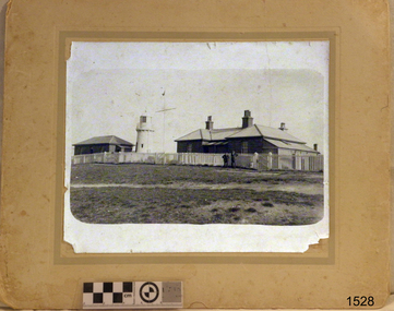
... tower, and the Lower Light is square. The Lighthouses were categorised as harbour lights rather than coastal lights, so they remain under the control of the Victorian Government’s Ports and Harbours section. ...tower, and the Lower Light is square. The Lighthouses were categorised as harbour lights rather than coastal lights, so they remain under the control of the Victorian Government’s Ports and Harbours section. ...The black and white photograph depicts the Lady Bay Lighthouse Complex at Flagstaff Hill, Warrnambool. It was opened on this site in 1871. From left to right, the Chartroom (previously named the Store), Upper Lighthouse, Flagstaff, Lighthouse Keeper's Quarters. The bluestone buildings are facing North on Merri Street. The Harbour Pilot's Lodgings were on the east of the Complex. There are two unknown male figures standing in front of the light-coloured picket fence that encompasses the Complex. The photograph is mounted on card. WARRNAMBOOL'S LADY BAY LIGHTHOUSES In the 1800s ships sailing from England to Australia began to use Bass Strait as a faster route to Melbourne. Small navigation errors led to many tragic shipwrecks. From 1848 lighthouses were operating along Victoria’s southern coast as a guide for sailors. Coastal towns such as Warrnambool grew and the exchange of trade and passengers was of great benefit. However, the uncertain weather changes, relatively shallow waters and treacherous, hidden rocky reefs were not really suitable for a Harbour and in the 1840s and 1850s, there were many shipwrecks in the area, with some even stranded in its Lady Bay harbour. A jetty was built in 1850 and a flagstaff to guide seafarers was placed up high on what became known now as Flagstaff Hill. In November 1857 the Victorian Government recommended that Warrnambool Harbour had beacons and two lighthouses to guide vessels into and out of the Harbour safely. The white light of the Middle Island lighthouse was to be used for the first time on September 1, 1859. The red light of the Beach Lighthouse, a wooden obelisk structure, was first operated on March 25, 1860, but in 1868 this light was ‘discontinued’ due to it being too low. Melbourne’s Department of Public Works decided to relocate the Middle Island Lighthouse Complex - Lighthouse, Keeper’s Quarters, Privy, Store Room and even water tanks - to Flagstaff Hill. The lower obelisk was shortened, and a protruding gallery, railing, and external ladder were added, and the light from the Beach Lighthouse. A green guiding light was erected on the end of the jetty. The transfer of the Complex began in March 1871. Each shaped stone of the lighthouse was carefully numbered, removed then reassembled on Flagstaff Hill. In 1872 the well was sunk behind the Lighthouse Keeper’s Cottage. The Keepers and families had left Middle Island in April and moved to Flagstaff Hill in October 1871. Vessels entering Lady Bay align the Upper and Lower Lighthouse towers during the day and the lights at night. The Upper Lighthouse is a round tower, and the Lower Light is square. The Lighthouses were categorised as harbour lights rather than coastal lights, so they remain under the control of the Victorian Government’s Ports and Harbours section. The lights were originally powered by oil, then acetylene gas, later by electricity, and then converted to solar power in 1988. In 1993 the solar panel was replaced by a battery charger. A decision was made in 1936 to replace the lighthouses’ lights with unattended lights that no longer required Keepers and Assistants. At least 29 Keepers had attended to the lighthouse from its opening in 1859 to when the last official Lightkeepers left In April 1916. The Warrnambool Harbour Board rented out the Quarters from 1916 to 1936. The Board closed down but the rentals continued with other unknown landlords. In the 1970s the Flagstaff Hill Planning Board was set up under the chairmanship of John Lindsay. The Board was to make recommendations to the Warrnambool City Council regarding using the buildings and the rest of the Crown Land on the site. The Flagstaff Hill Maritime Village opened in 1975 and began renovating the Cottage in stages, during which time evidence of a 1920s fire was found in the eastern section of the cottage. Additions of a porch on the west and a washroom on the east were made in the 1980s. The western part of the building is now a Shipwreck Museum and the east has returned to a late 19th-century Lighthouse Keeper’s cottage and includes the screen made by Assistant Lighthouse Keeper Thomas Hope in the late 19th century. He served as Assistant Keeper in Warrnambool for two periods.The Warrnambool Lighthouse Complex is now listed on the Victorian Heritage Register, H1520, for being of historical, scientific (technological) and architectural significance to the State of Victoria. The Complex is significant as an example of early colonial development. The buildings are significant for their connection with the important navigational function of the Lighthouses, a function still being performed to this day. The buildings are also significant as an example of structures designed and works carried out by the Public Works Department in Victoria in the mid-to-late 19th century. The structures still stand strong. Photograph; Warrnambool Lighthouse Keeper's cottage, lighthouse, flagstaff and chartroom at Flagstaff Hill, and a light-coloured picket fence with gate. Two male figures are in front of the fence. Black and white print glued to a yellow card. The inscription is indecipherable. The right side of the cottage has a built-in, enclosed addition.Ink stamped in lower right hand corner, too faded to be legible.flagstaff hill, flagstaff hill maritime museum, flagstaff hill maritime village, warrnambool, maritime museum, shipwreck coast, lighthouse keeper's cottage, lighthouse residence, lighthouse, chart room, quarters, privy, middle island, beach lighthouse, obelisk, lighthouse complex, lady bay complex, warrnambool port, warrnambool harbour, lady bay, keepers, lighthouse keeper, upper lighthouse, lower lighthouse, assistant keeper, ports and harbours, cottage, light keeper -
Marysville & District Historical Society
THE TRIANGLE NEWS-VOL 42 NO 2-JANUARY 23 2015
... control...marysville triangle real estate...buxton's multiplying rabbit population...buxton recreation reserve committee of management general meeting...emotions anonymous international meeting...australia day activities in marysville...celebrate australia day in murrindindi shire...access murrindindi project...australia day long weekend tower...marysville victoria australia an update on evie table tennis comes to the triangle what's on when in january triangle community dinner the committee of management of the gallipoli park precinct creative triangle evie gleeson donations marysville golfers play well in foodworks murrindindi masters at yea church notices adventurous cooks mayor's chair cr margaret rae taggerty 4 seasons summer market murrindindi shire harmony day change to learner permit testing day marysville & triangle community men's shed mindfulness in marysville advertisements happy 80th birthday bob emblin buxton bootcamp save lives together all for evie australia day street stall parks victoria fox control marysville triangle real estate buxton's multiplying rabbit population buxton recreation reserve committee of management general meeting emotions anonymous international meeting australia day activities in marysville celebrate australia day in murrindindi shire access murrindindi project australia day long weekend tower motel THE TRIANGLE NEWS-VOL 42 NO 2-JANUARY 23 2015 ...marysville, victoria, australia, an update on evie, table tennis comes to the triangle, what's on when in january, triangle community dinner, the committee of management of the gallipoli park precinct, creative triangle, evie gleeson donations, marysville golfers play well in foodworks murrindindi masters at yea, church notices, adventurous cooks, mayor's chair cr margaret rae, taggerty 4 seasons summer market, murrindindi shire harmony day, change to learner permit testing day, marysville & triangle community men's shed, mindfulness in marysville, advertisements, happy 80th birthday bob emblin, buxton bootcamp, save lives together all for evie, australia day street stall, parks victoria, fox control, marysville triangle real estate, buxton's multiplying rabbit population, buxton recreation reserve committee of management general meeting, emotions anonymous international meeting, australia day activities in marysville, celebrate australia day in murrindindi shire, access murrindindi project, australia day long weekend tower motel -
 Flagstaff Hill Maritime Museum and Village
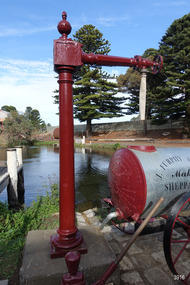
Functional object - Water standpipe, Langlands Bros. & Co, 1880-1893
... Warrnambool flagstaff hill maritime museum maritime museum shipwreck coast flagstaff hill maritime village great ocean road Flagstaff Hill Standpipe Stand-pipe Water standpipe Fire standpipe Firefighting equipment Water supply equipment Chinese Market Gardens Banyan Street Liebig Street Water tower Bateman’s fire Working display Water supply Town water Rural water Reticulated water Cannon Hill spring Merri River Otway water Water carters Horse and cart water supply Volunteer fire brigade Langlands Foundry Early Melbourne Iron works Bob Crossman Late 19th century water supply Embossed “LANGLANDS FOUNDRY CO. / LIMITED / ENGINEERS / MELBOURNE” Standpipe; vertical cast iron water pipe, painted crimson, fixed in position, tapering inward from the round base to the rectangular joint near the finial on top. A hexagonal pipe extends at right angles from the joint, with an outlet fitting and flow-controlling ...This water standpipe is believed to be the only one of its kind in working order. It was originally located in Warrnambool, on the hillside at the corner of Mickle Crescent and Banyan Street, providing water for the Chinese Market Gardens below, on the flats. It was removed from this location on May 2nd, 1979, with the intention to relocate it at the new Flagstaff Hill Maritime Museum & Village. The standpipe lay in storage for years until the Warrnambool Company, Chemblast, offered to restore it for use as a working display. The display was officially opened on March 31, 2014. The water from the adjacent lake is drawn out with a hand operated water pump, and goes up into the standpipe, where flows through the canvas hose and into the top of the Furphy Farm Water Cart. The display is a visual acknowledgement of the years served by Flagstaff Hill volunteer and Friends of Flagstaff Hill Chairperson, Bob Crossman. Warrnambool’s early settlers had no water supply prior to the mid-1850s. They relied on rain water tanks, domestic wells and springs. The town experienced a huge, destructive fire in William Bateman Jnr. & Co.’s large produce store in November 1856, which highlighted the need for both a fire brigade and a good supply of water. In 1863 a volunteer fire brigade was established. In August 1880 the town celebrated the installation of its first water standpipe on the corner of Liebig and Timor streets. The water was pumped from springs at Cannon Hill through the connected pipeline to the standpipe, then distributed to households via horse and cart. Each of the licenced cart drivers were compelled by Council regulations to keep their carts full from sunset to sunrise, ready to cart water to outbreaks of fire. They received a fee for this service. In 1893 the town installed a water supply, sourced from the Merri River, stored in a reservoir basin and tower in north Liebig Street, and distributed throughout the town in a system of pipes. By late 1939 a reticulated supply was installed, with the water piped in under the Otway Scheme. Standpipes are still used in modern times in rural and remote areas for homes, farms, stock, agriculture and firefighting. Many commercial or government owned standpipes are metered, charging a fee for the quantities of water supplied. This water standpipe was made by Langlands Foundry Co. Limited, Melbourne, which was establish in 1842. It was Melbourne’s first foundry and iron shipbuilder, and one of the largest employers in Victoria at the time. Langlands was known for its high quality workmanship and wide range of goods for mining, engineering, marine, railway and other industrial uses. The company made the first cast bell, the first lamp posts in the colony, and the boiler for the first Australian train. In the 1860s it produced cast iron pipes for the Board of Works, which laid the pipes for Melbourne’s first reticulated water supply. The firm was bought by Austral Otis Co. in 1897.This water standpipe is significant historically as it is believed to be the only one of its type in working condition. The standpipe is significant for being manufactured by early colonial firm Langlands Foundry of Melbourne, which was known for high quality, cast iron products. The firm made the boiler for the first Australian train, assembled the first Australian paddle steamer and made the first Australian cast bell and lamp posts. Langlands was one of the largest employers in Victoria at the time. The standpipe is significant historically as it represents the evolution of water supply services in Australia. Standpipe; vertical cast iron water pipe, painted crimson, fixed in position, tapering inward from the round base to the rectangular joint near the finial on top. A hexagonal pipe extends at right angles from the joint, with an outlet fitting and flow-controlling wheel on the end. A length of canvas hose hangs from the outlet fitting. Inscriptions are on one face of the joint. The standpipe was made by Langlands Foundry Company of Melbourne. Embossed “LANGLANDS FOUNDRY CO. / LIMITED / ENGINEERS / MELBOURNE”warrnambool, flagstaff hill maritime museum, maritime museum, shipwreck coast, flagstaff hill maritime village, great ocean road, flagstaff hill, standpipe, stand-pipe, water standpipe, fire standpipe, firefighting equipment, water supply equipment, chinese market gardens, banyan street, liebig street, water tower, bateman’s fire, working display, water supply, town water, rural water, reticulated water, cannon hill spring, merri river, otway water, water carters, horse and cart water supply, volunteer fire brigade, langlands foundry, early melbourne, iron works, bob crossman, late 19th century water supply -
Glenelg Shire Council Cultural Collection
Photograph - Photograph - Cliffs between Whaler's Bluff and the Water Tower, n.d
... Port of Portland Authority Archives Port of Portland Archives cliffs Water Tower Front: Biro line ruled horizontally, inersecting with a ruled biro vertical. P.H.T control on horizontal line in biro. ...Port of Portland Authority ArchivesFront: Biro line ruled horizontally, inersecting with a ruled biro vertical. P.H.T control on horizontal line in biro.port of portland archives, cliffs, water tower -
 Greensborough Historical Society
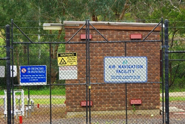
Photograph - Digital Image, Air Navigation Facility, Montmorency, 2018, 1930s
... tower and brick building surrounded by wire fences. It is sited in parkland at the end of Palara Court close to the Plenty River Trail. Warning signs are placed on the fences, including: "This facility is provided for the control and guidance of aircraft"....tower and brick building surrounded by wire fences. It is sited in parkland at the end of Palara Court close to the Plenty River Trail. Warning signs are placed on the fences, including: "This facility is provided for the control and guidance of aircraft". air navigation facility air control palara court montmorency Digital copy of colour photograph Air Navigation Facility, Montmorency, 2018 Photograph - Digital Image ...Air Navigation Facility, Palara Court Montmorency, is made up of a tower and brick building surrounded by wire fences. It is sited in parkland at the end of Palara Court close to the Plenty River Trail. Warning signs are placed on the fences, including: "This facility is provided for the control and guidance of aircraft".Digital copy of colour photographair navigation facility, air control, palara court montmorency -
 Greensborough Historical Society
Photograph - Digital Image, Marilyn Smith, Air Navigation Facility, Montmorency, 2018. Long view, 04/12/2018
... tower and brick building surrounded by wire fences. It is sited in parkland at the end of Palara Court close to the Plenty River Trail. Warning signs are placed on the fences, including: "This facility is provided for the control and guidance of aircraft"....tower and brick building surrounded by wire fences. It is sited in parkland at the end of Palara Court close to the Plenty River Trail. Warning signs are placed on the fences, including: "This facility is provided for the control and guidance of aircraft". air navigation facility air control palara court montmorency Digital copy of colour photographs Air Navigation Facility, Montmorency, 2018. ...Air Navigation Facility, Palara Court Montmorency, is made up of a tower and brick building surrounded by wire fences. It is sited in parkland at the end of Palara Court close to the Plenty River Trail. Warning signs are placed on the fences, including: "This facility is provided for the control and guidance of aircraft".Digital copy of colour photographsair navigation facility, air control, palara court montmorency -
 Greensborough Historical Society
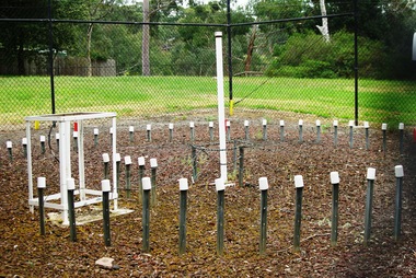
Photograph - Digital Image, Marilyn Smith, Air Navigation Facility, Montmorency, 2018. Close up, 04/12/2018
... tower and brick building surrounded by wire fences. It is sited in parkland at the end of Palara Court close to the Plenty River Trail. Warning signs are placed on the fences, including: "This facility is provided for the control and guidance of aircraft"....tower and brick building surrounded by wire fences. It is sited in parkland at the end of Palara Court close to the Plenty River Trail. Warning signs are placed on the fences, including: "This facility is provided for the control and guidance of aircraft". air navigation facility air control palara court montmorency Digital copy of colour photograph Air Navigation Facility, Montmorency, 2018. ...Air Navigation Facility, Palara Court Montmorency, is made up of a tower and brick building surrounded by wire fences. It is sited in parkland at the end of Palara Court close to the Plenty River Trail. Warning signs are placed on the fences, including: "This facility is provided for the control and guidance of aircraft".Digital copy of colour photographair navigation facility, air control, palara court montmorency -
 Greensborough Historical Society
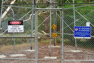
Photograph - Digital Image, Marilyn Smith, Air Navigation Facility, Montmorency, 2018. Signs at tower, 04/12/2018
... tower and brick building surrounded by wire fences. It is sited in parkland at the end of Palara Court close to the Plenty River Trail. Warning signs are placed on the fences, including: "This facility is provided for the control and guidance of aircraft". ...This photograph shows signs at tower. air navigation facility air control palara court montmorency Digital copy of colour photograph Air Navigation Facility, Montmorency, 2018. ...Air Navigation Facility, Palara Court Montmorency, is made up of a tower and brick building surrounded by wire fences. It is sited in parkland at the end of Palara Court close to the Plenty River Trail. Warning signs are placed on the fences, including: "This facility is provided for the control and guidance of aircraft". This photograph shows signs at tower.Digital copy of colour photographair navigation facility, air control, palara court montmorency -
 Greensborough Historical Society
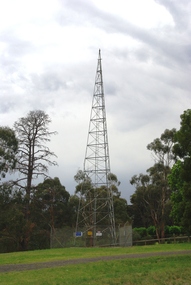
Photograph - Digital Image, Marilyn Smith, Air Navigation Facility, Montmorency, 2018. Tower, 04/12/2018
... tower and brick building surrounded by wire fences. It is sited in parkland at the end of Palara Court close to the Plenty River Trail. Warning signs are placed on the fences, including: "This facility is provided for the control and guidance of aircraft". ...This photograph shows the tower on the site. air navigation facility air control palara court montmorency Digital copy of colour photographs Air Navigation Facility, Montmorency, 2018. ...Air Navigation Facility, Palara Court Montmorency, is made up of a tower and brick building surrounded by wire fences. It is sited in parkland at the end of Palara Court close to the Plenty River Trail. Warning signs are placed on the fences, including: "This facility is provided for the control and guidance of aircraft". This photograph shows the tower on the site.Digital copy of colour photographsair navigation facility, air control, palara court montmorency -
 Ringwood and District Historical Society
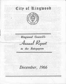
Pamphlet, F.P. Dwerryhouse, Town Clerk and Treasurer, Ringwood Council's Annual Report To The Ratepayers - December 1966, 1966
... City of Ringwood community information annual report for 1966, including sections covering Finance, Sanitary Service Charge, Municipal Library, Memorial Clock Tower, Reserves, Civic Centre, Maroondah Highway Reconstruction, Other Road Works, Building Activity and Development - Education, MacRobertsons Pty. Ltd. & Travellers' Facilities (Ringwood Station), Appreciation - Decimal Currency Conversion, Annual Special Clearance of Refuse, Garbage Removal, Fly Control, Immunisations, Infant Welfare Centres, Retention of Native Flora, Home Help Service, Dogs, Horse Riding, Fire Hazards and Burning Off, Secondary School Grants, and list of Council Representatives....rinx City of Ringwood community information annual report for 1966, including sections covering Finance, Sanitary Service Charge, Municipal Library, Memorial Clock Tower, Reserves, Civic Centre, Maroondah Highway Reconstruction, Other Road Works, Building Activity and Development - Education, MacRobertsons Pty. Ltd. & Travellers' Facilities (Ringwood Station), Appreciation - Decimal Currency Conversion, Annual Special Clearance of Refuse, Garbage Removal, Fly Control, Immunisations, Infant Welfare Centres, Retention of Native Flora, Home Help Service, Dogs, Horse Riding, Fire Hazards and Burning Off, Secondary School Grants, and list of Council Representatives. ...City of Ringwood community information annual report for 1966, including sections covering Finance, Sanitary Service Charge, Municipal Library, Memorial Clock Tower, Reserves, Civic Centre, Maroondah Highway Reconstruction, Other Road Works, Building Activity and Development - Education, MacRobertsons Pty. Ltd. & Travellers' Facilities (Ringwood Station), Appreciation - Decimal Currency Conversion, Annual Special Clearance of Refuse, Garbage Removal, Fly Control, Immunisations, Infant Welfare Centres, Retention of Native Flora, Home Help Service, Dogs, Horse Riding, Fire Hazards and Burning Off, Secondary School Grants, and list of Council Representatives.rinx -
 Ringwood and District Historical Society
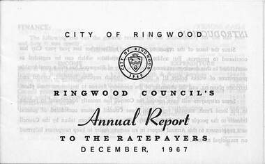
Pamphlet, F.P. Dwerryhouse, Town Clerk and Treasurer, Ringwood Council's Annual Report To The Ratepayers - December 1967, 1967
... City of Ringwood community information annual report for 1966, including sections covering Finance, Rates & Charges, Commercial Projects, Municipal Library, Memorial Clock Tower, Private Street Construction, Advisory Service, Litter, Fire Hazards, Home Help Service, Immunisations, Infant Welfare Centres, Native Flora, Dogs, Horse Riding, Fly Control, Garbage Removal, Metropolitan Fire Brigade, Vandalism, Street Lighting, and list of departing and current Council Representatives....City of Ringwood community information annual report for 1966, including sections covering Finance, Rates & Charges, Commercial Projects, Municipal Library, Memorial Clock Tower, Private Street Construction, Advisory Service, Litter, Fire Hazards, Home Help Service, Immunisations, Infant Welfare Centres, Native Flora, Dogs, Horse Riding, Fly Control, Garbage Removal, Metropolitan Fire Brigade, Vandalism, Street Lighting, and list of departing and current Council Representatives. ...City of Ringwood community information annual report for 1966, including sections covering Finance, Rates & Charges, Commercial Projects, Municipal Library, Memorial Clock Tower, Private Street Construction, Advisory Service, Litter, Fire Hazards, Home Help Service, Immunisations, Infant Welfare Centres, Native Flora, Dogs, Horse Riding, Fly Control, Garbage Removal, Metropolitan Fire Brigade, Vandalism, Street Lighting, and list of departing and current Council Representatives.Mrs. Elizabeth Penny, representing the East Ward, made history in Ringwood by being the first woman elected to the Council, and subsequently as Ringwood's first lady Mayor.rinx -
 Eltham District Historical Society Inc
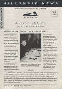
Journal - Newsletter, Nillumbik Shire Council, Nillumbik News, October 2000
... control...landcare...koalas...Drainage works...waterway protection...indigenous grass...environmental education...Open Space...public parkland...playgrounds...bike trail...Adventure Playground...community reserves...Kangaroo Ground Tower...October 2000 articles include: Safer roads for the Shire Eltham Festival program announced Commercial Place design released 2000-2003 Council Plan Released National Reconciliation Framework Living and Learning Centres More Playgrounds Susan St Pavilion completed Study to plan for BMX/skate track Wattle Glen Township Strategy Community Weed Control Program Count Koala Day Environment Centre proposed for Edendale Farm Open Space Strategy findings Neighbourhood Character Study and Residential Design Guidelines Friends groups Clean Drains – Living Creeks, National Water Week Nillumbik Shire Council Cultural Plan 2000-2005 adopted 2001 Alan Marshall Short Story Award Artists’ Open Studios program Kangaroo Ground Tower Advisory Committee Environment leaders at Eltham North primary Dollars saved by regular road maintenance Regional Road upgrades Rural roads grading program Stormwater Management Plan Locality boundary update ...October 2000 articles include: Safer roads for the Shire Eltham Festival program announced Commercial Place design released 2000-2003 Council Plan Released National Reconciliation Framework Living and Learning Centres More Playgrounds Susan St Pavilion completed Study to plan for BMX/skate track Wattle Glen Township Strategy Community Weed Control Program Count Koala Day Environment Centre proposed for Edendale Farm Open Space Strategy findings Neighbourhood Character Study and Residential Design Guidelines Friends groups Clean Drains – Living Creeks, National Water Week Nillumbik Shire Council Cultural Plan 2000-2005 adopted 2001 Alan Marshall Short Story Award Artists’ Open Studios program Kangaroo Ground Tower Advisory Committee Environment leaders at Eltham North primary Dollars saved by regular road maintenance Regional Road upgrades Rural roads grading program Stormwater Management Plan Locality boundary update Council Newsletters Nillumbik News Nillumbik Shire Council Council Plan 2000–2003 Municipal Road Safety Strategy Infrastructure services Stormwater Management Plan Locality boundary review Rates Sustainable agriculture rebate Capital works program road maintenance Better Roads Victorian program eltham - yarra glen road Warrandyte - Kangaroo Ground Road Rural roads grading program Commercial Place Public space public infrastructrue meals on wheels Eltham Living and Learning Centre Living and Learning Centre adult community education volunteer programs Australia Day Awards community groups environmental protection sustainability Community weed control landcare koalas Drainage works waterway protection indigenous grass environmental education Open Space public parkland playgrounds bike trail Adventure Playground community reserves Kangaroo Ground Tower reserve Cultural plan Eltham festival Artists Open Studios cultural tourism Alan Marshall Short Story Award Montsalvat community arts program garden walks Eltham Fun Run community market mudbrick tours CERES Environmental Education Centre Nillumbik Tourism Association Food and Wine trail Yarra Valley Tourism campaign road safety Adrian Cully Alan Marshall Andrew Port Anne Connor Catherine Dale Chris Wallace-Crabbe Claire Harris David Scott David Yencken Dean Stewart Deb Ganderton Debra Wilkinson Denis Ward drew gregory Daryl Taylor Fiona Austin Frank Butters Frank Nolan Gavin Jordan Glen Jameson Grace Mitchell Greg Scott Harry Gilham Helen Ash Jane Annois jane viola Jan Kelly Jenneke Korteweg Jenni Mitchell Jessica Davison Jill Forrest john hewish Jules Burns Julius Peiker kay steventon Kayte Nunn Lesley Shuttleworth leslie Avril Louise Heathcote Marg Jeffery Margaret Jennings Martin Wright Mathew Hodsnesse Maurice Stabb Megan McCarthy Mervyn Hannan Michael Jansz michael skewes Mick Woiwod nel ten wolde Nicholas Pelling Ona Henderson Peter Burn Piers Bateman reg cox Reg Evans Robert Boyle Robert Hay Robert Theobald shan shnookal Sigmund Jorgensen Stuart Menzies Steven White Vonnie Frazer Eltham District Historical Society Council for Aboriginal Reconciliation Eltham North Primary School Wattle Glen Primary School Eltham Arts Council Churinga Arts Harvey World Travel (Eltham) Eltham Little Book Shop Do Lunch Cafe Volumes Cafe Grovedale Cottage Lovegrove Winery Cottles Bridge Yarrambat Golf Club Eltham Football Club Eltham Rugby Football Club Lower Eltham Cricket Club Susan Street Oval Syd Tunn Jack Rasterhoff A4. monotone print, double stapled, 4 pages Nillumbik News Journal Newsletter Nillumbik Shire Council ...The newsletter outlines local government initiatives, community events, environmental programs, infrastructure projects, and cultural activities occurring in the Nillumbik Shire around October–November 2000. It highlights council plans, community participation opportunities, and local developments aimed at improving quality of life in the region. October 2000 articles include: Safer roads for the Shire Eltham Festival program announced Commercial Place design released 2000-2003 Council Plan Released National Reconciliation Framework Living and Learning Centres More Playgrounds Susan St Pavilion completed Study to plan for BMX/skate track Wattle Glen Township Strategy Community Weed Control Program Count Koala Day Environment Centre proposed for Edendale Farm Open Space Strategy findings Neighbourhood Character Study and Residential Design Guidelines Friends groups Clean Drains – Living Creeks, National Water Week Nillumbik Shire Council Cultural Plan 2000-2005 adopted 2001 Alan Marshall Short Story Award Artists’ Open Studios program Kangaroo Ground Tower Advisory Committee Environment leaders at Eltham North primary Dollars saved by regular road maintenance Regional Road upgrades Rural roads grading program Stormwater Management Plan Locality boundary update council newsletters, nillumbik news, nillumbik shire council, council plan 2000–2003, municipal road safety strategy, infrastructure services, stormwater management plan, locality boundary review, rates, sustainable agriculture rebate, capital works program, road maintenance, better roads victorian program, eltham - yarra glen road, warrandyte - kangaroo ground road, rural roads grading program, commercial place, public space, public infrastructrue, meals on wheels, eltham living and learning centre, living and learning centre, adult community education, volunteer programs, australia day awards, community groups, environmental protection, sustainability, community weed control, landcare, koalas, drainage works, waterway protection, indigenous grass, environmental education, open space, public parkland, playgrounds, bike trail, adventure playground, community reserves, kangaroo ground tower reserve, cultural plan, eltham festival, artists open studios, cultural tourism, alan marshall short story award, montsalvat, community arts program, garden walks, eltham fun run, community market, mudbrick tours, ceres environmental education centre, nillumbik tourism association, food and wine trail, yarra valley tourism campaign, road safety, adrian cully, alan marshall, andrew port, anne connor, catherine dale, chris wallace-crabbe, claire harris, david scott, david yencken, dean stewart, deb ganderton, debra wilkinson, denis ward, drew gregory, daryl taylor, fiona austin, frank butters, frank nolan, gavin jordan, glen jameson, grace mitchell, greg scott, harry gilham, helen ash, jane annois, jane viola, jan kelly, jenneke korteweg, jenni mitchell, jessica davison, jill forrest, john hewish, jules burns, julius peiker, kay steventon, kayte nunn, lesley shuttleworth, leslie avril, louise heathcote, marg jeffery, margaret jennings, martin wright, mathew hodsnesse, maurice stabb, megan mccarthy, mervyn hannan, michael jansz, michael skewes, mick woiwod, nel ten wolde, nicholas pelling, ona henderson, peter burn, piers bateman, reg cox, reg evans, robert boyle, robert hay, robert theobald, shan shnookal, sigmund jorgensen, stuart menzies, steven white, vonnie frazer, eltham district historical society, council for aboriginal reconciliation, eltham north primary school, wattle glen primary school, eltham arts council, churinga arts, harvey world travel (eltham), eltham little book shop, do lunch cafe, volumes cafe, grovedale cottage, lovegrove winery cottles bridge, yarrambat golf club, eltham football club, eltham rugby football club, lower eltham cricket club, susan street oval, syd tunn, jack rasterhoff -
Glen Eira Historical Society
Document - Hopetoun, Hopetoun Street, 2, Elsternwick
... control. By Andrew Ward. Includes two photocopied photographs of the exterior of the exterior. Italianate style Hopetoun Melrose Hospitals Verandahs Mansions Towers Architectural features Architectural styles Webb Charles Architects Glenhuntly Road Elsternwick Cutts Joseph Korong Street King Street Hopetoun Street Geoghegan Hanbury Webb Alfred Kopat Pty Ltd Webb Florence Mabel O’Brien Annie Reeve Charles Haines Edith Thomas Albert Ward Andrew Hopetoun Private Hospital Document Hopetoun, Hopetoun Street, 2, Elsternwick ...Photocopy of Caulfield Conservation Study for this address, conducted in September 1994. It outlines a description of the Italianate villa architectural aspects of Hopetoun Private Hospital, the history of the owners of the property and the recommendations for inclusion on the National Estate Register and for the planning Scheme control. By Andrew Ward. Includes two photocopied photographs of the exterior of the exterior.italianate style, hopetoun, melrose, hospitals, verandahs, mansions, towers, architectural features, architectural styles, webb charles, architects, glenhuntly road, elsternwick, cutts joseph, korong street, king street, hopetoun street, geoghegan hanbury, webb alfred, kopat pty ltd, webb florence mabel, o’brien annie, reeve charles, haines edith, thomas albert, ward andrew, hopetoun private hospital -
 Bendigo Military Museum
Photograph - RA Svy Project C4 Aerodist Operation, Eastern & Western Arnhem Land, NT, 1967, 1968
... control across northern NT from mid-July to October. The Aerodist MRC2 Remote antenna seen in Photos .24P to .26P is mounted on a 20 foot pole tower. ...control across northern NT from mid-July to October. The Aerodist MRC2 Remote antenna seen in Photos .24P to .26P is mounted on a 20 foot pole tower. ...This is a set of 26 photographs of Royal Australian Survey Corps (RA Svy) personnel from Central Comd Fd Svy Unit (Adelaide) on Aerodist survey operation - Project C4 in Eastern Arnhem Land, Northern Territory in 1967 (photos .4P to .26P) and in Western Arnhem Land, Northern Territory in 1968 (photos .1P to .3P). Photos of personnel were taken either at the operations base at Numbulwar or the main base at Gove (Nhulunbuy). RA Svy conducted nineteen Aerodist operations for 12 years from 1964 to 1975. Aerodist MRC2 was a tellurometer-based system adapted for aircraft to accurately measure distances between non-intervisible ground survey stations, using the aircraft as an intermediate station. Lower order geodetic results could be achieved by survey network trilateration. The measured distances between stations formed survey networks from which each station’s latitude and longitude was computed. Aerodist MRC2 was RA Svy’s major horizontal control survey tool for mainly medium scale topographic mapping (scale 1:100,000 Class A being spatially accurate to within 50 metres) in PNG, northern NT, north-west WA, Kalimantan Barat (West) Indonesia, Sumatra Indonesia, Gulf of Carpentaria and Cape York, QLD. In 1967, the Aerodist MRC2 Master equipment was installed in the aircraft featured in this set of photos, Executive Air Services’ (Essendon VIC) Grand Aero Commander VH-EXX. It was the same aircraft type and company contracted to Division of National Mapping for Aerodist MRC2 surveys. From July to October 1967 the aircraft was attached to Central Comd Fd Svy Unit (Adelaide - Major Don Ridge) on Project C4 eastern-Arnhem Land NT, where 317 Aerodist lines measuring 17,300 line miles were successfully completed. This was the most productive Aerodist project thus far. The most common helicopter used by RA Svy up to 1972 was the civilian Bell 47G-2 and the Sioux Light Observation Helicopters (LOH), the Australian Army’s equivalent featured in this photo set. These light observation helicopters had a limiting load carrying capacity of up to about 500 pounds. By comparison, one Aerodist team including two people weighed up to 1,500 pounds. In 1968, after completion of the Kimberley Aerodist Operation project, the Aerodist system in VH-EXX was immediately deployed to western-Arnhem Land NT for Central Comd Fd Svy Unit (Adelaide - Major Don Ridge) to complete the mapping control across northern NT from mid-July to October. The Aerodist MRC2 Remote antenna seen in Photos .24P to .26P is mounted on a 20 foot pole tower. The antenna direction was controlled by wires/ropes to the two arms under the dish at right angles. The antenna elevation could be changed to the vertical for aircraft height checks as seen in photo .25P. Source: Royal Australian Survey Corps – Aerodist Years 1964-1975 by Peter Jensen. Refer to Item 6449.30P for more photos taken during these Aerodist survey operations.This is a set of 26 photographs of Royal Australian Survey Corps (RA Svy) personnel on Aerodist survey operations in Eastern Arnhem Land, Northern Territory in 1967 and Western Arnhem Land, Northern Territory in 1968. The photographs are on 35mm negative film and scanned at 96 dpi. They are part of the Army Survey Regiment’s Collection. .1) to .2) – Photo, black & white, 1968, unidentified soldier with an opened can of food, possibly bully beef. .3) – Photo, black & white, 15 Aug 1968, aerial view of terrain taken from a helicopter in vicinity of MILINGIMBI SIERRA. .4) – Photo, black & white, 1967, aerial view of an island taken from a helicopter. .5) & .6) – Photo, black & white, 1967, unidentified soldier driving a Haflinger 4x4 Light utility vehicle with trailer. .7) – Photo, black & white, 1967, unidentified surveyors taking vertical measurements with a leveling instrument and staff. .8) – Photo, black & white, 1967, Australian Army Sioux Light Observation Helicopter (LOH) with float removed. .9) to .11) – Photo, black & white, 1967, Australian Army Sioux Light Observation Helicopter (LOH) with floats. .12) – Photo, black & white, 1967, civilian Bell 47G-2 helicopter (Australian Army Sioux LOH equivalent) refuelled. .13) – Photo, black & white, 1967, survey station on coastline surrounded by white plastic aerial photographic identification panels lined with rocks. .14) & .15) – Photo, black & white, 1967, soldier (possibly a signaller from RA Sigs) operating a radio. .16) – Photo, black & white, 1967, Central Comd Fd Svy Unit Operations Section tent, Main Base Gove (Nhulunbuy) L to R: SPR Harry Dunn, WO1 Pat Wood BEM. .17) – Photo, black & white, 1967, Central Comd Fd Svy Unit Operations Section tent, Main Base Gove (Nhulunbuy) L to R: unidentified, WO1 Pat Wood BEM. .18) – Photo, black & white, 1967, Central Comd Fd Svy Unit Operations Section, Main Base Gove (Nhulunbuy), unidentified Australian Army Catering Corps cook preparing meals. .19) – Photo, black & white, 1967, Central Comd Fd Svy Unit Operations Section, Main Base Gove (Nhulunbuy) mess tent in readiness for meals. .20) – Photo, black & white, 1967, Bank of batteries in transit boxes undergoing recharging using generators. .21) – Photo, black & white, 1967, A topographic survey identification plaque set in a concrete block being weighed using a set of scales hanging from slaughtering gallows. .22) – Photo, black & white, 1967, CPL (Geoff or Gary) Larkin operating the remote Aerodist MRC2 ground instrument at Veronica Island, located north of Nhulunbuy. .23) – Photo, black & white, 1967, L to R: CPL (Geoff or Gary) Larkin with unidentified surveyor operate the remote Aerodist MRC2 ground instrument at Venica Island, located north of Nhulunbuy. .24) & .25 – Photo, black & white, 1967, The Aerodist MRC2 Remote antenna. .26) – Photo, black & white, 1967, The Aerodist MRC2 Remote antenna.The following photos are annotated in black ink on edge of film negative: .3P – ’15 Aug ’68, 2000’, 1-C18 ’68 MILINGIMBI SIERRA’ .4P – ’U462’ .8P – ‘1-C3/67 Float Removed’ .13P – ‘U477 10-C3/67 .20P - ‘2-C3/67 Bank of Chargers’ .21P - ‘3-C3/67 Gallows & Scales’ .22P - ‘0462 VERONICA ISLAND NT, CPL Larkin’ .23P - ‘0462 VERONICA ISLAND NT’ .24P - ‘4-C3/67 20’ Aerodist Tower’ .25P - ‘5-C3/67 20’ Aerodist Tower’ .26P - ‘6-C3/67 20’ Aerodist Tower’royal australian survey corps, rasvy, army survey regiment, army svy regt, fortuna, asr, aerodist, surveying, central comd fd svy unit
