Showing 267 items matching "district surveyor"
-
 Greensborough Historical Society
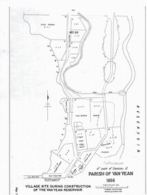
Map - Map (Copy), C. Hodgkinson, District Surveyor et al, Parish of Yan Yean 1856: Village site during construction of the Yan Yean Reservoir, 1978
... Hodgkinson, District Surveyor, redrawn by A. R. Blair 1978. ...Hodgkinson, District Surveyor...Hodgkinson, District Surveyor A R Blair ...Copy of map part Sec. 13, Parish of Yan Yean 1856, Map 3, Village site... Scale: 8 chains to 1 inch. Drawn by C. Hodgkinson, District Surveyor, redrawn by A. R. Blair 1978. 1 p. photocopy of map. yan yean reservoir, yan yean -
 Lakes Entrance Historical Society
Map - Lakes Entrance Gippsland Sheet No.2, W Dawson District Surveyor. Henry Davidson, 9/4/1866
... W Dawson District Surveyor. Henry Davidson...Barkly, Jemmys Point, Bullock Island Map Lakes Entrance Gippsland Sheet No.2 W Dawson District Surveyor. Henry Davidson ...Shows waterways, The Narrows, Reeves River, North Arm, Back Lake, Southern Ocean, Mt. Barkly, Jemmys Point, Bullock Islandwaterways, islands, topography -
Lakes Entrance Historical Society
Plan - Plan showing the entrance to the Lakes and the Snowy River Gipps Land, W Davidson District Surveyor, November 1882
... W Davidson District Surveyor...Waterways Topography Sketch showing Reeves River, Entrance to the lakes , Red Bluff, Snowy River shallow channel, old effluse to Point Ricardo Gippsland A and B 2 pages Plan Plan showing the entrance to the Lakes and the Snowy River Gipps Land W Davidson District Surveyor ...Sketch showing Reeves River, Entrance to the lakes , Red Bluff, Snowy River shallow channel, old effluse to Point Ricardo Gippsland A and B 2 pageswaterways, topography -
Lakes Entrance Historical Society
Map - Plan of the entrance to the Gippsland Lakes, W Davidson District Surveyor, 15 May 1883
... W Davidson District Surveyor...Map Plan of the entrance to the Gippsland Lakes W Davidson District Surveyor ...Sketch showing Lake Bunga, Reeves River, Hummock and Sand Bank.waterways, sand bars -
 Flagstaff Hill Maritime Museum and Village
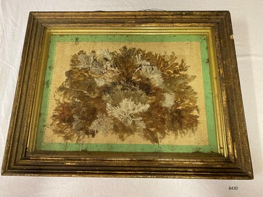
Artwork, other - Diorama with seaweed specimens, Richard Foster Norton, 1860
... ...District Surveyor...Watson was the Warrnambool District Surveyor at the time (1860). The inscription on the back of the frame links the artwork to the Pigeon Hill property, which was located on Allansford Road (corner of Staffords Road – north side of the Princes Highway-A1). ...Watson was the Warrnambool District Surveyor at the time (1860). The inscription on the back of the frame links the artwork to the Pigeon Hill property, which was located on Allansford Road (corner of Staffords Road – north side of the Princes Highway-A1). ...The diorama of mounted specimens of seaweed was framed by Richard Foster Norton for Thomas Watson and is dated 1860. Watson was the Warrnambool District Surveyor at the time (1860). The inscription on the back of the frame links the artwork to the Pigeon Hill property, which was located on Allansford Road (corner of Staffords Road – north side of the Princes Highway-A1). In the 1860s, the property known as Pigeon Hill was owned by William Wall who was a publican who ran several hotels in Warrnambool and district. In 1860 Wall, was running a hotel in Wangoom, near Pigeon Hill. Further research is required to determine the exact location, but Pigeon Hill could also have been the name for that area and may have had other people living there. Thomas Watson was a member of the local horticultural society. Another possible creator of the artwork is Samuel Hannaford, a biologist with a particular interest in collecting marine flora. Hannaford left Warrnambool in 1857 and went to Geelong, so it is possible he collected the specimens had them framed in Geelong, and then arranged for their return to Watson. The other known seaweed collector was Henry Watts, who lived in Warrnambool in the mid-19th century. The seaweed collection in this box was possibly one of Watts' and could have been prepared for the Victorian Exhibition of 1861, Richard Foster Norton, also known as R.F Norton, was one of only a handful of picture framers in 1850s Melbourne. Norton was born on the 24th of July 1822 in Yelvertoft, Northamptonshire and prior to his arrival in Australia, Norton is listed in England as having the occupation of a painter. It appears that he established his business in Melbourne in 1854 or 1855. Between 1855 and 1865 he operated from 87, then 83, and later 80 Collins Street. In the Argus newspaper, Norton advertised his business as a Print seller, Carver, Gilder and Picture Frame manufacturer, supplying the growing demand for artworks and decorative furnishings in the colony during the Gold Rush. Norton also had a Geelong branch in Market Square, where this work was produced. This framed work is highly significant. Previous research has found that only six frames are in existence that can be attributed to be made Norton, dating from the late 1850’s to the mid 1860’s. Moreover, Thomas Watson the owner of the artwork, is one of the government surveyors of the region during the mid-19th century.Diorama in deep wooden frame, behind glass. Seaweed specimens have been mounted within the frame. The back of the frame has handwritten inscriptions including the framer's label (portions missing). The diorama was framed by Richard Fraser Norton. Printed label; "RICHARD FOS --- Picture Framer and -- MANUF -- CARVER, GILDER, ---- PAINTINGS CLEANED, LINED AND --- GLASSES RESILVERED, FRAMES --- Architectual Decorations created to any design in Paper Mache, Carlton Pierre, or Composition, Country Orders promptly attended to, The Order Suppl ---, BRANCH ESTABLISHMENT, MARKET SQUARE, GEELONG" flagstaff hill, warrnambool, maritime museum, richard foster norton, r.f norton, picture framers, melbourne, geelong, artwork and decorative furnishings, gold rush, seaweed, botanical specimens, 1860, pigeon hill, district surveyor, thomas watson, william wall, wangoom, samuel hannaford, henry watts, victorian exhibition, 1861, yelvertoft, northamptonshire, market square -
 Bendigo Historical Society Inc.
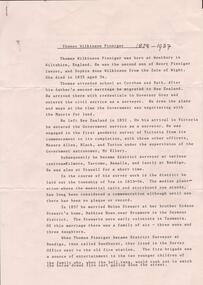
Document - RESEARCH PAPERS: THOMAS WILKINSON PINNIGER, 1828
... Document detailing the history of district surveyor Thomas Wilkinson Pinniger and his family history....Thomas Pinninger Family History Document detailing the history of district surveyor Thomas Wilkinson Pinniger and his family history. ...Thomas Pinniger (1828-1927) was born in England and emigrated to New Zealand before coming to Australia in 1852. With a team of 4 he conducted the first geodetic* survey of Victoria. He became the Government Surveyor for Bendigo in 1853 and in 1854 he laid out the plans for the town of Broadford. His son George, became the Victorian Surveyor General 1925-6. * Large scale mapping based on global measurements of large land masses. It allows corrections for the curvature of the earth.Document detailing the history of district surveyor Thomas Wilkinson Pinniger and his family history.thomas pinninger, family history -
 Whitehorse Historical Society Inc.
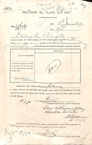
Document - Report, Section 31 Land Act 1869, 01/06/1872
... Land application by Frank Ainger, referred to District Surveyor. Report by Mounted Constable Douglas with description of proposed use of land. ...Whitehorse Historical Society Inc. 2-10 Deep Creek Road Mitcham melbourne ainger frank douglas (mounted constable) assistant commissioner of lands and survey whitehorse road mitcham doncaster east road land settlement Land application by Frank Ainger, referred to District Surveyor. Report by Mounted Constable Douglas with description of proposed use of land. ...Land application by Frank Ainger, referred to District Surveyor. Report by Mounted Constable Douglas with description of proposed use of land. Map of area. The area is on the corner of Whitehorse Road and Doncaster East Road.ainger, frank, douglas (mounted constable), assistant commissioner of lands and survey, whitehorse road, mitcham, doncaster east road, land settlement -
 Whitehorse Historical Society Inc.
Document - Correspondence, Anderson's Creek, 19/12/1874
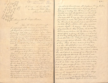
... Bennett Hull to the Surveyor General regarding complaints about the supervision of Mr Hodgkinson, District Surveyor during survey of road to Anderson's Creek....Bennett Hull to the Surveyor General regarding complaints about the supervision of Mr Hodgkinson, District Surveyor during survey of road to Anderson's Creek. ...Letter of resignation, 19 December 1854, from W. Bennett Hull to the Surveyor General regarding complaints about the supervision of Mr Hodgkinson, District Surveyor during survey of road to Anderson's Creek.hull, w. bennett, hodgkinson, clement, andersons creek, land surveys, roads and streets -
![Plan, Improvements on the Camp Reserve Ballarat, 1870, 26/4/1870 (exact); Traced by Henry [Mornes?], district surveyor, on the above date](/media/collectors/4f729f6797f83e0308601707/items/4f72a4fa97f83e0308602508/item-media/59b79d3921ea680200c6b8a7/item-fit-380x285.jpg?cb=6) Federation University Historical Collection
Federation University Historical CollectionPlan, Improvements on the Camp Reserve Ballarat, 1870, 26/4/1870 (exact); Traced by Henry [Mornes?], district surveyor, on the above date
... 26/4/1870 (exact); Traced by Henry [Mornes?], district surveyor, on the above date ...The Ballarat Camp housed the Goldfields administrators. It was from this site that the troopers left on the morning of 3 December 1854 to attack the Eureka Stockade. Much of the area shown in on the west side of Camp Street is now used by the Federation University Arts Academy.Hand-drawn plan on white linen showing the camp reserve in what is now known Ballarat's Camp Street. The plan shows allotments in an area bounded by Mair, Sturt and Lydiard Streets. The plan has colours indicating wooden buildings, stone buildings, brick buildings, Wood & zinc buildings, and wood & brick buildings.ballarat, camp street, horace walker, henry mornes, goldfields architecture, reserve for public, buildings, goldfields administration, eureka stockade -
 Bendigo Historical Society Inc.
Document - DUDLEY HOUSE COLLECTION: PLAN OF DUDLEY HOUSE, 1888
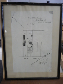
... Notation on bottom reads, For the information of the Secty for lands and signature of T.W.Pinniger D.S. (District Surveyor) 5/4/88...Notation on bottom reads, For the information of the Secty for lands and signature of T.W.Pinniger D.S. (District Surveyor) 5/4/88 Document DUDLEY HOUSE COLLECTION: PLAN OF DUDLEY HOUSE ...Wooden framed copy of allotment plan of Old Survey Office Premises (Dudley House) Sandhurst, under glass in thin black wooden frame. Notation on bottom reads, For the information of the Secty for lands and signature of T.W.Pinniger D.S. (District Surveyor) 5/4/88T.W.Pinniger D.S.document, certificate, plan -
 Orbost & District Historical Society
survey sheet, circa 1870's
... He began his service in Gippsland as assistant district surveyor and for the last 12 years before retirement he was district surveyor and land officer. ...He began his service in Gippsland as assistant district surveyor and for the last 12 years before retirement he was district surveyor and land officer. ...E.L. Bruce, born in Ireland on July 1,1854, came to Australia in 1854 and joined the Lands Department. He spent most of his service in Gippsland. The journey to Sale then was made by ship to Port Albert and thence on horseback. He began his service in Gippsland as assistant district surveyor and for the last 12 years before retirement he was district surveyor and land officer. His territory extended from the boundary of Victoria in east Gippsland down to Wilson's Promontory with his headquarters at sale.This map is a useful reference tool.A survey map - Sheet No 3 SnowyRiver Survey. This is a copy of the original survey. It shows the properties of W.J.T. Clarke - two in Orbost and one in Newmeralla (sic),. it has a faded, undecipherable red stamp in the bottom right corner.Gipps Land Rivers No 32B E.L. Brucesurvey bruce-e.l snowy-river-c19th -
 Bendigo Historical Society Inc.
Document - LAND AND SURVEY CIRCULARS 1876 - 1883, 1876 - 1883
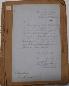
... Journal contains copies of letters signed by District Surveyor, Sandhurst....Journal contains copies of letters signed by District Surveyor, Sandhurst. Document LAND AND SURVEY CIRCULARS 1876 - 1883 ...Document: land and survey circulars - brown paper covered journal tied with string along spine. On front cover top LH corner '04A' Stuck to front cover is blue foolscap handwritten letter from Office of Lands and Survey (Occupation Branch) Melbourne 15th. March 1876. Journal contains copies of letters signed by District Surveyor, Sandhurst.Office of Lands and Surveyorganization, bendigo, sandhurst, land sales, land surveys -
 Bendigo Historical Society Inc.
Negative - DUDLEY HOUSE COLLECTION: NEGATIVES OF DUDLEY HOUSE PLUS 3 IMAGES
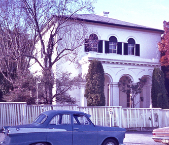
... It was originally built as a residence for the district surveyor, who designed the Bendigo street layout that we still use to this day. ...It was originally built as a residence for the district surveyor, who designed the Bendigo street layout that we still use to this day. ...Dudley House brick building is one of the earliest and most intact 1850s buildings remaining in Bendigo CBD. Like all government buildings of this era, its exterior is fairly modest, unlike the opulent styles of later decades. It was originally built as a residence for the district surveyor, who designed the Bendigo street layout that we still use to this day. Strip of Photo Negatives of Dudley House in View Street Bendigo, Victoria Australia. 3 Images date unknown, but car parked out of front of property is from the 1960s. Looks like a wooden fence is enclosing the property can we date image from this?bendigo, buildings, dudley house -
 Bendigo Historical Society Inc.
Document - The naming of Dudley House Bendigo, 2/11/2023
... It was originally built for the district surveyor, Richard Larritt, who designed the Bendigo street layout. ...It was originally built for the district surveyor, Richard Larritt, who designed the Bendigo street layout. ...Dudley House at 60 View St, Bendigo was built by builders, Gretchen and Cooper for the public Works Department in 1858-59. It was originally built for the district surveyor, Richard Larritt, who designed the Bendigo street layout. One of its earliest claims to fame was the hosting of world famous singer, Jenny Lind, in 1861, when she sang to raise money for charity.A nine page document theorizing the history behind the name of the Dudley House building. Written and presented by Terry Davidson.dudley house, view street, bruhn, serah bruhn -
Lakes Entrance Historical Society
Album - East Gippsland Album
... Twenty six images c 20 x 25 cm purchased from Apple Lea Craft Shop, W.T Dawson District Surveyor, C. W. Ligar Surveyor General of Victoria. ...Lakes Entrance Historical Society 4 Marine Parade Lakes Entrance gippsland Twenty six images c 20 x 25 cm purchased from Apple Lea Craft Shop, W.T Dawson District Surveyor, C. W. Ligar Surveyor General of Victoria. ...Twenty six images c 20 x 25 cm purchased from Apple Lea Craft Shop, W.T Dawson District Surveyor, C. W. Ligar Surveyor General of Victoria. North Arm, Jemmy.s Point, S.S Wyralla,Yacht Nyama, Kalimna Hotel, Whiters Camp Park, Metung, P.S. Tanjil, S.S. Gippsland, S.S. Burrabogie, S.S. J.C.D, White covered album containing 49 images of early East Gippsland Victoriawaterways, islands, townships -
Clunes Museum
Map, DEPARTMENT OF MINES, Untitled, c1859
... .1 360 Scale 1:2500 .2 303/59 33 hand written in ink "received 15 October 1859" signed by R Broughton, James Stevenson - District Mining Surveyor .3 40 chains to an Inch...Clunes Museum 36 Fraser Street enter building through Collins Place Clunes goldfields All maps show names and locations of mines operating in the district (see reference section link to article) gold mining dept of mines .1 360 Scale 1:2500 .2 303/59 33 hand written in ink "received 15 October 1859" signed by R Broughton, James Stevenson - District Mining Surveyor .3 40 chains to an Inch .1 Map of Creswick Clunes - lists 45 mines in the Clunes enlargement and 100 mines in the Creswick enlargement .2 Department of Mines map of Clunes Creswick and shows the McDonald & Co. ...All maps show names and locations of mines operating in the district (see reference section link to article).1 Map of Creswick Clunes - lists 45 mines in the Clunes enlargement and 100 mines in the Creswick enlargement .2 Department of Mines map of Clunes Creswick and shows the McDonald & Co. Pre-emptive area. Indexes for quartz and alluvial mine locations .3 Topographical map Ref GF23 Clunes Mt. Greenock Talbot.1 360 Scale 1:2500 .2 303/59 33 hand written in ink "received 15 October 1859" signed by R Broughton, James Stevenson - District Mining Surveyor .3 40 chains to an Inchgold mining, dept of mines -
Warrnambool and District Historical Society Inc.
Legal record - Architects Surveyors Engineers
... district during that time. It will be useful to researchers. Ledger J.W. Crawley & Son Architects Surveyors Engineers Shire Office Warrnambool. ...This ledger came from the office of John William Crawley, Junior, a surveyor, engineer and architect in private practice in Warrnambool and the engineer for the Shire of Warrnambool from 1895 to 1935. He had succeeded his father, John who had been engineer for the Shire of Warrnambool from 1874 to 1895. Lorenzo, the brother of John Junior, was Shire Secretary from 1904 to 1947. Rolf Crawley, the son of John William Crawley Junior, succeeded him as the Shire of Warrnambool engineer and served from 1935 to 1968. Thus the Crawley family recorded a total of 132 years of service to the Shire of Warrnambool which existed from 1863 to 1994. The ledger gives details of the accounts for engineering services for the years 1925 to 1935 from the office of John William Crawley Junior who for some of this time had his son Rolf in the office as an assistant engineer. This ledger is of interest, firstly because it is a work document that belonged to John Crawley, Junior in his capacity as an engineer in private practice and as the engineer of the Shire of Warrnambool in the 1920s and 30s and secondly because the entries in the ledger contain information on many prominent residents of Warrnambool and district during that time. It will be useful to researchers. This is a hard cover ledger of 151 pages with a black cover with red leather edging on the corners and on the spine. There is gold lettering on the spine. The pages have printed red lines and alphabetical tabs inserted in the first few pages. The ledger contains handwritten entries in black ink. There are some loose sheets among the pages. Ledger J.W. Crawley & Son Architects Surveyors Engineers Shire Office Warrnambool. -
 Warrnambool and District Historical Society Inc.
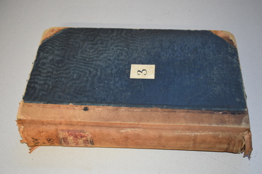
Ledger, Chadwick Copying Book Co, Letter book 1905, 1902
... Warrnambool and District Historical Society Inc. 2 Gilles Street (south of Merri St) Warrnambool great-ocean-road This letter book has maps, letters and plans dating from 1902 to 1905. It came from the office of John William Crawley, Junior, an engineer, architect and surveyor in private practice in Warrnambool and also the engineer for the Shire of Warrnambool from 1895 to 1935. ...This letter book has maps, letters and plans dating from 1902 to 1905. It came from the office of John William Crawley, Junior, an engineer, architect and surveyor in private practice in Warrnambool and also the engineer for the Shire of Warrnambool from 1895 to 1935. His father, brother and son were all engineers and worked in that capacity or as Shire Secretary for the Shire of Warrnambool, with the Crawley family recording a total of 132 years of service to the Shire of Warrnambool. The Shire of Warrnambool existed from 1863 to 1994. This letter book was passed on to John Crawley’s son, Rolf, engineer for the Shire of Warrnambool from 1935 to 1968. The letter book then came into the possession of Michael Hand who took over the private surveying business of Rolf Crawley in Warrnambool. The Warrnambool and District Historical Society acquired the letter book, along with several other Crawley ledgers, from the Michael Hand estate. This letter book is of considerable importance as it contains the letters, maps and plans produced by John William Crawley Junior, a Shire of Warrnambool engineer for 40 years. It will be useful to researchers. This is a black hard cover letter book of 505 pages, plus an alphabetical index at the back of the book. The letter book contains handwritten letters, sketch maps and plans. There is gold lettering on the spine.‘1’ ‘Invoice’ ‘Chadwick Copying Book Co. Springfield Mass.’ john william crawley, junior, warrnambool, rolf crawley, warrnambool, shire of warrnambool, history of warrnambool -
 Warrnambool and District Historical Society Inc.
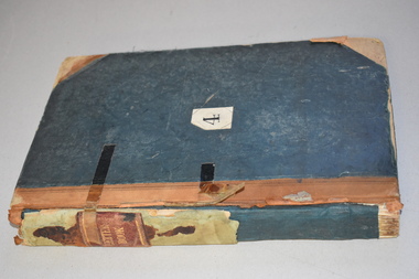
Ledger, Letter book 1892-1904, 1892
... Warrnambool and District Historical Society Inc. 2 Gilles Street (south of Merri St) Warrnambool great-ocean-road This letter book has letters, sketch maps and plans and dates from 1892 to 1904. It came from the office of John William Crawley, Junior, an engineer, architect and surveyor ...This letter book has letters, sketch maps and plans and dates from 1892 to 1904. It came from the office of John William Crawley, Junior, an engineer, architect and surveyor in private practice in Warrnambool and also the engineer of the Shire of Warrnambool from 1895 to 1935. His father, brother and son were also engineers and worked in that capacity or as the Shire Secretary for the Shire of Warrnambool, with the Crawley family recording a total of 132 years of service to the Shire. This letter book was passed on to John Crawley’s son, Rolf Crawley, Engineer for the Shire of Warrnambool from 1935 to 1968. The letter book then came into the possession of Michael Hand who took over the private surveying business of Rolf Crawley in Warrnambool. The Warrnambool and District Historical Society has acquired the letter book, one of several Crawley ledgers, from the Michael Hand estate. This letter book is of considerable significance as it contains maps, plans, sketches and written information which is the work of John William Crawley Junior, the engineer for the Shire of Warrnambool for 40 years. It will be very useful to researchers. This is a hard cover letter book of 500 pages. The cover is black with leather binding on the edges of the cover and on the spine. The pages contain an alphabetical listing of the letters, handwritten letters and many sketch maps and plans. There are several loose pages of plans and diagrams at the back of the book. The inside of the covers has a blue mottled pattern. The edges of the cover are torn. There is a mauve stamp on the first page. ‘Letter Book 1892 to 1901’ ‘Rolf L. Crawley, Civil Engineer, Drainage and Water Supply Engineer, Licensed Surveyor, Registered Architect, Warrnambool’ john william crawley, junior, warrnambool, rolf crawley, warrnambool, shire of warrnambool -
 Warrnambool and District Historical Society Inc.
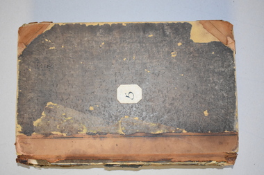
Letter Book 3, 1901 - 1908, 1900
... Warrnambool and District Historical Society Inc. 2 Gilles Street (south of Merri St) Warrnambool great-ocean-road This letter book has letters, plans and maps and dates from 1901 to 1908. It came from the office of John William Crawley, Junior, an engineer, architect and surveyor in private practice in Warrnambool and also the engineer for the Shire of Warrnambool from 1895 to 1935. ...This letter book has letters, plans and maps and dates from 1901 to 1908. It came from the office of John William Crawley, Junior, an engineer, architect and surveyor in private practice in Warrnambool and also the engineer for the Shire of Warrnambool from 1895 to 1935. His father, brother and son were also engineers and worked in that capacity or as the Shire Secretary for the Shire of Warrnambool, with the Crawley family recording a total of 132 years of service to the Shire. The letter book was passed on to John Crawley’s son, Rolf, engineer for the Shire of Warrnambool from 1935 to 1968. The letter book then came into the possession of Michael Hand who took over the private surveying business of Rolf Crawley in Warrnambool. The Warrnambool and District Historical Society has acquired the letter book, one of several Crawley ledgers, from the Michael Hand estate. The Shire of Warrnambool existed from 1863 to 1994. This letter book is of considerable significance as it contains maps, plans and letters produced by John William Crawley Junior, the engineer for the Shire of Warrnambool for 40 years. It will be very useful for research. This is a hard cover letter book of 717 pages. It has a black cover with brown leather binding on the cover edges and spine. The leather is worn away in places. The letter book contains an alphabetical index, handwritten letters, sketch plans and maps. There is a mauve stamp on the inside front cover. ‘3’ ‘Letter Book 1901 to 1908’ ‘Letter Book J.Wm. Crawley’ ‘Rolf L. Crawley, Civil Engineer, Drainage and Water Supply Engineer, Licensed Surveyor, Registered Architect, Warrnambool’ john william crawley junior, warrnambool, rolf crawley, warrnambool, history of warrnambool -
 Warrnambool and District Historical Society Inc.
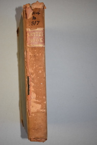
Letter Book 4, 1901, 1908
... Warrnambool and District Historical Society Inc. 2 Gilles Street (south of Merri St) Warrnambool great-ocean-road This letter book has letters, invoices, sketch maps and plans and dates from 1908 to 1910. It came from the office of John William Crawley Junior, an engineer, architect and surveyor ...This letter book has letters, invoices, sketch maps and plans and dates from 1908 to 1910. It came from the office of John William Crawley Junior, an engineer, architect and surveyor in private practice in Warrnambool and also the official engineer of the Shire of Warrnambool from 1895 to 1935. His father, brother and son were also engineers and worked in that capacity or as the Shire Secretary for the Shire of Warrnambool, with the Crawley family members recording a total of 132 years of service to the Shire. The letter book was passed on to John Crawley’s son, Rolf, Engineer for the Shire of Warrnambool from 1935 to 1968. The letter book then came into the possession of Michael Hand who took over the private surveying business of Rolf Crawley in Warrnambool and the Warrnambool and District Historical Society has acquired the letter book, one of several Crawley ledgers, from the Michael Hand estate. This letter book is of considerable significance as it contains maps, plans, sketches and written information on the work of John William Crawley, the engineer for the Shire of Warrnambool for 40 years. This is a black-covered letter book with copies of letters and field maps and plans and an alphabetical listing at the front. Some of the letters are invoices for work carried out. The leather section of the front cover has been almost completely torn away and the binding is mended with adhesive tape. There are some torn pages. The front page has a signature and a mauve stamp. ‘Letter Book’ ‘J.Wm. Crawley (Private)’ ‘ Rolf L. Crawley, Civil Engineer, Drainage and Water Supply Engineer, Licensed Surveyor, Registered Architect, Warrnambool’ ‘4’ rolf crawley, warrnambool, john william crawley, junior, warrnambool, history of warrnambool -
 Warrnambool and District Historical Society Inc.
Letter book 5, 1910
... Warrnambool and District Historical Society Inc. 2 Gilles Street (south of Merri St) Warrnambool great-ocean-road This letter book has letters, invoices and sketch maps and dates from 1910 to 1914. It came from the office of John William Crawley, Junior, an engineer, surveyor ...This letter book has letters, invoices and sketch maps and dates from 1910 to 1914. It came from the office of John William Crawley, Junior, an engineer, surveyor and architect in private practice in Warrnambool and also the official engineer for the Shire of Warrnambool from 1895 to 1935. His father, brother and son were also engineers and worked in that capacity or as the Shire Secretary for the Shire of Warrnambool, with the Crawley family recording a total of 132 years of service to the Shire. The letter book was passed on to John Crawley’s son, Rolf, engineer for the Shire of Warrnambool from 1935 to 1968. The letter book then came into the possession of Michael Hand who took over the private surveying business of Rolf Crawley in Warrnambool and the Warrnambool and District Historical Society has acquired the letter book, one of several Crawley ledgers, from the estate of Michael Hand.This letter book is of considerable significance as it contains maps, plans, sketches and written information, the work of John William Crawley, Junior, the Shire of Warrnambool engineer for 40 years. It will be very useful for research purposes. This is a brown-covered letter book of 750 pages with a mottled blue inside lining. The pages contain an alphabetical index and copies of handwritten letters and sketch maps and plans. There is one loose letter dated 1937. The pages are somewhat stained and the spine on the cover has been torn away. There is a mauve stamp on the first page. ‘5’ ‘Rolf L. Crawley, Civil Engineer, Drainage and Water Supply Engineer, Licensed Surveyor, Registered Architect, Warrnambool’ rolf crawley, warrnambool, john william crawley, junior, warrnambool -
 Warrnambool and District Historical Society Inc.
Letter book 6, Jan 1914 - 1917, 1914
... Warrnambool and District Historical Society Inc. 2 Gilles Street (south of Merri St) Warrnambool great-ocean-road This letter book contains letters, plans and sketch maps dating from 1914 to 1917. It came from the office of John William Crawley Junior, an engineer, architect and surveyor ...This letter book contains letters, plans and sketch maps dating from 1914 to 1917. It came from the office of John William Crawley Junior, an engineer, architect and surveyor in private practice in Warrnambool and also the engineer for the Shire of Warrnambool from 1895 to 1935. His father, brother and son were also engineers and worked in that capacity or as the Shire Secretary for the Shire of Warrnambool, with the Crawley family recording a total of 132 years of service to the Shire of Warrnambool. This Shire existed from 1863 to 1994. The letter book was passed on the John Crawley’s son, Rolf, engineer for the Shire of Warrnambool from 1935 to 1968. It then came into the possession of Michael Hand who took over the private surveying practice of Rolf Crawley in Warrnambool. The Warrnambool and District Historical Society has acquired the letter book, along with several other Crawley ledgers, from the Michael Hand estate. This letter book is of considerable significance as it contains letters, maps and plans drawn up by John William Crawley, Junior, the engineer for the Shire of Warrnambool for 40 years. It will be very useful for researchers. This is a brown hard cover letter book with leather binding on the edges of the cover and on the spine. The leather is worn away in several places. There is gold lettering on the spine. The book has 750 pages of handwritten letters, maps and plans. The inside cover is of a mottled blue colour. There is an alphabetical index at the beginning of the book. ‘6’ ‘Letter Book 1914 to 1917’ john william crawley junior, warrnambool, rolf crawley, warrnambool, shire of warrnambool -
 Warrnambool and District Historical Society Inc.
Book, John Ross notebook, 1890s
... This notebook is of considerable interest because it is an original note book that belonged to John Ross, the Warrnambool Town Surveyor and Engineer in the late 19th century and early 20th century. The note book contains important information on the engineering projects in Warrnambool and district from 1898 to 1902. ...This small note book belonged to John Ross, the Warrnambool Town Surveyor and Engineer (1889-1906 & 1913-1914). The book lists the levels taken for the benefit of contractors undertaking jobs for the Warrnambool Council from 1898 to 1902. The jobs include ‘Russells Creek from the Merri River upwards’, ‘Outlet at the Flume’, ‘Guns at the Battery’ and Drainage from the Terminus Hotel to the end of the Japan Street Tunnel’. John Ross was also in private practice with the architectural firm of Ross and Jackman. This notebook is of considerable interest because it is an original note book that belonged to John Ross, the Warrnambool Town Surveyor and Engineer in the late 19th century and early 20th century. The note book contains important information on the engineering projects in Warrnambool and district from 1898 to 1902. This note book has a red leather cover. The cover is a little creased. The inside pages have ruled red lines and printed headings regarding the levels taken of a site and the location of the site (1898 to 1902). The engineer’s entries in the printed columns are handwritten , mostly in pencil. The inscription on the first page is handwritten in black ink. ‘Jno C Ross, Town Surveyor Wbool 19/5/98’ john ross, warrnambool town council, history of warrnambool -
 Warrnambool and District Historical Society Inc.
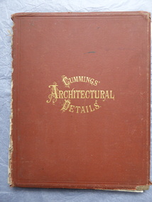
Book, Cummings Architectural Details, 1873
... This book was owned by John Crawley, engineer, architect and surveyor. He was appointed District Engineer for the Public Works Department for the Western District in 1866. ...Warrnambool and District Historical Society Inc. 2 Gilles Street (south of Merri St) Warrnambool great-ocean-road This book was owned by John Crawley, engineer, architect and surveyor. ...This book was owned by John Crawley, engineer, architect and surveyor. He was appointed District Engineer for the Public Works Department for the Western District in 1866. He was the Shire of Warrnambool Engineer from 1874 to 1895 when he was succeeded by his son.This book is of interest as it contains examples of architectural designs from U.S.A. in the 1870s. Designs such as these influenced the designs of buildings in other countries including Australia. This book is also of interest because of its connection to John Crawley, a member of the Crawley family that had a long and influential association with the Shire of Warrnambool.This is a hard cover book. It has a brown cover with gold lettering. The book has come apart from its binding so many of the pages are loose and the covering on the spine is missing . The front cover is somewhat stained and the edges are worn. The book has many diagrams and illustrations.The inscriptions are handwritten in black ink J. W. Crawley Warrnambool J.W. Crawley 1879john crawley, shire of warrnambool, crawley family -
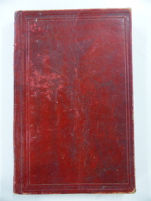
 Warrnambool and District Historical Society Inc.
Book, Architecture, 1865
... This book belonged to John William Crawley an engineer, architect and surveyor who was appointed District Engineer for the Public Works Department in the Western District in 1866. ...Warrnambool and District Historical Society Inc. 2 Gilles Street (south of Merri St) Warrnambool great-ocean-road This book belonged to John William Crawley an engineer, architect and surveyor who was appointed District Engineer for the Public Works Department in the Western District in 1866. ...This book belonged to John William Crawley an engineer, architect and surveyor who was appointed District Engineer for the Public Works Department in the Western District in 1866. He was the Shire of Warrnambool Engineer from 1874 to 1895 when he was succeeded by his son. This book is of minor importance as a memento of John William Crawley an important engineer in the Shire of WarrnamboolThis is a hard cover book with pages containing architectural plans, designs and printing. Some of the pages are blank. The cover is faded and spotted and has a gold title The spine is damaged. Inside the front cover is an inscription and on the following page is another inscription.J.W Crawley 1879 Architecture john william crawley, shire of warrnambool -
 Warrnambool and District Historical Society Inc.
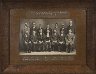
Photograph - Framed Photograph on the Occasion of Horace Lawson's Retirement, Arthur Jordan, 1918
... Warrnambool and District Historical Society Inc. 2 Gilles Street (south of Merri St) Warrnambool great-ocean-road This photograph was given to Horace Lawson on the occasion of his retirement in 1918 as Town Clerk of Warrnambool. The photographs are of the Town Clerk, the Town Surveyor ...This photograph was given to Horace Lawson on the occasion of his retirement in 1918 as Town Clerk of Warrnambool. The photographs are of the Town Clerk, the Town Surveyor, the Mayor and Councillors in June 1918. The Mayor, William Swinton and the Town Clerk, Horace Lawson are in civic robes. Horace Lawson had a distinguished career as the Town Clerk of Warrnambool from 1893 to 1918 (which is actually 25 years, not 30 years as stated on the photograph). Lawson was a keen cyclist and a member of the Warrnambool Volunteer Army Corps. He left Warrnambool in 1918 to take up the position in Melbourne as Secretary of the Municipal Association of Victoria. The photographer, Arthur Jordan, working in Warrnambool at the end of the 19th century and in the early 20th century, was well-known, particularly for his photographs of civic affairs. This photograph is of considerable interest as it concerns the retirement of Horace Lawson, an influential and highly-respected municipal officer in Warrnambool at a time of great growth in the town/city.This is a black and white photograph in a wooden frame with a heavy card inset and glass covering. The glass is broken at the right hand corner. On the back is a wire piece for hanging the photograph. The photograph is of 14 men with the names and inscription included.Presented to Mr. H.E. Lawson by the Mayor & Councillors of the City of Warrnambool on his retirement from the position of Town Clerk after 30 years faithful service June 1918 A.Lavercombe Town Surveyor W.E.Downing 1917 F.J.Gill 1917 M.L.Carter 1917 W. Burleigh 1915 H.H.Smith 1917 H.E.Lawson Town Clerk W. Swinton Mayor 1903 R.P. Christian 1917 W.H. Haberfield 1917 C. Jukes 1917 J.D.Anderson 1913 J.D. McConnell 1914 F.T. Retford 1916 Arthur Jordan Wboolarthur jordan, horace lawson, william swinton, warrnambool councillors -
 Warrnambool and District Historical Society Inc.
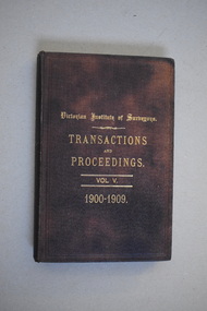
Book, Victorian Institute of Surveyors Transactions and Proceedings Vol V 1900-1909, 1910
... Warrnambool and District Historical Society Inc. 2 Gilles Street (south of Merri St) Warrnambool great-ocean-road This book belonged to John William Crawley, Junior who had acquired it in 1910 as a member of the Victorian Institute of Surveyors. ...This book belonged to John William Crawley, Junior who had acquired it in 1910 as a member of the Victorian Institute of Surveyors. John Crawley was an engineer, architect and surveyor in private practice in Warrnambool and also the official engineer of the Shire of Warrnambool from 1896 to 1935. His father, brother and son were also engineers and worked in that capacity for the Shire of Warrnambool or as the Shire Secretary, with the Crawley family members recording a total of 132 years of service to the Shire of Warrnambool which existed from 1863 to 1994. This book is retained as it belonged to John Crawley, the engineer for the Shire of Warrnambool for forty years. This is a hard cover book with a dark brown cover with gold printing on the front cover and spine. The cover is now stained. The book contains an introduction, twenty papers and reports from 1905 to 1910. There are many black and white photographs and fold-out maps and plans. The signature on the second page is handwritten in black ink. J.W.Crawley W’bool 26.3.10crawley family, warrnambool, shire of warrnambool, history of warrnambool -
 Warrnambool and District Historical Society Inc.
Book, Victorian Institute of Surveyors Transactions and Proceedings Vol. VI 1919, 1919
... Warrnambool and District Historical Society Inc. 2 Gilles Street (south of Merri St) Warrnambool great-ocean-road This book belonged to John William Crawley, Junior, a member of the Victorian Institute of Surveyors. ...This book belonged to John William Crawley, Junior, a member of the Victorian Institute of Surveyors. He was an engineer, architect and surveyor in private practice in Warrnambool and also the engineer for the Shire of Warrnambool from 1895 to 1935. His father, brother and son were also engineers and worked in that capacity or as the Shire Secretary for the Shire of Warrnambool, with the Crawley family members recording a total of 132 years of service to the Shire of Warrnambool which existed from 1863 to 1994. This book is retained as it belonged to John Crawley, the engineer for the Shire of Warrnambool for 40 years. This is a hard cover book with a dark brown cover with gold lettering on the spine. The cover is stained and worn away in places. The book contains 14 articles, reports of the Council for the years 1909 to 1919 and office-bearers for 1919-20. There are several black and white photographs and fold-out maps and plans. The signature on the first page is handwritten in black ink.J Wm Crawley 9/9/19crawley family, warrnambool, shire of warrnambool, history of warrnambool -
 Warrnambool and District Historical Society Inc.
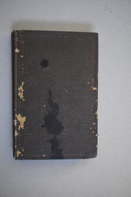
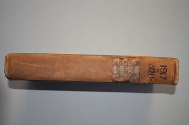
Letter book 7, 1917-1920, 1917
... Warrnambool and District Historical Society Inc. 2 Gilles Street (south of Merri St) Warrnambool great-ocean-road This letter book contains handwritten letters, sketch maps and plans and dates from 1917 to 1920. It comes from the office of John William Crawley Junior, an engineer, architect and surveyor ...This letter book contains handwritten letters, sketch maps and plans and dates from 1917 to 1920. It comes from the office of John William Crawley Junior, an engineer, architect and surveyor in private practice in Warrnambool and also the engineer for the Shire of Warrnambool from 1895 to 1935. His father, brother and son were also engineers and worked in that capacity or as Shire Secretary for the Shire of Warrnambool, with the Crawley family recording 132 years of service with the Shire of Warrnambool. The Shire existed from 1863 to 1994. The letter book was passed on to John Crawley’s son, Rolf, the engineer for the Shire of Warrnambool from 1935 to 1968. The letter book then came into the possession of Michael Hand who took over the private surveying business of Rolf Crawley in Warrnambool. The Warrnambool and District Historical Society then acquired this letter book, along with other Crawley ledgers, from the Michael Hand estate. This letter book is of considerable significance as it contains letters, plans and maps drawn up John William Crawley Junior, the engineer for the Shire of Warrnambool for 40 years. It will be very useful for research. This is a hard cover book of 745 pages. It has leather trim on the cover edges and the spine with gold lettering on the spine. The leather covering is scuffed and torn. The inside covers have a mottled blue lining. The book contains maps, plans and handwritten letters and has an alphabetical index at the beginning of the book. Most of the pages have been water-stained. ‘7 Private’ ‘Letter Book 1917 to 1920’john william crawley junior, warrnambool, rolf crawley, warrnambool, shire of warrnambool