
Showing 60 items matching "documents - maps - military "
-
 Bendigo Military Museum
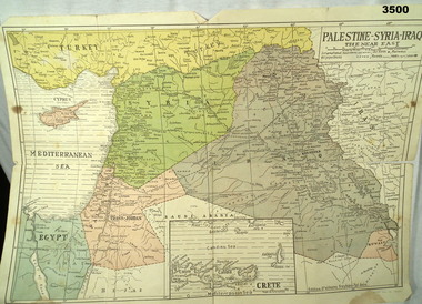
Map - MAP MIDDLE EAST, Dyag Press Ltd
... documents - maps...military...documents - maps military history Middle east Coloured map of Palestine, Syria, Iraq & Crete, countries involved in the war. ...Coloured map of Palestine, Syria, Iraq & Crete, countries involved in the war.documents - maps, military history, middle east -
 Bendigo Military Museum
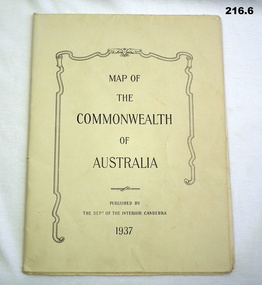
Map - MAPS, 1937
... documents - maps...military...Refer Cat No 215.9 for service history. documents - maps military equipment .1) map details on the map with biro lines marking the route taken by a traveller 1937 .2) map printed both sides Western New Guinea B6 December 1943 .3) map sheet B6 January 1944 top part of Australia .4) map Australia north plotting sheet .5) map C4 June 1943 .6) map Australian Aeronautical C5 June 1943 Map MAPS ...Items saved by Maurice Anthony BYRNE RAAF. Refer Cat No 215.9 for service history..1) map details on the map with biro lines marking the route taken by a traveller 1937 .2) map printed both sides Western New Guinea B6 December 1943 .3) map sheet B6 January 1944 top part of Australia .4) map Australia north plotting sheet .5) map C4 June 1943 .6) map Australian Aeronautical C5 June 1943documents - maps, military equipment -
 Bendigo Military Museum
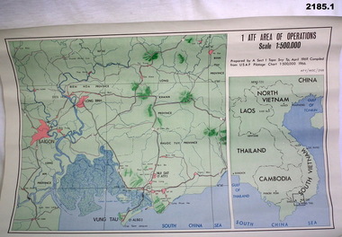
Map - MAPS, VIETNAM, April 1969
... documents - maps - military & tourist...documents - maps - military & tourist Vietnam 1.) Paper map, colour with black print, scale 1:500,000 area covers Saigon, Long Bin, Nui Dat, Vung Tau. .2) Laminated paper map showing city of Vung Tau with details of tourist destinations, hotels, churches, black & red print, scale 1:12,500 approx. ...1.) Paper map, colour with black print, scale 1:500,000 area covers Saigon, Long Bin, Nui Dat, Vung Tau. .2) Laminated paper map showing city of Vung Tau with details of tourist destinations, hotels, churches, black & red print, scale 1:12,500 approx.documents - maps - military & tourist, vietnam -
 Bendigo Military Museum
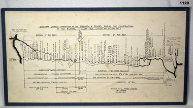
Map - DIAGRAM, MOUNTED
... documents - maps...military...Refer 2485 for his service history. documents - maps military history - pows Top centre: Diagram showing disposition of strength and others during construction of Burma - Siam Rly (Finished about Oct / Nov 1943) Diagram showing construction of Burma-Siam railway. ...Item donated by Alf Maskell POW. Refer 2485 for his service history.Diagram showing construction of Burma-Siam railway. White background with black writing & markings. Mounted on blue board.Top centre: Diagram showing disposition of strength and others during construction of Burma - Siam Rly (Finished about Oct / Nov 1943)documents - maps, military history - pows -
 Bendigo Military Museum
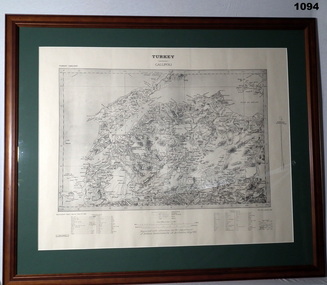
Map - MAP GALLIPOLI, FRAMED
... documents - maps...military...documents - maps military history Gallipoli Front Top Centre: Turkey, Gallipoli. ...Brown, wooden frame with glass front, white cardboard backing, map mounted with green border. Map of Gallipoli area in black & light grey with white border. A detailed map of Turkey area around Dardanelles with references & scale charts at bottom. Reprinted for the Department of Defence, Commonwealth of Australia, May 1915.Front Top Centre: Turkey, Gallipoli. Rear: Bethany Gallery stamp.documents - maps, military history, gallipoli -
 Bendigo Military Museum
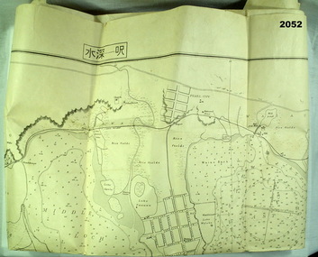
map - MAP, JAPANESE, C. 1930's
... documents - maps...military...documents - maps military history Pearl harbour Map, Japanese, B&W, yellowed "Pearl Harbour". ...Map, Japanese, B&W, yellowed "Pearl Harbour". Japanese and English translation, Map No. 2015.documents - maps, military history, pearl harbour -
 Bendigo Military Museum
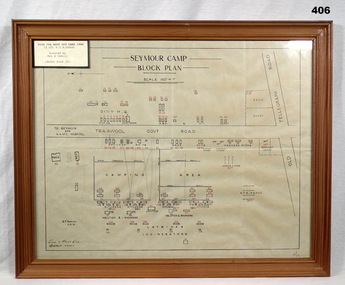
Map - PLAN, FRAMED
... documents - maps/plans...military...Refer Cat No 2039 for his Service History. documents - maps/plans military history - army frames Plan, detailing Seymour Camp Block Plan, Signals 7th Aust Div Camp 1940, re LT COL BENJAMIN THOMAS ROY CHADD. ...LT COL BENJAMIN THOMAS ROY CHADD No's 10594, VX20311, 1st and 2nd AIF. Refer Cat No 2039 for his Service History.Plan, detailing Seymour Camp Block Plan, Signals 7th Aust Div Camp 1940, re LT COL BENJAMIN THOMAS ROY CHADD. Tan coloured frame, glass front, cardboard backing, detail of camp layout, scale 160' = 1".documents - maps/plans, military history - army, frames -
 Bendigo Military Museum
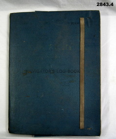
Administrative record - FOLDER, 2) & .3) Geographical Section, General Staff, No 4080 War Office 1941 et al, Navigator's Log Book, 2) & .3) 1941
... documents - maps/records...military...documents - maps/records military history passchendaele barracks trust .1) Hand written in black ink on front end paper: Wreck at Cape Juby. ....1) Navigator's Log Book, hard cover, blue colour buckram with dark blue paint on front cover. Back end paper includes a pocket for maps & has a Conversion Table & Nautical Miles, Statute Miles, Kilometres, tables in black print on beige paper included. Stiff card divider. .2) Map folded, black printing on beige paper. Gibraltar Scale 1:1,000,000 at 56 degrees N. .3) Map folded, black printing on beige paper. Algeria Scale 1:1,000,000 at 56 degrees N. .4) Pencil grey lead, timber colour. Stamped into pencil: HB Commonwealth of Australia..1) Hand written in black ink on front end paper: Wreck at Cape Juby. In pencil: S2 / MZ / W2 / 1Z . 35N .2) Hand written in blue pencil: Atlantic. Blue & red ink & lead pencil notations over map. .3) Hand written in blue pencil: Mediterranean. Blue & red ink numerous notations over map.documents - maps/records, military history, passchendaele barracks trust -
 Bendigo Military Museum
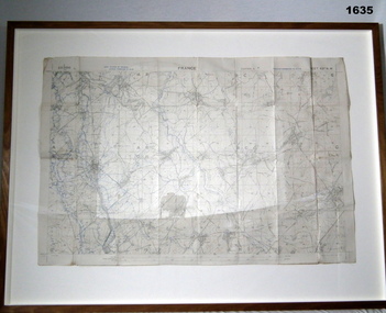
Map - TRENCH MAP, FRANCE WW1, FRAMED
... documents - maps...frame accessories...military...Refer 1634P for the story on the map. documents - maps frame accessories military history - army Top middle: France. ...Belonged to JOHN WILLIAM GRINTON No 1043 C Coy 38th Batt AIF. Refer Reg No 1280 for Service Details also 1317P, 1319P. Refer 1634P for the story on the map.Trench map of France - Edition 5A Bellicourt - Montbrahain - Bran Court. Tan, wooden frame, glass front with white cardboard backing. Hanging wire attached at back with centre strengthening brace. Map stuck on white background. German trenches in blue. Top middle: France. RHS bottom rear: The Union Studio - Castlemaine sticker.documents - maps, frame accessories, military history - army -
 Flagstaff Hill Maritime Museum and Village
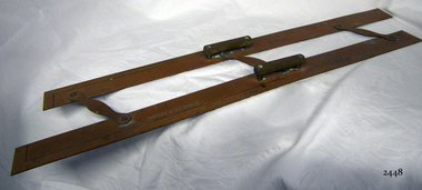
Parallel Rule, 1947-1955
... military use. (See Note section this document for further information on the company's origins) This model parallel map ruler is a good example of the commercial diversity of navigational instruments made by Kelvin & Hughes after world war 2. ...History/Context: In 1947, the scientific instrument manufacturing firms of Henry Hughes & Son Ltd, London, England, and Kelvin Bottomley & Baird Ltd, Glasgow, Scotland, came together to form Kelvin & Hughes Ltd. Hughes Company History: Henry Hughes & Sons were founded in 1838 in London as a maker of chronographic and scientific instruments. The firm was incorporated as “Henry Hughes & Sons Ltd” in 1903. In 1923, the company produced its first recording echo sounder and in 1935 a controlling interest in the company was acquired by S Smith & Son Ltd resulting in the development and production of marine and aircraft instruments. Following the London office's destruction in the Blitz of 1941, a collaboration was entered into with Kelvin, Bottomley & Baird Ltd resulting in the establishing “Marine Instruments Ltd”. Following the formal amalgamation of Kelvin, Bottomley & Baird Ltd and Henry Hughes & Sons Ltd in 1947 to form Kelvin & Hughes Ltd. Marine Instruments Ltd then acted as regional agents in the UK for Kelvin & Hughes Ltd who were essentially now a part of Smith's Industries Ltd founded in 1944 and the successors of S. Smith & Son Ltd. Kelvin & Hughes Ltd went on to develop various marine radar and echo sounders supplying the Ministry of Transport, and later the Ministry of Defence. The firm was liquidated in 1966 but the name was continued as Kelvin Hughes, a division of the Smiths Group. In 2002, Kelvin Hughes continues to produce and develop marine instruments for commercial and military use. (See Note section this document for further information on the company's origins)This model parallel map ruler is a good example of the commercial diversity of navigational instruments made by Kelvin & Hughes after world war 2. It was made in numbers for use by shipping after the second world war and is not particularly rare or significant for its type. Also, it was made no earlier than 1947 as the firms of Kelvin, Bottomley & Baird Ltd and Henry Hughes & Sons Ltd who took over from Smith & Sons were not amalgamated until 1947. It can there for be assumed that this ruler was made during the company's transitional period to Kelvin & Hughes from Smith Industries Ltd.Metal parallel rule with Kelvin & Hughes Ltd, Made in Great Britain imprinted, numerous measurements, two handles and 3 hinges.flagstaff hill, warrnambool, shipwrecked-coast, flagstaff-hill, flagstaff-hill-maritime-museum, maritime-museum, shipwreck-coast, flagstaff-hill-maritime-village, parallel rule, kelbin & hughes ltd, metal parallel rule -
 Federation University Historical Collection
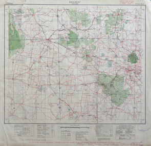
Map, Ballarat, Victoria, 1942, 1942
... Printed in red at the base of the map "This map is an official document. If found, itmust be handed in to the nearest Military Headquarters or Police Station....ballarat map world war two skipton creswick ararat lake bolac Printed in red at the base of the map "This map is an official document. If found, itmust be handed in to the nearest Military Headquarters or Police Station. ...Two copies of a map of the district around Ballarat, including Creswick, Scarsdale, Smythesdale, Lake Bolac, Ararat, Talbot, Sebastopol, Maryborough, Cardigan, Skipton, Mount Emu Creek, Leigh River, Fiery Creek, Hopkins River. Street names are listed on the back of the map. It includes roads, timber, creeks, rivers, telephone lines, railwayPrinted in red at the base of the map "This map is an official document. If found, itmust be handed in to the nearest Military Headquarters or Police Station.ballarat, map, world war two, skipton, creswick, ararat, lake bolac -
 Federation University Historical Collection
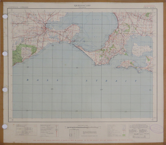
Map, Queenscliff, 1942, 1942
... "This map in an official document, if found, it must be handed in to the nearest military headquarters or police station."...queenscliff portsea point nepean point lonsdale barwon heads geelong corio bay port phillip bay "This map in an official document, if found, it must be handed in to the nearest military headquarters or police station." ...Two copies of printed colour map on paper showing Queenscliff and surrounds"This map in an official document, if found, it must be handed in to the nearest military headquarters or police station."queenscliff, portsea, point nepean, point lonsdale, barwon heads, geelong, corio bay, port phillip bay -
 Federation University Historical Collection
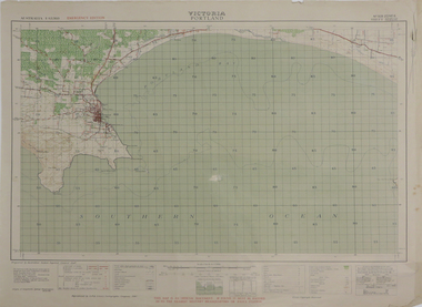
Map, Portland, 1942, 1942
... "This map is an official document. If found, it must be handed in to the nearest military headquarters or police. ...porland cape nelson lawrence rock point danger whaler's point "This map is an official document. If found, it must be handed in to the nearest military headquarters or police. ...Printed colour map on paper"This map is an official document. If found, it must be handed in to the nearest military headquarters or police. porland, cape nelson, lawrence rock, point danger, whaler's point -
 Federation University Historical Collection
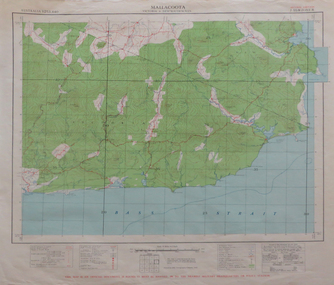
Map, Mallacoota, 1942, 1942
... This map is an official document, if found, it must be handed in to the nearest military headquarters or police station...mallacoota bass straight cape evarard cann river genoa river disaster bay This map is an official document, if found, it must be handed in to the nearest military headquarters or police station Printed colour map on paper Mallacoota, 1942 Map Map ...Printed colour map on paperThis map is an official document, if found, it must be handed in to the nearest military headquarters or police stationmallacoota, bass straight, cape evarard, cann river, genoa river, disaster bay -
 Flagstaff Hill Maritime Museum and Village
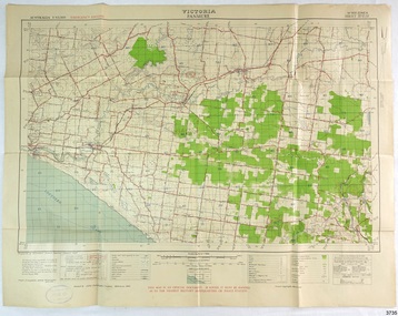
Document - Map, Department of Lands & Survey, Victoria / Panmure, 1942
... Printed in black; 'Victoria / Panmure", "No. 930 / Zone 6" Printed in red; “EMERGENCY EDITION”, “THIS MAP IS AN OFFICIAL DOCUMENT. IF FOUND, IT MUST BE HANDED / IN TO THE NEAREST MILITARY HEADQUARTERS OR POLICE STATION” Stamped: within concentric ovals (“- - - FOR SALE / PRICE 2/- / - - - - - OF THE ARMY”)...The collection includes Dr Angus’s Army objects and is significant as an example of items issued to Doctors and Surgeons in the Medical Services of the Australian Army in World War II flagstaff hill warrnambool flagstaff hill maritime museum maritime museum shipwreck coast flagstaff hill maritime village great ocean road dr w r angus dr ryan warrnambool base hospital flying doctor surgeon captain australian department of defence royal australian army world war 2 map panmure 1942 Roy Angus Port Medical Officer Nhill Base Hospital Military map Emergency Map Military Service Australian Army Department of Army Department of Lands and Survey A.H.Q. Cartographic Company Melbourne Panmure 1942 Australian Section Imperial General Staff Printed in black; 'Victoria / Panmure", "No. 930 / Zone 6" Printed in red; “EMERGENCY EDITION”, “THIS MAP IS AN OFFICIAL DOCUMENT. ...This Emergency Edition of the map of Panmure, Victoria, is part of the W.R. Angus Collection. It was printed in 1942 during World War II. It is one of two maps donated to Flagstaff Hill Maritime Village by the family of Doctor William Roy Angus, who served as Surgeon Captain in the Australian Defence Department. The map was compiled for the Dept. of Army by the Dept. of Lands and Survey in Melbourne, prepared by the Australian Section of the Imperial General Staff, which was a British Government body created in 1907 to co-ordinate the defence of Britain and its Empire. It was printed by A.H.Q. Cartographic Company, Survey Corps, which was formed in 1941. The Corp changed its name to L.H.Q. Cartographic Company of Bendigo. In 1947 the name reverted back to the A.H.Q. Cartographic Company until 1955 when it became the A.H.Q. Survey Regiment. The W.R. Angus Collection includes historical medical equipment, surgical instruments and material once belonging to Dr Edward Ryan and Dr Thomas Francis Ryan, (both of Nhill, Victoria) as well as Dr Angus’ own belongings. The Collection’s history spans the medical practices of the two Doctors Ryan, from 1885-1926 plus that of Dr Angus who began practice in 1924. Dr. Angus served with the Australian Department of Defence as a Surgeon Captain during the Second World Was from 1942 to 1945. He served in Ballarat, Victoria, and in Bonegilla, N.S.W. until he suffering from a heart attack just before the war ended. ABOUT THE “W.R.ANGUS COLLECTION” - Doctor William Roy Angus M.B., B.S., Adel., 1923, F.R.C.S. Edin.,1928, was generally known as Dr Roy Angus. His working life included a position as a doctor with the Flying Doctor Service in Australia’s rural and remote areas. After many varied experiences Dr Angus and his family moved to Warrnambool in 1939 where he purchased “Birchwood,” the 1852 home and medical practice of Dr John Hunter Henderson. He was appointed on a part-time basis as Port Medical Officer in Warrnambool and held this position until the 1940’s when the government no longer required the service of a Port Medical Officer. Dr Angus was a surgeon at the Warrnambool Base Hospital 1939-1942. After further studies he commenced practice as an ophthalmologist in Warrnambool, pioneering in artificial eye improvements. He was Honorary Consultant Ophthalmologist to Warrnambool Base Hospital for 31 years and made monthly visits to Portland to perform eye surgery. Dr Angus and his wife Gladys were very involved in Warrnambool’s community with a strong interest in civic affairs. They were both involved in the creation of Flagstaff Hill Maritime Village, including the layout of the gardens. After his death on 28th March 1970 his family requested his practitioner’s plate, medical instruments and some personal belongings be displayed in the Port Medical Office surgery at Flagstaff Hill Maritime Village, and be called the “W. R. Angus Collection”. This Emergency Edition of the Map of Panmure is significant as an example of the documents prepared for the defence of Australia in World War 2. The Map is also significant for its connection between the Australian Army and the involvement of Dr WR Angus as a Surgeon in the Medical Services during World War II. The W.R. Angus Collection is significant for still being located at the site it is connected with, Doctor Angus being the last Port Medical Officer in Warrnambool. The collection of medical instruments and other equipment is culturally significant, being an historical example of medicine, administration, household equipment and clothing from late 19th to mid-20th century. Dr Angus assisted Dr Tom Ryan, a pioneer in the use of X-rays and in ocular surgery. The collection includes Dr Angus’s Army objects and is significant as an example of items issued to Doctors and Surgeons in the Medical Services of the Australian Army in World War IIMilitary map of Panmure, Victoria, Australia; part of the W.R. Angus Collection. Rectangular coloured map on cream paper for the Australian Army. Details include sea, waterways and land, contour lines, grid lines, names of districts, towns and roads, bridges, swamps, rail lines, cuttings, tracks, buildings (including blacksmiths), pumps, lighthouses, telegraph, telephones and electric transmission lines, and fire stations. The map has margin notes that include distances in miles to nearby towns. The map was compiled for the Dept. of Army by the Dept. of Lands and Survey in Melbourne, prepared by the Australian Section, Imperial General Staff and printed by A.H.Q. Cartographic Company, Melbourne in 1942. Crown Copyright Reserved. Inscriptions in red print state that it is and Emergency Edition and an Official document. An oval purple stamp includes the price.Printed in black; 'Victoria / Panmure", "No. 930 / Zone 6" Printed in red; “EMERGENCY EDITION”, “THIS MAP IS AN OFFICIAL DOCUMENT. IF FOUND, IT MUST BE HANDED / IN TO THE NEAREST MILITARY HEADQUARTERS OR POLICE STATION” Stamped: within concentric ovals (“- - - FOR SALE / PRICE 2/- / - - - - - OF THE ARMY”)flagstaff hill, warrnambool, flagstaff hill maritime museum, maritime museum, shipwreck coast, flagstaff hill maritime village, great ocean road, dr w r angus, dr ryan, warrnambool base hospital, flying doctor, surgeon captain, australian department of defence, royal australian army, world war 2, map panmure 1942, roy angus, port medical officer, nhill base hospital, military map, emergency map, military service australian army, department of army, department of lands and survey, a.h.q. cartographic company melbourne, panmure 1942, australian section, imperial general staff -
 Flagstaff Hill Maritime Museum and Village
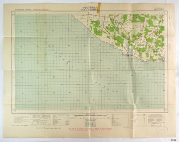
Document - Map, Department of Lands & Survey, Victoria / Port Campbell, 1942
... Printed in black; 'Victoria / Port Campbell", "No. 932 / Zone 6" Printed in red; “EMERGENCY EDITION”, “THIS MAP IS AN OFFICIAL DOCUMENT. IF FOUND, IT MUST BE HANDED / IN TO THE NEAREST MILITARY HEADQUARTERS OR POLICE STATION” Stamped: within concentric ovals (“- - - FOR SALE / PRICE 2/- / - - - - - OF THE ARMY”)...The collection includes Dr Angus’s Army objects and is significant as an example of items issued to Doctors and Surgeons in the Medical Services of the Australian Army in World War II flagstaff hill warrnambool flagstaff hill maritime museum maritime museum shipwreck coast flagstaff hill maritime village great ocean road dr w r angus dr ryan warrnambool base hospital nhill base hospital flying doctor surgeon captain map port campbell 1942 Roy Angus Port Medical Officer Military map Emergency Map Australian Department of Defence Royal Australian Army Military Service Australian Army Department of Army Department of Lands and Survey World War 2 A.H.Q. Cartographic Company Melbourne Australian Section Imperial General Staff Port Campbell 1942 Printed in black; 'Victoria / Port Campbell", "No. 932 / Zone 6" Printed in red; “EMERGENCY EDITION”, “THIS MAP IS AN OFFICIAL DOCUMENT. ...This Emergency Edition of the map of Port Campbell, Victoria, is part of the W.R. Angus Collection. It was printed in 1942 during World War II. It is one of two maps donated to Flagstaff Hill Maritime Village by the family of Doctor William Roy Angus, who served as Surgeon Captain in the Australian Defence Department. The map was compiled for the Dept. of Army by the Dept. of Lands and Survey in Melbourne, prepared by the Australian Section of the Imperial General Staff, which was a British Government body created in 1907 to co-ordinate the defence of Britain and its Empire. It was printed by A.H.Q. Cartographic Company, Survey Corps, which was formed in 1941. The Corp changed its name to L.H.Q. Cartographic Company of Bendigo. In 1947 the name reverted back to the A.H.Q. Cartographic Company until 1955 when it became the A.H.Q. Survey Regiment. The W.R. Angus Collection includes historical medical equipment, surgical instruments and material once belonging to Dr Edward Ryan and Dr Thomas Francis Ryan, (both of Nhill, Victoria) as well as Dr Angus’ own belongings. The Collection’s history spans the medical practices of the two Doctors Ryan, from 1885-1926 plus that of Dr Angus who began practice in 1924. Dr Angus served with the Australian Department of Defence as a Surgeon Captain during the Second World Was from 1942 to 1945. He served in Ballarat, Victoria, and in Bonegilla, N.S.W. until he suffering from a heart attack just before the war ended. ABOUT THE “W.R.ANGUS COLLECTION” - Doctor William Roy Angus M.B., B.S., Adel., 1923, F.R.C.S. Edin.,1928, was generally known as Dr Roy Angus. His working life included a position as a doctor with the Flying Doctor Service in Australia’s rural and remote areas. After many varied experiences Dr Angus and his family moved to Warrnambool in 1939 where he purchased “Birchwood,” the 1852 home and medical practice of Dr John Hunter Henderson. He was appointed on a part-time basis as Port Medical Officer in Warrnambool and held this position until the 1940’s when the government no longer required the service of a Port Medical Officer. Dr Angus was a surgeon at the Warrnambool Base Hospital 1939-1942. After further studies he commenced practice as an ophthalmologist in Warrnambool, pioneering in artificial eye improvements. He was Honorary Consultant Ophthalmologist to Warrnambool Base Hospital for 31 years and made monthly visits to Portland to perform eye surgery. Dr Angus and his wife Gladys were very involved in Warrnambool’s community with a strong interest in civic affairs. They were both involved in the creation of Flagstaff Hill Maritime Village, including the layout of the gardens. After his death on 28th March 1970 his family requested his practitioner’s plate, medical instruments and some personal belongings be displayed in the Port Medical Office surgery at Flagstaff Hill Maritime Village, and be called the “W. R. Angus Collection”. This Emergency Edition of the Map of Port Campbell is significant as an example of the documents prepared for the defence of Australia in World War 2. The Map is also significant for its connection between the Australian Army and the involvement of Dr WR Angus as a Surgeon in the Medical Services during World War II. The W.R. Angus Collection is significant for still being located at the site it is connected with, Doctor Angus being the last Port Medical Officer in Warrnambool. The collection of medical instruments and other equipment is culturally significant, being an historical example of medicine, administration, household equipment and clothing from late 19th to mid-20th century. Dr Angus assisted Dr Tom Ryan, a pioneer in the use of X-rays and in ocular surgery. The collection includes Dr Angus’s Army objects and is significant as an example of items issued to Doctors and Surgeons in the Medical Services of the Australian Army in World War IIMilitary map of Port Campbell, Victoria, Australia; part of the W.R. Angus Collection. Rectangular coloured map on cream paper for the Australian Army. Details include sea, waterways and land, contour lines, grid lines, names of districts, towns and roads, bridges, swamps, rail lines, cuttings, tracks, buildings (including blacksmiths), pumps, lighthouses, telegraph, telephones and electric transmission lines, and fire stations. The map has margin notes that include distances in miles to nearby towns. The map was compiled for the Dept. of Army by the Dept. of Lands and Survey in Melbourne, prepared by the Australian Section, Imperial General Staff and printed by A.H.Q. Cartographic Company, Melbourne in 1942. Crown Copyright Reserved. Inscriptions in red print state that it is and Emergency Edition and an Official document. An oval purple stamp includes the price.Printed in black; 'Victoria / Port Campbell", "No. 932 / Zone 6" Printed in red; “EMERGENCY EDITION”, “THIS MAP IS AN OFFICIAL DOCUMENT. IF FOUND, IT MUST BE HANDED / IN TO THE NEAREST MILITARY HEADQUARTERS OR POLICE STATION” Stamped: within concentric ovals (“- - - FOR SALE / PRICE 2/- / - - - - - OF THE ARMY”)flagstaff hill, warrnambool, flagstaff hill maritime museum, maritime museum, shipwreck coast, flagstaff hill maritime village, great ocean road, dr w r angus, dr ryan, warrnambool base hospital, nhill base hospital, flying doctor, surgeon captain, map port campbell 1942, roy angus, port medical officer, military map, emergency map, australian department of defence, royal australian army, military service australian army, department of army, department of lands and survey, world war 2, a.h.q. cartographic company melbourne, australian section, imperial general staff, port campbell 1942 -
 Bendigo Military Museum
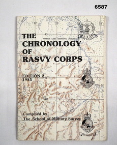
Booklet - The Chronology of the Royal Australian Survey Corps - Ed2 1985, School of Military Survey, Bonegilla, Vic, 24.06.1985
... document as part of their research. Royal Australian Survey Corps RASvy Fortuna Army Survey Regiment Army Svy Regt School of Military Survey Compiled and printed by the School of Military Survey A5 paper booklet, 56 x pages and stapled. Cover is a printed map ...This is the second Edition of the "Chrology of the Royal Australian Survey Corps" produced in 1985 by the officers at the School of Military Survey (SMS). The First Edition produced in 1979 was also produced at the SMS. Since the first edition was produced, a definitive history of the Corps has been published by Brigadier Fitzgerald in his book "Lebanon to Labuan" in 1980 and is the story of the Corps during WWII. This new edition has been completely revised and updated. In order that amendments for future editions may easily be made, this document has compiled on computer. Signed LTCOL JG Corless Commanding Officer SMS. Future and final editions of the History of the Royal Australian Survey Corps have used this document as part of their research.A5 paper booklet, 56 x pages and stapled. Cover is a printed map with title and printed versions of the initial Australian Survey Corps Badge, the "King's and Queen's Crown" versions of the Royal Australian Survey Corps badges. The booklet contains computer text and poor quality B/W photographs.Compiled and printed by the School of Military Surveyroyal australian survey corps, rasvy, fortuna, army survey regiment, army svy regt, school of military survey -
 Bendigo Military Museum
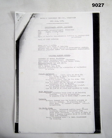
Document - Notes for the 1947 Commomwealth Survey Committee Meeting - Colonel Fitzgerald, 10 June 1947
... Military Survey. The document records the Members of the Committee and the frequency of Meetings and roles. The aim of the Committee was to avoid duplication of effort and to coordinate activities. The document describes the Military work being undertaken in each state and the manpower employed doing that. Of interest it also describes that the Army accepts producing the maps...Military Survey. The document records the Members of the Committee and the frequency of Meetings and roles. The aim of the Committee was to avoid duplication of effort and to coordinate activities. The document describes the Military work being undertaken in each state and the manpower employed doing that. Of interest it also describes that the Army accepts producing the maps ...These are notes for the 1947 Meeting of the Commonwealth Survey Committee by Colonel Fitzgerald Director of Military Survey. The document records the Members of the Committee and the frequency of Meetings and roles. The aim of the Committee was to avoid duplication of effort and to coordinate activities. The document describes the Military work being undertaken in each state and the manpower employed doing that. Of interest it also describes that the Army accepts producing the maps for the RAAF. The document provides a manning table indicating 28 Officers and 210 OR's in the Australian Survey Corps with a proposal for $3 Officers and 457 OR's as Post War Establishment. Documents also include directives and guidance from and to the Assistant Secretary, and Secretary, Department of Defence5 x A4 photocopy pages of typed text, stapled in the top Left-hand cornerroyal australian survey corps, rasvy, fortuna, army survey regiment, army svy regt, asr -
 Bendigo Military Museum
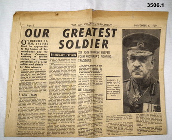
Newspaper - NEWSPAPER CUTTINGS, 1) 6.11.1959; .2) 2.7.1931
... See also Cat No's 3504P & 3505.23. documents - newspapers illustrations - pen ink military history .1) Page 2. taken from The Sun Children's Supplement, 6.11.1959 with article on Sir John Monash. .2) Clipping from The Herald, 2.7.1931 with a further clipping stuck onto the reverse of the sheet, origin unknown. Map ...See also Cat No's 3504P & 3505.23..1) Page 2. taken from The Sun Children's Supplement, 6.11.1959 with article on Sir John Monash. .2) Clipping from The Herald, 2.7.1931 with a further clipping stuck onto the reverse of the sheet, origin unknown. Map of front line on French / Belgian border from 1918 - The Hindenberg line & queries whether the Americans won the war. .3) Loose paper with biro portrait of man also in photos 3505.26Pdocuments - newspapers, illustrations - pen ink, military history -
 Bendigo Military Museum
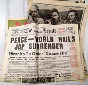
Newspaper - NEWSPAPERS & SUPPLEMENTS, 1) 15.8.1945; .2) 15.8.1995; .3) 29.7.1968; .4) 29.8.1973
... documents - newspapers military history Supplements. .1) The Herald 8.1945. Japanese Surrender. Broad sheet newspaper. .2) Bendigo Advertiser 8.1995. Special supplement commemorating the 50th anniversary of the end of WWII. Broadsheet. .3) The Age 7.1968. Pages 9/10, map ....1) The Herald 8.1945. Japanese Surrender. Broad sheet newspaper. .2) Bendigo Advertiser 8.1995. Special supplement commemorating the 50th anniversary of the end of WWII. Broadsheet. .3) The Age 7.1968. Pages 9/10, map showing Australia's place in Asian Defence 1967 - 68. Broadsheet. .4) The Sun 8.1973. Torn sheet showing photo of 3 marksmen from Bendigo & their rifles.documents - newspapers, military history, supplements. -
 Bendigo Military Museum
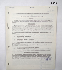
Administrative record - Royal Australian Survey Corps - A simple silk screen equipment for limited map reproduction by LTCOL HM Hall (RASvy) 1967, LtCol HM Hall (RASvy), 6 Feb 1967
... map reproduction and overprinting under field conditions. Written by LtCol HM Hall (RASvy) Royal Australian Survey Corps RASvy Fortuna Army Survey Regiment Army Svy Regt ASR School of Military Survey SMS 8 x A4 page document containing typed text, photos and map extract Royal Australian Survey Corps - A simple silk screen equipment for limited map reproduction by LTCOL HM Hall (RASvy) 1967 Administrative record Royal Australian Survey Corps - A simple silk screen equipment for limited map reproduction by LTCOL HM Hall (RASvy) 1967 LtCol HM Hall (RASvy) ...This paper deals with the employment of Hand operated Mobile Screen Printing Equipment and its associated cartographic techniques for limited map reproduction and overprinting under field conditions. Written by LtCol HM Hall (RASvy)8 x A4 page document containing typed text, photos and map extractroyal australian survey corps, rasvy, fortuna, army survey regiment, army svy regt, asr, school of military survey, sms -
 Bendigo Military Museum
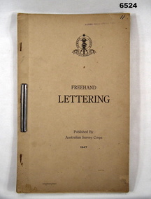
Pamphlet - Australian Survey Corps - Freehand Lettering Pamphlet 1947, Australian Survey Corps, Balcombe, 1947
... military maps was hand lettered in ink and an extremely high level of proficiency was required. Later technology changes meant that there was less reliance on hand lettering. This 17 x foolscap sized page booklet with light buff coloured cardboard covers held together with an ARNOS fastener was used to teach members of the Australian Survey Corps how to Hand Letter in 1947. Example practice lettering style work sheets are included at the rear of the document...military maps was hand lettered in ink and an extremely high level of proficiency was required. Later technology changes meant that there was less reliance on hand lettering. This 17 x foolscap sized page booklet with light buff coloured cardboard covers held together with an ARNOS fastener was used to teach members of the Australian Survey Corps how to Hand Letter in 1947. Example practice lettering style work sheets are included at the rear of the document ...All members of the Australian Survey Corps, that was later renamed the Royal Australian Survey Corps were expected to be proficient at freehand lettering and figuring. Initially all text on military maps was hand lettered in ink and an extremely high level of proficiency was required. Later technology changes meant that there was less reliance on hand lettering. This 17 x foolscap sized page booklet with light buff coloured cardboard covers held together with an ARNOS fastener was used to teach members of the Australian Survey Corps how to Hand Letter in 1947. Example practice lettering style work sheets are included at the rear of the document.17 x foolscap sized pages with light buff coloured cardboard covers held together with an ARNOS fastener. Example lettering style work sheets at the rear of the document. Cover has Australian Survey Corps Theodolite Badge in black and white above the Title "Freehand Lettering Published By Australian Survey Corps 1947.Hand-written No"11" in top RH corner. Has a stamp " E COMD FIELD SURVEY Unit"royal australian survey corps, rasvy, fortuna, army survey regiment, army svy regt, asr, school of military survey, sms, balcombe -
 Bendigo Military Museum
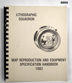
Manual - Map Reproduction and Equipment Specification Handbook, 1982
... military map production. Part 2 provided various tables such as printing sizes conversion tables. Part 3 provided technical guidance on the stipples and screens utilised in the map reproduction process. Part 4 detailed the Pantone Matching System printing colours for map and chart products. Part 5 was a Glossary of Lithographic Technical Terms. Royal Australian Survey Corps RASvy Fortuna Army Svy Regt ASR Army Survey Regiment Army Survey Regiment Manual/handbook with a manilla cover comprising approximately 100 pages. The pages in the document ...This handbook provided comprehensive technical information principally to the lithographic technician and to other Royal Australian Survey Corps technical trades. Part 1 comprised technical descriptions and photos of lithographic equipment used in military map production. Part 2 provided various tables such as printing sizes conversion tables. Part 3 provided technical guidance on the stipples and screens utilised in the map reproduction process. Part 4 detailed the Pantone Matching System printing colours for map and chart products. Part 5 was a Glossary of Lithographic Technical Terms.Army Survey Regiment Manual/handbook with a manilla cover comprising approximately 100 pages. The pages in the document are in black and white paper providing technical information and photograph identifying lithographic equipment and other information to lithographic technicians. Printed on standard paper bound by a by a black plastic spiral spline.royal australian survey corps, rasvy, fortuna, army svy regt, asr, army survey regiment -
 Bendigo Military Museum
Manual - DRAFT SPECIFICATIONS FOR TOPOGRAPHIC MAP SERIES, Specifications for 1:50000 and 1:25000 maps produced in Australia, Circa 1973
... These draft Specifications set out the Standards for the production of topographic maps within the Commonwealth of Australia at scales of 1:50000 and 1:25000 and are designed to satisfy the basic requirements of both civil and military map users. Royal Australian Survey Corps RASvy Fortuna Army Survey Regiment ASR Hard cover, cloth, Red, 11 Annexes, Supplementary documents. ...These draft Specifications set out the Standards for the production of topographic maps within the Commonwealth of Australia at scales of 1:50000 and 1:25000 and are designed to satisfy the basic requirements of both civil and military map users.Hard cover, cloth, Red, 11 Annexes, Supplementary documents.royal australian survey corps, rasvy, fortuna, army survey regiment, asr -
 Bendigo Military Museum
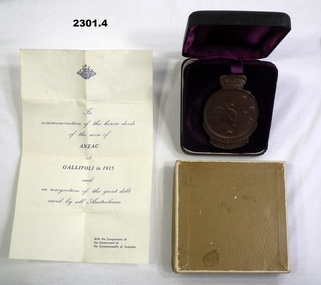
Award - MEDALLION, BOXES & LETTER
... Refer 2325.2 for his service history. numismatics - medals /military documents - letters containers .2) 1915 ANZAC, H E Hambly .1) Letter, small, yellowish with Coat of Arms, writing in blue re Commemorative ANZAC Medallion 1915. .2) Commemorative ANZAC medallion, front has crown over Simpson & donkey, rear has map of Australia & stars. .3) Small box, black, folds open, felt lined in purple, holds .2). .4) Small cardboard box, brown colour, holds .2) & .3). ...Horace Eli Hambly No 794 AIF. Refer 2325.2 for his service history..1) Letter, small, yellowish with Coat of Arms, writing in blue re Commemorative ANZAC Medallion 1915. .2) Commemorative ANZAC medallion, front has crown over Simpson & donkey, rear has map of Australia & stars. .3) Small box, black, folds open, felt lined in purple, holds .2). .4) Small cardboard box, brown colour, holds .2) & .3)..2) 1915 ANZAC, H E Hamblynumismatics - medals /military, documents - letters, containers -
 Bendigo Military Museum
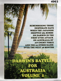
Book - BOOK, DARWIN, RUWOLDT Rex, Darwin's Battle for Australia. Vol. 2, 2005
... Military History Darwin WW2 Soft cover book. Cover - cardboard, yellow and black print on front, spine and back. Illustrated front - colour photograph of a beach scene, back - small colour photograph of the author's superimposed over colour photograph of a beach scene. 368 pages, cut, plain, glossy white, illustrated black and white and colour photographs, maps and documents. ...From the front cover " REMEMBERING THOSE/ DESPARATE DAYS/ WHEN THE JAPANESE/ DROPPED 683 BOMBS ON DARWIN IN THE/ FIRST EVER ATTACK/ ON AUSTRALIA BY/ AN ENEMY FORCE/ AND THE 62 OTHER RAIDS/ OVER THE NEXT 18 MONTHS.Soft cover book. Cover - cardboard, yellow and black print on front, spine and back. Illustrated front - colour photograph of a beach scene, back - small colour photograph of the author's superimposed over colour photograph of a beach scene. 368 pages, cut, plain, glossy white, illustrated black and white and colour photographs, maps and documents. DVD Plastic, adhered to back end paper.books, military history, darwin, ww2 -
 Bendigo Military Museum
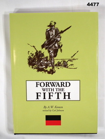
Book - BOOK, History of the 5th Battalion AIF WWI, Albert William Keown, "Forward with the Fifth"
... Military History WWI Opposite Title Page - printed donation label - "Donated by 39th Australian Infantry Battalion (1941-1943) Association Inc. www.39battalion.com" Hard cover with dust cover. Hard cover, cardboard with black coloured buckraw, red print on front and spine. Front - illustrated - silhouette drawing of soldier in uniform Back - black and white photograph of 2 soldiers on camel back. Small black over red rectangular colour patch front and back 342 pages, cut, plain, white. Illustrated black and white photographs, portraits, maps and documents ..."Narrative of the service history of the Fifth (Victorian) Infantry Battalion 1st AIF". "A remarkable testimony of their sacrifice in the First World War".Hard cover with dust cover. Hard cover, cardboard with black coloured buckraw, red print on front and spine. Front - illustrated - silhouette drawing of soldier in uniform Back - black and white photograph of 2 soldiers on camel back. Small black over red rectangular colour patch front and back 342 pages, cut, plain, white. Illustrated black and white photographs, portraits, maps and documents.Opposite Title Page - printed donation label - "Donated by 39th Australian Infantry Battalion (1941-1943) Association Inc. www.39battalion.com"books, military, history, wwi -
 Bendigo Military Museum
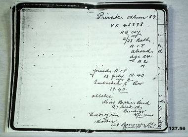
Literary work - DIARY, 1940
... map ref El Alamein 1/50000 87703021. He was required later at El Alamein cemetery grave 10, plot 8 row H 4.12.1942. As per the diary in case of his death he allotted any personnel affects to Miss Bettie Bird, refer 136.2P. The original diary was held by William (Billy) Bird, Betties brother, refer 1601. Billy and Colin rode bikes together. Also refer 128.2, 135.2, 137.3P documents diaries copies military ...Colin George ODLUM No VX45898 (born Bendigo, enlisted Caulfield) In the 2nd AIF on 1.7.1940 age 22 years. Colin was then posted to the 2/23rd Bn on 16.10.1940 at Bonegilla, embarked on 16.11.40 for the Middle East and disembarked on 17.12.1940. He was then graded group 2 Signaller. He went through the siege of Tobruk. Colin was KIA on 12.7.1942 at El Alamein. He is listed as buried 13.7.1942 grave No 11 map ref El Alamein 1/50000 87703021. He was required later at El Alamein cemetery grave 10, plot 8 row H 4.12.1942. As per the diary in case of his death he allotted any personnel affects to Miss Bettie Bird, refer 136.2P. The original diary was held by William (Billy) Bird, Betties brother, refer 1601. Billy and Colin rode bikes together. Also refer 128.2, 135.2, 137.3PPhotocopy of an extensive 56 page diary written by Colin ODLUM.Private Odlum C.G VX45898 HQ Coy 2/23 Batt AIF Abroad, Age 24, A2, Mdocuments, diaries, copies, military history -
 Bendigo Military Museum
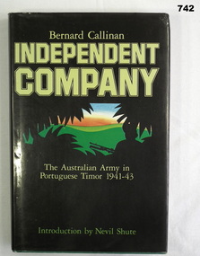
Book, William Heinemann, Independent Company The Australian Army in Portuguese Timor 1941-43, 1984
... Documents the role of the Australian Army in Portuguese Timor from 1941-43. Introduction written by Nevil Shute. books military history timor Printed sticker inside front cover "From Bishop Daly's collection 2004" On title page "+ N D Daly, Bendigo. January 1986" 235 page green hardcover book with gold title on spine. Dust cover is black with silhouette of soldier and leaves against green hills and orange and blue skyline. Pages edges are cut, inside front cover has map ...Documents the role of the Australian Army in Portuguese Timor from 1941-43. Introduction written by Nevil Shute.235 page green hardcover book with gold title on spine. Dust cover is black with silhouette of soldier and leaves against green hills and orange and blue skyline. Pages edges are cut, inside front cover has map of SE Asia and inside back cover has map of Timor. Includes maps and B&W illustrations.Printed sticker inside front cover "From Bishop Daly's collection 2004" On title page "+ N D Daly, Bendigo. January 1986"books, military history, timor -
 Bendigo Military Museum
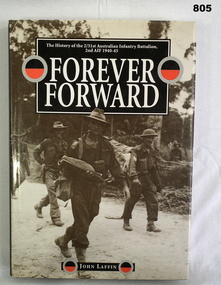
Book, 2/31 Australian Infantry Battalion Association, Forever Forward, 1994
... Documents the history of the 2/31st Australian infantry Battalion, 2nd AIF 1940-45. books-military-history Black hard cover with title in gold on spine. Dust jacket illustrated front and back. Title on spine 333p. Maps ...Documents the history of the 2/31st Australian infantry Battalion, 2nd AIF 1940-45.Black hard cover with title in gold on spine. Dust jacket illustrated front and back. Title on spine 333p. Maps and black & white illustrations. Page edges cut. Returned and Services League - Memorial Hall Bendigo stamp on inside front cover.books-military-history
