Showing 119 items matching "flat maps"
-
 Moorabbin Air Museum
Book - Aerial navigation, Navigation forA.T.C
... ...Flat maps...Moorabbin Air Museum Moorabbin Airport 12 First Street Moorabbin melbourne Aerial navigation Air navigation The earth as a sphere Meridians Latitude & longitude & changes Flat maps Magnetic variation Compass deviation Bearings/courses & tracks Topographical maps Plotting maps Reporting position The triangle of velocities Overview of the fundamental principles of aerial navigation . ...Overview of the fundamental principles of aerial navigation . No publication date statednon-fictionOverview of the fundamental principles of aerial navigation . No publication date statedair navigation, the earth as a sphere, meridians, latitude & longitude & changes, flat maps, magnetic variation, compass deviation, bearings/courses & tracks, topographical maps, plotting maps, reporting position, the triangle of velocities -
Bendigo Historical Society Inc.
Map - PART PARISHES OF SANDHURST MARONG AND NERRING, No date visible
... MAP...Bendigo...city streets...Parish of Sandhurst... Parish of Marong... Parish of Nerring... Ironbark... Eaglehawk... Myers Flat...Map: Section of a Parish plan of Bendigo, covering Ironbark, Eaglehawk and Myers Flat ( number 145 in Map Cupboard 1)...History House 11 Mackenzie Street Bendigo goldfields MAP Bendigo city streets Parish of Sandhurst Parish of Marong Parish of Nerring Ironbark Eaglehawk Myers Flat Map: Section of a Parish plan of Bendigo, covering Ironbark, Eaglehawk and Myers Flat ( number 145 in Map Cupboard 1) Map PART PARISHES OF SANDHURST MARONG AND NERRING ...Map: Section of a Parish plan of Bendigo, covering Ironbark, Eaglehawk and Myers Flat ( number 145 in Map Cupboard 1)map, bendigo, city streets, parish of sandhurst, parish of marong, parish of nerring, ironbark, eaglehawk, myers flat -
Whitehorse Historical Society Inc.
Map, City of Nunawading, 1970
... Map showing flats of high, medium low and restricted low density, adopted by Council in June 1969. ...Whitehorse Historical Society Inc. 2-10 Deep Creek Road Mitcham melbourne Scale: 100 ft :1 inch Flats City of Nunawading Map showing flats of high, medium low and restricted low density, adopted by Council in June 1969. ...Map showing flats of high, medium low and restricted low density, adopted by Council in June 1969.Map showing flats of high, medium low and restricted low density, adopted by Council in June 1969. Scale: 100 ft :1 inchMap showing flats of high, medium low and restricted low density, adopted by Council in June 1969.flats, city of nunawading -
 Bacchus Marsh & District Historical Society
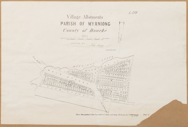
Map, Village allotments, Parish of Myrniong, County of Bourke
... Prior to 1863 the area was known as Blow's Flat. This map which was produced in 1903 and according to the catalogue record of this map held at the State Library of Victoria was based on an earlier map created in 1861. ...Prior to 1863 the area was known as Blow's Flat. This map which was produced in 1903 and according to the catalogue record of this map held at the State Library of Victoria was based on an earlier map created in 1861. ...Myrniong is a village 9 kilometers west of Bacchus Marsh. Prior to 1863 the area was known as Blow's Flat. This map which was produced in 1903 and according to the catalogue record of this map held at the State Library of Victoria was based on an earlier map created in 1861. The early layout of streets for the village of Myrniong can be seen on this map. The streets shown are, Main Street, Hardy Street, Blow Street, Myrniong Street, Shuter Street, and Blackwood Street. An area marked as a reserve for a school can be seen between Hardy Street and Main Street.A single page paper map. A cadastral parish map of Myrniong in Victoria, showing numbered land allotments. Photo-lithographed at the Department of Lands & Survey, Melbourne, in 1903. Based on an original map created in 1861. The map is pasted into a bound volume containing 76 maps or plans in total. High resolution digital image stored on BMDHS computer network. Surveyed by John Hardy, Surveyor ; photo-lithographed at the Department of Lands & Survey, Melbourne by T.F. McGauran, 24.12.03myrniong parish plan, myrniong parish maps -
 Bendigo Historical Society Inc.
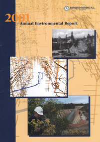
Booklet - Bendigo Mining N.L. 2001 Annual Environmental Report, 2001
... Cover has images of Pall Mall, Bendigo, entry to decline at Bendigo Mining, Kangaroo Flat and map of underground workings. The booklet 'provides stakeholders with a window into Bendigo Mining's environmental management in terms of strategy, activities and achievements in the calendar year 2001'. ...Cover has images of Pall Mall, Bendigo, entry to decline at Bendigo Mining, Kangaroo Flat and map of underground workings. The booklet 'provides stakeholders with a window into Bendigo Mining's environmental management in terms of strategy, activities and achievements in the calendar year 2001'. ...Yellow and black cover, 16 pages. Written on front cover: '2001 Annual Environmental Report, Bendigo Mining N.L.' Cover has images of Pall Mall, Bendigo, entry to decline at Bendigo Mining, Kangaroo Flat and map of underground workings. The booklet 'provides stakeholders with a window into Bendigo Mining's environmental management in terms of strategy, activities and achievements in the calendar year 2001'. bendigo mining n.l., doug buerger, environmental report, 2001 -
 Bendigo Historical Society Inc.
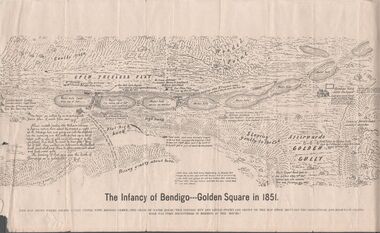
Map - MAP - THE INFANCY OF BENDIGO - GOLDEN SQUARE IN 1851
... Map shows the chain of waterholes, Golden Gully, hill and bush areas and open treeless flat. ...Map shows the chain of waterholes, Golden Gully, hill and bush areas and open treeless flat. ...Hand-drawn map of Bendigo - Golden Square in 1851. Map shows the chain of waterholes, Golden Gully, hill and bush areas and open treeless flat. Mentioned on the map are places where there were mia mias, stockyards, Gibson & Fenton's butchery & First Store.map, bendigo, goldfields, map the infancy of bendigo & golden square 1851, capt dane, william johnson, mrs kennedy, mrs farrell, ben hall, chris asquith, gibson & fenton's butchery & first store, p odonnell, walter r sandbach, william sandbach, mr frencham, john ross, thos myers, bendigo hut & little stockyard, commissioner horne, j jones, c cohen -
 Warrnambool and District Historical Society Inc.
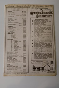
Pamphlet - Warrnambool Directories, Warrnambool City Council (Warrnambool Tourist Information Centre), Warrnambool Directory. Welcome to Warrnambool, Warrnambool and District Directory, 1970s and 80s
... maps of Warrnambool with a code to identify the location of the streets and information on local amenities, businesses, accommodation and tourist attractions. Tourism in Warrnambool became important in the 1890s and the city and area have continued to be promoted as a tourist destination, with emphasis on the bracing climate, the beaches, the coastal scenery and the sporting and cultural events. These directories are of some importance as early examples of directories published in Warrnambool to assist both local residents and tourists Warrnambool Tourism Shipwreck Coast Tourism Warrnambool Directories H.J. Henry Flat ...Warrnambool Directories.1 and .2 One sheet of paper folded twice to provide six pages. The pages contain a map and printed material. .3 One sheet pf paper folded to provide sixteen pages. The pages contain two maps and printed material. The front page has a stamp indicating the original owner. non-fictionWarrnambool Directorieswarrnambool tourism, shipwreck coast tourism -
 Warrnambool and District Historical Society Inc.
Medal, Villers & Heytesbury, 1879
... map of the Warrnambool district with the first landowners, a seminal resource for historians and was prominent in community affairs, especially in horse racing. He was also a Warrnambool and Shire Councillor. The medal was awarded for the best blood yearling of 1879 and this was Fright, one of the progeny of the famous stud horse Panic (second in the Melbourne Cup, 1865), His progeny won many hurdle races and flat races including the Melbourne Cup. ...map of the Warrnambool district with the first landowners, a seminal resource for historians and was prominent in community affairs, especially in horse racing. He was also a Warrnambool and Shire Councillor. The medal was awarded for the best blood yearling of 1879 and this was Fright, one of the progeny of the famous stud horse Panic (second in the Melbourne Cup, 1865), His progeny won many hurdle races and flat races including the Melbourne Cup. ...This splendid medal was awarded by the Villiers and Heytesbury Agricultural Association in 1879. This association held its first show in Port Fairy in 1854 and in Warrnambool in 1855. It continues to this day under the name of the Warrnambool and District Agricultural Society. The medal was awarded to James Astley Bromfield, am early Warrnambool chemist who arrived in Victoria in 1852 and is significant in Warrnambool’s history. He produced the 1856 map of the Warrnambool district with the first landowners, a seminal resource for historians and was prominent in community affairs, especially in horse racing. He was also a Warrnambool and Shire Councillor. The medal was awarded for the best blood yearling of 1879 and this was Fright, one of the progeny of the famous stud horse Panic (second in the Melbourne Cup, 1865), His progeny won many hurdle races and flat races including the Melbourne Cup. The medal features also the names of two donors of prizes to James Bromfield, Henry Phillips and Francis Tozer, both pioneer men in Warrnambool’s horse racing history. Henry Phillips was the first President of the Warrnambool Amateur Turf Club and had the horse Panic standing at his 1000 acre stud, Bryan O’Lynn, at Purnim in the Western District. Francis Tozer was an owner, breeder and steward in racing circles and in the 1870s had the 2000 acre stud farm, Wangoom Park, at Wangoom, near Warrnambool.This is a most significant item as it was awarded to James Astley Bromfield, an early Warrnambool chemist and a person concerned with the history of the early settlement of Warrnambool and one prominent in community affairs in Warrnambool in the 19th century. The item also has connections with the famous stud horse, Panic and two other noted personalities of Warrnambool and district, Francis Tozer and Henry Phillips. The item also is of intrinsic monetary value as a 19th century medal from the Villiers and Heytesbury Agricultural Association. This is a round silver medal. It has etched printing on one side and raised images of farm animals and farm implements on the other side. It also has etched printing around the edge of the medal. There are some slight dents around the edge of the medal.‘Villiers & Heytesbury Agricultural Association 1st Prize Awarded to J. A. Bromfield for Blood Yearling 1879 ‘Fright by Panic’ Warrnambool Oct. 16 1879’ ‘Also Phillips and Tozer’s Special Prizes’ james astley bromfield, warrnambool, villiers and heytesbury agricultural association, henry phillips, warrnambool, francis tozer, warrnambool, history of warrnambool -
 Bendigo Military Museum
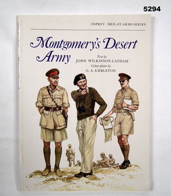
Book - BOOK, WW2, NORTH AFRICA, JOHN WILKINSON- LATHAM, Montgomery's Desert Army, 1977
... FLAT/ VICTORIA, 3555, AUSTRALIA," Soft cover book. Soft cover - cardboard, blue and black colour print on front, spine and back. Front cover illustration of three army personnel on white background. 40 pages, paper, cut, plain, white. Illustrated - black and white photographs, maps ...Colour Plates by 'G.A. EMELETON'. OSPREY MEN AT ARMS SERIES.Soft cover book. Soft cover - cardboard, blue and black colour print on front, spine and back. Front cover illustration of three army personnel on white background. 40 pages, paper, cut, plain, white. Illustrated - black and white photographs, maps and colour plates. Title page - two owner's stamps.Title page - owner's stamp, black ink, "MR. W.J. HAMMILL, A.A.I.M./ PO BOX 76, KANGAROO FLAT/ VICTORIA, 3555, AUSTRALIA,"books, history, ww2 -
 Bendigo Military Museum
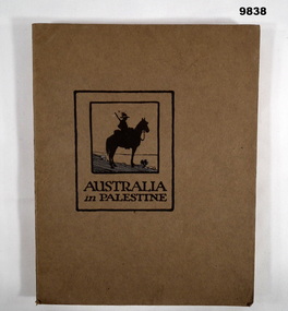
Book - PALESTINE, WW1, Angus & Robertson Ltd, Military Publisher, "AUSTRALIA IN PALESTINE", 1919
... maps, diagrams and cartoons. End papers - front and back - illustrated silhouette sketch of soldiers mounted on camels in a line within a landscape of flat hills, two palm trees and a grave cross....maps, diagrams and cartoons. End papers - front and back - illustrated silhouette sketch of soldiers mounted on camels in a line within a landscape of flat hills, two palm trees and a grave cross. ...Part of the William (Bill) THOMASON Collection. Refer Cat. No. 4136P for more items.Soft cover book. Cover - Brown colour cardboard, black colour print on front and back. Illustrated- front - silhouette sketch in black and blue colour ink, soldier on horseback. 153 pages - cut, plain, off white colour paper. Illustrated, black and white, sepia and colour plates of photographs, maps, diagrams and cartoons. End papers - front and back - illustrated silhouette sketch of soldiers mounted on camels in a line within a landscape of flat hills, two palm trees and a grave cross.publications, books, ww1, palestine campaign, william (bill) thomason collection -
 Kiewa Valley Historical Society
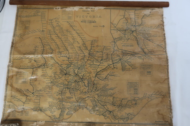
Map - Railway Map of Victoria, Amended to 1/11/1945
... There is a length of flat wood attached by 10 tacks across the top of the map...There is a length of flat wood attached by 10 tacks across the top of the map Amended to 1/11/1945 Map - Railway Map of Victoria ...Railways began in the 1850s and were privately owned and operated. Later they were taken over by the Victorian Government reaching a peak in the early 1940s.Steam trains were followed by electric trains with both running after the war in 1945.Bright was the closest station to the Kiewa Valley but road transport was used more often as the Kiewa Valley Highway was improved with the construction of the Kiewa Hydro Electric Scheme. To travel to Melbourne or Sydney by train residents went via Wodonga/Albury where they also did their shopping.Plastic on parchment with detailed railway routes (in green) across Victoria including each district's 'Road Foremen' and 'Depots'. There is a length of flat wood attached by 10 tacks across the top of the mapvictorian railways 1945, trains, transport -
 Bendigo Military Museum
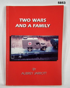
Book - BOOK, BIOGRAPHY, Aubrey JARROTT, "TWO WARS AND A FAMILY", 1997
... Illustrated - front, colour photograph of a vehicle on a flat top railway wagon. 134 pages - cut, plain, semi gloss, white paper. Illustrated black and white photographs, maps and papers. ...Illustrated - front, colour photograph of a vehicle on a flat top railway wagon. 134 pages - cut, plain, semi gloss, white paper. Illustrated black and white photographs, maps and papers. ...Owner and donor details - see Cat No. 5836.3.SOFT COVER BOOK. Cover - cardboard, white colour print on front, red colour background. Illustrated - front, colour photograph of a vehicle on a flat top railway wagon. 134 pages - cut, plain, semi gloss, white paper. Illustrated black and white photographs, maps and papers. Page 1. handwritten signature.Page 1 - handwritten in blue ink - signature "Aubrey Jarrott".books, military history, ww1, ww2, biography -
 Bendigo Military Museum
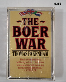
Book - BOOK, BOER WAR, Thomas Pakenham, The Boer War, 1982
... Flat 3555/ Victoria, Australia". Lower edge of pages - felt tipped pen, black ink - line drawn. Soft cover book with soft plastic dust cover. Soft cover - cardboard, black and red coloured print on front, spine and back. Yellow colour background. Top front page in colour, 3 flags illustration. 659 pages, paper, cut, plain, white. Illustrated black and white photographs, maps ..." The Boer War" Thomas Pakenham has written the first full scale history of the war since 1910.Soft cover book with soft plastic dust cover. Soft cover - cardboard, black and red coloured print on front, spine and back. Yellow colour background. Top front page in colour, 3 flags illustration. 659 pages, paper, cut, plain, white. Illustrated black and white photographs, maps and illustrations. Owner's label on front end paper. Soft plastic dust cover.Front end paper - printed owner's label " W & E R van der Eynden/ 6 Elvey Drive/ Kangaroo Flat 3555/ Victoria, Australia". Lower edge of pages - felt tipped pen, black ink - line drawn.books, history, the boer war -
 Bendigo Military Museum
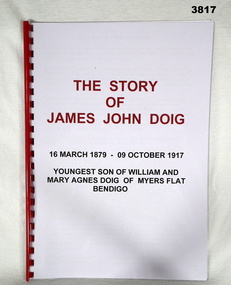
Booklet - BOOKLET, WW1, Glen Jones, The Story of James John Doig
... flat Biography - Facsimile. Clear plastic front over title page. Back is cardboard. Red / black print on title page. Plastic spiral bound. Cut, plain, white pages. Not numbered. Illustrated black / white / colour, maps ...The Story of James John Doig - 16 March 1879 - 9 October 1917. Youngest son of William and Mary Agnes Doig of Myers Flat, Bendigo.Biography - Facsimile. Clear plastic front over title page. Back is cardboard. Red / black print on title page. Plastic spiral bound. Cut, plain, white pages. Not numbered. Illustrated black / white / colour, maps photos, certificates & medals.booklet, doig, myers flat -
 Bendigo Military Museum
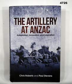
Book - BOOK Gallipoli, ROBERTS Chris and STEVENS Paul, The Artillery at ANZAC, Published 2021
... Flat VIC 3555 Hard cover book with dust cover. Hard cover - cardboard, black buckraw with gold print on spine. Dust cover - paper, black, brown and white print on front, spine and back. Front image - in black, grey tones, photograph of Observers scan the enemy lines for targets on 30 April 1915." 376 pages, wt, plain, white, illustrated in black and white and colour photographs and maps. ...Analysis of the Artillery at ANZACHard cover book with dust cover. Hard cover - cardboard, black buckraw with gold print on spine. Dust cover - paper, black, brown and white print on front, spine and back. Front image - in black, grey tones, photograph of Observers scan the enemy lines for targets on 30 April 1915." 376 pages, wt, plain, white, illustrated in black and white and colour photographs and maps. Owners label - opposite page to Title page.Analysis of the Artillery at ANZACbooks, military history, anzac, ww1, artillery -
 Bendigo Military Museum
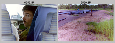
Photograph - 4th Field Survey Squadron – Operation MIZMAZE 92, Kimberley region, Western Australia, 1992
... Flat. It was a two-part operation involving the field completion of topographic maps and the acquisition of mapping control by GPS field parties utilising Texas Instruments TI4100 Global Positioning System receivers. ...Flat. It was a two-part operation involving the field completion of topographic maps and the acquisition of mapping control by GPS field parties utilising Texas Instruments TI4100 Global Positioning System receivers. ...This is a set of 40 photographs taken in 1992 during 4th Field Survey Squadron’s deployment on Operation MIZMAZE 92 in the Kimberley region of Western Australia from the 13th of May to the 14th of July 1992. The area of operations was Wyndham, Halls Creek and Sandfire Flat. It was a two-part operation involving the field completion of topographic maps and the acquisition of mapping control by GPS field parties utilising Texas Instruments TI4100 Global Positioning System receivers. Survey parties conducted field checking of topographic maps and GPS control acquisition in Perentie 110 Series Survey variant FFR Land Rovers. Three Bell Kiowa LOH helicopters provided by 162 Recce Sqn supported field checking and limited deployment of GPS surveys parties. C-l30 Hercules from 36 Sqn supported deployment and extraction of personnel and equipment to and from from the AO. A Cessna 404 Titan Ambassador from Vee-H Aviation was used as the Wild RC10 camera platform for aerial photography acquisition.This is a set of 40 photographs taken in 1992 during 4th Field Survey Squadron’s deployment on Operation MIZMAZE 92 in the Kimberley region of Western Australia. The colour photographs are on 35mm negative film and are part of the Army Survey Regiment’s Collection. The photographs were scanned at 96 dpi. .1) - Photo, colour, 1992. CAPT Craig Hersant. .2) - Photo, colour, 1992. Unidentified officer/soldier. .3) & .4) - Photo, colour, 1992. Aboriginal rock art - Wandjina Gunduran, Donkey Creek. .5) - Photo, colour, 1992. Aboriginal rock art - Track Wandjinas, Donkey Creek. .6) & .7) - Photo, colour, 1992. CAPT Craig Hersant. .8) - Photo, colour, 1992. Kimberley region topography. CPL Glen Weatherell. .9) - Photo, colour, 1992. Unidentified personnel .10) - Photo, colour, 1992. Supermarket at unknown location. .11) to .13) - Photo, colour, 1992. Caravan park at unknown location. .14) - Photo, colour, 1992. Old bridge at Fitzroy Crosssing. .15) & .16) - Photo, colour, 1992. Survey party in Perentie 110 Series Land Rover. .17) & .18) - Photo, colour, 1992. Kimberley region topography. .19) - Photo, colour, 1992. Kimberley region topography. CPL Glen Weatherell. .20) - Photo, colour, 1992. Kimberley region topography, possibly the Bungle Bungles. .21) - Photo, colour, 1992. Kimberley region topography. SGT Frank Downie. .22) - Photo, colour, 1992. Kimberley region topography: the Bungle Bungles. .23) - Photo, colour, 1992. Kimberley region topography: the Bungle Bungles. .24) - Photo, colour, 1992. Kimberley region topography: the Bungle Bungles. SPR Neil Pedler. .25) & .26) - Photo, colour, 1992. Kimberley region topography: the Bungle Bungles. .27) - Photo, colour, 1992. Kimberley region topography. .28) - Photo, colour, 1992. Survey party with Perentie 110 Series Land Rover. .29) - Photo, colour, 1992. Kimberley region topography. .30) - Photo, colour, 1992. Survey party outside Perentie 110 Series Land Rover. .31) & .32) - Photo, colour, 1992. Survey party operating TI4100 GPS Receiver next to Perentie 110 Series Land Rover. SGT Eddie Jacobs. .33) & .34) - Photo, colour, 1992. Survey party operating TI4100 GPS Receiver next to Perentie 110 Series Land Rover. Unidentified surveyor. .35) - Photo, colour, 1992. Kimberley region topography. Hand water pump at well. .36) - Photo, colour, 1992. Survey party in Perentie 110 Series Land Rover. .37) - Photo, colour, 1992. Kimberley region topography. CPL Glen Weatherell. .38) - Photo, colour, 1992. Kimberley region topography viewed from Bell Kiowa LOH helicopter. .39) & .40) - Photo, colour, 1992. Unidentified surveyor field checking a preliminary map in a Bell Kiowa LOH helicopter..1P to .40P – There are no personnel identified. ‘1992 OP MIZMAZE annotated on negative sleeve.royal australian survey corps, rasvy, 4 fd svy sqn, op mizmaze 92 -
 Lara RSL Sub Branch
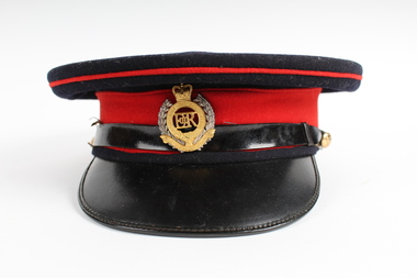
Uniform, Australian Engineers Force Officers cap
... The hat itself is a flat cap made out of navy blue felt. around this is a red felted band, itself encircled with a black patent band and peak. The black band is held on by two smaller badges, which are brass in colour and have an image of the Australian map (above which is the crown) and around the edges says Australian Military Forces. ...The hat itself is a flat cap made out of navy blue felt. around this is a red felted band, itself encircled with a black patent band and peak. The black band is held on by two smaller badges, which are brass in colour and have an image of the Australian map (above which is the crown) and around the edges says Australian Military Forces. ...Army officer's peaked cap worn on formal occasions, dark blue with red band around hat. The peak top side is finished in high gloss black leather and the hat has a similar high gloss black hat band. Worn by an officer in the Royal Australian Engineers (RAE). This hat is referred to as a 'blues' hat.Navy blue cap with red and black trimming. The hat itself is a flat cap made out of navy blue felt. around this is a red felted band, itself encircled with a black patent band and peak. The black band is held on by two smaller badges, which are brass in colour and have an image of the Australian map (above which is the crown) and around the edges says Australian Military Forces. At the front of the cap is a badge which says: Royal Australian Engineers. On badge: Royal Australian Engineers. Moni Soit Qui Mal Y Pense Inside cap: L. Silberston and Sons Ltd London hat, engineer, army, australian army, rae, royal australian engineer, officer -
Frankston RSL Sub Branch
Rule, Scale, E. ESDAILE & SONS, 1942
... A scale rule used by artillery units to measure distance between map co-ordinates on the 1 to 25,000 scale military map series. The rule is accurately machined from flat stainless steel strip and is stamped with Imperial measurements (thousands of yards) and metric measurements (thousands of metres)....Frankston RSL Sub Branch 183 Cranbourne Road Frankston mornington-peninsula artillery rule scale imperial metric distance world war 2 ww2 The rule is stamped with the following: "SCALE, ARTY, No 2, MKI, E.ESDAILE & SONS, D^D, 1942" A scale rule used by artillery units to measure distance between map co-ordinates on the 1 to 25,000 scale military map series. The rule is accurately machined from flat stainless steel strip and is stamped with Imperial measurements (thousands of yards) and metric measurements (thousands of metres). ...A scale rule used by artillery units to measure distance between map co-ordinates on the 1 to 25,000 scale military map series. The rule is accurately machined from flat stainless steel strip and is stamped with Imperial measurements (thousands of yards) and metric measurements (thousands of metres).The rule is stamped with the following: "SCALE, ARTY, No 2, MKI, E.ESDAILE & SONS, D^D, 1942"artillery, rule, scale, imperial, metric, distance, world war 2, ww2, -
Glen Eira Historical Society
Article - ELSTERNWICK RAILWAY STATION AND LINE
... map of the level crossing. 3/Handwritten note, signed ‘FEC, 17/11/2006’, headed ‘To be researched – Shooting in foot underpass-policeman killed-murder last man to be hanged in Victoria’, with note on Glenhuntly Road underpass. ‘Southern Cross’ Gardenvale Progress League Point Nepean Road Newspapers Caulfield Council North Road ‘Made in Australia’ week Railways Department Parliamentary representative Railway crossings Councillors Gardenvale School Elsternwick School Schools Market Gardens Gardenvale Progress Association England E.F.(Mayor) Elsternwick Caulfield Hoyts Theatre Theatres Glenhuntly Road Elsternwick station Police Murders Executions Shops Elsternwick Plaza Petrol stations ‘The Hub’ flats ...Contains three items about this: 1/A photocopied article (across 3 long columns) from the Southern Cross newspaper dated 21/07/1928. The article contains details of the opening of the Gardenvale Martin Street subway ceremony. Mention is made of the Caulfield Council’s spontaneous assistance, harmony working alongside Brighton and their financial assistance, as well. Councillor E.F. England (Mayor of Caulfield) attended on behalf of the Caulfield Council. He referred to the large patronage on the Brighton line, also mentioning similar issues for the Elsternwick level crossing. There are brief summaries from the many speakers. The pupils from Gardenvale and Elsternwick schools were congregated around the subway, and the Brighton municipal Brass Band rendered selections. 2/Newspaper clipping (source not stated perhaps Melbourne Sun), ‘Elsternwick to get underpass’, dated 25/02/1959, stating that ‘work has begun to build an underpass that will abolish the Glenhuntly Road level crossing’, with photograph and a map of the level crossing. 3/Handwritten note, signed ‘FEC, 17/11/2006’, headed ‘To be researched – Shooting in foot underpass-policeman killed-murder last man to be hanged in Victoria’, with note on Glenhuntly Road underpass.‘southern cross’, gardenvale progress league, point nepean road, newspapers, caulfield council, north road, ‘made in australia’ week, railways department, parliamentary representative, railway crossings, councillors, gardenvale school, elsternwick school, schools, market gardens, gardenvale progress association, england e.f.(mayor), elsternwick, caulfield, hoyts theatre, theatres, glenhuntly road, elsternwick station, police, murders, executions, shops, elsternwick plaza, petrol stations, ‘the hub’, flats, brothels, ‘the daily planet’ (sic), car parks -
 Bendigo Historical Society Inc.
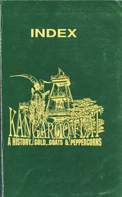
Book - INDEX KANGAROO FLAT A HISTORY, GOLD, GOATS & PEPPERCORN, c1993
... Flat A History, Gold, Goats & Peppercorns. Publisher: Richmond Cambridge Printers, Bendigo. ISBN: 0 646 126510 2. Date: 1993. 33 pages. Photographs, illustrations & Maps...Flat A History, Gold, Goats & Peppercorns. Publisher: Richmond Cambridge Printers, Bendigo. ISBN: 0 646 126510 2. Date: 1993. 33 pages. Photographs, illustrations & Maps ...Index Kangaroo Flat A History, Gold, Goats & Peppercorns. Publisher: Richmond Cambridge Printers, Bendigo. ISBN: 0 646 126510 2. Date: 1993. 33 pages. Photographs, illustrations & Maps. Signed by David Horsfall. Gloss green cover gold print and picture (poppet head, goat, tree). Green pennant inside book reads> HOP TO KANGAROO FLAT MARCH 26th, 27th & 28th 1993, picture of kangaroo and below a white shield. Size of pennant: 15.2 x 4.8 cm. 23.6.200 Green pennant not with book. Needs to be located.David G Horsfallbook, bendigo, kangaroo flat, kangaroo flat, history -
 Bendigo Historical Society Inc.
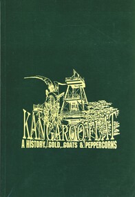
Book - KANGAROO FLAT A HISTORY, GOLD, GOATS & PEPPERCORN, c1993
... Flat A History, Gold, Goats & Peppercorns. Catalogue number 5165. ISBN: 0 646 126510 2. Date: 1993. 164 pages. Photographs, illustrations & Maps. ...Flat A History, Gold, Goats & Peppercorns. Catalogue number 5165. ISBN: 0 646 126510 2. Date: 1993. 164 pages. Photographs, illustrations & Maps. ...Kangaroo Flat A History, Gold, Goats & Peppercorns. Publisher: Richmond Cambridge Printers, Bendigo. (also see Index Kangaroo Flat A History, Gold, Goats & Peppercorns. Catalogue number 5165. ISBN: 0 646 126510 2. Date: 1993. 164 pages. Photographs, illustrations & Maps. Signed by David Horsfall. Gloss green cover gold print and picture (poppet head, goat, tree).David G Horsfallbook, bendigo, kangaroo flat, history, kangaroo flat -
 Bendigo Historical Society Inc.
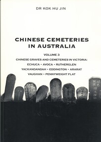
Book - CHINESE CEMETERIES IN AUSTRALIA, VOLUME 3. CHINESE GRAVES AND CEMETERIES IN VICTORIA, 2003
... Flat. Publisher: Golden Dragon Museum, Bendigo. ISBN: 09578013 7 8. 93 pages. Black and white illustrations & map....Flat. Publisher: Golden Dragon Museum, Bendigo. ISBN: 09578013 7 8. 93 pages. Black and white illustrations & map. ...Chinese Cemeteries in Australia, Volume 3. Chinese Graves and Cemeteries in Victoria: Echuca, Avoca, Rutherglen, Yackandandah, Eddington, Ararat, Vaughan, Pennyweight Flat. Publisher: Golden Dragon Museum, Bendigo. ISBN: 09578013 7 8. 93 pages. Black and white illustrations & map.Dr Kok Hu Jincemetery, chinese, bendigo cemeteries victoria, chinese graves, genealogy -
 Bendigo Historical Society Inc.
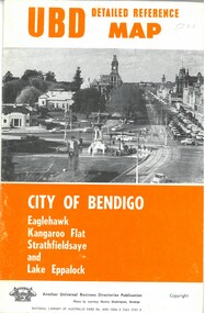
Map - U.B.D.MAP CITY OF BENDIGO, 1971
... UBD Detail reference map City of Bendigo, Eaglehawk,Kangaroo Flat, Strathfieldsaye and Lake Eppalock....UBD Detail reference map City of Bendigo, Eaglehawk,Kangaroo Flat, Strathfieldsaye and Lake Eppalock. ...UBD Detail reference map City of Bendigo, Eaglehawk,Kangaroo Flat, Strathfieldsaye and Lake Eppalock.Universal Business Directories.bendigo, hospital, map, localities - bendigo and district street names. -
 Bendigo Historical Society Inc.
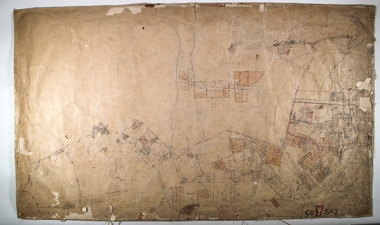
Map - SANDHURST ? SHEET 5, 29/10/1879
... MAP...Bendigo...parish plan...Parish of Sandhurst... Kangaroo Flat...Map: Parish plan showing area Northwards from Kangaroo Flat...History House 11 Mackenzie Street Bendigo goldfields MAP Bendigo parish plan Parish of Sandhurst Kangaroo Flat Map: Parish plan showing area Northwards from Kangaroo Flat Map SANDHURST ? ...Map: Parish plan showing area Northwards from Kangaroo Flatmap, bendigo, parish plan, parish of sandhurst, kangaroo flat -
 Bendigo Historical Society Inc.
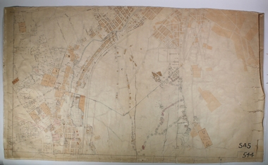
Map - KANGAROO FLAT ?, Circa 1880
... MAP...Bendigo...parish plan...Kangaroo Flat...Map: Parish plan showing area from Kangaroo Flat to Spring Gully...History House 11 Mackenzie Street Bendigo goldfields MAP Bendigo parish plan Kangaroo Flat Spring Gully Map: Parish plan showing area from Kangaroo Flat to Spring Gully Map KANGAROO FLAT ? ...Map: Parish plan showing area from Kangaroo Flat to Spring Gullymap, bendigo, parish plan, kangaroo flat, spring gully -
Bendigo Historical Society Inc.
Map - TOWNSHIP OF KANGAROO FLAT, 27/01/1932
... MAP...Bendigo...township...Kangaroo flat...Map: Township of Kangaroo flat, Parish of Sandhurst , County of Bendigo. ...History House 11 Mackenzie Street Bendigo goldfields MAP Bendigo township Kangaroo flat Map: Township of Kangaroo flat, Parish of Sandhurst , County of Bendigo. ...Map: Township of Kangaroo flat, Parish of Sandhurst , County of Bendigo. Parish plan ( number 194 in Map Cupboard 1)map, bendigo, township, kangaroo flat -
Bendigo Historical Society Inc.
Map - KANGAROO FLAT SUBDIVISION, 26/11/1900
... MAP...Bendigo...parish plan...Kangaroo Flat...Map: Plan of Subdivision at Kangaroo flat, Parish of Sandhurst, County of Bendigo ( number 149 in Map Cupboard 1)...History House 11 Mackenzie Street Bendigo goldfields MAP Bendigo parish plan Kangaroo Flat Parish of Sandhurst County of Bendigo Map: Plan of Subdivision at Kangaroo flat, Parish of Sandhurst, County of Bendigo ( number 149 in Map Cupboard 1) Map KANGAROO FLAT SUBDIVISION ...Map: Plan of Subdivision at Kangaroo flat, Parish of Sandhurst, County of Bendigo ( number 149 in Map Cupboard 1)map, bendigo, parish plan, kangaroo flat, parish of sandhurst, county of bendigo -
Bendigo Historical Society Inc.
Map - KANGAROO FLAT, 27/.01/1932
... MAP...Bendigo...township...Kangaroo Flat...Map: Township of Kangaroo Flat, Parish of Sandhurst, County of Bendigo ( number 148 in Map Cupboard 1)...History House 11 Mackenzie Street Bendigo goldfields MAP Bendigo township Kangaroo Flat Parish of Sandhurst county of Bendigo Map: Township of Kangaroo Flat, Parish of Sandhurst, County of Bendigo ( number 148 in Map Cupboard 1) Map KANGAROO FLAT ...Map: Township of Kangaroo Flat, Parish of Sandhurst, County of Bendigo ( number 148 in Map Cupboard 1)map, bendigo, township, kangaroo flat, parish of sandhurst, county of bendigo -
Bendigo Historical Society Inc.
Map - PART PARISHES OF MARONG AND LOCKWOOD, No date visible
... MAP...Bendigo...city streets...Parish of Marong... Parish of Lockwood...Kangaroo Flat...Map: Section of Parish plan of Bendigo, covering Kangaroo Flat, Golden Square, and Specimen Hill ( number 146 in Map Cupboard 1)...History House 11 Mackenzie Street Bendigo goldfields MAP Bendigo city streets Parish of Marong Parish of Lockwood Kangaroo Flat Golden Square Specimen Hill Map 10 Map: Section of Parish plan of Bendigo, covering Kangaroo Flat, Golden Square, and Specimen Hill ( number 146 in Map Cupboard 1) Map PART PARISHES OF MARONG AND LOCKWOOD ...Map: Section of Parish plan of Bendigo, covering Kangaroo Flat, Golden Square, and Specimen Hill ( number 146 in Map Cupboard 1)Map 10map, bendigo, city streets, parish of marong, parish of lockwood, kangaroo flat, golden square, specimen hill -
 Bendigo Historical Society Inc.
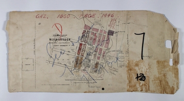
Map - NEILBOROUGH RAVENSWOOD, October 21 1859
... MAP...Bendigo...Neilborough... Elysian Flat...Map:Township of Neilborough, Elysian Flat, near Sandhurst,County unnamed. Parish plan. Backing is a part of Ravenswood Township map....History House 11 Mackenzie Street Bendigo goldfields MAP Bendigo Neilborough Elysian Flat Ravenswood Map:Township of Neilborough, Elysian Flat, near Sandhurst,County unnamed. ...Map:Township of Neilborough, Elysian Flat, near Sandhurst,County unnamed. Parish plan. Backing is a part of Ravenswood Township map.map, bendigo, neilborough, elysian flat, ravenswood