
Showing 980 items matching "hand drawn"
-
 Wodonga & District Historical Society Inc
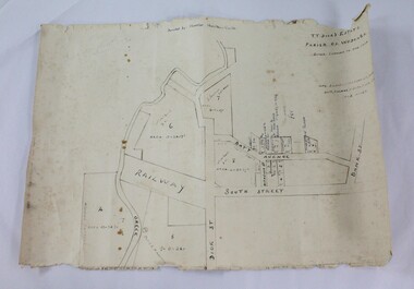
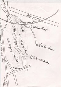
Map - Hamilton-Smith Collection Hand Drawn Map of Wodonga c1938
... Hamilton-Smith Collection Hand Drawn Map of Wodonga c1938...Hamilton-Smith Collection Hand Drawn Map of Wodonga c1938...A map hand drawn in black pen on thick beige paper. ...Hamilton-Smith Collection Hand Drawn Map of Wodonga c1938 Map Hamilton-Smith Collection Hand Drawn Map of Wodonga c1938 ...The Hamilton-Smith collection was donated by the children of Grace Mary Hamilton-Smith nee Ellwood (1911-2004) and John Hamilton-Smith (1909-1984) who settled in Wodonga in the 1940s. The Ellwood family had lived in north-east Victoria since the late 1800s. Grace’s mother, Rosina Ellwood nee Smale, was the first teacher at Baranduda in 1888, and a foundation member of the C.W.A. Rosina and her husband Mark retired to Wodonga in 1934. Grace and John married at St. David’s Church, Albury in 1941. John was a grazier, and actively involved in Agricultural Societies. The collection contains significant items which reflect the local history of Wodonga, including handmade needlework, books, photographs, a wedding dress, maps, and material relating to the world wars. This item is unique, handmade and has a known owner. It forms part of a significant and representative historical collection which reflects the local history of Wodonga. It contributes to our understanding of social and family life in early twentieth century Wodonga, as well as providing interpretative capacity for themes including local history and social history.A map hand drawn in black pen on thick beige paper. map, subdivison, development, wodonga, local history, hamilton-smith, hamilton-smith collection -
 Marysville & District Historical Society
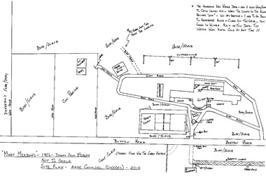
Map (item) - Hand drawn map, Anne Counsel, 2010
... Hand drawn map......hand-drawn map...A hand-drawn map of Mary-Meadows guest house drawn by Anne Counsel (Sievers) from her memories of the guest house. ...A hand-drawn map of Mary-Meadows guest house drawn by Anne Counsel (Sievers) from her memories of the guest house. ...A hand-drawn map of Mary-Meadows guest house drawn by Anne Counsel (Sievers) from her memories of the guest house. ...A hand-drawn map of Mary-Meadows guest house drawn by Anne Counsel (Sievers) from her memories of the guest house. The map was of Mary-Meadows in 1956 and was drawn in 2010. Mary-Meadows and was part of the Mary Chain of guest houses built by Eric Dowdle in Marysville. A hand-drawn map of Mary-Meadows guest house drawn by Anne Counsel (Sievers) from her memories of the guest house.marysville, victoria, australia, mary chain guesthouses, eric dowdle, rita dowdle, marylands, mary lyn, mary lodge, kerami, mary meadows, mary brook, barron of beef, mary port, guest house, photograph, sherbrooke, mount martha, the golf house, el kanah, mary chain golf links, map, anne counsel (sievers), hand-drawn map, alec sievers, rene sievers, robert sievers, anne sievers -
 Beechworth Honey Archive
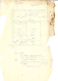
Hand-Drawn Diagram of Land by Frank Lebbell Frost September 1920
... Hand-Drawn Diagram of Land by Frank Lebbell Frost September 1920...Hand Drawn...Hand-drawn diagram of land at Dookie by Frank L. ...Hand Drawn Hand-Drawn Plan Land Dookie Frost Beekeeper Beechworth Honey Hand-drawn diagram of land at Dookie by Frank L. ...Hand-drawn diagram of land at Dookie by Frank L. Frost. Depicts plan od three allotments.hand drawn, hand-drawn, plan, land, dookie, frost, beekeeper, beechworth honey -
 Beechworth Honey Archive
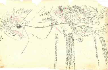
Hand-Drawn Map Centred on Ararat by Frank Lebbell Frost December 1916
... Hand-Drawn Map Centred on Ararat by Frank Lebbell Frost December 1916...Hand Drawn...Front Side: Hand-drawn map centred on Ararat, central Victoria. ...This particular map may be reference in the "Wooden" Diary on page 11. Hand Drawn Hand-Drawn Map Ararat Frost Beekeeper Beechworth Honey Front Side: Hand-drawn map centred on Ararat, central Victoria. ...This is one of the maps drawn by Frank L. Frost while he was beekeeping in North-East Victoria. This particular map may be reference in the "Wooden" Diary on page 11. Front Side: Hand-drawn map centred on Ararat, central Victoria. Details road and railway and vegetation with comments on flowering. Back Side: Comments in grey lead [ca 1923]hand drawn, hand-drawn, map, ararat, frost, beekeeper, beechworth honey -
 Clunes Museum
Drawing - HAND DRAWN SKETCH, POST OFFICE CLUNES
... HAND DRAWN SKETCH......HAND DRAWN...HAND DRAWN BLACK AND WHITE PICTURE OF POST OFFICE CLUNES. ...POST OFFICE CLUNES HAND DRAWN F.R. ANDERSON POST OFFICE CLUNES F.R. ...HAND DRAWN BLACK AND WHITE PICTURE OF POST OFFICE CLUNES. ISOMETRIC SKETCH (2 COPIES)POST OFFICE CLUNES F.R. ANDERSONpost office clunes, hand drawn, f.r. anderson -
 Beechworth Honey Archive
Hand-Drawn Map Centred on Armstrong by Frank Lebbell Frost Dec 1916
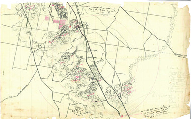
... Hand-Drawn Map Centred on Armstrong by Frank Lebbell Frost Dec 1916...Hand Drawn...Hand-drawn map centred on Armstrong, a town 6 miles from Ararat. ...This particular map may be reference in the "Wooden" Diary on page 11. Hand Drawn Hand-Drawn Map Armstrong Ararat Frost Beekeeper Beechworth Honey Hand-drawn map centred on Armstrong, a town 6 miles from Ararat. ...This is one of the maps drawn by Frank L. Frost while he was beekeeping in North-East Victoria. This particular map may be reference in the "Wooden" Diary on page 11.Hand-drawn map centred on Armstrong, a town 6 miles from Ararat. Details vegetation along Great Western Highway. Drawn with black pen and grey lead on paper. Features are marked in red.hand drawn, hand-drawn, map, armstrong, ararat, frost, beekeeper, beechworth honey -
![Hand-Drawn Map Centred on Myrtleford by Frank Lebbell Frost [ca 1915-1918]](/media/collectors/51d110e42162ef12e06aa06b/items/51fb0bb72162ef156c79aeee/item-media/52a11c442162ef1f0c9c052b/item-fit-380x285.jpg?cb=6) Beechworth Honey Archive
Beechworth Honey ArchiveHand-Drawn Map Centred on Myrtleford by Frank Lebbell Frost [ca 1915-1918]
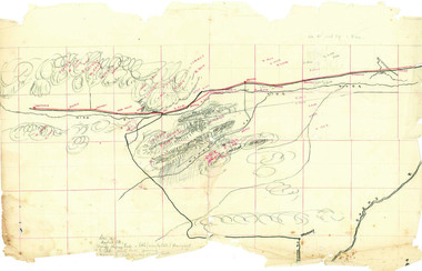
... Hand-Drawn Map Centred on Myrtleford by Frank Lebbell Frost [ca 1915-1918]...Hand Drawn...Hand-drawn map centred on Myrtleford, Palmerston, Gapstead Road, the Ovens River and the Myrtleford-Wangaratta Road. ...This particular map may be reference in the "Wooden" Diary on page 8. Hand Drawn Hand-Drawn Map Myrtleford Palmerston Gapstead Ovens Beekeeping Frost Beechworth Honey Hand-drawn map centred on Myrtleford, Palmerston, Gapstead Road, the Ovens River and the Myrtleford-Wangaratta Road. ...This is one of the maps drawn by Frank L. Frost while he was beekeeping in North-East Victoria. This particular map may be reference in the "Wooden" Diary on page 8.Hand-drawn map centred on Myrtleford, Palmerston, Gapstead Road, the Ovens River and the Myrtleford-Wangaratta Road. Shows locations of flowering eucalypts. Scale is 1 mile to 1 inch. Drawn with black pen and grey lead on paper. Names of towns are marked in red pen. hand drawn, hand-drawn, map, myrtleford, palmerston, gapstead, ovens, beekeeping, frost, beechworth honey -
 Beechworth Honey Archive
Hand-Drawn Map Centred on Worouly by Frank Lebbell Frost December 1916
... Hand-Drawn Map Centred on Worouly by Frank Lebbell Frost December 1916...Hand Drawn...Hand-drawn map centred on Whorouly and showing other towns, including Oxley, Byrne, Edi and Whitfield. ...This particular map may be reference in the "Wooden" Diary on page 10. Hand Drawn Hand-Drawn Map Oxley Byrne Whitfield Edi Frost Beekeeping Beechworth Honey Hand-drawn map centred on Whorouly and showing other towns, including Oxley, Byrne, Edi and Whitfield. ...This is one of the maps drawn by Frank L. Frost while he was beekeeping in North-East Victoria. This particular map may be reference in the "Wooden" Diary on page 10.Hand-drawn map centred on Whorouly and showing other towns, including Oxley, Byrne, Edi and Whitfield. Details the local flowering eucalypts. Scale is each red square equals three miles. Drawn with black pen and grey lead on paper. Grid and other features are marked in red.hand drawn, hand-drawn, map, oxley, byrne, whitfield, edi, frost, beekeeping, beechworth honey -
 Beechworth Honey Archive
Hand-Drawn Map Centred on Buckland Gap Road by Frank Lebbell Frost July 1916
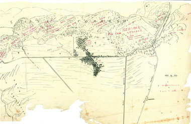
... Hand-Drawn Map Centred on Buckland Gap Road by Frank Lebbell Frost July 1916...Hand Drawn...Hand-drawn map centred on Buckland Gap road (near Murmungee). ...This particular map may be reference in the "Wooden" Diary on page 8. Hand Drawn Hand-Drawn Map Buckland Gap Frost Beekeeper Beechworth Honey Hand-drawn map centred on Buckland Gap road (near Murmungee). ...This is one of the maps drawn by Frank L. Frost while he was beekeeping in North-East Victoria. This particular map may be reference in the "Wooden" Diary on page 8.Hand-drawn map centred on Buckland Gap road (near Murmungee). Details the quantity and quality of flowering timber in the nearby State Forest. Scale is 1/2 mile to 1 inch. Map was drawn on the 16th July, 1916. Drawn with black pen and grey lead on paper. Features are marked in red.hand drawn, hand-drawn, map, buckland gap, frost, beekeeper, beechworth honey -
![Hand-Drawn Plans for Caravan by Frank Lebbell Frost [ca 1915-1924]](/media/collectors/51d110e42162ef12e06aa06b/items/51fb1e922162ef156c79dac3/item-media/52a121752162ef1f0c9c161b/item-fit-380x285.jpg?cb=6) Beechworth Honey Archive
Beechworth Honey ArchiveHand-Drawn Plans for Caravan by Frank Lebbell Frost [ca 1915-1924]
... Hand-Drawn Plans for Caravan by Frank Lebbell Frost [ca 1915-1924]...Hand Drawn...Hand-drawn plans for two types of homemade caravan. ...Hand Drawn Hand-Drawn Plan Caravan Frost Beekeeper Beechworth Honey Hand-drawn plans for two types of homemade caravan. ...Hand-drawn plans for two types of homemade caravan. Front Side: Drawing of caravan with detailed measurements. Caravan dimensions; 6 foot 2 inches from ground to top, approx. 5 yards from end to end. Detailed measurements of construction framing, detailed measurements of two beds on wire mattresses. Back Side: Drawing of a caravan. Few details. Drawn with blue pen and grey lead on paper. hand drawn, hand-drawn, plan, caravan, frost, beekeeper, beechworth honey -
![Hand-Drawn Map Centred on Chiltern by Frank Lebbell Frost [ca 1915-1918]](/media/collectors/51d110e42162ef12e06aa06b/items/51fb08452162ef156c79a623/item-media/52a11e6d2162ef1f0c9c0af4/item-fit-380x285.jpg?cb=6) Beechworth Honey Archive
Beechworth Honey ArchiveHand-Drawn Map Centred on Chiltern by Frank Lebbell Frost [ca 1915-1918]
... Hand-Drawn Map Centred on Chiltern by Frank Lebbell Frost [ca 1915-1918]...Hand Drawn...Front Side: Hand-drawn map centred on Chiltern showing the Melbourne road [Hume Freeway] and the Beechworth-Rutherglen road with detailed locations of flora in the region. ...This particular map may be reference in the "Wooden" Diary on pages 12, 13 and 17. Hand Drawn Hand-Drawn map Chiltern 1915 Beekeeper Frost Beechworth Honey Front Side: Hand-drawn map centred on Chiltern showing the Melbourne road [Hume Freeway] and the Beechworth-Rutherglen road with detailed locations of flora in the region. ...This is one of the maps drawn by Frank L. Frost while he was beekeeping in North-East Victoria. This particular map may be reference in the "Wooden" Diary on pages 12, 13 and 17.Front Side: Hand-drawn map centred on Chiltern showing the Melbourne road [Hume Freeway] and the Beechworth-Rutherglen road with detailed locations of flora in the region. Flora includes; Iron Bark, Stringy Bark, Red Box and Yellow Box. Details regarding quantity of flowers and quality of trees is included. Back Side: Some names and addresses are recorded in pencil. Drawn with black pen and grey lead on paper. A grid and other symbols are marked in red ink.hand drawn, hand-drawn, map, chiltern, 1915, beekeeper, frost, beechworth honey -
 Warrnambool RSL Sub Branch
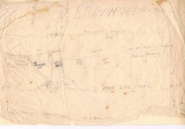
Bob Snape's HAND-DRAWN MAP of ERQUINGHAM-SUR -LYS, FRANCE, centring on 6th Field Ambulance base
... Bob Snape's HAND-DRAWN MAP of ERQUINGHAM-SUR -LYS, FRANCE, centring on 6th Field Ambulance base....Snape Collection Bob Snape's HAND-DRAWN MAP of ERQUINGHAM-SUR -LYS, FRANCE, centring on 6th Field Ambulance base. ...snape collection -
Charlton RSL Sub Branch
Souvenir - Decorated envelopes WW2, Copies of 30 hand drawn envelopes from WW2
... Copies of 30 hand drawn envelopes from WW2...5 A3 sheets of copied hand drawn envelopes by serviceman PVT Edward Davis to his Mother and Sister...5 A3 sheets of copied hand drawn envelopes by serviceman PVT Edward Davis to his Mother and Sister Copies of 30 hand drawn envelopes from WW2 Souvenir Decorated envelopes WW2 ...5 A3 sheets of copied hand drawn envelopes by serviceman PVT Edward Davis to his Mother and Sister -
 Bendigo Historical Society Inc.
Document - CONSTABLE RYAN COLLECTION: HAND DRAWN MAP OF AREA OF CONSTABLE RYAN DISAPPEARANCE
... CONSTABLE RYAN COLLECTION: HAND DRAWN MAP OF AREA OF CONSTABLE RYAN DISAPPEARANCE...An hand drawn map of the area of constable Ryan disappearance. ...DOCUMENT An hand drawn map of the area of constable Ryan disappearance. ...An hand drawn map of the area of constable Ryan disappearance. The map is not to scale.document -
Glenelg Shire Council Cultural Collection
Postcard - Postcard - Hand drawn image of swamp and local Indigenous people, Vanda Savill, c. 1985
... Postcard - Hand drawn image of swamp and local Indigenous people...Black and white postcard, hand drawn by Vanda Savill. Image of swamp and local indigenous people....Black and white postcard, hand drawn by Vanda Savill. Image of swamp and local indigenous people. ...Black and white postcard, hand drawn by Vanda Savill. Image of swamp and local indigenous people. -
 Peterborough History Group
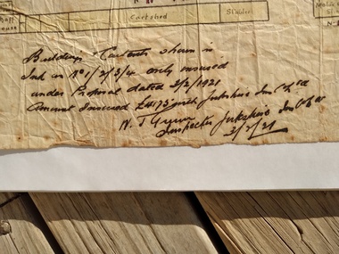
Map - Map of Peterborough House 1921, 1921
... This hand drawn map of the buildings and out buildings was done for insurance purposes. ...A4 photocopy of a hand drawn map of the buildings and out buildings comprising Peterborough House. ...Hand drawn map...This hand drawn map of the buildings and out buildings was done for insurance purposes. ...This hand drawn map of the buildings and out buildings was done for insurance purposes. It indicates which buildings are covered and which are uninsured. Significant as it shows a plan of the hotel as it was in 1921. Each building is labelled by its purpose, which provides an interesting insight into holidays of the time. For example, 'sleep outs' and external bathrooms. A4 photocopy of a hand drawn map of the buildings and out buildings comprising Peterborough House. Hand drawn map -
 Federation University Historical Collection
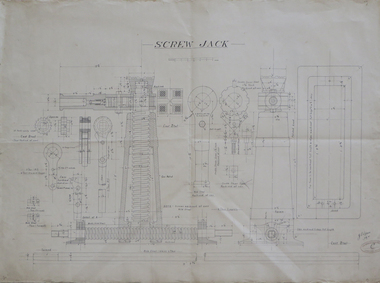
Plan - Technical drawing, Hand drawn plan for screw jack, 1916
... Hand drawn plan for screw jack...technical drawing screw jack Ink on paper technical drawing for screw jack Hand drawn plan for screw jack Plan Technical drawing ...Ink on paper technical drawing for screw jack technical drawing, screw jack -
 Ringwood and District Historical Society
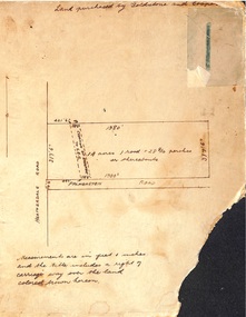
Map, Hand-drawn map of block of land on Heatherdale Road and Palmerston Road, Ringwood, Vic. (Undated)
... Hand-drawn map of block of land on Heatherdale Road and Palmerston Road, Ringwood, Vic. ...One of three unrelated maps on cardboard backing. Hand-drawn map of block of land on Heatherdale Road and Palmerston Road, Ringwood, Vic. ...One of three unrelated maps on cardboard backing.Handwritten notations - Land purchased by Goldstone and Cooper; 14 acres, 1 rood and 28-8/10 perches or thereabouts; Creation of easement to S.E.C. -
 Ringwood and District Historical Society
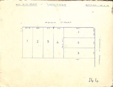
Map, Hand-drawn outline of residential allotments in Nelson Street and Ringwood Street, Ringwood, Vic., headed Mrs N.M. Adam - Subdivision - Auction 26.6.54
... Hand-drawn outline of residential allotments in Nelson Street and Ringwood Street, Ringwood, Vic., headed Mrs N.M. ...Pen drawing on cardboard backing. Hand-drawn outline of residential allotments in Nelson Street and Ringwood Street, Ringwood, Vic., headed Mrs N.M. ...Pen drawing on cardboard backing. -
 Ringwood and District Historical Society
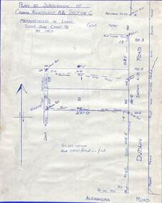
Drawing - Plan of Subdivision of Crown Allotment 42, Section C, Ringwood, Vic (Undated), Hand-drawn outline of residential allotments in Dublin Road north of Alexandra Road, Ringwood East, Victoria
... Hand-drawn outline of residential allotments in Dublin Road north of Alexandra Road, Ringwood East, Victoria....Pen drawing on cardboard backing. Hand-drawn outline of residential allotments in Dublin Road north of Alexandra Road, Ringwood East, Victoria. ...Pen drawing on cardboard backing. -
 Ringwood and District Historical Society
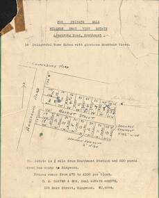
Card - Subdivision Advertisement - Millers Beau View Estate, Heathmont, Victoria - (Undated, circa 1950s), Hand-drawn outline of 18 home sites for private sale in Armstrong Road and Harriet Street, Heathmont
... Hand-drawn outline of 18 home sites for private sale in Armstrong Road and Harriet Street, Heathmont....Pen drawing on white paper with green cardboard backing. Hand-drawn outline of 18 home sites for private sale in Armstrong Road and Harriet Street, Heathmont. ...Pen drawing on white paper with green cardboard backing.Typewritten description - This Estate is 3/4 mile from Heathmont Station and 200 yards from bus route to Ringwood. Prices range from £70 to £100 per block. Agents - C.E. Carter & Son, 126 Main Street, Ringwood, (Phone) WU.6024. -
 Ringwood and District Historical Society
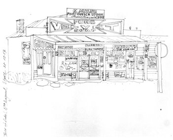
Photograph, Hand drawn picture by Eric Thake dated 1954 depicting Milne's Post Office and Store on the south-east corner of Oban Road and Warrandyte Road, North Ringwood
... Hand drawn picture by Eric Thake dated 1954 depicting Milne's Post Office and Store on the south-east corner of Oban Road and Warrandyte Road, North Ringwood....Now demolished". Hand drawn picture by Eric Thake dated 1954 depicting Milne's Post Office and Store on the south-east corner of Oban Road and Warrandyte Road, North Ringwood. ...Typed below picture, "Mr. K. Milnes store. Corner Oban Rd. and Warrandyte Rd. 1954. Now demolished". -
Croydon Conservation Society Inc.
Map, Hand drawn location map of Cheong Wildflower Sanctuary, Croydon 1991
... Hand drawn location map of Cheong Wildflower Sanctuary, Croydon 1991...Handwritten inscription on top of map: Croydon 1991 A4 sized handwritten map Hand drawn location map of Cheong Wildflower Sanctuary, Croydon 1991 Map ...A4 sized handwritten mapHandwritten inscription on top of map: Croydon 1991 -
 Ringwood and District Historical Society
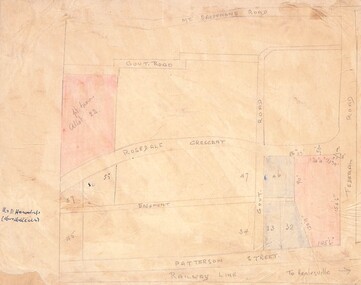
Drawing - Hand-drawn map, Part of Crown Allotment 22, Ringwood East, Victoria (Undated)
... Hand-drawn map ...Part of Crown Allotment 22, Ringwood East, Victoria (Undated). Drawing Hand-drawn map ...Pencil drawing on light cardboard backing. Colour-shaded residential allotments on Rosedale Crescent, Patterson Street and Federal Road, Ringwood East.(Railway line to Healesville marked on the map indicates creation date precedes closure of line beyond Lilydale in 1980) -
 Uniting Church Archives - Synod of Victoria
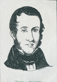
Photocopy of hand-drawn portrait, Unknown
... Photocopy of hand-drawn portrait...Thomas Mowbray Head and shoulders portrait (drawing) of Thomas Mowbray by E Powell Photocopy of hand-drawn portrait ...Born: 1812 at Hamilton, Lanarkshire, Scotland Baptised: Arrived: 26 January 1842 per "Robert Benn" from Greenock, Scotland Church Registers: Presbyterian Baptisms Campbellfield 1842 Church Registers: Presbyterian Burials Melbourne 1840-1842 Church Registers: Presbyterian Burials Melbourne 1843 Married: 17 August 1841 at West Colinton, Edinburgh, Scotland to Williamina Anderson Died: 24 December 1867 at Kangaroo Point, Moreton Bay, Queensland Buried: 25 December 1867 at Paddington Cemetery, Brisbane, Queensland "As the European population grew, settlement outside Melbourne developed, and the Colonial Committee of the Church of Scotland sent out more ministers. The second to arrive was the Rev. Thomas Mowbray, on January 28th 1842. He almost immediately settled in Campbellfield, called by a small congregation brought into being largely by the work of people such as Neil Campbell, Dr Wilson and George Somerville. Mr Campbell donated five acres of land to the Presbyterian Church for the purposes of building a church, a school-house and a manse. No pictures or clear description of the church that Mowbray built on the site. One source described it as being “built of logs and roofed with imported shingles”, another said it was “shingle-roofed wattle and daub”, and still others mention “rough adzed beams” and a “bark roof”. No trace remains on the site now. Yet while it may have been “so low that people had to stoop to enter”, it is certain that the building was erected with great pride and it was with much excitement that regular, well-attended worship services began on the present Campbellfield site with its dedication on May 8th 1842. An early colonist recollected that over the next two and half years Campbellfield developed into “an important charge, with many influential and wealthy adherents”. The first meeting of the Presbytery of Melbourne was held on June 7th 1842, with the Revs James Forbes, Thomas Mowbray and Peter Gunn, with Dr David Patrick (Elder) . Their first priority for action was public education. At their second meeting on September 6th it was reported that “schools which had been established by Mr Forbes in Melbourne were well attended and efficiently taught; also that schools were connected with the congregations at Campbellfield, Geelong and Portland.” The official history of Presbyterianism in Victoria , written in 1888, says of Mowbray: He was a man of high scholarly attainments, took special interest in the cause of education, and was a preacher of superior ability. His useful and acceptable labours were very much confined to the district in which he was settled. By reason of infirm health he was unable to undergo the fatigue of long excursions into the interior. But his labours were highly appreciated at the school which he originated and superintended sustained a good reputation. No official public records can be traced pertaining to Mowbray’s school. There may be a simple reason for this, and it is suggested that it has to do with the rifts in Presbyterianism which culminated in the Great Disruption in the Church of Scotland in May of 1843. The same divisions were by then already reflected in Victoria. Clergy from both ‘sides’ came to Australia and the main criterion for categorising them as Presbyterians of the Established Church of Scotland or Free Presbyterians was their acceptance or non-acceptance of state aid. Mowbray remained neutral in the 1846 Assembly-level wrangling and, although there is no evidence to support this contention, he may well have struggled to maintain his school with local resources rather than accept Government money; hence the lack of Government records. Unfortunately Mr Mowbray’s health declined rapidly and in answer to a call from Sydney on the 3rd of December 1844, he left Campbellfield on Boxing Day in 1844. Later he established the Presbyterian Church in Queensland, with the Ann Street Presbyterian Church being established in 1849." Quoted from "Scots Church Campbellfield—A Brief History" (ed. Robert Renton), 2nd Ed. 2017, pp. 2–4.Head and shoulders portrait (drawing) of Thomas Mowbray by E PowellChurch & Nation 10/8/1988 p32; Rev. Thomas Mowbrayrev. thomas mowbray; ordained 1841 church of scotland. served at campbellfield (scots) 1842, sydney 1844, moreton bay 1847 qld. pioneer of the presbyterian church of queensland -
Clunes Museum
Artwork, other - HAND DRAWN SKETCH
... HAND DRAWN SKETCH...A CAT ON THIS SIDE GREY ON BEIGE, GOLD CRACKED FRAME .2 PHOTOCOPY OF THE DRAWING .3 ORIGINAL BACKING OF THE DRAWING WITH PIECES OF WRITTEN NOTES AND NEWSPAPER CLIPPINGS BUT ILLEGIBLE, BROWN PAPER Artwork, other HAND DRAWN SKETCH ....1 PENCIL SKETCH OF A CREEK, A PUBLIC BATH HOUSE ON THE OTHER SIDE OF THE CREEK AND A RAT ON THE BUILDING. A CAT ON THIS SIDE GREY ON BEIGE, GOLD CRACKED FRAME .2 PHOTOCOPY OF THE DRAWING .3 ORIGINAL BACKING OF THE DRAWING WITH PIECES OF WRITTEN NOTES AND NEWSPAPER CLIPPINGS BUT ILLEGIBLE, BROWN PAPER.1 ON SKETCH: CAT:AH MY GOTT!! DERE IS ZE RAT ON ZE HOUSE OF ZE ISLAND, I WILL HAVE A POKE AT HIM BUT - OH - IF I MISSES HIM HE MAY FLY AT ME, GOTTTAM RAT HApencil sketch, cartoon sketch -
 Tramways/East Melbourne RSL Sub Branch - RSL Victoria Listing id: 27511
Print - Black and White pencil, hand drawn, MEDCAP, Uruzgan, Afganistan, 2010, 2010
... Black and White pencil, hand drawn...Image shows a young child receiving medical attention in Afghanistan MEDCAP, Uruzgan, Afganistan, 2010 Print Black and White pencil, hand drawn ...The artist is currently a member of the Tramways / East Melbourne RSL, and has donated these prints himself. Framed print of the image created by 'Andrew Archibald'. Print is signed by the artist and editioned as 11/ 100. Image shows a young child receiving medical attention in AfghanistanPlate states 'Donated by Craig Horne' andrew archibald, afghanistan, medcap, children, medical treatment, doctors, artworks, war -
 City of Moorabbin Historical Society (Operating the Box Cottage Museum)
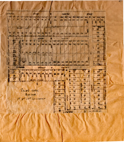
Plan - Scott's Estate, Bentleigh
... Hand drawn plan of Scott's Estate, Bentleigh...Hand drawn plan of Scott's Estate, Bentleigh...Example of the progress of the Municipality of Moorabbin Centre Road Scotts Street Renown Street Lawaon Street Wood Street Leckie Street Bolinda Street Bentleigh real estate Hand drawn plan of Scott's Estate, Bentleigh Hand drawn plan of Scott's Estate, Bentleigh Plan Scott's Estate, Bentleigh ...The train line from the city to Frankston was electrified in 1922 which intensified the sale in the municipality of Moorabbin, particularly land which was in the vicinity of the railway stations.Example of the progress of the Municipality of MoorabbinHand drawn plan of Scott's Estate, BentleighHand drawn plan of Scott's Estate, Bentleighcentre road, scotts street, renown street, lawaon street, wood street, leckie street, bolinda street, bentleigh, real estate -
 City of Moorabbin Historical Society (Operating the Box Cottage Museum)
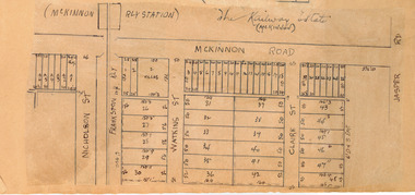
Plan - McKinnon Railway Estate, McKinnon, c 1921
... Hand drawn plan of the McKinnon Railway Estate, McKinnon...McKinnon Railway Estate, McKinnon - hand drawn plan...Example of the progress of the Municipality of Moorabbin McKinnon Road Watkins Street (now Bent Street) Claire Street real estate McKinnon Moorabbin McKinnon Railway Estate, McKinnon - hand drawn plan Hand drawn plan of the McKinnon Railway Estate, McKinnon Plan McKinnon Railway Estate, McKinnon ...At the end of World War One, there was a renewed interest in residential land and a number of estates opened up in the Municipality of Moorabbin. The train line from the city to Frankston was electrified in 1922 which intensified the sale in the municipality of Moorabbin, particularly land which was in the vicinity of the railway stations.Example of the progress of the Municipality of MoorabbinHand drawn plan of the McKinnon Railway Estate, McKinnonMcKinnon Railway Estate, McKinnon - hand drawn planmckinnon road, watkins street (now bent street), claire street, real estate, mckinnon, moorabbin -
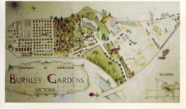 University of Melbourne, Burnley Campus Archives
Slide - Colour slide, Milton Gellert, Department of Agriculture Burnley Gardens Victoria, 1955-1990
... ...hand drawn plan of site...2 copies, large colour negative. Coloured hand drawn plan of of the whole site in a frame. ...Coloured hand drawn plan of of the whole site in a frame. ...Copied for use as a postcard for the Centennial Year in 1990. Note by T.H. Kneen 18 March 1992, "The original drawing was done by Milton Gellert and for a considerable time was displayed in the Fruit Preserving Branch's display window. This was Milton's own concept and was probably done in late 50's. Milton was on Burnley Staff 1955-57 & then employed at Plant Research Institute, Burnley Gardens." The picture was later hung in the Staff Room in the Administration Building but has disappeared.2 copies, large colour negative. Coloured hand drawn plan of of the whole site in a frame. Photographed in 1965.centennial year, milton gellert, fruit preserving branch, staff, plant research institute, burnley gardens, hand drawn plan of site, 1991, plan
