
Showing 29 items matching "irrigation - murray river"
-
 Wodonga & District Historical Society Inc
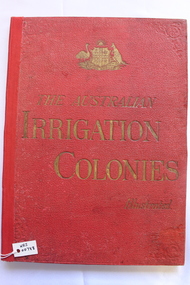
Book - The Australian Irrigation Colonies Illustrated, Chaffey Brothers, C. 1888
... Irrigation - Murray River...Irrigation - Murray River Irrigation districts -- Victoria -- Mildura Region -- History Irrigation districts -- South Australia -- Renmark Region -- History Chaffey Brothers A prospectus on a grand scale, designed to promote the irrigation scheme developed by the Chaffey Brothers, primarily focussed on their work in Victoria and South Australia. ...A prospectus on a grand scale, designed to promote the irrigation scheme developed by the Chaffey Brothers, primarily focussed on their work in Victoria and South Australia. It was published to promote 'irrigation colonisation'" and contains numerous advertisements promoting life in the colonies of South Australia and Victoria. This volume was issued in association with the 1888 Melbourne International Exhibition.A volume with a gilt- and blind-decorated red bubble-grain cloth, with a large advertisement for Pears' Soap in gilt on the rear cover.non-fictionA prospectus on a grand scale, designed to promote the irrigation scheme developed by the Chaffey Brothers, primarily focussed on their work in Victoria and South Australia. It was published to promote 'irrigation colonisation'" and contains numerous advertisements promoting life in the colonies of South Australia and Victoria. This volume was issued in association with the 1888 Melbourne International Exhibition.irrigation - murray river, irrigation districts -- victoria -- mildura region -- history, irrigation districts -- south australia -- renmark region -- history, chaffey brothers -
 Port of Echuca
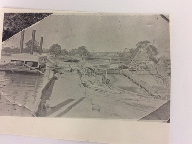
A rectangular copy of a black and white photograph, 24/09/1984
... irrigation industry...murray river...Murray in the early days of the 20th Century. It shows the strategy and the lay out do constructing a Lock. irrigation industry murray river lock construction. the price family collection Written in lead pencil on the back are the words; Constructing Lock. ...This photograph shows how locks were constructed in the early 20th Century. There is floating steam equipment in the left of the photograph. This photograph is significant because it shows equipment used to construct Locks along the Murray in the early days of the 20th Century. It shows the strategy and the lay out do constructing a Lock.A photo copy of a black and white photograph, which looks like it was a photograph taken of a photo which was still in someone's photo album. The photograph shows Lock construction. Locality is unknown.Written in lead pencil on the back are the words; Constructing Lock. Unknown site.irrigation industry, murray river, lock construction., the price family collection -
 Tatura Irrigation & Wartime Camps Museum
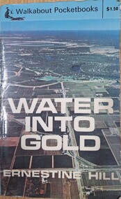
Book, Water into Gold, 1965
... Depicts pioneers of irrigation, Chaffey Bros., and story of irrigation on the Murray River...Depicts pioneers of irrigation, Chaffey Bros., and story of irrigation on the Murray River water into gold irrigation hill e tatura books history local rural industry Blue soft cover, depicting aerial photo of farmland, white lettering. ...Depicts pioneers of irrigation, Chaffey Bros., and story of irrigation on the Murray RiverBlue soft cover, depicting aerial photo of farmland, white lettering.water into gold, irrigation, hill e, tatura, books, history, local, rural, industry -
 Bendigo Historical Society Inc.
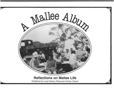
Book - "A Mallee Album. Reflections on Mallee Life.", 1988
... In 1903 the railway line was extended from Woomelang (80 km south of Ouyen) to Mildura, the site of an irrigation settlement on the Murray River. The prospect of farming in the Mallee had been enhanced by settlements at Hopetoun and Lascelles (both near Woomelang), and the opening of the railway line invited settlement along its route. ...In 1903 the railway line was extended from Woomelang (80 km south of Ouyen) to Mildura, the site of an irrigation settlement on the Murray River. The prospect of farming in the Mallee had been enhanced by settlements at Hopetoun and Lascelles (both near Woomelang), and the opening of the railway line invited settlement along its route. ...Ouyen is a rural township near the centre of the Mallee region in north-west Victoria. It is on the Sunraysia Highway, 100 km south of Mildura, and is a railway junction for the lines to Mildura and westwards through the Mallee to Murrayville and Pinnaroo, South Australia. In 1903 the railway line was extended from Woomelang (80 km south of Ouyen) to Mildura, the site of an irrigation settlement on the Murray River. The prospect of farming in the Mallee had been enhanced by settlements at Hopetoun and Lascelles (both near Woomelang), and the opening of the railway line invited settlement along its route. Settlers began arriving in the Ouyen district in 1906, and the township was proclaimed in 1909. It is thought that the name was derived from an Aboriginal word meaning ghost or waterhole. West of Ouyen an area of land extending to the South Australian border was found to be adequate for farming and contained bore water (1906). Settlement spread westwards from about 1909 to Walpeup and beyond. Ouyen began functioning as a service centre. A school was opened in 1909 in a coffee palace and public hall. Within 15 years of its settlement Ouyen had 900 people, and was the administrative centre of Walpeup shire (1911). A shire hall was built in 1918. A district hospital was built in 1929, and a higher education school was opened in 1928. It became a high school in 1952. A Catholic primary school was also opened in 1952. By the 1930s, though, Ouyen had a local court, four banks, an agricultural society, sporting and racing clubs, and local industries such as cordial making, plaster sheet, a freezing works and an electricity generation plant. Silos were later built for the storage and railing of cereal grains."A Mallee Album. Reflections on Mallee Life" published by Local History Resource Centre, Ouyen. Foreword by The Local History Resource Centre Committee, Ouyen. A collection of images from the area and brief description associated with each image. Published in Australia by Local History Resource centre, Ouyen, 1988. White colored hard cover book. Black and white photograph on front cover. Titles printed in black. Book includes black and white photographs of local people and events. 153 pp.mallee, ouyen -
 Orbost & District Historical Society
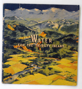
book, Water For the Thirsty Inland, 1945
... River waters to the Murrumbidgee. In 1950 The Murrumbidgee Valley Water Users Association and the League established the Murray-Murrumbidgee Development Committee to ensure the Snowy Scheme was completed. This book is a significant research tool for the history of the diversion of the Snowy River. Snowy-River Murrumbidgee-Valley-Water-Users' irrigation ...Water For the Thirsty Inland was published by The Murrumbidgee Valley Water Users Association as a case for diversion of part of the Snowy River waters to the Murrumbidgee. In 1950 The Murrumbidgee Valley Water Users Association and the League established the Murray-Murrumbidgee Development Committee to ensure the Snowy Scheme was completed.This book is a significant research tool for the history of the diversion of the Snowy River.A 44 pp book, titled Water For The Thirsty Inland. On the front cover is a coloured print of a painting of a river (Snowy River?) from the mountains to the flats. The text of the title is white with a black shadow. The book contains b/w photographs and the print is black and green.Some pencilled notes on back.snowy-river murrumbidgee-valley-water-users' irrigation -
 Orbost & District Historical Society
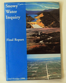
book, Snowy Water Inquiry, Snowy Water Inquiry Final Report, 1998
... Murray River and other rivers associated with the Scheme. The Inquiry objectives were that the recommendations would not adversely impact on water supplies to existing irrigators or the viability of the Snowy Mountains Scheme. ...Murray River and other rivers associated with the Scheme. The Inquiry objectives were that the recommendations would not adversely impact on water supplies to existing irrigators or the viability of the Snowy Mountains Scheme. ...The Snowy Water Inquiry was commissioned in 1998 with a brief to recommend environmental water release options to the Commonwealth, Victorian, and NSW Governments so that corporatisation of the Snowy Mountains Scheme could proceed. These release options related to the Snowy River below Jindabyne, the Murray River and other rivers associated with the Scheme. The Inquiry objectives were that the recommendations would not adversely impact on water supplies to existing irrigators or the viability of the Snowy Mountains Scheme. (ref snowyhydro.com.au)This report contains information about water allocation and uses of the Snowy River.A book of 160 pp - Snowy River Inquiry Final report 23rd October 1998. Submitted to the Governments of New South Wales and Victoria / Commissioner: The Hon. Robert Webster. On the front cover are three aerial photographs of the Snowy River and Snowy Hydro Scheme. The book contains maps and photographs. snowy-river snowy-hydro snowy-mountains government-inquiry -
 Kiewa Valley Historical Society
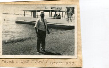
Photographs x 3- Cruise on Lake Mulwala, 25/2/1973
... Lake Mulwala is a man–made reservoir created through the construction of the Yarrawonga Weir across the Murray River, is located between Bundalong and Yarrawonga in Hume region of Victoria and Mulwala in the Riverina region of New South Wales, in eastern Australia. The weir was constructed in 1939 to provide water for irrigation...Lake Mulwala is a man–made reservoir created through the construction of the Yarrawonga Weir across the Murray River, is located between Bundalong and Yarrawonga in Hume region of Victoria and Mulwala in the Riverina region of New South Wales, in eastern Australia. The weir was constructed in 1939 to provide water for irrigation ...Lake Mulwala is a man–made reservoir created through the construction of the Yarrawonga Weir across the Murray River, is located between Bundalong and Yarrawonga in Hume region of Victoria and Mulwala in the Riverina region of New South Wales, in eastern Australia. The weir was constructed in 1939 to provide water for irrigation of the surrounding district. The weir also serves as a crossing of the Murray between the two towns. It is a popular tourist destination for boating, fishing and other water recreation.Photographs demonstrate local Kiewa Valley residents enjoying a visit to the picturesque area of Lake Mulwala. Also provides a pictorial history of 1973.3 black and white photographs mounted on buff card. Photographs of a cruise on Lake Mulwala 25th Feb. 1973 1. Photo of unidentified man standing on the shore of Lake Mulwala beside cruise launch. 2. Group photo of people standing by cruise boat as others disembark. Woman in centre holding handbag may be Clare Roper (unconfirmed) 3. Photo of 2 men aboard cruise launch looking out over Lake Mulwala1. Handwritten at bottom of photo in black ink. 'Cruise on Lake Mulwala. 25th Feb. 1973' 2. Painted sign above cruise launch- Scenic Lake Cruises 3. No markingsclare roper -
 Port of Echuca
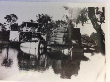
Photograph, Early 20th Century
... Murray River to aide in the construction of Locks 6,7,9 and Yarrawonga Weir. The barge is viewed from the rear, as the rudder can be seen, and shows the enormity of the loads of wool which a barge could carry. The two vessels are tied together and appear to be moored at a small pier. The P.S Australien is one of the oldest paddle steamers built at Echuca. It was a working vessel during the construction of the Yarrawonga weir in the 1930s which was the beginning of the irrigation ...The P.S Australien was built in 1897 by Richard Wilson, of Moama. In 1937 the vessel was used to tow boilers, winches and derricks to the banks of the Murray River to aide in the construction of Locks 6,7,9 and Yarrawonga Weir. The barge is viewed from the rear, as the rudder can be seen, and shows the enormity of the loads of wool which a barge could carry. The two vessels are tied together and appear to be moored at a small pier.The P.S Australien is one of the oldest paddle steamers built at Echuca. It was a working vessel during the construction of the Yarrawonga weir in the 1930s which was the beginning of the irrigation system which enabled the Agriculture Industry to become such a prominent part of the Murray-Darling River Basin social history. A paddle steamer and a barge, loaded with wool, are seen docked together on a river. There is a small wooden jetty leading to the bank where gum trees are growing.p.s australien, yarrawonga weir, echuca paddlesteamers, murray river paddle steamers, wilson, richard, wool industry -
 Tatura Irrigation & Wartime Camps Museum
Video tape, Sir Ronald East, 1993/06/05
... Interview made with Sir Ronald East (Long term Chairman of State Rivers and Water Supply Commission from 1937 - 1965) and part of a longer tape made by the MDBC. Irrigation victoria state rivers and water supply commission Sir Ronald East Murray-Darling Basin Commission Sir Ronald East 5-6-1993 VHS Video Tape - Murray-Darling Basin Commission Sir Ronald East Video tape ...Interview made with Sir Ronald East (Long term Chairman of State Rivers and Water Supply Commission from 1937 - 1965) and part of a longer tape made by the MDBC.VHS Video Tape - Murray-Darling Basin CommissionMurray-Darling Basin Commission Sir Ronald East 5-6-1993irrigation, victoria state rivers and water supply commission, sir ronald east -
Tatura Irrigation & Wartime Camps Museum
Photograph, Goulburn Weir Sign, 1970s
... Sign describing Goulburn Weir - "State rivers and Water Supply Commission/Goulburn Weir/Diversion Headworks for Goulburn Irrigation System/Designed and Constructed by Victorian Water Supply Department 1891./Full Supply Level is 408 Feet Above Sea Level/Stuart Murray...Sign describing Goulburn Weir - "State rivers and Water Supply Commission/Goulburn Weir/Diversion Headworks for Goulburn Irrigation System/Designed and Constructed by Victorian Water Supply Department 1891./Full Supply Level is 408 Feet Above Sea Level/Stuart Murray ...Taken by photographer for State Rivers and Water Supply Commission.Medium sized black and white photograph. Sign describing Goulburn Weir - "State rivers and Water Supply Commission/Goulburn Weir/Diversion Headworks for Goulburn Irrigation System/Designed and Constructed by Victorian Water Supply Department 1891./Full Supply Level is 408 Feet Above Sea Level/Stuart Murray M.I.C.E Chief Engineer/William Henderson A.M.I.C.E Supervising Engineer."goulburn weir, victorian state rivers and supply commission -
Tatura Irrigation & Wartime Camps Museum
Photograph, Stuart Murray Canal Sign, 1890s
... Sign:-"STATE RIVERS AND WATER SUPPLY COMMISSION/GOULBURN IRRIGATION SYSTEM/STUART MURRAY CANAL/CONVEYS WATER FROM GOULBURN WEIR TO WARANGA RESERVOIR/DESIGNED AND CONSTRUCTED BY VICTORIAN WATER SUPPLY DEPARTMENT - 1981....Sign:-"STATE RIVERS AND WATER SUPPLY COMMISSION/GOULBURN IRRIGATION SYSTEM/STUART MURRAY CANAL/CONVEYS WATER FROM GOULBURN WEIR TO WARANGA RESERVOIR/DESIGNED AND CONSTRUCTED BY VICTORIAN WATER SUPPLY DEPARTMENT - 1981. ...Taken by photographer for State Rivers and Water Supply Commission.Medium sized black and white photograph. Sign:-"STATE RIVERS AND WATER SUPPLY COMMISSION/GOULBURN IRRIGATION SYSTEM/STUART MURRAY CANAL/CONVEYS WATER FROM GOULBURN WEIR TO WARANGA RESERVOIR/DESIGNED AND CONSTRUCTED BY VICTORIAN WATER SUPPLY DEPARTMENT - 1981./STUART MURRAY M.I.C.E CHIEF ENGINEER."goulburn weir, victorian state rivers and supply commission -
Tatura Irrigation & Wartime Camps Museum
Photograph, Goulburn Irrigation System, 1970s
... rivers and supply commission Medium sized black and white photograph. Map showing the Goulburn Irrigation System in Northern Victoria including Eildon Reservoir, Waranga Reservoir, Eppalock Reservoir, Eppalock, Cairn Curran, Laancoorie, Tullaroop Reservoirs, the Stuart Murray, Cattanach Canal, East Goulburn Main and Waranga Western Channels. ...Taken by photographer for State Rivers and Water Supply Commission.Medium sized black and white photograph. Map showing the Goulburn Irrigation System in Northern Victoria including Eildon Reservoir, Waranga Reservoir, Eppalock Reservoir, Eppalock, Cairn Curran, Laancoorie, Tullaroop Reservoirs, the Stuart Murray, Cattanach Canal, East Goulburn Main and Waranga Western Channels.goulburn weir, victorian state rivers and supply commission -
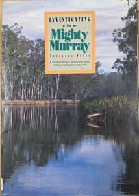 Tatura Irrigation & Wartime Camps Museum
Book, Investigating the Mighty Murray, 1993
... The River Murray - history at a glance. Murray Darling Basin Map 1902 irrigation books school educational Front and back covers of Murray river scenes. ...The River Murray - history at a glance. Murray Darling Basin Map 1902Front and back covers of Murray river scenes. Teachers' Guide Bookletsirrigation, books, school, educational -
Tatura Irrigation & Wartime Camps Museum
Book, Emergence of Bioregionalism in the MD Basin, 1993
... An exploratory essay on he ongoing history of Murray Darling Basin includes legacies, explorations, soil erosion, irrigation divsity, land degradation, change, regionalism, conservation, maps of Vic. NSW and Queensland murray darling basin legacies erosion degradation diversity tatura murray river books rural industry Gloosy cover, brown marbled scenes from Berri Irrigation Area Reiver Murray, South Australia on back. ...An exploratory essay on he ongoing history of Murray Darling Basin includes legacies, explorations, soil erosion, irrigation divsity, land degradation, change, regionalism, conservation, maps of Vic. NSW and QueenslandGloosy cover, brown marbled scenes from Berri Irrigation Area Reiver Murray, South Australia on back. Maps, water scenes, Pyap Estates on front.murray darling basin, legacies, erosion, degradation, diversity, tatura, murray river, books, rural, industry -
Tatura Irrigation & Wartime Camps Museum
Book, The Supply of Water for Irrigation in Victoria 1881-1981, 1981
... Includes history of early irrigation schemes, Goulburn system, river Murray system, Post war expansion, drainage and salinity. ...Includes history of early irrigation schemes, Goulburn system, river Murray system, Post war expansion, drainage and salinity. ...Includes history of early irrigation schemes, Goulburn system, river Murray system, Post war expansion, drainage and salinity. Change from State Rivers & Water Supply Commission to Rural CommissionCream cover, black writing. Cover photo of early days of irrigation, many channels constructed by teams of horses dragging scoops.sr & wscommision, books, rural, industry -
Tatura Irrigation & Wartime Camps Museum
Book, Irrigation and Water Supply Development in Victoria, 1954
... Reference to Eildon Reservoir, Goulburn Weir, Waranga Reservoir, River Murray irrigation systems...Reference to Eildon Reservoir, Goulburn Weir, Waranga Reservoir, River Murray irrigation systems irrigation water supply goulburn river books history local Buff and blue covered book, showing farmhouse, dairy cattle on front cover, cattle, trees and channel on back Irrigation and Water Supply Development in Victoria Book ...History of irrigaton in Victoria. Reference to Eildon Reservoir, Goulburn Weir, Waranga Reservoir, River Murray irrigation systemsBuff and blue covered book, showing farmhouse, dairy cattle on front cover, cattle, trees and channel on backirrigation, water supply, goulburn river, books, history, local -
Tatura Irrigation & Wartime Camps Museum
Document, History of Irrigation in Goulburn Murray Irrigaton District, 1990
... Brief history of irrigation in Goulburn Murray Irrigation district and brief information on headworks supplying water to the area. document irrigation Black folder, containing papers on State Rivers and Water Supply Commission works History of Irrigation in Goulburn Murray Irrigaton District Document ...Brief history of irrigation in Goulburn Murray Irrigation district and brief information on headworks supplying water to the area.Black folder, containing papers on State Rivers and Water Supply Commission worksdocument, irrigation -
Tatura Irrigation & Wartime Camps Museum
Book, The River Murray, 1990
... Written to record history of River Murray from aboriginal times, early settlers, riverboats, maps, irrigation, agriculture....Written to record history of River Murray from aboriginal times, early settlers, riverboats, maps, irrigation, agriculture. irrigation books reference rural industry Map of Murray River and districts on front cover. 4 river scenes in square boxes. ...Written to record history of River Murray from aboriginal times, early settlers, riverboats, maps, irrigation, agriculture.Map of Murray River and districts on front cover. 4 river scenes in square boxes. Gold disc, paddle steamer, names of 3 states. Early scenes n back cover. 1 present day.irrigation, books, reference, rural, industry -
Tatura Irrigation & Wartime Camps Museum
Box, 1920's
... Rivers and Water Supply Commission for construction of Waranga Basin 1923 - 1929. Cards handwritten by D.O'Shannessy who was taught to read and write by the Waranga school teacher. tatura irrigation employment records waranga basin rural water corporation rural water commission goulburn murray water rural industry employment records Plastic box containing 235 employment cards Box ...Employment records of State Rivers and Water Supply Commission for construction of Waranga Basin 1923 - 1929. Cards handwritten by D.O'Shannessy who was taught to read and write by the Waranga school teacher.Plastic box containing 235 employment cardstatura, irrigation, employment records, waranga basin, rural water corporation, rural water commission, goulburn murray water, rural, industry, employment, records -
Tatura Irrigation & Wartime Camps Museum
Booklet, Hume Reservoir, 1986
... Booklet produced to commemorate 50 years of hume Reservoir (1936-1986) Contains photos of early construction hume reservoir 1936-1986 tatura irrigation books reference rural industry Pictures, past and present of Hume Reservoir. Front and back covers coloured and sepia. River Murray ...Booklet produced to commemorate 50 years of hume Reservoir (1936-1986) Contains photos of early constructionPictures, past and present of Hume Reservoir. Front and back covers coloured and sepia. River Murray Commission in blue writing.hume reservoir, 1936-1986, tatura, irrigation, books, reference, rural, industry -
Tatura Irrigation & Wartime Camps Museum
Book, Register of Lands, 1979-1980
... Rodney irrigation area of the Goulburn-Murray Irrigation District. 1979-1980 irrigation season irrigation books history local rural industries Beige front, black back cover.Greeen cloth spine, black writing. State "Rivers ...Register of Lands - rates payable. Rodney irrigation area of the Goulburn-Murray Irrigation District. 1979-1980 irrigation seasonBeige front, black back cover.Greeen cloth spine, black writing. State "Rivers & Water Supply Commission, Vic. 79/80" on spine.irrigation, books, history, local, rural, industries -
Tatura Irrigation & Wartime Camps Museum
Map, Irrigation Trust distribution channels
... Map retrieved from State Rivers & Water Supply Commission Offices by Gilian Payne. Map of Rodney Irrigation Trust distribution channels, 1887, prepared by Walter Scott Murray. ...Map retrieved from State Rivers & Water Supply Commission Offices by Gilian Payne. Map of Rodney Irrigation Trust distribution channels, 1887, prepared by Walter Scott Murray. ...Map retrieved from State Rivers & Water Supply Commission Offices by Gilian Payne. Map of Rodney Irrigation Trust distribution channels, 1887, prepared by Walter Scott Murray. Copied in seven sections. -
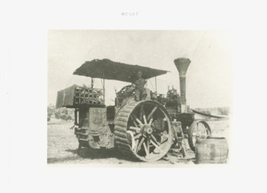 Lakes Entrance Historical Society
Photograph - J & H McLaren 8 nhp serial No. 1185 compound steam traction engine, J & H McLaren, c1950
... Murray River in NSW. McLaren had a family connection to the Chaffey brothers who set up irrigation around Mildura. ...Murray River in NSW. McLaren had a family connection to the Chaffey brothers who set up irrigation around Mildura. ...Contractor with steam engine often travelled to district farms as required. Further history of this engine has come to hand from Nev Scobie: There are very few McLaren tractors worldwide and this is the only one known to have worked in Central Victoria. A few worked along the Murray River in NSW. McLaren had a family connection to the Chaffey brothers who set up irrigation around Mildura. This engine was bought new by McMillan brothers and used in the Forbes NSW area. It pulled a record load of wheat - 57 tons 21 miles in a day, its top speed was 7 km per hour. It was sold to someone in Central Victoria and is known to have been owned by Ray Jones of Kyneton who worked it until the early 1950s. It was reconditioned at Trentham by Trewhella Bros. and sold to Nev Scobie's family in 1966. The driver in the photograph is Henry Carr who drove for Ray Jones and continued to drive it after it was sold to Scobies. The Scobies had it restored and it worked into the 1970s. Nev Scobie and his brother began restoring it again around 2020 - a project which is ongoing.The life of an engine tells a story of agricultureBlack and white enlarged photograph of a large steam traction engine showing container at back holding wood for boiler and smoke stack. Driver on board is Henry Carr.agriculture, engineering -
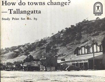 Wodonga & District Historical Society Inc
Education kit - How do towns change? - Tallangatta, SHEP Project, 1979
... Murray Rivers threatened the town. Stage one of Lake Hume was completed in 1936, sparing the town temporarily. After WWII, demand for irrigation water rose—and residents were told the town would be flooded. ...The Tallangatta pastoral run was established in 1838. By the 1850s a thriving town had been established near the junction of the Mitta Mitta River and Tallangatta Creek. Officially named in 1854, Tallangatta became a vital gateway to nearby goldfields such as Mount Wills, Mitta Mitta, and Cravensville. It also grew as a service centre to the pastoralists in the surrounding area. Rail reached Tallangatta in 1891, doubling the population within a decade. A mile-long viaduct took two years to complete. The railway brought jobs and connected local mining and farming industries to broader markets. From 1918, Tallangatta's future was uncertain. Plans for a reservoir at the confluence of the Mitta Mitta and Murray Rivers threatened the town. Stage one of Lake Hume was completed in 1936, sparing the town temporarily. After WWII, demand for irrigation water rose—and residents were told the town would be flooded. Between 1952 and 1958, Tallangatta was relocated. The State Rivers and Water Supply Commission oversaw the move with a £3 million budget. Over 100 timber homes were relocated, 37 brick homes rebuilt, and 74 prefabricated houses brought in. Thirty-five new buildings were added, including hotels, banks, a butter factory, a hospital, and a modern shopping centre. The new town of Tallangatta was officially reopened by Governor Sir William Slim on June 29, 1956. In 2016, Tallangatta was designated a "Notable Town" by the National Trust for its architectural and historical significance, making it the second town to receive this honour.A set of 89 Photographs, maps and information sheets produced as a case study of the moving of the town of Tallangatta in the 1950s. It was created as a resource to enable secondary school students to investigate how towns can change over time. non-fictionThe Tallangatta pastoral run was established in 1838. By the 1850s a thriving town had been established near the junction of the Mitta Mitta River and Tallangatta Creek. Officially named in 1854, Tallangatta became a vital gateway to nearby goldfields such as Mount Wills, Mitta Mitta, and Cravensville. It also grew as a service centre to the pastoralists in the surrounding area. Rail reached Tallangatta in 1891, doubling the population within a decade. A mile-long viaduct took two years to complete. The railway brought jobs and connected local mining and farming industries to broader markets. From 1918, Tallangatta's future was uncertain. Plans for a reservoir at the confluence of the Mitta Mitta and Murray Rivers threatened the town. Stage one of Lake Hume was completed in 1936, sparing the town temporarily. After WWII, demand for irrigation water rose—and residents were told the town would be flooded. Between 1952 and 1958, Tallangatta was relocated. The State Rivers and Water Supply Commission oversaw the move with a £3 million budget. Over 100 timber homes were relocated, 37 brick homes rebuilt, and 74 prefabricated houses brought in. Thirty-five new buildings were added, including hotels, banks, a butter factory, a hospital, and a modern shopping centre. The new town of Tallangatta was officially reopened by Governor Sir William Slim on June 29, 1956. In 2016, Tallangatta was designated a "Notable Town" by the National Trust for its architectural and historical significance, making it the second town to receive this honour.moving tallangatta, tallangatta - the town that moved, history tallangatta -
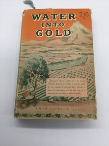 Rutherglen Historical Society
Book, Robertson & Mullens, Water Into Gold, 1946
... Renmark dried fruit Murray River mildura agriculture Irrigation On inside page opposite first title - "Mrs Iggsten Xmas 1946" Book with orange cloth cover with black writing. ...From the estate of Florence Iggsten.Book with orange cloth cover with black writing. Dust cover printed in shades of orange and green with view of river and fields.On inside page opposite first title - "Mrs Iggsten Xmas 1946"renmark, dried fruit, murray river, mildura, agriculture, irrigation -
 Maldon Vintage Machinery Museum Inc
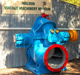
Pump - Centrifugal, Approximately 1954
... This pump was situated at Mildura Victoria and pumped water from the Murray river to irrigate the fruit blocks. Machinery - Pumps; Metalwork The pump identification plate has been removed and there are no markings cast on it. ...This pump was situated at Mildura Victoria and pumped water from the Murray river to irrigate the fruit blocks.Large double suction centrifugal pump with 36" suction and discharge branches weighing 7500 kg. Cast iron baseplate for the pump measuring 154 x 185 x 22 cm. The pump is fitted with a spring grid coupling. The pump and baseplate are painted pale blue. The pump identification plate has been removed and there are no markings cast on it. The baseplate has Thompsons cast in relief on the top surface. The coupling has a brass nameplate with Richardson Spring Grid Coupling engraved on it.machinery - pumps; metalwork -
 Wodonga & District Historical Society Inc
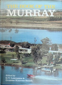
Book - The Book of the Murray, Lawrence, G. V.; and Smith, Graeme Kinross, 1975
... Murray River area. It provides a comprehensive picture of the river in all its aspects. It gives a fascinating look at one of Australia's most important geographical and historical features. Contributors and chapters in this book are: - 1. Past, Present and Future – G. V. Lawrence 2. The Structure of the Murray – Edmund D. Gill 3. Seeing the Murray – Graeme Kinross Smith 4. The Mountains at the Source – Elyne Mitchell 5. The Explorers – Leigh Betheras 6. The Irrigators ...This book contains contributions from 16 writers who have first-hand knowledge of the Murray River area. It provides a comprehensive picture of the river in all its aspects. It gives a fascinating look at one of Australia's most important geographical and historical features. Contributors and chapters in this book are: - 1. Past, Present and Future – G. V. Lawrence 2. The Structure of the Murray – Edmund D. Gill 3. Seeing the Murray – Graeme Kinross Smith 4. The Mountains at the Source – Elyne Mitchell 5. The Explorers – Leigh Betheras 6. The Irrigators – G. Arch Grosvenor 7. Murray Water Conservation – W. G. L. Harrison & K. E. Johnson 8. The Murray River Steamers – Ian Mudie 9. Pioneer Days: A Story of Seventy Years Ago – Dorothy Roysland 10. Birdlife of the Murray Valley – John Eckert 11 .Aborigines in the Murray Valley, How We Learned the Story – H. A. Lindsay, The Aboriginal Occupation – Norman B. Tindale 12. Fish of the Murray River – John S. Lake 13. Native Plants of the Murray Valley – J. H. Willis 14. Murray Wildlife – K. N. G. SimpsonThis publication has a hard cover with blue boards and a pictorial dust jacket. It consists of 264 pages.This book contains contributions from 16 writers who have first-hand knowledge of the Murray River area. It provides a comprehensive picture of the river in all its aspects. It gives a fascinating look at one of Australia's most important geographical and historical features. Contributors and chapters in this book are: - 1. Past, Present and Future – G. V. Lawrence 2. The Structure of the Murray – Edmund D. Gill 3. Seeing the Murray – Graeme Kinross Smith 4. The Mountains at the Source – Elyne Mitchell 5. The Explorers – Leigh Betheras 6. The Irrigators – G. Arch Grosvenor 7. Murray Water Conservation – W. G. L. Harrison & K. E. Johnson 8. The Murray River Steamers – Ian Mudie 9. Pioneer Days: A Story of Seventy Years Ago – Dorothy Roysland 10. Birdlife of the Murray Valley – John Eckert 11 .Aborigines in the Murray Valley, How We Learned the Story – H. A. Lindsay, The Aboriginal Occupation – Norman B. Tindale 12. Fish of the Murray River – John S. Lake 13. Native Plants of the Murray Valley – J. H. Willis 14. Murray Wildlife – K. N. G. Simpsonmurray river, australian geography, settlement on the murray river, native plants, aborigines in the murray valley, murray valley flora and fauna -
 Wodonga & District Historical Society Inc
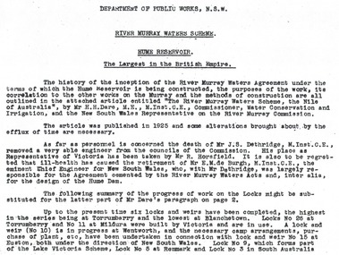
Album - Hume Reservoir Australia Album - Introduction - Part 1, Department of Public Works, N.S.W, 1927
... RIVER MURRAY WATERS SCHEME, HUME RESERVOIR THE LARGEST IN THE BRITISH EMPIRE. ' The history of the inception of the River Murray Waters Agreement under the terms of which the Hume Reservoir is being constructed, the purposes of the work, its correlation to the other works on the Murray and the methods of construction are all outlined in the attached article entitled “The River Murray Waters Scheme, the Nile of Australia”, by Mr H.H. Dare, M.E., M.Inst.C.E., Commissioner, Water Conservation and Irrigation...Hume Reservoir Australia River Murray Waters Scheme RIVER MURRAY WATERS SCHEME, HUME RESERVOIR THE LARGEST IN THE BRITISH EMPIRE. ' The history of the inception of the River Murray Waters Agreement under the terms of which the Hume Reservoir is being constructed, the purposes of the work, its correlation to the other works on the Murray and the methods of construction are all outlined in the attached article entitled “The River Murray Waters Scheme, the Nile of Australia”, by Mr H.H. Dare, M.E., M.Inst.C.E., Commissioner, Water Conservation and Irrigation ...This set of photos is from a leather bound album bearing the inscription "HUME RESERVOIR AUSTRALIA" plus 'The Rt. Hon. L. C. M. S. Amery, P. C., M .P.' all inscribed in gold. It was presented to The Rt. Hon. L. C. M. S. Amery, P. C., M. P, Secretary of State for Dominion Affairs on the occasion of his visit to the Hume Reservoir on 2nd November 1927. This album is of local and national significance as it documents the planning and development of the Hume Reservoir up to 1927. It was the largest water reservoir in the British Empire. The album records the pioneering engineering work that went into its construction.RIVER MURRAY WATERS SCHEME, HUME RESERVOIR THE LARGEST IN THE BRITISH EMPIRE. ' The history of the inception of the River Murray Waters Agreement under the terms of which the Hume Reservoir is being constructed, the purposes of the work, its correlation to the other works on the Murray and the methods of construction are all outlined in the attached article entitled “The River Murray Waters Scheme, the Nile of Australia”, by Mr H.H. Dare, M.E., M.Inst.C.E., Commissioner, Water Conservation and Irrigation, and the New South Wales Representative on the River Murray Commission. The article was published in 1925 and some alterations brought about by the efflux of time are necessary. As far as personnel is concerned, the death of Mr J.S. Dethridge, M.Inst.C.E., removed a very able engineer from the councils of the Commission. His place as Representative of Victoria has been taken by Mr R. Horsfield. It is also to be regretted that ill-health has caused the retirement of Mr E.M. de Burgh, M.Inst.C.E., the eminent Chief Engineer for New South Wales, who, with Mr Dethridge, was largely responsible for the Agreement cemented by the River Murray Waters Acts and, inter alia, for the design of the Hume Dam. The following summary of the progress of work on the Locks might be substituted for the latter part of Mr Dare’s paragraph. Up to the present time six locks and weirs have been completed, the highest in the series being at Torrumberry and the lowest at Blanchetown. Locks No.26 at Torrumberry and No.11 at Mildura were built by Victoria and are in use. A lock and weir (No.10) is in progress at Wentworth, and the necessary camp arrangements, purchase of plant, etc., have been undertaken in connection with lock and weir No.15 at Euston, both under the direction of New South Wales. Lock No.9, which forms part of the Lake Victoria Scheme, Lock No.5 at Renmark and Lock No.3 in South Australia hume reservoir australia, river murray waters scheme -
 Wodonga & District Historical Society Inc
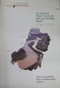
Book - Audit of Water Use in the Murray-Darling Basin. Water use and healthy rivers - working towards a balance, Murray-Darling Basin Ministerial Council, 1995
... Murray-Darling Basin. It highlights that diversions have increased significantly since 1988 and will continue to increase unless water management arrangements are amended. This increase in diversion will have an adverse impact on river health. It concludes that the most urgent priority is to define the appropriate balance between water for consumptive uses (i.e. irrigation ...This paper describes the water audit which has been carried out in the Murray-Darling Basin. It highlights that diversions have increased significantly since 1988 and will continue to increase unless water management arrangements are amended. This increase in diversion will have an adverse impact on river health. It concludes that the most urgent priority is to define the appropriate balance between water for consumptive uses (i.e. irrigation, domestic and industrial) and that required to be left in rivers (environmental flows) to ensure that the consumptive uses are sustainable and that the rivers remain in a healthy state. This water audit does not attempt to strike the balance between consumptive and instream water use. Rather it provides a sound body of knowledge on which to base the necessary community discussions which will lead to decisions about an appropriate balance between consumptive and instream uses.non-fictionThis paper describes the water audit which has been carried out in the Murray-Darling Basin. It highlights that diversions have increased significantly since 1988 and will continue to increase unless water management arrangements are amended. This increase in diversion will have an adverse impact on river health. It concludes that the most urgent priority is to define the appropriate balance between water for consumptive uses (i.e. irrigation, domestic and industrial) and that required to be left in rivers (environmental flows) to ensure that the consumptive uses are sustainable and that the rivers remain in a healthy state. This water audit does not attempt to strike the balance between consumptive and instream water use. Rather it provides a sound body of knowledge on which to base the necessary community discussions which will lead to decisions about an appropriate balance between consumptive and instream uses.murray-darling basin, water management, water audit murray-darling
